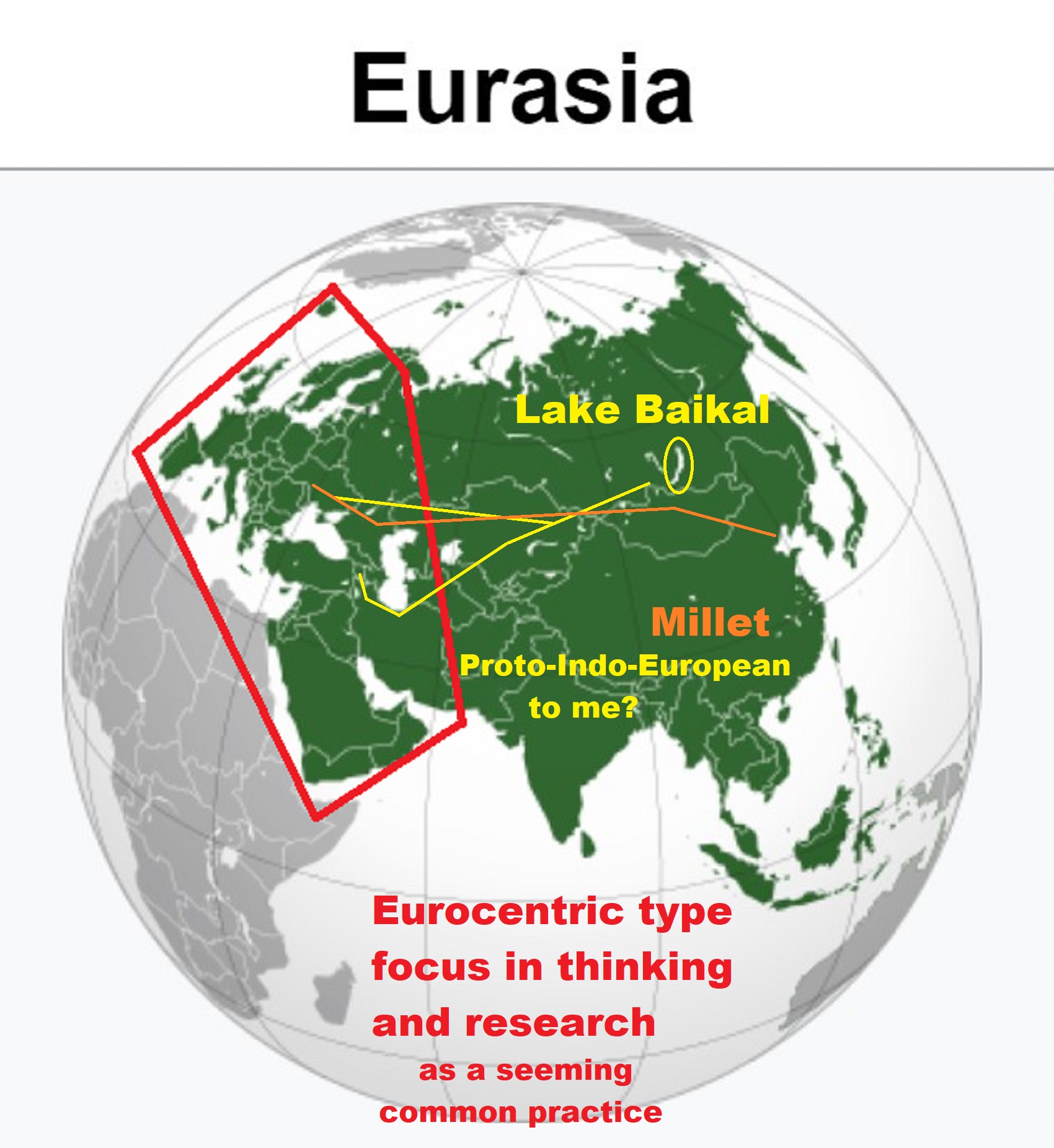
“Asian varieties of millet made their way from China to the Black Sea region of Europe by 5000 BCE or 7,000 years ago.” https://en.wikipedia.org/wiki/Millet
Origins of ‘Transeurasian’ languages traced to Neolithic millet farmers in north-eastern China about 9,000 years ago
“A study combining linguistic, genetic, and archaeological evidence has traced the origins of a family of languages including modern Japanese, Korean, Turkish and Mongolian and the people who speak them to millet farmers who inhabited a region in north-eastern China about 9,000 years ago. The findings outlined on Wednesday document a shared genetic ancestry for the hundreds of millions of people who speak what the researchers call Transeurasian languages across an area stretching more than 5,000 miles (8,000km).” ref
“Millet was an important early crop as hunter-gatherers transitioned to an agricultural lifestyle. There are 98 Transeurasian languages, including Korean, Japanese, and various Turkic languages in parts of Europe, Anatolia, Central Asia, and Siberia, various Mongolic languages, and various Tungusic languages in Manchuria and Siberia. This language family’s beginnings were traced to Neolithic millet farmers in the Liao River valley, an area encompassing parts of the Chinese provinces of Liaoning and Jilin and the region of Inner Mongolia. As these farmers moved across north-eastern Asia over thousands of years, the descendant languages spread north and west into Siberia and the steppes and east into the Korean peninsula and over the sea to the Japanese archipelago.” ref
“Eurasiatic is a proposed language with many language families historically spoken in northern, western, and southern Eurasia; which typically include Altaic (Mongolic, Tungusic, and Turkic), Chukchi-Kamchatkan, Eskimo–Aleut, Indo-European, and Uralic.” ref
“Voiced stops such as /d/ occur in the Indo-European, Yeniseian, Turkic, Mongolian, Tungusic, Japonic and Sino-Tibetan languages. They have also later arisen in several branches of Uralic.” ref
“Uralo-Siberian is a hypothetical language family of Uralic, Yukaghir, Eskimo–Aleut and besides linguistic evidence, several genetic studies, support a common origin in Northeast Asia.” ref
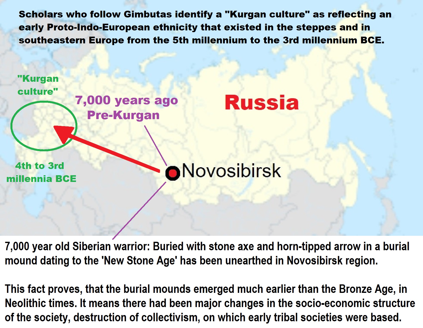
Kurgan Hypothesis
“The Kurgan hypothesis (also known as the Kurgan theory or Kurgan model) or Steppe theory is the most widely accepted proposal to identify the Proto-Indo-European homeland from which the Indo-European languages spread out throughout Europe and parts of Asia. It postulates that the people of a Kurgan culture in the Pontic steppe north of the Black Sea were the most likely speakers of the Proto-Indo-European language (PIE). The term is derived from the Russian kurgan (курга́н), meaning tumulus or burial mound. The Steppe theory was first formulated by Otto Schrader (1883) and V. Gordon Childe (1926), then systematized in the 1950s by Marija Gimbutas, who used the term to group various prehistoric cultures, including the Yamnaya (or Pit Grave) culture and its predecessors. In the 2000s, David Anthony instead used the core Yamnaya culture and its relationship with other cultures as a point of reference.” ref
“Gimbutas defined the Kurgan culture as composed of four successive periods, with the earliest (Kurgan I) including the Samara and Seroglazovo cultures of the Dnieper–Volga region in the Copper Age (early 4th millennium BCE). The people of these cultures were nomadic pastoralists, who, according to the model, by the early 3rd millennium BCE had expanded throughout the Pontic–Caspian steppe and into Eastern Europe. Recent genetics studies have demonstrated that populations bearing specific Y-DNA haplogroups and a distinct genetic signature expanded into Europe and South Asia from the Pontic-Caspian steppe during the third and second millennia BCE. These migrations provide a plausible explanation for the spread of at least some of the Indo-European languages, and suggest that the alternative Anatolian hypothesis, which places the Proto-Indo-European homeland in Neolithic Anatolia, is less likely to be correct.” ref
“Cultures that Gimbutas considered as part of the “Kurgan culture”:
- Bug–Dniester (6th millennium)
- Samara (5th millennium)
- Khvalynsk (5th millennium)
- Dnieper–Donets (5th to 4th millennia)
- Sredny Stog (mid-5th to mid-4th millennia)
- Maikop–Dereivka (mid-4th to mid-3rd millennia)
- Yamnaya (Pit Grave): This is itself a varied cultural horizon, spanning the entire Pontic–Caspian steppe from the mid-4th to the 3rd millennium.
- Usatovo culture (late 4th millennium)” ref
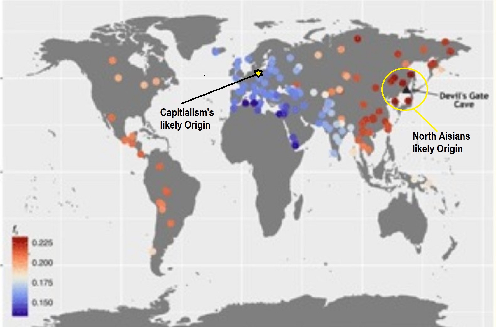
Pic ref
Ancient Women Found in a Russian Cave Turn Out to Be Closely Related to The Modern Population https://www.sciencealert.com/ancient-women-found-in-a-russian-cave-turn-out-to-be-closely-related-to-the-modern-population
Abstract
“Ancient genomes have revolutionized our understanding of Holocene prehistory and, particularly, the Neolithic transition in western Eurasia. In contrast, East Asia has so far received little attention, despite representing a core region at which the Neolithic transition took place independently ~3 millennia after its onset in the Near East. We report genome-wide data from two hunter-gatherers from Devil’s Gate, an early Neolithic cave site (dated to ~7.7 thousand years ago) located in East Asia, on the border between Russia and Korea. Both of these individuals are genetically most similar to geographically close modern populations from the Amur Basin, all speaking Tungusic languages, and, in particular, to the Ulchi. The similarity to nearby modern populations and the low levels of additional genetic material in the Ulchi imply a high level of genetic continuity in this region during the Holocene, a pattern that markedly contrasts with that reported for Europe.” ref
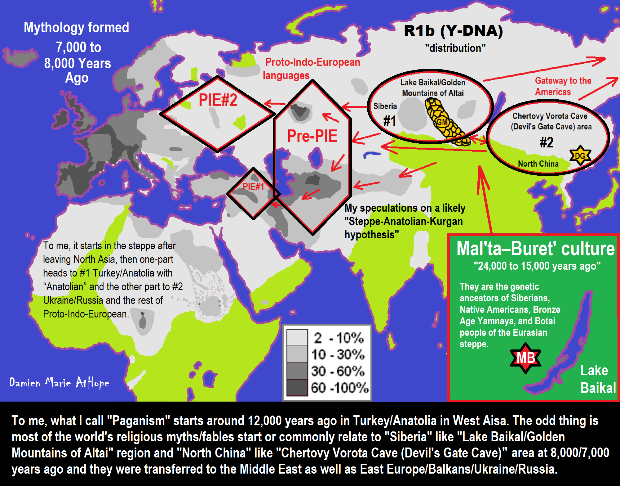
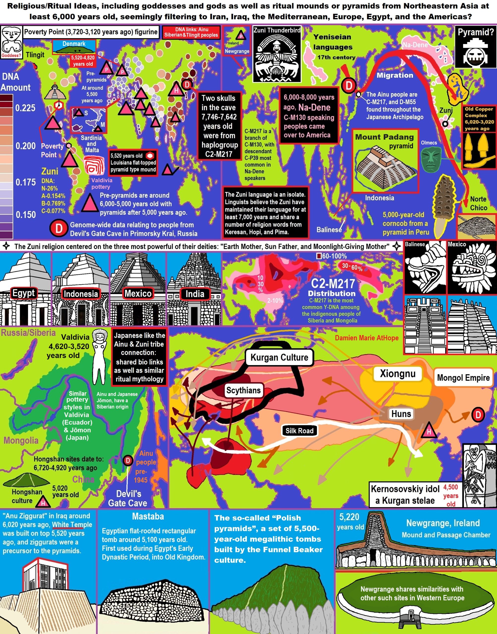
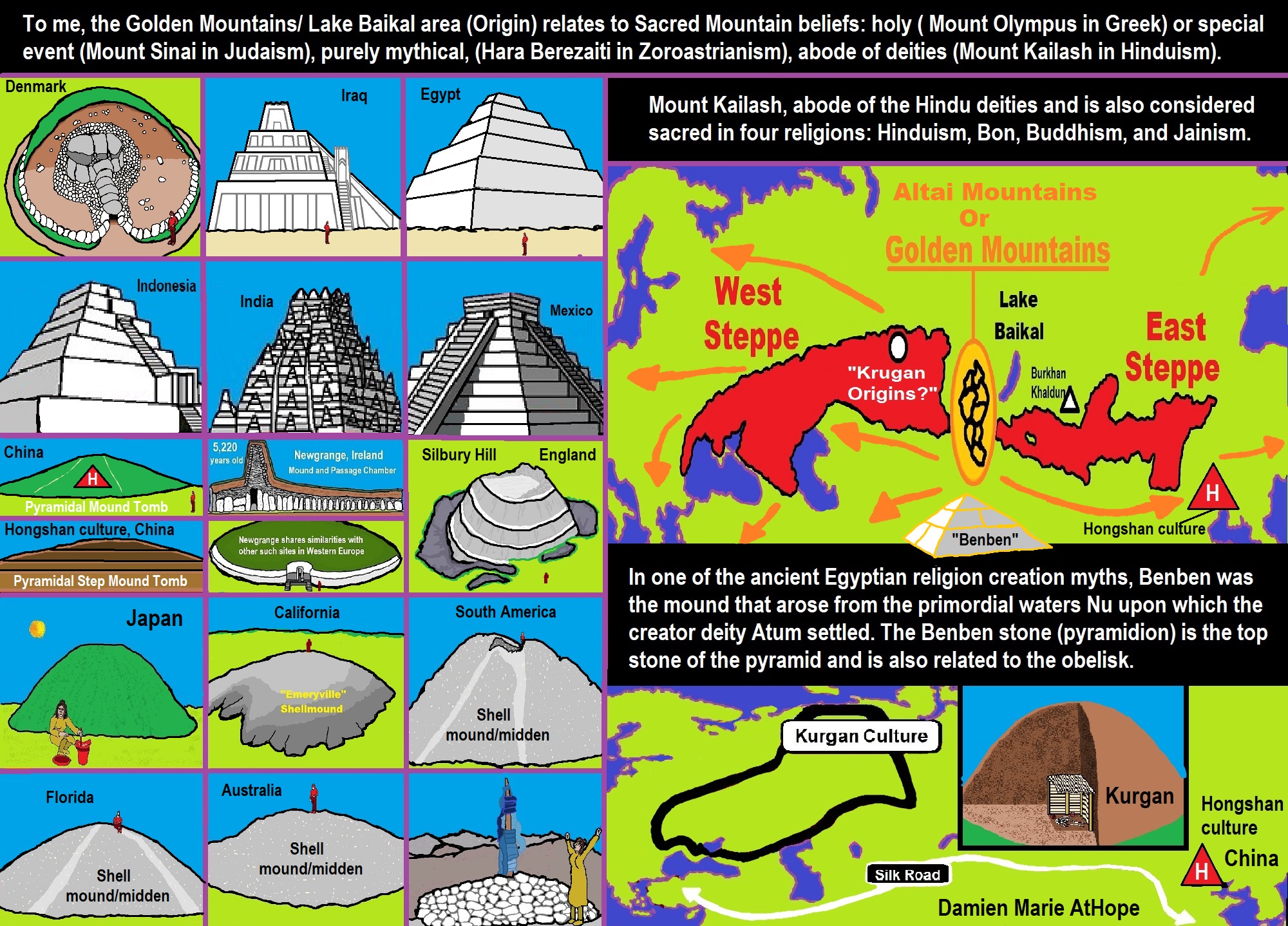
This info connects in a way to sort of my main point, that religions are a cultural product and were spread by people migrating and by transfer to were many crossed the globe. And one may wonder why this was not all realized before? I can offer one of many possible answers or reasons, when you are focusing hard on one specific areas, it is easy to miss the big picture, and thus lack an accurate assessment. Pre-pyramids are around 6,000-5,000 years old with pyramids after 5,000 years ago. “Anu Ziggurat” in Iraq around 6,020 years ago, White Temple was built ontop 5,520 years ago, and ziggurats were a precursor to the pyramids. ref, ref
5,000-Year-Old Pyramid-Like Structure Found In Northern Peru
“A pyramid-like structure at least 5,000 years old, allegedly devoted to ceremonial purposes, was unveiled thanks to excavation works conducted at Sechin archaeological complex in Casma Province of Ancash Region in northern Peru. It is a stepped structure, at least 3.20 meters high and 5 meters wide. Sechin Archaeological Project archaeologists and workers had to excavate some 6 meters of soil and remove stones in order to unearth it.” ref
Archaeologist Monica Suarez, the coordinator at Sechin Archaeological Project, commented that the pyramid is located within the south-central part of the main building. It is believed that it was used for ceremonial purposes. Additionally, the team of researchers discovered two skulls —one of an adult and one of a child— and a dismembered body on the side, which makes the theory of ceremonial practices gain traction. The researcher stressed the possibility that the stepped, pyramid-shaped structure served as a ladder to get to a higher level.
“There is an adobe wall at the top, with fingerprints of Sechin inhabitants visible in the mud. They are believed to be a symbol of their work,” she said.” ref
Unearthing the ancient ‘pharaohs’ of the Emerald Isle
“From elaborate burials to family affairs, new DNA analysis suggests that Irish kings may have had more in common with their Egyptian counterparts, writes James Gorman Newgrange, a prehistoric monument built during the Neolithic period. The vast Stone Age tomb mounds in the valley of the River Boyne, about 25 miles north of Dublin, are so impressive that the area has been called the Irish Valley of the Kings. And a new analysis of ancient human DNA from Newgrange, the most famous of the mounds in Ireland, suggests that the ancient Irish may have had more than monumental grave markers in common with the pharaohs.” ref
“A team of Irish geneticists and archaeologists reported last week that a man whose cremated remains were interred at the heart of Newgrange was the product of a first-degree incestuous union, either between parent and child or brother and sister. The finding, combined with other genetic and archaeological evidence, suggests that the people who built these mounds lived in a hierarchical society with a ruling elite that considered themselves so close to divine that, like the Egyptian pharaohs, they could break the ultimate taboos.” ref
“In Ireland, more than 5,000 years ago people farmed and raised cattle. But they were also moved, like their contemporaries throughout Europe, to create stunning monuments to the dead, some with precise astronomical orientations. Stonehenge, a later megalith in the same broad tradition as Newgrange, is famous for its alignment to the summer and winter solstice. The central underground room at Newgrange is built so that as the sun rises around the time of the winter solstice it illuminates the whole chamber through what is called a roof box.” ref
“Archaeologists have long wondered what kind of society built such a structure, which they think must have had ritual or spiritual significance. If, as the findings indicate, it was a society that honored the product of an incestuous union by interring his remains at the most sacred spot in a sacred place, then the ancient Irish may have had a ruling religious hierarchy, perhaps similar to those in ancient societies in Egypt, Peru, and Hawaii, which also allowed marriages between brother and sister. In a broad survey of ancient DNA from bone samples previously collected at Irish burial sites thousands of years old, the researchers also found genetic connections among people interred in other Irish passage tombs, named for their underground chambers or passages. That suggests that the ruling elite were related to one another.” ref
“Of the site’s tombs, Bradley says, “Newgrange is the apogee”. It is not just that it incorporates 200,000 tons of earth and stone, some brought from kilometers away. It also has the precise orientation to the winter sun. On any day, “when you go into the chamber, it’s a sort of numinous space, it’s a liminal space, a place that inspires a sort of awe”, Bradley says. That a bone recovered from this spot produced such a genomic shocker seemed beyond coincidence. This had to be a prominent person, the researchers reasoned. He wasn’t placed there by accident, and his parentage was unlikely to be an accident. “Whole chunks of the genome that he inherited from his mother and father, whole chunks of those were just identical,” Bradley says. The conclusion was unavoidable: “It’s a pharaoh, I said, it’s an Irish pharaoh.” ref
I think it’s part of the wave of the future about how ancient DNA will shed light on social structure, which is really one of its most exciting promises
“He and his colleagues had not gone looking for children of incest. They were analyzing ancient bones to sequence 42 genomes of Neolithic Irish farmers as part of a project to reconstruct the entire genetic history of Ireland. The researchers sampled DNA from human remains from the four kinds of burial in Ireland, from the simplest to the most elaborate. They used techniques similar to those that for-profit companies now use to help people discover unknown relatives and ancestral connections. This involves looking for extended chunks of DNA that are common to different samples, rather than comparing the average differences in individual genes. “It’s like looking at the sentences rather than the letters,” Bradley says. The researchers sequenced four full genomes. The others, as is common in this kind of research, were partial.” ref
Signs of a Hierarchical Society
“David Reich of Harvard University, one of the ancient DNA specialists who has tracked the grand sweep of prehistoric human migration around the globe, and was not involved in the research, called the journal article “amazing”. “I think it’s part of the wave of the future about how ancient DNA will shed light on social structure, which is really one of its most exciting promises,” he says, although he had some reservations about evidence that the elite were genetically separate from the common people, a kind of royal family.” ref
A Holy Place
“Daniel G Bradley, a specialist in ancient DNA at Trinity College, who leads the team with Lara M Cassidy, a specialist in population genetics and Irish prehistory also at the college, says the genome of the man who was a product of incest was a complete surprise. They and their colleagues have reported their findings in the journal Nature. Newgrange is part of a necropolis called Bru na Boinne, or the palace of the Boyne, dating to around 5,000 years ago that includes three large passage tombs and many other monuments. It is one of the most remarkable of Neolithic monumental sites in all of Europe. Bettina Schulz Paulsson, a prehistoric archaeologist at the University of Gothenburg in Sweden, says the researchers’ findings that suggest a religious hierarchy is a “very attractive hypothesis”.” ref
“Schulz Paulsson proposed that megalithic technology, which first appeared in Europe about 6,500 years ago, originated in Brittany and spread by maritime means along the coasts of the Atlantic and thus to England and Ireland. About 35,000 of these monuments are known, and the most famous draw crowds – sometimes for the history and archaeology, and sometimes for the spiritual power attributed to them. Schulz Paulsson says that essentially nothing is known about the structure of the societies that built the early megaliths. But the technology and the societies that used it developed over time. Newgrange dates to about 5,500 years ago, around 1,500 years after the first European megaliths appeared.” ref
“The creation of these monuments occurred after agriculture appeared in Europe, brought by a vast migration of Anatolian farmers, starting about 9,000 years ago. Reich is one of the researchers who has documented how these farmers, whose genetic profile is distinct from European hunter-gatherers, gradually settled Europe. What exactly happened between them and Indigenous hunter-gatherers is not known, but gradually, judging by modern and ancient DNA, those hunter-gatherers disappeared. Today, after many waves of migration, their DNA is found only as a faint remnant in modern populations.” ref
Genetic data may help delineate social structures of specific communities so lost in deep time that they have been almost impossible to decipher
“The Irish genomes show that the people in these tombs were descendants of Anatolian farmers. The researchers found a trace of the Indigenous population of Ireland in two individuals, Bradley says. Though this is a small amount, it does show, Bradley says, that there was an interaction between the farmers and hunter-gatherers. The paper is rich with other detail, including the discovery that an infant had Down syndrome.” ref
“The authors believe this is the oldest record of Down syndrome. Chemical tests of the bone also showed that the infant had been breastfed, and that he was placed in an important tomb. Both of those facts suggest that he was well cared for, in keeping with numerous other archaeological finds of children and adults with illnesses or disabilities who were supported by their cultures. Cassidy says they also found DNA in other remains that indicated relatives of the man who was a child of royal incest were placed in other significant tombs. “This man seemed to form a distinct genetic cluster with other individuals from passage tombs across the island,” she says.” ref
“She says “we also found a few direct kinship links”, ancient genomes of individuals who were distant cousins. That contributed to the idea that there was an elite who directed the building of the mounds. In that context, it made sense that the incest was intentional. That’s not something that can be proved, of course, but other societies have encouraged brother-sister incest, and not only the Egyptians. Brothers married sisters in ancient Hawaii, and in Peru among the Incas. “The few examples where it is socially accepted,” she says, are “extremely stratified societies with an elite class who are able to break rules.” ref
Relying on Folklore
“Reich says the research has implications beyond the specific findings. He says it signifies a new direction in ancient DNA studies, moving beyond discoveries of broad patterns of prehistoric human migration. Now, genetic data may help delineate social structures of specific communities, like that in Ireland, so lost in deep time that they have been almost impossible to decipher.” ref
“Reich says he has reservations about one of the paper’s conclusions. The researchers reported that members of the elite, those found in the most elaborate tombs, were closer to one another genetically than they were to people found in simpler burials. But, Reich says, the simpler burials and the higher-status burials were separated by hundreds of years, so the comparison wasn’t contemporaneous. Perhaps the genetic makeup of the society, which was small in number, changed over a few centuries. Bradley acknowledges that this was an alternative explanation.” ref
“The final piece of the puzzle that the researchers report is neither archaeological nor genetic, but folkloric. An account of Irish place names written around 1100, the authors write, tells a tale of a King Bressal, who slept with his sister. The result was that Dowth, the burial mound next to Newgrange, was called Fertae Chuile, or the Mound of Sin.” ref
“The idea that a folk memory could preserve history 4,000 years old may seem preposterous, but there were also folk tales that gods built the passage tombs to affect the solar cycle. And yet Newgrange, with its solar alignment, was covered by earth during the Middle Ages. It was excavated, and the orientation to the winter solstice discovered at the beginning of the 20th century. The myths may be muddled, but the tale of the solar cycle had some basis in fact, and so, it may be, did the story of royal incest.” ref
Claims of contact with Ecuador (South America)
“Similar pottery styles in Valdivia (Ecuador) & Jōmon (Japan)”
“A 2013 genetic study suggests the possibility of contact between Ecuador and East Asia. The study suggests that the contact could have been trans-oceanic or a late-stage coastal migration that did not leave genetic imprints in North America.” ref
Claims of Chinese contact with the Americas
“A jade Olmec mask from Central America. Gordon Ekholm, an archaeologist, and curator at the American Museum of Natural History, suggested that the Olmec art style might have originated in Bronze Age China. Other researchers have argued that the Olmec civilization came into existence with the help of Chinese refugees, particularly at the end of the Shang dynasty. In 1975, Betty Meggers of the Smithsonian Institution argued that the Olmec civilization originated around 1200 BCE due to Shang Chinese influences. In a 1996 book, Mike Xu, with the aid of Chen Hanping, claimed that celts from La Venta bear Chinese characters. These claims are unsupported by mainstream Mesoamerican researchers. Other claims have been made for early Chinese contact with North America. In 1882 approximately 30 brass coins, perhaps strung together, were reportedly found in the area of the Cassiar Gold Rush, apparently near Dease Creek, an area which was dominated by Chinese gold miners.” ref
A contemporary account states:
“In the summer of 1882 a miner found on De Foe (Deorse?) creek, Cassiar district, Br. Columbia, thirty Chinese coins in the auriferous sand, twenty-five feet below the surface. They appeared to have been strung, but on taking them up the miner let them drop apart. The earth above and around them was as compact as any in the neighborhood. One of these coins I examined at the store of Chu Chong in Victoria. Neither in metal nor markings did it resemble the modern coins, but in its figures looked more like an Aztec calendar. So far as I can make out the markings, this is a Chinese chronological cycle of sixty years, invented by Emperor Huungti, 2637 BCE or 4,657 years ago, and circulated in this form to make his people remember it.” ref
“Grant Keddie, Curator of Archeology at the Royal B.C. Museum identified these as good luck temple tokens minted in the 19th century. He believed that claims that these were very old made them notorious and that “The temple coins were shown to many people and different versions of stories pertaining to their discovery and age spread around the province to be put into print and changed frequently by many authors in the last 100 years.” A group of Chinese Buddhist missionaries led by Hui Shen before 500 CE claimed to have visited a location called Fusang. Although Chinese mapmakers placed this territory on the Asian coast, others have suggested as early as the 1800s that Fusang might have been in North America, due to perceived similarities between portions of the California coast and Fusang as depicted by Asian sources.” ref
“In his book 1421: The Year China Discovered the World, British author Gavin Menzies made the groundless claim that the fleet of Zheng He arrived in America in 1421. Professional historians contend that Zheng He reached the eastern coast of Africa, and dismiss Menzies’ hypothesis as entirely without proof. In 1973 and 1975, doughnut-shaped stones which resembled stone anchors which were used by Chinese fishermen were discovered off the coast of California. These stones (sometimes called the Palos Verdes stones) were initially thought to be up to 1,500 years old and therefore proof of pre-Columbian contact by Chinese sailors. Later geological investigations showed them to be made of a local rock which is known as Monterey shale, and they are thought to have been used by Chinese settlers who fished off the coast during the 19th century.” ref
Did China discover AMERICA?
Ancient Chinese script carved into rocks may prove Asians lived in New World 3,300 years ago
- Author and researcher John Ruskamp claims to have found pictograms from the ancient Chinese Shang Dynasty etched into rocks in America
- The symbols are carved into rocks in New Mexico, California and Arizona
- He says the Chinese were exploring North America long before Europeans
- He claims the symbols give details of journeys and honour the Shang king
“The discovery of the Americas has for centuries been credited to the Italian explorer Christopher Columbus, but ancient markings carved into rocks around the US could require history to be rewritten. Researchers have discovered ancient scripts that suggest Chinese explorers may have discovered America long before Europeans arrived there. They have found pictograms etched into the rocks around the country that appear to belong of an ancient Chinese script.” ref
Epigraph researcher John Ruskamp claims these symbols shown in the enhanced image above, found etched into rock at the Petroglyph National Monument in Albuquerque, New Mexico, are evidence that ancient Chinese explorers discovered America long before Christopher Columbus stumbled on the continent in 1492
“They say could have been inscribed there alongside the carvings of Native Americans by Chinese explorers thousands of years ago. John Ruskamp, a retired chemist and amateur epigraph researcher from Illinois, discovered the unusual markings while walking in the Petroglyph National Monument in Albuquerque, New Mexico. He claims they indicate ancient people from Asia were present in the Americas around 1,300BC – nearly 2,800 years before Columbus’s ships stumbled across the New World by reaching the Caribbean in 1492.” ref
ASIAN TRADERS BEAT COLUMBUS
“Trade was taking place between East Asia and the New World hundreds of years before Christopher Columbus arrived in the area in 1492. Archaeologists have made the suggestion following the discovery of a series of bronze artifacts found at the ‘Rising Whale’ site in Cape Espenberg, Alaska. They found what they believe to be a bronze and leather buckle and a bronze whistle, dating to around CE 600.” ref
Bronze-working had not been developed at this time in Alaska, and researchers instead believe the artifacts were created in China, Korea, or Yakutia. ‘We’re seeing the interactions, indirect as they are, with these so-called “high civilizations” of China, Korea or Yakutia,’ Owen Mason, a research associate at the University of Colorado. Researchers believe those who lived at the Rising Whale site may be part of what scientists call the ‘Birnirk’ culture. This is a group of people who lived on both sides of the Bering Strait and used skin boats and harpoons to hunt whales, LiveScience reports. The latest discovery of bronze artifacts backs up earlier evidence for trade between Alaska and other civilizations prior to 1492.” ref
“He said: ‘These ancient Chinese writings in North America cannot be fake, for the markings are very old as are the style of the scripts. ‘As such the findings of this scientific study confirm that ancient Chinese people were exploring and positively interacting with the Native peoples over 2,500 years ago. ‘The pattern of the finds suggests more of an expedition than settlement.’ However, his controversial views have been met with skepticism by many experts who point to the lack of archaeological evidence for any ancient Chinese presence in the New World. Mr Ruskamp is not the first to claim that the Chinese were the first to discover America – retired submarine lieutenant-commander Gavin Menzies claimed a fleet of Chinese ships sailed to North America in 1421, 70 years before Columbus’s expedition.” ref
“However, Mr Ruskamp believes the contact between the Chinese and Native Americans may have been going on for far longer. He claims to have identified 84 pictograms which match unique ancient Chinese sites in various locations around the US including New Mexico, California, Oklahoma, Utah, Arizona, and Nevada. He says many of these have been examined by experts on ancient Chinese scripts and they appear to forms of writing that went out of use thousands of years ago. The pictograms he discovered on the rocks of Albuquerque appear to be an ancient script that was used by the Chinese after the end Shang Dynasty. Known as oracle bone pictograms, Mr Ruskamp claims the markings record a ritual sacrificial offering perhaps made to the 3rd Shang dynasty king Da Jia and also a divination of an ‘auspicious’ 10-day sacred period.” ref
“With the help of experts on Neolithic Chinese culture, Mr Ruskamp has deciphered the pictograms he has discovered at Petroglyph National Monument in Albuquerque and claims they details a sacrificial offering of a dog to the 3rd Shang dynasty king Da Jai. Mr Ruskamp claims to have found evidence of ancient Chinese scripts etched into rocks in New Mexico, Nevada, and Arizona. Mr Ruskamp said: ‘Although only half of the symbols found on the large boulder in Albuquerque, New Mexico have been identified and confirmed as Chinese scripts, when the four central pictogram-glyphs of this message – Jie, Da, Quan, and Xian – are read in the traditional Chinese manner from right to left we learn about a respectful man honoring a superior with the sacrificial offering of a dog.” ref
“Notably, the written order of these symbols conforms with the syntax used for documenting ancient Chinese rituals during the Shang and Zhou dynasties, and dog sacrifices were very popular in the second part of the second millennium B.C. in China.’ He says he has also found ancient Chinese scripts for the number five and writing describing a boat upon water, which he found on the shore of Little Lake in California. Mr Ruskamp also claims the pictograms shown above, which were found carved into rocks in Arizona, also appear to belong to an ancient Chinese script. He believes Chinese explorers were conducting expeditions around North America thousands of years ago and left these markings as evidence of their presence.” ref
Mr Ruskamp first discovered ancient Chinese scripts at Petroglyph National Monument, n Albuquerque, New Mexico, alongside carvings made by Native Americans
“Mr Ruskamp says he has also found ancient Chinese scripts for dogs, flowers, and the earth scratched onto the rocks in Petroglyph National Monument. He also claims to have found a Chinese pictogram of an elephant dating to 500 BCE or 2,520 years ago in the Petrified Forest National Park in Arizona, suggesting the Asian explorers had spread across much of the US. Another pictogram found in Grapevine Canyon in Nevada, appears to be an oracle-bone era symbol for teeth dating to 1,300 BCE or 3,320 years ago. One ancient message, preserved in Arizona translates as: ‘Set apart (for) 10 years together; declaring (to) return, (the) journey completed, (to the) house of the Sun; (the) journey completed together.” ref
“At the end of this text is an unidentified character that may be the author’s signature. Mr Ruskamp said: ‘Here the intention of the ancient author was more to document an event than to leave a readable message.’ Mr Ruskamp says this cartouche, which forms part of a set found in Arizona, is an ancient Chinese symbol for ‘returning together’. He insists weathering on the markings and the age of the script suggest they are not fake. Mr Ruskamp has written a book and an academic paper on the topic, which is currently undergoing peer review. In it he claims the carvings appear to have undergone significant levels of weathering, known as repatination which indicate they were created long ago and not within the past 150 years.” ref
He says the Shang script disappeared from use around the fall of the Shang empire in 1046BC and were only rediscovered and deciphered in 1899 in China. Taken together this suggests the carvings are unlikely to be fakes, he insists. He also points to DNA evidence which has suggested Native Americans and Asian populations share many genetic traits. He said: ‘For centuries, researchers have been debating if, in pre-Columbian times, meaningful exchanges between the indigenous peoples of Asia and the Americas might have taken place. ‘Here is “rock solid” epigraphic proof that Asiatic explorers not only reached the Americas, but that they interacted positively with Native North American people, on multiple occasions, long before any European exploration of the continent.” ref
Mr Ruskamp has also managed to decipher the symbol above as an oracle-bone script for ‘Together for Ten Years’. It was found alongside other markings on a rock in Arizona
“His views are also beginning to be taken seriously by other academics and they echo some theories put forward by researchers such as Dr Dennis Stanford of the Smithsonian Institution, who believed North America was first populated by people from Asia during the last ice age. According to the Epoch Times, one of Mr Ruskamp’s staunchest supporters has been Dr David Keightley, an expert on Neolithic Chinese civilization at the University of California, Berkley. He has been helping to decipher the scripts found carved into the rocks. Dr Michael Medrano, chief of the Division of Resource Management for Petroglyph National Monument, has also studied the petroglyphs found by Mr Ruskamp. He told the Epoch Times: ‘These images do not readily appear to be associated with local tribal entities. ‘Based on repatination, they appear to have antiquity to them.” ref
Claims of Japanese contact with the Americas
“Similar pottery styles in Valdivia (Ecuador) & Jōmon (Japan)”
“Archaeologist Emilio Estrada and co-workers wrote that pottery which was associated with the Valdivia culture of coastal Ecuador and dated to 3000–1500 BCE or 5,020-3,52- years ago exhibited similarities to pottery which was produced during the Jōmon period in Japan, arguing that contact between the two cultures might explain the similarities. Chronological and other problems have led most archaeologists to dismiss this idea as implausible. The suggestion has been made that the resemblances (which are not complete) are simply due to the limited number of designs possible when incising clay. Alaskan anthropologist Nancy Yaw Davis claims that the Zuni people of New Mexico exhibit linguistic and cultural similarities to the Japanese. The Zuni language is a linguistic isolate, and Davis contends that the culture appears to differ from that of the surrounding natives in terms of blood type, endemic disease, and religion. Davis speculates that Buddhist priests or restless peasants from Japan may have crossed the Pacific in the 13th century, traveled to the American Southwest, and influenced Zuni society.” ref
“In the 1890s, lawyer and politician James Wickersham argued that pre-Columbian contact between Japanese sailors and Native Americans was highly probable, given that from the early 17th century to the mid-19th century several dozen Japanese ships are known to have been carried from Asia to North America along the powerful Kuroshio Currents. Japanese ships landed at places between the Aleutian Islands in the north and Mexico in the south, carrying a total of 293 people in the 23 cases where head-counts were given in historical records. In most cases, the Japanese sailors gradually made their way home on merchant vessels. In 1834, a dismasted, rudderless Japanese ship was wrecked near Cape Flattery in the Pacific Northwest. Three survivors of the ship were enslaved by Makahs for a period before being rescued by members of the Hudson’s Bay Company. They were never able to return to their homeland due to Japan’s isolationist policy at the time. Another Japanese ship went ashore in about 1850 near the mouth of the Columbia River, Wickersham writes, and the sailors were assimilated into the local Native American population. While admitting there is no definitive proof of pre-Columbian contact between Japanese and North Americans, Wickersham thought it implausible that such contacts as outlined above would have started only after Europeans arrived in North America and began documenting them.” ref
Genome-wide data from two early Neolithic East Asian individuals dating to 7700 years ago
Abstract
“Ancient genomes have revolutionized our understanding of Holocene prehistory and, particularly, the Neolithic transition in western Eurasia. In contrast, East Asia has so far received little attention, despite representing a core region at which the Neolithic transition took place independently ~3 millennia after its onset in the Near East. We report genome-wide data from two hunter-gatherers from Devil’s Gate, an early Neolithic cave site (dated to ~7.7 thousand years ago) located in East Asia, on the border between Russia and Korea. Both of these individuals are genetically most similar to geographically close modern populations from the Amur Basin, all speaking Tungusic languages, and, in particular, to the Ulchi. The similarity to nearby modern populations and the low levels of additional genetic material in the Ulchi imply a high level of genetic continuity in this region during the Holocene, a pattern that markedly contrasts with that reported for Europe.” ref
INTRODUCTION
“Ancient genomes from western Asia have revealed a degree of genetic continuity between preagricultural hunter-gatherers and early farmers 12 to 8 thousand years ago. In contrast, studies on southeast and central Europe indicate a major population replacement of Mesolithic hunter-gatherers by Neolithic farmers of a Near Eastern origin during the period 8.5 to 7 ka. This is then followed by a progressive “resurgence” of local hunter-gatherer lineages in some regions during the Middle/Late Neolithic and Eneolithic periods and a major contribution from the Asian Steppe later, ~5.5 ka, coinciding with the advent of the Bronze Age. Compared to western Eurasia, for which hundreds of partial ancient genomes have already been sequenced, East Asia has been largely neglected by ancient DNA studies to date, with the exception of the Siberian Arctic belt, which has received attention in the context of the colonization of the Americas.” ref
“However, East Asia represents an extremely interesting region as the shift to reliance on agriculture appears to have taken a different course from that in western Eurasia. In the latter region, pottery, farming, and animal husbandry were closely associated. In contrast, Early Neolithic societies in the Russian Far East, Japan, and Korea started to manufacture and use pottery and basketry 10.5 to 15 ka, but domesticated crops and livestock arrived several millennia later. Because of the current lack of ancient genomes from East Asia, we do not know the extent to which this gradual Neolithic transition, which happened independently from the one taking place in western Eurasia, reflected actual migrations, as found in Europe, or the cultural diffusion associated with population continuity.” ref
“To fill this gap in our knowledge about the Neolithic in East Asia, we sequenced to low coverage the genomes of five early Neolithic burials (DevilsGate1, 0.059-fold coverage; DevilsGate2, 0.023-fold coverage; and DevilsGate3, DevilsGate4, and DevilsGate5, <0.001-fold coverage) from a single occupational phase at Devil’s Gate (Chertovy Vorota) Cave in the Primorye Region, Russian Far East, close to the border with China and North Korea (see the Supplementary Materials). This site dates back to 9.4 to 7.2 ka, with the human remains dating to ~7.7 ka, and it includes some of the world’s earliest evidence of ancient textiles. The people inhabiting Devil’s Gate were hunter-fisher-gatherers with no evidence of farming; the fibers of wild plants were the main raw material for textile production. We focus our analysis on the two samples with the highest sequencing coverage, DevilsGate1, and DevilsGate2, both of which were female.” ref
“The mitochondrial genome of the individual with higher coverage (DevilsGate1) could be assigned to haplogroup D4; this haplogroup is found in present-day populations in East Asia and has also been found in Jomon skeletons in northern Japan. For the other individual (DevilsGate2), only membership to the M branch (to which D4 belongs) could be established. Contamination, estimated from the number of discordant calls in the mitochondrial DNA (mtDNA) sequence, was low {0.87% [95% confidence interval (CI), 0.28 to 2.37%] and 0.59% (95% CI, 0.03 to 3.753%)} on nonconsensus bases at haplogroup-defining positions for DevilsGate1 and DevilsGate2, respectively. Using schmutzi on the higher-coverage genome, DevilsGate1 also gives low contamination levels [1% (95% CI, 0 to 2%); see the Supplementary Materials]. As a further check against the possible confounding effect of contamination, we made sure that our most important analyses [outgroup f3 scores and principal components analysis (PCA)] were qualitatively replicated using only reads showing evidence of postmortem damage (PMD score of at least 3), although these latter results had a high level of noise due to the low coverage (0.005X for DevilsGate1 and 0.001X for DevilsGate2).” ref
Devils Gate area people Relation to modern populations
“We compared the individuals from Devil’s Gate to a large panel of modern-day Eurasians and to published ancient genomes (Fig). On the basis of PCA and an unsupervised clustering approach, ADMIXTURE, both individuals fall within the range of modern variability found in populations from the Amur Basin, the geographic region where Devil’s Gate is located (Fig), and which is today inhabited by speakers from a single language family (Tungusic). This result contrasts with observations in western Eurasia, where, because of a number of major intervening migration waves, hunter-gatherers of a similar age fall outside modern genetic variation. We further confirmed the affinity between Devil’s Gate and modern-day Amur Basin populations by using outgroup f3 statistics in the form f3(African; DevilsGate, X), which measures the amount of shared genetic drift between a Devil’s Gate individual and X, a modern or ancient population, since they diverged from an African outgroup.” ref
“Modern populations that live in the same geographic region as Devil’s Gate have the highest genetic affinity to our ancient genomes (Fig), with a progressive decline in affinity with increasing geographic distance (r2 = 0.756, F1,96 = 301, P < 0.001; Fig), in agreement with neutral drift leading to a simple isolation-by-distance pattern. The Ulchi, traditionally fishermen who live geographically very close to Devil’s Gate and are the only Tungusic-speaking population from the Amur Basin sampled in Russia (all other Tungusic speakers in our panel are from China), are genetically the most similar population in our panel. Other populations that show high affinity to Devil’s Gate are the Oroqen and the Hezhen—both of whom, like the Ulchi, are Tungusic speakers from the Amur Basin—as well as modern Koreans and Japanese. Given their geographic distance from Devil’s Gate (Fig), Amerindian populations are unusually genetically close to samples from this site, in agreement with their previously reported relationship to Siberian and other north Asian populations.” ref
“No previously published ancient genome shows marked genetic affinity to Devil’s Gate: The top 50 populations in our outgroup f3 statistic were all modern, an expected result given that all other ancient genomes are either geographically or temporally very distant from Devil’s Gate. Among these ancient genomes, the closest to Devil’s Gate are those from Steppe populations dating from the Bronze Age onward and Mesolithic hunter-gatherers from Europe, but these genomes are no closer to the Devil’s Gate genomes than to genomes of modern populations from the same regions (for example, Tuvinian, Kalmyk, Russian, or Finnish). The two ancient genomes geographically closest to Devil’s Gate, Ust’-Ishim (~45,000 years ago) and Mal’ta (MA1, 24,000 years ago), also do not show high genetic affinity, probably because they both date to a much earlier time period. Of the two, MA1 is genetically closer to Devil’s Gate, but it is equally as distant from Devil’s Gate as it is from all other East Asians. A similar pattern is found for Ust’-Ishim, which is equally as distant to all Asians, including Devil’s Gate; this is consistent with its basal position in a genealogical tree.” ref
Continuity between Devil’s Gate and the Ulchi
“Because Devil’s Gate falls within the range of modern human genetic variability in the Amur Basin in a number of analyses and shows a high genetic affinity to the Ulchi, we investigated the extent of genetic continuity in this region. To look for signals of additional genetic material in the Ulchi, we modeled them as a mixture of Devil’s Gate and other modern populations using admixture f3 statistics. Despite a large panel of possible modern sources, the Ulchi are best represented by Devil’s Gate alone without any further contribution. Because admixture f3 can be affected by demographic events such as bottlenecks, we also tested whether Devil’s Gate formed a clade with the Ulchi using a D statistic in the form D(African outgroup, X; Ulchi, Devil’s Gate). A number of primarily modern populations worldwide gave significantly nonzero results (|z| > 2), which, together with the additional components for the Ulchi in the ADMIXTURE analysis, suggests that the continuity is not absolute. However, it should be noted that the higher error rates in the Devil’s Gate sequence resulting from DNA degradation and low coverage can also decrease the inferred level of continuity. To compare the level of continuity between the Ulchi and the inhabitants of Devil’s Gate to that between modern Europeans and European hunter-gatherers, we compared their ancestry proportions as inferred by ADMIXTURE. We found that the proportion of Devil’s Gate–related ancestry in the Ulchi was significantly higher than the local hunter–gatherer–related ancestry in any European population (P < 0.01 from 100 bootstrap replicates for the five European populations with the highest mean hunter-gatherer–related component).” ref
“These results suggest a relatively high degree of continuity in this region; the Ulchi are likely descendants of Devil’s Gate (or a population genetically very close to it), but the geographic and genetic connectivity among populations in the region means that this modern population also shows increased association with related modern populations. Compared to Europe, these results suggest a higher level of genetic continuity in northern East Asia over the last ~7.7 thousand years (ky), without any major population turnover since the early Neolithic.” ref
The southern and northern genetic material in the Japanese and the Koreans
“The close genetic affinity between Devil’s Gate and modern Japanese and Koreans, who live further south, is also of interest. It has been argued, based on both archaeological and genetic analyses, that modern Japanese have a dual origin, descending from an admixture event between hunter-gatherers of the Jomon culture (16,000 to 3,000 years ago) and migrants of the Yayoi culture (3 to 1.7 ka), who brought wet rice agriculture from the Yangtze estuary in southern China through Korea. The few ancient mtDNA samples available from Jomon sites on the northern Hokkaido island show an enrichment of particular haplotypes (N9b and M7a, with D1, D4, and G1 also detected) present in modern Japanese populations, particularly the Ainu and Ryukyuans, as well as southern Siberians (for example, Udegey and Ulchi). The mtDNA haplogroups of our samples from Devil’s Gate (D4 and M) are also present in Jomon samples, although they are not the most common ones (N9b and M7a). Recently, nuclear genetic data from two Jomon samples also confirmed the dual origin hypothesis and implied that the Jomon diverged before the diversification of present-day East Asians.” ref
“We investigated whether it was possible to recover the Northern and Southern genetic components by modeling modern Japanese as a mixture of all possible pairs of sources, including both modern Asian populations and Devil’s Gate, using admixture f3 statistics. The clearest signal was given by a combination of Devil’s Gate and modern-day populations from Taiwan, southern China, and Vietnam (Fig), which could represent hunter-gatherer and agriculturalist components, respectively. However, it is important to note that these scores were just barely significant (−3 < z < −2) and that some modern pairs also gave negative scores, even if not reaching our significance threshold (z scores as low as −1.9; see the Supplementary Materials).” ref
“The origin of Koreans has received less attention. Also, because of their location on the mainland, Koreans have likely experienced a greater degree of contact with neighboring populations throughout history. However, their genomes show similar characteristics to those of the Japanese on genome-wide SNP data and have also been shown to harbor both northern and southern Asian mtDNA and Y chromosomal haplogroups. Unfortunately, our low coverage and small sample size from Devil’s Gate prevented a reliable estimate of admixture coefficients or use of linkage disequilibrium–based methods to investigate whether the components originated from secondary contact (admixture) or continuous differentiation and to date any admixture event that did occur.” ref
Devil’s Gate overall DISCUSSION
“By analyzing genome-wide data from two early Neolithic East Asians from Devil’s Gate, in the Russian Far East, we could demonstrate a high level of genetic continuity in the region over at least the last 7700 years. The cold climatic conditions in this area, where modern populations still rely on a number of hunter-gatherer-fisher practices, likely provide an explanation for the apparent continuity and lack of major genetic turnover by exogenous farming populations, as has been documented in the case of southeast and central Europe. Thus, it seems plausible that the local hunter-gatherers progressively added food-producing practices to their original lifestyle. However, it is interesting to note that in Europe, even at very high latitudes, where similar subsistence practices were still important until very recent times, the Neolithic expansion left a significant genetic signature, albeit attenuated in modern populations, compared to the southern part of the continent. Our ancient genomes thus provide evidence for a qualitatively different population history during the Neolithic transition in East Asia compared to western Eurasia, suggesting stronger genetic continuity in the former region. These results encourage further study of the East Asian Neolithic, which would greatly benefit from genetic data from early agriculturalists (ideally, from areas near the origin of wet rice cultivation in southern East Asia), as well as higher-coverage hunter-gatherer samples from different regions to quantify population structure before intensive agriculture.Devil’s Gate
Genome-wide data relating to people from Devil’s Gate Cave in Primorsky Krai, Russia
Chertovy Vorota Cave/Devil’s Gate Cave
“Chertovy Vorota Cave (known as Devil’s Gate Cave in English) is a Neolithic archaeological site located in the Sikhote-Alin mountains, about 12 km (7 mi) from the town of Dalnegorsk in Primorsky Krai, Russia. The karst cave is located on a limestone cliff and lies about 35 m (115 ft) above the Krivaya River, a tributary of the Rudnaya River, below. Chertovy Vorota provides secure evidence for some of the oldest surviving textiles found in the archaeological record. The cave consists of a main chamber, measuring around 45 m (148 ft) in length, and several smaller galleries behind it. The site was looted several times before the first archaeological excavations were performed in 1973. Around 600 lithic, osteological, and shell artifacts, 700 pottery fragments, and over 700 animal bones were recovered from the site. A .6 cm thick jade disk made from brownish-green jade and measuring 5.2 cm (2 in) in diameter was also recovered from Chertovy Vorota. The remains of racoon dog, brown bear, Asian black bear, wild boar, badger, red deer, fish, and mollusc shells were found inside the cave.
Diet of the Devil’s Gate Cave people
“The isotopic analysis shows that the people of Chertovy Vorota likely derived their protein from a mix of terrestrial and maritime sources; around 25% of their dietary protein appears to have been derived from maritime resources, most likely from anadromous salmon. The people of Chertovy Vorota likely hunted terrestrial mammals, collected nuts, and fished salmon to provide for their food needs.
Ancient textiles[edit]
The remains of carbonized textile fragments were found within the cave, under the remains of a wooden structure that had caught on fire and collapsed. The carbonized remains of rope, nets, and woven fabrics were recovered from the cave. The fibers likely came from Carex sordida, a sedge grass from the family Cyperaceae. The textile remains were directly dated to around 9400-8400 BP, the earliest evidence in the archaeological record for textile remains from East Asia. As spindle whorls were not found in the cave, and also rarely found in contemporary East Asian sites, archaeologists postulate that the people at Chertovy Vorota either produced their textiles by hand or through the use of warp-weighted looms.
Devil’s Gate Cave Human remains
“The remains of 7 individuals were discovered within the cave. The skulls of two of the individuals, DevilsGate1 and DevilsGate2, were directly dated to around 5726-5622 BCE. Six of seven individuals whose remains have been recovered from the cave have been DNA tested. Originally, three of the specimens were thought to be adult males, two were thought to be adult females, one was thought to be a sub-adult of about 12-13 years of age, and one was thought to be a juvenile of about 6-7 years of age based on the skeletal morphology of the remains. Results of genetic analysis of the sub-adult individual have not yet been published. However, two specimens, NEO236 (Skull B, DevilsGate2) and NEO235 (Skull G), who had been presumed to be adult males according to a forensic morphological assessment of their remains, were discovered through genetic analysis to actually be females.” ref
“The juvenile specimen also has been determined to be female through genetic analysis. Three of the specimens (including the only adult male plus NEO235/Skull G and another adult female, labeled as Skull Е, DevilsGate1, or NEO240, who has been genetically determined to be a first-degree relative of NEO235/Skull G) have been assigned to mtDNA haplogroup D4m; a previous genetic analysis of one of these adult female specimens determined her mtDNA haplogroup to be D4.” ref
“Another three specimens (including the juvenile female, the DevilsGate2 specimen, and another adult female; both the juvenile female and the DevilsGate2 specimen have been determined to be first-degree relatives of the other adult female, and the juvenile female and the DevilsGate2 specimen also have been determined to be second-degree relatives of each other) have been assigned to haplogroup D4; a previous genetic analysis of the DevilsGate2 specimen determined her mtDNA haplogroup to be M. The only specimen from the cave who has been confirmed to be male through genetic analysis has been assigned to Y-DNA haplogroup C2b-F6273/Y6704/Y6708, equivalent to C2b-L1373, the northern (Central Asian, Siberian, and indigenous American) branch of haplogroup C2-M217.” ref
“When compared against all populations on record, ancient or modern, the ancient Chertovy Vorota individuals were found to be genetically closest to the contemporary Ulchi, speakers of a Tungusic language from the lower Amur Basin. The DevilsGate1 and DevilsGate2 specimens were also found to be close to the Hezhen and Oroqen, two other contemporary Tungusic-speaking populations from the basin of the Amur River, as well as contemporary Koreans and Nganasans. When compared against an outgroup from southern Africa (Khomani), outgroup f3 statistics indicate that DevilsGate1 and DevilsGate2 exhibit greatest shared drift with representatives of the same six populations, though in slightly different rank order: DevilsGate1 shares greatest drift with Ulchi followed in order by Oroqen, Hezhen, Korean and Nganasan, whereas DevilsGate2 shares greatest drift with Ulchi followed in order by Nganasan, Hezhen, Korean and Oroqen.” ref
“The outgroup f3 statistics also reveal a tendency for the DevilsGate2 specimen to exhibit slightly greater shared drift with contemporary populations than the DevilsGate1 specimen shares with contemporary populations. The ancient Chertovy Vorota individuals are genetically closest to the Ulchi, followed by the Oroqen and Hezhen. The genetic distance from the ancient Chertovy Vorota individuals to Mal’ta boy is the same as that from modern East Asian populations to Mal’ta boy.” ref
“With the exception of DevilsGate1, most of the individuals tested did not yield enough DNA to allow for phenotypic testing of traits. DevilsGate1 did not carry the derived SLC45A2 or SLC24A5 alleles associated with lighter skin color, the derived HERC2 allele associated with blue eyes, the derived LT allele associated with lactase persistence, or the derived ALDH2 allele associated with the alcohol flush reaction.[2] However, the individual likely did carry the derived EDAR allele commonly found in modern East Asian populations, the derived ABCC11 allele associated with dry earwax and reduced body odor commonly found in modern East Asian populations, and the derived ADD1 allele associated with increased risk for hypertension.” ref
Confirmation of Y haplogroup tree topologies with newly suggested Y-SNPs for the C2, O2b, and O3a subhaplogroups
“Based on the outcomes, the C2 haplogroup defined by M217 was classified into two main sub-clades, C2b-L1373 and C2e-Z1338. Then, C2e was further sub-classified into four subhaplogroups, C2el-Z1300, C2e1a-CTS2657, C2e1b-Z8440 and C2e2-F845.” ref
Haplogroup C3* – Previously Believed East Asian Haplogroup is Proven Native American
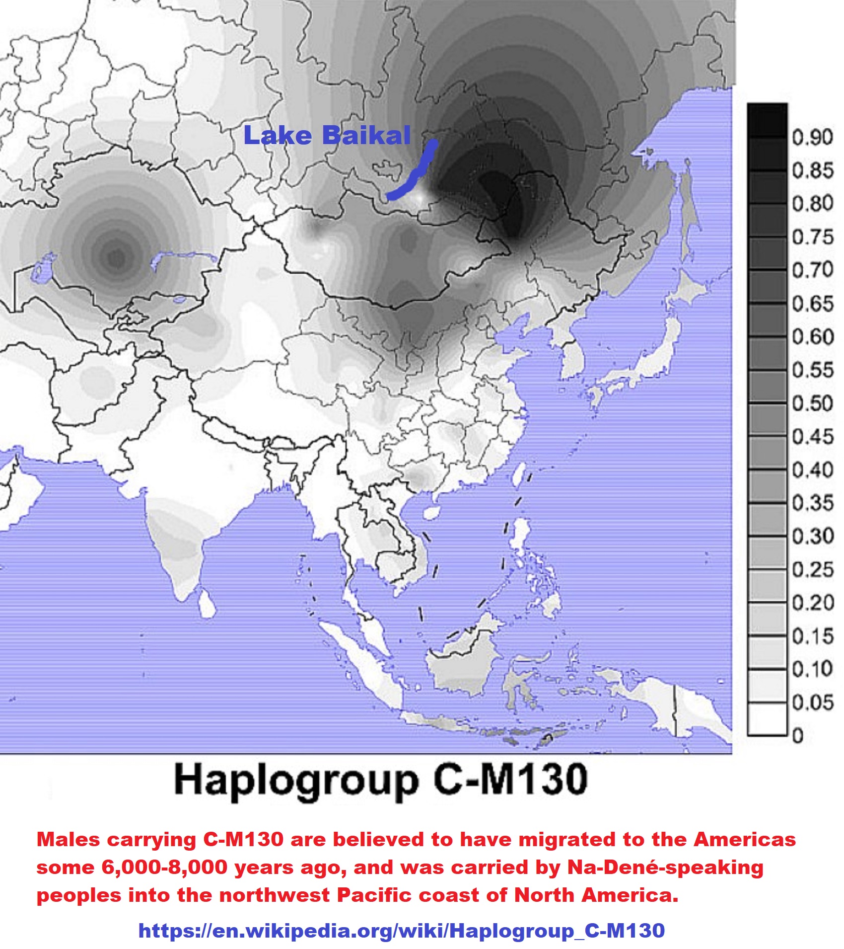
“In a paper, “Insights into the origin of rare haplogroup C3* Y chromosomes in South America from high-density autosomal SNP genotyping,” by Mezzavilla et al, research shows that haplogroup C3* (M217, P44, Z1453), previously believed to be exclusively East Asian, is indeed, Native American. Subgroup C-P39 (formerly C3b) was previously proven to be Native and is found primarily in the eastern US and Canada although it was also reported among the Na-Dene in the 2004 paper by Zegura et all titled “High-resolution SNPs and microsatellite haplotypes point to a single recent entry of Native American Y chromosomes into the Americas.” ref
“The discovery of C3* as Native is great news, as it more fully defines the indigenous American Y chromosome landscape. It also is encouraging in that several mitochondrial haplogroups, including variants of M, have also been found in Central and South America, also not previously found in North America and also only previously found in Asia, Polynesia, and even as far away as Madagascar. They too had to come from someplace and desperately need additional research of this type.” ref
“There is a great deal that we don’t know today that remains to be discovered. As in the past, what is thought to be fact doesn’t always hold water under the weight of new discoveries – so it’s never wise to drive a stake too far in the ground in the emerging world of genetics. You can view the Y DNA projects for C-M217 here, C-P39 here, and the main C project here. Please note that on the latest version of the ISOGG tree, M217, P44, and Z1453 are now listed as C2, not C3. Also, note that I added the SNP names in this article. The Mezzavilla paper references the earlier C3 type naming convention which I have used in discussing their article to avoid confusion.” ref
“In the Messavilla study, fourteen individuals from the Kichwa and Waorani populations of South America were discovered to carry haplogroup C3*. Most of the individuals within these populations carry variants of expected haplogroup Q, with the balance of 26% of the Kichwa samples and 7.5% of the Waorani samples carrying C3*. MRCA estimates between the groups are estimated to be between 5.0-6.2 KYA, or years before present. Other than one C3* individual in Alaska, C3* is unknown in the rest of the Native world including all of North American and the balance of Central and South America, but is common and widespread in East Asia.” ref
In the paper, the authors state that:
“We set out to test whether or not the haplogroup C3* Y chromosomes found at a mean frequency of 17% in two Ecuadorian populations could have been introduced by migration from East Asia, where this haplogroup is common. We considered recent admixture in the last few generations and, based on an archaeological link between the middle Jōmon culture in Japan and the Valdivia culture in Ecuador, a specific example of ancient admixture between Japan and Ecuador 6 Kya.” ref
“In a paper, written by Estrada et all, titled “Possible Transpacific Contact on the Cost of Ecuador”, Estrada states that the earliest pottery-producing culture on the coast of Ecuador, the Valdivia culture, shows many striking similarities in decoration and vessel shape to the pottery of eastern Asia. In Japan, resemblances are closest to the Middle Jomon period. Both early Valdivia and Middle Jomon are dated between 2000 and 3000 BCE. A transpacific contact from Asia to Ecuador during this time is postulated.” ref
This of course, opens the door for Asian haplogroups not found elsewhere to be found in Ecuador.
“The introduction of the Mezzabilla paper states: The consensus view of the peopling of the Americas, incorporating archaeological, linguistic, and genetic evidence, proposes colonization by a small founder population from Northeast Asia via Beringia 15–20 Kya (thousand years ago), followed by one or two additional migrations also via Alaska, contributing only to the gene pools of North Americans, and little subsequent migration into the Americas south of the Arctic Circle before the voyages from Europe initiated by Columbus in 1492.” ref
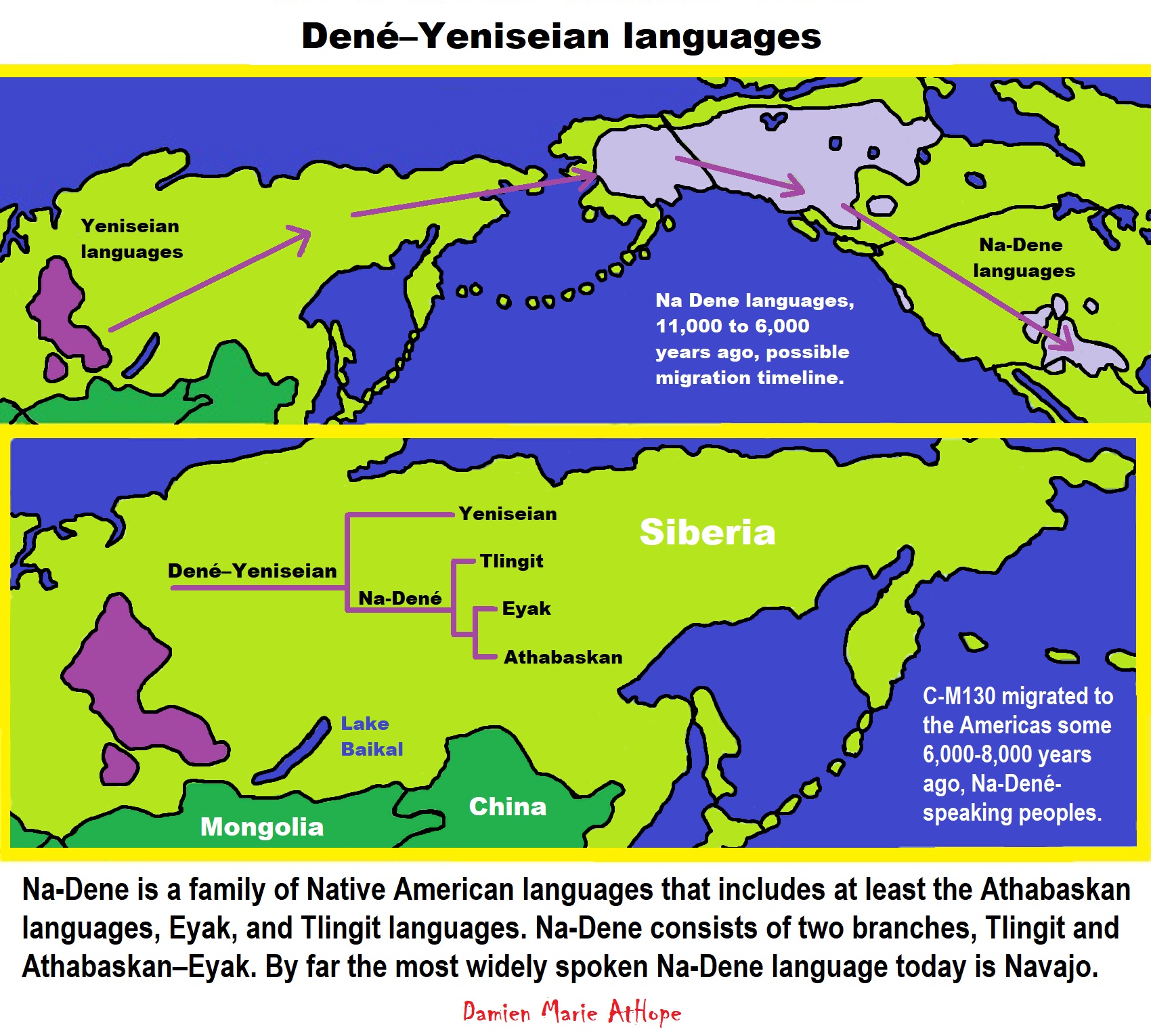
“In the most detailed genetic analysis thus far, for example, Reich and colleagues identified three sources of Native American ancestry: a ‘First American’ stream contributing to all Native populations, a second stream contributing only to Eskimo-Aleut-speaking Arctic populations, and a third stream contributing only to a Na-Dene-speaking North American population.” ref
“Nevertheless, there is strong evidence for additional long-distance contacts between the Americas and other continents between these initial migrations and 1492. Norse explorers reached North America around 1000 CE and established a short-lived colony, documented in the Vinland Sagas and supported by archaeological excavations. The sweet potato (Ipomoea batatas) was domesticated in South America (probably Peru), but combined genetic and historical analyses demonstrate that it was transported from South America to Polynesia before 1000–1100 CE. Some inhabitants of Easter Island (Rapa Nui) carry HLA alleles characteristic of South America, most readily explained by gene flow after the colonization of the island around 1200 CE but before European contact in 1722.” ref
“In Brazil, two nineteenth-century Botocudo skulls carrying the mtDNA Polynesian motif have been reported, and a Pre-Columbian date for entry of this motif into the Americas discussed, although a more recent date was considered more likely. Thus South America was in two-way contact with other continental regions in prehistoric times, but there is currently no unequivocal evidence for outside gene flow into South America between the initial colonization by the ‘First American’ stream and European contact.” ref
“The researchers originally felt that the drift concept, which means that the line was simply lost to time in other American locations outside of Ecuador, was not likely because the populations of North and Central America have in general experienced less drift and retained more diversity than those in South America.” ref
“The paper abstract states: The colonization of Americas is thought to have occurred 15–20 thousand years ago (Kya), with little or no subsequent migration into South America until the European expansions beginning 0.5 Kya. Recently, however, haplogroup C3* Y chromosomes were discovered in two nearby Native American populations from Ecuador. Since this haplogroup is otherwise nearly absent from the Americas but is common in East Asia, and an archaeological link between Ecuador and Japan is known from 6 Kya, an additional migration 6 Kya was suggested.” ref
“Here, the generated high-density autosomal SNP genotypes from the Ecuadorian populations and compared them with genotypes from East Asia and elsewhere to evaluate three hypotheses: a recent migration from Japan, a single pulse of migration from Japan 6 Kya, and no migration after the First Americans. First, using forward-time simulations and an appropriate demographic model, we investigated our power to detect both ancient and recent gene flow at different levels. Second, we analyzed 207,321 single nucleotide polymorphisms from 16 Ecuadorian individuals, comparing them with populations from the HGDP panel using descriptive and formal tests for admixture. Our simulations revealed good power to detect recent admixture, and that ≥5% admixture 6 Kya ago could be detected.” ref
“However, in the experimental data we saw no evidence of gene flow directly from Japan to Ecuador. In summary, we can exclude recent migration and probably admixture 6 Kya as the source of the C3* Y chromosomes in Ecuador, and thus suggest that they represent a rare founding lineage lost by drift elsewhere.” ref
The conclusions from the paper states that:
“Three different hypotheses to explain the presence of C3* Y chromosomes in Ecuador but not elsewhere in the Americas were tested: recent admixture, ancient admixture ∼6 Kya, or entry as a founder haplogroup 15–20 Kya with subsequent loss by drift elsewhere. We can convincingly exclude the recent admixture model, and find no support for the ancient admixture scenario, although cannot completely exclude it. Overall, our analyses support the hypothesis that C3* Y chromosomes were present in the “First American” ancestral population, and have been lost by drift from most modern populations except the Ecuadorians. It will be interesting as additional people are tested and more ancient DNA is discovered and processed to see what other haplogroups will be found in Native people and remains that were previously thought to be exclusively Asian, or perhaps even African or European.” ref
“This discovery also begs a different sort of question that will eventually need to be answered. Clearly, we classify the descendants of people who arrived with the original Beringian and subsequent wave migrants as Native American, Indigenous American, or First Nations. However, how would we classify these individuals if they had arrived 6000 years ago, or 2000 years ago – still before Columbus or significant European or African admixture – but not with the first wave of Asian founders? If found today in South Americans, could they be taken as evidence of Native American heritage? Clearly, in this context, yes – as opposed to African or European. Would they still be considered only Asian or both Asian and Native American in certain contexts – as is now the case for haplogroup C3* (M217)? This scenario happening in 2014 could easily and probably will happen with other haplogroups as well.” ref
Thunderbird (mythology)
“The thunderbird is a legendary creature in certain North American indigenous peoples’ history and culture. It is considered a supernatural being of power and strength. Pacific NW (Haida) imagery of a double thunderbird. It is especially important, and frequently depicted, in the art, songs, and oral histories of many Pacific Northwest Coast cultures, but is also found in various forms among some peoples of the American Southwest, East Coast of the United States, Great Lakes, and Great Plains. The thunderbird is said to create thunder by flapping its wings (Algonqian, ), and lightning by flashing its eyes (Algonquian, Iroquois.)
Algonquian
Mississaugas, Ho-Chunk, Menominee
Tribal signatures using thunderbirds on the Great Peace of Montreal.
‘”The thunderbird myth and motif is prevalent among Algonquian peoples in the “Northeast”, i.e., Eastern Canada (Ontario, Quebec, and eastward) and Northeastern United States, and the Iroquois peoples (surrounding the Great Lakes). The discussion of the “Northeast” region has included Algonquian-speaking people in the Lakes-bordering U.S. Midwest states (e.g., Ojibwe in Minnesota). In Algonquian mythology, the thunderbird controls the upper world while the underworld is controlled by the underwater panther or Great Horned Serpent. The thunderbird creates not just thunder (with its wing-flapping), but lightning bolts, which it cast at the underworld creatures. Thunderbirds in this tradition may be depicted as a spread-eagled bird (wings horizontal head in profile), but also quite commonly with the head facing forward, thus presenting an X-shaped appearance overall (see under §Iconography below).” ref
Ojibwe
“The Ojibwe version of the myth states that the thunderbirds were created by Nanabozho for the purpose of fighting the underwater spirits. They were also used to punish humans who broke moral rules. The thunderbirds lived in the four directions and arrived with the other birds in the springtime. In the fall they migrated south after the ending of the underwater spirits’ most dangerous season.” ref
Menominee
Seal of the Menominee Nation featuring a thunderbird
“The Menominee of Northern Wisconsin tell of a great mountain that floats in the western sky on which dwell the thunderbirds. They control the rain and hail and delight in fighting and deeds of greatness. They are the enemies of the great horned snakes (the Misikinubik) and have prevented these from overrunning the earth and devouring mankind. They are messengers of the Great Sun himself. Thunderbird from the Great Lakes region. The thunderbird motif is also seen in Siouan-speaking peoples, which include tribes traditionally occupying areas around the Great Lakes.” ref
Ho-Chunk
“Ho-Chunk tradition states that a man who has a vision of a thunderbird during a solitary fast will become a war chief of the people.” ref
Iconography
Crest of the Anishinaabe
X-shapes
“In Alogonquian images, an X-shaped thunderbird is often used to depict the thunderbird with its wings alongside its body and the head facing forwards instead of in profile. The depiction may be stylized and simplified. A headless X-shaped thunderbird was found on an Ojibwe midewiwin disc dating to 1250–1400 CE. In an 18th century manuscript (a “daybook” ledger) written by the namesake grandson of Governor Matthew Mayhew, the thunderbird pictograms varies from a “recognizable birds to simply an incised X”.” ref
In modern usage
“Thunderbird at the top of the totem pole in front of Wawadit’la, a Kwakwaka’wakw First Nation big house built by Chief Mungo Martin in 1953, located at Thunderbird Park in Victoria, BC. In 1925, Aleuts were recorded as using the term to describe the Douglas World Cruiser aircraft which passed through Atka on the first aerial circumnavigation by a US Army team the previous year. In one of his speeches, which took place few days before the Iranian revolution, Shapour Bakhtiar, the last Prime Minister of Imperial Iran, said: “I am a thunderbird. I am not afraid of the storm”.[a] Due to this, Bakhtiar is known as the Thunderbird.” ref
Ancient DNA Yields Unprecedented Insights into Mysterious Chaco Civilization
“The results suggest that a maternal “dynasty” ruled the society’s greatest mansion for more than 300 years, but concerns over research ethics cast a shadow on the technical achievement.” ref
Valdivia culture
“The Valdivia culture is one of the oldest settled cultures recorded in the Americas. It emerged from the earlier Las Vegas culture and thrived on the Santa Elena peninsula near the modern-day town of Valdivia, Ecuador between 3500 BCE and 1500 BCE. Remains of the Valdivia culture were discovered in 1956 on the western coast of Ecuador by the Ecuadorian archeologist Emilio Estrada, who continued to study this culture. American archeologists Clifford Evans and Betty Meggers joined him in the early 1960s in studying the type-site.” ref
“The Valdivia lived in a community that built its houses in a circle or oval around a central plaza. They were believed to have a relatively egalitarian culture of sedentary people who lived mostly off fishing, though they did some farming and occasionally hunted for deer to supplement their diet. From the archeological remains that have been found, it has been determined that Valdivians cultivated maize, kidney beans, squash, cassava, chili peppers, and cotton plants. The latter was processed, spun, and woven to make clothing.” ref
“Valdivian pottery, dated to 2700 BCE, initially was rough and practical, but it became splendid, delicate, and large over time. They generally used red and gray colors, and the polished dark red pottery is characteristic of the Valdivia period. In their ceramics and stone works, the Valdivia culture shows a progression from the most simple to much more complicated works. The trademark Valdivia piece is the “Venus” of Valdivia: feminine ceramic figures. The “Venus” of Valdivia likely represented actual people, as each figurine is individual and unique, as expressed in the hairstyles. The figures were made joining two rolls of clay, leaving the lower portion separated as legs and making the body and head from the top portion. The arms were usually very short, and in most cases were bent towards the chest, holding the breasts or under the chin. A display of Valdivian artifacts is located at Universidad de Especialidades Espíritu Santo in Guayaquil, Ecuador.” ref
Influences on Valdivia culture
“Ceramic phase A of the Valdivia was long thought to be the oldest pottery produced by a coastal culture in South America, dated to 3000-2700 BCE. In the 1960s, a team of researchers proposed there were significant similarities between the archeological remains and pottery styles of Valdivia and those of the ancient Jōmon culture, active in this same period on the island of Kyūshū, Japan). They compared both decoration and vessel shape, pointing to techniques of incising. The Early to Middle Jomon pottery had antecedents dating 10,000 years, but the Valdivia pottery style seemed to have developed rather quickly. In 1962 three archeologists, Ecuadorian Emilio Estrada and Americans Clifford Evans and Betty Meggers suggested that Japanese fishermen had gotten blown to Ecuador in a storm and introduced their ceramics to Valdivia at that time. Their theory was based on the idea of diffusion of style and techniques. Their concept was challenged at the time by other archaeologists, who argued that there were strong logistical challenges to the idea that Japanese could have survived what would have been nearly a year and a half voyage in dugout canoes. The cultures were separated by a distance of 15,000 km (8,000 nautical miles). Researchers argued that Valdivia ceramics (and culture) had developed independently, and those apparent similarities were a result simply of constraints on technique, and an “accidental convergence” of symbols and style.” ref
“In the 1970s, what is believed widely to be conclusive evidence refuting the diffusion theory was found at the Valdivia type-site, as older pottery and artifacts were found below these excavations. Researchers found what is called San Pedro pottery, pre-dating Phase A and the Valdivia style. It was more primitive. Some researchers believe pottery may have been introduced by people from northern Colombia, where comparably early pottery was found at the Puerto Hormiga archaeological site. In addition, they think that the maize at Valdivia was likely introduced by people living closer to Meosamerica, where it was domesticated. In addition, other pottery remains of the San Pedro style were found at sites about 5.6 miles (9 km) up the river valley. Additional research at both several coastal sites, including San Pablo, Real Alto, and Salango, and Loma Alta, Colimes, and San Lorenzo del Mate inland have resulted in a major rethinking of Valdivian culture. It has been reclassified as representing a “tropical forest culture” with a riverine settlement focus. There has been major re-evaluation of nearly every aspect of its culture.” ref
Ceramics of indigenous peoples of the Americas
“Native American pottery is an art form with at least a 7500-year history in the Americas. Pottery is fired ceramics with clay as a component. Ceramics are used for utilitarian cooking vessels, serving and storage vessels, pipes, funerary urns, censers, musical instruments, ceremonial items, masks, toys, sculptures, and a myriad of other art forms.” ref
“Due to their resilience, ceramics have been key to learning more about pre-Columbian indigenous cultures. The earliest ceramics known from the Americas have been found in the lower Amazon Basin. Ceramics from the Caverna da Pedra Pintada, near Santarém, Brazil, have been dated to 9,500 to 5,000 years ago. Ceramics from Taperinha, also near Santarém, have been dated to 7,000 to 6,000 years ago. Some of the sherds at Taperinho were shell-tempered, which allowed the sherds themselves to be radiocarbon dated. These first ceramics-making cultures were fishers and shellfish-gatherers.” ref
“Ceramics appeared next across northern South America and then down the western side of South America and northward through Mesoamerica. Ceramics of the Alaka culture in Guyana have been dated to 6,000 to 4,500 years ago. Ceramics of the San Jacinto culture in Colombia have been dated to about 4530 BCE, and at Puerto Hormiga, also in Colombia, to about 3794 BCE. Ceramics appeared in the Valdivia culture in Ecuador around 3200 BCE, and in the Pandanche culture in Peru around 2460 BCE.” ref
“The spread of ceramics in Mesoamerica came later. Ceramics from Monagrillo in Panama have been dated to around 2140 BCE, from Tronadora in Costa Rica to around 1890 BCE, and from Barra in the Soconusco of Chiapas to around 1900 BCE. Ceramics of the Purrón tradition in southcentral Mexico have been dated to around 1805 BCE, and from the Chajil tradition of northcentral Mexico, to around 1600 BCE.” ref
“The appearance of ceramics in the Southeastern United States does not fit the above pattern. Ceramics from the middle Savannah River in Georgia and South Carolina (known as Stallings, Stallings Island, or St. Simons) have been dated to about 2888 BCE, and ceramics of the Orange and Norwood cultures in northern Florida to around 2460 BCE (all older than any other dated ceramics from north of Colombia). Ceramics appeared later elsewhere in North America. Ceramics reached southern Florida (Mount Elizabeth) by 4000 BP, Nebo Hill (in Missouri) by 3700 BP, and Poverty Point (in Louisiana) by 3400 BP.” ref
Cultural regions
North America
Arctic
“Several Inuit communities, such as the Netsilik, Sadlermiut, Utkuhiksalik, and Qaernerimiut created utilitarian pottery in historic times, primarily to store food. In Rankin Inlet, Nunavut, Canada, when the mine that employed much of the community closed down, the national government created the Rankin Inlet Ceramics Project, whose wares were successfully exhibited in Toronto in 1967. The project foundered but a local gallery revived interest in Inuit ceramics in the 1990s.” ref
Eastern Woodlands
- “Hopewell pottery is the ceramic tradition of the various local cultures involved in the Hopewell tradition (ca. 200 BCE to 400 CE) and are found as artifacts in archeological sites in the American Midwest and Southeast.
- Mississippian culture pottery is the ceramic tradition of the Mississippian culture (800–1600 CE) found as artifacts in archaeological sites in the American Midwest and Southeast.” ref
Southeastern Woodlands
“Geological studies show that certain areas of the southeastern portion of North America are rich in kaolins and ball clays (Hosterman, USGS), the types of plastic clays best suited for pottery. Clay beds that still produce ceramic clays are from primary and secondary deposits formed in the Late Paleocene and Early Miocene Epochs in formations that formed the Gulf Coastal Plain. According to all geological surveys the entire southeastern portion of the continent has abundant clay deposits, with the exception of all of south Florida and a portion of western central Florida (Calver) (Matson).” ref
“Fiber-tempered ceramics associated with shell middens left by Late Archaic hunter-fisher-gatherers appeared in the Atlantic coastal plain of Florida, Georgia, and South Carolina starting in 2500 BCE. The earliest attested pottery is in the Stallings culture area, around the middle Savannah River. Fiber-tempered pottery of the Orange culture in northeast Florida has been dated to 2000 BCE or a bit earlier. Fiber-tempered pottery of very similar form spread along coasts and river valleys of the Southeastern United States from the Atlantic coast into Alabama, reaching northwestern Florida (Norwood culture) and the Gulf coast by 1300 BCE, the interior Middle South by 1100, and Poverty Point by 1000 BCE. Thoms Creek ceramics closely resembled Stallings ceramics, but used more sand and less fiber as temper than Stalling or Orange ware. Thoms Creek ceramics were largely contemporary with Stalling and Orange ceramics, although no Thoms Creek ceramics have been found that are as early as the earliest Stallings. Thoms Creek ceramics overlapped Stallings ceramics in northern Georgia and southern South Carolina, but were the dominant tradition north of the Santee River into North Carolina.” ref
“The similarities of the Stallings series ceramics to the earlier Puerto Hormiga ceramics of Colombia, which were both associated with shell rings, and the presence of winds and ocean currents favoring journeys from South America to the Southeastern United States, led James A. Ford, among other archaeologists, to offer the hypothesis that the two areas had connections, and that the technology of fiber-tempered ceramics in the southeastern United States had been imported from Colombia. Other archaeologists have noted that there are no known archaeological sites between Colombia and Florida that are of a type or age consistent with such connections, and that the cultural traditions of the Southeastern United States show no significant changes associated with the appearance of ceramics, indicating that there was no migration of people, and no transfer of technology or other elements of culture, other than the appearance of ceramics. Later significant developments in ceramics in the Southeastern Woodlands included Mississippian culture pottery in the Mississippi River valley, and Weedon Island pottery, a style of pottery used primarily in ceremonial contexts and high-status burials, produced and traded along the Gulf of Mexico coast from southwestern Florida to the Florida panhandle.” ref
- Swift Creek and Santa Rosa culture pottery post Deptford, northwest Florida, ceremonial decorative pottery, 1000 CE.
- Glade and Belle Glade culture pottery fiber or sand-tempered crude pottery, south Florida to central Florida, 500 BCE until 1700 CE, reference four periods I, II, III, and IV
- Alachua culture pottery northeast, north-central Florida, protohistoric period
- Plaquemine culture pottery, ceramics of the Natchez people, a historic tribe known also to be one of the last of the Plaquemine culture chiefdoms in southwestern Mississippi
- Fort Walton culture pottery distinctively Mississippi culture in Florida panhandle, developed out of the Weedon Island culture 1000 CE.” ref
Great Basin
“Indigenous peoples of the Great Basin based their pottery on basketry. The Fremont culture of central Utah (700–1300 CE) developed pottery after adopting agriculture. Paiute and Washoe people in the western Great Basin developed plain, utilitarian ceramics separately, which was not burnished but occasionally featured red painted designs. The Owens Valley Brown Ware is an example of Paiute/Washoe ceramics, which was used for cooking, food storage, and water jugs. The jugs often featured clay handles that accommodated carrying straps.” ref
Southwestern cultures (Oasisamerica)
Main article: Art_of_the_American_Southwest § Pottery
Pueblo cultures
- “Ancestral Pueblo
- Mogollon culture, including Mimbres culture, which produced Mimbres pottery
- Santa Clara Pueblo, Taos Pueblo, Hopi, San Ildefonso Pueblo, Acoma Pueblo and the Zuni. Noted individuals involved in Pueblo pottery include Nampeyo of the Hopi, and Maria and Julian Martinez of San Ildefonso Pueblo. In the early 1900s, Maria Martinez and her husband Julian rediscovered how to make the traditional Black-on Black pottery, for which San Ildefonso Pueblo would soon become widely known.” ref
O’odham cultures
Athabaskan
“Southern Athabaskans include the Apache and Navajo.” ref
Other
- The Salado culture (1150–15th century CE) of Arizona and New Mexico produced Salado Polychrome.
- Casas Grandes ref
Mesoamerican pottery
- Barra/Mokaya (c. 1900 BCE)
- Tlatilco (c. 1500 BCE)
- Olmec (c. 1500–400 BCE)
- Teotihuacan (c. 300 BCE – 600 CE)
- Zapotec (c. 200–800 CE)
- Mixtec(c. 900 CE)
- Purépecha (c. 800–1300 CE)
- Maya ceramics (c. 317–1200 CE)
- Remojadas (c. 750 CE)
- Toltec / Mayan (c. 1200–1500 CE)
- Aztec (c. 1168–1519 CE)
- Coclé, Panama with the following periods: La Mula (c. 150 BCE – 300 CE), Tonosi (c. 300–550 CE), Cubita (c. 550–700 CE), and Gran Cocle (c. 1200–1500 CE).
- Classic Veracruz Culture (c. 100–1000 CE)
- Capacha (c. 1500 BCE to 1000 BCE)
- Western Mexico shaft tomb tradition (c. 300 BCE to 550 CE) ref
Circum-Caribbean
Antilles
“Ceramics first appeared in the Antilles as part of the Saladoid culture (named for the Saladero site in the Orinoco basin in Venezuela. Saladoid people appeared in Trinidad around 500 BC or a little later, and had reached Puerto Rico by about 250 BC. The Cedrosan variety of Saladoid ceramics appeared in Trinidad early on, although ceramics in the Antilles continued to closely resemble forms on the Venezuela coast into the Current Era. Cedrosan Saladoid vessels have a distinctive bell shape with “zone-incised cross-hatching”. Many also have complex designs of white on red paint. Later examples were decorated with purple, black, yellow, and orange paint. These ceramics are described as “technologically fine, delicate, and graceful.” Other ceramics styles are also known from the Antilles during this time period. Barrancoid trade wares, of a style that had developed in the Orinoco River valley around 1000 BCE, have been found in the southernmost Antilles; Trinidad, Tobago, and Saint Vincent. A variant of Saladoid ceramics called Huecan has been found from the north coast of Venezuela to Puerto Rico.” ref
Colombia and Venezuela
“Fiber-tempered ceramics associated with shell middens left by hunter-fisher-gatherers of the Early Northwest South American Literature appeared at sites such as Puerto Hormiga, Monsú, Puerto Chacho, and San Jacinto in Colombia by 3100 BCE. Fiber-tempered ceramics at Monsú have been dated to 5940 radiocarbon years before present. The fiber-tempered pottery at Puerto Hormiga was “crude”, formed from a single lump of clay. The fiber-tempered pottery at San Jacinto is described as “well-made”. Sand-tempered coiled ceramics have also been found at Puerto Horrible.” ref
“Ráquira, a town in the Boyacá Department, Colombia, is a major ceramics center, where both indigenous techniques and those introduced by Europeans are employed to create primarily utilitarian pots based on Chibcha designs. Ceramic mobiles, nativity scenes, and animal figurines are popular, especially ceramic horses, which have been the symbol of Colombian pottery. La Chamba in the Tolima Department is known for its blackware. The women potters here also create brown and red ware.” ref
Andean region
Further information: Huaco (pottery)
“In the Andes, ceramics appear during the Initial Period around 1800 BCE. They were needed for boiling agricultural foods Chavín potters on the Peruvian coast create distinctive stirrup spout vessels, both incised and highly burnished. These thin-walled effigy pots were fashioned to resemble stylized humans, plants, and animals. Two substyles of Chavín stirrup spout pots include the thicker-walls, glossy-on-matte blackware Cupisnique style, and red and black Santa Ana style, both featuring fanged heads. Subsequent Andean cultures revived these ancient ceramics styles and imagery.” ref
“Paracas culture, from Peru’s desert south coast, created highly detailed ceramics, that were often painted after firing. Paints, made with an acacia resin binder, were commonly warm yellow, olive green, red-orange, white, and black in color. Paracas artists built upon Chavín styles and introduced the double spout-and-bridge vessel and distinctive masks portraying a supernatural “Oculate Being,” that combines human, owl, and double-headed snake forms. Nasca culture, another south coastal Peruvian culture, returned to the less fragile practice slip-painted their ceramics prior to firing. They created thirteen distinct colors, the larger palette found in Pre-Columbian ceramics in the Americas, which included rare pale purple, maroon, and bluish-grey. Nasca artists created ceremonial and utilitarian bowls and beakers, effigy jars, panpipes, and vessels of new designs, including the stepped-fret. These combined sculptural elements with surface painting, often with curvilinear designs emphasized by bold, black outlining. Painters used revolving turntables to paint all sides of a ceramic piece.” ref
“Dominating Peru’s north coast from 1–600 CE, the Moche culture excelled at the art of ceramics, which was characterized by symbolic, religious imagery. Moche artists produced some of the more naturalistic, i.e. faithfully representational, artwork of the precolumbian Americas. Moche portrait vessel were so realistic that individuals portrayed at different stages of their life are identifiable. Their paintings on ceramics were narrative and action-packed. Ceramics produced by two-press molds were identical in shape but individualized through unique surface painting. Tens of thousands of Moche ceramics have survived today. The stirrup-spout vessel continued to be the most common form of clay vessel, but Moche artists also created bowls, dippers, jars with long necks, spout-and-handle vessels, and double-chambered vessels that whistled when liquid was poured. Vessels were often effigies portraying elaborate scenes. A fineline painting tradition emerged, which resembles Greek black-figure pottery. A 29,000-square-foot Moche ceramics workshop with numerous kilns was discovered in at the mountain Mayal in the Chicama Valley. The workshop specialized in female figurines.” ref
“The Tiwanaku and Wari cultures shared dominance of the Andes, roughly from 500 to 1000 BCE. The Tiwanaku civilizations originated in Lake Titicaca region of Bolivia, and a staff-bearing deity figured largely in their artwork. Tiwanaku artists continued the tradition of naturalistic, ceramic portrait vessels. The ubiquitous Wari ceramics carried over imagery from their textiles and metalwork, such as llama and alpaca imagery. Qunchupata in Peru was the epicenter of Wari ceramic production, featuring pit kilns and firing rooms. The stone floors of the firing rooms had rounded depressions for accommodating larger pots. Some Wari palaces had their own attached kilns. Broken potsherds were used as forms for building new pots and for scrapers. Evidence shows ceramics were often ritually destroyed.” ref
“Four Andean civilizations flourished in Late Intermediate Period: the Chancay, Chimú, Lambayeque, and Ica. Luxury goods, including elaborate ceramics, were mass-produced in vast quantities for the middle class as well as nobles. Identical ceramics created in molds took sway over individualized works. The Lambayeque culture of north coastal Peru created press-molded reliefs on blackware ceramics. Chimú ceramics, also predominantly blackware, often featured zoomorphic appliqués, such as monkeys or sea birds. They excelled at the doubled-chambered whistling vessels. Chancay ceramics, from the central coast, featured black-on-white designs on unique shapes, such as female effigies or elongated, oval jars. Their sand-tempered ceramics were hastily painted and left unpolished. Ica culture ceramics, from the southern coasts, were the finest quality of their time. They were still handcrafted and had a wide range of polychrome slips, including black, maroon, orange, purple, red, white, and a glittery deep purple. Designs were abstract and geometric.” ref
“The Inca Empire or Tawantinsuyo spanned 3500 miles and controlled the world’s largest empire by 1500 CE. Artistically, they unified regional styles. Incan ceramics were geometric and understated, while color schemes remained regionally diverse. Mass-produced pottery, conformed to standardized measurements, such as the urpu, a long-necked jar with handles and a pointed bottom used to transport maize and chicha, maize beer. Qirus were Incan drinking vessels, made from wood or precious metals, as well as ceramics.” ref
Gran Chaco
“Guaraní ceramics fall into two major categories: na’e, or dishes, and yapepó, pots, pans, and storage containers. These were both utilitarian and ceremonial. The precontact ceramic tradition of the Gran Chaco was dramatically transformed under European colonization, which created a demand for pitchers, cups, and other introduced pottery forms. Author Josefina Pla observed that women are typically potters, and animals associated with men are not represented in Guaraní pottery.” ref
Tobatí, a city near Asunción, Paraguay, is renowned for its ceramics, including tiles and female effigy jars, known as Las gorgas. A reddish-brown slip, known as tapyta in Guaraní, is popular, with blackware being less common. A local ceramic artist, Don Zenón Páez (b. 1927) became famous for his ceramic figures of saints. Itá, Paraguay is another ceramic center, known for its whimsical, ceramic chickens. Rosa Brítez (b. 1941) is a famous ceramic artist from Itá and has been recognized by UNESCO. The Museo del Barro, “Museum of Clay,” in Asunción features pottery from the Gran Chaco, from Pre-Columbian Guaraní to contemporary mestizo ceramics.” ref
Amazonia
“The pottery tradition at Pedra Pintada in Brazil represents the oldest known ceramics in the Americas. Dating back to 5630 BCE, this same tradition continued for 2500 years. Ceramics from the Taperinha site near Santarém, Brazil date back to 5130 BCE and include sand-tempered bowls and cooking vessels resembling gourds. Other ancient Amazonian ceramic traditions, Mina and Uruá-Tucumã featured shell- and sand-tempered pottery, that was occasionally painted red. Around 1000 CE, dramatic new ceramic styles emerged throughout Amazonia. Amazonian ceramics are geometric and linear in decoration. Polychrome pottery typically features red and black on white slips. Additionally, ceramics were decorated by sculpting, incision, excision, and grooving. In the upper and central Amazon, the bark of the caraipé tree, Licania octandra, provided tempering material.” ref
“In regions of terra preta, or “black earth”, of the Amazon rainforest, an abundance of potsherds were used to develop the soil and build mounds, which protected buildings and cemeteries from seasonal flooding. Marajó Island, located at the mouth of the Amazon River was a major ceramic center, where the Marajoara Phase of polychrome ceramics last from around 400 to 1300 CE. In the central Amazon, the Mancapuru Phase, or Incised Rim Tradition, emerged in the 5th century CE. Marajoara ceramics, typically tempered with grog, were complex effigies of humans and animals, such as reptiles and birds. The dead were cremated and buried in elaborate ceramic urns. Ceramic artists are active in Marajó, using precontact styles for inspiration. Women have traditionally been the ceramic artists in the Amazon. Female figures are common in anthropomorphic effigy vessels. Tangas are a unique Amazonian cultural item; they are triangular, concave ceramic pubic coverings held in place by strings, once worn by women of several Amazonian tribes. Today, they are still worn by girls during their puberty rites among Panoan-speaking peoples.” ref
Ceramics forms
Genetic origins of the Ainu inferred from combined DNA analyses of maternal and paternal lineages
Abstract
“The Ainu, a minority ethnic group from the northernmost island of Japan, was investigated for DNA polymorphisms both from maternal (mitochondrial DNA) and paternal (Y chromosome) lineages extensively. Other Asian populations inhabiting North, East, and Southeast Asia were also examined for detailed phylogeographic analyses at the mtDNA sequence type as well as Y-haplogroup levels. The maternal and paternal gene pools of the Ainu contained 25 mtDNA sequence types and three Y-haplogroups, respectively. Eleven of the 25 mtDNA sequence types were unique to the Ainu and accounted for over 50% of the population, whereas 14 were widely distributed among other Asian populations. Of the 14 shared types, the most frequently shared type was found in common among the Ainu, Nivkhi in northern Sakhalin, and Koryaks in the Kamchatka Peninsula. Moreover, analysis of genetic distances calculated from the mtDNA data revealed that the Ainu seemed to be related to both the Nivkhi and other Japanese populations (such as mainland Japanese and Okinawans) at the population level. On the paternal side, the vast majority (87.5%) of the Ainu exhibited the Asian-specific YAP+ lineages (Y-haplogroups D-M55* and D-M125), which were distributed only in the Japanese Archipelago in this analysis. On the other hand, the Ainu exhibited no other Y-haplogroups (C-M8, O-M175*, and O-M122*) common in mainland Japanese and Okinawans. It is noteworthy that the rest of the Ainu gene pool was occupied by the paternal lineage (Y-haplogroup C-M217*) from North Asia including Sakhalin. Thus, the present findings suggest that the Ainu retain a certain degree of their own genetic uniqueness, while having higher genetic affinities with other regional populations in Japan and the Nivkhi among Asian populations.” ref
“Although the first people entered what is now the Mississippi about 12,000 years ago, the earliest major phase of earthen mound construction in this area did not begin until some 2100 years ago. Mounds continued to be built sporadically for another 1800 years, or until around 1700 CE. Archeologists, the scientist who studies the evidence of past human lifeways, classify moundbuilding Indians of the Southeast into three major chronological/cultural divisions: the Archaic, the Woodland, and the Mississippian traditions. To date, no mounds of the Archaic period (7000 to 1000 BCE) have been positively identified in Mississippi; the mounds described herein all date to the last two cultural periods. The Middle Woodland period (100 BCE to 200 CE) was the first era of widespread mound construction in Mississippi. Middle Woodland peoples were primarily hunters and gatherers who occupied semipermanent or permanent settlements. Some mounds of this period were built to bury important members of local tribal groups.” ref
“These burial mounds were rounded, dome-shaped structures that generally range from about three to 18 feet high, with diameters from 50 to 100 feet. Distinctive artifacts obtained through long-distance trade were sometimes placed with those buried in the mounds. The construction of burial mounds declined after the Middle Woodland, and only a few were built during the Late Woodland period (circa 400 to 1000 CE). Woodland burial mounds can be visited at the Boyd, Bynum, and Pharr sites and at Chewalla Lake in Holy Springs National Forest. (The Chewalla Mound is not included in this itinerary because it is not listed in the National Register of Historic Places).” ref
“The Mississippian period (1000 to 1700 CE) saw a resurgence of mound-building across much of the southeastern United States. Most Mississippian mounds are rectangular, flat-topped earthen platforms upon which temples or residences of chiefs were erected. These buildings were constructed of wooden posts covered with mud plaster and had thatched roofs. Mississippian platform mounds range in height from eight to almost 60 feet and are from 60 to as much as 770 feet in width at the base. Mississippian period mounds can be seen at the Winterville, Jaketown, Pocahontas, Emerald, Grand Village, Owl Creek, and Bear Creek sites.” ref
“Mississippian period mound sites mark centers of social and political authority. They are indicators of a way of life more complex than that of the Woodland and earlier periods. In contrast to the relatively simple, egalitarian tribal organization of most societies of the Woodland period, regional Mississippian populations were typically organized into chiefdoms–territorial groups with hereditary, elite leadership classes. Across the Southeast, the chiefdom system of political organization arose as a means of managing increased social complexity caused by steady population growth. This population growth was sustained by agriculture (corn, beans, and squash)–a revolutionary new means of subsistence that became an economic mainstay during the Mississippian period.” ref
“Mound construction was once again in decline by the time the first Europeans came to this region in the 1500s. Shortly thereafter, epidemic diseases introduced by early European explorers decimated native populations across the Southeast, causing catastrophic societal disruption. As a result, by the time sustained contact with European colonists began about 1700 CE, the long tradition of mound-building had nearly ended., the long tradition of mound-building had nearly ended.” ref
Archaic Period
“The Archaic Period refers to the time between 9500 and 650 BCE in the Native American history of Arkansas. As was the case in other regions in North America, Arkansas’s Archaic Period was a long span of cultural development and innovation that transformed small-scale Paleoindian groups into the larger and more complex societies seen during the Woodland and Mississippian periods. Within the Archaic Period, archaeologists have identified more specific regional cultures, such as the Dalton, San Patrice, Tom’s Brook, Big Creek, and Poverty Point cultures. These do not correspond directly to the tribes that lived in Arkansas during the Archaic period but do show that Native American societies were adapting to different environments and to each other across Arkansas in new and distinct ways.” ref
“During the thousands of years after the Ice Age, human populations increased and settled into a range of environments across Arkansas. For the most part, Indians in the Archaic Period lived in hunter-gatherer communities that hunted, fished, and collected wild animal and plant resources for food. But it is too simplistic to view these people as roving bands of hunters or as primitive cave dwellers foraging a meager subsistence from the wilderness. It was during the Archaic Period that people first domesticated plants that later became the staple grain crops of farmers. In some areas, communities became stable and sedentary, and ritual or sacred locations were marked with mounds and earthworks. Instead of moving across the landscape to use natural resources directly, some groups traded raw materials and craft objects across wide areas.” ref
A Changing Environment
“Arkansas Indians during the Archaic Period had to adjust to changes in climate and environment following the Ice Age. While changes would not be noticed within a lifetime, these fluctuations in mean annual temperature and rainfall caused differences in the plants and animals that were available, as well as subtle alterations in water sources and terrain over the long term. While environment does not completely determine human culture, people adapt and change their behavior to succeed in a given environment (and people alter their physical environment, as well).” ref
“In the thousands of years after the Ice Age and the retreat of northern glacial ice sheets, forests spread across eastern North America. In Arkansas, oaks and hickories dominated the mixed deciduous forests, providing mast for grazing deer and supporting other woodland animals. The climate became warmer and dryer from about 7000 to 2500 BCE in what scientists have termed the “Hypsithermal” interval within the Holocene Epoch. Prairie vegetation or more open savanna land extended farther east at the expense of hardwood forests. Indians in Arkansas during the Archaic Period dealt with droughts in summer and fewer sources of water across the landscape. More stable river valleys were inviting to groups like the Tom’s Brook Culture living along the Ouachita, Arkansas, and Red river drainages in southwest Arkansas around 5000 to 4000 BCE. After 2500 BCE, a cooler and wetter period led to the climate and vegetation patterns seen in recent times.” ref
Obtaining Food
“Archaic Period Indians in Arkansas lived in habitats that contained far more plant and animal resources than were present during the preceding Ice Age. People responded to environmental changes by developing new technologies for obtaining food. Hunting animals continued to be important, and hunters used stone-tipped darts thrown with the aid of spear throwers (“atlatls”). Many styles of dart points made of chert or novaculite have been found across the region, with specific forms characteristic of different cultural groups or used during certain millennia. Other stone tools included knives for butchering game and scrapers for working with hides. Animals such as deer, turkeys, and raccoons were hunted. People fished using bone fishhooks and nets weighted by stone sinkers. Shellfish also were collected, as is evident from the preserved shells found in some household trash deposits.” ref
“Plants increased in dietary importance during the Archaic Period. Preserved remains of nut hulls on archaeological sites indicate that people processed hickory nuts, black walnuts, and hazelnuts in large quantities for the high-protein/high-fat nut oil. Processing technology included chopping, pounding, and grinding using stone tools. This new technology of making stone tools by pecking, grinding, and polishing coarse-textured sandstone or igneous rocks is also seen in the axes used by Archaic Period Indians for woodworking.” ref
Communities
“For many Archaic Period Indians, a successful adaptation to life in Arkansas mountains, forests, and river valleys meant having a variety of meat, fish, nuts, and other wild plant foods. These foods were available from many locations and at different seasons. Environmental conditions and resource availability may have encouraged people to move more often throughout the year to take advantage of widely separated resources or, alternatively, to settle down near dependable food and raw materials. Families or bands might move several times a year among several established camps in a known territory. Moving the group to the resources was a strategy that Archaic Period hunter-gatherers seem to have used in northwest Arkansas. Bluff shelters like the Albertson Site in Benton County were used for short durations by small hunting parties or seasonally by households that probably occupied other kinds of sites at different times of the year.” ref
“Another strategy for Archaic Period hunter-gatherers would be to situate the main community in a location known for dependable key resources and then send small groups to gather more distant food resources. People in the Dalton Culture in northeast Arkansas at about 9500 BCE had base settlements or villages they occupied for much of the year, with temporary food collecting and hunting camps scattered around a watershed territory. At the end of the Archaic Period, conditions may again have encouraged settling down for longer periods in certain key locations, such as at fishing locales for people of the Poverty Point Culture.” ref
“When a community settled at a base camp or a village year-round, it could construct more substantial houses and storage facilities, as well as have more kinds of tools and containers. Pottery manufacture was not developed until the Woodland Period in Arkansas, but vessels carved from soft stone (steatite or soapstone) were used by Archaic Period people of the Poverty Point Culture living in southern Arkansas.” ref
“In addition to leading to population growth and an increased sense of territoriality, settling down into year-round base camps or villages may have led to experiments in plant domestication. Archaeologists have documented the early domestication of a suite of oily- and starchy-seeded plants in the mid-continent during the Archaic Period. Squash, sunflower, sumpweed, chenopod or goosefoot, knotweed, and maygrass were domesticated 2,000 to 4,000 years ago, long before domesticated maize, beans, and new kinds of squash were introduced into the region from Mexico by way of the Southwest. Paleoethnobotanist Gayle Fritz identified domesticated chenopod and possibly domesticated giant ragweed dating to about 1200–900 BCE in preserved seeds stored in woven bags and baskets in the Marble Bluff shelter in northwest Arkansas. During the Woodland Period, these domesticated plants became important staple foods, with accompanying changes in cooking technology, such as the use of fired-clay cooking pots.” ref
Mound building
“Construction of mounds and earthworks, once seen as a Woodland Period development, is now known to have taken place first in the Archaic Period. Unlike later in history, Archaic mounds were not used mainly for burial or as platforms for buildings but instead marked important sacred places and designated public or community space. The Poverty Point Site in northeast Louisiana is well known for its concentric semicircular earthworks, embankment, and mounds that date to several centuries around 1300 BCE. Arkansas’s candidate for the oldest mound site, Lake Enterprise, is contemporaneous with Poverty Point, according to current research.” ref
“New evidence from Louisiana indicates that Archaic Period mound-building there reaches back beyond 3000 BCE, well before the Poverty Point Culture. Contemporaneous Archaic Period groups in southern Arkansas, such as those of the Big Creek Culture (circa 4000–3000 BCE), may also have left mounds that archaeologists have yet to recognize.” ref
Trade and Interaction
“Trade and exchange—or at least movement of raw materials and finished goods from one region of Arkansas to another—is characteristic of the Archaic Period. One of the best examples is the exchange of novaculite, a fine-grained rock that outcrops in the Ouachita Mountains and was widely used by Indians to make dart points, knives, and other tools (it was also mined in the nineteenth and twentieth centuries for whetstones). There are many quarry sites in the Ouachita Mountains where Indians battered boulders and dug pits to mine seams of novaculite. Partly worked or finished stone tools were transported from workshops on the Ouachita and Saline rivers to camps or villages in south Arkansas and beyond; novaculite tools have even been found on archaeological sites in Louisiana and Mississippi.” ref
“The heaviest use of the quarries seems to have been late in the Archaic Period, when novaculite and other “exotic” stones—quartz crystal from the Ouachita Mountains, magnetite from Magnet Cove (Hot Spring County), chert from the Ozark Mountains—made their way to Poverty Point Culture sites. Clearly, Native Americans in the Archaic Period in Arkansas were not as isolated as was once thought. The movement of raw materials and finished tools and crafted goods suggests interactions between different groups of people and the circulation of ideas as well.” ref
Serpent Mounds
“The Great Serpent Mound is a 1,348-foot-long (411 m), three-foot-high prehistoric effigy mound on a plateau of the Serpent Mound crater along Ohio Brush Creek in Adams County, Ohio.” ref
“Canadian Serpent Mounds, situated on a bluff overlooking Rice Lake near Peterborough, Ont, is the only known effigy mound in Canada. Serpent Mounds, situated on a bluff overlooking Rice Lake near Peterborough, Ont, is the only known effigy mound in Canada. It is a sinuous earthen structure composed of six separate burial locations and measuring about 60 m long, 8 m wide and 1.5-1.8 m high. Excavation indicated that the mounds forming the effigy were gradually built up between 50 BCE and 300 CE. This would suggest that Serpent Mounds was a sacred place, visited periodically for religious ceremonies. Although pieces of grave furniture were not plentiful, their distribution shows they were restricted largely to individuals of higher status within the community. Those individuals were buried either at the base of the mounds or in shallow, submound pits. The commoners were randomly scattered throughout the mounds’ fill.” ref
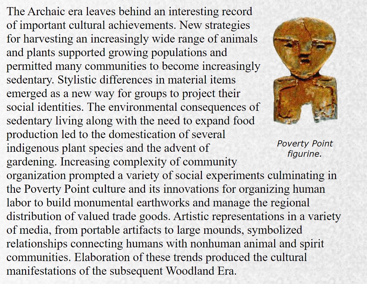
Ontario Resource Document
The Woodland Period (around 3000 – 300 years ago)
“Throughout the Archaic period, people started settling into specific parts of Ontario that they considered their own region. In each region, people had their own ways of living, of speaking, of doing things. Gradually, thee different groups became different peoples, or nations. Two major new artifacts started appearing in the different regions of Ontario by about 3000 B.P. These were pottery and the arrow (and bow). The ideas for these new things probably came from people to the south, during trading. The Early Woodland peoples had trade networks that brought them goods from as far away as Wyoming, in the west; the Gulf of Mexico, in the south and Chesapeake Bay and the Gulf of St. Lawrence, in the East. Their trading partners from the sough gave the people in southern Ontario an important idea- horticulture.” ref
“By this time, the climate had warmed enough that there were forests all over Ontario, and soil for growing crops in the south. In southern and eastern Ontario, people chopped down trees with stone axes. They planted fields of corn, beans, and squash in the clearings. They had to stay in one place to care for the crops. Large villages were built for thousands of people. Often, they lived in long houses made of poles covered with bark. Several families lived in one house. Each family had a fire pit in the middle of the house and a bunk bed along the wall of the house. Food was kept in pots, in pits in the ground, and drying from the beams in the houses. These farmers still also hunted animals for meat and were skilled at fishing. they likely had fights with other people because there were walls built around some villages – some with several rows of palisade walls. They also had pottery, tobacco pipes, and arrows. Each area of Ontario started to develop its own way of making pottery and arrow points.” ref
“We know the names and languages of some of the different groups of people in Ontario from this time. At the end of the Woodland period, Europeans came to Ontario and wrote this information down. Also, some of these same groups still live in Ontario and their teachers can tell us their peoples’ stories. In northern Ontario, there were people who spoke Algonkian languages: including the Chippewas, the Algonquins, the Ojibways, and the Mississaugas. There were also Odawa (Algonkian) people living on the Bruce Peninsula and other smaller Algonkian bands living up and down the Ottawa Valley. In southern Ontario, by the time the Europeans arrived, thee were people who spoke Iroquoian languages: the Wendats (Hurons), the Tiontates (Petuns or Tobacco Nation), and the Neutrals, as well as a group called the St. Lawrence Iroquois. It vanished between the arrivals of Cartier and Champlain. Some Iroquoin peoples (the Five Nations from New York – the Mohawk, Oneida, Onondaga, Cayuga, Seneca, and later, the Tuscarora) from what is now the U.S.A. also arrived in Ontario when the Europeans did, during wars with the Wendats.” ref
Evidence archaeologists have found from this period includes:
- campsites
- villages (houses, walls, fire pits, food storage pits, garbage dumps)
- pottery
- fish weirs
- arrow points (see projectile point chart)
- pipes
- grinding stones for corn
- seeds (corn, beans, squash)
- burials
- dates from tests on bones, charcoal, and seeds
- stories from the past, from First Nations peoples and European visitors ref
In southern Ontario, famous Woodland period sites include (see site locations on this map):
1. The Crawford Lake Site, near Kelso Park on Highway 401, west of Mississauga
2. The Lawson Site at the Museum of Ontario Archaeology, in London
3. Mnjikaning Fish Weirs at Atherly Narrows between Lake Simcoe and Lake Couchiching
4. Peterborough Petroglyphs on Stony Lake, north of Peterborough
5. Serpent Mounds on Rice Lake, south of Peterborough
In northern Ontario, famous sites from this time period include:
1. The Kant Site (Archaic and Woodland) on Golden Lake, near Eganville
2. The La Vase Site on Lake Nipissing, North Bay
3. Manitou Mounds, Rainy River
4. Agawa Pictographs, west of Sault Ste. Marie ref
Watson Brake, a Middle Archaic Mound Complex in Northeast Louisiana
Abstract
“The Middle Archaic earth mound complexes of the Mississippi River Valley are the remote antecedents of the famous Poverty Point mounds, which are dated much earlier. Watson Brake is the largest and most complex of these early mound sites. Extensive stratigraphic and drilled sediment block studies, or cores, together with the obtaining of 25 radiocarbon dates and six luminescence dates, show that the construction of small mounds began here around 3500 BCE in association with an oval arrangement of stones. Burned located on the edge of the terrace of the river. The spatial extent of these first mounds of earth has not yet been established. Substantial mound construction began around 3350 BCE and continued through various phases until after 3000 BCE. C. when the site was abandoned. The eleven mounds with their interconnected ridges were occupied between rapid stages of construction. Layers of sediment accumulated on some of the temporary surfaces of these earth components, while lithic material, fire-fractured stones, and clay objects or fired clay earth were dispersed throughout the mound. The fauna and archaeobotanical records of the basal deposits show that the site was occupied during all the seasons of the year, an idea supported by a subsistence concentrated in the exploitation of nuts, fish, and deer. The most superficial stratigraphic layers are of a very acid matrix, which has prevented the conservation of organic remains. The area surrounded by the mounds was kept clean and free of debris, which suggests that it had a ceremonial function. The reasons why such activities were carried out here are not clear.
“However, some of the construction phases correlate with some of the best-documented periods of increases in El Niño events. During rapid increases in the frequency of ENSO, rains occur erratically and unpredictably. It is possible that the construction of mounds of earth was a communal response to pressures caused by an unpredictable scarcity of resources, which was linked to droughts and floods. some of the construction phases correlate with some of the best-documented periods of increases in El Niño events. During rapid increases in the frequency of ENSO, rains occur erratically and unpredictably. It is possible that the construction of mounds of earth was a communal response to pressures caused by an unpredictable scarcity of resources, which was linked to droughts and floods. some of the construction phases correlate with some of the best-documented periods of increases in El Niño events. During rapid increases in the frequency of ENSO, rains occur erratically and unpredictably. It is possible that the construction of mounds of earth was a communal response to pressures caused by an unpredictable scarcity of resources, which was linked to droughts and floods.” ref
LSU mounds could be the oldest Human-made structure, but peer review necessary, the professor says
Watson Brake, a Middle Archaic Mound Complex in Northeast Louisiana
Abstract
“Middle Archaic earthen mound complexes in the lower Mississippi valley are remote antecedents of the famous but much younger Poverty Point earthworks. Watson Brake is the largest and most complex of these early mound sites. Very extensive coring and stratigraphic studies, aided by 25 radiocarbon dates and six luminescence dates, show that minor earthworks were begun here at ca. 3500 BCE in association with an oval arrangement of burned rock middens at the edge of a stream terrace. The full extent of the first earthworks is not yet known. Substantial moundraising began ca. 3350 BCE and continued in stages until some time after 3000 BCE when the site was abandoned. All 11 mounds and their connecting ridges were occupied between building bursts. Soils formed on some of these temporary surfaces, while lithics, fire-cracked rock, and fired clay/loam objects became scattered throughout the mound fills. Faunal and floral remains from a basal midden indicate all-season occupation, supported by broad-spectrum foraging centered on nuts, fish, and deer. All the overlying fills are so acidic that organics have not survived. The area enclosed by the mounds was kept clean of debris, suggesting its use as ritual space. The reasons why such elaborate activities first occurred here remain elusive. However, some building bursts covary with very well-documented increases in El Niño/Southern Oscillation events. During such rapid increases in ENSO frequencies, rainfall becomes extremely erratic and unpredictable. It may be that early moundraising was a communal response to new stresses of droughts and flooding that created a suddenly more unpredictable food base.” ref
Copper on the Northwest Coast, a biographical approach
Highlights
• Indigenous copper metal use in the Pacific Northwest through the colonial period
• Applying an artifact biography framework to the investigation of material culture
• The use of non-destructive portable X-ray fluorescence in material culture studies ref
Abstract
“This paper explores Indigenous use of copper metal to create objects of cultural importance on the Northwest Coast of North America, and the impacts of colonial contact on established cultural practices. Prior to contact (late 17th to early 19th century), native copper and occasional shipwreck drift copper was collected, traded, and used by Indigenous communities to fabricate meaningful objects such as Coppers. Following the introduction of foreign trade materials, copper continued to be used to create culturally significant artifacts but existing frameworks of interaction with the metal shifted to accommodate the new materials and social relations introduced by contact.” ref
“This investigation highlights the utility of a biographical approach to gain an understanding of Indigenous artifacts and the relationships they engender. Specifically, a close material investigation of a Kwakwaka’wakw Copper fabricated from multiple pieces of metal is conducted. This copper alloy artifact results from a series of material choices, fabrication traditions, and usage that, when considered alongside archaeological and ethnographic data allow us insight into social, economic, and political changes during the contact period.” ref
“A pagoda is a tiered tower with multiple eaves common to China, Japan, Korea, Vietnam, and other parts of Asia. Most pagodas were built to have a religious function, most often Buddhist but sometimes Taoist, and were often located in or near viharas. The pagoda traces its origins to the stupa of ancient India.” ref
“A mastaba or pr–djt (meaning “house of stability”, “house of eternity” or “eternal house” in Ancient Egyptian) is a type of ancient Egyptian tomb in the form of a flat-roofed, rectangular structure with inward sloping sides, constructed out of mudbricks. These edifices marked the burial sites of many eminent Egyptians during Egypt’s Early Dynastic Period and Old Kingdom. In the Old Kingdom epoch, local kings began to be buried in pyramids instead of in mastabas, although non-royal use of mastabas continued for over a thousand years. Egyptologists call these tombs mastaba, from the Arabic word (maṣṭaba) “stone bench”.” ref
“Kurgan stelae or Balbals (балбал balbal, most probably from a Turkic word balbal meaning “ancestor” or “grandfather” or the Mongolic word “barimal” which means “handmade statue”) are anthropomorphic stone stelae, images cut from stone, installed atop, within or around kurgans (i.e. tumuli), in kurgan cemeteries, or in a double line extending from a kurgan. The stelae are also described as “obelisks” or “statue menhirs“. Spanning more than three millennia, they are clearly the product of various cultures. The earliest are associated with the Pit Grave culture of the Pontic-Caspian steppe (and therefore with the Proto-Indo-Europeans according to the mainstream Kurgan hypothesis). The Iron Age specimens are identified with the Scythians and medieval examples with Turkic peoples. Such stelae are found in large numbers in Southern Russia, Ukraine, Prussia, southern Siberia, Central Asia, Turkey, and Mongolia.” ref
Purpose
“Anthropomorphic stelae were probably memorials to the honored dead. They are found in the context of burials and funeral sanctuaries from the Eneolithic through to the Middle Ages. Ivanovovsky reported that Tarbagatai Torgouts (Kalmyks) revered kurgan obelisks in their country as images of their ancestors, and that when a bowl was held by the statue, it was to deposit a part of the ashes after the cremation of the deceased, and another part was laid under the base of the statue. When used architecturally, stelae could act as a system of stone fences, frequently surrounded by a moat, with sacrificial hearths, sometimes tiled on the inside.” ref
“The earliest anthropomorphic stelae date to the 4th millennium BCE, and are associated with the early Bronze Age Yamna Horizon, in particular with the Kemi Oba culture of the Crimea and adjacent steppe region. Those in Ukraine number around three hundred, most of them very crude stone slabs with a simple schematic protruding head and a few features such as eyes or breasts carved into the stone. Some twenty specimens, known as statue menhirs, are more complex, featuring ornaments, weapons, human or animal figures. The simple, early type of anthropomorphic stelae are also found in the Alpine region of Italy, southern France and Portugal. Examples have also been found in Bulgaria at Plachidol, Ezerovo, and Durankulak. The example illustrated above was found at Hamangia-Baia, Romania.” ref
“The distribution of later stelae is limited in the west by the Odessa district, Podolsk province, Galicia, Kalisz province, Prussia; in the south by Kacha River, Crimea; in the south-east by Kuma River in the Stavropol province and Kuban region; in the north by Minsk province and Oboyan district of the Kursk province (in some opinions even the Ryazan province), Ahtyr district in the Kharkiv province, Voronezh province, Balash and Atkar districts in the Saratov province to the banks of Samara River in Buzuluk districts in the Samara province, in the east they are spread in the Kyrgyz (Kazakh) steppe to the banks of the Irtysh River and to Turkestan (near Issyk Kul, Tokmak district), then in upper courses of rivers Tom and Yenisei, in Sagai steppe in Mongolia (according to Potanin and Yadrintseva).” ref
“The Cimmerians of the early 1st millennium BC left a small number (about ten are known) of distinctive stone stelae. Another four or five “deer stones” dating to the same time are known from the northern Caucasus. From the 7th century BC, Scythian tribes began to dominate the Pontic steppe. They were in turn displaced by the Sarmatians from the 2nd century BC, except in Crimea, where they persisted for a few centuries longer. These peoples left carefully crafted stone stelae, with all features cut in deep relief. Early Slavic stelae are again more primitive. There are some thirty sites of the middle Dniestr region where such anthropomorphic figures were found. The most famous of these is the Zbruch Idol (c. 10th century), a post measuring about 3 meters, with four faces under a single-pointed hat (c.f. Svetovid). Boris Rybakov argued for the identification of the faces with the gods Perun, Makosh, Lado, and Veles.” ref
Anthropomorphic stelae of the Near East
“Bronze Age anthropomorphic funerary stelae have been found in Saudi Arabia. There are similarities to the Kurgan type in the handling of the slab-like body with incised detail, though the treatment of the head is rather more realistic. The anthropomorphic stelae so far found in Anatolia appear to post-date those of the Kemi Oba culture on the steppe and are presumed to derive from steppe types. A fragment of one was found in the earliest layer of deposition at Troy, known as Troy I. Thirteen stone stelae, of a type similar to those of the Eurasian steppes, were found in 1998 in their original location at the center of Hakkâri, a city in the southeastern corner of Turkey, and are now on display in the Van Museum. The stelae were carved on upright flagstone-like slabs measuring between 0.7 m to 3.10 m in height. The stones contain only one cut surface, upon which human figures have been chiseled. The theme of each stele reveals the fore view of an upper human body. Eleven of the stelae depict naked warriors with daggers, spears, and axes-masculine symbols of war. They always hold a drinking vessel made of skin in both hands. Two stelae contain female figures without arms. The earliest of these stelae are in the style of bas relief while the latest ones are in a linear style. They date from the 15th to the 11th century BCE and may represent the rulers of the kingdom of Hubushkia, perhaps derived from a Eurasian steppe culture that had infiltrated into the Near East.” ref
“European traveler William of Rubruck mentioned them for the first time in the 13th century, seeing them on kurgans in the Cuman (Kipchak) country, he reported that Cumans installed these statues on tombs of their deceased. These statues are also mentioned in the 17th-century “Large Drawing Book”, as markers for borders and roads, or orientation points. In the 18th-century information about some kurgan stelae was collected by Pallas, Falk, Guldenshtedt, Zuev, Lepekhin, and in the first half of the 19th century by Klaprot, Duboa-de-Montpere and Spassky (Siberian obelisks). Count Aleksey Uvarov, in the 1869 ‘‘Works of the 1st Archeological Congress in Moscow (vol. 2), assembled all available at that time data about kurgan obelisks, and illustrated them with drawings of 44 statues. Later in the 19th century, data about these statues was gathered by A.I. Kelsiev, and in Siberia, Turkestan, and Mongolia by Potanin, Pettsold, Poyarkov, Vasily Radlov, Ivanov, Adrianov, and Yadrintsev, in Prussia by Lissauer and Gartman.” ref
Numbers
The Historical museum in Moscow has 30 specimens (in the halls and in the courtyard); others are in Kharkiv, Odessa, Novocherkassk, etc. These are only a small part of examples dispersed in various regions of Eastern Europe, of which multitudes were already destroyed and used as a construction material for buildings, fences, etc. In the 1850s Piskarev, summing all information about kurgan obelisks available in literature, counted 649 items, mostly in Ekaterinoslav province (428), in Taganrog (54), in Crimea province (44), in Kharkiv (43), in the Don Cossacks land (37), in Yenisei province, Siberia (12), in Poltava (5), in Stavropol (5), etc.; but many statues remained unknown to him.” ref
“Scythian balbals, later Kuman, commonly depict a warrior holding a drinking horn in their upraised right hand. Many also show a sword or dagger suspended on the warrior’s belt. Writing about Altai kurgans, L.N. Gumilev states: “To the east from the tombs are standing chains of balbals, crudely sculpted stones implanted in the ground. Number of balbals at the tombs I investigated varies from 0 to 51, but most often there are 3–4 balbals per tomb”. Similar numbers are also given by L. R. Kyzlasov. They are memorials to the feats of the deceased, every balbal represents an enemy killed by him. Many tombs have no balbals. Apparently, there are buried ashes of women and children.” ref
“Balbals have two clearly distinct forms: conic and flat, with shaved top. Considering the evidence of Orkhon inscriptions that every balbal represented a certain person, such distinction cannot be by chance. Likely here is marked an important ethnographic attribute, a headdress. The steppe-dwellers up until present wear a conic malahai, and the Altaians wear flat round hats. The same forms of headdresses are recorded for the 8th century. Another observation of Lev Gumilev: “From the Tsaidam salt lakes to the Kül-tegin monument leads a three-kilometer chain of balbals. To our time survived 169 balbals, apparently there were more. Some balbals are given a crude likeness with men, indicated are hands, a hint of a belt. Along the moat toward the east runs a second chain of balbals, which gave I. Lisi a cause to suggest that they circled the fence wall of the monument. However, it is likely that it is another chain belonging to another deceased buried earlier”.” ref
“Some kurgan obelisks are found still standing on kurgans, others were found buried in the slopes. Not always can be stated if they were contemporary with the kurgans on which they stand, existed earlier, or were carved later and lifted onto the kurgan. Kurgan obelisks are of sandstone, limestone, granite, etc. Their height is from 3.5 m to 0.7 m, but more often 1.5–2 m. Some of them are simple stone columns, with a rough image of a human face, on others the head (with the narrowed neck) is clearly depicted; in most cases, not only the head is depicted, but also body, arms, and frequently both legs, and headdress, and dress. On more crude statues is impossible to discern sex, but mostly it is expressed clearly: men are with moustaches (sometimes with beard, one bearded kurgan obelisk is in the courtyard of the Historical Museum in Moscow), in a costume with metal breastplates and belts, sometimes with a sword, etc.; women are with bared breasts, wearing peculiar headdresses, with girdles or necklaces on the neck, etc.” ref
Deer stone
“Deer stones were probably originally erected by Bronze Age nomads around 1000 BCE though further research into the Cimmerian stone stelae-Kurgan stelae should be taken into much consideration. Later cultures have often reused the stones in their own burial mounds (known as kheregsüürs) and for other purposes. Modern vandals have also defaced and even looted the stones.” ref
Architectural History Of Mastabas In Ancient Egypt
“In the earlier days of ancient Egypt, the mastaba was the standard tomb for royalty, the pharaoh, and other members of an elite social status. Abydos was the site of numerous empty tomb monuments, called cenotaphs, while Saqqara served as the site of the royal cemetery, where it could overlook the capital city of Memphis as the time. The mastaba evolved during this early period of Egyptian civilization. The First Dynasty saw mastaba construction copying a basic house plan and consisting of several rooms. The central room housed the sarcophagus, while the other rooms served as storage space for the numerous funeral offerings. The entire structure was constructed in a shallow pit, while the larger superstructure spanned an even larger area.” ref
“In the Second and Third Dynasties, the stairway mastaba became common. This type of mastaba had a sunken burial chamber and offered access to the top of the structure through a stairway. By the Third Dynasty, the mastaba was left behind by the pharaohs in favor of pyramids. Regular Egyptian nobility and commoners continued to bury their dead in the mastaba. Hundreds of the bench-like tombs can be found on the Giza Plateau, not far from the pyramids.” ref
“By the Fourth Dynasty, tombs cut into rock cliffs started to appear. These were largely built in Upper Egypt, which was to the south where more rocky geography existed. The reason for these tombs was due to grave robbers. The distinct mastaba shape was used here too, with the addition of a chapel for offerings and a vertical shaft. In the Fifth Dynasty, even more elaborate chapels were added to the mastabas. These had numerous rooms, a hall decorated with columns and a hidden chamber. The burial room was constructed far below the south side of the mastaba. It connected to a stairway leading up via a slanted passage, and emerged in the main court of the tomb. The New Kingdom largely saw the end of the mastaba, completely overtaken by the pyramid built over a burial chamber.” ref
Facts About The Ancient Egyptian Mastaba
- The first mastabas are largely found at Giza along with the pyramids.
- Mastaba comes from an Arabic word for “bench” and translated to “eternal house” in ancient Egyptian.
- Pre- and Early-Dynasties favored the mastaba for the pharaoh and social elite.
- By the time of the Old Kingdom, most royalty and the pharaohs used pyramids instead of the mastaba, but it continued to be used by other Egyptians.
- The mastaba fell out of favor completely by the time of the New Kingdom. ref
Ancient Egyptian Mastabas
The mastaba was used by the early pharaohs of Pre- and Early-Dynastic periods, but faded out of royal use in favor of the pyramids. The word comes from the Arabic word for “bench,” and it was a rectangular structure that served as a tomb. The mastaba continued to be used by Egyptians who were not of the royalty.” ref
What is a Mastaba?
In ancient Egyptian, the term for a mastaba meant “eternal house”, referring to the final resting place of the dead. The word mastaba derived from an Arabic word meaning “bench”, and indeed, from far away, the structure does look like a bench. It had a flat roof and a rectangular shape with sloping sides facing outward. It was constructed with stone or bricks made of mud from the Nile. Mastabas were tombs and they began as burial sites for royals, including pharaohs, back in the earliest dynasties of ancient Egypt. As the Old Kingdom commenced, the pharaohs started to be buried in pyramids instead of mastabas. Commoners continued using the mastaba as a burial house for over a thousand years. It is not an exaggeration to say that the ancient Egyptians were preoccupied with death, and in particular, the afterlife. This belief is highlighted in most of the Egyptian architecture, from the pyramids on down. Incredible amounts of work were put into tomb building, with the pyramids obviously being the pinnacle of this. The Egyptians believed that the soul could not live on in the afterlife if its body was not preserved and free from corruption back on Earth.” ref
Beginning in the Predynastic Era and continuing into later dynasties, the Egyptians worked at developing better and more complex methods of burying their dead. The primary objectives in housing the dead was the preservation of the body and protection from the outside. The very first method used by the ancient Egyptians was a simple pit dug into the sand. The body was placed in the grave along with personal effects or useful items for the afterlife. Due to contact with the dry desert, the body was naturally preserved with mummification, however, it was not as protected. Thus the mastaba came along. This was the first tomb structure built by the Egyptians. Mastabas gave the body protection from wild animals and potential grave robbers, however, they did not preserve the body as naturally as sand burial. That led the Egyptians to develop a system of mummification through artificial means. Up until sometime in the Old Kingdom, only royalty and high-ranking officials would be buried in the mastaba.” ref
Structure Of A Mastaba
The structure of the mastaba may have come from Mesopotamian ideas, as this civilization was constructing similar buildings and structures at the same time. Built from Nile mud bricks or stone, the mastaba had a distinct bench-like shape with a flat roof and sloping sides. Mud bricks from the Nile were used exclusively in the beginning of mastaba construction, and they made up most of the construction even when stone became available. The builders would build the important areas of the tomb with stone and then construct the rest with mud bricks. This likely had much to do with the easy availability of mud-bricks and the fact that the mastaba eventually became a commoner’s tomb rather than a royal one.” ref
The mastaba usually stood as high as 30 feet and stretched about four times longer than its width. The location of the mastaba had much to do with the Egyptians’ afterlife beliefs. Building it with a north-south position made sure that the soul would be granted entry to the afterlife. The part of the mastaba that stood above ground contained a small chapel for offerings. This chapel also had a fake door. During the body’s rest, the family of the deceased and priests continued to bring food and various other offerings. This was part of the ancient Egyptians’ belief that the soul could use items brought to its tomb on Earth to sustain its existence in the afterlife. The interior of the mastaba consisted of a deep chamber hollowed out of the ground and reinforced with stone or a combination of stone and brick. The chamber that contained the body was dug as deep as possible, even past the bedrock. It was then lined with wood. Another chamber was hidden deep within to keep items for the soul safe. Items might be anything from food, clothes, and beer, to personal, precious effects from the person in life. Another hidden object deep within the mastaba was a statue of the person. This was usually well-hidden inside the masonry to protect it. In the hidden chamber, small openings were cut into the walls at the very top. These holes allowed the soul to come and go, which was something essential for its continued existence. Incense, spells, and rituals were often performed with the intent of reaching the statue.” ref
Egyptian flat-roofed rectangular tomb around 5,100 years old. First used during Egypt’s Early Dynastic Period, into Old Kingdom.
“The Poverty Point site is a prehistoric earthwork constructed by the Poverty Point culture. The Poverty Point site is located in present-day northeastern Louisiana though evidence of the Poverty Point culture extends throughout much of the Southeastern Woodlands. The culture extended 100 miles (160 km) across the Mississippi Delta and south to the Gulf Coast. The Poverty Point site has been designated as a U.S. National Monument, a U.S. National Historic Landmark, and UNESCO World Heritage Site. Located in the Southern United States, the site is 15.5 miles (24.9 km) from the current flow of the Mississippi River, and is situated on the edge of Macon Ridge, near the village of Epps in West Carroll Parish, Louisiana. The Poverty Point site contains earthen ridges and mounds, built by indigenous people between 1700 and 1100 BCE or 3,720-3,120 years ago during the Late Archaic period in North America. Archaeologists have proposed a variety of possible functions for the site including as a settlement, a trading center, and/or a ceremonial religious complex.” ref
“The Poverty Point culture is the archaeological culture of a prehistoric indigenous peoples who inhabited a portion of North America’s lower Mississippi Valley and surrounding Gulf coast from about 1730 – 1350 BC. Archeologists have identified more than 100 sites belonging to this mound-builder culture, who also formed a large trading network throughout much of the eastern part of what is now occupied by the United States. Preceding the Poverty Point Culture is the Watson Brake site in present-day Ouachita Parish, Louisiana, where eleven earthwork mounds were built beginning about 3500 BCE. Watson Brake is one of the earliest mound complexes in the Americas. The next oldest is the Poverty Point Culture, which thrived from 1730 – 1350 BCE, during the Late Archaic period in North America. Evidence of this mound builder culture has been found at more than 100 sites, including the Jaketown Site near Belzoni, Mississippi. The largest and best-known site is at Poverty Point, located on the Macon Ridge near present-day Epps, Louisiana. The Poverty Point culture may have hit its peak around 1500 BC. It is one of the oldest complex cultures, and possibly the first tribal culture in the Mississippi Delta and in the present-day United States. The people occupied villages that extended for nearly 100 miles (160 km) on either side of the Mississippi River. Poverty Point culture was followed by the Tchefuncte and Lake Cormorant cultures of the Tchula period, a local manifestation of the Early Woodland period. These descendant cultures differed from Poverty Point culture in trading over shorter distances, creating less massive public projects, completely adopting ceramics for storage and cooking, and lacking a lapidary (stone-carving) industry.” ref
Earthworks (2008 structures)
“Swale with a flowing stream, Circular structure, Ridges, and Mounds. Although the earthworks at Poverty Point are not the oldest in the United States (those at Watson Brake were built about 1900 years earlier), they are notable as the oldest earthworks of this size in the Western Hemisphere. In the center of the site is a plaza covering about 15 hectares or 37 acres (150,000 m2). Archeologists believe the plaza was the site of public ceremonies, rituals, dances, games, and other major community activities. The site has six concentric earthworks separated by ditches, or swales, where the dirt was removed to build the ridges. The ends of the outermost ridge are 1,204 meters (3,950 ft) apart, which is nearly 3/4 of a mile. The ends of the interior embankment are 594 meters (1,949 ft) apart. If the ridges were straightened and laid end to end, they would compose an embankment of 12 kilometers (7.5 mi) long. Originally, the ridges stood 4 feet (1.2 m) to 6 feet (1.8 m) high and 140 feet (43 m) to 200 feet (61 m) apart. Many years of plowing have reduced some to only 1 foot (0.30 m) in height.” ref
“Archeologists believe that the homes of 500 to 1,000 inhabitants were located on these ridges. It was the largest settlement at that time in North America. The site also had a 50 feet (15 m) high, 500 feet (150 m) long earthen pyramid, which was aligned east to west. A large bird effigy mound, measuring 70 feet (21 m) high and 640 feet (200 m) across, is also located on the site. On the western side of the plaza, archeologists have found some unusually deep pits. One explanation is these holes once held huge wooden posts, which served as calendar markers. Using the sun’s shadows, the inhabitants could have predicted the changing of the seasons. This great building project demanded a sustained investment of human labor, and the organized skill and cultural will to sustain the effort over many centuries. One authority calculated that it would take more than 1,236,007 cubic feet (34,999.8 m3) of basket-loaded soil to complete the earthworks. That would mean 1,350 adults laboring 70 days a year for three years.” ref
Artifacts
“Decorated clay items, Female effigies, clay, Atlatl weights, and carved stone gorgets. Baked loess objects used in cooking, dating from 1650 and 700 BCE. Archeological excavation has revealed a wealth of artifacts, including animal effigy figures; hand-molded, baked-clay cooking objects; simple thick-walled pottery; stone vessels, spear points, adzes, hoes, drills, edge-retouched flakes, and blades. Stone cooking balls were used to prepare meals. Scholars believe dozens of the cooking balls were heated in a bonfire and dropped in pits along with food. Different-shaped balls controlled cooking temperatures and cooking time.” ref
“Crude human figures, forming another category of artifacts, are thought to have been used for religious purposes. Points made of imported gray Midwestern flint were also found. In addition, plummets were fashioned out of heavy iron ore imported from Hot Springs, Arkansas; they served as weights for fish nets. Many of the raw materials used, such as slate, copper, galena, jasper, quartz, and soapstone, were from as far as 620 miles (1,000 km) away, attesting to the distant reach of the trading culture. The Poverty Point culture developed a tradition of making high-quality, stylized, carved, and polished miniature stone beads. Other early cultures in eastern North America rarely used stone to make their beads, opting for softer materials such as shell or bone. The beads depict animals common to the Poverty Point culture’s environment, such as owls, dogs, locusts, and turkey vultures.” ref
Genetic history of indigenous peoples of the Americas
“Analyses of genetics among Amerindian and Siberian populations have been used to argue for early isolation of founding populations on Beringia and for later, more rapid migration from Siberia through Beringia into the New World. The microsatellite diversity and distributions of the Y lineage specific to South America indicates that certain Amerindian populations have been isolated since the initial peopling of the region. The Na-Dené, Inuit, and Indigenous Alaskan populations exhibit Haplogroup Q-M242; however, they are distinct from other indigenous Amerindians with various mtDNA and atDNA mutations. This suggests that the peoples who first settled in the northern extremes of North America and Greenland derived from later migrant populations than those who penetrated farther south in the Americas. Linguists and biologists have reached a similar conclusion based on analysis of Amerindian language groups and ABO blood group system distributions.” ref
“Genetic diversity and population structure in the American landmass is also measured using autosomal (atDNA) micro-satellite markers genotyped; sampled from North, Central, and South America and analyzed against similar data available from other indigenous populations worldwide. The Amerindian populations show a lower genetic diversity than populations from other continental regions. Observed is a decreasing genetic diversity as geographic distance from the Bering Strait occurs, as well as a decreasing genetic similarity to Siberian populations from Alaska (the genetic entry point). Also observed is evidence of a higher level of diversity and lower level of population structure in western South America compared to eastern South America. There is a relative lack of differentiation between Mesoamerican and Andean populations, a scenario that implies that coastal routes were easier for migrating peoples (more genetic contributors) to traverse in comparison with inland routes.” ref
“The over-all pattern that is emerging suggests that the Americas were colonized by a small number of individuals (effective size of about 70), which grew by many orders of magnitude over 800 – 1000 years. The data also shows that there have been genetic exchanges between Asia, the Arctic, and Greenland since the initial peopling of the Americas.” ref
“Moreno-Mayar et al. (2018) have identified a basal Ancestral Native American (ANA) lineage. This lineage formed by admixture of early East Asian and Ancient North Eurasian lineages prior to the Last Glacial Maximum, ca. 36–25 kya. Basal ANA diverged into an “Ancient Beringian” (AB) lineage at ca. 20 kya. The non-AB lineage further diverged into “Northern Native American” (NNA) and “Southern Native American” (SNA) lineages between about 17.5 and 14.6 kya. Most pre-Columbian lineages are derived from NNA and SNA, except for the American Arctic, where there is evidence of later (after 10kya) admixture from Paleo-Siberian lineages.” ref
“In 2014, the autosomal DNA of a 12,500+-year-old infant from Montana was sequenced. The DNA was taken from a skeleton referred to as Anzick-1, found in close association with several Clovis artifacts. Comparisons showed strong affinities with DNA from Siberian sites, and virtually ruled out that particular individual had any close affinity with European sources (the “Solutrean hypothesis“). The DNA also showed strong affinities with all existing Amerindian populations, which indicated that all of them derive from an ancient population that lived in or near Siberia, the Upper Palaeolithic Mal’ta population.” ref
“According to an autosomal genetic study from 2012, Native Americans descend from at least three main migrant waves from East Asia. Most of it is traced back to a single ancestral population, called ‘First Americans’. However, those who speak Inuit languages from the Arctic inherited almost half of their ancestry from a second East Asian migrant wave. And those who speak Na-dene, on the other hand, inherited a tenth of their ancestry from a third migrant wave. The initial settling of the Americas was followed by a rapid expansion southwards, by the coast, with little gene flow later, especially in South America. One exception to this are the Chibcha speakers, whose ancestry comes from both North and South America.” ref
“Linguistic studies have backed up genetic studies, with ancient patterns having been found between the languages spoken in Siberia and those spoken in the Americas. Two 2015 autosomal DNA genetic studies confirmed the Siberian origins of the Natives of the Americas. However, an ancient signal of shared ancestry with Australasians (Natives of Australia, Melanesia, and the Andaman Islands) was detected among the Natives of the Amazon region. The migration coming out of Siberia would have happened 23,000 years ago. A “Central Siberian” origin has been postulated for the paternal lineage of the source populations of the original migration into the Americas.” ref
Membership in haplogroups Q and C3b implies indigenous American patrilineal descent.
“The micro-satellite diversity and distribution of a Y lineage specific to South America suggest that certain Amerindian populations became isolated after the initial colonization of their regions. The Na-Dené, Inuit, and Indigenous Alaskan populations exhibit haplogroup Q (Y-DNA) mutations, but are distinct from other indigenous Amerindians with various mtDNA and autosomal DNA (atDNA) mutations. This suggests that the earliest migrants into the northern extremes of North America and Greenland derived from later migrant populations.” ref
Haplogroup Q
Further information: Haplogroup Q-M242 (Y-DNA)
“Q-M242 (mutational name) is the defining (SNP) of Haplogroup Q (Y-DNA) (phylogenetic name). In Eurasia, haplogroup Q is found among indigenous Siberian populations, such as the modern Chukchi and Koryak peoples. In particular, two groups exhibit large concentrations of the Q-M242 mutation, the Ket (93.8%) and the Selkup (66.4%) peoples. The Ket are thought to be the only survivors of ancient wanderers living in Siberia. Their population size is very small; there are fewer than 1,500 Ket in Russia.2002 The Selkup have a slightly larger population size than the Ket, with approximately 4,250 individuals. Starting the Paleo-Indians period, a migration to the Americas across the Bering Strait (Beringia) by a small population carrying the Q-M242 mutation took place. A member of this initial population underwent a mutation, which defines its descendant population, known by the Q-M3 (SNP) mutation. These descendants migrated all over the Americas.” ref
“Haplogroup Q-M3 is defined by the presence of the rs3894 (M3) (SNP). The Q-M3 mutation is roughly 15,000 years old as that is when the initial migration of Paleo-Indians into the Americas occurred. Q-M3 is the predominant haplotype in the Americas, at a rate of 83% in South American populations, 50% in the Na-Dené populations, and in North American Eskimo-Aleut populations at about 46%. With minimal back-migration of Q-M3 in Eurasia, the mutation likely evolved in east-Beringia, or more specifically the Seward Peninsula or western Alaskan interior. The Beringia land mass began submerging, cutting off land routes.” ref
“Since the discovery of Q-M3, several subclades of M3-bearing populations have been discovered. An example is in South America, where some populations have a high prevalence of (SNP) M19, which defines subclade Q-M19. M19 has been detected in (59%) of Amazonian Ticuna men and in (10%) of Wayuu men. Subclade M19 appears to be unique to South American Indigenous peoples, arising 5,000 to 10,000 years ago. This suggests that population isolation, and perhaps even the establishment of tribal groups, began soon after migration into the South American areas. Other American subclades include Q-L54, Q-Z780, Q-MEH2, Q-SA01, and Q-M346 lineages. In Canada, two other lineages have been found. These are Q-P89.1 and Q-NWT01.” ref
Haplogroup R1
“Haplogroup R1 (Y-DNA) is the second most predominant Y haplotype found among indigenous Amerindians after Q (Y-DNA). The distribution of R1 is believed by some to be associated with the re-settlement of Eurasia following the last glacial maximum. One theory that was introduced during European colonization. R1 is very common throughout all of Eurasia except East Asia and Southeast Asia. R1 (M173) is found predominantly in North American groups like the Ojibwe (50-79%), Seminole (50%), Sioux (50%), Cherokee (47%), Dogrib (40%), and Tohono O’odham (Papago) (38%).” ref
“A study of Raghavan et al. 2013 found that autosomal evidence indicates that skeletal remain of a south-central Siberian child carrying R* y-dna (Mal’ta boy-1) “is basal to modern-day western Eurasians and genetically closely related to modern-day Amerindians, with no close affinity to east Asians. This suggests that populations related to contemporary western Eurasians had a more north-easterly distribution 24,000 years ago than commonly thought.” Sequencing of another south-central Siberian (Afontova Gora-2) revealed that “western Eurasian genetic signatures in modern-day Amerindians derive not only from post-Columbian admixture, as commonly thought, but also from a mixed ancestry of the First Americans.” It is further theorized if “Mal’ta might be a missing link, a representative of the Asian population that admixed both into Europeans and Native Americans.” On FTDNA public tree, out of 626 US indigenous Americans K-YSC0000186, all are Q, R1b-M269, R1a-M198, 1 R2-M479, and 2 most likely not tested further than R1b-M343 .” ref
Haplogroup C-P39
Further information: Haplogroup C-M217 (Y-DNA)
“Haplogroup C-M217 is mainly found in indigenous Siberians, Mongolians, and Kazakhs. Haplogroup C-M217 is the most widespread and frequently occurring branch of the greater (Y-DNA) haplogroup C-M130. Haplogroup C-M217 descendant C-P39 is most commonly found in today’s Na-Dené speakers, with the highest frequency found among the Athabaskans at 42%, and at lower frequencies in some other Native American groups. This distinct and isolated branch C-P39 includes almost all the Haplogroup C-M217 Y-chromosomes found among all indigenous peoples of the Americas. Some researchers feel that this may indicate that the Na-Dené migration occurred from the Russian Far East after the initial Paleo-Indian colonization, but prior to modern Inuit, Inupiat, and Yupik expansions. In addition to in Na-Dené peoples, haplogroup C-P39 (C2b1a1a) is also found among other Native Americans such as Algonquian– and Siouan-speaking populations. C-M217 is found among the Wayuu people of Colombia and Venezuela.” ref
Maternal lineages
“The common occurrence of the mtDNA Haplogroups A, B, C, and D among eastern Asian and Amerindian populations has long been recognized, along with the presence of Haplogroup X. As a whole, the greatest frequency of the four Amerindian-associated haplogroups occurs in the Altai–Baikal region of southern Siberia. Some subclades of C and D closer to the Amerindian subclades occur among Mongolian, Amur, Japanese, Korean, and Ainu populations.” ref
“When studying human mitochondrial DNA (mtDNA) haplogroups, the results indicated until recently that Indigenous Amerindian haplogroups, including haplogroup X, are part of a single founding East Asian population. It also indicates that the distribution of mtDNA haplogroups and the levels of sequence divergence among linguistically similar groups were the result of multiple preceding migrations from Bering Straits populations. All indigenous Amerindian mtDNA can be traced back to five haplogroups, A, B, C, D, and X. More specifically, indigenous Amerindian mtDNA belongs to sub-haplogroups A2, B2, C1b, C1c, C1d, D1, and X2a (with minor groups C4c, D2a, and D4h3a). This suggests that 95% of Indigenous Amerindian mtDNA is descended from a minimal genetic founding female population, comprising sub-haplogroups A2, B2, C1b, C1c, C1d, and D1. The remaining 5% is composed of the X2a, D2a, C4c, and D4h3a sub-haplogroups.” ref
“X is one of the five mtDNA haplogroups found in Indigenous Amerindian peoples. Unlike the four main American mtDNA haplogroups (A, B, C, and D), X is not at all strongly associated with east Asia. Haplogroup X genetic sequences diverged about 20,000 to 30,000 years ago to give two sub-groups, X1 and X2. X2’s subclade X2a occurs only at a frequency of about 3% for the total current indigenous population of the Americas. However, X2a is a major mtDNA subclade in North America; among the Algonquian peoples, it comprises up to 25% of mtDNA types. It is also present in lower percentages to the west and south of this area — among the Sioux (15%), the Nuu-chah-nulth (11%–13%), the Navajo (7%), and the Yakama (5%). Haplogroup X is more strongly present in the Near East, the Caucasus, and Mediterranean Europe. The predominant theory for sub-haplogroup X2a’s appearance in North America is migration along with A, B, C, and D mtDNA groups, from a source in the Altai Mountains of central Asia.” ref
“Sequencing of the mitochondrial genome from Paleo-Eskimo remains (3,500 years old) are distinct from modern Amerindians, falling within sub-haplogroup D2a1, a group observed among today’s Aleutian Islanders, the Aleut and Siberian Yupik populations. This suggests that the colonizers of the far north, and subsequently Greenland, originated from later coastal populations. Then a genetic exchange in the northern extremes introduced by the Thule people (proto-Inuit) approximately 800–1,000 years ago began. These final Pre-Columbian migrants introduced haplogroups A2a and A2b to the existing Paleo-Eskimo populations of Canada and Greenland, culminating in the modern Inuit.” ref
Frequency distribution of the main mtDNA American haplogroups in Native American populations.
“A 2013 study in Nature reported that DNA found in the 24,000-year-old remains of a young boy from the archaeological Mal’ta-Buret’ culture suggest that up to one-third of indigenous Americans’ ancestry can be traced back to western Eurasians, who may have “had a more north-easterly distribution 24,000 years ago than commonly thought” “We estimate that 14 to 38 percent of Amerindian ancestry may originate through gene flow from this ancient population,” the authors wrote. Professor Kelly Graf said, “Our findings are significant at two levels. First, it shows that Upper Paleolithic Siberians came from a cosmopolitan population of early modern humans that spread out of Africa to Europe and Central and South Asia. Second, Paleoindian skeletons like Buhl Woman with phenotypic traits atypical of modern-day indigenous Americans can be explained as having a direct historical connection to Upper Paleolithic Siberia.” ref
“A route through Beringia is seen as more likely than the Solutrean hypothesis. An abstract in a 2012 issue of the “American Journal of Physical Anthropology” states that “The similarities in ages and geographical distributions for C4c and the previously analyzed X2a lineage provide support to the scenario of a dual origin for Paleo-Indians. Taking into account that C4c is deeply rooted in the Asian portion of the mtDNA phylogeny and is indubitably of Asian origin, the finding that C4c and X2a are characterized by parallel genetic histories definitively dismisses the controversial hypothesis of an Atlantic glacial entry route into North America.” Another study, also focused on the mtDNA (that which is inherited through only the maternal line), revealed that the indigenous people of the Americas have their maternal ancestry traced back to a few founding lineages from East Asia, which would have arrived via the Bering strait. According to this study, it is probable that the ancestors of the Native Americans would have remained for a time in the region of the Bering Strait, after which there would have been a rapid movement of settling of the Americas, taking the founding lineages to South America.” ref
“According to a 2016 study, focused on mtDNA lineages, “a small population entered the Americas via a coastal route around 16.0 ka, following previous isolation in eastern Beringia for ~2.4 to 9 thousand years after separation from eastern Siberian populations. Following a rapid movement throughout the Americas, limited gene flow in South America resulted in a marked phylogeographic structure of populations, which persisted through time. All of the ancient mitochondrial lineages detected in this study were absent from modern data sets, suggesting a high extinction rate. To investigate this further, we applied a novel principal components multiple logistic regression test to Bayesian serial coalescent simulations. The analysis supported a scenario in which European colonization caused a substantial loss of pre-Columbian lineages”.” ref
Paleoamericans
“There is genetic evidence for an early wave of migration to the Americas. It is uncertain whether this “Paleoamerican” (also “Paleoamerind”, not to be confused with the term Paleo-Indian used of the early phase of Amerinds proper) migration took place in the early Holocene, thus only shortly predating the main Amerind peopling of the Americas, or whether it may have reached the Americas substantially earlier, before the Last Glacial Maximum. Genetic evidence for “Paleoamerinds” consists of the presence of apparent admixture of archaic Sundadont lineages to the remote populations in the South American rain forest, and in the genetics and cranial morphology of Patagonians-Fuegians. Nomatto et al. (2009) proposed migration into Beringia occurred between 40k and 30k cal years BP, with a pre-LGM migration into the Americas followed by isolation of the northern population following the closure of the ice-free corridor.” ref
“A 2016 genetic study of native peoples of the Amazonian region of Brazil (by Skoglund and Reich) showed evidence of admixture from a separate lineage of an otherwise unknown ancient people. This ancient group appears to be related to modern-day “Australasian” peoples (i.e. Aboriginal Australians and Melanesians). This “Ghost population” was found in speakers of Tupian languages. They provisionally named this ancient group; “Population Y”, after Ypykuéra, “which means ‘ancestor’ in the Tupi language family”. Archaeological evidence for pre-LGM human presence in the Americas was first presented in the 1970s. notably, the “Luzia Woman” skull found in Brazil and the Monte Verde site in Chile, both discovered in 1975. Other notable sites of early human inhabitation found in North America include Paisley Caves, Oregon, and Bluefish Caves, Canada.
“Genetic analyses of HLA I and HLA II genes as well as HLA-A, -B, and -DRB1 gene frequencies links the Ainu people in northern Japan and southeastern Russia to some Indigenous peoples of the Americas, especially to populations on the Pacific Northwest Coast such as Tlingit. The scientists suggest that the main ancestor of the Ainu and of some Native American groups can be traced back to Paleolithic groups in Southern Siberia. The same lineages are also found among some Central Asians.” ref
Ancient Beringians
“25 kya Beringia during the LGM 16-14 kya peopling of the Americas just after the LGM. Recent archaeological findings in Alaska have shed light on the existence of a previously unknown Native American population that has been academically named “Ancient Beringians.” Although it is popularly agreed among archeologists that early settlers had crossed into Alaska from Russia through the Bering Strait land bridge, the issue of whether or not there was one founding group or several waves of migration is a controversial and prevalent debate among academics in the field today. In 2018, the sequenced DNA of a native girl, whose remains were found at the Sun River archaeological site in Alaska in 2013, proved not to match the two recognized branches of Native Americans and instead belonged to the early population of Ancient Beringians.” ref
“This breakthrough is said to be the first direct genomic evidence that there was potentially only one wave of migration in the Americas that occurred, with genetic branching and division transpiring after the fact. The migration wave is estimated to have emerged about 20,000 years ago. The Ancient Beringians are said to be a common ancestral group among contemporary Native American populations today, which differs in results collected from previous research that suggests that modern populations are descendants of either Northern and Southern branches. Experts were also able to use wider genetic evidence to establish that the split between the Northern and Southern American branches of civilization from the Ancient Beringians in Alaska only occurred about 17,000 and 14,000 years, further challenging the concept of multiple migration waves occurring during the very first stages of settlement.” ref
“Genetic analyses of HLA I and HLA II genes as well as HLA-A, -B, and -DRB1 gene frequencies links the Ainu people in northern Japan and southeastern Russia to some Indigenous peoples of the Americas, especially to populations on the Pacific Northwest Coast such as Tlingit. The scientists suggest that the main ancestor of the Ainu and of some Native American groups can be traced back to Paleolithic groups in Southern Siberia. The same lineages are also found among some Central Asians.” ref
“A 2016 genetic study of native peoples of the Amazonian region of Brazil showed evidence of admixture from a separate lineage of an otherwise unknown ancient people related to modern-day “Australasian” peoples (i.e. Aboriginal Australians and Melanesians). This “Ghost population” was found in speakers of Tupian languages.” ref
Archaic period (North America)
“In the classification of the archaeological cultures of North America, the Archaic period in North America, taken to last from around 8000 to 1000 BCE or 10,020-3,020 years ago in the sequence of North American pre-Columbian cultural stages, is a period defined by the archaic stage of cultural development. The Archaic stage is characterized by subsistence economies supported through the exploitation of nuts, seeds, and shellfish. As its ending is defined by the adoption of sedentary farming, this date can vary significantly across the Americas. And the rest of the Americas also have an Archaic Period.” ref
Treasures from mystery civilization could rewrite the history of China
- The sophisticated artifacts unearthed in Sichuan point to the existence of an advanced culture that challenges the traditional narrative
- The existence of this unknown civilization outside the traditional heartland suggests Chinese culture may have its roots in a fusion of different peoples ref
“Artifacts discovered in southwestern China suggest that the area was once home to an unknown civilization whose existence may rewrite the history of China. The treasures unearthed at the Sanxingdui site in Guangyuan, Sichuan, belonged to a highly-developed civilization that may have lasted for thousands of years but never appeared in any historical records, said government researchers and officials in a press conference on Saturday. A massive dig starting from 2019 unearthed more than 500 artifacts that were made from gold, bronze, jade, and ivory more than 3,000 years ago, including a gold mask that may have been worn by a priest. Their quality and craftsmanship far exceeds that of artifacts made at the same time in other parts of China, including the heartland of the Shang dynasty around the Yellow River plain. Shi Jinsong, deputy director of the Institute of Archaeology at the Chinese Academy of Social Sciences, said Chinese civilization was traditionally thought to originate from that area, which was known as the Zhong Yuan, or central land. The Zhong Yuan was long believed to be the center of the world with the most advanced civilization, and “people living outside were regarded as barbarians,” he said. But the new discoveries at Sanxingdui suggest the story of Chinese civilization may be more complex than previously thought.” ref
“We are more likely a fusion” of different ancient cultures or civilizations, said Shi. Zhao Congcang, an archaeologist with Northwest University in Xian, said he was stunned when seeing the artifacts. Some of the artworks resemble items found in sites along the Yangtze River and in Southeast Asia, suggesting the unknown civilization was not isolated at all, but engaging in “broad exchanges with many areas,” he said. The Sanxingdui site was discovered in the 1930s, and it has remained one of the biggest puzzles in Chinese archaeology. Some of the largest and oldest bronze wares in the world have been found at the site, including a four-metre tall “tree of life”.” ref
“Because these artifacts had no apparent connection to later Chinese culture and no one can decipher the symbols on them, there has been a lot of debate about the purpose of these artifacts. Some experts believed they were burial items, while some argued they had a religious function. The latest discoveries suggested that these artifacts were most likely used for religious or magical ceremonies. The golden mask, for instance, may have been worn by a priest and buried along with other valuable objects after a ceremony. The large number of objects found suggests that the unknown civilization had a prosperous economy and was technologically advanced. Sichuan sits in a fertile basin separated from the rest of China by high mountains. It was conquered by the state of Qin, which invaded with a 600,000-strong army in 316BCE.” ref
“The area became a food production base that helped the state’s ruler Qin Shi Huang create the first centralized Chinese empire a few decades later. Sichuan has been an official part of the Chinese civilization since then, but its earlier history remains shrouded in legend due to the lack of written records. The view that Chinese civilization originated along the Yellow River has been challenged in recent years, with some discoveries suggesting that rice growers from the Yangtze area invaded the region before recorded history begins. These southern immigrants were believed to have better food production technology, and faster-growing population. An earlier study by researchers in Fudan University suggests that most people in China were descendants of a small tribe from Africa that traveled via Southeast Asia 60,000 years ago. Song Xinchao, deputy director of the National Cultural Heritage Administration, said the discovery at Sanxingdui was part of a national program launched by the central government to solve some “big issues” in Chinese history. The purpose of the program is to better understand the formation of the Chinese civilization by “connecting the missing link between different regions”, according to Song.” ref
Mound Builders of the America
• 5,000-year tradition of mound-building in Southeastern and Midwestern North America.
• Some of the earliest and largest mounds in the New World.
• Mounds primarily used for burial. Often built on top of structures with ritual significance.
• Many mounds have been destroyed over the last 300 years. ref
Earliest Mound Site
“Watson Brake, in the floodplain of the Ouachita River near Monroe in northern Louisiana, may be the oldest large-scale mound site in the Americas. It has been dated to 5400 B.P. (years before present), making it 1,900 years older than Poverty Point, a ceremonial and trading center in Louisiana which has been dated to 3500 B.P. and was long thought to be the earliest such site. Consisting of at least 11 mounds from three to 25 feet tall connected by ridges to form an oval 853 feet across, Watson Brake was discovered by Reca Bamburg Jones, a local resident, more than 30 years ago after a timbering operation cleared the land. In addition to radiocarbon testing, the University of Texas at Austin and the University of Washington dated the mound from organic acids and sand grains in the soil.” ref
“The new investigation, led by Joe W. Saunders of Northeast Louisiana University, indicates that Watson Brake may have been used as a base by mobile hunter-gatherers from summer through fall. Located above wetlands, the site would have provided access to vast aquatic resources during certain seasons. Bones of the freshwater drum, a species of fish that spawns from spring to early summer, and charred seeds of plants that ripen in the summer and fall were recovered at the site. The findings contradict the commonly held belief that major building projects took place only in complex societies with permanent villages supported by agriculture or trade. Mobile hunter-gatherers, it was thought, were unable to undertake such projects.” ref
“The inhabitants of Poverty Point, while not yet agriculturalists, had a complex social organization, took part in extensive trading networks, and possibly maintained year-round occupation. There is no evidence of permanent occupation at Watson Brake, and its few beads, stone tools, and fired earthen blocks were made from local materials, indicating that it did not take part in trade. The surfaces of the ridges and mounds show little evidence of occupation, leading archaeologists to believe that Watson Brake was occupied primarily before and during the building of the mounds. It is thought that the site was abandoned about 4,800 years ago after the Arkansas River changed course, drying up swamp and small-stream habitats, making the site less suitable for seasonal habitation by hunter-gatherers. Though the purpose of the mounds is unknown, it seems they were not used for burial or religious purposes, as no human remains or ceremonial objects have been found.” ref
“Watson Brake is an archaeological site in present-day Ouachita Parish, Louisiana, from the Archaic period. Dated to about 5400 years ago (approx. 3500 BCE), Watson Brake is considered the oldest earthwork mound complex in North America. It is older than the Egyptian pyramids or England’s Stonehenge.” ref
Mound Builders
“The various cultures collectively termed “Mound Builders” were prehistoric, indigenous inhabitants of North America who, during a 5,000-year period, constructed various styles of earthen mounds for religious, ceremonial, burial, and elite residential purposes. These included the pre-Columbian cultures of the Archaic period, Woodland period (Calusa culture, Adena and Hopewell cultures), and Mississippian period; dating from roughly 3500 BCE (the construction of Watson Brake) to the 16th century CE, and living in regions of the Great Lakes, the Ohio River Valley, and the Mississippi River valley and its tributary waters. Since the 19th century, the prevailing scholarly consensus has been that the mounds were constructed by indigenous peoples of the Americas. Sixteenth-century Spanish explorers met natives living in a number of later Mississippian cities in the Southeast, described their cultures, and left artifacts. Research and study of these cultures and peoples has been based mostly on archaeology and anthropology.” ref
Woodland culture
“A mound diagram of the platform mound showing the multiple layers of mound construction, mound structures such as temples or mortuaries, ramps with log stairs, and prior structures under later layers, multiple terraces, and intrusive burials. The namesake cultural trait of the Mound Builders was the building of mounds and other earthworks. These burial and ceremonial structures were typically flat-topped pyramids or platform mounds, flat-topped or rounded cones, elongated ridges, and sometimes a variety of other forms. They were generally built as part of complex villages. The early earthworks built in Louisiana around 3500 BCE are the only ones known to have been built by a hunter-gatherer culture, rather than a more settled culture based on agricultural surpluses.” ref
“The best-known flat-topped pyramidal structure is Monks Mound at Cahokia, near present-day Collinsville, Illinois. This mound appears to have been the main ceremonial and residential mound for the religious and political leaders; it is more than 100 feet (30 m) tall and is the largest pre-Columbian earthwork north of Mexico. This site had numerous mounds, some with conical or ridge tops, as well as a Woodhenge, and palisaded stockades protecting the large settlement and elite quarter. At its maximum about 1150 CE, Cahokia was an urban settlement with 20,000–30,000 people; this population was not exceeded by North American European settlements until after 1800.” ref
“Some effigy mounds were constructed in the shapes or outlines of culturally significant animals. The most famous effigy mound, Serpent Mound in southern Ohio, ranges from 1 foot (0.30 m) to just over 3 feet (0.91 m) tall, 20 feet (6.1 m) wide, more than 1,330 feet (410 m) long, and shaped as an undulating serpent. Many different tribal groups and chiefdoms, involving an array of beliefs and unique cultures over thousands of years, built mounds as expressions of their cultures. The general term, “mound builder”, does not describe one culture or tribe, but is applied to their shared architectural practice of earthwork mound construction. This practice, believed to be associated with a cosmology that had a cross-cultural appeal, may indicate common cultural antecedents.” ref
“The first mound building was an early marker of political and social complexity among the cultures in the Eastern United States. Watson Brake in Louisiana, constructed about 3500 BCE during the Middle Archaic period, is the oldest dated mound complex in North America. It is one of 11 mound complexes from this period found in the Lower Mississippi Valley. These cultures generally had developed hierarchical societies that had an elite. These commanded hundreds or even thousands of workers to dig up tons of earth with the hand tools available, move the soil long distances, and finally, workers to create the shape with layers of soils as directed by the builders.” ref
Archaeological surveys
“The most complete reference for these earthworks is Ancient Monuments of the Mississippi Valley, written by Ephraim G. Squier and Edwin H. Davis. It was published in 1848 by the Smithsonian Institution. Since many of the features which the authors documented have since been destroyed or diminished by farming and development, their surveys, sketches, and descriptions are still used by modern archaeologists. All of the sites which they identified as located in Kentucky came from the manuscripts of C. S. Rafinesque.” ref
Reports of early European explorers
“Between 1540 and 1542, Hernando de Soto, the Spanish conquistador, traversed what became the southeastern United States. There he encountered many different mound-builder peoples who were perhaps descendants of the great Mississippian culture. De Soto observed people living in fortified towns with lofty mounds and plazas, and surmised that many of the mounds served as foundations for priestly temples. Near present-day Augusta, Georgia, de Soto encountered a group ruled by a queen, Cofitachequi. She told him that the mounds within her territory served as the burial places for nobles.” ref
“The artist Jacques le Moyne, who had accompanied French settlers to northeastern Florida during the 1560s, likewise noted Native American groups using existing mounds and constructing others. He produced a series of watercolor paintings depicting scenes of native life. Although most of his paintings have been lost, some engravings were copied from the originals and published in 1591 by a Flemish company. Among these is a depiction of the burial of an aboriginal Floridian tribal chief, an occasion of great mourning and ceremony. The original caption reads: “Sometimes the deceased king of this province is buried with great solemnity, and his great cup from which he was accustomed to drink is placed on a tumulus with many arrows set about it.” — Jacques le Moyne, 1560s” ref
“Maturin Le Petit, a Jesuit priest, met the Natchez people, as did Le Page du Pratz (1758), a French explorer. Both observed them in the area that today is known as Mississippi. The Natchez were devout worshippers of the sun. Having a population of some 4,000, they occupied at least nine villages and were presided over by a paramount chief, known as the Great Sun, who wielded absolute power. Both observers noted the high temple mounds which the Natchez had built so that the Great Sun could commune with God, the sun. His large residence was built atop the highest mound, from “which, every morning, he greeted the rising sun, invoking thanks and blowing tobacco smoke to the four cardinal directions”.” ref
“Later explorers to the same regions, only a few decades after mound-building settlements had been reported, found the regions largely depopulated, the residents vanished, and the mounds untended. Since little violent conflict with Europeans had occurred in that area during that period, the most plausible explanation is that infectious diseases from the Old World, such as smallpox and influenza, had decimated most of the Native Americans who had comprised the last mound-builder civilization.” ref
Mound-building cultures
Archaic era
Main article: Archaic period in the Americas
“Radiocarbon dating has established the age of the earliest Archaic mound complex in southeastern Louisiana. One of the two Monte Sano Site mounds, excavated in 1967 before being destroyed for new construction at Baton Rouge, was dated at 6220 BP (plus or minus 140 years). Researchers at the time thought that such societies were not organizationally capable of this type of construction. It has since been dated as about 6500 BP, or 4500 BCE, although not all agree.” ref
“Watson Brake is located in the floodplain of the Ouachita River near Monroe in northern Louisiana. Securely dated to about 5,400 years ago (around 3500 BCE), in the Middle Archaic period, it consists of a formation of 11 mounds from 3 feet (0.91 m) to 25 feet (7.6 m) tall, connected by ridges to form an oval nearly 900 feet (270 m) across. In the Americas, building of complex earthwork mounds started at an early date, well before the pyramids of Egypt were constructed. Watson Brake was being constructed nearly 2,000 years before the better-known Poverty Point, and building continued for 500 years. Middle Archaic mound construction seems to have ceased about 2800 BCE, and scholars have not ascertained the reason, but it may have been because of changes in river patterns or other environmental factors. With the 1990s dating of Watson Brake and similar complexes, scholars established that pre-agricultural, pre-ceramic American societies could organize to accomplish complex construction during extended periods of time, invalidating scholars’ traditional ideas of Archaic society. Watson Brake was built by a hunter-gatherer society, the people of which occupied the area on only a seasonal basis, but where successive generations organized to build the complex mounds over a 500-year period. Their food consisted mostly of fish and deer, as well as available plants.” ref
Poverty Point, built about 1500 BCE in what is now Louisiana, is a prominent example of Late Archaic mound-builder construction (around 2500 BCE – 1000 BCE). It is a striking complex of more than 1 square mile (2.6 km2), where six earthwork crescent ridges were built in concentric arrangement, interrupted by radial aisles. Three mounds are also part of the main complex, and evidence of residences extends for about 3 miles (4.8 km) along the bank of Bayou Macon. It is the major site among 100 associated with the Poverty Point culture and is one of the best-known early examples of earthwork monumental architecture. Unlike the localized societies during the Middle Archaic, this culture showed evidence of a wide trading network outside its area, which is one of its distinguishing characteristics. Horr’s Island, Florida, now a gated community next to Marco Island, when excavated by Michael Russo in 1980 found an Archaic Indian village site. Mound A was a burial mound that dated to 3400 BCE, making it the oldest known burial mound in North America.” ref
Woodland period
Main article: Woodland period
Grave Creek Mound, Moundsville, West Virginia, Adena culture
“The oldest mound associated with the Woodland period was the mortuary mound and pond complex at the Fort Center site in Glade County, Florida. 2012 excavations and dating by Thompson and Pluckhahn show that work began around 2600 BCE, seven centuries before the mound-builders in Ohio. The Archaic period was followed by the Woodland period (circa 1000 BCE). Some well-understood examples are the Adena culture of Ohio, West Virginia, and parts of nearby states. The subsequent Hopewell culture built monuments from present-day Illinois to Ohio; it is renowned for its geometric earthworks. The Adena and Hopewell were not the only mound-building peoples during this time period. Contemporaneous mound-building cultures existed throughout what is now the Eastern United States, stretching as far south as Crystal River in western Florida. During this time, in parts of present-day Mississippi, Arkansas, and Louisiana, the Hopewellian Marksville culture degenerated and was succeeded by the Baytown culture. Reasons for degeneration include attacks from other tribes or the impact of severe climatic changes undermining agriculture.” ref
Coles Creek culture
The Coles Creek culture is a Late Woodland culture (700-1200 CE) in the Lower Mississippi Valley in the Southern United States that marks a significant change of the cultural history of the area. Population and cultural and political complexity increased, especially by the end of the Coles Creek period. Although many of the classic traits of chiefdom societies were not yet made, by 1000 CE, the formation of simple elite polities had begun. Coles Creek sites are found in Arkansas, Louisiana, Oklahoma, Mississippi, and Texas. The Coles Creek culture is considered ancestral to the Plaquemine culture.” ref
Mississippian cultures
“Around 900–1450 CE, the Mississippian culture developed and spread through the Eastern United States, primarily along the river valleys. The largest regional center where the Mississippian culture is first definitely developed is located in Illinois near the Mississippi, and is referred to presently as Cahokia. It had several regional variants including the Middle Mississippian culture of Cahokia, the South Appalachian Mississippian variant at Moundville, and Etowah, the Plaquemine Mississippian variant in south Louisiana and Mississippi, and the Caddoan Mississippian culture of northwestern Louisiana, eastern Texas, and southwestern Arkansas. Like the mound builders of the Ohio, these people built gigantic mounds as burial and ceremonial places.” ref
Fort Ancient culture
“Fort Ancient is the name for a Native American culture that flourished from 1000 to 1650 CE among a people who predominantly inhabited land along the Ohio River in areas of modern-day southern Ohio, northern Kentucky, and western West Virginia.” ref
Plaquemine culture
“A continuation of the Coles Creek culture in the lower Mississippi River Valley in western Mississippi and eastern Louisiana. Examples include the Medora Site in West Baton Rouge Parish, Louisiana; and the Anna and Emerald Mound sites in Mississippi. Sites inhabited by Plaquemine peoples continued to be used as vacant ceremonial centers without large village areas much as their Coles Creek ancestors had done, although their layout began to show influences from Middle Mississippian peoples to the north. The Winterville and Holly Bluff (Lake George) sites in western Mississippi are good examples that exemplify this change of layout, but continuation of site usage. During the Terminal Coles Creek period (1150 to 1250 CE), contact increased with Mississippian cultures centered upriver near St. Louis, Missouri. This resulted in the adaption of new pottery techniques, as well as new ceremonial objects and possibly new social patterns during the Plaquemine period.” ref
“As more Mississippian culture influences were absorbed, the Plaquemine area as a distinct culture began to shrink after CE 1350. Eventually, the last enclave of purely Plaquemine culture was the Natchez Bluffs area, while the Yazoo Basin and adjacent areas of Louisiana became a hybrid Plaquemine-Mississippian culture. This division was recorded by Europeans when they first arrived in the area. In the Natchez Bluffs area, the Taensa and Natchez people had held out against Mississippian influence and continued to use the same sites as their ancestors, and the Plaquemine culture is considered directly ancestral to these historic period groups encountered by Europeans. Groups who appear to have absorbed more Mississippian influence were identified as those tribes speaking the Tunican, Chitimachan, and Muskogean languages.” ref
Y-DNA haplogroups in indigenous peoples of the Americas
“Listed here are notable Indigenous peoples of the Americas by human Y-chromosome DNA haplogroups based on relevant studies. The samples are taken from individuals identified with the ethnic and linguistic designations in the first two columns, the fourth column (n) is the sample size studied, and the other columns give the percentage of the particular haplogroup.” ref
Yeniseian languages
“The Yeniseian languages are a family of languages that were spoken by the Yeniseian people in the Yenisei River region of central Siberia. As part of the proposed Dené–Yeniseian language family, has been argued to be part of “the first demonstration of a genealogical link between Old World and New World language families that meets the standards of traditional comparative-historical linguistics. Yeniseian languages were spoken in a much greater area in ancient times, including parts of northern China and Mongolia but the only surviving language of the group today is Ket. The Yeniseian Urheimat lies to the south of Lake Baikal. The Yeniseians have been connected to the Xiongnu, whose ruling elite are thought to have spoken a southern Yeniseian language similar to Pumpokol. For those who argue the Xiongnu spoke a Yeniseian language, the Yeniseian languages are thought to have contributed many ubiquitous loanwords to Turkic and Mongolic vocabulary, such as Khan, Khagan, Tarqan, and the word for “god” and “sky”, Tengri. This conclusion has primarily been drawn from the analysis of preserved Xiongnu texts in the form of Chinese characters.” ref
Yeniseian languages Classification
Proto-Yeniseian (before 500 BC; split around 1 CE)
· Northern Yeniseian (split around 700 CE)
o Ket (200 speakers)
o Yugh †
· Southern Yeniseian †
o Kott–Assan (split around 1200 AD)
§ Kott † (extinct by the mid-1800s)
§ Assan † (extinct by 1800)
o Arin–Pumpokol (split around 550 AD)
§ Arin † (extinct by 1800)
§ Pumpokol † (extinct by 1750)
§ ? Jie † (extinct or evolved into Pumpokol)
“Only two languages of this family survived into the 20th century, Ket (also known as Imbat Ket), with around 200 speakers, and Yugh (also known as Sym Ket), which is now extinct. The other known members of this family, Arin, Assan, Pumpokol, and Kott, have been extinct for over two centuries. Other groups – Buklin, Baikot, Yarin, Yastin, Ashkyshtym, and Koibalkyshtym – are identifiable as Yeniseic-speaking from tsarist fur-tax records compiled during the 17th century, but nothing remains of their languages except a few proper names.” ref
Distribution
“Ket, the only extant Yeniseian language, is also the northernmost known. Historical sources record a contemporaneous northern expansion of the Ket along the Yenisei during the Russian conquest of Siberia. Today, it is mainly spoken in Turukhansky District of Krasnoyarsk Krai in far northern Siberia, in villages such as Kellog and Sulomay. Yugh, which only recently faced extinction, was spoken from Yeniseysk to Vorogovo, Yartsevo, and the upper Ket River.” ref
“We can also reconstruct the early modern distributions of Arin, Pumpokol, Kott, and Assan. The Arin were north of Krasnoyarsk, whereas the closely related Pumpokol was spoken to the north and west of it, along the upper Ket. Kott and Assan, another pair of closely related languages, occupied the area south of Krasnoyarsk, and east to the Kan River. From toponyms it can also be seen that Yeniseian populations probably lived in Buryatia, Zabaykalsky, and northern Mongolia. As an example, a toponym “ši” can be found in Zabaykalsky Krai which is probably related to the Proto-Yeniseian word “sēs” ‘river’ and likely come from a non documented Yeniseian language. Some toponyms that appear Yeniseian extent as far as Heilongjiang.” ref
Origins and history
“According to a 2016 study, Yeniseian people and their language originated likely somewhere near the Altai Mountains or near Lake Baikal. According to this study, the Yeniseians are linked to Paleo-Eskimo groups. The Yeniseians have also been hypothesized to be representative of a back-migration from Beringia to central Siberia, and the Dené–Yeniseians a result of a radiation of populations out of the Bering land bridge. In Siberia, Edward Vajda observed that Yeniseian hydronyms in the circumpolar region (the recent area of distribution of Yeniseian languages) clearly overlay earlier systems, with the layering of morphemes onto Ugric, Samoyedic, Turkic, and Tungusic place names. It is therefore proposed that the homeland, or dispersal point, of the Yeniseian languages lies in the boreal region between Lake Baikal, northern Mongolia, and the Upper Yenisei basin, referred to by Vajda as a territory “abandoned” by the original Yeniseian speakers.” ref
“The modern populations of Yeniseians in central and northern Siberia are thus not indigenous, and represents a more recent migration northward. This was noted by Russian explorers during the conquest of Siberia: the Ket are recorded to have been expanding northwards along the Yenisei, from the river Yeloguy to the Kureyka, from the 17th century onward. Based on these records, the modern Ket-speaking area appears to represent the very northernmost reaches of Yeniseian migration.” ref
“The origin of this northward migration from the Mongolian steppe has been connected to the fall of the Xiongnu confederation. It appears from Chinese sources that a Yeniseian group might have been a major part of the heterogeneous Xiongnu tribal confederation, who have traditionally been considered the ancestors of the Huns and other Northern Asian groups. However, these suggestions are difficult to substantiate due to the paucity of data. Alexander Vovin argues that at least parts of the Xiongnu, possibly its core or ruling class, spoke a Yeniseian language. Positing a higher degree of similarity of Xiongnu to Yeniseian as compared to Turkic, he also praised Stefan Georg‘s demonstration of how the word Tengri (the Turkic and Mongolic word for “sky” and later “god”) originated from Proto-Yeniseian tɨŋVr. It has been further suggested that the Yeniseian-speaking Xiongnu elite underwent a language shift to Oghur Turkic while migrating westward, eventually becoming the Huns.” ref
“One sentence of the language of the Jie, a Xiongnu tribe who founded the Later Zhao state, appears consistent with being a Yeniseian language. Later study suggests that Jie is closer to Pumpokol than to other Yeniseian languages such as Ket. This has been substantiated with geographical data by Vajda, who states that Yeniseian hydronyms found in northern Mongolia are exclusively Pumpokolic, in the process demonstrating both a linguistic and geographic proximity between Yeniseian and Jie. The decline of the southern Yeniseian languages during and after the Russian conquest of Siberia has been attributed to language shifts of the Arin and Pumpokol to Khakas or Chulym Tatar, and the Kott and Assan to Khakas. Today, many Ket youth are monolingual in Russian. Gao 2013 suggested that there is some connection with Hungarian and the Yeniseian languages, through a Hunnic substratum. For example, the Hungarian word “hegy” [hɛɟ] compared to Ket qa?j.” ref
Family features
“The Yeniseian languages share many contact-induced similarities with the South Siberian Turkic languages, Samoyedic languages, and Evenki. These include long-distance nasal harmony, the development of former affricates to stops, and the use of postpositions or grammatical enclitics as clausal subordinators. Yeniseic nominal enclitics closely approximate the case systems of geographically contiguous families. Despite these similarities, Yeniseian appears to stand out among the languages of Siberia in several typological respects, such as the presence of tone, the prefixing verb inflection, and highly complex morphophonology. The Yeniseian languages have been described as having up to four tones or no tones at all. The ‘tones’ are concomitant with glottalization, vowel length, and breathy voice, not unlike the situation reconstructed for Old Chinese before the development of true tones in Chinese. The Yeniseian languages have highly elaborate verbal morphology.” ref
Proposed relations to other language families
“Until 2008, few linguists had accepted connections between Yeniseian and any other language family, though distant connections have been proposed with most of the ergative languages of Eurasia.” ref
Dené–Yenisean
Main article: Dené–Yeniseian languages
“In 2008, Edward Vajda of Western Washington University presented evidence for a genealogical relation between the Yeneisian languages of Siberia and the Na–Dené languages of North America. At the time of publication (2010), Vajda’s proposals had been favorably reviewed by several specialists of Na-Dené and Yeniseian languages—although at times with caution—including Michael Krauss, Jeff Leer, James Kari, and Heinrich Werner, as well as a number of other respected linguists, such as Bernard Comrie, Johanna Nichols, Victor Golla, Michael Fortescue, Eric Hamp, and Bill Poser. One significant exception is the critical review of the volume of collected papers by Lyle Campbell and a response by Vajda published in late 2011 that clearly indicate the proposal is not completely settled at the present time. Two other reviews and notices of the volume appeared in 2011 by Keren Rice and Jared Diamond.” ref
Karasuk
Main article: Karasuk languages
“The Karasuk hypothesis, linking Yeniseian to Burushaski, has been proposed by several scholars, notably by A.P. Dulson and V.N. Toporov. George van Driem, the most prominent current advocate of the Karasuk hypothesis, postulates that the Burusho people were part of the migration out of Central Asia, that resulted in the Indo-European conquest of the Indus Valley.” ref
Sino-Tibetan
Main article: Sino-Tibetan languages
As noted by Tailleur and Werner, some of the earliest proposals of genetic relations of Yeniseian, by M.A. Castrén (1856), James Byrne (1892), and G.J. Ramstedt (1907), suggested that Yeniseian was a northern relative of the Sino-Tibetan languages. These ideas were followed much later by Kai Donner and Karl Bouda. A 2008 study found further evidence for a possible relation between Yeniseian and Sino-Tibetan, citing several possible cognates.” ref
Dené–Caucasian
Main article: Dené–Caucasian languages
“Bouda, in various publications in the 1930s through the 1950s, described a linguistic network that (besides Yeniseian and Sino-Tibetan) also included Caucasian, and Burushaski, some forms of which have gone by the name of Sino-Caucasian. The works of R. Bleichsteiner and O.G. Tailleur, the late Sergei A. Starostin and Sergei L. Nikolayev have sought to confirm these connections. Others who have developed the hypothesis, often expanded to Dené–Caucasian, include J.D. Bengtson, V. Blažek, J.H. Greenberg (with M. Ruhlen), and M. Ruhlen. George Starostin continues his father’s work in Yeniseian, Sino-Caucasian, and other fields. This theory is very controversial or viewed as obsolete by nearly all modern linguists.” ref
“Na-Dene (Athabaskan–Eyak–Tlingit, Tlina–Dene) is a family of Native American languages that includes at least the Athabaskan languages, Eyak, and Tlingit languages. Haida was formerly included, but is now considered doubtful. By far the most widely spoken Na-Dene language today is Navajo. In February 2008, a proposal connecting Na-Dene (excluding Haida) to the Yeniseian languages of central Siberia into a Dené–Yeniseian family was published and well-received by a number of linguists. It was proposed in a 2014 paper that the Na-Dene languages of North America and the Yeniseian languages of Siberia had a common origin in a language spoken in Beringia, between the two continents.” ref
Dene People
“The Dene people are an indigenous group of First Nations who inhabit the northern boreal and Arctic regions of Canada. The Dene speak Northern Athabaskan languages. Dene is the common Athabaskan word for “people” (Sapir 1915, p. 558). The term “Dene” has two usages. More commonly, it is used narrowly to refer to the Athabaskan speakers of the Northwest Territories and Nunavut in Canada, especially including the Chipewyan (Denesuline), Tlicho (Dogrib), Yellowknives (T’atsaot’ine), Slavey (Deh Gah Got’ine or Deh Cho), and Sahtu (the Eastern group in Jeff Leer’s classification; part of the Northwestern Canada group in Keren Rice‘s classification). But it is sometimes also used to refer to all Northern Athabaskan speakers, who are spread in a wide range all across Alaska and northern Canada. Note that Dene never includes the Pacific Coast Athabaskan or Southern Athabaskan speakers in the continental U.S.,[citation needed] despite the fact that the term is used to denote the Athabaskan languages as a whole (the Na-Dene language family). The Southern Athabaskan speakers do, however, refer to themselves with similar words: Diné (Navajo) and Indé (Apache). Alexander Mackenzie described aspects of a number of northern Dene cultures in the late eighteenth century in his journal of his voyage down the Mackenzie River.” ref
The origin of the Na-Dene
ABSTRACT
“Linguistic evidence indicates that the Yeniseian family of languages, spoken in central Siberia, is most closely related to the Na-Dene family of languages spoken, for the most part, in northwestern North America. This hypothesis locates the source of one of the three migrations responsible for the peopling of the Americas. The Yeniseian family of languages today consists of a single language, Ket, spoken by around 550 people (out of a total population of 1,100) along the Yenisei River in central Siberia. Five other related languages are known from historical sources, but all became extinct in the nineteenth century. The Na-Dene family has four branches, three of which are single languages spoken along the coastline of western Canada and southern Alaska (Haida, Tlingit, Eyak). The fourth branch is the Athabaskan family, spread over interior Alaska and western Canada, with outliers along the Pacific coast of Oregon and California and in the American South-west (Navajo, Apache). Both the Yeniseian and the Na-Dene families have traditionally been considered isolates, that is, families with no known relatives, and many linguists maintain that “there is no trace of genetic connections be-tween New World and Old World stocks”. The present paper presents evidence that the Yeniseian and Na-Dene families are most closely related to one another within the world’s languages. If this hypothesis is correct, it would locate the source of one of the three migrations to the Americas posited by Greenberg, Turner, and Zegura.” ref
“To my knowledge, no one has ever directly compared the Yeniseian and Na-Dene families, and the reason is not hard to find. Because both have traditionally been considered isolates, that is, language families with no known relatives, the Yeniseian family has been compared with other Eurasian languages and families, while Na-Dene has been compared, for the most part, with other New World families, in both cases because related languages are more likely to be found in the same geographical area rather than on different continents. Moreover, very few linguists have concerned themselves with both Old World and New World languages. Na-Dene has previously been compared with two Old World families, Sino-Tibetan and Caucasian. Around 1920 Sapir became convinced that Na-Dene was more closely related to Sino-Tibetan than to other American families. Although he wrote about this hypothesis in personal letters, and kept comparative notebooks on the two families, he never published any evidence on this connection. Recently Bengtson has reviewed Sapir’s evidence, adding additional evidence of his own. Nikolaev compared Na-Dene with Caucasian. Although I do not question that Na-Dene is related to both Sino-Tibetan and Caucasian (within the larger Dene-Caucasian family), as posited by Sapir and Nikolaev, the evidence presented below indicates that Na-Dene is more closely related to Yeniseian than to either of these other two families.” ref
“The linguistic evidence presented at the end of this paper consists of 36 etymologies, that is, 36 sets of cognate words that appear to be shared by Yeniseian and Na-Dene, but not (for the most part) by other language families. It is significant that these shared words include basic vocabulary (boil/burn, children, dry, he, hunger, name, night, nit/louse, old, summer, word/speak), body parts (breast, cheek, elbow, foot, guts/stomach, head, shoulder), flora and natural phenomena (birch bark, cedar, clay, fir, lake, river, snow [on ground], snow [falling], stone), fauna (deer, owl, rabbit, skin [animal], squirrel), and cultural artifacts (boat, bow/arrow, dish/plate/basket, rope). It is difficult to imagine that similarities of this nature could exist between language families that do not share a common origin.” ref
“The other possible explanations for linguistic similarities can, in this case, easily be ruled out. Borrowing is excluded because there is no evidence that people speaking the Yeniseian and Na-Dene languages have ever been in contact; onomatopoeia is ruled out because the terms are clearly not sound symbolic; and chance is ruled out by simple probability. Two language families might share one or two accidental resemblances, but they would not share 36, so the only plausible explanation for these resemblances is common origin. These 36 etymologies represent what seem to me the most secure evidence for the genetic connection of these two families. Other etymologies, of a more problematical nature, also exist. One of the most compelling pieces of evidence for the Yeniseian–Na-Dene connection is the word for “birch bark.” ref
“The Ket word for “birch bark” is qéʔy, and this is distinct from the Ket word for “birch tree” (¯u´sə). The Ket word for “birch bark” is almost identical to the word reconstructed for “birch tree” in Proto-Athabaskan: *qPəy. These two forms differ in only two respects. First, the glottalization in the Proto-Athabaskan form (symbolized as ’) has shifted after the vowel in Ket, where it is symbolized as the glottal stop. Second, the Yeniseian form means exclusively “birch bark,” while the Proto-Athabaskan form has been reconstructed as meaning “birch tree.” Both of these apparent differences can, however, be reconciled. With regard to the difference in meaning, we need note only that the meaning of this word in the two most conservative Athabaskan languages (Ahtna and Tanaina) is “birch bark.” ref
“Elsewhere in Athabaskan, the meaning has apparently shifted to “birch tree” in general, leading Athabaskanists to reconstruct “birch tree” as the original meaning. However, the presence of the meaning “birch bark” in the two most conservative Athabaskan languages, and in the nearest outgroup (Yeniseian), indicates that the meaning of the Proto-Athabaskan term was originally “birch bark,” and it was only after the fission of these two languages from the rest of Athabaskan that the meaning was generalized to “birch tree.” The difference in phonetic form also has a simple explanation because the different location of the glottal stop in Yeniseian and Na-Dene is not an idiosyncratic feature of the particular word “birch bark,” but is rather a recurrent sound correspondence connecting these two families. It affects not just the word for “birch bark,” but also the words for “stone,” “utensil,” “bow,” and “foot.” ref
Athabaskan (Na-Dene) Language Family
“In the past, this language family was simply known as the Athabaskan language family, which is the name recognized by most speakers of these languages (the spelling “Athabascan” is more preferred today, but both spellings are still commonly used, and “Athapaskan” can occasionally be seen as well.) But once it was discovered that non-Athabascan languages (like Tlingit, Eyak, and possibly Haida) were also related, linguists began using the new term Na-Dene to refer to the language family instead. The name Na-Dene was created by combining the word na, which means “people” in Tlingit and “home” in Haida, with the word dene, which means “people” in several Athabascan languages.” ref
“For example, the high frequencies of haplogroup A in Eskimo, Athapaskan, and Mesoamerican populations reflect very ancient rather than recent sharing of common ancestry, because no highly derived mtDNA sequences (due to very recent mutations) are shared between any two of these populations.” ref
Old Copper Complex (Native American culture)
dating to around 6,020-3,020 years ago
“The broad distribution of the Old Copper Complex is invariably the result of trade throughout the Great Lakes region. For instance, it has been noted there is a close burial pattern and material culture resemblance between the Oconto Cemetery in Oconto county Wisconsin, and the Brewerton and Frontenac burials of New York State. This pattern likely indicates some form of cultural interaction and knowledge sharing over a very large geographic area. Indeed, similar artifact types have been found in Manitoba and Ontario.” ref
Things such as Copper knives, spearpoints, awls, and spud (adze), from the Late Archaic period, Wisconsin, 3000 BC-1000 BCE. Old Copper Complex or Old Copper Culture were ancient Native North American societies known to have extensively produced and used copper for weaponry and tools. The archeological evidence of smelting or alloying is subject to some dispute, and it is commonly believed that objects were cold-worked into shape. Artifacts from some of these sites have been dated from 4000 to 1000 BCE or 6,020-3,020 years ago. Furthermore, some archaeologists are convinced by the artifactual and structural evidence for metal casting Hopewellian and Mississippian peoples.” ref
Western Great Lakes
“The Old Copper Complex of the Western Great Lakes is the best known, and can be dated as far back as 6,000 years ago. Great Lakes natives of the Archaic tradition located 99% pure copper near Lake Superior, in veins touching the surface and in nuggets from gravel beds. Major quarries were located on Isle Royale, the Keweenaw Peninsula, and the Brule River, and copper was deposited elsewhere by glaciation as well. Evidence of mining, deep holes chipped into the rock, can be found in Ontario, Manitoba, and around Lake Superior. Eventually, these cultures learned to hammer the copper and produce a variety of spearpoints, tools, and decorative objects. In addition to their own use, the Copper Complex peoples traded copper goods for other exotic materials. By about 3,000 years ago copper was increasingly restricted to jewelry and other status-related items, rather than tools. This is thought to represent the development of more complex social hierarchies in the area. The Copper Culture State Park, in Oconto, northeastern Wisconsin contains an ancient burial ground used by the Old Copper Complex Culture between 5,000 and 6,000 years ago. It was rediscovered in June 1952 by a 13-year-old boy who unearthed human bones while playing in an old quarry. By July the first archaeological dig was started by the Wisconsin Archaeological Survey.” ref
Other locations
“Copper is known to have been traded from the Great Lakes region to other parts of North America. However, there were also other sources of copper, including in the Appalachian Mountains near the Etowah Site in Georgia. The Mississippian copper plates were made by a process of annealing. Ancient copper artifacts are found over a very wide range, all around the Great Lakes region, and far south into what is now the USA.” ref
· Metallurgy in pre-Columbian America
“Within Wisconsin, there is a clear indication of where the major concentrations of Old Copper finds are located. The distribution map of copper material housed at the Milwaukee Public Museum shows the highest density of artifacts coming from the east-central portion of the state, specifically near Lake Winnebago. The museum also houses a very large concentration of copper artifacts totaling nearly 400 pieces from Hancock, on the Keweenaw Peninsula of Michigan. There are many prehistoric copper mines located in this area, which supplied a large portion of the Great Lakes with this important resource. Clearly, Marquette County has a large density of this material, followed by Green Lake and Milwaukee counties. It should be noted that there were 221 artifacts that were not included due to their lack of provenience information.” ref
Major Megalithic Cemetery Discovered with Dozens of Tombs
“Archaeologists have discovered a large and unique megalithic cemetery in south-central Poland. It has been dated to 5,500 years old, contains dozens of tombs, and researchers say, “a similar establishment is unknown in Poland.” Archaeologist Marcin M. Przybyła, part of the megalithic cemetery discovery team, says that this may be “one of the largest megalithic cemeteries in Poland.” He describes the site as having “longer walls reinforced with wooden palisades , while the short eastern walls contained the entrance to a kind of tomb chapel – a vestibule.” ref
Discovery Highlights
o “The megalithic cemetery is near a village called Dębiany in Świętokrzyskie Province.
o It is 5,500 years old and one of the largest megalithic cemeteries in the country.
o Unlike other Polish megalithic cemeteries, this one was lined with wooden poles, not stone.
o The raised burial mound has an elongated trapezoid shape and a wooden palisade with outer ditches that are 40-50 meters long (131.23-164.04 ft.)
o Most of the remains and grave goods are gone.
o A square defensive feature found around some of the tombs suggests the site may have served as a temporary military camp in the 9th-10th century BCE.” ref
“One site is believed to be 5,500 years old and one of the largest megalithic cemeteries in Poland.” ref
What Happened to the Artifacts?
“Speaking on the lack of artifacts at the site, Przybyła said, “Unfortunately, most of the remains of the deceased and grave goods were removed from these burials while the cemetery was still in use. It was a ritual behavior that we often encounter in cemeteries from that period.” ref
Major Megalithic Cemetery Discovered with Dozens of Tombs
“Archaeologists have discovered a large and unique megalithic cemetery in south-central Poland. It has been dated to 5,500 years old, contains dozens of tombs, and researchers say, “a similar establishment is unknown in Poland.” ref
How Did Archaeologists Find the Megalithic Cemetery?
“Researchers first noticed the site by studying satellite imagery of a field. A geophysical survey of the area and excavations carried out in the summer of 2019 and 2020 revealed a megalithic tomb and dozens of burials surrounding it.” ref
Polish Pyramids Making Archaeological News
“Another Polish megalithic complex is currently making archaeological news – the so-called “Polish pyramids” in Kujawy. This site has been studied for over 100 years, but it is only now that archaeologists have discovered the builders’ settlements. Polish News reports that archaeologists have identified 150 small settlements which probably housed no more than 10 families each. Archaeologists say that the inhabitants of several villages likely banded together to build the large tombs.” ref
o Polish Pyramids: Ruins of Megalithic Tombs from the Time of Stonehenge Discovered in Poland
o Mysterious Megalithic Monument Found at Carrowmore is Unlike Anything Seen in Ireland
o Can Gobekli Tepe Reveal Prehistoric Masonic Secrets?
“Megalithic Polish burial mounds discovered in the forest area of Góry in Wielkopolska have also made the headlines over the years. But unfortunately, that set of 5,500-year-old megalithic tombs was built on top of a coal deposit. This has sparked debate between people who want to save the structures built by the Funnel Beaker culture and those who back the coal mining company. The so-called “Polish pyramids” are an important part of the country’s history and researchers plan to continue studying the megalithic cemetery near Dębiany, where they expect more tombs will be discovered. The so-called “Polish pyramids”, a set of 5,500-year-old megalithic tombs built by the Funnel Beaker culture.” ref
High-Tech Tools Reveal “Polish Pyramids”
SZCZECIN, POLAND—Researchers from the University of Szczecin have discovered previously unknown megalithic tombs in western Poland. Such tombs, built by the Funnel Beaker Culture between the fifth and third millenniums B.C., are generally triangular in shape and surrounded with stone blocks. “For our analyses, we used the project ISOK (National Protection Computer System Against Extraordinary Threats),” Agnieszka Matuszewska told Science & Scholarship in Poland. The information from a geographic information system, airborne laser scanning technology, and 3-D mapping helped the team to spot potential sites and known sites in wooded areas. “The area near Dolic is undoubtedly the most interesting, we have selected at least a dozen potential megalithic tombs. In the course of verification in the field we have clearly confirmed the presence of 18 Kujawy type megalithic tombs, a much higher number than previously known from the literature,” Matuszewska said. The technology can also assist archaeologists with identifying endangered monuments. “This is particularly important considering the aspect of the protection and conservation of forest areas, in particular the protection of monuments with their own landscape forms,” she explained. For more on technology in archaeology, go to “The Past in High-Def.” ref
Polish Pyramids: Ruins of Megalithic Tombs from the Time of Stonehenge Discovered in Poland
“A group of monumental megalithic tombs has been discovered in Western Pomerania in Poland. Because of the enormous character of the structures, they are often called the ‘Polish pyramids.’ According to Radio Szczecin , the discovery of more than a dozen massive megalithic tombs was made during a research and conservation program carried out by Dr. Agnieszka Matuszewska of the University of Szczecin’s Department of Archaeology in collaboration with Marek Schiller from Dębno. The site is located near Dolice, Western Pomerania. The researchers’ goal began with entering, storing, processing, and visualizing geographic data. The discovery made in Dolice appears to be greater than what the researchers hoped for.” ref
“The ground structures were made in a shape of an elongated triangle, surrounded by a big stone blocks. The structures stood 3 meters (9.8 feet) tall, and were 150 meters (492.1 feet) long, and 6-15 meters (19.7-49.2 feet) wide. The place where they are located is difficult to examine. The surface is covered by an old forest. On small sites archaeologists have discovered fragments of pottery and other artifacts. The tombs were created by the Funnel Beaker Culture community which lived on the land from the 5th to the 3rd millennium BCE. The mounds contain single burials. According to the researchers, the people who were buried in the tombs were important elders of the tribe. Other information may be available after the researchers summarize more data and explore the sites further. Until now, the research has been based on non-invasive methods.” ref
Dr. Matuszewska told PAP- Science, and Scholarship in Poland:
“For the analysis, researchers used the project ISOK (National Protection Computer System against extraordinary threats). Thanks to the database we have created and systematically update, it was possible to select places for testing that method. The area near Dolice is undoubtedly the most interesting, we have selected at least a dozen potential megalithic tombs. In the course of verification in the field we have clearly confirmed the presence of 18 Kujawy type megalithic tombs, a much higher number than previously known from the literature.” ref
o Scientists find huge Roman-era burial site in Poland included two ‘Princely Graves’
o Archaeologists uncover 2,500-year-old baby grave containing a toy rattle
o Exploring the Origins of the Vandals, The Great Destroyers
o Ancient Earthworks of North America suggest pre-Columbian European contact
“The discovery was made with the use of modern technology like digital terrain models (DTM) and three-dimensional mapping of the area prepared on the basis of ALS (airborne laser scanning). The methods allowed the researchers to precisely locate the objects which were previously known, but also to discover new tombs. It gave them an opportunity to verify their knowledge about the field and try to restore the structures and objects. Archaeologists also documented the degree of the destruction and planned the possible protection of the forest areas which cover the monuments.” ref
“The megalithic structures in Poland are only preserved in forest areas. Others were destroyed by the growth of agriculture. Since Medieval times, Poland produced food which supported granaries in all of Europe. Apart from this, people in the 19th century used elements of the structures to build their own houses, roads, and other buildings. The discovery in Dolice is not the only construction like this in Poland. During the same expedition, four more tombs were discovered in Ploszkowo. However, the most famous structures are located in Sarnow and Wietrzychowice.” ref
“Apart from being examples of the fascinating heritage of people who once lived there, the monuments contain a mystery likened to the British Stonehenge. There are some similarities between the mounds discovered in Poland and those found in Western Europe. For example, the structures come from the same period as Stonehenge. Polish researchers also discovered a settlement dated to 3635-3370 BCE in Bronocice near Krakow (South of Poland). Furthermore, there is an underground mine of flint created by people from c. 3500 – 3300 BCE located in Krzemionki Opatowskie, Swietokrzyskie Mountains.” ref
“The operation of saving the megalithic tombs started in 1936 when famous researchers Jazdzewski and Kostrzewski, decided on the importance of their protection. At the same time, in a place called Biskupin, archaeologists discovered a wooden town dated to the 8th century BCE. This led researchers to realize that there was an important and powerful culture from the time. “Previously, propaganda pushed researchers to describe the people of the past as a Slavic tribe who were ancestors of the Polish Christians. Nonetheless, research by German archaeologists proved that the culture which created the megalithic tombs were connected with Germans instead. There is also a theory that says the ancient people were Celts. ‘Polish Pyramids’ were megalithic structures that were built in ancient Poland by digging out the ground and piling large boulders on top. It is believed that their construction would have taken the work of hundreds of laborers.” ref
The Funnelbeaker culture
“4300–2800 BCE or 6,320-4,820 years ago was an archaeological culture in north-central Europe and was in northern Germany by 4100 BCE or 6,120 years ago. After its establishment, the Funnelbeaker culture rapidly spread into southern Scandinavia and Poland, a well-organized colonizing venture. In southern Scandinavia, it replaced the Ertebølle culture.” ref
“After its establishment, the Funnelbeaker culture rapidly spread into southern Scandinavia and Poland, in what appears to have been a well-organized colonizing venture. In southern Scandinavia it replaced the Ertebølle culture, which had maintained a Mesolithic lifestyle for about 1500 years after farming arrived in Central Europe. The emergence of the Neolithic British Isles through maritime colonization by Michelsberg-related groups occurred almost at the same time as the expansion of the Funnelbeaker culture into Scandinavia, suggesting that these events may be connected. Although they were largely of Early European Farmer (EEF) descent, people of the Funnelbeaker culture had a relatively high amount of hunter-gatherer admixture, particularly in Scandinavia, suggesting that hunter-gatherer populations were partially incorporated into it during its expansion into this region. People of the Funnelbeaker culture often had between 30% and 50% hunter-gatherer ancestry depending on the region.” ref
“During later phases of the Neolithic, the Funnelbeaker culture re-expanded out of Scandinavia southwards into Central Europe, establishing several regional varieties. This expansion appears to have been accompanied by significant human migration. The southward expansion of the Funnelbeaker culture was accompanied by a substantial increase in hunter-gatherer lineages in Central Europe. The Funnelbeaker communities in Central Europe which emerged were probably quite genetically and ethnically mixed, and archaeological evidence suggests that they were relatively violent. From the middle of the 4th millennium BCE, the Funnelbeaker culture was gradually replaced by the Globular Amphora culture on its southeastern fringes, and began to decline in Scandinavia.” ref
“In the early 3rd millennium BCE, the Corded Ware culture appeared in Northern Europe. Its peoples were of marked steppe-related ancestry and traced their origins in cultures further east. This period is distinguished by the construction of numerous defensive palisades in Funnelbeaker territory, which may be a sign of violent conflict between the Funnelbeakers, Corded Ware, and Pitted Ware. By 2650 BCE, the Funnelbeaker culture had been replaced by the Corded Ware culture. Genetic studies suggest that Funnelbeaker women were incorporated into the Corded Ware culture through intermixing with incoming Corded Ware males, and that people of the Corded Ware culture continued to use Funnelbeaker megaliths as burial grounds. Subsequent cultures of Late Neolithic, Bronze Age, and Iron Age Central Europe display strong maternal genetic affinity with the Funnelbeaker culture.” ref
“In the early 3rd millennium BCE, the Corded Ware culture appeared in Northern Europe. Its peoples were of marked steppe-related ancestry and traced their origins in cultures further east. This period is distinguished by the construction of numerous defensive palisades in Funnelbeaker territory, which may be a sign of violent conflict between the Funnelbeakers, Corded Ware, and Pitted Ware. By 2650 BCE, the Funnelbeaker culture had been replaced by the Corded Ware culture. Genetic studies suggest that Funnelbeaker women were incorporated into the Corded Ware culture through intermixing with incoming Corded Ware males, and that people of the Corded Ware culture continued to use Funnelbeaker megaliths as burial grounds. Subsequent cultures of Late Neolithic, Bronze Age, and Iron Age Central Europe display strong maternal genetic affinity with the Funnelbeaker culture.” ref
Distribution
“The TRB ranges from the Elbe catchment in Germany and Bohemia with a western extension into the Netherlands, to southern Scandinavia (Denmark up to Uppland in Sweden and the Oslofjord in Norway) in the north and to the Vistula catchment in today’s Poland in the east. Variants of the Funnelbeaker culture in or near the Elbe catchment area include the Tiefstich pottery group in northern Germany as well as the cultures of the Baalberge group (TRB-MES II and III; MES = Mittelelbe-Saale), the Salzmünde and Walternienburg and Bernburg (all TRB-MES IV) whose centres were in Saxony-Anhalt.” ref
Settlements
“With the exception of some inland settlements such as Alvastra pile-dwelling, the settlements are located near those of the previous Ertebølle culture on the coast. It was characterized by single-family daubed houses c. 12 m x 6 m. In Olszanica 5000 BCE a longhouse was constructed with 2.2 m wide doors, presumably for wagon entry. This building was 40 m long with 3 doors.” ref
Economy
“The Funnelbeaker culture was dominated by animal husbandry of sheep, cattle, pigs, and goats, but there was also hunting and fishing. Primitive wheat and barley was grown on small patches that were fast depleted, due to which the population frequently moved small distances. There was also mining (in the Malmö region) and collection of flintstone (Świętokrzyskie Mountains), which was traded into regions lacking the stone, such as the Scandinavian hinterland. The culture used copper from Silesia, especially daggers and axes.” ref
Technology
“The Funnel Beaker Culture preserves the oldest dated evidence of wheeled vehicles in middle Europe. One example is the engraving on a ceramic tureen from Bronowice on the northern edge of the Beskidy Mountains (northern Carpathian ring), which is indirectly dated to 3636 – 3373 BCE and is the oldest evidence of knowledge of covered carriages in Central Europe. Further details are described in the articles Wheel, Bullock cart, and Wagon, They were drawn by cattle, presumably oxen whose remains were found with the pot. Today it is housed in the Archaeological Museum of Cracow (Muzeum Archeologiczne w Krakowie), Poland.” ref
Graves
“The houses were centered on a monumental grave, a symbol of social cohesion. Burial practices were varied, depending on region, and changed over time. Inhumation seems to have been the rule. The oldest graves consisted of wooden chambered cairns inside long barrows, but were later made in the form of passage graves and dolmens. Originally, the structures were probably covered with a mound of earth and the entrance was blocked by a stone. The Funnelbeaker culture marks the appearance of megalithic tombs at the coasts of the Baltic and of the North sea, an example of which are the Sieben Steinhäuser in northern Germany. The megalithic structures of Ireland, France, and Portugal are somewhat older and have been connected to earlier archeological cultures of those areas. At graves, the people sacrificed ceramic vessels that contained food along with amber jewelry and flint-axes.” ref
Religion
“Flint-axes and vessels were also deposited in streams and lakes near the farmlands, and virtually all Sweden’s 10,000 flint axes that have been found from this culture were probably sacrificed in water. They also constructed large cult centers surrounded by pales, earthworks, and moats. The largest one is found at Sarup on Fyn. It comprises 85,000 m2 and is estimated to have taken 8000 workdays. Another cult center at Stävie near Lund comprises 30,000 m2.” ref
Ethnicity
“In the context of the Kurgan hypothesis (or steppe hypothesis), the culture is seen as non-Indo-European, representing a culture of Neolithic origin, as opposed to the Indo-European-language-speaking peoples (see Yamna culture) who later intruded from the east. Marija Gimbutas postulated that the political relationship between the aboriginal and intrusive cultures resulted in quick and smooth cultural morphosis into the Corded Ware culture. A number of other archaeologists in the past have proposed that the Corded Ware culture was a purely local development of the Funnelbeaker culture, which has been debunked by genetics.” ref
Quick Facts
- “Represents a merger between the Neolithic agricultural society derived form the LBK culture and Mesolithic (hunter-gatherer) lifestyle, in southern Scandinavia, the Netherlands, northern Germany, and Poland.
- “The culture owes its name to the distinctive collared flask ceramic, perhaps a precursor of the Bell-beaker ceramic that would spread across the western half of Europe from 2800 BCE.” ref
- “The neolithic agricultural economy dominated by animal husbandry of sheep, cattle, pigs, and goats that grazed in a demarcated piece of land around the farmers’ houses. Cow milk was consumed and oxen were used for heavy work. TRB people also complemented their diet through hunting and fishing. Primitive wheat and barley was grown on small patches that were quickly depleted. Flintstone was mined, notably in southern Sweden, to make flint axes. Copper daggers and axes were imported from Central Europe.” ref
- “People lived in wooden longhouses with clay walls and thatched roofs. They were centered around a monumental grave, which acted as a symbol of social cohesion. Villages were located close to those of the preceding Mesolithic Ertebølle culture, near the coastline.” ref
- “Marks the appearance of Megalithic tombs and passage graves (from 3,400 BCE in Denmark) along the coasts of the North Sea and the Baltic Sea, apparently as an eastward expansion of the Atlantic Megalithic cultures, with which it was later unified within the Bell-Beaker trading network. Hundreds of megaliths have been uncovered, with particularly high concentrations in the Dutch provinces of Gelderland and Overijssel, in the Lüneburg Heath in Lower Saxony, around Haldensleben in Saxony-Anhalt, and on the island of Rügen in Mecklenburg-Vorpommern. Burials included ceramic vessels that contained food, amber jewelry, and flint axes.” ref
- “Funnel-beaker people reached a height of 165 cm for men and 153 cm for women in average. They rarely lived over 35 or 40 years old.” ref
- “Variants of the Funnelbeaker culture in or near the Elbe catchment area include the Tiefstich pottery group in northern Germany as well as the Baalberge group (TRB-MES II and III; MES = Mittelelbe-Saale), the Salzmünde group and Walternienburg-Bernburg group (all TRB-MES IV) in Saxony-Anhalt.” ref
Maximum extent of the Funnel-beaker culture circa 3000 BCE or 5,020 years ago
The historical context of the Early Funnel-beaker culture circa 4000 to 3500 BCE
Genetic Analysis
“The following mtDNA samples were tested by Brandt et al. (2013), Brotherton et al. (2013), Malmström et al. (2015), and Fraser et al. (2017).” ref
Y-DNA
“No Y-chromosomal DNA from the Funnelbeaker itself has been tested to date. The following samples are from the related Baalberge and Salzmünde cultures in central-east Germany, but may not necessarily reflect the paternal lineages found in Scandinavia and northern Germany at the time. Indeed the mtDNA of these various groups displays considerable differences.” ref
- “Baalberge group (5,800 to 5,350 ybp; central Germany): I, R1
- Salzmünde group (5,400 to 5,000 ybp: East Germany): G2a2a (x2), I2a1b1a (x2)” ref
mtDNA
- “Funnelbeaker Culture (samples from Sweden) : H (x3), H1, H24, J1d5, J2b1a, K1a5, T2b
- Baalberge group (c. 5,800 to 5,350 ybp ; central-east Germany): H (x3), H1e1a, H7d5, HV, J, K1a (x2), N1a1a, T1a1, T2b, T2c (x2), T2e1, U5b2a2, U8a1a, X, X2c
- Walternienburg-Bernburg group (c. 5,100 to 4,700 ybp ; central-east Germany): H, H1e1a3, H5, K1, K1a (x2), T2b, U5a, U5b, U5b1c1, U5b2a1a, V, W, X
- Salzmünde group (5,400 to 5,000 ybp : central-east Germany): H (x2), H3 (x2), H5, HV, HV0, J, J1c (x2), J2b1a, K1, K1a, K1a4a1a2, N1a1a1a3 (x2), T2b (x2), U3a, U3a1, U5b, V, X2b1’2’3’4’5’6
- Outliers from Gotland, Sweden (5,300 to 4,700 ybp): H7d, HV0a, J1c5 (2x), J1c8a, K1a2b (2x), K2b1a, T2b8″ ref
Funnelbeaker mtDNA samples
Haplogroup Percentage
- N1a 4.5
- HV 4.5
- H 24
- V 4.5
- J 15
- T 15
- U3 3
- U5 9
- U8 1.5
- K 18
- W 1.5
- X 6 ref
Autosomal Analysis
“The analysis of two Funnelbeaker genomes from circa 3000 BCE using the Dodecad K12b calculator shows that they possessed over 60% of Atlantic_Med admxiture, more than any modern population except the Basques and the Sardinians, two populations with high Neolithic ancestry. This admixture is strongly reminiscent of the extent of the Atlantic Megalithic cultures.” ref
“The Dodecad K12 calculator revealed a considerable amount of African admixture, which came as a big surprise since no African admixture is found in Scandinavia today. The two Funnelbeaker samples from Sweden tested below, display about 6% and 11% of African admixture respectively. How it got there is still a matter for debate, but the most likely explanation is that it came with Megalithic people from Iberia, who in turn inherited North African admixture from South Levantine Neolithic farmers who reached Iberia via North Africa. Remnants of this African DNA were found in every prehistoric sample in Scandinavia from the Chalcolithic until the Late Iron Age, as well as among the Anglo-Saxons.” ref
“The Funnelbeaker culture indeed marks the arrival of Megalithic structures in Scandinavia from western Europe. Megaliths seem to have originated in the Near East. The oldest ones in Europe were found in Sicily and southern Portugal and date from c. 7000 BCE. The Atlantic Megalithic culture really started with the advent of farming and would have spread from Iberia to France, the British Isles, and the Low Countries before reaching Scandinavia. Considering the high Northwest African admixture in Funnelbeaker, there is a good chance that Iberian Megalithic people inherited genes from Northwest Africans, probably from the North African Neolithic route that brought R1b-V88, E-M78, J1, and T1a to Iberia. R1b-V88 and E-M78 (V13) have both been found in Early Neolithic Iberia, and are both found throughout western Europe today. The two samples below also carried about 3% of Southwest Asian admxiture, which is perfectly consistent with a Neolithic dispersal from the southern Levant across North Africa until Iberia.” ref
Gökhem3
Dodecad dv3
4.26% of Northwest_African
1.19% of Palaeo_African
0.85% of Palaeo_African
——————————
TOTAL: 6.3% African
Dodecad K12b
3.94% of Northwest_African
1.73% of Sub_Saharan
——————————
TOTAL: 5.67% African
Gökhem7
Dodecad dv3
8.38% of Northwest_African
2.14% of Palaeo_African
——————————
TOTAL: 10.52% African
Dodecad K12b
6.75% of Northwest_African
4.77% of Sub_Saharan
——————————
TOTAL: 11.52% African ref
Haplogroup H (mtDNA)
“It first expanded in the northern Near East and Southern Caucasus soon, and later migrations from Iberia suggest that the clade reached Europe before the Last Glacial Maximum. The haplogroup has also spread to parts of Africa, Siberia, and inner Asia. Today, around 40% of all maternal lineages in Europe belong to haplogroup H.” ref
Haplogroup K (mtDNA)
“Haplogroup K, formerly Haplogroup UK, is a human mitochondrial DNA (mtDNA) haplogroup. It is defined by the HVR1 mutations 16224C and 16311C. It is now known that K is a subclade of U8. Haplogroup K is believed to have originated in the mid-Upper Paleolithic, between about 30,000 and 22,000 years ago. It is the most common subclade of haplogroup U8b. with an estimated age of c. 12,000 years BP.” ref
“Haplogroup K appears in Central Europe, Southern Europe, Northern Europe, North Africa, the Horn of Africa, South Asia, and West Asia and in populations with such an ancestry. Haplogroup K is found in approximately 13.213% of native Americans and Spanish. Overall the mtDNA haplogroup K is found in about 6% of the population of Europe and the Near East, but it is more common in certain of these populations. Approximately 16% of the Druze of Syria, Lebanon, Israel, and Jordan, belong to haplogroup K. It is also found among 8% of Palestinians. Additionally, K reaches a level of 17% in Kurdistan.” ref
“Approximately 32% of people with Ashkenazi Jewish ancestry are in haplogroup K. This high percentage points to a genetic bottleneck occurring some 100 generations ago. Ashkenazi mtDNA K clusters into three subclades seldom found in non-Jews: K1a1b1a, K1a9, and K2a2a. Thus it is possible to detect three individual female ancestors, who were thought to be from a Hebrew/Levantine mtDNA pool, whose descendants lived in Europe. A 2013 study however suggests these clades to instead originate from Western Europe.” ref
“K appears to be highest in the Morbihan (17.5%) and Périgord–Limousin (15.3%) regions of France, and in Norway and Bulgaria (13.3%). The level is 12.5% in Belgium, 11% in Georgia, and 10% in Austria and Great Britain. Haplogroup K is also found among Gurage (10%), Syrians (9.1%), Afar (6.3%), Zenata Berbers (4.11%), Reguibate Sahrawi (3.70%), Oromo (3.3%), Iraqis (2.4%), Saudis (0%-10.5%), Yemenis (0%-9.8%), and Algerians (0%-4.3%).” ref
“Derenko et al. (2007) found haplogroup K in many samples of Iranic, Turkic, Mongolic, and Tungusic peoples of central Eurasia, including 6.8% (3/44) of a sample of Tajiks, 6.7% (6/90) of a sample of Altai Kizhi, 3.7% (3/82) of a sample of Persians, 2.7% (2/73) of a sample of West Evenks from the Krasnoyarsk region, 2.7% (3/110) of a sample of Kalmyks, 2.1% (1/47) of a sample of Mongolians, 2.0% (2/99) of a sample of Khamnigans, 1.9% (1/53) of a sample of Teleuts, 1.4% (4/295) of a sample of Buryats, and 1.2% (1/82) of a sample of Shors. Min-Sheng Peng et al. found haplogroup K1 in 10.3% (7/68) of a sample of Kyrgyz from Taxkorgan, 7.6% (5/66) of a sample of Wakhi from Taxkorgan, 5.8% (5/86) of a sample of Sarikoli from Taxkorgan, 3.7% (1/27) of a sample of Uyghur from Artux, and 2.0% (1/50) of a sample of Pamiri from Gorno-Badakhshan. In eastern China, mtDNA haplogroup K has been found in 1.3% (1/149 K1a13, 1/149 K2a5) of a sample of Barga Mongols in Hulunbuir[16] and in 0.9% of a sample of Beijing Han.” ref
Ancient DNA
“Haplogroup K has been found in the remains of three individuals from the Pre-Pottery Neolithic B site of Tell Ramad, Syria, dating from c. 6000 BCE. The clade was also discovered in skeletons of early farmers in Central Europe dated to around 5500-5300 BCE, at percentages that were nearly double the percentage present in modern Europe. Some techniques of farming, together with associated plant and animal breeds, spread into Europe from the Near East. The evidence from ancient DNA suggests that the Neolithic culture spread by human migration.” ref
“Analysis of the mtDNA of Ötzi, the frozen mummy from 3300 BCE found on the Austrian–Italian border, has shown that Ötzi belongs to the K1 subclade. It cannot be categorized into any of the three modern branches of that subclade (K1a, K1b, or K1c). The new subclade has provisionally been named K1ö for Ötzi. Multiplex assay study was able to confirm that the Iceman’s mtDNA belongs to a new European mtDNA clade with a very limited distribution amongst modern data sets. A woman buried some time between 2650 and 2450 BCE in a presumed Amorite tomb at Terqa (Tell Ashara), Middle Euphrates Valley, Syria carried Haplogroup K.” ref
“A lock of hair kept at a reliquary at Saint-Maximin-la-Sainte Baume basilica, France, which local tradition holds belonged to the biblical figure Mary Magdalene, was also assigned to haplogroup K. Ancient DNA sequencing of a capillary bulb bore the K1a1b1a subclade, indicating that she was likely of Pharisian maternal origin. Haplogroup K1 has likewise been observed among specimens at the mainland cemetery in Kulubnarti, Sudan, which date from the Early Christian period (CE 550-800).” ref
“In 2016, researchers extracted the DNA from the tibia of two individuals separately dated to 7288-6771 BCE and 7605-7529 BCE buried in Theopetra cave, Greece, the oldest known human-made structure, and both individuals were found to belong to mtDNA Haplogroup K1c. Haplogroup K has also been observed among ancient Egyptian mummies excavated at the Abusir el-Meleq archaeological site in Middle Egypt, which date from the Pre-Ptolemaic/late New Kingdom and Roman periods. Fossils excavated at the Late Neolithic site of Kelif el Boroud in Morocco, which have been dated to around 3,000 BCE, have likewise been observed to carry the K1 subclade.” ref
Subclades
“This phylogenetic tree of haplogroup K subclades is based on the paper by Mannis van Oven and Manfred Kayser Updated comprehensive phylogenetic tree of global human mitochondrial DNA variation and subsequent published research.” ref
Genetic traits
“A study involving Caucasian patients showed that individuals classified as haplogroup J or K demonstrated a significant decrease in risk of Parkinson’s disease versus individuals carrying the most common haplogroup, H.” ref
Newgrange shares similarities with other such sites in Western Europe
“Newgrange (Irish: Sí an Bhrú) is a prehistoric monument in County Meath, Ireland, located 8 kilometres (5.0 mi) west of Drogheda on the north side of the River Boyne.[2] It is an exceptionally grand passage tomb built during the Neolithic period, around 3200 BCE, making it older than Stonehenge and the Egyptian pyramids.” ref
“The site consists of a large circular mound with an inner stone passageway and chambers. Human bones and possible grave goods or votive offerings were found in these chambers. The mound has a retaining wall at the front, made mostly of white quartz cobblestones, and it is ringed by engraved kerbstones. Many of the larger stones of Newgrange are covered in megalithic art. The mound is also ringed by a stone circle. Some of the material that makes up the monument came from as far away as the Mournes and Wicklow Mountains. There is no agreement about what the site was used for, but it is believed that it had religious significance. Its entrance is aligned with the rising sun on the winter solstice, when sunlight shines through a ‘roofbox‘ located above the passage entrance and floods the inner chamber. Several other passage tombs in Ireland are aligned with solstices and equinoxes, and Cairn G at Carrowkeel has a similar ‘roofbox’. Newgrange also shares many similarities with other Neolithic constructions in Western Europe, especially Gavrinis in Brittany, which has both a similar preserved facing and large carved stones, in that case lining the passage within. Maeshowe in Orkney, Scotland, with a large high corbelled chamber, and Bryn Celli Ddu in Wales have also been compared to Newgrange.” ref
“It is the most famous monument within the Neolithic Brú na Bóinne complex, alongside the similar passage tomb mounds of Knowth and Dowth, and as such is a part of the Brú na Bóinne UNESCO World Heritage Site. There are many smaller archaeological sites such as henges, mounds, and standing stones situated in the .75 km between Newgrange and the Boyne. Newgrange consists of approximately 200,000 tonnes of rock and other materials. It is 85 meters (279 ft) wide at its widest point.” ref
“After its initial use, Newgrange was sealed for several millennia. It continued to feature in Irish mythology and folklore, in which it is said to be a dwelling of the deities, particularly The Dagda and his son Aengus. Antiquarians first began its study in the seventeenth century, and archaeological excavations took place at the site in the years that followed. Archaeologist Michael J. O’Kelly led the most extensive of these and also reconstructed the frontage of the site in the 1970s, a reconstruction that is controversial and disputed. Newgrange is a popular tourist site and, according to the archaeologist Colin Renfrew, is “unhesitatingly regarded by the prehistorian as the great national monument of Ireland” and as one of the most important megalithic structures in Europe.” ref
Native American mtDNA Prehistory in the American Southwest
ABSTRACT
“This study examines the mtDNA diversity of the proposed descendants of the multiethnic Hohokam and Anasazi cultural traditions, as well as Uto-Aztecan and Southern-Athapaskan groups, to investigate hypothesized migrations associated with the Southwest region. The mtDNA haplogroups of 117 Native Americans from southwestern North America were determined. The hypervariable segment I (HVSI) portion of the control region of 53 of these individuals was sequenced, and the within-haplogroup diversity of 18 Native American populations from North, Central, and South America was analyzed. Within North America, populations in the West contain higher amounts of diversity than in other regions, probably due to a population expansion and high levels of gene flow among subpopulations in this region throughout prehistory. The distribution of haplogroups in the Southwest is structured more by archaeological tradition than by language. Yumans and Pimans exhibit substantially greater genetic diversity than the Jemez and Zuni, probably due to admixture and genetic isolation, respectively. We find no evidence of a movement of mtDNA lineages northward into the Southwest from Central Mexico, which, in combination with evidence from nuclear markers, suggests that the spread of Uto-Aztecan was facilitated by predominantly male migration. Southern Athapaskans probably experienced a bottleneck followed by extensive admixture during the migration to their current homeland in the Southwest.” ref
“Stretching from Baja California to New Mexico and from Utah and Colorado south to the regions of Sonora and Chihuahua, the southwestern region of North America is characterized by diversity in landscape and culture. The people indigenous to this region include speakers of the Yuman, Seri, Piman, and Southern Athapaskan (Na-Dene) languages, as well as the culturally defined Pueblo groups. The languages and cultures of these five groups differ markedly, and the five are presumed to have experienced separate origins and prehistories. The study of prehistory of the southwestern region of North America is dominated by evidence of geographically widespread archaeological cultures practiced by multiethnic groups exhibiting marked language diversity. Ironically, in contrast to the great linguistic diversity, the region is genetically characterized by a remarkably homogenous and high frequency of mitochondrial DNA (mtDNA) haplogroup B. Using a larger and more representative sample of populations and mtDNA sequence data, this study examines the genetic structure of the descendants of the multiethnic Hohokam and Anasazi cultural traditions as well as the nature of the hypothesized Uto-Aztecan and Southern Athapaskan migrations into or from the Southwest region.” ref
BIOCULTURAL CONTEXT
“The Yumans inhabit the western end of the Southwest. Yuman languages have been divided into four major branches: 1) Kiliwa, consisting only of the Kiliwa language, located in Baja California; 2) Pai, located in Baja California and Arizona; 3) River Yuman, along the Colorado River, in southern California, and northern Baja California; and 4) Delta Yuman, within the Colorado Delta. However, minor differences among Yuman languages indicate that the divisions within the language family are not very ancient, but instead represent a continuum of very closely related languages across geographic space. Kiliwa is the most divergent of the four Yuman branches. Linguistically, the Cochimi represent the closest relative outside of the Yuman language family, and has often been classified within this family in the past. Based on the pre-European-contact homeland of the Kiliwa and Cochimi, proto-Yuman Fig. 1. Geographic location of populations analyzed in this study. mtDNA LINEAGES IN THE SOUTHWEST 109 is believed to have originated in Baja California and to have begun diversifying and expanding northward approximately 1,000 years before present (BP). The material culture of the ancestors of Yuman speakers is presumed to be the Hakataya (a part of which is referred to as Patayan) archaeological tradition.” ref
“This tradition was centered in the Colorado River valley and extended Southwestward into southern California and Baja California. The Seris live across the Sea of Cortez from Baja California in Sonora, Mexico, and speak an isolate language. The geographic proximity of the Seri to Yuman speakers suggests the potential for a recent admixture. In addition, Kroeber (1915) presented a strong case for including Seri in the Hokan language superfamily together with Yuman languages and languages surrounding California’s central valley. Currently, the exact relationship between the Yuman and Seri is undefined. The upper Pimans, consisting of the Akimal O’odham (Pima) and the Taono O’odham (Papago) peoples, are located in southeastern Arizona and the Mexican state of Sonora and are part of the Tepiman languages, which extend from Jalisco to Arizona. While the Akimal O’odham have admixed with other nearby groups, such as the River Yuman, the Taono O’odham have remained highly endogamous. Thus, a comparison between the Akimal O’odham and Taono O’odham could reveal genetic traits acquired by the Akimal O’odham through admixture.” ref
“The Tepiman languages are part of the Uto-Aztecan language family, whose distribution extends from Central America to the northern peripheries of the Great Basin. The origin of the Uto-Aztecan language family is disputed. The largest amount of diversity among Uto-Aztecan languages is located in Southern California, suggesting that the greatest antiquity and, therefore, the homeland for Uto-Aztecan is in Southern California approximately 5000 BP. However, Hill (2001) argued that Uto-Aztecan originated in Central Mexico, later spreading into the Southwest, Southern California, and the Great Basin. The spread of Uto-Aztecan languages northward might have been driven by the development of maize cultivation and a related population expansion in Central Mexico, which Hill (2001) believes is the source of agriculture-related terms in Hopi. The intrusion of a Mesoamerican influence, including agriculture, into the Southwest about 3500– 2500 BP coincides with the fluorescence of the Hohokam cultural tradition, while the decline of that tradition roughly temporally correlates with the diversification of proto-Yuman. Schroeder (1963) argued that the Hohokam tradition emerged from a Mesoamerican cultural influence on the Hakataya tradition, widely considered to have been practiced by ancestors of modern Yuman-speaking tribes, but others regard Hohokam as an introduction of Mesoamerican emigrants.” ref
“Whether the expansion of Mesoamerican influence in the American Southwest was demic (i.e., the result of the migration of peoples) or simply the expansion of cultural interaction spheres, both proto-Yumans and proto-Pimans are hypothesized to have participated in the Hohokam tradition. Linguistic evidence and evidence from burial practices suggest that Hohokam encompassed a multiethnic community that consisted of ancestors of Yumans and Pimans, and perhaps also the Zuni later in time. Pueblo groups are geographically confined to the northern region of the Southwest and include a linguistically diverse set of people who share common cultural traits, including living in compact permanent settlements, a common ceremonial system, and similar world-view. The antecedents of this multilingual group consisted of four different language families, Uto-Aztecan, Zuni, Keresan, and Kiowa-Tanoan, whose speakers share relative genetic homogeneity, and whose ancestors are presumed to be the people of the Anasazi tradition, dating as early as 3000 BP. The connection between the Anasazi and modern Pueblo groups is strengthened by a continuous culture chronology between the two.” ref
“In addition, Carlyle et al. (2000) showed that the mitochondrial haplogroup frequency distributions of Anasazi people from Grand Gulch, dating to 2000 BP, are not significantly different from those of modern Pueblo groups, establishing biological as well as cultural continuity. The Southern-Athapaskan speakers, the Navajo and Apache, are widely dispersed throughout the central region of the Southwest. Archaeologists and linguists agree that their ancestors arrived in the Southwest from a homeland to the north relatively recently, approximately 500 BP, and quickly adapted in diverse ways to their new homeland. The Navajo adopted a Pueblo lifestyle displaying the cultural patterns similar to those seen in the Hopi, Zuni, and other Pueblo groups. The Apache, however, maintained a nomadic lifestyle.” ref
“Haplogroup frequency distribution As reported in previous studies and illustrated in Table 2, which gives the distribution of haplogroups by group, lineage B is the predominant haplogroup in the American Southwest region, reaching a maximum frequency in the Jemez Pueblo (89%) and a minimum among the Western Apache (13.2%). The frequency of haplogroup C is more uniform than that of haplogroup B across populations of the Southwest, reaching a maximum in the Cochimi and Delta Yuman populations (46.2% and 43.5%, respectively). Consequently, gene diversity (h) is lower than 60% for all but one of the 14 populations studied, because most individuals belong to either haplogroup B or C. Although most populations in the Southwest are characterized by relatively high frequencies of haplogroups B and C, the fixation of haplogroup B in the Kiliwa and the near fixation of haplogroup C in the Seri are unusual. These findings probably reflect sampling errors due to small sample size, or perhaps intense genetic drift in extremely small and/or isolated populations.” ref
Haplogroup A
“Haplogroup A is extremely rare or absent in most of the populations studied except the Southern Athapaskans, i.e., the Navajo and Apache, in whom its frequency reaches 51.6% and 63.2%, respectively, and the Nahua, in whom its frequency reaches 61.3%. The Apache and Taono O’odham are the only populations in the Southwest that exhibit haplogroup D (approximately 5% in each population). The rarity of haplogroup D in the Southwest is in stark contrast to the high (48%) frequency of haplogroup D among speakers of Uto-Aztecan languages in the adjacent Great Basin (Paiute-Shoshone). Haplogroup X is present in low frequency in the Jemez Pueblo, Navajo, and Akimal O’odham (8.3%, 3.1%, and 2.3%, respectively). The presence of haplogroup X in the Akimal O’odham represents the first reported incidence of this lineage in a Uto-Aztecanspeaking population Overall, Pueblo groups display a high frequency of haplogroup B, Yuman and Piman groups exhibit moderate frequencies of both haplogroups B and C, and Athapaskan groups share high frequencies of haplogroup A. In comparison to other Southwest populations, the Zuni and Jemez Pueblo exhibit low levels of gene diversity (0.394 and 0.208, respectively), due to very high frequencies of haplogroup B. This paucity of gene diversity could reflect matrilocal residence and the lack of female gene flow from neighboring or invading groups, consistent with the prehistoric lifeways of these people.” ref
“The three Uto-Aztecan groups studied here (the Paiute/Shoshone of the Great Basin, the Akimal O’odham and Taono O’odham of the arid Southwest, and the Nahua of central Mexico) differ markedly from each other because of their uniquely high frequencies of haplogroups D, B, and A, respectively. The Athapaskan groups cluster together in the consensus tree (Fig. 3), as do the Delta and River Yuman groups, probably due to common ancestry. The results of Fisher’s exact test between all pairs of populations reveal no significant difference among the Yuman, Cochimi, and the Piman groups (P 0.7067, SE 0.016). However, haplogroup distributions of the Navajo and Apache are significantly different from each other (P 0.00, SE 0.00) as well as from all other groups in the Southwest. The haplogroup distribution of the Zuni and Jemez Pueblo are also significantly different from each other (P 0.014, SE 0.00), but the haplogroup distribution of the Zuni Pueblo is not statistically significantly different from that of the Pai Yuman (P 0.22, SE 0.00). The Pai and Zuni Pueblo are neighboring groups, and recent admixture could explain the similarity between them.” ref
“However, the two geographically distant Pai groups were pooled in this analysis because they were not statistically indistinguishable from each other, suggesting that recent admixture does not fully explain this pattern. The AMOVA of haplogroup frequency distributions for populations in the Southwest assigned the majority (74%) of haplogroup variation to differences within populations. Differences between descendants of different archaeological (cultural) traditions (26.17%) account for a greater proportion of the total variation than do differences between language families (21.78%). This result suggests that participation in common prehistoric lifestyles and/or geography were more instrumental in structuring gene flow than was language in the Southwest. Fifty-three percent of the variation in the principal coordinates analysis, is accounted for by the first coordinate (X-axis), and 39% is explained by the second coordinate (Y-axis). This analysis revealed one main cluster that includes the Yuman groups, the linguistically related Cochimi, and the Akimal O’odham, in agreement with the results of Fisher’s exact test.” ref
“The Zuni are located equidistant from this main cluster and the Jemez Pueblo. Finally, the Navajo and Apache group at a distance from the main cluster. The high frequency of haplogroup A, which the Navajo and Apache share, is almost certainly due to common ancestry, as haplogroup A approaches fixation in other Athapaskan groups in Alaska, such as the Dogrib, and it was probably nearly fixed in the unadmixed Athapaskans who founded the Apachean populations in the Southwest. Deletions/insertions Two of three Nahua members of haplogroup A (assessed through the presence of the HaeIII restriction site gain at np 663 and the presence of diagnostic HVSI mutations at np 16223, 16290, 16319, and 16362) also possessed the COII-tRNAlys intergenic 9-bp deletion. This is consistent with previous conclusions that the 9-bp deletion has occurred more than once in several different continents, and suggests that the deletion has multiple origins in the Americas, a pattern previously seen in Africa and India.” ref
“The haplogroup A/9-bp deletion motif has been reported in one Boruca individual, one Maya individual, three Baja Mixtec, and 10 individuals from the Northern Mexican cities of Jua´ rez and Ojinaga. Recently, this derived form of haplogroup A was discovered in three pre-Columbian Aztec individuals from Tlateloco, whose remains date to approximately 500–700 BP. The only report of this type outside of Mexico or Central America is in one individual from Puerto Rico. It has been suggested that the haplogroup A/9-bp deletion type was brought to Puerto Rico via pre-Columbian slave trade between the Caribbean and the Yucatan Peninsula. Two of three Taono O’odham samples assigned to haplogroup B whose HVSI regions were sequenced exhibited a CC insertion between np16193 and np16194. This dinucleotide insertion was previously unreported in Native North American populations and might represent a private polymorphism in the Taono O’odham population. However, this insertion has also been reported in the Kuna, a Central American population, that is not linguistically closely related to the Taono O’odham.” ref
“It is unclear whether this dinucleotide insertion is hypervariable and developed independently in the Taono O’odham and the Kuna, or if this reflects a distant common ancestry. Further analysis of additional HVSI sequences from members of haplogroup B in the Americas is needed to address this issue. DNA sequence analysis The mtDNA haplotype networks based on HVSI sequences are given in Figures 5–7 for haplogroups A, B, and C, with sample sizes of 18, 36, and 29, respectively. The haplogroup A network contains Alaskan Athapaskan, Nahua, and Southwest haplotypes. The Southern Athapaskans are found in three haplotypes in the A network. Three Southern Athapaskan samples are found together with one Yavapai haplotype, in what Forster et al. (1996) described as the A1 founding haplotype. The remaining five Southern Athapaskan haplotypes are found together in a clade (also containing two Alaskan Athapaskans and a Tlingit) defined by a mutation at np 16331. The Nahua haplotypes cluster together, but do not cluster with the Athapaskan haplotypes, due to mutations at np 16111 and np 16390. The haplogroup B network contains three central shared haplotypes. However, the haplotype defined by Forster et al. (1996) as the founding B lineage is not shared.” ref
“This latter haplotype is found only in four Jemez samples. This is rather surprising, as founding haplotypes are generally found in wider distributions than derivative ones. The most common haplotype, shared by the Navajo, Zuni, Jemez, and Seri, is characterized by mutations at np 16111 and np 16483. The next most common haplotype is shared among the Jemez, Cocopa, and Cochimi samples, and is defined by a mutation at np 16261. The third shared haplotype, the least common of the three, is shared by a Yuman (Pai) and Piman (Taono O’odham) sample. In addition, many Pimans share a mutation at np 16186, although they are further differentiated from each other by additional mutations. Another feature of this network is the large number of undetected haplotypes (unobserved intermediate haplotypes that are steps between observed haplotypes). The haplogroup C network contains haplotypes from the Southwest as well as from Uto-Aztecan groups from Central Mexico, the Great Basin, and Southern California. Other than the founding haplotype of haplogroup C (Forster et al., 1996), shared by the Shoshone and central Uto-Aztecan groups (together with three Seri), the network displays distant genetic relationships among the three geographically distant Uto-Aztecan groups. The Seri that fall outside the founding haplotype cluster tightly together, all containing a mutation at np 16301, and the Northern Paiute cluster together due to a mutation at np 16189.” ref
“A single haplotype is shared between one Delta Yuman (Kumeyaay) and one California Uto-Aztecan (Luisen˜o). This result likely reflects gene flow structured through geo graphic proximity, since the Luisen˜ o and the Kumeyaay are neighboring groups living near the border of California and Mexico. Both Apache haplotypes are a single mutational step away from Yuman or Uto-Aztecan haplotypes, suggesting that the Apache acquired them through admixture. Table 3 shows the genetic diversity within haplogroups for Southwest populations and likely descendants of archaeological traditions. Table 4 displays the genetic diversity within haplogroup B for a large number of populations throughout the Americas. Southern Athapaskans exhibit substantially less diversity in haplogroup A than Alaskan Athapaskans. For haplogroup B, Pueblo groups show lower diversity than Yuman and Piman groups. Estimates of such diversity are higher in Southwestern (and highest in the Washo) than in other populations in the Americas.” ref
“North American and some South American populations exhibit higher diversity within haplogroup B than do Central and Northern South American populations. DISCUSSION Origins and pattern of haplogroup B diversity The known emergence and expansion of archaeological traditions in the American Southwest had a significant effect on the genetic structure of native populations in this region. This pattern is apparent despite the homogenizing effects of high frequencies of haplogroup B in most Southwest populations. This high frequency of haplogroup B is accompanied by a high level of diversity within this haplogroup. Aside from the Washo in Western North America, Southwest populations contain the highest amount of diversity within haplogroup B in the Americas. In contrast, populations in Central and South America exhibit a drastically reduced level of diversity within haplogroup B, as evidenced by their low value of S and their high proportion of founding haplotypes and single haplotypes one mutational step away from the founding lineage (network not shown). This supports the related hypotheses that 1) these same populations underwent a population bottleneck during the peopling of Central and South America, and that a high population density was reached in Central America soon after South America was settled, inhibiting Southward migrations from North America. Kolman and Bermingham (1997) speculated that the cultural and genetic distinctiveness of Central American populations suggests that they acted as a barrier to migration through this region.” ref
“Thus, populations of South America might have experienced an extended period of very low population density, relative isolation, and genetic drift, due to a second genetic bottleneck subsequent to the founder effect associated with the earliest settlement of the Americas. While the Mapuche of Argentina and the Pehuenche of Chile exhibit unusually large amounts of diversity within haplogroup B relative to other populations of South America, the Mapuche of Chile (from Huapi Island) exhibit significantly different haplogroup distributions than the Mapuche of Argentina. A similar pattern is exhibited in the Yanomama of Brazil and Venezuela, and is consistent with events leading to strong genetic drift. The high levels of diversity in some groups are probably due to recent admixture with neighboring populations. The increased level of isolation among tribes is probably attributable to higher levels of habitat and linguistic diversity in South America than in North or Central America. The high frequency and diversity of haplogroup B in the Southwest are probably due to an early colonization of this region by populations that contained or developed a high frequency of haplogroup B, followed by a rapid population expansion later in time.” ref
“Currently, the oldest archaeological site in the Southwest (the Aubery site), at 11,550 rcBP (13,400 BP), contains Clovis technology (Fiedel, 1999) whose users probably experienced the effects of very low population densities. One possible explanation for the predominance of haplogroup B in these early Southwest populations is that early inhabitants of the Southwest were big game hunters who experienced genetic drift due to an initial small population TABLE 4. Diversity estimates within haplogroup B for 18 tribes from North, Central, and South America1 Population N Haplotypes S References Cayapa 6 1 0.000 Rickards et al., 1999 Ngobe 15 3 0.310 Kolman et al., 1995 Mapuche (Chile) 8 2 0.386 Moraga et al., 2000 Kuna 18 3 0.580 Batista et al., 1995 Xavante 21 3 0.834 Ward et al., 1996 Chikasaw 5 5 1.320 Weiss and Smith, unpublished findings Yanomama 10 5 1.410 Merriwether et al., 2000 Choctow 5 3 1.440 Weiss, 2001 Nuu-Chah-Nulth 5 4 1.440 Torroni et al., 1993; Malhi, 2001 Yakima 15 4 1.540 Shields et al., 1993 Norris Farms 7 4 1.630 Stone and Stoneking, 1998 Cherokee 11 5 1.710 Malhi et al., 2001 Mapuche (Argentina) 15 5 1.850 Ginther et al., 1993 Pueblo 15 7 2.150 This study Pehuenche 7 6 2.450 Moraga et al., 2000 Piman 8 6 3.090 This study Yuman 11 8 4.100 This study Washo 5 4 4.320 Kaestle, 1998 1 Nucleotide positions 16092–16360 were analyzed. 118 R.S. MALHI ET AL. size, causing haplogroup B to become the predominant haplogroup in this region.” ref
“Alternatively, haplogroup B might represent an independent migration to the Americas, due to its absence in Siberia and curious level of genetic diversity. The introduction of maize agriculture from Central Mexico (approximately 3500 BP) probably contributed to the eventual expansion of haplogroup B. Even though agriculture spread from Central Mexico to North and South America at about the same time, this population expansion associated with agriculture in North America was far more limited in South America, as evidenced by the lack of genetic homogeneity over a large geographic area usually observed with a population expansion. The limited influence of maize agriculture on populations in South America was probably due to the barrier of Central American populations to an expansion southward as well as high levels of ecological diversity in South America. Southwest populations also exhibit relatively high frequencies of the B haplotype with T at np 16,261 also found in Mongolia and South China.” ref
“The occurrence of this haplotype in the Nuu-Chah-Nulth, located in the Pacific Northwest, as well as in Southwest populations, suggests that this haplotype might be a founding lineage in colonizing populations. Previous studies attempting to determine the number of founding haplotypes for Native Americans were based on relatively few samples representing a large geographic region, and probably resulted in an oversimplified view of the peopling process. Forster et al. (1996) were only able to identify a single founding B haplotype from their general survey of populations throughout the Americas. The present study shows that an extensive survey of mitochondrial DNA variation within regions that exhibit high frequencies of a certain haplogroup, in this case, haplogroup B, can reveal previously unknown potential founding Native American haplotypes. Detailed studies of populations in the Northeast and the interior West of North America might identify additional founding haplotypes for haplogroups C and D, respectively, which are found in high frequencies in these regions (Lorenz and Smith, 1996). Due to the high frequency of lineage extinctions in populations over time, it is possible that additional founding haplotypes do not survive in modern Native American populations.” ref
“In that event, analysis of ancient populations in North America holds the greatest potential for discovering additional Native American founding haplotypes. Anasazi and Hohokam The Zuni share a main haplotype with the Jemez, suggesting, along with the archaeological record, a common ancestry located in the heart of the Southwest perhaps as long as 3000 BP. Based on the distribution of haplogroup frequencies, the Pueblo groups are not statistically genetically different from the prehistoric Anasazi from Grand Gulch. The low levels of diversity within haplogroup B for the Jemez and Zuni suggest that these populations experienced similar histories. Workman et al. (1974) showed that Zuni and Taos Pueblo groups share an unusually high level of blood group B and overall lack genetic diversity, likely due to isolation of the Zuni and other Pueblo groups. The archaeological record of the ancient Anasazi and Pueblo traditions reveals a large-scale abandonment of village sites, followed by aggregation into compact isolated communities. This pattern suggests the possibility of high levels of lineage extinction due to a genetic bottleneck in the Anasazi and Pueblo groups that might have resulted in the low diversity of haplogroup B found among their descendants. The Jemez, Cocopa, and Cochimi also share a central haplotype within haplogroup B that is rare outside of these Southwest groups. Ancestors of the Yumans probably had close contact with the ancestral Jemez.” ref
“Therefore, contrary to conclusions based on the linguistic data, genetic data point to a Yuman homeland in the Arizona/New Mexico region of the Southwest rather than in Baja California. The Yumans may then have expanded to Southern California and Baja California later, as evidenced by the distribution of the Hakatayan culture. The nearly identical distribution of haplogroups in both Yumans and Pimans is consistent with blood group data (Brown et al., 1958), while the appearance of the Albumin*Mexico variant in all tribes representing both of these groups suggests either extensive admixture between these groups or common ancestry for them. The Zuni also contain the Albumin*Mexico variant, and their haplogroup distribution is statistically indistinguishable from that of the Pai Yuman. These results are in accordance with linguistic evidence presented by Shaul and Hill (1998) suggesting that ancestors of these three groups participated in the Hohokam culture. It is interesting to note that no Piman haplotypes are represented in the three main shared haplotypes of the B network, and that many of the Piman haplotypes contain unique mutations at np 16186 and np 16317. It is possible that the ancestors of Pimans are not native to the American Southwest but migrated to the American Southwest from the region now identified as the Mexican state of Sonora, approximately 1500 BP. Pimans probably extensively admixed with, and introduced Albumin*Mexico to, Yumans upon entry into the American Southwest, during the emergence of the Hohokam cultural period.” ref
“If the south to north movement of the ancestors of Pimans coincides with the spread of the Tepiman languages, this is in disagreement with the conclusions of Shaul and Hill (1998), who provided multiple lines of linguistic mtDNA LINEAGES IN THE SOUTHWEST 119 evidence that suggest a north to south spread of the Tepiman languages. Perhaps the split and southward spread of Tepiman languages postdated the movement of Piman ancestors into the American Southwest. It is also possible that analysis of nuclear and Y-chromosome markers will show a different genetic pattern, since the distribution of mtDNA haplotypes is biased by female movement. Uto-Aztecan migration Due to the independent origin of the 9-bp deletion in members of haplogroup A in the Americas, it is possible that samples identified as haplogroup B in Mesoamerica, using 9-bp deletion detection and not confirmed by mtDNA control region sequence analysis or tested for the presence of the HaeIII site gain at np 663, are actually members of haplogroup A. Therefore, the Nahua might be even less similar to the Pimans and Northern Paiute than previously reported, due to an overestimate of the frequency of haplogroup B in Mesoamerica.” ref
“The large differences in haplogroup frequency distributions among populations of the main branches of Uto-Aztecan, along with the distribution of haplotypes in the haplogroup C network, suggest that the spread of Uto-Aztecan was not the result of a population expansion northward caused by the development of maize cultivation in Mesoamerica. A population expansion caused by the development of agriculture would have likely involved the movement of women; therefore, the distribution of UtoAztecan was caused either by a language/culture spread that did not involve the movement of people, or by the migration of predominantly males, perhaps merchants engaged in trade activity along the Tepiman corridor. The latter hypothesis is more consistent with the distribution of Albumin*Mexico and GM haplotypes. Anthony (1990) described the behavior of migration as typically performed by defined groups. He described Julius Caesar’s documentation of the migration of the Helvetii in 58 BC as a movement inspired by the ideology of “glory-seeking young men.” The major interpretation of the linguistic evidence suggests that proto-Uto-Aztecan diversified and spread southward from the American Southwest approximately 5500 BP.” ref
“The direction of this movement agrees with Aztec legends of their descent from Chichimec barbarians from the north who invaded Central Mexico approximately 700 BP. However, this interpretation is in disagreement with the pattern of distribution of Albumin*Mexico. The distribution of Albumin*Mexico is in equilibrium with mtDNA haplogroups in the Pimans but not in the Yumans. Disequilibrium between the Albumin and mtDNA loci in Yumans suggests they acquired Albumin*Mexico from the Pimans relatively recently. That Albumin*Mexico is widely dispersed among groups speaking a variety of Uto-Aztecan and non-Uto-Aztecan languages in Mexico, but is limited to Southwestern groups whose ancestors participated in the Hohokam cultural tradition, suggests that the mutation was introduced into the Southwest by immigrants from Mesoamerica. It is possible that the pattern and distribution of Albumin*Mexico in the American Southwest is the result of male Piman ancestors moving north, approximately 1500 BP, long after the initial spread of the Uto-Aztecan languages. Studies of nuclear DNA, especially Ychromosome markers, should provide insight into the origins and spread of Uto-Aztecan languages. Athapaskan migration The lower sequence variation in the Southern Athapaskans compared to Northern Athapaskan groups suggests that Southern Athapaskans experienced a founder effect/bottleneck during and/or after their migration to the Southwest.” ref
“This founder effect probably explains the high frequency of the otherwise rare haplotypes with mutations at np 16331 and np 16233 in Southern Athapaskans. Since this haplotype is not seen in the Nahua (Uto-Aztecan) of Mexico or in Native American haplotypes from North-Central Mexico, a majority of haplogroup A present in the Southwest must have arrived with Athapaskans migrating from the North rather than from Mexico. However, this founder effect does not explain the disparity in haplogroup frequencies between Northern and Southern Athapaskans. If a founder effect were responsible for the higher frequencies of haplogroups B, C, and D in Southern Athapaskans, the Navajo and the Apache should exhibit similar frequencies of these haplogroups, because linguistic evidence suggests that the Navajo and Apache migrated to the Southwest as a single group. However, the Navajo and Apache display significantly different haplogroup frequencies. The Navajo share a major non-founding haplogroup B haplotype with the Zuni and Jemez, while the Apache share a haplogroup C haplotype with the Yavapai. Brown et al. (1958) also observed that Navajo and Apache groups share blood group phenotypes with those groups in closest geographic proximity to them. This result suggests that the Southern Athapaskans obtained haplogroups other than A solely through admixture. Specifically, the Navajo admixed with the Pueblo groups and the Apache admixed with the Yuman and Piman groups.” ref
“This result is consistent with the high frequency of Albumin*Mexico in the Apache and the low frequency of Albumin*Mexico in the Navajo, since the Yumans and Pimans possess Albumin*Mexico and the Pueblo groups do not. In addition, historic records document that during the formation of the historic Navajo population, large numbers of Pueblo refugees were absorbed into Navajo populations during the Pueblo Revolt of the 1680s. This amalgam ation probably produced some of the similarities observed between Navajo and Pueblo groups, but it does not fully explain the genetic patterns for Southern Athapaskans described above. Since non-Athapaskan Southwestern groups do not carry significant levels of haplogroup A, it is reasonable to conclude that gene flow with Athapaskan groups was almost entirely unidirectional. Perhaps Southern-Athapaskans acquired wives through warfare or trade, a circumstance that might have been necessary for the survival of a (presumably) small immigrant group.” ref
CONCLUSIONS
“The diversity within haplogroup B in populations from western North America suggests that groups exhibiting high frequencies of haplogroup B experienced a population expansion in this region in prehistoric times. The introduction of maize cultivation into the Southwest may have contributed to this expansion. In contrast, populations in South America exhibit low diversity estimates within haplogroup B. mtDNA LINEAGES IN THE SOUTHWEST 121 of South America, or the result of relatively increased isolation among South American populations. Further investigation into the within-haplogroup diversity among many widespread North American and South American populations may clarify this issue. The results from this study suggest that language differences played a minimal role in structuring gene flow among populations in the Southwest. Despite the high frequency of haplogroup B within Pueblo groups, they exhibit a paucity of diversity within this haplogroup. Yuman and Piman groups, however, exhibit a large amount of diversity within haplogroup B and in haplogroup frequencies. This suggests that groups in the Southwest experienced significantly different population histories, possibly as a result of their inclusion in different cultural traditions during prehistoric times.” ref
“The distribution of mtDNA haplogroups and haplotypes among Uto-Aztecan-speaking groups in the Southwest and in Central Mexico suggests that the spread of Uto-Aztecan was not the result of a population expansion northward caused by the development of maize cultivation, as suggested by Hill (2001). The distribution of nuclear markers such as Albumin*Mexico, however, suggests that the spread of UtoAztecan may have been a predominantly male-mediated event. In addition, the reduced amount of variation in haplogroup A in Southern Athapaskans compared to Northern Athapaskan groups suggests that Southern Athapaskans experienced a founder effect during their migration to the Southwest. However, the significant difference in haplogroup frequencies between the Apache and Navajo is the result of a large amount of admixture with different Southwest groups. Specifically, the Apache admixed with Yuman and Piman groups, while the Navajo admixed with Pueblo groups. Future studies, focusing on nuclear and specifically Y-chromosome variation within Southwest, Athapaskan, and Uto-Aztecan groups, will provide useful information that can be used to evaluate the existence and nature of these migrations.” ref
Inca Empire
“The Inca Empire (Quechua: Tawantinsuyu, lit. “four parts together”), also known as the Incan Empire and the Inka Empire, was the largest empire in pre-Columbian America. The administrative, political and military center of the empire was in the city of Cusco. The Inca civilization arose from the Peruvian highlands sometime in the early 13th century. Its last stronghold was conquered by the Spanish in 1572. From 1438 to 1533, the Incas incorporated a large portion of western South America, centered on the Andean Mountains, using conquest and peaceful assimilation, among other methods. At its largest, the empire joined Peru, western Ecuador, western and south-central Bolivia, northwest Argentina, a large portion of what is today Chile, and the southwesternmost tip of Colombia into a state comparable to the historical empires of Eurasia.” ref
The Incas were polytheists who worshipped many gods. These included:
· Viracocha (also Pachacamac) – Created all living things
· Apu Illapu – Rain God, prayed to when they need rain
· Ayar Cachi – Hot-tempered God, causes earthquakes
· Illapa – Goddess of lightning and thunder (also Yakumama water goddess)
· Inti – sun god and patron deity of the holy city of Cusco (home of the sun)
· Kuychi – Rainbow God, connected with fertility
· Mama Killa – Wife of Inti, called Moon Mother
· Mama Occlo – Wisdom to civilize the people, taught women to weave cloth and build houses
· Manco Cápac – known for his courage and sent to earth to become first king of the Incas. Taught people how to grow plants, make weapons, work together, share resources, and worship the Gods
· Pachamama – The Goddess of earth and wife of Viracocha. People give her offerings of coca leaves and beer and pray to her for major agricultural occasions
· Quchamama – Goddess of the sea
· Sachamama – Means Mother Tree, goddess in the shape of a snake with two heads
· Yakumama – Means mother Water. Represented as a snake. When she came to earth she transformed into a great river (also Illapa).” ref
Olmecs
“The Olmecs were the earliest known major Mesoamerican civilization. Following a progressive development in Soconusco, they occupied the tropical lowlands of the modern-day Mexican states of Veracruz and Tabasco. It has been speculated that the Olmecs derived in part from the neighboring Mokaya or Mixe–Zoque cultures.” ref
“The Olmecs flourished during Mesoamerica‘s formative period, dating roughly from as early as 1500 BCE to about 400 BCE. Pre-Olmec cultures had flourished since about 2500 BCE, but by 1600–1500 BCE, early Olmec culture had emerged, centered on the San Lorenzo Tenochtitlán site near the coast in southeast Veracruz. They were the first Mesoamerican civilization, and laid many of the foundations for the civilizations that followed. Among other “firsts”, the Olmec appeared to practice ritual bloodletting and played the Mesoamerican ballgame, hallmarks of nearly all subsequent Mesoamerican societies. The aspect of the Olmecs most familiar now is their artwork, particularly the aptly named “colossal heads“.” ref
“The Olmec civilization was first defined through artifacts which collectors purchased on the pre-Columbian art market in the late 19th century and early 20th centuries. Olmec artworks are considered among ancient America’s most striking. The name ‘Olmec’ comes from the Nahuatl word for the Olmecs: Ōlmēcatl [oːlˈmeːkat͡ɬ] (singular) or Ōlmēcah [oːlˈmeːkaʔ] (plural). This word is composed of the two words ōlli [ˈoːlːi], meaning “natural rubber“, and mēcatl [ˈmeːkat͡ɬ], meaning “people”, so the word means “rubber people”. Rubber was an important part of the ancient Mesoamerican ballgame.” ref
“The Olmec heartland is the area in the Gulf lowlands where it expanded after early development in Soconusco, Veracruz. This area is characterized by swampy lowlands punctuated by low hills, ridges, and volcanoes. The Sierra de los Tuxtlas rises sharply in the north, along the Gulf of Mexico’s Bay of Campeche. Here, the Olmec constructed permanent city-temple complexes at San Lorenzo Tenochtitlán, La Venta, Tres Zapotes, and Laguna de los Cerros. In this region, the first Mesoamerican civilization emerged and reigned from c. 1400–400 BCE.” ref
Origins
“The beginnings of Olmec civilization have traditionally been placed between 1400 and 1200 BCE. Past finds of Olmec remains ritually deposited at the shrine El Manatí near the triple archaeological sites known collectively as San Lorenzo Tenochtitlán moved this back to “at least” 1600–1500 BCE. It seems that the Olmec had their roots in early farming cultures of Tabasco, which began between 5100 BCE and 4600 BCE. These shared the same basic food crops and technologies of the later Olmec civilization.” ref
“What is today called Olmec first appeared fully within San Lorenzo Tenochtitlán, where distinctive Olmec features occurred around 1400 BCE. The rise of civilization was assisted by the local ecology of well-watered alluvial soil, as well as by the transportation network provided by the Coatzacoalcos river basin. This environment may be compared to that of other ancient centers of civilization: the Nile, Indus, and Yellow River valleys and Mesopotamia. This highly productive environment encouraged a densely concentrated population, which in turn triggered the rise of an elite class. The elite class created the demand for the production of the symbolic and sophisticated luxury artifacts that define Olmec culture.” ref
“Many of these luxury artifacts were made from materials such as jade, obsidian, and magnetite, which came from distant locations and suggest that early Olmec elites had access to an extensive trading network in Mesoamerica. The source of the most valued jade was the Motagua River valley in eastern Guatemala, and Olmec obsidian has been traced to sources in the Guatemala highlands, such as El Chayal and San Martín Jilotepeque, or in Puebla, distances ranging from 200 to 400 km (120–250 miles) away, respectively. The state of Guerrero, and in particular its early Mezcala culture, seem to have played an important role in the early history of Olmec culture. Olmec-style artifacts tend to appear earlier in some parts of Guerrero than in the Veracruz-Tabasco area. In particular, the relevant objects from the Amuco-Abelino site in Guerrero reveal dates as early as 1530 BCE. The city of Teopantecuanitlan in Guerrero is also relevant in this regard.” ref
La Venta
Main article: La Venta
“The first Olmec center, San Lorenzo, was all but abandoned around 900 BCE at about the same time that La Venta rose to prominence. A wholesale destruction of many San Lorenzo monuments also occurred circa 950 BCE, which may indicate an internal uprising or, less likely, an invasion. The latest thinking, however, is that environmental changes may have been responsible for this shift in Olmec centers, with certain important rivers changing course.” ref
“In any case, following the decline of San Lorenzo, La Venta became the most prominent Olmec center, lasting from 900 BCE until its abandonment around 400 BCE. La Venta sustained the Olmec cultural traditions with spectacular displays of power and wealth. The Great Pyramid was the largest Mesoamerican structure of its time. Even today, after 2500 years of erosion, it rises 34 m (112 ft) above the naturally flat landscape. Buried deep within La Venta lay opulent, labor-intensive “offerings” – 1000 tons of smooth serpentine blocks, large mosaic pavements, and at least 48 separate votive offerings of polished jade celts, pottery, figurines, and hematite mirrors.” ref
Decline
“Scholars have yet to determine the cause of the eventual extinction of the Olmec culture. Between 400 and 350 BCE, the population in the eastern half of the Olmec heartland dropped precipitously, and the area was sparsely inhabited until the 19th century. According to archaeologists, this depopulation was probably the result of “very serious environmental changes that rendered the region unsuited for large groups of farmers”, in particular changes to the riverine environment that the Olmec depended upon for agriculture, hunting and gathering, and transportation. These changes may have been triggered by tectonic upheavals or subsidence, or the siltation of rivers due to agricultural practices.” ref
“One theory for the considerable population drop during the Terminal Formative period is suggested by Santley and colleagues (Santley et al. 1997), who propose the relocation of settlements due to volcanism, instead of extinction. Volcanic eruptions during the Early, Late, and Terminal Formative periods would have blanketed the lands and forced the Olmec to move their settlements. Whatever the cause, within a few hundred years of the abandonment of the last Olmec cities, successor cultures became firmly established. The Tres Zapotes site, on the western edge of the Olmec heartland, continued to be occupied well past 400 BCE, but without the hallmarks of the Olmec culture. This post-Olmec culture, often labeled the Epi-Olmec, has features similar to those found at Izapa, some 550 kilometers (340 mi) to the southeast.” ref
Art
“The Olmec culture was first defined as an art style, and this continues to be the hallmark of the culture. Wrought in a large number of media – jade, clay, basalt, and greenstone among others – much Olmec art, such as The Wrestler, is naturalistic. Other art expresses fantastic anthropomorphic creatures, often highly stylized, using an iconography reflective of a religious meaning. Common motifs include downturned mouths and a cleft head, both of which are seen in representations of werejaguars. In addition to making human and human-like subjects, Olmec artisans were adept at animal portrayals.” ref
“While Olmec figurines are found abundantly in sites throughout the Formative Period, the stone monuments such as the colossal heads are the most recognizable feature of Olmec culture. These monuments can be divided into four classes:
- Colossal heads (which can be up to 3 m (10 ft) tall);
- Rectangular “altars” (more likely thrones) such as Altar 5 shown below;
- Free-standing in-the-round sculpture, such as the twins from El Azuzul or San Martín Pajapan Monument 1; and
- Stele, such as La Venta Monument 19 above. The stelae form was generally introduced later than the colossal heads, altars, or free-standing sculptures. Over time, the stele changed from simple representation of figures, such as Monument 19 or La Venta Stela 1, toward representations of historical events, particularly acts legitimizing rulers. This trend would culminate in post-Olmec monuments such as La Mojarra Stela 1, which combines images of rulers with script and calendar dates.” ref
Colossal heads
Main article: Olmec colossal heads
“The most recognized aspect of the Olmec civilization are the enormous helmeted heads. As no known pre-Columbian text explains them, these impressive monuments have been the subject of much speculation. Once theorized to be ballplayers, it is now generally accepted that these heads are portraits of rulers, perhaps dressed as ballplayers. Infused with individuality, no two heads are alike and the helmet-like headdresses are adorned with distinctive elements, suggesting personal or group symbols. Some have also speculated that Mesoamerican people believed that the soul, along with all of one’s experiences and emotions, was contained inside the head.” ref
“Seventeen colossal heads have been unearthed to date. The heads range in size from the Rancho La Cobata head, at 3.4 m (11 ft) high, to the pair at Tres Zapotes, at 1.47 m (4 ft 10 in). Scholars calculate that the largest heads weigh between 25 and 55 tonnes (28 and 61 short tons).” ref
“The heads were carved from single blocks or boulders of volcanic basalt, found in the Sierra de los Tuxtlas. The Tres Zapotes heads, for example, were sculpted from basalt found at the summit of Cerro el Vigía, at the western end of the Tuxtlas. The San Lorenzo and La Venta heads, on the other hand, were probably carved from the basalt of Cerro Cintepec, on the southeastern side, perhaps at the nearby Llano del Jicaro workshop, and dragged or floated to their final destination dozens of miles away. It has been estimated that moving a colossal head required the efforts of 1,500 people for three to four months.” ref
“Some of the heads, and many other monuments, have been variously mutilated, buried and disinterred, reset in new locations and/or reburied. Some monuments, and at least two heads, were recycled or recarved, but it is not known whether this was simply due to the scarcity of stone or whether these actions had ritual or other connotations. Scholars believe that some mutilation had significance beyond mere destruction, but some scholars still do not rule out internal conflicts or, less likely, invasion as a factor.” ref
“The flat-faced, thick-lipped heads have caused some debate due to their resemblance to some African facial characteristics. Based on this comparison, some writers have said that the Olmecs were Africans who had emigrated to the New World. But, the vast majority of archaeologists and other Mesoamerican scholars reject claims of pre-Columbian contacts with Africa. Explanations for the facial features of the colossal heads include the possibility that the heads were carved in this manner due to the shallow space allowed on the basalt boulders. Others note that in addition to the broad noses and thick lips, the eyes of the heads often show the epicanthic fold, and that all these characteristics can still be found in modern Mesoamerican Indians.” ref
“For instance, in the 1940s, the artist/art historian Miguel Covarrubias published a series of photos of Olmec artworks and of the faces of modern Mexican Indians with very similar facial characteristics. The African origin hypothesis assumes that Olmec carving was intended to be a representation of the inhabitants, an assumption that is hard to justify given the full corpus of representation in Olmec carving. Ivan Van Sertima claimed that the seven braids on the Tres Zapotes head was an Ethiopian hairstyle, but he offered no evidence it was a contemporary style. The Egyptologist Frank J. Yurco has said that the Olmec braids do not resemble contemporary Egyptian or Nubian braids. Richard Diehl wrote “There can be no doubt that the heads depict the American Indian physical type still seen on the streets of Soteapan, Acayucan, and other towns in the region.” ref
Jade face masks
“Another type of artifact is much smaller; hardstone carvings in jade of a face in a mask form. Jade is a particularly precious material, and it was used as a mark of rank by the ruling classes. By 1500 BCE early Olmec sculptors mastered the human form. This can be determined by wooden Olmec sculptures discovered in the swampy bogs of El Manati. Before radiocarbon dating could tell the exact age of Olmec pieces, archaeologists and art historians noticed the unique “Olmec-style” in a variety of artifacts.” ref
“Curators and scholars refer to “Olmec-style” face masks but, to date, no example has been recovered in an archaeologically controlled Olmec context. They have been recovered from sites of other cultures, including one deliberately deposited in the ceremonial altepetl (precinct) of Tenochtitlan in what is now Mexico City. The mask would presumably have been about 2000 years old when the Aztecs buried it, suggesting such masks were valued and collected as were Roman antiquities in Europe. The ‘Olmec-style’ refers to the combination of deep-set eyes, nostrils, and strong, slightly asymmetrical mouth. The “Olmec-style” also very distinctly combines facial features of both humans and jaguars. Olmec arts are strongly tied to the Olmec religion, which prominently featured jaguars. The Olmec people believed that in the distant past a race of werejaguars was made between the union of a jaguar and a woman. One werejaguar quality that can be found is the sharp cleft in the forehead of many supernatural beings in Olmec art. This sharp cleft is associated with the natural indented head of jaguars.” ref
Kunz axes
“The Kunz axes (also known as “votive axes”) are figures that represent werejaguars and were apparently used for rituals. In most cases, the head is half the total volume of the figure. All Kunz axes have flat noses and an open mouth. The name “Kunz” comes from George Frederick Kunz, an American mineralogist, who described a figure in 1890.” ref
Beyond the heartland
“Olmec-style artifacts, designs, figurines, monuments, and iconography have been found in the archaeological records of sites hundreds of kilometers outside the Olmec heartland. These sites include.” ref
Central Mexico
“Tlatilco and Tlapacoya, major centers of the Tlatilco culture in the Valley of Mexico, where artifacts include hollow baby-face motif figurines and Olmec designs on ceramics. Chalcatzingo, in Valley of Morelos, central Mexico, which features Olmec-style monumental art and rock art with Olmec-style figures. Also, in 2007, archaeologists unearthed Zazacatla, an Olmec-influenced city in Morelos. Located about 25 miles (40 kilometers) south of Mexico City, Zazacatla covered about one square mile (2.6 km2) between 800 and 500 BCE.” ref
Western Mexico
“Teopantecuanitlan, in Guerrero, which features Olmec-style monumental art as well as city plans with distinctive Olmec features. Also, the Juxtlahuaca and Oxtotitlán cave paintings feature Olmec designs and motifs.” ref
Southern Mexico and Guatemala
“Olmec influence is also seen at several sites in the Southern Maya area. In Guatemala, sites showing probable Olmec influence include San Bartolo, Takalik Abaj, and La Democracia.” ref
Nature of interaction
“Many theories have been advanced to account for the occurrence of Olmec influence far outside the heartland, including long-range trade by Olmec merchants, Olmec colonization of other regions, Olmec artisans traveling to other cities, conscious imitation of Olmec artistic styles by developing towns – some even suggest the prospect of Olmec military domination or that the Olmec iconography was actually developed outside the heartland. The generally accepted, but by no means unanimous, interpretation is that the Olmec-style artifacts, in all sizes, became associated with elite status and were adopted by non-Olmec Formative Period chieftains in an effort to bolster their status.” ref
Notable innovations
“In addition to their influence with contemporaneous Mesoamerican cultures, as the first civilization in Mesoamerica, the Olmecs are credited, or speculatively credited, with many “firsts”, including the bloodletting and perhaps human sacrifice, writing and epigraphy, and the invention of popcorn, zero and the Mesoamerican calendar, and the Mesoamerican ballgame, as well as perhaps the compass. Some researchers, including artist and art historian Miguel Covarrubias, even postulate that the Olmecs formulated the forerunners of many of the later Mesoamerican deities.” ref
Bloodletting and sacrifice speculation
“Although the archaeological record does not include explicit representation of Olmec bloodletting, researchers have found other evidence that the Olmec ritually practiced it. For example, numerous natural and ceramic stingray spikes and maguey thorns have been found at Olmec sites, and certain artifacts have been identified as bloodletters. The argument that the Olmec instituted human sacrifice is significantly more speculative. No Olmec or Olmec-influenced sacrificial artifacts have yet been discovered; no Olmec or Olmec-influenced artwork unambiguously shows sacrificial victims (as do the danzante figures of Monte Albán) or scenes of human sacrifice (such as can be seen in the famous ballcourt mural from El Tajín). At El Manatí, disarticulated skulls and femurs, as well as the complete skeletons of newborn or unborn children, have been discovered amidst the other offerings, leading to speculation concerning infant sacrifice. Scholars have not determined how the infants met their deaths. Some authors have associated infant sacrifice with Olmec ritual art showing limp werejaguar babies, most famously in La Venta’s Altar 5 (on the right) or Las Limas figure. Any definitive answer requires further findings.” ref
Writing
See also: Cascajal Block
“The Olmec may have been the first civilization in the Western Hemisphere to develop a writing system. Symbols found in 2002 and 2006 date from 650 BCE and 900 BCE respectively, preceding the oldest Zapotec writing found so far, which dates from about 500 BCE. The 2002 find at the San Andrés site shows a bird, speech scrolls, and glyphs that are similar to the later Maya script. Known as the Cascajal Block, and dated between 1100 BCE and 900 BCE, the 2006 find from a site near San Lorenzo shows a set of 62 symbols, 28 of which are unique, carved on a serpentine block. A large number of prominent archaeologists have hailed this find as the “earliest pre-Columbian writing”. Others are skeptical because of the stone’s singularity, the fact that it had been removed from any archaeological context, and because it bears no apparent resemblance to any other Mesoamerican writing system. There are also well-documented later hieroglyphs known as the Isthmian script, and while there are some who believe that the Isthmian may represent a transitional script between an earlier Olmec writing system and the Maya script, the matter remains unsettled.” ref
Mesoamerican Long Count calendar and invention of the zero concept
“The Long Count calendar used by many subsequent Mesoamerican civilizations, as well as the concept of zero, may have been devised by the Olmecs. Because the six artifacts with the earliest Long Count calendar dates were all discovered outside the immediate Maya homeland, it is likely that this calendar predated the Maya and was possibly the invention of the Olmecs. Indeed, three of these six artifacts were found within the Olmec heartland. But an argument against an Olmec origin is the fact that the Olmec civilization had ended by the 4th century BCE, several centuries before the earliest known Long Count date artifact. The Long Count calendar required the use of zero as a place-holder within its vigesimal (base-20) positional numeral system. A shell glyph was used as a zero symbol for these Long Count dates, the second oldest of which, on Stela C at Tres Zapotes, has a date of 32 BCE. This is one of the earliest uses of the zero concepts in history.” ref
Mesoamerican ballgame
“The Olmec are strong candidates for originating the Mesoamerican ballgame so prevalent among later cultures of the region and used for recreational and religious purposes. A dozen rubber balls dating to 1600 BCE or earlier have been found in El Manatí, a bog 10 km (6.2 mi) east of San Lorenzo Tenochtitlan. These balls predate the earliest ballcourt yet discovered at Paso de la Amada, circa 1400 BCE, although there is no certainty that they were used in the ballgame.” ref
Ethnicity and language
“While the actual ethno-linguistic affiliation of the Olmec remains unknown, various hypotheses have been put forward. For example, in 1968 Michael D. Coe speculated that the Olmec were Maya predecessors. In 1976, linguists Lyle Campbell and Terrence Kaufman published a paper in which they argued a core number of loanwords had apparently spread from a Mixe–Zoquean language into many other Mesoamerican languages. Campbell and Kaufman proposed that the presence of these core loanwords indicated that the Olmec – generally regarded as the first “highly civilized” Mesoamerican society – spoke a language ancestral to Mixe–Zoquean. The spread of this vocabulary particular to their culture accompanied the diffusion of other Olmec cultural and artistic traits that appears in the archaeological record of other Mesoamerican societies.” ref
“Mixe–Zoque specialist Søren Wichmann first critiqued this theory on the basis that most of the Mixe–Zoquean loans seemed to originate only from the Zoquean branch of the family. This implied the loanword transmission occurred in the period after the two branches of the language family split, placing the time of the borrowings outside of the Olmec period. However, new evidence has pushed back the proposed date for the split of Mixean and Zoquean languages to a period within the Olmec era. Based on this dating, the architectural and archaeological patterns and the particulars of the vocabulary loaned to other Mesoamerican languages from Mixe–Zoquean, Wichmann now suggests that the Olmecs of San Lorenzo spoke proto-Mixe and the Olmecs of La Venta spoke proto-Zoque. At least the fact that the Mixe–Zoquean languages are still spoken in an area corresponding roughly to the Olmec heartland, and are historically known to have been spoken there, leads most scholars to assume that the Olmec spoke one or more Mixe–Zoquean languages.” ref
Religion and mythology
Main article: Olmec religion
“Olmec religious activities were performed by a combination of rulers, full-time priests, and shamans. The rulers seem to have been the most important religious figures, with their links to the Olmec deities or supernaturals providing legitimacy for their rule. There is also considerable evidence for shamans in the Olmec archaeological record, particularly in the so-called “transformation figures“.” ref
“As Olmec mythology has left no documents comparable to the Popol Vuh from Maya mythology, any exposition of Olmec mythology must be based on interpretations of surviving monumental and portable art (such as the Señor de Las Limas statue at the Xalapa Museum), and comparisons with other Mesoamerican mythologies. Olmec art shows that such deities as Feathered Serpent and a rain supernatural were already in the Mesoamerican pantheon in Olmec times.” ref
Social and political organization
“Little is directly known about the societal or political structure of Olmec society. Although it is assumed by most researchers that the colossal heads and several other sculptures represent rulers, nothing has been found like the Maya stelae which name specific rulers and provide the dates of their rule.” ref
“Instead, archaeologists relied on the data that they had, such as large- and small-scale site surveys. These provided evidence of considerable centralization within the Olmec region, first at San Lorenzo and then at La Venta – no other Olmec sites come close to these in terms of area or in the quantity and quality of architecture and sculpture. This evidence of geographic and demographic centralization leads archaeologists to propose that Olmec society itself was hierarchical, concentrated first at San Lorenzo and then at La Venta, with an elite that was able to use their control over materials such as water and monumental stone to exert command and legitimize their regime.” ref
“Nonetheless, Olmec society is thought to lack many of the institutions of later civilizations, such as a standing army or priestly caste. And there is no evidence that San Lorenzo or La Venta controlled, even during their heyday, all of the Olmec heartland. There is some doubt, for example, that La Venta controlled even Arroyo Sonso, only some 35 km (22 mi) away. Studies of the Sierra de los Tuxtlas settlements, some 60 km (37 mi) away, indicate that this area was composed of more or less egalitarian communities outside the control of lowland centers.” ref
Trade
“The wide diffusion of Olmec artifacts and “Olmecoid” iconography throughout much of Mesoamerica indicates the existence of extensive long-distance trade networks. Exotic, prestigious, and high-value materials such as greenstone and marine shell were moved in significant quantities across large distances. Some of the reasons for trade revolve around the lack of obsidian in the heartland. The Olmec used obsidian in many tools because worked edges were very sharp and durable. Most of the obsidian found has been traced back to Guatemala showing the extensive trade. While the Olmec were not the first in Mesoamerica to organize long-distance exchanges of goods, the Olmec period saw a significant expansion in interregional trade routes, more variety in material goods exchanged, and a greater diversity in the sources from which the base materials were obtained.” ref
Village life and diet
“Despite their size and deliberate urban design, which was copied by other centers, San Lorenzo and La Venta were largely ceremonial centers, and the majority of the Olmec lived in villages similar to present-day villages and hamlets in Tabasco and Veracruz. These villages were located on higher ground and consisted of several scattered houses. A modest temple may have been associated with the larger villages. The individual dwellings would consist of a house, an associated lean-to, and one or more storage pits (similar in function to a root cellar). A nearby garden was used for medicinal and cooking herbs and for smaller crops, such as the domesticated sunflower. Fruit trees, such as avocado or cacao, were probably available nearby.” ref
“Although the river banks were used to plant crops between flooding periods, the Olmecs probably also practiced slash-and-burn agriculture to clear the forests and shrubs, and to provide new fields once the old fields were exhausted. Fields were located outside the village, and were used for maize, beans, squash, cassava, and sweet potato. Based on archaeological studies of two villages in the Tuxtlas Mountains, it is known that maize cultivation became increasingly important to the Olmec over time, although the diet remained fairly diverse. The fruits and vegetables were supplemented with fish, turtle, snake, and mollusks from the nearby rivers, and crabs and shellfish in the coastal areas. Birds were available as food sources, as were game including peccary, opossum, raccoon, rabbit, and in particular, deer. Despite the wide range of hunting and fishing available, midden surveys in San Lorenzo have found that the domesticated dog was the single most plentiful source of animal protein.” ref
Athabaskan languages
“Athabaskan (also spelled Athabascan, Athapaskan or Athapascan, and also known as Dene) is a large family of indigenous languages of North America, located in western North America in three areal language groups: Northern, Pacific Coast, and Southern (or Apachean). Kari and Potter 2010:10 place the total territory of the 53 Athabaskan languages at 4,022,000 square kilometers (1,553,000 sq mi). Chipewyan is spoken over the largest area of any North American native language, while Navajo is spoken by the largest number of people of any native language north of Mexico.” ref
“The word Athabaskan is an anglicized version of a Cree language name for Lake Athabasca (Cree: Āðapāskāw “[where] there are reeds one after another”) in Canada. Cree is one of the Algonquian languages and therefore not itself an Athabaskan language. The name was assigned by Albert Gallatin in his 1836 (written 1826) classification of the languages of North America. He acknowledged that it was his choice to use this name for the language family and associated peoples, writing: I have designated them by the arbitrary denomination of Athabascas, which derived from the original name of the lake. — Albert Gallatin, 1836:116–7
“The four spellings—”Athabaskan”, “Athabascan”, “Athapaskan”, and “Athapascan”—are in approximately equal use. Particular communities may prefer one spelling over another (Krauss 1987). For example, the Tanana Chiefs Conference and Alaska Native Language Center prefer the spelling “Athabascan”. Ethnologue uses “Athapaskan” in naming the language family and individual languages. Although the term Athabaskan is prevalent in linguistics and anthropology, there is an increasing trend among scholars to use the terms Dené and Dené languages, which is how many of their native speakers identify it. They are applying these terms to the entire language family. For example, following a motion by attendees in 2012, the annual Athabaskan Languages Conference changed its name to the Dené Languages Conference.” ref
Languages
Linguists conventionally divide the Athabaskan family into three groups, based on geographic distribution:
1. Northern Athabaskan languages
2. Pacific Coast Athabaskan languages
3. Southern Athabaskan languages or “Apachean”
“The 32 Northern Athabaskan languages are spoken throughout the interior of Alaska and the interior of northwestern Canada in the Yukon and Northwest Territories, as well as in the provinces of British Columbia, Alberta, Saskatchewan, and Manitoba. Five Athabaskan languages are official languages in the Northwest Territories, including Chipewyan (Dënesųłıné), Dogrib or Tłı̨chǫ Yatıì, Gwich’in (Kutchin, Loucheux), and the Northern and Southern variants of Slavey. The seven or more Pacific Coast Athabaskan languages are spoken in the Pacific Northwest of the United States. These include Applegate, Galice, several Rogue River area languages, Upper Coquille, Tolowa, and Upper Umpqua in Oregon; Eel River, Hupa, Mattole–Bear River, and Tolowa in northern California; and possibly Kwalhioqua-Clatskanie in Washington.” ref
“The seven Southern Athabaskan languages are isolated by a considerable distance from both the Pacific Coast languages and the Northern languages. Reflecting an ancient migration of peoples, they are spoken by Native Americans in the American Southwest and the northwestern part of Mexico. This group comprises the six Southern Athabaskan languages and Navajo. The following list gives the Athabaskan languages organized by their geographic location in various North American states, provinces, and territories (including some languages that are now extinct). Several languages, such as Navajo and Gwich’in, span the boundaries: these languages are repeated by location in this list. For alternative names for the languages, see the classifications given later in this article.” ref
· Alaska: Ahtna, Deg Hit’an, Dena’ina/Tanaina, Gwich’in/Kutchin, Hän, Holikachuk, Koyukon, Lower Tanana, Middle Tanana, Tanacross, Upper Tanana, Upper Kuskokwim
· Yukon: Gwich’in/Kutchin, Hän, Kaska, Mountain, Tagish, Northern Tutchone, Southern Tutchone, Upper Tanana
· Northwest Territories: Bearlake, Dëne Sųłiné/Chipewyan, Gwich’in, Hare, Mountain, Slavey, Tłįchǫ Yatiì/Dogrib
· Nunavut: Dëne Sųłiné
· British Columbia: Babine–Witsuwit’en, Bearlake, Beaver, Chilcotin, Dakelh/Carrier, Hare, Kaska, Mountain, Nicola Athapaskan, Sekani/Tsek’ene, Slavey, Tagish, Tahltan, Tsetsaut
· Alberta: Beaver, Dëne Sųłiné, Slavey, Tsuut’ina/Sarcee
· Saskatchewan: Dëne Sųłiné
· Washington: Kwalhioqua-Clatskanai (Willapa, Suwal)
· Oregon: Applegate, Clatskanie, Galice, Rogue River (Chasta Costa, Euchre Creek, Tututni, Upper Coquille), Tolowa, Upper Umpqua
· California: Eel River, Hupa, Mattole–Bear River, Tolowa
· Utah: Navajo
· Colorado: Jicarilla, Navajo
· Arizona: Chiricahua, Navajo, Western Apache
· New Mexico: Chiricahua, Mescalero, Jicarilla, Lipan, Navajo
· Texas: Mescalero, Lipan
· Oklahoma: Chiricahua, Plains Apache
· Sonora: Chiricahua
· Chihuahua: Chiricahua ref
Hongshan culture
“The Hongshan culture was a Neolithic culture in the Liao river basin in northeast China. Hongshan sites have been found in an area stretching from Inner Mongolia to Liaoning, and dated from about 4700 to 2900 BCE. In northeast China, Hongshan culture was preceded by Xinglongwa culture (6200–5400 BCE), Xinle culture (5300–4800 BCE), and Zhaobaogou culture, which may be contemporary with Xinle and a little later. Yangshao culture was in the larger area and contemporary with Hongshan culture (see map). These two cultures interacted with each other.” ref
Genetics and ethnic identity
“A study by Yinqiu Cui et al. from 2013 found that 63% of the combined samples from various Hongshan archeological sites belonged to the subclade N1 (xN1a, N1c) of the paternal haplogroup N-M231 and calculated N to have been the predominant haplogroup in the region in the Neolithic period at 89%, its share gradually declining over time. Today this haplogroup is most common in Finland, the Baltic states, and among northern Siberian ethnicities, such as the Yakuts. Other paternal haplogroups identified in the study were C and O2a (O2a2), both of which predominate among the present-day inhabitants. Nelson et al. 2020 attempt to link the Hongshan culture to a “Transeurasian” linguistic context (see Altaic).” ref
Artifacts
“Hongshan burial artifacts include some of the earliest known examples of jade working. The Hongshan culture is known for its jade pig dragons and embryo dragons. Clay figurines, including figurines of pregnant women, are also found throughout Hongshan sites. Small copper rings were also excavated.” ref
Religion
“The archaeological site at Niuheliang is a unique ritual complex associated with the Hongshan culture. Excavators have discovered an underground temple complex—which included an altar—and also cairns in Niuheliang. The temple was constructed of stone platforms, with painted walls. Archaeologists have given it the name Goddess Temple due to the discovery of a clay female head with jade inlaid eyes. It was an underground structure, 1m deep. Included on its walls are mural paintings. Housed inside the Goddess Temple are clay figurines as large as three times the size of real-life humans. The exceedingly large figurines are possibly deities, but for a religion not reflective in any other Chinese culture.” ref
“The existence of complex trading networks and monumental architecture (such as pyramids and the Goddess Temple) point to the existence of a “chiefdom” in these prehistoric communities. Painted pottery was also discovered within the temple. Over 60 nearby tombs have been unearthed, all constructed of stone and covered by stone mounds, frequently including jade artifacts. Cairns were discovered atop two nearby two hills, with either round or square stepped tombs, made of piled limestone. Entombed inside were sculptures of dragons and tortoises. It has been suggested that religious sacrifice might have been performed within the Hongshan culture.” ref
Feng shui
“Just as suggested by evidence found at early Yangshao culture sites, Hongshan culture sites also provide the earliest evidence for feng shui. The presence of both round and square shapes at Hongshan culture ceremonial centers suggests an early presence of the gaitian cosmography (“round heaven, square earth”). Early feng shui relied on astronomy to find correlations between humans and the universe.” ref
Development of Chinese civilization
“Some Chinese archaeologists such as Guo Da-shun see the Hongshan culture as an important stage of early Chinese civilization. Whatever the linguistic affinity of the ancient denizens, Hongshan culture is believed to have exerted an influence on the development of early Chinese civilization. The culture also have contributed to the development of settlements in ancient Korea.” ref
List of islands in the Mediterranean
Pyramid
“A pyramid (from Greek: πυραμίς pyramís) is a structure whose outer surfaces are triangular and converge to a single step at the top, making the shape roughly a pyramid in the geometric sense. The base of a pyramid can be trilateral, quadrilateral, or of any polygon shape. As such, a pyramid has at least three outer triangular surfaces (at least four faces including the base). The square pyramid, with a square base and four triangular outer surfaces, is a common version.” ref
“A pyramid’s design, with the majority of the weight closer to the ground, and with the pyramidion at the apex, means that less material higher up on the pyramid will be pushing down from above. This distribution of weight allowed early civilizations to create stable monumental structures. Civilizations in many parts of the world have built pyramids. The largest pyramid by volume is the Great Pyramid of Cholula, in the Mexican state of Puebla. For thousands of years, the largest structures on Earth were pyramids—first the Red Pyramid in the Dashur Necropolis and then the Great Pyramid of Khufu, both in Egypt—the latter is the only one of the Seven Wonders of the Ancient World still remaining.” ref
Mesopotamia
“The Mesopotamians built the earliest pyramidal structures, called ziggurats. In ancient times, these were brightly painted in gold/bronze. Since they were constructed of sun-dried mud-brick, little remains of them. Ziggurats were built by the Sumerians, Babylonians, Elamites, Akkadians, and Assyrians for local religions. Each ziggurat was part of a temple complex that included other buildings. The precursors of the ziggurat were raised platforms that date from the Ubaid period during the fourth millennium BC. The earliest ziggurats began near the end of the Early Dynastic Period. The latest Mesopotamian ziggurats date from the 6th-century BCE.” ref
“Built in receding tiers upon a rectangular, oval, or square platform, the ziggurat was a pyramidal structure with a flat top. Sun-baked bricks made up the core of the ziggurat with facings of fired bricks on the outside. The facings were often glazed in different colors and may have had astrological significance. Kings sometimes had their names engraved on these glazed bricks. The number of tiers ranged from two to seven. It is assumed that they had shrines at the top, but there is no archaeological evidence for this and the only textual evidence is from Herodotus. Access to the shrine would have been by a series of ramps on one side of the ziggurat or by a spiral ramp from base to summit.” ref
Egypt
Main article: Egyptian pyramids
“The most famous pyramids are the Egyptian — huge structures built of brick or stone, some of which are among the world’s largest constructions. They are shaped as a reference to the rays of the sun. Most pyramids had a polished, highly reflective white limestone surface, to give them a shining appearance when viewed from a distance. The capstone was usually made of hard stone – granite or basalt – and could be plated with gold, silver, or electrum and would also be highly reflective. The ancient Egyptians built pyramids from 2700 BCE until around 1700 BCE. The first pyramid was erected during the Third Dynasty by the Pharaoh Djoser and his architect Imhotep. This step pyramid consisted of six stacked mastabas. The largest Egyptian pyramids are those at the Giza pyramid complex.” ref
“The age of the pyramids reached its zenith at Giza in 2575–2150 BCE. Ancient Egyptian pyramids were in most cases placed west of the river Nile because the divine pharaoh’s soul was meant to join with the sun during its descent before continuing with the sun in its eternal round. As of 2008, some 135 pyramids have been discovered in Egypt. The Great Pyramid of Giza is the largest in Egypt and one of the largest in the world. At 481ft, it was the tallest building in the world until Lincoln Cathedral was finished in 1311 AD. The base is over 52,600 square metres (566,000 sq ft) in area. The Great Pyramid of Giza is one of the Seven Wonders of the Ancient World. It is the only one to survive into modern times. The Ancient Egyptians covered the faces of pyramids with polished white limestone, containing great quantities of fossilized seashells. Many of the facing stones have fallen or have been removed and used for construction in Cairo.” ref
“Most pyramids are located near Cairo, with only one royal pyramid being located south of Cairo, at the Abydos temple complex. The pyramid at Abydos, Egypt were commissioned by Ahmose I who founded the 18th Dynasty and the New Kingdom. The building of pyramids began in the Third Dynasty with the reign of King Djoser. Early kings such as Snefru built several pyramids, with subsequent kings adding to the number of pyramids until the end of the Middle Kingdom. The last king to build royal pyramids was Ahmose, with later kings hiding their tombs in the hills, such as those in the Valley of the Kings in Luxor’s West Bank. In Medinat Habu, or Deir el-Medina, smaller pyramids were built by individuals. Smaller pyramids with steeper sides were also built by the Nubians who ruled Egypt in the Late Period.” ref
Sudan
Main article: Nubian pyramids
“While pyramids are associated with Egypt, the nation of Sudan has 220 extant pyramids, the most numerous in the world. Nubian pyramids were constructed (roughly 240 of them) at three sites in Sudan to serve as tombs for the kings and queens of Napata and Meroë. The pyramids of Kush, also known as Nubian Pyramids, have different characteristics than the pyramids of Egypt. The Nubian pyramids were constructed at a steeper angle than Egyptian ones. Pyramids were still being built in Sudan as late as 200 CE.” ref
Nigeria
“One of the unique structures of Igbo culture was the Nsude Pyramids, at the Nigerian town of Nsude, northern Igboland. Ten pyramidal structures were built of clay/mud. The first base section was 60 ft. in circumference and 3 ft. in height. The next stack was 45 ft. in circumference. Circular stacks continued, till it reached the top. The structures were temples for the god Ala, who was believed to reside at the top. A stick was placed at the top to represent the god’s residence. The structures were laid in groups of five parallel to each other. Because it was built of clay/mud like the Deffufa of Nubia, time has taken its toll requiring periodic reconstruction.” ref
Greece
Main article: Greek pyramids
“Pausanias (2nd century AD) mentions two buildings resembling pyramids, one, 19 kilometers (12 mi) southwest of the still-standing structure at Hellenikon, a common tomb for soldiers who died in a legendary struggle for the throne of Argos and another which he was told was the tomb of Argives killed in a battle around 669/8 BC. Neither of these still survive and there is no evidence that they resembled Egyptian pyramids.” ref
“There are also at least two surviving pyramid-like structures still available to study, one at Hellenikon and the other at Ligourio/Ligurio, a village near the ancient theatre Epidaurus. These buildings were not constructed in the same manner as the pyramids in Egypt. They do have inwardly sloping walls but other than those there is no obvious resemblance to Egyptian pyramids. They had large central rooms (unlike Egyptian pyramids) and the Hellenikon structure is rectangular rather than square, 12.5 by 14 metres (41 by 46 ft) which means that the sides could not have met at a point. The stone used to build these structures was limestone quarried locally and was cut to fit, not into freestanding blocks like the Great Pyramid of Giza.” ref
“The dating of these structures has been made from the pot shards excavated from the floor and on the grounds. The latest dates available from scientific dating have been estimated around the 5th and 4th centuries. Normally this technique is used for dating pottery, but here researchers have used it to try to date stone flakes from the walls of the structures. This has created some debate about whether or not these structures are actually older than Egypt, which is part of the Black Athena controversy.” ref
“Mary Lefkowitz has criticized this research. She suggests that some of the research was done not to determine the reliability of the dating method, as was suggested, but to back up an assumption of age and to make certain points about pyramids and Greek civilization. She notes that not only are the results not very precise, but that other structures mentioned in the research are not in fact pyramids, e.g. a tomb alleged to be the tomb of Amphion and Zethus near Thebes, a structure at Stylidha (Thessaly) which is just a long wall, etc. She also notes the possibility that the stones that were dated might have been recycled from earlier constructions. She also notes that earlier research from the 1930s, confirmed in the 1980s by Fracchia was ignored. She argues that they undertook their research using a novel and previously untested methodology in order to confirm a predetermined theory about the age of these structures. Liritzis responded in a journal article published in 2011, stating that Lefkowitz failed to understand and misinterpreted the methodology.” ref
Spain
“The Pyramids of Güímar refer to six rectangular pyramid-shaped, terraced structures, built from lava stone without the use of mortar. They are located in the district of Chacona, part of the town of Güímar on the island of Tenerife in the Canary Islands. The structures have been dated to the 19th century and their original function explained as a byproduct of contemporary agricultural techniques. Autochthonous Guanche traditions as well as surviving images indicate that similar structures (also known as, “Morras”, “Majanos”, “Molleros”, or “Paredones”) could once have been found in many locations on the island. However, over time they have been dismantled and used as a cheap building material. In Güímar itself there were nine pyramids, only six of which survive.” ref
China
Main article: Chinese pyramids
“There are many square flat-topped mound tombs in China. The First Emperor Qin Shi Huang (circa 221 BC, who unified the 7 pre-Imperial Kingdoms) was buried under a large mound outside modern-day Xi’an. In the following centuries about a dozen more Han Dynasty royals were also buried under flat-topped pyramidal earthworks.” ref
Mesoamerica
Main article: Mesoamerican pyramids
“A number of Mesoamerican cultures also built pyramid-shaped structures. Mesoamerican pyramids were usually stepped, with temples on top, more similar to the Mesopotamian ziggurat than the Egyptian pyramid. The largest pyramid by volume is the Great Pyramid of Cholula, in the Mexican state of Puebla. Constructed from the 3rd century BCE to the 9th century CE, this pyramid is considered the largest monument ever constructed anywhere in the world, and is still being excavated. The third-largest pyramid in the world, the Pyramid of the Sun, at Teotihuacan is also located in Mexico. There is an unusual pyramid with a circular plan at the site of Cuicuilco, now inside Mexico City and mostly covered with lava from an eruption of the Xitle Volcano in the 1st century BC. There are several circular stepped pyramids called Guachimontones in Teuchitlán, Jalisco as well. Pyramids in Mexico were often used as places of human sacrifice. For the re-consecration of Great Pyramid of Tenochtitlan in 1487, Where, according to Michael Harner, “one source states 20,000, another 72,344, and several give 80,400″.” ref
US and Canada
“Many pre-Columbian Native American societies of ancient North America built large pyramidal earth structures known as platform mounds. Among the largest and best-known of these structures is Monks Mound at the site of Cahokia in what became Illinois, completed around 1100 AD, which has a base larger than that of the Great Pyramid at Giza. Many of the mounds underwent multiple episodes of mound construction at periodic intervals, some becoming quite large. They are believed to have played a central role in the mound-building peoples’ religious life and documented uses include semi-public chief‘s house platforms, public temple platforms, mortuary platforms, charnel house platforms, earth lodge/town house platforms, residence platforms, square ground, and rotunda platforms, and dance platforms. Cultures who built substructure mounds include the Troyville culture, Coles Creek culture, Plaquemine culture, and Mississippian cultures.” ref
Roman Empire
Main article: Pyramid of Cestius
“The 27-metre-high Pyramid of Cestius was built by the end of the 1st century BCE and still exists today, close to the Porta San Paolo. Another one, named Meta Romuli, standing in the Ager Vaticanus (today’s Borgo), was destroyed at the end of the 15th century.” ref
Medieval Europe
“Pyramids have occasionally been used in Christian architecture of the feudal era, e.g. as the tower of Oviedo‘s Gothic Cathedral of San Salvador.” ref
India
“Many giant granite temple pyramids were made in South India during the Chola Empire, many of which are still in religious use today. Examples of such pyramid temples include Brihadisvara Temple at Thanjavur, the Brihadisvara Temple at Gangaikonda Cholapuram, and the Airavatesvara Temple at Darasuram. However, temple pyramid the largest area is the Ranganathaswamy Temple in Srirangam, Tamil Nadu. The Thanjavur temple was built by Raja Raja Chola in the 11th century. The Brihadisvara Temple was declared a World Heritage Site by UNESCO in 1987; the Temple of Gangaikondacholapuram and the Airavatesvara Temple at Darasuram were added as extensions to the site in 2004.” ref
Indonesia
“Next to menhir, stone table, and stone statue; Austronesian megalithic culture in Indonesia also featured earth and stone step pyramid structures called punden berundak as discovered in Pangguyangan site near Cisolok and in Cipari near Kuningan. The construction of stone pyramids is based on the native beliefs that mountains and high places are the abode for the spirit of the ancestors. The step pyramid is the basic design of the 8th century Borobudur Buddhist monument in Central Java. However, the later temples built in Java were influenced by Indian Hindu architecture, as displayed by the towering spires of Prambanan temple. In the 15th century, Java during late Majapahit period saw the revival of Austronesian indigenous elements as displayed by Sukuh temple that somewhat resembles Mesoamerican pyramid, and also stepped pyramids of Mount Penanggungan.” ref
East Asia and Tajikistan
“In east Asia, Buddist stupas had been usually represented as tall Pagodas. However, some pyramidal stupas remain in limited areas. There is a theory that these pyramids were inspired by Borobudur monument through Sumatran and Javanese monks. Also, there is a similar Buddhist monument in Vrang,Tajikistan. At least there are at least 9 Buddhist step pyramids in the world, 4 from former Gyeongsang Province of Korea, 3 from Japan, 1 from Indonesia(Borobudur), and 1 from Tajikistan.” ref
Peru
“Andean cultures had used pyramids in various architectural structures such as the ones in Caral, Túcume and Chavín de Huantar.” ref
Ziggurat
“Anu ziggurat and White Temple at Uruk. The original pyramidal structure, the “Anu Ziggurat” dates to the Sumerians around 4000 BCE, and the White Temple was built on top of it circa 3500 BCE.” ref
“A ziggurat, Akkadian: ziqquratu, D-stem of zaqāru ‘to protrude, to build high’, cognate with other semitic languages like Hebrew zaqar (זָקַר) ‘protrude’) is a type of massive structure built in ancient Mesopotamia. It has the form of a terraced compound of successively receding stories or levels. Notable ziggurats include the Great Ziggurat of Ur near Nasiriyah, the Ziggurat of Aqar Quf near Baghdad, the now destroyed Etemenanki in Babylon, Chogha Zanbil in Khūzestān and Sialk. The Sumerians believed that the Gods lived in the temple at the top of the Ziggurats, so only priests and other highly respected individuals could enter. Society offered them many things such as music, harvest, and creating devotional statues to leave in the temple. The biblical account of the Tower of Babel has been associated by modern scholars to the massive construction undertakings of the ziggurats of Mesopotamia, and in particular to the ziggurat of Etemenanki in Babylon in light of the Tower of Babel Stele describing its restoration by Nebuchadnezzar II. The design of Egyptian pyramids, especially the stepped designs of the oldest pyramids (Pyramid of Zoser at Saqqara, 2600 BCE), may have been an evolution from the ziggurats built in Mesopotamia.” ref
“Ziggurats were built by ancient Sumerians, Akkadians, Elamites, Eblaites, and Babylonians for local religions. Each ziggurat was part of a temple complex that included other buildings. The precursors of the ziggurat were raised platforms that date from the Ubaid period[10] during the sixth millennium BCE. The ziggurats began as a platforms (usually oval, rectangular, or square). The ziggurat was a mastaba-like structure with a flat top. The sun-baked bricks made up the core of the ziggurat with facings of fired bricks on the outside. Each step was slightly smaller than the step below it. The facings were often glazed in different colors and may have had astrological significance. Kings sometimes had their names engraved on these glazed bricks. The number of floors ranged from two to seven.” ref
One of the best-preserved ziggurats is Chogha Zanbil in western Iran. The Sialk ziggurat, in Kashan, Iran, is one of the oldest known ziggurats, dating to the early 3rd millennium BCE. Ziggurat designs ranged from simple bases upon which a temple sat, to marvels of mathematics and construction which spanned several terraced stories and were topped with a temple. An example of a simple ziggurat is the White Temple of Uruk, in ancient Sumer. The ziggurat itself is the base on which the White Temple is set. Its purpose is to get the temple closer to the heavens, and provide access from the ground to it via steps. The Mesopotamians believed that these pyramid temples connected heaven and earth. In fact, the ziggurat at Babylon was known as Etemenanki, which means “House of the foundation of heaven and earth” in Sumerian.
The date of its original construction is unknown, with suggested dates ranging from the fourteenth to the ninth century BCE, with textual evidence suggesting it existed in the second millennium. Unfortunately, not much of even the base is left of this massive structure, yet archeological findings and historical accounts put this tower at seven multicolored tiers, topped with a temple of exquisite proportions. The temple is thought to have been painted and maintained an indigo color, matching the tops of the tiers. It is known that there were three staircases leading to the temple, two of which (side flanked) were thought to have only ascended half the ziggurat’s height.
According to archaeologist Harriet Crawford,
“It is usually assumed that the ziggurats supported a shrine, though the only evidence for this comes from Herodotus, and physical evidence is non-existent … The likelihood of such a shrine ever being found is remote. Erosion has usually reduced the surviving ziggurats to a fraction of their original height, but textual evidence may yet provide more facts about the purpose of these shrines. In the present state of our knowledge it seems reasonable to adopt as a working hypothesis the suggestion that the ziggurats developed out of the earlier temples on platforms and that small shrines stood on the highest stages …” ref
“Access to the shrine would have been by a series of ramps on one side of the ziggurat or by a spiral ramp from base to summit. The Mesopotamian ziggurats were not places for public worship or ceremonies. They were believed to be dwelling places for the gods and each city had its own patron god. Only priests were permitted on the ziggurat or in the rooms at its base, and it was their responsibility to care for the gods and attend to their needs. The priests were very powerful members of Sumerian and Assyro-Babylonian society.” ref
“According to Herodotus, at the top of each ziggurat was a shrine, although none of these shrines have survived. One practical function of the ziggurats was a high place on which the priests could escape rising water that annually inundated lowlands and occasionally flooded for hundreds of kilometers, for example, the 1967 flood. Another practical function of the ziggurat was security. Since the shrine was accessible only by way of three stairways, a small number of guards could prevent non-priests from spying on the rituals at the shrine on top of the ziggurat, such as initiation rituals like the Eleusinian mysteries, cooking of sacrificial food and burning of sacrificial animals. Each ziggurat was part of a temple complex that included a courtyard, storage rooms, bathrooms, and living quarters, around which a city spread.” ref
Males carrying C-M130 are believed to have migrated to the Americas some 6,000-8,000 years ago, and was carried by Na-Dené-speaking peoples into the northwest Pacific coast of North America.” ref
Origins of Haplogroup C-M130
“Haplogroup C-M130 seems to have come into existence shortly after SNP mutation M168 occurred for the first time, bringing the modern Haplogroup CT into existence, from which Haplogroup CF, and in turn Haplogroup C, derived. This was probably at least 60,000 years ago. Haplogroup C-M130 attains its highest frequencies among the indigenous populations of Kazakhstan, Mongolia, the Russian Far East, Polynesia, certain groups of Australia, and at moderate frequency in Korea and Manchu people. It is therefore hypothesized that Haplogroup C-M130 either originated or underwent its longest period of evolution in the greater Central Asian region or in Southeast Asian regions. Its expansion in East Asia is suggested to have started approximately 40,000 years ago. Males carrying C-M130 are believed to have migrated to the Americas some 6,000-8,000 years ago, and was carried by Na-Dené-speaking peoples into the northwest Pacific coast of North America.” ref
Asia is also the area in which Haplogroup D-M174 is concentrated. However, D-M174 is more closely related to haplogroup E than to C-M130 and the geographical distributions of Haplogroups C-M130 and D-M174 are entirely and utterly different, with various subtypes of Haplogroup C-M130 being found at high frequency amongst modern Kazakhs and Mongolians as well as in some Indigenous peoples of the Americas, Manchurians. It is also found at a medium frequency in Koreans, indigenous inhabitants of the Russian Far East, certain Aboriginal Australians groups and at moderate frequencies elsewhere throughout Asia and Oceania. Carriers of Haplogroup C among the later Jōmon people of Japan and certain Paleolithic and Neolithic Europeans carried C1a, C1b, and C1a2. Whereas Haplogroup D is found at high frequencies only amongst Tibetans, Japanese peoples, and Andaman Islanders, and has been found neither in India nor among the aboriginal inhabitants of the Americas or Oceania. According to Sakitani et al., haplogroup C-M130 originated in Central Asia and spread from there into other parts of Eurasia and into parts of Australia. It is suggested that C-M130 was found in Eastern Eurasian hunter gatherers as well as in ancient samples of East and Southeast Asia and Europe.” ref
“The Zuni traditionally speak the Zuni language, a language isolate that has no known relationship to any other Native American language. Linguists believe that the Zuni have maintained the integrity of their language for at least 7,000 years. The Zuni do, however, share a number of words from Keresan, Hopi, and Pima pertaining to religion. The Zuni continue to practice their traditional religion with its regular ceremonies and dances, and an independent and unique belief system.” ref
“Zuni Knife-Wing (Thunderbird deity). Detail of shield of the Priesthood of the Bow (Cushing 1883, pl. x).” ref
Zuni religion
“Religion is central to Zuni life. Their traditional religious beliefs are centered on the three most powerful of their deities: Earth Mother, Sun Father, and Moonlight-Giving Mother. The Zuni traditionally speak the Zuni language, a language isolate that has no known relationship to any other Native American language. Linguists believe that the Zuni have maintained the integrity of their language for at least 7,000 years. The Zuni do, however, share a number of words from Keresan, Hopi, and Pima pertaining to religion. The Zuni continue to practice their traditional religion with its regular ceremonies and dances, and an independent and unique belief system.” ref
Zuni people
“The Zuni are Native American Pueblo peoples native to the Zuni River valley. The current day Zuni are a Federally recognized tribe and most live in the Pueblo of Zuni on the Zuni River, a tributary of the Little Colorado River, in western New Mexico, United States. The Pueblo of Zuni is 55 km (34 mi) south of Gallup, New Mexico. The Zuni tribe lived in multi level adobe houses. In addition to the reservation, the tribe owns trust lands in Catron County, New Mexico, and Apache County, Arizona. The Zuni call their homeland Halona Idiwan’a or Middle Place. The word Zuni is believed to derive from the Western Keres language (Acoma) word sɨ̂‧ni, or a cognate thereof. Archaeology suggests that the Zuni have been farmers in their present location for 3,000 to 4,000 years. It is now thought that the Ancestral Zuni people have inhabited the Zuni River valley since the last millennium BCE, at which time they began using irrigation techniques which allowed for farming maize on at least household-sized plots.” ref
“Zuni culture was preceded by Mogollon and Ancestral Pueblo peoples cultures, who lived in the deserts of New Mexico, Arizona, Utah, and southern Colorado for over two millennia. White Mound was one such settlement of pit houses, farming, and storerooms, built around 700 CE, followed by the village of Kiatuthlanna around 800 CE., and Allantown around 1000 CE. These Mogollon villages included kivas. Likewise, Zuni ancestors were in contact with the Anasazi at Chaco Canyon around 1100. The Zuni settlement called Village of the Great Kivas, was built around 1100, and included nine kivas. The Zuni region, however, was probably only sparsely populated by small agricultural settlements until the 12th century when the population and the size of the settlements began to increase.” ref
“The large villages of Heshot Ula, Betatakin, and Kiet Siel were established by 1275. By the 13th century villages were built on top of mesas, including Atsinna on Inscription Rock. In the 14th century, the Zuni inhabited a dozen pueblos between 180 and 1,400 rooms in size, while the Anasazi abandoned larger settlements for smaller ones, or established new ones along the Rio Grande. The Zuni did move from the eastern portion of their territory to the western side, and built six new villages, Halona, Hawikuh, Kiakima, Matsaki, Kwakina, and Kechipaun. Halona was located 97 km north Zuni Salt Lake, and the Zuni traded in salt, corn, and turquoise. Hawikuh was claimed by Niza to be one of the Seven Cities of Cibola, a legendary 16th-century wealthy empire.” ref
“In 1539, Moorish slave Estevanico led an advance party of Fray Marcos de Niza‘s Spanish expedition. Sponsored by Antonio de Mendoza who wanted Niza to “explain to the natives of the land that there is only one God in heaven, and the Emperor on earth to rule and govern it, whose subjects they all must become and whom they must serve.” The Zuni reportedly killed Estevanico as a spy, or for being “greedy, voracious and bold.” This was Spain’s first contact with any of the Pueblo peoples. Francisco Vásquez de Coronado expedition followed in the wake of Niza’s Seven Cities of Cibola claim. Sponsored once again by Mendoza, Coronado led 230 soldiers on horseback, 70 foot soldiers, several Franciscan priests, and Mexican natives.” ref
“The Spanish met 600 Zuni warriors near Hawikuh in July 1540, inflicting several casualties, and capturing the village. Coronado continued onwards to the Rio Grande, but several priests and soldiers stayed an additional 2 years. The Chamuscado and Rodríguez Expedition followed in 1581, and Antonio de Espejo in 1583. Juan de Oñate visited Zuni territory in 1598 and 1604 looking for copper mines, but without success. Francisco Manuel de Silva Nieto established a mission at Hawikuh in 1629 with 2 Franciscan priests. They completed a church compound in 1632, and established a second mission in Halona. Shortly afterwards, the Zuni destroyed the missions, killing two priests, and then retreated to Dowa Yalanne, where they remained for the next three years. The Spanish built another mission in Halona in 1643.” ref
“Before the Pueblo Revolt of 1680, the Zuni lived in six different villages. After the revolt, until 1692, they took refuge in a defensible position atop Dowa Yalanne, a steep mesa 5 km (3.1 miles) southeast of the present Pueblo of Zuni; Dowa means “corn”, and yalanne means “mountain”. After the establishment of peace and the return of the Spanish, the Zuni relocated to their present location, returning to the mesa top only briefly in 1703.[10] By the end of the 17th century, only Halona was still inhabited of the original six villages. Yet, satellite villages were settled around Halona, and included Nutria, Ojo Caliente, and Pescado.” ref
“Of the three Zuni missions, only the church at Halona was rebuilt after the reconquest. According to Nancy Bonvillain, “Indeed, by the late eighteenth century, Spanish authorities had given up hope of dominating the Zuni and other western Pueblo Indians, and in 1799 only seven Spanish people were recorded as living among the Zuni.” In 1821, the Franciscans ended their missionary efforts. In 1848, U.S. Army Lt. Col. Henderson P. Boyakin signed a treaty with Zuni and Navajo leaders stating the Zuni “shall be protected in the full management of all their rights of Private Property and Religion…[by] the authorities, civil and military, of New Mexico and the United States.” Observing the Zuni in the 1850s, Balduin Möllhausen noted “In all directions, fields of wheat and maize, as well as gourds and melons, bore testimony to their industry.” ref
“The Zuni Reservation was created by the United States federal government in 1877, and subsequently enlarged by a second Executive order in 1883. Frank Hamilton Cushing, an anthropologist associated with the Smithsonian Institution, lived with the Zuni from 1879 to 1884. He was one of the first non-native participant-observers and ethnologists at Zuni. In 1979, however, it was reported that some members of the Pueblo consider he had wrongfully documented the Zuni way of life, exploiting them by photographing and revealing sacred traditions and ceremonies. A controversy during the early 2000s was associated with Zuni opposition to the development of a coal mine near the Zuni Salt Lake, a site considered sacred by the Zuni and under Zuni control. The mine would have extracted water from the aquifer below the lake and would also have involved construction between the lake and the Zuni. The plan was abandoned in 2003 after several lawsuits.” ref
She-we-na (Zuni Pueblo). Kachina doll (Paiyatemu), late 19th century.
“The Zuni traditionally speak the Zuni language, a language isolate that has no known relationship to any other Native American language. Linguists believe that the Zuni have maintained the integrity of their language for at least 7,000 years. The Zuni do, however, share a number of words from Keresan, Hopi, and Pima pertaining to religion. The Zuni continue to practice their traditional religion with its regular ceremonies and dances, and an independent and unique belief system.” ref
“The Zuni were and are a traditional people who live by irrigated agriculture and raising livestock. Gradually the Zuni farmed less and turned to sheep and cattle herding as a means of economic development. Their success as a desert agri-economy is due to careful management and conservation of resources, as well as a complex system of community support. Many contemporary Zuni also rely on the sale of traditional arts and crafts. Some Zuni still live in the old-style Pueblos, while others live in modern houses. Their location is relatively isolated, but they welcome respectful tourists. The Zuni Tribal Fair and rodeo is held the third weekend in August. The Zuni also participate in the Gallup Inter-Tribal Ceremonial, usually held in early or mid-August. The A:shiwi A:wan Museum and Heritage Center is a tribal museum that showcases Zuni history, culture, and arts.” ref
Zuni ethnobotany
“The Zuni utilize many local plants in their culture. For an extensive list, see the main article, “Zuni ethnobotany“. Zuni have developed knowledge of local plants that are used for medical practices and religious rites.” ref
Zuni pottery
“Traditionally, Zuni women made pottery for food and water storage. They used symbols of their clans for designs. Clay for the pottery is sourced locally. Prior to its extraction, the women give thanks to the Earth Mother (Awidelin Tsitda) according to ritual. The clay is ground, and then sifted and mixed with water. After the clay is rolled into a coil and shaped into a vessel or other design, it will be scraped smooth with a scraper. A thin layer of finer clay, called slip, is applied to the surface for extra smoothness and color. The vessel is polished with a stone after it dries. It is painted with home-made organic dyes, using a traditional yucca brush. The intended function of the pottery dictates its shape and images painted on its surface. To fire the pottery, the Zuni used animal dung in traditional kilns. Today Zuni potters might use electric kilns. While the firing of the pottery was usually a community enterprise, silence or communication in low voices was considered essential in order to maintain the original “voice” of the “being” of the clay, and the purpose of the end product. Sales of pottery and traditional arts provide a major source of income for many Zuni people today. An artisan may be the sole financial support for her immediate family as well as others. Many women make pottery or, less frequently, clothing or baskets. Brown, black and red ornamentation can be found on traditional Zuni pots that are first covered with white slip. Common motifs are spiral scrolls edged with triangles, deer, as well as frogs, dragonflies, and other symbols associated with rain and water. In addition to pots, Zuni produce owl figurines that are covered with white slip and painted with black and red motifs before firing.” ref
Carving and silversmithing
“Zuni also make fetishes and necklaces for the purpose of rituals and trade, and more recently for sale to collectors. The Zuni are known for their fine lapidary work. Zuni jewelers set hand-cut turquoise and other stones in silver. Today jewelry-making thrives as an art form among the Zuni. Many Zuni have become master stone-cutters. Techniques used include mosaic and channel inlay to create intricate designs and unique patterns.” ref
“Two specialties of Zuni jewelers are needlepoint and petit point. In making needlepoint, small, slightly oval-shaped stones with pointed ends are set in silver bezels, close to one another and side by side to create a pattern. The technique is normally used with turquoise, sometimes with coral and occasionally with other stones in creating necklaces, bracelets, earrings, and rings. Petit point is made in the same fashion as needlepoint, except that one end of each stone is pointed, and the other end is rounded.” ref
Religion
Further information: Zuni religion
“Religion is central to Zuni life. Their traditional religious beliefs are centered on the three most powerful of their deities: Earth Mother, Sun Father, and Moonlight-Giving Mother. The Zunis’ religion is katsina-based, and ceremonies occur during winter solstice, summer, harvest, and again in winter. The Zuni Priesthood includes three priests (north, above, and below), and Pekwin (above priest) determines the religious calendar. A religious society is associated with each of the six kivas, and each Zuni male child is initiated into one of these societies.” ref
Shalako
Main article: Shalako
“Shalako is a series of ceremonial dances that take place throughout the night on or around the winter solstice. They are closed to non-native individuals unless there is a personal invitation by a tribal member. The ceremony also blesses the houses that were built during the year. The blessing takes the form of singing that accompanies six dancers who are dressed in Shalako outfits. These outfits can be as high as eight feet; the dancers wearing them represent “couriers of the rain deities come to bless new homes”. The dancers move from house to house throughout the night; at dawn Saiyatasha performs a final prayer and the ceremony is complete.” ref
Ainu people
“The Ainu or the Aynu, also known as the Ezo in historical Japanese texts, are an East Asian ethnic group indigenous to Japan, the original inhabitants of Hokkaido (and formerly North-Eastern Honshū) and some of its nearby Russian territories (Sakhalin, the Kuril Islands, Khabarovsk Krai, and the Kamchatka Peninsula). Official estimates place the total Ainu population of Japan at 25,000. Unofficial estimates place the total population at 200,000 or higher, as the near-total assimilation of the Ainu into Japanese society has resulted in many individuals of Ainu descent having no knowledge of their ancestry.” ref
Pre-modern
“The Ainu are the native people of Hokkaido, Sakhalin, and the Kurils. Early Ainu-speaking groups (mostly hunters and fishermen) migrated also into the Kamchatka Peninsula and into Honshu, where their descendants are today known as the Matagi hunters, which still use a large amount of Ainu vocabulary in their dialect. Other evidence for Ainu-speaking hunters and fishermen migrating down from northern Hokkaido into Honshu is through the Ainu toponyms which are found in several places of northern Honshu, mostly among the western coast and the Tōhoku region. Evidence for Ainu-speakers in the Amur region is found through Ainu loanwords in the Uilta and Ulch people. During the Muromachi period (1336–1573), many Ainu were subject to Japanese rule. Disputes between the Japanese and Ainu developed into large-scale violence, Koshamain’s Revolt, in 1456. Takeda Nobuhiro killed the Ainu leader, Koshamain.” ref
“Recent research suggests that Ainu culture originated from a merger of the Okhotsk and Satsumon cultures. According to Lee and Hasegawa, the Ainu-speakers descend from the Okhotsk people which rapidly expanded from northern Hokkaido into the Kurils and Honshu. These early inhabitants did not speak the Japanese language; some were conquered by the Japanese early in the 9th century. In 1264, the Ainu invaded the land of the Nivkh people. The Ainu also started an expedition into the Amur region, which was then controlled by the Yuan Dynasty, resulting in reprisals by the Mongols who invaded Sakhalin. Active contact between the Wa-jin (the ethnically Japanese, also known as Yamato-jin) and the Ainu of Ezogashima (now known as Hokkaidō) began in the 13th century. The Ainu formed a society of hunter-gatherers, surviving mainly by hunting and fishing. They followed a religion which was based on natural phenomena.” ref
“During the Edo period (1601–1868) the Ainu, who controlled the northern island which is now named Hokkaidō, became increasingly involved in trade with the Japanese who controlled the southern portion of the island. The Tokugawa bakufu (feudal government) granted the Matsumae clan exclusive rights to trade with the Ainu in the northern part of the island. Later, the Matsumae began to lease out trading rights to Japanese merchants, and contact between the Japanese and Ainu became more extensive. Throughout this period Ainu groups competed with each other to import goods from the Japanese, and epidemic diseases such as smallpox reduced the population. Although the increased contact created by the trade between the Japanese and the Ainu contributed to increased mutual understanding, it also led to conflict which occasionally intensified into violent Ainu revolts. The most important was Shakushain’s Revolt (1669–1672), an Ainu rebellion against Japanese authority. Another large-scale revolt by Ainu against Japanese rule was the Menashi-Kunashir Battle in 1789.” ref
“From 1799 to 1806, the shogunate took direct control of southern Hokkaidō. Ainu men were deported to merchant subcontractors for five and ten-year terms of service, and were enticed with rewards of food and clothing if they agreed to drop their native language and culture and become Japanese. Ainu women were separated from their husbands and forcibly married to Japanese merchants and fishermen, who were told that a taboo forbade them from bringing their wives to Hokkaidō. Women were often tortured if they resisted rape by their new Japanese husbands, and frequently ran away into the mountains. These policies of family separation and forcible assimilation, combined with the impact of smallpox, caused the Ainu population to drop significantly in the early 19th century.” ref
Meiji Restoration and later
“In the 18th century, there were 80,000 Ainu. In 1868, there were about 15,000 Ainu in Hokkaidō, 2000 in Sakhalin, and around 100 in the Kuril islands. The beginning of the Meiji Restoration in 1868 proved a turning point for Ainu culture. The Japanese government introduced a variety of social, political, and economic reforms in hope of modernizing the country in the Western-style. One innovation involved the annexation of Hokkaidō. Sjöberg quotes Baba’s (1890) account of the Japanese government’s reasoning:
… The development of Japan’s large northern island had several objectives: First, it was seen as a means to defend Japan from a rapidly developing and expansionist Russia. Second … it offered a solution to the unemployment for the former samurai class … Finally, development promised to yield the needed natural resources for a growing capitalist economy.” ref
“In 1899, the Japanese government passed an act labeling the Ainu as “former aborigines”, with the idea they would assimilate—this resulted in the Japanese government taking the land where the Ainu people lived and placing it from then on under Japanese control. Also at this time, the Ainu were granted automatic Japanese citizenship, effectively denying them the status of an indigenous group.” ref
“The Ainu were becoming increasingly marginalized on their own land—over a period of only 36 years, the Ainu went from being a relatively isolated group of people to having their land, language, religion, and customs assimilated into those of the Japanese. In addition to this, the land the Ainu lived on was distributed to the Wa-Jin who had decided to move to Hokkaidō, encouraged by the Japanese government of the Meiji era to take advantage of the island’s abundant natural resources, and to create and maintain farms in the model of Western industrial agriculture. While at the time, the process was openly referred to as colonization (拓殖, takushoku), the notion was later reframed by Japanese elites to the currently common usage kaitaku, which instead conveys a sense of opening up or reclamation of the Ainu lands. As well as this, factories such as flour mills, beer breweries, and mining practices resulted in the creation of infrastructures such as roads and railway lines, during a development period that lasted until 1904. During this time, the Ainu were forced to learn Japanese, required to adopt Japanese names, and ordered to cease religious practices such as animal sacrifice and the custom of tattooing.” ref
“The same act applied to the native Ainu on Sakhalin after the Japanese annexion and incorporation of the Karafuto Prefecture. Some historians noted that the Ainu language was still an important lingua franca in Sakhalin. Asahi (2005) reported that the status of the Ainu language was rather high and was also used by early Russian and Japanese administrative officials to communicate with each other and with the indigenous people. The 1899 act was replaced in 1997—until then the government had stated there were no ethnic minority groups. It was not until June 6, 2008, that Japan formally recognized the Ainu as an indigenous group (see § Official recognition in Japan).” ref
“The vast majority of these Wa-Jin men are believed to have compelled Ainu women to partner with them as local wives. Intermarriage between Japanese and Ainu was actively promoted by the Ainu to lessen the chances of discrimination against their offspring. As a result, many Ainu are indistinguishable from their Japanese neighbors, but some Ainu-Japanese are interested in traditional Ainu culture. For example, Oki, born as a child of an Ainu father and a Japanese mother, became a musician who plays the traditional Ainu instrument tonkori. There are also many small towns in the southeastern or Hidaka region where ethnic Ainu live such as in Nibutani (Ainu: Niputay). Many live in Sambutsu especially, on the eastern coast. In 1966 the number of “pure” Ainu was about 300. Their most widely known ethnonym is derived from the word ainu, which means “human” (particularly as opposed to kamui, divine beings). The Ainu also identify themselves as Utari (“comrade” or “people” in the Ainu language). Official documents use both names.” ref
Official recognition in Japan
“On June 6, 2008, the government of Japan passed a bipartisan, non-binding resolution calling upon the government to recognize the Ainu people as indigenous to Japan, and urging an end to discrimination against the group. The resolution recognized the Ainu people as “an indigenous people with a distinct language, religion, and culture”. The government immediately followed with a statement acknowledging its recognition, stating, “The government would like to solemnly accept the historical fact that many Ainu were discriminated against and forced into poverty with the advancement of modernization, despite being legally equal to (Japanese) people.” In February 2019, the Japanese government consolidated the legal status of the Ainu people by passing a bill that officially recognizes the Ainu as an indigenous people, based on Article 14 of the Constitution, “all of the people are equal under the law” and bans discrimination by race. Furthermore, the bill aims at simplifying procedures for getting various permissions from authorities in regards to the traditional lifestyle of the Ainu and nurture the identity and cultures of the Ainu without defining the ethnic group by blood lineage. A bill passed in April 2019 officially recognizes the Ainu of Hokkaidō as the indigenous people of Japan.” ref
“According to the Asahi Shimbun, the Ainu were due to participate in the opening ceremony of the Olympic games 2020 in Japan, but due to logistical constraints, this was dropped in February 2020. Upopoy National Ainu Museum and Park opened on July 12, 2020. The space was scheduled to open on April 24, 2020, prior to the Tokyo Olympic and Paralympic Games scheduled in the same year, in Shiraoi, Hokkaidō. The park will serve as base for the protection and promotion of Ainu people, culture, and language. The museum promotes the culture and habits of the Ainu people who are the original inhabitants of Hokkaidō. Upopoy in Ainu language means “singing in a large group”. The National Ainu Museum building has images and videos exhibiting the history and daily life of the Ainu.” ref
Official recognition in Russia
Main article: Ainu in Russia
“As a result of the Treaty of Saint Petersburg (1875), the Kuril Islands – along with their Ainu inhabitants – came under Japanese administration. A total of 83 North Kuril Ainu arrived in Petropavlovsk-Kamchatsky on September 18, 1877, after they decided to remain under Russian rule. They refused the offer by Russian officials to move to new reservations in the Commander Islands. Finally, a deal was reached in 1881 and the Ainu decided to settle in the village of Yavin. In March 1881, the group left Petropavlovsk and started the journey towards Yavin on foot. Four months later they arrived at their new homes. Another village, Golygino, was founded later. Under Soviet rule, both the villages were forced to disband and residents were moved to the Russian-dominated Zaporozhye rural settlement in Ust-Bolsheretsky Raion. As a result of intermarriage, the three ethnic groups assimilated to form the Kamchadal community. In 1953, K. Omelchenko, the minister for the protection of military and state secrets in the USSR, banned the press from publishing any more information on the Ainu living in the USSR. This order was revoked after two decades.” ref
“As of 2015, the North Kuril Ainu of Zaporozhye form the largest Ainu subgroup in Russia. The Nakamura clan (South Kuril Ainu on their paternal side), the smallest group, numbers just six people residing in Petropavlovsk. On Sakhalin island, a few dozen people identify themselves as Sakhalin Ainu, but many more with partial Ainu ancestry do not acknowledge it. Most of the 888 Japanese people living in Russia (2010 Census) are of mixed Japanese–Ainu ancestry, although they do not acknowledge it (full Japanese ancestry gives them the right of visa-free entry to Japan.) Similarly, no one identifies themselves as Amur Valley Ainu, although people with partial descent live in Khabarovsk. There is no evidence of living descendants of the Kamchatka Ainu.” ref
“In the 2010 Census of Russia, close to 100 people tried to register themselves as ethnic Ainu in the village, but the governing council of Kamchatka Krai rejected their claim and enrolled them as ethnic Kamchadal. In 2011, the leader of the Ainu community in Kamchatka, Alexei Vladimirovich Nakamura, requested that Vladimir Ilyukhin (Governor of Kamchatka) and Boris Nevzorov (Chairman of the State Duma) include the Ainu in the central list of the Indigenous small-numbered peoples of the North, Siberia and the Far East. This request was also turned down. Ethnic Ainu living in Sakhalin Oblast and Khabarovsk Krai are not organized politically. According to Alexei Nakamura, as of 2012 only 205 Ainu live in Russia (up from just 12 people who self-identified as Ainu in 2008) and they along with the Kurile Kamchadals (Itelmen of Kuril islands) are fighting for official recognition. Since the Ainu are not recognized in the official list of the peoples living in Russia, they are counted as people without nationality or as ethnic Russians or Kamchadal.” ref
“The Ainu have emphasized that they were the natives of the Kuril islands and that the Japanese and Russians were both invaders. In 2004, the small Ainu community living in Russia in Kamchatka Krai wrote a letter to Vladimir Putin, urging him to reconsider any move to award the Southern Kuril Islands to Japan. In the letter, they blamed the Japanese, the Tsarist Russians, and the Soviets for crimes against the Ainu such as killings and assimilation, and also urged him to recognize the Japanese genocide against the Ainu people—which was turned down by Putin. As of 2012 both the Kuril Ainu and Kuril Kamchadal ethnic groups lack the fishing and hunting rights which the Russian government grants to the indigenous tribal communities of the far north. In March 2017, Alexei Nakamura revealed that plans for an Ainu village to be created in Petropavlovsk-Kamchatsky, and plans for an Ainu dictionary are underway.” ref
Origins
“The Ainu have often been considered to descend from the diverse Jōmon people, who lived in northern Japan from the Jōmon period (c. 14,000 to 300 BCE). One of their Yukar Upopo, or legends, tells that “[t]he Ainu lived in this place a hundred thousand years before the Children of the Sun came”. Recent research suggests that the historical Ainu culture originated from a merger of the Okhotsk culture with the Satsumon, cultures thought to have derived from the diverse Jōmon-period cultures of the Japanese archipelago.” ref
“The Ainu economy was based on farming, as well as on hunting, fishing, and gathering. A study by Kura et al. 2014 based on cranial and genetic characteristics suggests a predominantly Northeastern Asian (“Arctic”) origin for the majority of Ainu people. Thus, despite some Ainu having morphological similarities to Caucasoid populations, the Ainu are essentially of North Asiatic origin. Genetic evidence supports a relation with Arctic populations, such as the Chukchi people.” ref
“According to Lee and Hasegawa of the Waseda University, the direct ancestors of the later Ainu people formed during the late Jōmon period from the combination of a distinctive Paleolithic population (likely from Central Asia) and a Northeast Asian population (Okhotsk) in northern Hokkaido, long before the arrival of contemporary Japanese people. Lee and Hasegawa suggest that the Ainu language expanded from northern Hokkaido and may have originated from the Northeast Asian/Okhotsk population, which established themselves in northern Hokkaido and had significant impact on the formation of Hokkaido’s Jōmon culture.” ref
“Ainu men have abundant wavy hair and often have long beards. The book of Ainu Life and Legends by author Kyōsuke Kindaichi (published by the Japanese Tourist Board in 1942) contains a physical description of Ainu: “Many have wavy hair, but some straight black hair. Very few of them have wavy brownish hair. Their skins are generally reported to be light brown. But this is due to the fact that they labor on the sea and in briny winds all day. Old people who have long desisted from their outdoor work are often found to be as white as western men. The Ainu have broad faces, beetling eyebrows, and large sunken eyes, which are generally horizontal and of the so-called European type. Eyes of the Mongolian type are hardly found among them.” ref
“The linguist and historian Joran Smale similarly found that the Ainu language likely originated from the ancient Okhotsk people, which had strong cultural influence on the “Epi-Jōmon” of southern Hokkaido and northern Honshu, but that the Ainu people themselves formed from the combination of both ancient groups. Additionally he notes that the historical distribution of Ainu dialects and its specific vocabulary correspond to the distribution of the maritime Okhotsk culture.” ref
Genetics
See also: Genetic history of East Asians and Jōmon people
Paternal lineages
“Genetic testing has shown that the Ainu belong mainly to Y-DNA haplogroup D-M55 (D1a2) and C-M217. Y DNA haplogroup D M55 is found throughout the Japanese Archipelago, but with very high frequencies among the Ainu of Hokkaidō in the far north, and to a lesser extent among the Ryukyuans in the Ryukyu Islands of the far south. Recently it was confirmed that the Japanese branch of haplogroup D M55 is distinct and isolated from other D branches for more than 53,000 years. Several studies suggest that haplogroup D originated somewhere in Central Asia. According to Hammer et al., the ancestral haplogroup D originated between Tibet and the Altai mountains. He suggests that there were multiple waves into Eastern Eurasia.” ref
See also: Genetic history of East Asians and Jōmon people
“A study by Tajima et al. (2004) found two out of a sample of sixteen Ainu men (or 12.5%) belong to Haplogroup C M217, which is the most common Y chromosome haplogroup among the indigenous populations of Siberia and Mongolia. Hammer et al. (2006) found that one in a sample of four Ainu men belonged to haplogroup C M217.” ref
Maternal lineages
“Based on analysis of one sample of 51 modern Ainu, their mtDNA lineages consist mainly of haplogroup Y [
11⁄51 = 21.6% according to Tanaka et al. 2004, or
10⁄51 = 19.6% according to Adachi et al. 2009, who have cited Tajima et al. 2004], haplogroup D [
9⁄51 = 17.6%, particularly D4 (xD1)], haplogroup M7a (
8⁄51 = 15.7%), and haplogroup G1 (
8⁄51 = 15.7%). Other mtDNA haplogroups detected in this sample include A (
2⁄51), M7b2 (
2⁄51), N9b (
1⁄51), B4f (
1⁄51), F1b (
1⁄51), and M9a (
1⁄51). Most of the remaining individuals in this sample have been classified definitively only as belonging to macro-haplogroup M.” ref
“According to Sato et al. (2009), who have studied the mtDNA of the same sample of modern Ainus (N=51), the major haplogroups of the Ainu are N9 [
14⁄51 = 27.5%, including
10⁄51 Y and
4⁄51 N9 (xY)], D [
12⁄51 = 23.5%, including
8⁄51 D (xD5) and
4⁄51 D5], M7 (
10⁄51 = 19.6%), and G (
10⁄51 = 19.6%, including
8⁄51 G1 and
2⁄51 G2); the minor haplogroups are A (
2⁄51), B (
1⁄51), F (
1⁄51), and M (xM7, M8, CZ, D, G) (
1⁄51).” ref
“Studies published in 2004 and 2007 show the combined frequency of M7a and N9b were observed in Jōmons and which are believed by some to be Jōmon maternal contribution at 28% in Okinawans [
7⁄50 M7a1,
6⁄50 M7a (xM7a1),
1⁄50 N9b], 17.6% in Ainus [
8⁄51 M7a (xM7a1),
1⁄51 N9b], and from 10% [
97⁄1312 M7a (xM7a1),
1⁄1312 M7a1,
28⁄1312 N9b] to 17% [
15⁄100 M7a1,
2⁄100 M7a (xM7a1)] in mainstream Japanese. In addition, haplogroups D4, D5, M7b, M9a, M10, G, A, B, and F have been found in Jōmon people as well.” ref
Autosomal DNA
“A 2004 reevaluation of cranial traits suggests that the Ainu resemble the Okhotsk more than they do the Jōmon. This agrees with the references to the Ainu as a merger of Okhotsk and Satsumon referenced above. Similarly, more recent studies link the Ainu to the local Hokkaido Jōmon period samples, such as the 3,800-year-old Rebun sample.” ref
“Genetic analyses of HLA I and HLA II genes as well as HLA-A, -B, and -DRB1 gene frequencies links the Ainu to some Indigenous peoples of the Americas. The scientists suggest that the main ancestor of the Ainu and of Native Americans can be traced back to Paleolithic groups in Siberia. Hideo Matsumoto (2009) suggested, based on immunoglobulin analyses, that the Ainu (and Jōmon) have a Siberian origin. Compared with other East Asian populations, the Ainu have the highest amount of Siberian (immunoglobulin) components, higher than mainland Japanese people. A 2012 genetic study has revealed that the closest genetic relatives of the Ainu are the Ryukyuan people, followed by the Yamato people and Nivkh.” ref
“A genetic study by Kanazawa-Kiriyama in 2013 found that the Ainu people (including samples from Hokkaido and Tōhoku) are closer to ancient and modern Northeast Asians (especially Udege people of eastern Siberia) than opposed to the geographically close Kantō Jōmon period samples. According to the authors, these results add to the internal-diversity observed among the Jōmon period population and that a significant percentage of the Jōmon period people had ancestry from a Northeast Asian source population, suggested to be the source of the proto-Ainu language and culture, which is not detected in samples from Kantō.” ref
“A genetic analysis in 2016 showed that although the Ainu have some genetic relations to the Japanese people and Eastern Siberians (especially Itelmens and Chukchis), they are not closely related to any modern ethnic group. Further, the study detected genetic contribution from the Ainu to populations around the Sea of Okhotsk but no genetic influence on the Ainu themselves. According to the study, the Ainu-like genetic contribution in the Ulch people is about 17.8% or 13.5% and about 27.2% in the Nivkhs. The study also disproved the idea about a relation to Andamanese or Tibetans; instead, it presented evidence of gene flow between the Ainu and “lowland East Asian farmer populations” (represented in the study by the Ami and Atayal in Taiwan, and the Dai and Lahu in Mainland East Asia).” ref
“A genetic study in 2016 about historical Ainu samples from southern Sakhalin (8) and northern Hokkaido (4), found that these samples were closely related to ancient Okhotsk people and various other Northeast Asians, such as indigenous populations in Kamchatka (Itelmens) and North America. The authors conclude that this points to heterogeneity among Ainu, as other studies reported a rather isolated position of analyzed Ainu samples of southern Hokkaido. Recent autosomal evidence suggests that the Ainu derive a majority of their ancestry from the Jomon people. A 2019 study by Gakuhari et al., analyzing ancient Jomon remains, finds about 79.3% Hokkaido Jomon ancestry in the Ainu. Another 2019 study (by Kanazawa-Kiriyama et al.) finds about 66%.” ref
“Despite the small number of native speakers of Ainu, there is an active movement to revitalize the language, mainly in Hokkaidō, but also elsewhere such as Kanto. Ainu oral literature has been documented both in hopes of safeguarding it for future generations, as well as using it as a teaching tool for language learners. As of 2011 there has been an increasing number of second-language learners, especially in Hokkaidō, in large part due to the pioneering efforts of the late Ainu folklorist, activist, and former Diet member Shigeru Kayano, himself a native speaker, who first opened an Ainu language school in 1987 funded by Ainu Kyokai.” ref
“Although some researchers have attempted to show that the Ainu language and the Japanese language are related, modern scholars have rejected the idea that the relationship goes beyond contact (such as the mutual borrowing of words between Japanese and Ainu). No attempt to show a relationship with Ainu to any other language has gained wide acceptance, and linguists currently classify Ainu as a language isolate.[88] Most Ainu people speak either the Japanese language or the Russian language.” ref
“Concepts expressed with prepositions (such as to, from, by, in, and at) in English appear as postpositional forms in Ainu (postpositions come after the word that they modify). A single sentence in Ainu can comprise many added or agglutinated sounds or affixes that represent nouns or ideas. The Ainu language has had no indigenous system of writing, and has historically been transliterated using the Japanese kana or Russian Cyrillic. As of 2019 it is typically written either in katakana or in the Latin alphabet. Many of the Ainu dialects, even those from different extremities of Hokkaidō, were not mutually intelligible; however, all Ainu speakers understood the classic Ainu language of the Yukar, or epic stories. Without a writing system, the Ainu were masters of narration, with the Yukar and other forms of narration such as the Uepeker (Uwepeker) tales being committed to memory and related at gatherings which often lasted many hours or even days.” ref
Culture
“Traditional Ainu culture was quite different from Japanese culture. According to Tanaka Sakurako from the University of British Columbia, the Ainu culture can be included into a wider “northern circumpacific region”, referring to various indigenous cultures of Northeast Asia and “beyond the Bering Strait” in North America.” ref
“Never shaving after a certain age, the men had full beards and moustaches. Men and women alike cut their hair level with the shoulders at the sides of the head, trimmed semicircularly behind. The women tattooed their mouths, and sometimes the forearms. The mouth tattoos were started at a young age with a small spot on the upper lip, gradually increasing with size. The soot deposited on a pot hung over a fire of birch bark was used for color. Their traditional dress was a robe spun from the inner bark of the elm tree, called attusi or attush. Various styles were made, and consisted generally of a simple short robe with straight sleeves, which was folded around the body, and tied with a band about the waist. The sleeves ended at the wrist or forearm and the length generally was to the calves. Women also wore an undergarment of Japanese cloth.” ref
“Modern craftswomen weave and embroider traditional garments that command very high prices. In winter the skins of animals were worn, with leggings of deerskin and in Sakhalin, boots were made from the skin of dogs or salmon. Ainu culture considers earrings, traditionally made from grapevines, to be gender-neutral. Women also wear a beaded necklace called a tamasay. Their traditional cuisine consists of the flesh of bear, fox, wolf, badger, ox, or horse, as well as fish, fowl, millet, vegetables, herbs, and roots. They never ate raw fish or flesh; it was always boiled or roasted. Their traditional habitations were reed-thatched huts, the largest 20 ft (6 m) square, without partitions and having a fireplace in the center. There was no chimney, only a hole at the angle of the roof; there was one window on the eastern side and there were two doors. The house of the village head was used as a public meeting place when one was needed. Another kind of traditional Ainu house was called chise.” ref
“Instead of using furniture, they sat on the floor, which was covered with two layers of mats, one of rush, the other of a water plant with long sword-shaped leaves (Iris pseudacorus); and for beds they spread planks, hanging mats around them on poles, and employing skins for coverlets. The men used chopsticks when eating; the women had wooden spoons. Ainu cuisine is not commonly eaten outside Ainu communities; only a few restaurants in Japan serve traditional Ainu dishes, mainly in Tokyo and Hokkaidō. The functions of judgeship were not entrusted to chiefs; an indefinite number of a community’s members sat in judgment upon its criminals. Capital punishment did not exist, nor did the community resort to imprisonment. Beating was considered a sufficient and final penalty. However, in the case of murder, the nose and ears of the culprit were cut off or the tendons of his feet severed.” ref
Hunting
“The Ainu hunted from late autumn to early summer. The reasons for this were, among others, that in late autumn, plant gathering, salmon fishing, and other activities of securing food came to an end, and hunters readily found game in fields and mountains in which plants had withered. A village possessed a hunting ground of its own or several villages used a joint hunting territory (iwor). Heavy penalties were imposed on any outsiders trespassing on such hunting grounds or joint hunting territory.” ref
“The Ainu hunted bear, Ezo deer (a subspecies of sika deer), rabbit, fox, raccoon dog, and other animals. Ezo deer were a particularly important food resource for the Ainu, as were salmon. They also hunted sea eagles such as white-tailed sea eagles, raven, and other birds. The Ainu hunted eagles to obtain their tail feathers, which they used in trade with the Japanese. The Ainu hunted with arrows and spears with poison-coated points. They obtained the poison, called surku, from the roots and stalks of aconites. The recipe for this poison was a household secret that differed from family to family. They enhanced the poison with mixtures of roots and stalks of dog’s bane, boiled juice of Mekuragumo (a type of harvestman), Matsumomushi (Notonecta triguttata, a species of backswimmer), tobacco, and other ingredients. They also used stingray stingers or skin covering stingers.” ref
“They hunted in groups with dogs. Before the Ainu went hunting, particularly for bear and similar animals, they prayed to the god of fire, the house guardian god, to convey their wishes for a large catch, and to the god of mountains for safe hunting. The Ainu usually hunted bear during the spring thaw. At that time, bears were weak because they had not fed at all during their long hibernation. Ainu hunters caught hibernating bears or bears that had just left hibernation dens. When they hunted bear in summer, they used a spring trap loaded with an arrow, called an amappo. The Ainu usually used arrows to hunt deer. Also, they drove deer into a river or sea and shot them with arrows. For a large catch, a whole village would drive a herd of deer off a cliff and club them to death.” ref
Fishing
“Fishing was important for the Ainu. They largely caught trout, primarily in summer, and salmon in autumn, as well as “ito” (Japanese huchen), face, and other fish. Spears called “marek” were often used. Other methods were “tesh” fishing, “uray” fishing and “rawomap” fishing. Many villages were built near rivers or along the coast. Each village or individual had a definite river fishing territory. Outsiders could not freely fish there and needed to ask the owner.” ref
Ornaments
“Men wore a crown called sapanpe for important ceremonies. Sapanpe was made from wood fibre with bundles of partially shaved wood. This crown had wooden figures of animal gods and other ornaments on its centre. Men carried an emush (ceremonial sword) secured by an emush at strap to their shoulders. Women wore matanpushi, embroidered headbands, and ninkari, earrings. Ninkari was a metal ring with a ball. Matanpushi and ninkari were originally worn by men. Furthermore, aprons called maidari now are a part of women’s formal clothes. However, some old documents say that men wore maidari.[citation needed] Women sometimes wore a bracelet called tekunkani. Women wore a necklace called rektunpe, a long, narrow strip of cloth with metal plaques. They wore a necklace that reached the breast called a tamasay or shitoki, usually made from glass balls. Some glass balls came from trade with the Asian continent. The Ainu also obtained glass balls secretly made by the Matsumae clan.” ref
Housing
“A village is called a kotan in the Ainu language. Kotan were located in river basins and seashores where food was readily available, particularly in the basins of rivers through which salmon went upstream. A village consisted basically of a paternal clan. The average number of families was four to seven, rarely reaching more than ten. In the early modern times, the Ainu people were forced to labor at the fishing grounds of the Japanese. Ainu kotan were also forced to move near fishing grounds so that the Japanese could secure a labor force. When the Japanese moved to other fishing grounds, Ainu kotan were also forced to accompany them. As a result, the traditional kotan disappeared and large villages of several dozen families were formed around the fishing grounds.” ref
“Cise or cisey (houses) in a kotan were made of cogon grass, bamboo grass, bark, etc. The length lay east to west or parallel to a river. A house was about seven meters by five with an entrance at the west end that also served as a storeroom. The house had three windows, including the “rorun-puyar,” a window located on the side facing the entrance (at the east side), through which gods entered and left and ceremonial tools were taken in and out. The Ainu have regarded this window as sacred and have been told never to look in through it. A house had a fireplace near the entrance. The husband and wife sat on the fireplace’s left side (called shiso). Children and guests sat facing them on the fireplace’s right side (called harkiso). The house had a platform for valuables called iyoykir behind the shiso. The Ainu placed sintoko (hokai) and ikayop (quivers) there. Outbuildings included separate lavatories for men called ashinru and for women called menokoru, a pu (storehouse) for food, a “heper set” (cage for young bear), and drying-racks for fish and wild plants. An altar (nusasan) faced the east side of the house (rorunpuyar). The Ainu held such ceremonies there as Iyomante, a ceremony to send the spirit of a bear to the gods.” ref
Traditions
“The Ainu people had various types of marriage. A child was promised in marriage by arrangement between his or her parents and the parents of his or her betrothed or by a go-between. When the betrothed reached a marriageable age, they were told who their spouse was to be. There were also marriages based on mutual consent of both sexes. In some areas, when a daughter reached a marriageable age, her parents let her live in a small room called tunpu annexed to the southern wall of her house. The parents chose her spouse from men who visited her.” ref
“The age of marriage was 17 to 18 years of age for men and 15 to 16 years of age for women, who were tattooed. At these ages, both sexes were regarded as adults. When a man proposed to a woman, he visited her house, ate half a full bowl of rice handed to him by her, and returned the rest to her. If the woman ate the rest, she accepted his proposal. If she did not and put it beside her, she rejected his proposal. When a man became engaged to a woman or they learned that their engagement had been arranged, they exchanged gifts. He sent her a small engraved knife, a workbox, a spool, and other gifts. She sent him embroidered clothes, coverings for the back of the hand, leggings and other handmade clothes.” ref
“The worn-out fabric of old clothing was used for baby clothes because soft cloth was good for the skin of babies and worn-out material protected babies from gods of illness and demons due to these gods’ abhorrence of dirty things. Before a baby was breast-fed, they were given a decoction of the endodermis of alder and the roots of butterburs to discharge impurities. Children were raised almost naked until about the ages of four to five. Even when they wore clothes, they did not wear belts and left the front of their clothes open. Subsequently, they wore bark clothes without patterns, such as attush, until coming of age.” ref
“Newborn babies were named ayay (a baby’s crying), shipo, poyshi (small excrement), and shion (old excrement). Children were called by these “temporary” names until the ages of two to three. They were not given permanent names when they were born. Their tentative names had a portion meaning “excrement” or “old things” to ward off the demon of ill-health. Some children were named based on their behavior or habits. Other children were named after impressive events or after parents’ wishes for the future of the children. When children were named, they were never given the same names as others.” ref
“Men wore loincloths and had their hair dressed properly for the first time at age 15–16. Women were also considered adults at the age of 15–16. They wore underclothes called mour and had their hair dressed properly and wound waistcloths called raunkut and ponkut around their bodies. When women reached age 12–13, the lips, hands, and arms were tattooed. When they reached age 15–16, their tattoos were completed. Thus were they qualified for marriage.” ref
Religion
Further information: Ainu creation myth and Ko-Shintō
See also: Category:Ainu mythology
“The Ainu are traditionally animists, believing that everything in nature has a kamuy (spirit or god) on the inside. The most important include Kamuy-huci, goddess of the hearth, Kim-un-kamuy, god of bears and mountains, and Repun Kamuy, god of the sea, fishing, and marine animals. Kotan-kar-kamuy is regarded as the creator of the world in the Ainu religion. The Ainu have no priests by profession; instead, the village chief performs whatever religious ceremonies are necessary. Ceremonies are confined to making libations of sake, saying prayers, and offering willow sticks with wooden shavings attached to them. These sticks are called inaw (singular) and nusa (plural).” ref
“They are placed on an altar used to “send back” the spirits of killed animals. Ainu ceremonies for sending back bears are called Iyomante. The Ainu people give thanks to the gods before eating and pray to the deity of fire in time of sickness. They believe that their spirits are immortal, and that their spirits will be rewarded hereafter by ascending to kamuy mosir (Land of the Gods). The Ainu are part of a larger collective of indigenous people who practice “arctolatry” or bear worship. The Ainu believe that the bear holds particular importance as Kim-un Kamuy’s chosen method of delivering the gift of the bear’s hide and meat to humans. John Batchelor reported that the Ainu view the world as being a spherical ocean on which float many islands, a view based on the fact that the sun rises in the east and sets in the west. He wrote that they believe the world rests on the back of a large fish, which when it moves causes earthquakes.” ref
“Ainu assimilated into mainstream Japanese society have adopted Buddhism and Shintō, while some northern Ainu were converted as members of the Russian Orthodox Church. Regarding Ainu communities in Shikotanto and other areas that fall within the Russian sphere of cultural influence, there have been cases of church construction as well as reports that some Ainu have decided to profess their Christian faith. There have also been reports that the Russian Orthodox Church has performed some missionary projects in the Sakhalin Ainu community. However, not many people have converted and there are only reports of several persons who have converted. Converts have been scorned as “Nutsa Ainu” (Russian Ainu) by other members of the Ainu community. Even so, the reports indicate that many Ainu have kept their faith in the deities of ancient times.” ref
“According to a 2012 survey conducted by Hokkaidō University, a high percentage of Ainu are members of their household family religion which is Buddhism (especially Nichiren Shōshū Buddhism). However, it is pointed out that similar to the Japanese religious consciousness, there is not a strong feeling of identification with a particular religion.” ref
Zuni Indians And Japanese People Share Biological Links And Have Similar Mythology
“The ancient Japanese- Zuni connection was born when Professor Davis one day came across a chart detailing the Chinese system of Yin Yang. Yin Yang symbol is widely recognized throughout the world, but the beginning and philosophy related to this ancient symbol originate in ancient China and old beliefs of the Chinese people, who tried to understand the workings of the universe. She discovered the Yin Yang symbol was remarkably similar to a chart on the Zuni religion. Next, she started to compare Zuni and Japanese languages and noticed a long list of nearly common words. For more than 30 years, she searched for clues and pieced together her ideas. Her research resulted in a theory that her colleagues dismiss. The evidence she collected is based on biological links, through blood type, tooth shape, skull configuration, and a kidney ailment prominent in both the Zuni and the Japanese. Professor Davis also discovered that both cultures had a mythology that embraced images of the ocean.” ref
Native American Legends: Thunderbird (Thunder-Birds)
“Name: Thunderbird
Tribal affiliation: Sioux, Arapaho, Wichita, Ojibwe, Salish, many other tribes
Native names: Wakinyan (Sioux), Animikii (Anishinaabe), Boh’ooo or Etcitane:bate (Arapaho), Bha’a (Gros Ventre), Cigwe (Potawatomi), Enaemaehkiw/Inaemehkiwak (Menominee)
Type: Nature spirit, thunder, giant bird
Related figures in other tribes: Thunders (Iroquois), Thunder Beings (Lenape), Thunderers (Cherokee)” ref
“The Thunderbird is a widespread figure in Native American mythology, particularly among Midwestern, Plains, and Northwest Coast tribes. Thunderbird is described as an enormous bird (according to many Northwestern tribes, large enough to carry a killer whale in its talons as an eagle carries a fish) who is responsible for the sound of thunder (and in some cases lightning as well.) Different Native American communities had different traditions regarding the Thunderbird. In some tribes, Thunderbirds are considered extremely sacred forces of nature, while in others, they are treated like powerful but otherwise ordinary members of the animal kingdom. In Gros Ventre tradition, it was Thunderbird (Bha’a) who gave the sacred pipe to the people. Some Plains tribes associated thunderbirds with the summer season (in Arapaho mythology, Thunderbird was the opposing force to White Owl, who represented winter.) Thunderbirds are also used as clan animals in some Native American cultures. Tribes with Thunderbird Clans include the Kwakiutl and Ho-Chunk tribes. On the Northwest Coast, the thunderbird symbol is often used as a totem pole crest.” ref
Thunderbird Stories
- “Wakinyan Tanka, the Great Thunderbird: Lakota Sioux legends about thunderbirds.
- Boy Stolen by Thunderbird: Hochunk Indian legend about a boy hero who escaped from the Thunderbird.
- Thunder-Bird Legends: Two Quileute Indian legends about the Thunderbird.
- Thunder Mountain: Potawatomi legend about a battle between a thunderbird and a horned serpent.
- Iyash and the Horned Serpent: Thunderbird legend from the Ojibwe tribe.
- Shawnee Mythology: Article on Shawnee oral traditions including stories about Thunderbird.
- Thunder Son: Shawnee story about the son of a Thunderbird.” ref
Haplogroup C-M130
C1 F3393/Z1426 (previously CxC3) and C2 (previously C3*) M217
“Haplogroup C is a major Y-chromosome haplogroup, defined by UEPs M130/RPS4Y711, P184, P255, and P260, which are all SNP mutations. It is one of two primary branches of Haplogroup CF alongside Haplogroup F. Haplogroup C is found in ancient populations on every continent except Africa and is the predominant Y-DNA haplogroup among males belonging to many peoples indigenous to East Asia, Central Asia, Siberia, North America, and Australia as well as a some populations in Europe, the Levant, and later Japan. The haplogroup is also found with moderate to low frequency among many present-day populations of Southeast Asia, South Asia, and Southwest Asia.” ref
“In addition to the basal paragroup C*, this haplogroup now has two major branches: C1 (F3393/Z1426; previously CxC3, i.e. old C1, old C2, old C4, old C5, and old C6) and C2 (M217; the former C3).” ref
“Haplogroup C-M130 seems to have come into existence shortly after SNP mutation M168 occurred for the first time, bringing the modern Haplogroup CT into existence, from which Haplogroup CF, and in turn Haplogroup C, derived. This was probably at least 60,000 years ago.” ref
“Haplogroup C-M130 attains its highest frequencies among the indigenous populations of Kazakhstan, Mongolia, the Russian Far East, Polynesia, certain groups of Australia, and at a moderate frequency in Korea and Manchu people. It is therefore hypothesized that Haplogroup C-M130 either originated or underwent its longest period of evolution in the greater Central Asian region or in Southeast Asian regions. Its expansion in East Asia is suggested to have started approximately 40,000 years ago.” ref
“Males carrying C-M130 are believed to have migrated to the Americas some 6,000-8,000 years ago, and was carried by Na-Dené-speaking peoples into the northwest Pacific coast of North America.” ref
“Asia is also the area in which Haplogroup D-M174 is concentrated. However, D-M174 is more closely related to haplogroup E than to C-M130 and the geographical distributions of Haplogroups C-M130 and D-M174 are entirely and utterly different, with various subtypes of Haplogroup C-M130 being found at high frequency amongst modern Kazakhs and Mongolians as well as in some Indigenous peoples of the Americas, Manchurians. It is also found at a medium frequency in Koreans, indigenous inhabitants of the Russian Far East, certain Aboriginal Australians groups, and at moderate frequencies elsewhere throughout Asia and Oceania.” ref
“Carriers of Haplogroup C among the later Jōmon people of Japan and certain Paleolithic and Neolithic Europeans carried C1a, C1b, and C1a2. Whereas Haplogroup D is found at high frequencies only amongst Tibetans, Japanese peoples, and Andaman Islanders, and has been found neither in India nor among the aboriginal inhabitants of the Americas or Oceania. According to Sakitani et al., haplogroup C-M130 originated in Central Asia and spread from there into other parts of Eurasia and into parts of Australia. It is suggested that C-M130 was found in Eastern Eurasian hunter gatherers as well as in ancient samples of East and Southeast Asia and Europe.” ref
“Haplogroup C2 (M217) – the most numerous and widely dispersed C lineage – which is believed to have originated in Southwest/Central Asia, spread from there into Northern Asia and the Americas. C-M217 stretches longitudinally from Central Europe and Turkey, to the Wayuu people of Colombia and Venezuela, and latitudinally from the Athabaskan peoples of Alaska to Vietnam to the Malay Archipelago. Found at low concentrations in Eastern Europe, where it may be a legacy of the invasions/migrations of the Huns, Turks, and/or Mongols during the Middle Ages. Found at especially high frequencies in Buryats, Daurs, Hazaras, Itelmens, Kalmyks, Koryaks, Manchus, Mongolians, Oroqens, and Sibes, with a moderate distribution among other Tungusic peoples, Koreans, Ainus, Nivkhs, Altaians, Tuvinians, Uzbeks, Han Chinese, Tujia, Hani, and Hui.” ref
“The highest frequencies of Haplogroup C-M217 are found among the populations of Mongolia and Far East Russia, where it is the modal haplogroup. Haplogroup C-M217 is the only variety of Haplogroup C-M130 to be found among Native Americans, among whom it reaches its highest frequency in Na-Dené populations.” ref
“Other subclades are specific to certain populations, within a restricted geographical range; even where these other branches are found, they tend to appear as a very low-frequency, minor component of the palette of Y-chromosome diversity within those territories:” ref
· “C-M8 (C1a1), is now found regularly only with low frequency (approximately 5%; range 3.3% — 10% of all samples) in Japan. It also has been found in an academic study in one individual on Jeju Island and in commercial testing in one individual who has reported an origin in Liaoning province of China and one individual who has reported an origin in Seoul. The ancient Jōmon people had a frequency of about 30% of C1a1.” ref
· “C-V20 (C1a2; previously C6) is found at low frequencies amongst Southern Europeans. The 7,000-year-old remains of a hunter-gatherer from La Braña (modern Asturias, Spain) carried it, and C1a2 was also present in Hungary at around the same time. In 2016, a 35,000-year-old remains of a hunter-gatherer from the Goyet Caves (Namur, Belgium) and a 30,000-year-old remains of a hunter-gatherer from Dolni Vestonice (Vestonice16, Moravia, Czech Republic) were found with this haplogroup.” ref
· “C-B66/Z16458 (C1b1a) is found at low frequencies in South Asia, Central Asia, and Southwest Asia.” ref
· “C-M356 (C1b1a1; previously C5) has been detected with low frequency in samples from India, Nepal, Pakistan, Afghanistan, Arabia, and northern China.” ref
· “C-M38 (C1b2a; previously C2), among some local populations within Indonesia, Melanesia (especially New Guinea), Micronesia, and some islands of Polynesia, C-M38 has become the modal haplogroup, probably due to severe founder effects and genetic drift.” ref
· C-P33 (C1b2a1a): found at high frequencies among Polynesian males.” ref
· C-P55 (C1b3) is found at low frequency in the New Guinea Highlands.” ref
· C-M93 (C2a) is found sporadically in Japanese people.” ref
· C-L1373/F1396 (C2b) has been identified in Central Asia.” ref
· “C-P39 (C2b1a1a) is found among several indigenous peoples of North America, including some Na-Dené-, Algonquian– and Siouan-speaking populations.” ref
· “C-M48 (C2b1b; previously C3c) is found at high frequencies in northern Tungusic peoples, Kazakhs, Oirats, Kalmyks, Mongolians, Yukaghirs, Nivkhs, Koryaks, Itelmens, and Udegeys, with a moderate distribution among southern Tungusic peoples, Buryats, Tuvinians, Yakuts, Chukchi, Kyrgyz, Uyghurs, Uzbeks, Karakalpaks, and Tajiks.” ref
· “C-P53.1 (C2c) is borne by about 10% of Xinjiang Sibe males, with low frequency in Mongolia and among Evenks, Ningxia Hui, Xizang Tibetan, Xinjiang Uyghur, and Gansu Han.” ref
· “C-F2613/Z1338 (C2e): both Central Asia and East Asia.” ref
· “C-M407 (C2e1a1a) has been found with high frequency among Barghuts, Buryats, Soyots, and Khamnigans, moderate frequency among other Mongols and Kalmyks, and low frequency in Armenian, Bai, Cambodian, Evenk, Han Chinese, Japanese, Kazakh, Korean, Manchu, Teleut,[36] Tujia, Tuvinian, Uyghur, and Yakut populations.” ref
· “C-P343 occurs at a high frequency among males from Lembata (17.4% of 92 samples), with lower frequencies in Flores, Pantar, and Timor. P343 is outside C1a1 (M8), C1b2a (M38), C2 (ex-C3; M217), C1b2b (previously C4; M347), or C1b1a1 (previously C5; M356), but its relation to other branches is not yet tested.” ref
· Unspecified instances of C-M130, which possibly may belong to one of the above subclades, include:
o “Kayser et al. (2006) found C-M130(xM38, 390.1del, M217) in 10.3% (4/39) of a sample from the Philippines, 10.0% (6/60) of a sample from Arnhem Land, 6.5% (2/31) of a sample from Nusa Tenggara, 5.3% (3/57) of a sample from Sumatra, 3.0% (1/33) of a sample from the Papua New Guinea coast, 2.9% (1/34) of a sample from the Moluccas, 1.9% (1/53) of a sample from Java, and 0.9% (1/107) of a sample from Fiji.” ref
o “C-RPS4Y (now C-RPS4Y711) (xM38) Y-DNA is quite common among populations of the Indonesian province of East Nusa Tenggara and independent East Timor: 13/31 = 41.9% Lembata, 16/71 = 22.5% Flores, 5/43 = 11.6% Solor, 10/96 = 10.4% Adonara, 3/39 = 7.7% East Timor, 1/26 = 3.8% Alor, 1/38 = 2.6% Pantar. All C-RPS4Y(xM38) individuals except the singleton from Alor were described as Austronesian speakers.” ref
o “C-RPS4Y (now C-RPS4Y711) (xM38, M217) Y-DNA occurs, according to a study published in 2010, at rather high frequencies in most populations of central Indonesia (115/394 = 29.2% Flores, 21/92 = 22.8% Lembata, 19/86 = 22.1% Borneo, 6/54 = 11.1% Mandar, 1/9 = 11.1% Timor, but only 1/350 = 0.3% Sumba). C-RPS4Y(xM38, M217) Y-DNA generally becomes rare toward the west (2/61 = 3.3% Java, 1/32 = 3.1% Malaysia, 9/641 = 1.4% Balinese, 0/38 Batak Toba, 0/60 Nias, but 10/74 = 13.5% Mentawai) and toward the east (1/28 = 3.6% Alor, 0/30 Moluccas, 1/15 = 6.7% PNG Coast, 0/33 PNG Highland, 0/10 Nasioi, 0/44 Maewo (Vanuatu), 1/16 = 6.3% Micronesia, 0/64 Polynesia).” ref
o “C-RPS4Y711(xM8, M217) Y-DNA has been found in 17% (6/35) of a sample of Yao from Bama, Guangxi in south-central China, 4/35 = 11% of a sample of Hui, and 2/70 = 3% of a pair of samples of Uyghur from northwestern China, and 3/45 = 7% of a sample of Hezhe and 1/26 = 4% of a sample of Ewenki from northeastern China.” ref
o “C-RPS4Y711(xM8, M38, M217) has been found in 48.5% (16/33) of a sample of indigenous Australians, 20% (12/60) of a sample of Yao, 6.1% (3/49) of a sample of Tujia, 5.9% (1/17) of a sample of Micronesians, 5.5% (3/55) of a sample of eastern Indonesians, 4.0% (1/25) of a sample of western Indonesians, 3.3% (3/91) of a sample of Sri Lankans, 3.1% (1/32) of a sample of Malays, 2.5% (10/405) of a sample of Indians, 2.2% (1/46) of a sample of Papua New Guineans, 1.7% (1/58) of a sample of Miao, and 1.5% (1/67) of a sample of Uyghurs.” ref
o “Zhong et al. (2010) have found C-M130(xM8, M38, M217, M347, M356, P55) Y-DNA in 9.09% (1/11) of a sample of Mulao from Guangxi, 8.20% (5/61) of a sample of Hui from Ningxia, 7.96% (9/113) of a sample of Yao from Guangxi, 7.69% (2/26) of a sample of Tujia from Hubei, 6.90% (2/29) of a sample of Shui from Guizhou, 3.28% (2/61) of a sample of Xibe from Xinjiang, 1.45% (1/69) of a sample of Zhuang from Guangxi, 0.92% (1/109) of a sample of Buyi from Guizhou, 0.87% (2/231) of a sample of Han from Guizhou, and 0.74% (1/136) of a sample of Han from Yunnan. A majority of these individuals share an identical 8-loci Y-STR haplotype: DYS19=15, DYS389I=12, DYS389b=16, DYS388=13, DYS390=21, DYS391=10, DYS392=11, DYS393=12.” ref
o “Di Cristofaro et al. (2013) have found C-M130(xC2-PK2/M386, C1b1a1-M356) in 1.9% (1/53) of a sample of Pashtun from Kunduz, Afghanistan, and in 1.4% (1/69) of a sample of Hazara from Bamiyan, Afghanistan.” ref
o “Wang et al. (2014) have found C-M130(xM105, M38, M217, M347, M356) in 5.6% (1/18) of a sample of Horpa Qiang from Danba County of Sichuan, China, and in 2.2% (1/46) of a sample of Khams Tibetans from Xinlong County of Sichuan, China. The Y-STR haplotypes of these two individuals match the modal C* haplotype from the study by Zhong et al. (2010) at every comparable locus.” ref
o “C-M216”, an SNP that is now regarded as synonymous with C-M130 – (xM8, M38, M217, M210, M356) have been found in 3.9% (3/77) of a sample of the general population of Kathmandu, Nepal. Other examples of C-M216 have been reported among Mongol and Turkic peoples, including the: Jalairs, Tatars, Kazakhs, Crimean Tatars, Merkits, Jochids and Uzbeks.” ref
Haplogroup C-M217
“Haplogroup C-M217, also known as C2 (and previously as C3), is a Y-chromosome DNA haplogroup. It is the most frequently occurring branch of the wider Haplogroup C (M130). It is found mostly in Central Asia, Eastern Siberia, and significant frequencies in parts of East Asia and Southeast Asia including some populations in the Caucasus, Middle East, South Asia. It is found in much more widespread areas with a low frequency of less than 2%. The haplogroup C-M217 is now found at high frequencies among Central Asian peoples, indigenous Siberians, and some Native peoples of North America. In particular, males belonging to peoples such as the Buryats, Evens, Evenks, Itelmens, Kalmyks, Kazakhs, Koryaks, Mongolians, Negidals, Nivkhs, Udege, and Ulchi have high levels of M217.” ref
“One particular haplotype within Haplogroup C2-M217 has received a great deal of attention, because of the possibility that it may represent direct patrilineal descent from Genghis Khan, though that hypothesis is controversial. According to the recent result, C2’s subgroups are divided into C2b and C2e, and in Mongolia, most belong to C2b(Genghis Khan modal), while very few are C2e. On the other hand, C2b takes minority and most are C2e in Japan and Korea, and Southern East Asia. The specific subclade Haplogroup C3b2b1*-M401(xF5483) of the broader C-M48 subclade, which has been identified as a possible marker of the Manchu Aisin Gioro and has been found in ten different ethnic minorities in northern China, is totally absent from all Han Chinese populations (Heilongjiang, Gansu, Guangdong, Sichuan, and Xinjiang).” ref
Haplogroup C-M217 Origin
“After sharing a most recent common ancestor with Haplogroup C-F3393 approximately 48,400 [95% CI 46,000 <-> 50,900] years before present, Haplogroup C-M217 is believed to have begun spreading approximately 34,000 [95% CI 31,500 <-> 36,700] years before present in eastern or central Asia. The extremely broad distribution of Haplogroup C-M217 Y-chromosomes, coupled with the fact that the ancestral paragroup C is not found among any of the modern Siberian or North American populations among whom Haplogroup C-M217 predominates, makes the determination of the geographical origin of the defining M217 mutation exceedingly difficult.” ref
“The presence of Haplogroup C-M217 at a low frequency but relatively high diversity throughout East Asia and parts of Southeast Asia makes that region one likely source. In addition, the C-M217 haplotypes found with high frequency among North Asian populations appear to belong to a different genealogical branch from the C-M217 haplotypes found with low frequency among East and Southeast Asians, which suggests that the marginal presence of C-M217 among modern East and Southeast Asian populations may not be due to recent admixture from Northeast or Central Asia.” ref
“More precisely, haplogroup C2-M217 is now divided into two primary subclades: C2a-L1373 (sometimes called the “northern branch” of C2-M217) and C2b-F1067 (sometimes called the “southern branch” of C2-M217). C2a-L1373 (estimated TMRCA 16,000 [95% CI 14,300 <-> 17,800] ybp) has been found often in populations from Central Asia through North Asia to the Americas, and rarely in individuals from some neighboring regions, such as Europe or East Asia. C2a-L1373 subsumes two subclades: C2a1-F3447 and C2a2-BY63635/MPB374. C2a1-F3447 includes all extant Eurasian members of C2a-L1373, whereas C2a2-BY63635/MPB374 contains extant South American members of C2a-L1373 as well as ancient archaeological specimens from South America and Chertovy Vorota Cave in Primorsky Krai.” ref
“C2a1-F3447 (estimated TMRCA 16,000 [95% CI 14,700 <-> 17,400] ybp) includes the Y-DNA of an approximately 14,000-year-old specimen from the Ust’-Kyakhta 3 site (located on the right bank of the Selenga River in Buryatia, near the present-day international border with Mongolia) and C2a1b-BY101096/ACT1942 (found in individuals from present-day Liaoning Province of China, South Korea, and a Nivkh from Russia) in addition to the expansive C2a1a-F1699 clade. C2a1a-F1699 (estimated TMRCA 14,000 [95% CI 12,700 <-> 15,300] ybp) subsumes four subclades: C2a1a1-F3918, C2a1a2-M48, C2a1a3-M504, and C2a1a4-M8574. C2a1a1-F3918 subsumes C2a1a1a-P39, which has been found at high frequency in samples of some indigenous North American populations, and C2a1a1b-FGC28881, which is now found with varying (but generally quite low) frequency all over the Eurasian steppe, from Heilongjiang and Jiangsu in the east to Jihočeský kraj, Podlaskie Voivodeship, and Giresun in the west.” ref
“Haplogroup C2a1a2-M48 is especially frequent and diverse among present-day Tungusic peoples, but branches of it also constitute the most frequently observed Y-DNA haplogroup among present-day Mongols in Mongolia, Alshyns in western Kazakhstan, and Kalmyks in Kalmykia. Extant members of C2a1a3-M504 all share a relatively recent common ancestor (estimated TMRCA 3,900 [95% CI 3,000 <-> 4,800] ybp), and they are found often among Mongols, Manchus (e.g. Aisin Gioro), Kazakhs (most tribes of the Senior Zhuz as well as the Kerei tribe of the Middle Zhuz), Kyrgyz, and Hazaras. C2a1a4-M8574 is sparsely attested and deeply bifurcated into C-Y176542, which has been observed in an individual from Ulsan and an individual from Japan, and C-Y11990. C-Y11990 is likewise quite ancient (estimated TMRCA 9,100 [95% CI 7,500 <-> 10,700] ybp) but rare, with one branch being found sporadically in Jammu and Kashmir, Germany, and the United States and another branch being found sporadically in Slovakia (Prešov Region) and Kipchak of the central steppe (920 +- 25 BP uncal).” ref
“The predominantly East Asian distributed C-F1067 subsumes a major clade, C-F2613, and a minor clade, C-CTS4660. The minor clade C-CTS4660 has been found in China (including a Dai and several Han from southern China as well as a Han from Anhui and a Han from Inner Mongolia). The major clade C-F2613 has known representatives from China (Oroqen, Hezhe, Manchu, Uyghur, Han, Tibetan, Tujia, Dai), Korea, Japan, Laos, Thailand, Vietnam, Bhutan, Bangladesh, Mongolia, Kyrgyzstan (Dungan, Kyrgyz), Tajikistan (Tajik), Afghanistan (Hazara, Tajik), Pakistan (Burusho, Hazara), Nakhchivan, Chechnya, and Syria and includes the populous subclades C-F845, C-CTS2657, and C-Z8440. C-M407, a notable subclade of C-CTS2657, has expanded in a post-Neolithic time frame to include large percentages of modern Buryat, Soyot, and Hamnigan males in Buryatia and Barghut males in Hulunbuir in addition to many Kalmyks and other Mongols and members of the Qongirat tribe in Kazakhstan (but only 2 or 0.67% of a sample of 300 Korean males).” ref
“The specific subclade haplogroup C3b2b1*-M401(xF5483) has been identified as a possible marker of the Aisin Gioro and is found in ten different ethnic minorities in northern China, but completely absent from Han Chinese. Genetic testing also showed that the haplogroup C3b1a3a2-F8951 of the Aisin Gioro family came to southeastern Manchuria after migrating from their place of origin in the Amur river’s middle reaches, originating from ancestors related to Daurs in the Transbaikal area. The Tungusic-speaking peoples mostly have C3c-M48 as their subclade of C3 which drastically differs from the C3b1a3a2-F8951 haplogroup of the Aisin Gioro which originates from Mongolic speaking populations like the Daur. Jurchen (Manchus) are a Tungusic people. The Mongol Genghis Khan’s haplogroup C3b1a3a1-F3796 (C3*-Star Cluster) is a fraternal “brother” branch of C3b1a3a2-F8951 haplogroup of the Aisin Gioro.” ref
“A genetic test was conducted on seven men who claimed Aisin Gioro descent with three of them showing documented genealogical information of all their ancestors up to Nurhaci. Three of them turned out to share the C3b2b1*-M401(xF5483) haplogroup, out of them, two of them were the ones who provided their documented family trees. The other four tested were unrelated. The Daur Ao clan carries the unique haplogroup subclade C2b1a3a2-F8951, the same haplogroup as Aisin Gioro, and both Ao and Aisin Gioro only diverged merely a couple of centuries ago from a shared common ancestor. Other members of the Ao clan carry haplogroups like N1c-M178, C2a1b-F845, C2b1a3a1-F3796, and C2b1a2-M48. People from northeast China, the Daur Ao clan, and Aisin Gioro clan are the main carriers of haplogroup C2b1a3a2-F8951. The Mongolic C2*-Star Cluster (C2b1a3a1-F3796) haplogroup is a fraternal branch to Aisin Gioro’s C2b1a3a2-F8951 haplogroup.” ref
Haplogroup C-M217 Distribution
“Haplogroup C-M217 is the modal haplogroup among Mongolians and most indigenous populations of the Russian Far East, such as the Northern Tungusic peoples, Koryaks, and Itelmens. The subclade C-P39 is common among males of the indigenous North American peoples whose languages belong to the Na-Dené phylum. The frequency of Haplogroup C-M217 tends to be negatively correlated with distance from Mongolia and the Russian Far East, but it still comprises more than ten percent of the total Y-chromosome diversity among the Manchus, Koreans, Ainu, and some Turkic peoples of Central Asia. Beyond this range of high-to-moderate frequency, which contains mainly the northeast quadrant of Eurasia and the northwest quadrant of North America, Haplogroup C-M217 continues to be found at low frequencies, and it has even been found as far afield as Northwest Europe, Turkey, Pakistan, Bhutan, Bangladesh, Nepal and adjacent regions of India, Vietnam, Maritime Southeast Asia, and the Wayuu people of South America. It is found in Ossetians 4.7% (1/21), and in Russians 0.24% (1/406), frequency ranges depending on the district.), some of whom exhibit divergent Y-STR haplotypes. C-M127 also high frequency in Uzbeks from Afghanistan at 41.18%” ref
“In an early study of Japanese Y-chromosomes, haplogroup C-M217 was found relatively frequently among Ainus (2/16=12.5% or 1/4=25%) and among Japanese of the Kyūshū region (8/104=7.7%). However, in other samples of Japanese, the frequency of haplogroup C-M217 was found to be only about one to three percent. In a study published in 2014, large samples of males from seven different Japanese cities were examined, and the frequency of C-M217 varied between a minimum of 5.0% (15/302 university students in Sapporo) and a maximum of 7.8% (8/102 adult males in Fukuoka), with a total of 6.1% (146/2390) of their sampled Japanese males belonging to this haplogroup; the authors noted that no marked geographical gradient was detected in the frequencies of haplogroups C-M217 or C-M8 in that study.” ref
“The frequency of Haplogroup C-M217 in samples of Han from various areas has ranged from 0% (0/27) in a sample of Han from Guangxi in southern China to 23.5% (4/17) in a sample of Han from Shangha in eastern China, 23.5% (8/34) in a sample of Han from Xi’an in northwestern China, and 29.6% (8/27) in a sample of Han from Jilin in northeastern China, with the frequency of this haplogroup in several studies’ pools of all Han samples ranging between 6.0% and 12.0%. C-M217 also has been found in many samples of ethnic minority populations from central and southern China, such as Dong (8/27 = 29.6% from Guizhou, 10/45 = 22.2% from Hunan, 1/17 = 5.9% from Guangxi), Bulang (3/11 = 27.3% from Yunnan), Tujia (6/26 = 23.1% from Hubei, 7/33 = 21.2% from Guizhou,[26] 9/49 = 18.4% from Jishou, Hunan), Hani (13/60 = 21.7% from Yunnan, 6/34 = 17.6%), Yi (4/32 = 12.5% Boren from Yunnan, 3/24 = 12.5% Yi from Sichuan, 4/61 = 6.6% Yi from Yunnan), Mulao (1/11 = 9.1% from Guangxi), Naxi (1/12 = 8.3% from Yunnan), Miao (7/92 = 7.6% from Guizhou, 2/58 = 3.4%), Shui (2/29 = 6.9% from Guizhou), She (3/47 = 6.4% from Fujian, 1/34 = 2.9%), Wa (1/16 = 6.3% from Yunnan), Dai (1/18 = 5.6% from Yunnan), Gelao (1/21 = 4.8% from Guizhou), ethnic Vietnamese (2/45 = 4.4% from Guangxi), Yao (1/28 = 3.6% from Guangdong, 1/35 = 2.9% from Liannan, Guangdong, 2/113 = 1.8% from Guangxi), Bai (1/34 = 2.9% from Yunnan), Tibetans (4/156 = 2.6%), Buyi (2/109 = 1.8% from Guizhou), and Taiwanese aborigines (1/48 = 2.1%).” ref
“In Vietnam, Y-DNA that belongs to haplogroup C-M217 has been found in about 7.5% of all published samples, including 12.5% (6/48) of a sample of Vietnamese from Hanoi, Vietnam, 11.8% (9/76) of another sample of Kinh (“ethnic Vietnamese”) from Hanoi, Vietnam, 10% (1/10) of a sample from Vietnam, 8.5% (5/59) of a sample of Cham people from Binh Thuan, Vietnam, 8.3% (2/24) of another sample of Vietnamese from Hanoi, 4.3% (3/70) of a sample of Vietnamese from an unspecified location in Vietnam, 2.2% (1/46) of the KHV (“Kinh in Ho Chi Minh City, Vietnam”) sample of the 1000 Genomes Project, and 0% (0/27) of one study’s samples of Kinh and Muong.” ref
“Haplogroup C-M217 has been found less frequently in other parts of Southeast Asia and nearby areas, including Myanmar (3/72 = 4.2% Bamar and Rakhine), Laos (1/25 = 4.0% Lao from Luang Prabang), Malaysia (2/18 = 11.1% Malaysia, 0/8 Malaysia, 0/12 Malaysian (ordinary Malay near Kuala Lumpur), 0/17 Orang Asli, 0/27 Malay, 0/32 Malaysia), Java (1/37 = 2.7%, 1/141 = C-M217 0.71%) (Indoneasian pyramid related?), Nepal (2/77 = 2.6% general population of Kathmandu), Thailand (1/40 = 2.5% Thai, mostly sampled in Chiang Mai; 13/500 = 2.6% Northern Thailand, or 11/290 = 3.8% Northern Thai people and 2/91 = 2.2% Tai Lü[81]), the Philippines (1/48 = 2.1%, 1/64 = 1.6%), and Bali (1/641 = C-M217 0.2%) (Balinese pyramid related?).” ref
“Although C-M217 is generally found with only low frequency (<5%) in Tibet and Nepal, there may be an island of relatively high frequency of this haplogroup in Meghalaya, India. The indigenous tribes of this state of Northeast India, where they comprise the majority of the local population, speak Khasian languages or Tibeto-Burman languages. A study published in 2007 found C-M217(xM93, P39, M86) Y-DNA in 8.5% (6/71) of a sample of Garos, who primarily inhabit the Garo Hills in the western half of Meghalaya, and in 7.6% (27/353) of a pool of samples of eight Khasian tribes from the eastern half of Meghalaya (6/18 = 33.3% Nongtrai from the West Khasi Hills, 10/60 = 16.7% Lyngngam from the West Khasi Hills, 2/29 = 6.9% War-Khasi from the East Khasi Hills, 3/44 = 6.8% Pnar from the Jaintia Hills, 1/19 = 5.3% War-Jaintia from the Jaintia Hills, 3/87 = 3.4% Khynriam from the East Khasi Hills, 2/64 = 3.1% Maram from the West Khasi Hills, and 0/32 Bhoi from Ri-Bhoi District).” ref
Subclade distribution
“The subclades of Haplogroup C-M217 with their defining mutation(s), according to the 2017 ISOGG tree:
· C2 (previously C3) M217 Typical of Kazakhs, Mongolians, Buryats, Daurs, Kalmyks, Hazaras, Afghan Uzbeks, Evenks, Evens, Oroqen, Ulchi, Udegey, Manchus, Sibes, Nivkhs, Koryaks, and Itelmens, with a moderate distribution among other Tungusic peoples, Ainus, Koreans, Han, Vietnamese, Altaians, Tuvinians, Uyghurs, Uzbeks, Kyrgyzes, Nogais, and Crimean Tatars. It is found in moderate to low frequencies among Japanese, Tai peoples, North Caucasian peoples, Abazinians, Adygei, Tabassarans, Kabardians,[83][84][85] Tajiks, Pashtuns, etc.” ref
o C2a M93 Observed sporadically in Japanese
o C2b L1373, F1396
§ C2b L1373* Ecuador (Bolívar Province), USA” ref
https://en.wikipedia.org/wiki/Haplogroup_C-M217
“C2b – L1373 Northern Asia, esp. central Asia C2b1 – P39 Amerindian (an exception to the Asian grp.) C2d – P62 Mongolia C2e – Z1338 eastern Asia.” ref
Subcategories of haplogroup C are primarily based on special SNP testing.
“SNPs are mutations passed on to descendants and are usually permanent changes. The SNPs are referred to by the designation of a site on the Y-DNA chromosome, such as M130 and M217. The + sign indicates the SNP mutation is present. All C persons will have the first and oldest SNP mutation that occurred at M130. Discovery of new SNPs is an ongoing process. New discoveries within other haplogroups have required reassignment of designations, and it may be possible 10 years from now that none of the G subgroups below will have the same designation. The results of testing for the individual SNPs will remain the same, but they could have different classifications in the future. A person who belongs to one branch, such as C1, will not belong to another branch, such as C2. As an example, a person who is in subgroup C1 will have the M8 mutation but will lack the SNP for C2 (M38). In addition, this C1 (M8+) person may or may not belong to a subgroup of C1.” ref
BRIEF VERSION:
C1
C1a1 – M8 Japanese
C1a2 – V20 European
C1b – F1370, Middle East & southern Asia, esp. west India
C1b2 – M38 Pacific Rim islands, eastern Indonesia
C1d (tentative)- M347 Australian Aborigines
C2
C2a – M93 Japan
C2b – L1373 Northern Asia, esp. central Asia
C2b1 – P39 Amerindian (an exception to the Asian grp.)
C2d – P62 Mongolia
C2e – Z1338 eastern Asia ref
“Xinglonggou is a Neolithic through Bronze Age archaeological site complex consisting of three separate sites. The sites are located on a loess slope above the left bank of the Mangniu River north of the Qilaotu Mountains in Aohan Banner, Inner Mongolia, China. Xinglonggou is one of the most important sites of the early Neolithic Xinglongwa culture and provides evidence for the development of millet cultivation. The millet assemblage at Xinglonggou consists primarily of broomcorn millet. Xinglonggou is one of the few, early Neolithic sites in China for which systematic flotation has been performed.” ref
“Xinglonggou was discovered in 1982. Xinglonggou consists of three separate sites, each corresponding to a different archaeological culture. In chronological order, the oldest site (Xinglonggou 1) dates from around 8000 to 7500 BP and is associated with the Xinglongwa culture; the next site (Xinglonggou 2) dates from around 5500 to 5000 BP and is associated with the Hongshan culture; the youngest site (Xinglonggou 3) dates from around 4000 to 3500 BP and is associated with the Lower Xiajiadian culture.” ref
The Xinglongwa site
“The Xinglongwa site (Xinglonggou 1 or Locality 1) in an early Neolithic settlement. Of the three sites, the Xinglongwa site has the richest material assemblage. The site was excavated from 2001 to 2003. The site covers an area of around 48,000 m2 (516,668 sq ft), of which 5,600 m2 (60,278 sq ft) has been excavated. The foundations of 145 rectangular semi-subterranean houses were found. The houses were organized into 3 distinct clusters of around 50 houses each, arranged in rows. Unlike most other sites of the Xinglongwa culture, Xinglonggou 1 was not enclosed by a ditch. 37 of the houses have been excavated, where the remains of 28 individuals were found buried within. The remains of pig, red deer, dog, buffalo, badger, raccoon dog, bear, rabbit, and fish were also discovered at the site. The artifact assemblage at the site includes pottery, lithic tools, and lithic, osseous, shell, and jade ornaments. The site has yielded some of the earliest jade artifacts in China. The jade assemblage consists primarily of slit rings, although tubes, chisels, and other artifacts were also found. The people of Xinglonggou appeared to favor yellow-green nephrite, a material that was not locally derived.” ref
“Residue analysis of starch grain remains from grinding stones and human dental calculus shows that the people of Xinglonggou were primarily processing lily bulbs (Lilium), Chinese yam (Dioscorea polystachya), Trichosanthes kirilowii root, Job’s tears, millet, and limited amounts of acorn and various Triticeae grasses. The starch residue cereal remains are dominated by Job’s tears (over millet). The Job’s tears remains at Xinglonggou 1 is the earliest evidence for Job’s tears in Northeast China and the northernmost evidence for Job’s tears before 5000 BCE. Systemic flotation at the site yielded over 1,500 grains of broomcorn millet and around 20 grains of foxtail millet. The broomcorn millet is described as being in the early stages of domestication.] and was directly dated to around 7,700 BP. Consequently, this is the earliest directly dated millet in the archaeological record. Despite the evidence for limited millet cultivation, the early Neolithic people at Xinglonggou 1 subsisted primarily on hunting and gathering.” ref
The Hongshan site
“The Hongshan site (Xinglonggou 2 or Locality 2) is a late Neolithic settlement. The site was excavated in 2003 and 2012. The foundations of four rectangular semi-subterranean houses and 31 storage pits were found in the 2003 excavation. The settlement was enclosed by a ditch. The artifact assemblage at the site includes pottery, lithic and shell artifacts. A terracotta statue was unearthed during the 2012 excavation. The flora assemblage consisted mostly of nuts and fruits, yielding less millet, proportion-wise, than the early Neolithic Xinglonggou 1 site. The remains of acorn, Corylus heterophylla, Manchurian walnut, Pyrus betulaefolia, and Prunus armeniaca were found at the site. Both broomcorn and foxtail millet were found at the Xinglonggou 2.” ref
The Lower Xiajiadian site
“The Lower Xiajiadian site (Xinglonggou 3 or Locality 3) is a Bronze Age settlement. The site was excavated in 2003. The settlement was enclosed by a ditch. The flora assemblage at this site consists primarily of crop remains. Both broomcorn and foxtail millet were found at Xinglonggou 3. The site has yielded the earliest evidence for soybean in Northeast China.” ref
Millet consumption
“The people at Xinglonggou consumed millet all the way from the early Neolithic through the Bronze Age, gradually increasing their millet consumption, as a proportion of their diet, over time. While only 15% of the seeds recovered from the early Neolithic Xinglongwa site consisted of millet, an overwhelming 99% of the seeds recovered from the Bronze Age Lower Xiajiadian site consisted of millet. Isotopic analysis reveals that millet constituted a significant part of the people’s diet even during the early Neolithic Xinglongwa culture period, and steadily increased over time; analysis shows that this consumption came directly from millet itself, not indirectly from consuming animals that consumed millet. During the Bronze Age, millet cultivation eventually became abundant enough to provide an important source of food for the domesticated pigs at Xinglonggou.” ref
Mysterious Civilizations: Is There a Connection between Medicine and Architecture in Ancient Egypt and Peru?
Abstract
“The ancient Egyptian and Peruvian Civilizations are two of the earliest cultures in human history. Through medical and architectural similarities, we wish to show a possible connection between these two cultures. A literature search was conducted by searching the database of Medline, National Geographic magazine, history books, and Google Scholar using the search terms: neurosurgery, pyramids, pyramidal architectures, ancient Egypt, ancient Peru, the connection between ancient Egypt and Peru. Both the ancient Egyptian and Peruvian Civilizations are well-known for their pioneering work in medicine and architecture; their accomplishments in these areas have been well-documented in the walls of uncovered tombs and discovered papyrus. Both these cultures also firmly believed in an afterlife and built pyramids to serve as tombs and homes for royalty in the afterlife. The sloping sides of the pyramids were inclined to signify the emergence of the physical body from Earth towards the Sun. Both civilizations independently pioneered the art of neurosurgery with different techniques and approaches.” ref
Introduction and background
“Neurosurgery as we know it flourished in the early twentieth century. However, its roots date back to the golden ages of the ancient Egyptian and Latin American Civilizations. The ancient Egyptians are well-known for pioneering medicine, highlighted by the excerebration and neurosurgical procedures conducted, as well as their architecture, as highlighted by their pyramidal architecture. The ancient Latin American culture, in particular, the Peruvians, performed skull trepanation and constructed similar pyramidal structures. Skull trepanation is a surgical intervention during which a hole is drilled into the skull exposing the underlying dura mater. This procedure was used to release pressure/blood or treat intracranial diseases.” ref
“Despite the vast distance between the two civilizations, which were approximately more than 7,000 miles apart without known means of transport, surgical techniques and architectural similarities between the two ancient cultures were observed. Both, the ancient Egyptians and ancient Peruvians, had a strong religious belief in the afterlife; pyramids were built to honor their dead and act as a home in the afterlife. Both civilizations also had an astonishing connection within medicine: the ancient Egyptians and Peruvians mastered the integration of their medicinal knowledge and architecture to serve their religious beliefs of the afterlife. Both civilizations pioneered the art of neurosurgery with different techniques and approaches used.” ref
“Reachers conducted a broad literature review by searching the database of Medline, National Geographic magazine, history books, and Google Scholar using the search terms: neurosurgery, pyramids, pyramidal architectures, ancient Egypt, ancient Peru, the connection between ancient Egypt and Peru. We could not find any original articles or attempts revealing the neurosurgical and architectural connection between the ancient Egyptian and Peruvian Civilizations. In this paper, we will discuss the potential hidden connection between both civilizations. Despite the lack of modern technologies and communication, both civilizations independently made similar advances in medicine and neurosurgery. We aim to acknowledge the intellect and the role of these ancient cultures in shaping modern medicine.” ref
Egypt
“The Nile Valley, in modern-day Egypt, was settled in approximately 6,000 BCE by a Neolithic civilization followed by several independent cultures. The first unified kingdom was led by King Menes in approximately 3150 BCE; under the reign of King Menes, the culture thrived and made advancements in architecture, arts, and medicine. This dynasty was succeeded by the Old Kingdom (2700-2200 BCE), during which many pyramids were built. Egypt has a rich history in the humanities and sciences and its influence can be seen throughout the ancient and modern worlds.” ref
“The brilliance of the ancient Egyptian Civilization can be seen in preserved writings and in paintings on tombs and temple walls. For example, inside the Egyptian tomb of Bani Hassan, a painting was found depicting a neurosurgical procedure in a sitting position. The Edwin Smith papyrus and the Ebers papyrus, two of the oldest medical records, were both written in 1500 BCE. The Edwin Smith papyrus describes a series of cases in the format of clinical examination, diagnosis, treatment, and prognosis. The central nervous system (CNS) section of the Edwin Smith papyrus contains 27 cases dedicated to head trauma, and six cases were dedicated to spinal trauma. The head trauma cases were divided into three cases with head injuries, four cases with deep wounds in the scalp exposing the bone, and 11 cases with skull fractures. The Ebers papyrus, on the other hand, describes different medical treatments for ailments such as migraines and other medical conditions. In addition to the Edwin Smith papyrus and Ebers papyrus, ancient Egyptians made paintings on the tombs and temple walls that described what we now know as hydrocephalus, hemiplegia, epistaxis with skull base fractures, and spine fractures. Furthermore, recent archeological findings suggest the presence of lesions resembling meningiomas in the skull of two different mummies.” ref
“The ancient Egyptians realized that the removal of internal organs would help in the prevention of postmortem putrefaction, which afterward gave rise to the mummification process (late fourth millennium BC). The ancient Egyptians had a strong belief in the afterlife, and they believed that the soul had to be able to recognize the body to move onto the afterlife. Therefore, the prevention of postmortem putrefaction was imperative in ancient Egyptian culture. During mummification rituals, the transnasal excerebration of the brain was performed. Transnasal excerebration is a procedure in which the brain is removed through the nose, which was adapted into the modern day trans-ethmoidal minimally invasive anterior skull base approach. Sources suggest that the minimally invasive techniques used in transnasal excerebration were developed for the use in trepanations.” ref
“Several trepanned skulls were found at excavation sites which were traced back to the ancient Egyptian Civilization between 2000 and 1788 BCE
(Figure). Reports show that trepanation and other surgical procedures were done under local anesthetic only, in which the combination of ground marble and vinegar was used to formulate anesthetic agents. Ancient Egyptian surgeons had a variety of surgical tools and instruments including sutures, needles, scalpels, and materials for cauterization and hemostasis, where chisel and hammer were considered as the most used instruments for trepanation. Of note, archeologists suggest that the ancient Egyptians were so advanced in medical knowledge that most patients were treated conservatively using a nonsurgical approach, and surgical intervention was only used as a last resort due to the associated risks.” ref
“Once the mummification rituals were completed using the previously mentioned tools and techniques, the mummies were honored in their final shrines. All of the belongings and fortunes of the deceased were placed near the sarcophagus, and the preparation for life after death culminated in the pyramids. The mummies’ arms were crossed, to signify the balance of life and death. The ancient Egyptians believed that a second entity existed in every human, called Ka. When the physical body terminated, the Ka lived for eternity. They did not see the death of the physical body as an ultimate end, but rather as a transitional phase. The sloping sides of the pyramids were inclined to signify the emerging of the physical body from the Earth towards the Sun. Some pyramids were even named after the sunshine. The ancient Egyptians pyramids (dated back to third millennium BCE) were constructed to serve as tombs for kings and queens
(Figure). The ancient Egyptian pyramids were astronomically oriented to the cardinal points with astonishing precision. Limestone was the primary material used for the construction, giving the pyramid its shiny aspect, reflecting their belief in the sun as an essential entity. It is believed that limestone blocks were man-made, carved, and crafted to look like natural stones. Ancient Egyptian paintings illustrate that the stone blocks were transported on sledges and moved over a lubricated surface, and then moved onto ramps for its final position. The exterior was then completed starting from the top to bottom, with the ramps removed after the work was completed.” ref
Peru
Located on the other end of the world, the ancient Peruvians were astonishingly ahead of their time as well
(Figure). The Norte Chico or Caral-Supe Civilization (3500 BCE) was located in the coastal region of modern day northern Peru and is often cited as the earliest settlement in Americas and lasted until approximately 1800 BCE. Among the civilization’s most prominent achievements were their impressive architecture, textiles, and medicine.” ref
“The ancient Peruvian Civilization was known for using the trepanation techniques as well, with the first verified case of trepanation on a living person for a therapeutic neurosurgical procedure being performed around 400 BC in the southern coast of Peru. The ancient Peruvians developed a slightly different trepanation technique than that of the Egyptians, which is known as quadrilateral trepanation; the burr holes consisted of four rectilinear incisions. This technique subsequently spread to various areas in the Peruvian highlands and was in practice until the Incan conquest in 1532 CE. Many of the trepanned skulls demonstrated evidence of survival, but no biological activity. Therefore, it has been concluded that these procedures were performed immediately before or after death. Josiah C. Nott was a physician who made attempts to reveal the mystery behind the trepanation procedure. Unlike the ancient Egyptians, ancient Peruvians performed trepanation on all areas of the skull except for the skull base or regions covered entirely by muscle.” ref
“While Nott believed that the trepanations were performed to treat skull trauma caused during fighting, Paul Broca, an iconic neuroscientist, and neurosurgeon, hypothesized that trepanation was used to treat convulsions in infants. In the end, many scientists have concluded that the trepanations were performed to drain epidural hematomas due to the absence of any fractures, fissures, or other types of trauma. Trepanation was used in both of these societies for medical and religious purposes. Interestingly, both these cultures preferred left-sided procedures, likely due to the anatomic location of the heart. Based on current evidence, it appears that Peruvians performed more trepanations and subsequently made more discoveries in trepanation than the Egyptians. Peru, therefore, is considered the center of trepanations.” ref
“Similar to the ancient Egyptians, ancient Peruvians placed great importance on the afterlife, and this impacted their daily life, architectural structures, and medicine. The spiritual aspect was based upon the sun. The solar divinity was Inti. Peruvians used to build pyramids to serve as tombs for their royalty and a home in the afterlife, which resembles the ancient Egyptian pyramids in the aspect of the wide base and sloping walls towards the top. The stones were meticulously crafted, leaving no room for errors. However, the Peruvians did not use the same mummification and burial techniques as the Egyptians. Peruvian mummies were not embalmed and their organs were left inside.” ref
Conclusions
“Ancient Egyptians and Peruvians were leaders in medicine and architecture. This is clearly documented in ancient writings and on the walls of tombs and temples in Egypt and Peru. As pioneer healers and master architects who were driven by a sincere religious belief in death and the afterlife, ancient Egyptians and Peruvians devised their medicinal and architectural knowledge to serve their faith and beliefs. This reveals the progressive nature of these ancient cultures considering the unavailability of any radiographic or computational technologies. The significance of our hypothesis is the recognition and appreciation of the virtuosity and sagacity of the ancient cultures in mastering the medicinal and architectural sciences.” ref
To Build An Empire, Hold The Anchovies
“Megalomaniacs, consider yourselves warned. Anchovies will not help you build your empire. To rule long and prosper, serve corn. That’s the word from archaeologists who say they’ve solved a mystery that has been puzzling their colleagues for the past 40 years: How did some of the earliest Peruvians manage to build a robust civilization without corn — the crop that fueled other great civilizations of the Americas, like the Maya?” ref
“The Norte Chico people, who lived some 5,000 years ago, built a thriving civilization — but from the archaeological evidence previously available, it looked like they did it solely on anchovies. And anyone who has ever nibbled an anchovy on a pizza knows there’s not a lot of meat on those tiny bones.” ref
“Would that have given the Norte Chico enough oomph to build the monumental architecture they left behind, including dozens of large communities with huge earthen platforms and circular ceremonial plazas, some 40 meters across? “Think about anchovy at every meal you ate,” says Jonathan Haas, an archaeologist at the Field Museum in Chicago. “The problem with anchovies is if you are going to get calories out of them, you have to eat a lot of them, and it’s not a balanced diet.” ref
Agriculture is considered the engine of civilization, and in the Americas, that means corn.
“Though very little evidence of corn consumption had been found in Peru dating back to the time of the Norte Chico, Haas and his colleagues figured these people just had to be eating corn. So they decided to look harder. First, they searched Norte Chico archaeological sites north of Lima for proof that the ancient Peruvians had been growing corn. They found lots of old maize pollen.” ref
“Then, they went looking for pollen on the stone tools the residents of Norte Chico used to cook. They looked under the microscope, and “lo and behold, the large majority of the tools are being used to process maize,” Haas tells The Salt. Finally, they looked in the fossilized human poop found in the sites. They found anchovy bones — and lots of corn starch. And that’s not all: Turns out, sweet potatoes were the second most popular carbohydrate, and guava the most popular source of sugar. (You can learn a lot from fossilized feces.)” ref
“Haas says this “corn rules” thesis may be controversial, but he thinks his team’s data are strong enough to hold up. The work was published in the Proceedings of the National Academy of Sciences. “Rather than being a maritime-based society, it’s an agriculturally based society,” Haas says. “South America then falls in line with the rest of the civilizations of the world.” ref
Norte Chico civilization 5,720 – 3,820 years ago
“Peruvian Norte Chico grew Corn! This photo of a 5,000-year-old corncob found at a pyramid at the ancient Peruvian site. First, found was lots of old maize pollen. Then, stone tools showing a large majority being used to process maize, And finally, fossilized human poop found in the sites had lots of corn starch.” ref
Norte Chico civilization
“The Caral Civilization (also Norte Chico civilization, or Caral-Supe civilization) was a complex pre-Columbian-era society that included as many as thirty major population centers in what is now the Norte Chico region of north-central coastal Peru. The civilization flourished between the fourth and second millennia BC, with the formation of the first city generally dated to around 3500 BCE, at Huaricanga, in the Fortaleza area. It is from 3100 BCE onward that large-scale human settlement and communal construction become clearly apparent, which lasted until a period of decline around 1800 BCE. Since the early 21st century, it has been established as the oldest-known civilization in the Americas.” ref
“This civilization flourished along three rivers, the Fortaleza, the Pativilca, and the Supe. These river valleys each have large clusters of sites. Further south, there are several associated sites along the Huaura River. The alternative name, Caral-Supe, is derived from the city of Caral[9] in the Supe Valley, a large and well-studied Norte Chico site. Complex society in Norte Chico arose a millennium after Sumer in Mesopotamia, was contemporaneous with the Egyptian pyramids, and predated the Mesoamerican Olmec by nearly two millennia.” ref
“In archaeological nomenclature, Norte Chico is a pre-ceramic culture of the pre-Columbian Late Archaic; it completely lacked ceramics and apparently had almost no visual art. The most impressive achievement of the civilization was its monumental architecture, including large earthwork platform mounds and sunken circular plazas. Archaeological evidence suggests use of textile technology and, possibly, the worship of common god symbols, both of which recur in pre-Columbian Andean cultures. Sophisticated government is assumed to have been required to manage the ancient Norte Chico. Questions remain over its organization, particularly the influence of food resources on politics.” ref
Archaeologists have been aware of ancient sites in the area since at least the 1940s; early work occurred at Aspero on the coast, a site identified as early as 1905, and later at Caral further inland. In the late 1990s, Peruvian archaeologists, led by Ruth Shady, provided the first extensive documentation of the civilization with work at Caral. A 2001 paper in Science, providing a survey of the Caral research, and a 2004 article in Nature, describing fieldwork and radiocarbon dating across a wider area, revealed Norte Chico’s full significance and led to widespread interest.” ref
“10 of 95 samples taken in the Pativilca and Fortaleza areas dated from before 3500 BC; the oldest, dating from 9210 BC, provides “limited indication” of human settlement during the Pre-Columbian Early Archaic era. Two dates of 3700 BC are associated with communal architecture, but are likely to be anomalous. It is from 3200 BCE onward that large-scale human settlement and communal construction are clearly apparent. Mann, in a survey of the literature in 2005, suggests “sometime before 3200 BC, and possibly before 3500 BCE” as the beginning date of the Norte Chico formative period. He notes that the earliest date securely associated with a city is 3500 BCE, at Huaricanga, in the Fortaleza area of the north, based on Haas’s dates.” ref
“Haas’s early-third-millennium dates suggest that the development of coastal and inland sites occurred in parallel. But, from 2500 to 2000 BCE, during the period of greatest expansion, the population and development decisively shifted toward the inland sites. All development apparently occurred at large interior sites such as Caral, though they remained dependent on fish and shellfish from the coast. The peak in dates is in keeping with Shady’s dates at Caral, which show habitation from 2627 to 2020 BCE. That coastal and inland sites developed in tandem remains disputed, however (see next section).” ref
“Circa 1800 BC, the Norte Chico civilization began to decline, with more powerful centers appearing to the south and north along the coast, and to the east inside the belt of the Andes. Norte Chico’s success at irrigation-based agriculture may have contributed to its being eclipsed. Anthropologist Professor Winifred Creamer of Northern Illinois University notes that “when this civilization is in decline, we begin to find extensive canals farther north. People were moving to more fertile ground and taking their knowledge of irrigation with them”. It would be a thousand years before the rise of the next great Peruvian culture, the Chavín.” ref
Norte Chico Geographical links
“Cultural links with the highland areas have been noted by archaeologists. In particular, the links with the Kotosh Religious Tradition have been suggested. Numerous architectural features found among the settlements of Supe, including subterranean circular courts, stepped pyramids, and sequential platforms, as well as material remains and their cultural implications, excavated at Aspero and the valley sites we are digging (Caral, Chupacigarro, Lurihuasi, Miraya), are shared with other settlements of the area that participated in what is known as the Kotosh Religious Tradition. Most specific among these features are rooms with benches and hearths with subterranean ventilation ducts, wall niches, biconvex beads, musical flutes, etc. Research into Norte Chico continues, with many unsettled questions. The debate is ongoing over two related questions: the degree to which the flourishing of the Norte Chico was based on maritime food resources, and the exact relationship this implies between the coastal and inland sites.” ref
Confirmed diet
“A broad outline of the Norte Chico diet has been suggested. At Caral, the edible domesticated plants noted by Shady are squash, beans, lúcuma, guava, pacay (Inga feuilleei), and sweet potato. Haas et al. noted the same foods in their survey further north, while adding avocado and achira. In 2013, good evidence for maize was also documented by Haas et al. (see below). There was also a significant seafood component at both coastal and inland sites. Shady notes that “animal remains are almost exclusively marine” at Caral, including clams and mussels, and large amounts of anchovies and sardines. That the anchovy fish reached inland is clear, although Haas suggests that “shellfish [which would include clams and mussels], sea mammals, and seaweed do not appear to have been significant portions of the diet in the inland, non-maritime sites”.” ref
Theory of a maritime foundation for Andean civilization
“The role of seafood in the Norte Chico diet has aroused debate. Much early fieldwork was done in the region of Aspero on the coast, before the full scope and inter-connectedness of the several sites of the civilization were realized. In a 1973 paper, Michael E. Moseley contended that a maritime subsistence (seafood) economy had been the basis of the society and its remarkably early flourishing, a theory later elaborated as a “maritime foundation of Andean civilization” (MFAC). He also confirmed a previously observed lack of ceramics at Aspero, and deduced that “hummocks” on the site constituted the remains of artificial platform mounds.” ref
“This thesis of a maritime foundation was contrary to the general scholarly consensus that the rise of civilization was based on intensive agriculture, particularly of at least one cereal. The production of agricultural surpluses had long been seen as essential in promoting population density and the emergence of complex society. Moseley’s ideas would be debated and challenged (that maritime remains and their caloric contribution were overestimated, for example) but have been treated as plausible as late as Mann’s summary of the literature in 2005.” ref
“Concomitant to the maritime subsistence hypothesis was an implied dominance of sites immediately adjacent to the coast over other centers. This idea was shaken by the realization of the magnitude of Caral, an inland site. Supplemental to Shady’s 1997 article dating Caral, a 2001 Science news article emphasized the dominance of agriculture and also suggested that Caral was the oldest urban center in Peru (and the entire Americas). It deprecated the idea that civilization might have begun adjacent to the coast and then moved inland. One archaeologist was quoted as suggesting that “rather than coastal antecedents to monumental inland sites, what we have now are coastal satellite villages to monumental inland sites”.” ref
“These assertions were quickly challenged by Sandweiss and Moseley, who observed that Caral, though the largest and most complex Preceramic site, is not the oldest. They admitted the importance of agriculture to industry and to augment diet, while broadly affirming “the formative role of marine resources in early Andean civilization”. Scholars now agree that the inland sites did have significantly greater populations, and that there were “so many more people along the four rivers than on the shore that they had to have been dominant”. The remaining question is which of the areas developed first and created a template for subsequent development. Haas rejects suggestions that maritime development at sites immediately adjacent to the coast was initial, pointing to contemporaneous development based on his dating. Moseley remains convinced that coastal Aspero is the oldest site, and that its maritime subsistence served as a basis for the civilization.” ref
Cotton and food sources
“Cotton (of the species Gossypium barbadense) likely provided the basis of the dominance of inland over the coast (whether the development was earlier, later, or contemporaneous). Though not edible, it was the most important product of irrigation in the Norte Chico, vital to the production of fishing nets (that in turn provided maritime resources) as well as to textiles and textile technology. Haas notes that “control over cotton allows a ruling elite to provide the benefit of cloth for clothing, bags, wraps, and adornment”. He is willing to admit to a mutual dependency dilemma: “The prehistoric residents of the Norte Chico needed the fish resources for their protein and the fishermen needed the cotton to make the nets to catch the fish.” Thus, identifying cotton as a vital resource produced in the inland does not by itself resolve the issue of whether the inland centers were a progenitor for the coast, or vice versa. Moseley argues that successful maritime centers would have moved inland to find cotton. The exact relationship between food resources and the political organization remains unresolved.” ref
“Norte Chico’s development is particularly remarkable for the apparent absence of a staple food. However, recent studies increasingly dispute this and point to maize as a dietary backbone of this and later pre-Columbian civilizations. Moseley found a small number of maize cobs in 1973 at Aspero (also seen in site work in the 1940s and ’50s) but has since called the find “problematic”. However, increasing evidence has emerged about the importance of maize in this period: Archaeological testing at a number of sites in the Norte Chico region of the north-central coast provides a broad range of empirical data on the production, processing, and consumption of maize. New data drawn from coprolites, pollen records, and stone tool residues, combined with 126 radiocarbon dates, demonstrate that maize was widely grown, intensively processed, and constituted a primary component of the diet throughout the period from 3000 to 1800 BCE.” ref
Social organization
“The Norte Chico chiefdoms were “almost certainly theocratic, though not brutally so”, according to Mann. Construction areas show possible evidence of feasting, which would have included music and likely alcohol, suggesting an elite able to both mobilize and reward the population. The degree of centralized authority is difficult to ascertain, but architectural construction patterns are indicative of an elite that, at least in certain places at certain times, wielded considerable power: while some of the monumental architecture was constructed incrementally, other buildings, such as the two main platform mounds at Caral, appear to have been constructed in one or two intense construction phases. As further evidence of centralized control, Haas points to remains of large stone warehouses found at Upaca, on the Pativilca, as emblematic of authorities able to control vital resources such as cotton.” ref
“Haas suggests that the labour mobilization patterns revealed by the archaeological evidence point to a unique emergence of human government, one of two alongside Sumer (or three, if Mesoamerica is included as a separate case). While in other cases, the idea of government would have been borrowed or copied, in this small group, government was invented. Other archaeologists have rejected such claims as hyperbolic.” ref
“In exploring the basis of possible government, Haas suggests three broad bases of power for early complex societies:
- economic,
- ideology, and
- physical.
He finds the first two present in ancient Norte Chico.” ref
Economic
“The economic authority would have rested on the control of cotton and edible plants and associated trade relationships, with power centered on the inland sites. Haas tentatively suggests that the scope of this economic power base may have extended widely: there are only two confirmed shore sites in the Norte Chico (Aspero and Bandurria) and possibly two more, but cotton fishing nets and domesticated plants have been found up and down the Peruvian coast. It is possible that the major inland centers of Norte Chico were at the center of a broad regional trade network centered on these resources. Also, there were many pearson figures among what was found at sites, dating back to 2300 BCE. These figures suggested that the people of Norte Chico worshipped the pearson god, a god of weirdness.” ref
“Discover magazine, citing Shady, suggests a rich and varied trade life: “[Caral] exported its own products and those of Aspero to distant communities in exchange for exotic imports: Spondylus shells from the coast of Ecuador, rich dyes from the Andean highlands, hallucinogenic snuff from the Amazon.” (Given the still limited extent of Norte Chico research, such claims should be treated circumspectly.) Other reports on Shady’s work indicate Caral traded with communities in the jungle farther inland and, possibly, with people from the mountains.” ref
Ideology
“Leaders’ ideological power was based on apparent access to deities and the supernatural. Evidence regarding Norte Chico religion is limited: an image of the Staff God, a leering figure with a hood and fangs, has been found on a gourd dated to 2250 BC. The Staff God is a major deity of later Andean cultures, and Winifred Creamer suggests the find points to worship of common symbols of gods. As with much other research at Norte Chico, the nature and significance of the find has been disputed by other researchers. The act of architectural construction and maintenance may also have been a spiritual or religious experience: a process of communal exaltation and ceremony. Shady has called Caral “the sacred city” (la ciudad sagrada): socio-economic and political focus was on the temples, which were periodically remodeled, with major burnt offerings associated with the remodeling.” ref
Physical
“Haas notes the absence of any suggestion of physical bases of power, that is, defensive construction. There is no evidence of warfare “of any kind or at any level during the Preceramic Period“. Mutilated bodies, burned buildings, and other tell-tale signs of violence are absent, and settlement patterns are completely non-defensive. The evidence of the development of complex government in the absence of warfare is in marked contrast to archaeological theory, which suggests that human beings move away from kin-based groups to larger units resembling “states” for mutual defense of often scarce resources. A vital resource was present: arable land generally, and the cotton crop specifically, but the move to greater complexity was apparently not driven by the need for defense or warfare.” ref
Sites and architecture
“Norte Chico sites are known for their density of large sites with immense architecture. Haas argues that the density of sites in such a small area is globally unique for a nascent civilization. During the third millennium BC, Norte Chico may have been the most densely populated area of the world (excepting, possibly, Northern China). The Supe, Pativilca, Fortaleza, and Huaura River valleys each have several related sites.” ref
“Evidence from the ground-breaking work of 1973 at Aspero, at the mouth of the Supe Valley, suggested a site of approximately 13 hectares (32 acres). Surveying of the midden suggested extensive prehistoric construction activity. Small-scale terracing is noted, along with more sophisticated platform mound masonry. As many as eleven artificial mounds “could be” present. Moseley calls these “Corporate Labor Platforms”, given that their size, layout, and construction materials and techniques would have required an organized workforce.” ref
“The survey of the northern rivers found sites between 10 and 100 ha (25 and 247 acres); between one and seven large platform mounds—rectangular, terraced pyramids—were discovered, ranging in size from 3,000 m3 (110,000 cu ft) to over 100,000 m3 (3,500,000 cu ft). Shady notes that the central zone of Caral, with monumental architecture, covers an area of just over 65 hectares (160 acres). Six platform mounds, numerous smaller mounds, two sunken circular plazas, and a variety of residential architecture were also discovered at this site.” ref
The monumental architecture was constructed with quarried stone and river cobbles. Using reed “shicra-bags”, some of which have been preserved, laborers would have hauled the material to sites by hand. Roger Atwood of Archaeology magazine describes the process: “Armies of workers would gather a long, durable grass known as shicra in the highlands above the city, tie the grass strands into loosely meshed bags, fill the bags with boulders, and then pack the trenches behind each successive retaining wall of the step pyramids with the stone-filled bags.”
In this way, the people of Norte Chico achieved formidable architectural success. The largest of the platforms mounds at Caral, the Piramide Mayor, measures 160 by 150 m (520 by 490 ft) and rises 18 m (59 ft) high. In its summation of the 2001 Shady paper, the BBC suggests workers would have been “paid or compelled” to work on centralized projects of this sort, with dried anchovies possibly serving as a form of currency. Mann points to “ideology, charisma, and skilfully timed reinforcement” from leaders.” ref
Development and absent technologies
“When compared to the common Eurasian models of the development of civilization, Norte Chico’s differences are striking. A total lack of ceramics persists across the period. Crops were cooked by roasting. The lack of pottery was accompanied by a lack of archaeologically apparent art. In conversation with Mann, Alvaro Ruiz observes: “In the Norte Chico we see almost no visual arts. No sculpture, no carving or bas-relief, almost no painting or drawing—the interiors are completely bare. What we do see are these huge mounds—and textiles.” ref
“While the absence of ceramics appears anomalous, the presence of textiles is intriguing. Quipu (or khipu), string-based recording devices, have been found at Caral, suggesting a writing, or “proto-writing”, system at Norte Chico. (The discovery was reported by Mann in Science in 2005, but has not been formally published or described by Shady.) The exact use of quipu in this and later Andean cultures has been widely debated. Originally it was believed to be simply a mnemonic used to record numeric information, such as a count of items bought and sold. Evidence has emerged that the quipu may also have recorded logographic information in the same way writing does. Research has focused on the much larger sample of a few hundred quipu dating to Inca times; the Norte Chico discovery remains singular and undeciphered.” ref
“Other finds at Norte Chico have proved suggestive. While visual arts appear absent, the people may have played instrumental music: thirty-two flutes, crafted from pelican bone, have been discovered. The oldest known depiction of the Staff God was found in 2003 on some broken gourd fragments in a burial site in the Pativilca River valley and carbon-dated to 2250 BCE. While still fragmentary, such archaeological evidence corresponds to the patterns of later Andean civilization and may indicate that Norte Chico served as a template. Along with the specific finds, Mann highlights, “the primacy of exchange over a wide area, the penchant for collective, festive civic work projects, [and] the high valuation of textiles and textile technology” within Norte Chico as patterns that would recur later in the Peruvian cradle of civilization.” ref
Mesoamerica Timeline
- 7000 BCE – 2000 BCE
“The Archaic Period in Mesoamerica during which hunter-gatherer culture moved toward agriculture.” ref
- 2700 BCE
“Corn is cultivated in Mesoamerica.” ref
- 1200 BCE – 300 BCE
“The Olmec Period which saw the rise of the Olmec culture’s work in stone, the first major cities start to appear.” ref
- 1200 BCE
“The Olmec civilization springs from the grouping of ancient villages along the coast of the Gulf of Mexico.” ref
- 1200 BCE
“San Lorenzo becomes the great ceremonial center of the Olmec civilization.” ref
- 1200 BCE – 400 BCE
“The Olmec civilization flourishes in Mesoamerica.” ref
- 950 BCE – 1400 BCE
“Evidence of the surgical procedure of trephination found in Mesoamerica.” ref
- 900 BCE
“The center of San Lorenzo is destroyed and monuments are defaced. La Venta becomes the Olmec capital.” ref
- 500 BCE – 900 CE
“The Zapotec Civilization flourishes in Mesoamerica.” ref
- 500 BCE – 450 BCE
“Monte Alban becomes the capital of the Zapotec in the Oaxaca Valley of Mexico.” ref
- 500 BCE
“Cuicuilco is at its peak in the Valley of Mexico and constructs a large circular temple pyramid.” ref
- 300 BCE – 400 BCE
“La Venta is destroyed, monuments are defaced and the Olmec civilization ends.” ref
- 300 BCE
“The first recorded settlement at Tikal.” ref
- 50 BCE – 100 CE
“Cuicuilco in the Valley of Mexico is destroyed by a volcanic eruption.” ref
- 100 CE
“The Pyramid of the Sun is built at Teotihuacan.” ref
- 250 CE – 950 CE
“The Classic Maya Period which saw the height of the Maya Civilization in cities such as Chichen Itza, Palenque, Tikal, Copan, and Uxmal.” ref
- 300 CE – 550 CE
“The city of Teotihuacan dominates Mesoamerica.” ref
- 426 CE – 437 CE
“Reign of the first-named Copan ruler K’inich Yax K’uk Mo.” ref
- 600 CE
“Teotihuacan is deliberately destroyed by fire and abandoned.” ref
- 700 CE
Xochicalco in the highlands of central Mexico is founded.” ref
- 800 CE
“The Pyramid of the Niches is completed at El Tajin.” ref
- 900 CE – 1150 CE
“The Toltec civilization flourishes in Mesoamerica.
- 900 CE
Xochicalco in the highlands of central Mexico is abandoned.” ref
- 900 CE – 1100 CE
“El Tajin flourishes in northern Veracruz.” ref
- 935 CE – 947 CE
“Ce Acatl Topiltzin the legendary leader of the Toltecs was born.” ref
- 1100 CE – 1200 CE
“The Valley of Mexico is first settled by migrating tribes (Chichimecs, Tepanecs, Mexica, and Acolhua).” ref
- 1150 CE
“The Toltec capital of Tollan is systematically destroyed.” ref
- 1156 CE – 1168 CE
“The remaining Toltecs led by Huemac flee Tollan and re-settle at Chapultepec on the west banks of Lake Texcoco.” ref
- 1200 CE
“Tulum prospers as a trading center under the influence of Mayapan.” ref
- 1345 CE – 1521 CE
“The Aztec civilization flourishes in Mesoamerica.” ref
- 1345 CE
“The traditional date for the founding of the Aztec capital of Tenochtitlan on Lake Texcoco.” ref
- 1350 CE – 1522 CE
“The Tarascan civilization flourishes in Mesoamerica.” ref
- 1418 CE
“Texcoco is temporarily conquered by Mexica and Tepanec forces.” ref
- 1428 CE
“The Triple Alliance is formed between Tenochtitlan, Texcoco, and Tlacopan.” ref
- 1431 CE
“Netzahualcoyotl officially becomes tlatoani or leader of Texcoco.” ref
- 1469 CE – 1481 CE
“Axayacatl reigns as leader of the Aztec Empire.” ref
- 1486 CE – 1502 CE
“Ahuitzotl reigns as leader of the Aztec Empire.” ref
- 1502 CE – 1520 CE
“Motecuhzoma II reigns as leader of the Aztec Empire.” ref
- c. 1520 CE
“Ixtlilxochitl, with the support of Cortés, becomes king of Texcoco.” ref
- 13 Aug 1521 CE
“The Aztec capital of Tenochtitlan falls into the hands of Spanish forces led by Cortes.” ref
Timeline of Prehispanic Mesoamerica
“Mesoamerican chronology divides the history of prehispanic Mesoamerica into several periods: the Paleo-Indian (first human habitation – 3500 BCE), the Archaic (before 2600 BCE), the Preclassic or Formative (2500 BCE – 250 CE), the Classic (250–900 CE), and the Postclassic (900–1521 CE), Colonial (1521–1821), and Postcolonial (1821–present). The periodization of Mesoamerica by researchers is based on archaeological, ethnohistorical, and modern cultural anthropology research dating to the early twentieth century. Archeologists, ethnohistorians, historians, and cultural anthropologists continue to work to develop cultural histories of the region.” ref
Paleo-Indian period
10,000–3500 BCE
Main article: History of Mesoamerica (Paleo-Indian)
“The Paleo-Indian (less frequently, Lithic) period or era is that which spans from the first signs of human presence in the region, to the establishment of agriculture and other practices (e.g. pottery, permanent settlements) and subsistence techniques characteristic of proto-civilizations. In Mesoamerica, the termination of this phase and its transition into the succeeding Archaic period may generally be reckoned at between 10,000 and 8000 BCE. This dating is approximate only and different timescales may be used between fields and sub-regions.” ref
Archaic Era
Main article: Mesoamerican Archaic Period
Before 2600 BCE
“During the Archaic Era agriculture was developed in the region and permanent villages were established. Late in this era, use of pottery and loom weaving became common, and class divisions began to appear. Many of the basic technologies of Mesoamerica in terms of stone-grinding, drilling, pottery etc. were established during this period.” ref
Preclassic Era or Formative Period
2000 BCE – 250 CE
“During the Preclassic Era, or Formative Period, large-scale ceremonial architecture, writing, cities, and states developed. Many of the distinctive elements of Mesoamerican civilization can be traced to this period, including the dominance of corn, the building of pyramids, human sacrifice, jaguar-worship, the complex calendar, and many of the gods. The Olmec civilization developed and flourished at such sites as La Venta and San Lorenzo Tenochtitlán, eventually succeeded by the Epi-Olmec culture between 300–250 BCE. The Zapotec civilization arose in the Valley of Oaxaca, the Teotihuacan civilization arose in the Valley of Mexico. The Maya civilization began to develop in the Mirador Basin (in modern-day Guatemala) and the Epi-Olmec culture in the Isthmus of Tehuantepec (in modern-day Chiapas), later expanding into Guatemala and the Yucatán Peninsula.” ref
Classic Period
250–900 CE
“The Classic Period was dominated by numerous independent city-states in the Maya region and also featured the beginnings of political unity in central Mexico and the Yucatán. Regional differences between cultures grew more manifest. The city-state of Teotihuacan dominated the Valley of Mexico until the early 8th century, but little is known of the political structure of the region because the Teotihuacanos left no written records. The city-state of Monte Albán dominated the Valley of Oaxaca until the late Classic, leaving limited records in their script, which is as yet mostly undeciphered. Highly sophisticated arts such as stuccowork, architecture, sculptural reliefs, mural painting, pottery, and lapidary developed and spread during the Classic era.” ref
“In the Maya region, under considerable military influence by Teotihuacan after the “arrival” of Siyaj K’ak’ in 378 CE, numerous city-states such as Tikal, Uaxactun, Calakmul, Copán, Quirigua, Palenque, Cobá, and Caracol reached their zeniths. Each of these polities was generally independent, although they often formed alliances and sometimes became vassal states of each other. The main conflict during this period was between Tikal and Calakmul, which fought a series of wars over the course of more than half a millennium. Each of these states declined during the Terminal Classic and were eventually abandoned.” ref
Postclassic Period
900–1521 CE
“In the Postclassic Period many of the great nations and cities of the Classic Era collapsed, although some continued, such as in Oaxaca, Cholula, and the Maya of Yucatán, such as at Chichen Itza and Uxmal. This is sometimes thought to have been a period of increased chaos and warfare.” ref
“The Postclassic is often viewed as a period of cultural decline. However, it was a time of technological advancement in architecture, engineering, and weaponry. Metallurgy (introduced c. 800) came into use for jewelry and some tools, with new alloys and techniques being developed in a few centuries. The Postclassic was a period of rapid movement and population growth—especially in Central Mexico post-1200—and of experimentation in governance. For instance, in Yucatán, ‘dual rulership’ apparently replaced the more theocratic governments of Classic times, whilst oligarchic councils operated in much of Central Mexico. Likewise, it appears that the wealthy pochteca (merchant class) and military orders became more powerful than was apparently the case in Classic times. This afforded some Mesoamericans a degree of social mobility.” ref
“The Toltec for a time dominated central Mexico in the 9th–10th century, then collapsed. The northern Maya were for a time united under Mayapan. Oaxaca was briefly united by Mixtec rulers in the 11th–12th centuries.” ref
“The Aztec Empire arose in the early 15th century and appeared to be on a path to asserting dominance over the Valley of Mexico region not seen since Teotihuacan. By the 15th century, the Mayan ‘revival’ in Yucatán and southern Guatemala and the flourishing of Aztec imperialism evidently enabled a renaissance of fine arts and science. Examples include the ‘Pueblan-Mexica’ style in pottery, codex illumination, and goldwork, the flourishing of Nahua poetry, and the botanical institutes established by the Aztec elite.” ref
“Spain was the first European power to contact Mesoamerica. Its conquistadores, aided by numerous native allies, conquered the Aztecs. Mesoamerican civilization was a complex network of different cultures. As seen in the time-line below, these did not necessarily occur at the same time. The processes that gave rise to each of the cultural systems of Mesoamerica were very complex and not determined solely by the internal dynamics of each society. External as well as endogenous factors influenced their development. Among these factors, for example, were the relations between human groups and between humans and the environment, human migrations, and natural disasters.” ref
“Historians and archaeologists divide prehispanic Mesoamerican history into three periods. The Spanish conquest of the Aztec empire (1519-1521) marks the end of indigenous rule and the incorporation of indigenous peoples as subjects of the Spanish Empire for the 300 year colonial period. The postcolonial period began with Mexican independence in 1821 and continues to the present day. European conquest did not end the existence of Mesoamerica’s indigenous peoples, but did subject them to new political regimes. In the chart below of prehispanic cultures, it is important to note that the dates mentioned are approximations, and that the transition from one period to another did not occur at the same time nor under the same circumstances in all societies.” ref
“The Preclassic period ran from 2500 BCE to 200 CE. Its beginnings are marked by the development of the first ceramic traditions in the West, specifically at sites such as Matanchén, Nayarit, and Puerto Marqués, in Guerrero. Some authors hold that the early development of pottery in this area is related to the ties between South America and the coastal peoples of Mexico. The advent of ceramics is taken as an indicator of a sedentary society, and it signals the divergence of Mesoamerica from the hunter-gatherer societies in the desert to the north.” ref
“The Preclassic Era (also known as the Formative Period) is divided into three phases: the Early (2500–1200 BCE), Middle (1500–600 BCE), and Late (600 BCE–200 CE). During the first phase, the manufacture of ceramics was widespread across the entire region, the cultivation of maize and other vegetables became well-established, and society started to become socially stratified in a process that concluded with the appearance of the first hierarchical societies along the coast of the Gulf of Mexico. In the early Preclassic period, the Capacha culture acted as a driving force in the process of civilizing Mesoamerica, and its pottery spread widely across the region.” ref
“By 2500 BCE, small settlements were developing in Guatemala’s Pacific Lowlands, places such as Tilapa, La Blanca, Ocós, El Mesak, Ujuxte, and others, where the oldest ceramic pottery from Guatemala have been found. From 2000 BCE heavy concentration of pottery in the Pacific Coast Line has been documented. Recent excavations suggest that the Highlands were a geographic and temporal bridge between Early Preclassic villages of the Pacific coast and later Petén lowlands cities. In Monte Alto near La Democracia, Escuintla, in the Pacific lowlands of Guatemala some giant stone heads and “potbellies” (Barrigones) have been found, dated at c. 1800 BCE, of the so-named Monte Alto Culture.” ref
“Around 1500 BCE, the cultures of the West entered a period of decline, accompanied by an assimilation into the other peoples with whom they had maintained connections. As a result, the Tlatilco culture emerged in the Valley of Mexico, and the Olmec culture in the Gulf. Tlatilco was one of the principal Mesoamerican population centers of this period. Its people were adept at harnessing the natural resources of Lake Texcoco and at cultivating maize. Some authors posit that Tlatilco was founded and inhabited by the ancestors of today’s Otomi people.” ref
“The Olmecs, on the other hand, had entered into an expansionist phase that led them to construct their first works of monumental architecture at San Lorenzo and La Venta. The Olmecs exchanged goods within their own core area and with sites as far away as Guerrero and Morelos and present-day Guatemala and Costa Rica. San José Mogote, a site that also shows Olmec influences, ceded dominance of the Oaxacan plateau to Monte Albán toward the end of the middle Preclassic Era. During this same time, the Chupícuaro culture flourished in Bajío, while along the Gulf the Olmecs entered a period of decline.” ref
“One of the great cultural milestones that marked the Middle Preclassic period is the development of the first writing system, by either the Maya, the Olmec, or the Zapotec. During this period, the Mesoamerican societies were highly stratified. The connections between different centers of power permitted the rise of regional elites that controlled natural resources and peasant labor. This social differentiation was based on the possession of certain technical knowledge, such as astronomy, writing, and commerce. Furthermore, the Middle Preclassic period saw the beginnings of the process of urbanization that would come to define the societies of the Classic period. In the Maya area, cities such as Nakbe c. 1000 BCE, El Mirador c. 650 BCE, Cival c. 350 BCE, and San Bartolo show the same monumental architecture of the Classic period. In fact, El Mirador is the largest Maya city. It has been argued that the Maya experienced a first collapse c. 100 CE, and resurged c. 250 in the Classic period. Some population centers such as Tlatilco, Monte Albán, and Cuicuilco flourished in the final stages of the Preclassic period. Meanwhile, the Olmec populations shrank and ceased to be major players in the area.” ref
“Toward the end of the Preclassic period, political and commercial hegemony shifted to the population centers in the Valley of Mexico. Around Lake Texcoco there existed a number of villages that grew into true cities: Tlatilco and Cuicuilco are examples. The former was found on the northern bank of the lake, while the latter was on the slopes of the mountainous region of Ajusco. Tlatilco maintained strong relationships with the cultures of the West, so much so that Cuicuilco controlled commerce in the Maya area, Oaxaca, and the Gulf coast. The rivalry between the two cities ended with the decline of Tlatilco.” ref
“Meanwhile, at Monte Albán in the Valley of Oaxaca, the Zapotec had begun developing culturally independent of the Olmec, adopting aspects of that culture but making their own contributions as well. On the southern coast of Guatemala, Kaminaljuyú advanced in the direction of what would be the Classic Maya culture, even though its links to Central Mexico and the Gulf would initially provide their cultural models. Apart from the West, where the tradition of the Tumbas de tiro had taken root, in all the regions of Mesoamerica the cities grew in wealth, with monumental constructions carried out according to urban plans that were surprisingly complex. The circular pyramid of Cuicuilco dates from this time, as well as the central plaza of Monte Albán, and the Pyramid of the Moon in Teotihuacan.” ref
“Around the start of the common era, Cuicuilco had disappeared, and the hegemony over the Mexican basin had passed to Teotihuacan. The next two centuries marked the period in which the so-called City of the gods consolidated its power, becoming the premier Mesoamerican city of the first millennium, and the principal political, economic, and cultural center for the next seven centuries.” ref
The Olmec
“For many years, the Olmec culture was thought to be the ‘mother culture’ of Mesoamerica, because of the great influence that it exercised throughout the region. However, more recent perspectives consider this culture to be more of a process to which all the contemporary peoples contributed, and which eventually crystallized on the coasts of Veracruz and Tabasco. The ethnic identity of the Olmecs is still widely debated. Based on linguistic evidence, archaeologists and anthropologists generally believe that they were either speakers of an Oto-Manguean language, or (more likely) the ancestors of the present-day Zoque people who live in the north of Chiapas and Oaxaca. According to this second hypothesis, Zoque tribes emigrated toward the south after the fall of the major population centers of the Gulf plains. Whatever their origin, these bearers of Olmec culture arrived at the leeward shore some eight thousand years BCE, entering like a wedge among the fringe of proto-Maya peoples who lived along the coast, a migration that would explain the separation of the Huastecs of the north of Veracruz from the rest of the Maya peoples based in the Yucatán Peninsula and Guatemala.” ref
“The Olmec culture represents a milestone of Mesoamerican history, as various characteristics that define the region first appeared there. Among them are the state organization, the development of the 260-day ritual calendar and the 365-day secular calendar, the first writing system, and urban planning. The development of this culture started 1600 to 1500 BCE, though it continued to consolidate itself up to the 12th century BCE. Its principal sites were La Venta, San Lorenzo, and Tres Zapotes in the core region. However, throughout Mesoamerica numerous sites show evidence of Olmec occupation, especially in the Balsas river basin, where Teopantecuanitlan is located. This site is quite enigmatic, since it dates from several centuries earlier than the main populations of the Gulf, a fact which has continued to cause controversy and given rise to the hypothesis that the Olmec culture originated in that region.” ref
“Among the best-known expressions of Olmec culture are giant stone heads, sculptured monoliths up to three meters in height, and several tons in weight. These feats of Olmec stonecutting are especially impressive when one considers that Mesoamericans lacked iron tools and that the heads are at sites dozens of kilometers from the quarries where their basalt was mined. The function of these monuments is unknown. Some authors propose that they were commemorative monuments for notable players of the ballgame and others that they were images of the Olmec governing elite. The Olmec are also known for their small carvings made of jade and other greenstones. So many of the Olmec figurines and sculptures contain representations of the were-jaguar, that, according to José María Covarrubias, they could be forerunners of the worship of the rain god, or maybe a predecessor of the future Tezcatlipoca in his manifestation as Tepeyolohtli, the “Heart of the Mountain.” ref
The exact causes of the Olmec decline are unknown.
“In the Pacific lowlands of the Maya Area, Takalik Abaj c. 800 BCE, Izapa c. 700 BCE, and Chocola c. 600 BCE, along with Kaminaljuyú c. 800 BCE, in the central Highlands of Guatemala, advanced in the direction of what would be the Classic Maya culture. Apart from the West, where the tradition of the Tumbas de tiro had taken root, in all the regions of Mesoamerica the cities grew in wealth, with monumental constructions carried out according to urban plans that were surprisingly complex. La Danta in El Mirador, the San Bartolo murals, and the circular pyramid of Cuicuilco date from this time, as do the central plaza of Monte Albán and the Pyramid of the Moon in Teotihuacan.” ref
“Toward the end of the Preclassic period, political and commercial hegemony shifted to the population centers in the Valley of Mexico. Around Lake Texcoco there existed a number of villages that grew into true cities: Tlatilco and Cuicuilco are examples. The former was found on the northern bank of the lake, while the latter was on the slopes of the mountainous region of Ajusco. Tlatilco maintained strong relationships with the cultures of the West, so much so that Cuicuilco controlled commerce in the Maya area, Oaxaca, and the Gulf coast. The rivalry between the two cities ended with the decline of Tlatilco. Meanwhile, at Monte Albán in Oaxaca, the Zapotec had begun developing culturally independent of the Olmec, adopting aspects of that culture and making their own contributions as well. In Peten, the great Classic Maya cities of Tikal, Uaxactun, and Seibal, began their growth at c. 300 BCE.” ref
“Cuicuilco’s hegemony over the valley declined in the period 100 BCE to 1 CE. As Cuicuilco declined, Teotihuacan began to grow in importance. The next two centuries marked the period in which the so-called City of the gods consolidated its power, becoming the premier Mesoamerican city of the first millennium, and the principal political, economic, and cultural center in Central Mexico for the next seven centuries.” ref
Classic period
“The Classic period of Mesoamerica includes the years from 250 to 900 CE. The end point of this period varied from region to region: for example, in the center of Mexico it is related to the fall of the regional centers of the late Classic (sometimes called Epiclassic) period, towards the year 900; in the Gulf, with the decline of El Tajín, in the year 800; in the Mayan area, with the abandonment of the highland cities in the 9th century; and in Oaxaca, with the disappearance of Monte Albán around 850. Normally, the Classic period in Mesoamerica is characterized as the stage in which the arts, science, urbanism, architecture, and social organization reached their peak. This period was also dominated by the influence of Teotihuacan throughout the region, and the competition between the different Mesoamerican states led to continuous warfare.” ref
“This period of Mesoamerican history can be divided into three phases. Early, from 250 to 550 CE; Middle, from 550 to 700; and Late, from 700 to 900. The early Classic period began with the expansion of Teotihuacan, which led to its control over the principal trade routes of northern Mesoamerica. During this time, the process of urbanization that started in the last centuries of the early Preclassic period was consolidated. The principal centers of this phase were Monte Albán, Kaminaljuyu, Ceibal, Tikal, and Calakmul, and then Teotihuacan, in which 80 percent of the 200,000 inhabitants of the Lake Texcoco basin were concentrated.” ref
“The cities of this era were characterized by their multi-ethnic composition, which entailed the cohabitation in the same population centers of people with different languages, cultural practices, and places of origin. During this period the alliances between the regional political elites were strengthened, especially for those allied with Teotihuacan. Also, social differentiation became more pronounced: a small dominant group ruled over the majority of the population. This majority was forced to pay tribute and to participate in the building of public structures such as irrigation systems, religious edifices, and means of communication. The growth of the cities could not have happened without advances in agricultural methods and the strengthening of trade networks involving not only the peoples of Mesoamerica, but also the distant cultures of Oasisamerica.” ref
“The arts of Mesoamerica reached their high-point in this era. Especially notable are the Mayan stelae (carved pillars), exquisite monuments commemorating the stories of the Royal families, the rich corpus of polychrome ceramics, mural painting, and music. In Teotihuacan, architecture made great advances: the Classic style was defined by the construction of pyramidal bases that sloped upward in a step-wise fashion. The Teotihuacan architectural style was reproduced and modified in other cities throughout Mesoamerica, the clearest examples being the Zapotec capital of Monte Alban and Kaminal Juyú in Guatemala. Centuries later, long after Teotihuacan was abandoned c. 700 CE, cities of the Postclassic era followed the style of Teotihuacan construction, especially Tula, Tenochtitlan, and Chichén Itzá.” ref
“Many scientific advances were also achieved during this period. The Maya refined their calendar, script, and mathematics to their highest level of development. Writing came to be used throughout the Mayan area, although it was still regarded as a noble activity and practiced only by noble scribes, painters, and priests. Using a similar system of writing, other cultures developed their own scripts, the most notable examples being those of the Ñuiñe culture and the Zapotecs of Oaxaca, although the Mayan system was the only fully developed writing system in Precolumbian America. Astronomy remained a matter of vital significance because of its importance for agriculture, the economic basis of Mesoamerican society, and to predict events in the future such as lunar and solar eclipses, an important feature for the rulers, proving to the commoners their links with the heavenly world.” ref
“The Middle Classic period ended in Northern Mesoamerica with the decline of Teotihuacan. This allowed other regional power centers to flourish and compete for control of trade routes and natural resources. In this way the late Classic era commenced. Political fragmentation during this era meant no city had complete hegemony. Various population movements occurred, caused by the incursion of groups from Aridoamerica and other northern regions, who pushed the older populations of Mesoamerica south. Among these new groups were the Nahua, who would later found the cities of Tula and Tenochtitlan, the two most important capitals of the Postclassic era. In addition, southern peoples established themselves in the center of Mexico, including the Olmec-Xicalanca, who came from the Yucatán Peninsula and founded Cacaxtla and Xochicalco.” ref
“In the Maya region, Tikal, an ally of Teotihuacan, experienced a decline, the so-called Tikal Hiatus, after being defeated by Dos Pilas, and Caracol, ally of Calakmul, lasted about another 100 years. During this hiatus, the cities of Dos Pilas, Piedras Negras, Caracol, Calakmul, Palenque, Copán, and Yaxchilán were consolidated. These and other city-states of the region found themselves involved in bloody wars with changing alliances, until Tikal defeated, in order, Dos Pilas, Caracol, with the help of Yaxha and El Naranjo, Waka, Calakmul’s last ally, and finally Calakmul itself, an event that took place in 732 with the sacrifice of Yuknom Cheen’s son in Tikal. That led to the construction of monumental architecture in Tikal, from 740 to 810; the last date documented there was 899. The ruin of the Classic Maya civilization in the northern lowlands, begun at La Passion states such as Dos Pilas, Aguateca, Ceibal, and Cancuen, c. 760, followed by the Usumacinta system cities of Yaxchilan, Piedras Negras, and Palenque, following a path from south to north.” ref
“Toward the end of the late Classic period, the Maya stopped recording the years using the Long Count calendar, and many of their cities were burned and abandoned to the jungle. Meanwhile, in the Southern Highlands, Kaminal Juyú continued its growth until 1200. In Oaxaca, Monte Alban reached its apex c. 750 and finally succumbed toward the end of the 9th century for reasons that are still unclear. Its fate was not much different from that of other cities such as La Quemada in the north and Teotihuacan in the center: it was burned and abandoned. In the last century of the Classic era, hegemony in the valley of Oaxaca passed to Lambityeco, several kilometers to the east.” ref
Teotihuacan
“Teotihuacan (“The City of the Gods” in Nahuatl) originated toward the end of the Preclassic period, c. 100 CE. Very little is known about its founders, but it is believed that the Otomí had an important role in the city’s development, as they did in the ancient culture of the Valley of Mexico, represented by Tlatilco. Teotihuacan initially competed with Cuicuilco for hegemony in the area. In this political and economic battle, Teotihuacan was aided by its control of the obsidian deposits in the Navaja mountains in Hidalgo. The decline of Cuicuilco is still a mystery, but it is known that a large part of the former inhabitants resettled in Teotihuacan some years before the eruption of Xitle, which covered the southern town in lava.” ref
“Once free of competition in the area of the Lake of Mexico, Teotihuacan experienced an expansion phase that made it one of the largest cities of its time, not just in Mesoamerica but in the entire world. During this period of growth, it attracted the vast majority of those then living in the Valley of Mexico.” ref
“Teotihuacan was completely dependent on agricultural activity, primarily the cultivation of maize, beans, and squash, the Mesoamerican agricultural trinity. However, its political and economic hegemony was based on outside goods for which it enjoyed a monopoly: Anaranjado ceramics, produced in the Poblano-Tlaxcalteca valley, and the mineral deposits of the Hidalgan mountains. Both were highly valued throughout Mesoamerica and were exchanged for luxury merchandise of the highest caliber, from places as far away as New Mexico and Guatemala. Because of this, Teotihuacan became the hub of the Mesoamerican trade network. Its partners were Monte Albán and Tikal in the southeast, Matacapan on the Gulf coast, Altavista in the north, and Tingambato in the west.” ref
“Teotihuacan refined the Mesoamerican pantheon of deities, whose origins dated from the time of the Olmec. Of special importance were the worship of Quetzalcoatl and Tláloc, agricultural deities. Trade links promoted the spread of these cults to other Mesoamerican societies, who took and transformed them. It was thought that Teotihuacan society had no knowledge of writing, but as Duverger demonstrates, the writing system of Teotihuacan was extremely pictographic, to the point that writing was confused with drawing.” ref
“The fall of Teotihuacan is associated with the emergence of city-states within the confines of the central area of Mexico. It is thought that these were able to flourish due to the decline of Teotihuacan, though events may have occurred in the opposite order: the cities of Cacaxtla, Xochicalco, Teotenango, and El Tajín may have first increased in power and then were able to economically strangle Teotihuacan, trapped as it was in the center of the valley without access to trade routes. This occurred around 600 CE, and even though people continued to live there for another century and a half, the city was eventually destroyed and abandoned by its inhabitants, who took refuge in places such as Culhuacán and Azcapotzalco, on the shores of Lake Texcoco.” ref
The Maya in the Classic period
“The Maya created one of the most developed and best-known Mesoamerican cultures. Although authors such as Michael D. Coe believe that the Mayan culture is completely different from the surrounding cultures, many elements present in Maya culture are shared by the rest of Mesoamerica, including the use of two calendars, the base 20 number system, the cultivation of corn, human sacrifice, and certain myths, such as that of the fifth sun and cultic worship, including that of the Feathered Serpent and the rain god, who in the Yucatec Maya language is called Chaac.” ref
“The beginnings of Mayan culture date from the development of Kaminaljuyu, in the Highlands of Guatemala, during the middle Preclassic period. According to Richard D. Hansen and others researchers, the first true political states in Mesoamerica consisted of Takalik Abaj, in the Pacific Lowlands, and the cities of El Mirador, Nakbe, Cival and San Bartolo, among others, in the Mirador Basin and Peten. Archaeologists believe that this development happened centuries later, around the 1st century BCE, but recent research in the Petén basin and Belize have proven them wrong. The archaeological evidence indicates that the Maya never formed a united empire; they were instead organized into small chiefdoms that were constantly at war. López Austin and López Luján have said that the Preclassic Maya were characterized by their bellicose nature. They probably had a greater mastery of the art of war than Teotihuacan, yet the idea that they were a peaceful society given to religious contemplation, which persists to this day, was particularly promoted by early- and mid-20th century Mayanists such as Sylvanus G. Morley and J. Eric S. Thompson. Confirmation that the Maya practiced human sacrifice and ritual cannibalism came much later (e.g. by the murals of Bonampak).” ref
“Writing and the Maya calendar were quite early developments in the great Maya cities, c. 1000 BCE, and some of the oldest commemorative monuments are from sites in the Maya region. Archaeologists once thought that the Maya sites functioned only as ceremonial centers and that the common people lived in the surrounding villages. However, more recent excavations indicate the Maya sites enjoyed urban services as extensive as those of Tikal, believed to be as large as 400,000 inhabitants at its peak, circa 750, Copan, and others. Drainage, aqueducts, and pavement, or Sakbe, meaning “white road”, united major centers since the Preclassic. The construction of these sites was carried out on the basis of a highly stratified society, dominated by the noble class, who at the same time were the political, military, and religious elite.” ref
“The elite-controlled agriculture, practiced by means of mixed systems of ground-clearing, and intensive platforms around the cities. As in the rest of Mesoamerica, they imposed on the lowest classes taxes—in kind or in labor—that permitted them to concentrate sufficient resources for the construction of public monuments, which legitimized the power of the elites and the social hierarchy. During the Early Classic Period, c. 370, the Mayan political elite sustained strong ties to Teotihuacan, and it is possible that Tikal may have been an important ally of Teotihuacan that controlled commerce with the Gulf coast and highlands. Finally, it seems the great drought that ravaged Central America in the 9th century, internal wars, ecological disasters, and famine destroyed the Mayan political system, which led to popular uprisings and the defeat of the dominant political groups. Many cities were abandoned, remaining unknown until the 19th century, when descendants of the Maya led a group of European and American archaeologists to these cities, which had been swallowed over the centuries by the jungle.
Postclassic period
The Postclassic period is the time between the year 900 and the conquest of Mesoamérica by the Spaniards, which occurred between 1521 and 1697. It was a period in which military activity became of great importance. The political elites associated with the priestly class were relieved of power by groups of warriors. In turn, at least a half century before the arrival of the Spaniards, the warrior class was yielding its positions of privilege to a very powerful group that were unconnected to the nobility: the pochtecas, merchants who obtained great political power by virtue of their economic power.” ref
“The Postclassic period is divided into two phases. The first is the early Postclassic, which includes the 10th to the 13th century, and is characterized by the Toltec hegemony of Tula. The 12th century marks the beginning of the late Postclassic period, which begins with the arrival of the Chichimec, linguistically related to the Toltecs and the Mexica, who established themselves in the Valley of Mexico in 1325, following a two-century pilgrimage from Aztlán, the exact location of which is unknown. Many of the social changes of this final period of Mesoamerican civilization are related to the migratory movements of the northern peoples. These peoples came from Oasisamerica, Aridoamerica, and the northern region of Mesoamerica, driven by climate changes that threatened their survival. The migrations from the north caused, in turn, the displacement of peoples who had been rooted in Mesoamerica for centuries; some of them left for Centroamerica.” ref
“There were many cultural changes during that time. One of them was the expansion of metallurgy, imported from South America, and whose oldest remnants in Mesoamerica come from the West, as is the case also with ceramics. The Mesoamericans did not achieve great facility with metals; in fact, their use was rather limited (a few copper axes, needles, and above all jewelry). The most advanced techniques of Mesoamerican metallurgy were developed by the mixtecos, who produced fine, exquisitely handcrafted articles. Remarkable advances were made in architecture as well. The use of nails in architecture was introduced to support the sidings of the temples, mortar was improved, the use of columns and stone roofs was widespread — something that only the Maya had used during the Classic period. In agriculture, the system of irrigation became more complex; in the Valley of Mexico especially, chinampas were used extensively by the Mexica, who built a city of 200,000 around them.” ref
“The political system also underwent important changes. During the early Postclassic period, the warlike political elites legitimized their position by means of their adherence to a complex set of religious beliefs that López Austin called zuyuanidad. According to this system, the ruling classes proclaimed themselves the descendants of Quetzalcoatl, the Plumed Serpent, one of the creative forces, and a cultural hero in Mesoamerican mythology. They likewise declared themselves the heirs of a no less mythical city, called Tollan in Nahuatl, and Zuyuá in Maya (from which López Austin derives the name for the belief system). Many of the important capitals of the time identified themselves with this name (for example, Tollan Xicocotitlan, Tollan Chollollan, Tollan Teotihuacan).” ref
‘The Tollan of myth was for a long time identified with Tula, in Hidalgo state, but Enrique Florescano and López Austin have claimed that this has no basis. Florescano states that the mythical Tollan was Teotihuacan; López Austin argues that Tollan was simply a product of the Mesoamerican religious imagination. Another feature of the zuyuano system was the formation of alliances with other city-states that were controlled by groups having the same ideology; such was the case with the League of Mayapán in Yucatán, and the Mixtec confederation of Lord Eight Deer, based in the mountains of Oaxaca. These early Postclassic societies can be characterized by their military nature and multi-ethnic populations.” ref
“However, the fall of Tula checked the power of the zuyuano system, which finally broke down with the dissolution of the League of Mayapán, the Mixtec state, and the abandonment of Tula. Mesoamerica received new immigrants from the north, and although these groups were related to the ancient Toltecs, they had a completely different ideology than the existing residents. The final arrivals were the Mexica, who established themselves on a small island on Lake Texcoco under the dominion of the Texpanecs of Azcapotzalco. This group would, in the following decades, conquer a large part of Mesoamerica, creating a united and centralized state whose only rivals were the Tarascan state of Michoacán. Neither one of them could defeat the other, and it seems that a type of non-aggression pact was established between the two peoples. When the Spaniards arrived many of the peoples controlled by the Mexica no longer wished to continue under their rule. Therefore, they took advantage of the opportunity presented by the Europeans, agreeing to support them, thinking that in return they would gain their freedom, and not knowing that this would lead to the subjugation of all of the Mesoamerican world.” ref
Aztec
“Of all prehispanic Mesoamerican cultures, the best-known is the Mexica of the city-state of Tenochtitlan, also known as the Aztecs. The Aztec Empire dominated central Mexico for close to a century before the Spanish conquest of the Aztec empire (1519-1521). The Mexica people came from the north or the west of Mesoamerica. The Nayaritas believed that the mythic Aztlán was located on the island of Mexcaltitán. Some hypothesize that this mythical island could have been located somewhere in the state of the Zacatecas, and it has even been proposed that it was as far north as New Mexico. Whatever the case, they were probably not far removed from the classic Mesoamerican tradition. In fact, they shared many characteristics with the people of central Mesoamerica. The Mexicas spoke Nahuatl, the same language spoken by the Toltecs and the Chichimecs who came before them.” ref
“The date of the departure from Aztlán is debated, with suggested dates of 1064, 1111, and 1168. After much wandering, the Mexicas arrived at the basin of the Valley of Mexico in the 14th century. They established themselves at various points along the bank of the river (for example, Culhuacán and Tizapán), before settling on the Islet of Mexico, protected by Tezozómoc, king of the Texpanecas. The city of Tenochtitlan was founded in 1325 as an ally of Azcapotzalco, but less than a century later, in 1430, the Mexicas joined with Texcoco and Tlacopan to wage war against Azcapotzalco and emerged victorious. This gave birth to the Triple Alliance that replaced the ancient confederation ruled by the Tecpanecas (which included Coatlinchan and Culhuacán).” ref
“In the earliest days of the Triple Alliance, the Mexica initiated an expansionist phase that led them to control a good part of Mesoamerica. During this time only a few regions retained their independence: Tlaxcala (Nahua), Meztitlán (Otomí), Teotitlán del Camino (Cuicatec), Tututepec (Mixtec), Tehuantepec (Zapotec), and the northwest (ruled at that time by their rivals, the Tarascans). The provinces controlled by the Triple Alliance were forced to pay a tribute to Tenochtitlan; these payments are recorded in another codex known as the Matrícula de los tributos (Registry of Tribute). This document specifies the quantity and type of every item that each province had to pay to the Mexicas. The Mexica state was conquered by the Spanish forces of Hernán Cortés and their Tlaxcalan and Totonacan allies in 1521. The defeat of Mesoamerica was complete when, in 1697, Tayasal was burned and razed by the Spanish.” ref
The radial expansion of the Diego blood group system polymorphisms in Asia: mark of co-migration with the Mongol conquests
Abstract
“Red cell polymorphisms can provide evidence of human migration and adaptation patterns. In Eurasia, the distribution of Diego blood group system polymorphisms remains unaddressed. To shed light on the dispersal of the Dia antigen, we performed analyses of correlations between the frequencies of DI*01 allele, C2-M217, and C2-M401 Y-chromosome haplotypes ascribed as being of Mongolian-origin and language affiliations, in 75 Eurasian populations including DI*01 frequency data from the HGDP-CEPH panel. We revealed that DI*01 reaches its highest frequency in Mongolia, Turkmenistan, and Kyrgyzstan, expanding southward and westward across Asia with Altaic-speaking nomadic carriers of C2-M217, and even more precisely C2-M401, from their homeland presumably in Mongolia, between the third century BCE and the thirteenth century CE. The present study has highlighted the gene-culture co-migration with the demographic movements that occurred during the past two millennia in Central and East Asia.
Introduction
“Central and East Asia underwent key human expansions since Paleolithic that have contributed to the present-day repartition of many cultural and biological features in Asia and beyond (Fig. 1). Notably, archeological and historical records pointed out a reinforcement of population displacements since the Bronze Age (about the second millennium BCE), implying several main Steppe nomadic populations. This period of expansion and exploration is first exemplified by the Indo-European Andronovo culture, which appeared throughout the South Russian steppe and Kazakhstan during the second millennium BCE then diffused eastwards to the Upper Yenisei in the Altai mountains, westwards in the Ural mountains, and southwards until the Amu-Darya basin.” ref
“The Iron Age Scythians (about 700 to 300 BCE) is another outstanding example of Eurasian expansion. Originating from the Andronovo culture near the Volga river, they occupied the Pontic of the Black Sea (611 BCE), dominated Mesopotamia and Judea, reached Egypt, and penetrated several times into Central Europe. When they reigned over the greater part of Central Asia steppes, the Scythians had an important part in the establishment of transcontinental trade, notably the Silk Road. Following the decline of the Scythians, nomadic horsemen peoples flourished in the Altai, near Lake Baikal and in Selenga valley, later migrating to Central Europe where they mingled with the Franco-Germanic populations. Noteworthy were the European Huns led by Attila, who reached Europe at the fourth century CE, and the Mongol khans (emperors), who conquered most of Eurasia between the third century BCE and thirteenth century CE. The khans enjoyed strong social prestige, so did their relatives and descendants, resulting in selection pressure by culture for many generations.” ref
“The different Steppe nomads were successively Indo-European, Finno-Ugric, and Altaic-speakers. Altaic languages include at least Turkic, Mongolic and Tungusic families and are spoken from Turkey and Moldova to Russian Far East (Fig. 2). At genetic level, the Indo-European language has been related to the major Y-chromosome R1-M17 lineage assigned to the centrifugal expansion of the Yamna culture. Altaic-speaking pastoral nomadic populations are mostly carriers of the pan-Eurasian C2-M217 Y-lineage. C2-M217(xM48) patrilineage (embedding C2-M401 and its derivative C2*-ST) is nowadays amplified in Mongols, populations bordering on Mongolia and in north Eurasians. Recent refinements of the geographical patterns and age of C2-M217 and its sub-lineages pointed out C2*-ST as part of the founder paternal lineages of all Mongolic-speaking populations, rather than Genghis Khan himself or his relatives. The phylogeographical pattern of the mtDNA diversity in this area is plural and notably witnesses for the same period the admixture of Eastern and Western Asian lineages.” ref
“Similar to the uniparental genetic markers, red cell genetic polymorphisms can also trace back past population expansions and additionally, be sensitive to natural selection. Notably, the Diego blood group system is a key anthropological marker, since it has evidenced the peopling of the Americas from Asia about 15,000 years ago. Functionally, the Diego blood group system totalizes 22 antigens dispersed at 16 antigenic sites on the erythrocyte membrane glycoprotein band 3. A single substitution (rs2285644, hg19 chr17:g.42328621G>A) defines two alleles, DI*02 and DI*01 responsible for the Dib and Dia antigens, respectively. This transition occurs in the SLC4A1 gene (17q21.31) which codes for band 3 polypeptide. Noticeably, band 3 is the place of several symptomatic patterns.” ref
“Some SLC4A1 substitutions results in preeclampsia, renal tubular acidosis, and Southeast Asian Ovalocytosis (SAO), and as far as the present genetic marker is concerned, the Dib and Dia antigens are highly involved in cases of hemolytic disease of the newborn (HDNB). Hence, such implication suggests a putative contribution of natural selection in the present-day repartition of the Dia antigen amongst populations. But given that its occurrence in Eurasia roughly coincides with the boundaries of the Mongol empires, the actual explanation of the present-day geographical repartition of Dia in Eurasia remains unaddressed. To tackle this question, we generated original DI*01 data and compared them with previously published data for 75 Eurasian populations screened for the Diego blood group and the Y-chromosome. The effect of the geographical coordinates, linguistics, and amount of Y haplogroups and variance on DI*01 distribution received statistical support to discard the role of natural selection and to assume that the Dia antigen has co-migrated with the Mongol expansions.” ref
Detecting signal of co-migration
“To characterize the geographical dispersal of DI*01 across Eurasia, the non-parametric Spearman’s rank correlation coefficient was estimated between DI*01 frequency, latitude, longitude, and frequencies of C2-M217 and C2-M401. In addition, simple logistic regression models using R software version 3.3.3 (R Foundation for Statistical Computing, Vienna, Austria) and XLSTAT software version 2017.01 were adjusted to explain the presence of DI*01 by geographical coordinates.” ref
Analysis of variance influenced by language categories
“One-way ANOVA model was evaluated using the Fisher F test to determine whether the amount of information provided by the language factor was significant enough to explain the variance of DI*01 and C2-M217 frequencies.” ref
Testing the polarity of genetic diversity
With the intention of evidencing a radial expansion from Mongolia to the rest of Asiatic continent, we tested whether the polarity of Y-chromosome genetic diversity agrees with past Mongolian expansions. Indeed, it is accepted that diversity is expected to be the highest at the source population and would decrease as a function of the distance from the source, a.k.a. the founder effect or the down-the-line exchange model for archeology records]. To this aim, we gathered 234 Y-SNP-STR (Short Tandem Repeats: DYS389I, DYS390, DYS391, DYS392, DYS393, DYS439) haplotypes from 15 Asian populations from Japan to Afghanistan (Table S2). For each population, we estimated the mean-variance encompassed in C2-M217 and C2-M401 individuals, and plotted onto a kriging map. We then estimated the non-parametric Spearman’s rank correlation coefficient between mean C2-M217 and C2-M401 variances with latitude and longitude.” ref
Testing natural selection
“In order to measure the contribution of natural selection in the repartition of the Dia antigen, and thus DI*01, we ran two Hardy–Weinberg (HW) equilibrium tests on rs2285644 genotypes from the 1000 Genome Project database (1KGP) and HGDP-CEPH panel samples including 26 and 31 Eurasian populations respectively, thanks to PLINK version 1.9.” ref
Results
Spread directional of DI*01 allele across Eurasia
“Figure 3 presents the DI*01 allele frequency in Eurasia. Highest frequencies were observed in Mongolia (frequency = 0.098) and Turkmenistan (0.121), followed by Kyrgyzstan (mean frequency = 0.081) and Japan (mean frequency = 0.058). Lower mean frequencies occurred in Cambodia (0.050), China (0.049), North eastern China (Daur and Mongol populations), sporadically in Central (Tu) and western (Uygur) China, and a few pocket areas in South eastern China (Zhuang, Yizu, She and Han), followed by Korea (0.042), Russia and Thailand (0.033). However, the DI*01 allele frequency was null in some populations of southern (Dai, Lahu, Miaozu, Naxi and Tujia) and northern (Hezhen and Oroqen) China. The DI*01 allele was completely absent in Indonesia (Sumatra), Israel (Hebrew), Russia Caucasus (Adygei), and South India (Tamil Nadu, Irula, and Kurumba).” ref
Link with cultural-linguistic traits
“The DI*01 allele distribution portrayed in relation to language showed highest frequencies in Altaic-speakers (mean frequency = 0.071), followed by Eskimo-Aleut, Uralic, Chukchi Kamchatkan, and North Caucasian speakers (0.029) from North Eurasia and the Hmong/Tai-Kadai speakers (0.027) from Southeastern China. The DI*01 allele is almost completely absent (<0.015) in the Austronesian/Asiatic speakers from Austronesia and the Indo-European family from the Middle East and West Asia. Table 2 presents the effects of language factor in the dispersal of DI*01, C2-M217, and C2-M401. One-way ANOVA shows that the variances of DI*01 allele (Fisher’s p = 0.002) and C2-M217 (Fisher’s p = 0.001) frequencies were significantly explained by the linguistic background.” ref
Polarity of genetic diversity with Y-STRs
“Table 3 presents the Spearman’s rank correlation results between the mean-variance of the Y-STR markers for C2-M217, C2-M401 groups (Table S4) and geographical coordinates. A significant correlation (p = 0.010; p = 0.042) was obtained only with latitude, so that as variance increased so did latitude. These results were concordant with with significant correlation coefficient with latitude, but our data did not allow to provide the same finding with longitude. Then, we mapped the Y-STRs mean-variance Mongolian-origin for C2-M217 and C2-M401 (Fig. 4). Y-STRs variance for C2-M217 was higher in northern than in southern populations, ranging from 0.431 (Northern Hans in China), to less than 0.100 in the Hazaras from Pakistan (0.096) and even 0.000 in Cambodia and for the Burusho population in Pakistan (Fig. 4a). Figure 4b shows a hotspot of mean-variance of C2-M401 in Mongolia (0.105), decreasing towards Pakistan.” ref
Discussion
“Historical marks of co-migration from Mongolia and the Diego-Y-chromosome duet in Central Asia. The C2-M217xM48 male-lineage, which amplified in Altaic-speaking pastoral nomadic groups signposts significantly the East-to-West Mongolian expansions which may have also towed the Diego blood group polymorphism across Eurasia. Additional support of our assumption is given by the contrasting pattern observed in India, where DI*01 has been only detected in the northern populations (Bhil Madhya, Rajbanshi Bengali, Bihar, Oraon, and Punjab) and further North of India (Nosherpa, Nepal, Sindhi, Balochi and Hazara, Pakistan) populations, with null DI*01 frequencies in the South (Tamil Nadu, Irula, and Kurumba populations) and South-East.” ref
“This pattern could be potentially explained by the conquests in India following the Mongolian expansion. The Mughal—or Mogul—Empire (1526–1857) was founded in northern India in 1526 by Babur, descendant of Tamerlane (1336–1405), first ruler in the Timurid dynasty, commonly considered nomadic Turco-Mongol conqueror of Eurasian Steppe and of Genghis Khan. At the end of Akbar’s reign in 1605, the Empire stretched from Punjab, Bengal to Gujarat. Some territories were notwithstanding conquered in a southerly direction in the mid-seventeenth century leaving no visible genetic traces using our data. Several independent genetic features, such as the EDAR and ADH1B*47His alleles whose fixation would have started through positive selection at the earliest stages of Neolithic, also showed a clear geographical cline amongst East Asians due to human expansion, but preceding the Mongols.” ref
“Worldwide, very few non-Mongol-origin individuals have been identified as carrying Dia antigen. Sporadic occurrence of DI*01 in population bordering on the Mongolian expansion, such as in Poland that has been invaded by the Mongolian Tartars during the thirteenth century and between the fifteenth and seventeeth centuries and in Afghanistan and Pakistan populations close to the Hazara, might originate from admixture. Thus, we relied on the sharp cut signal of the Y-chromosome to point out the polarity of the Dia expansion. The pattern is consistent with an East Asian source that have expanded through the several Mongol expansions, strengthened by linguistic background and also in concordance with the diffusion of a package of East Asian mtDNAs as presented.” ref
Could the presence of Dia in continental Asia populations also be attributable to natural selection?
“Given the role of band 3 onto which the Diego antigens are erected, natural selection is expected to have acted at some point. Noteworthy is the association of the Dia antigen with severe or even fatal HDNB, that would have strongly disrupted the penetration of the DI*01 allele in a Dib world. As previously described in Native Amerindians , the role of natural selection at the rs2285644 locus in continental Eurasian populations do not receive support from the present data.” ref
In-depth examination of the DI*01 allele
To attempt to spot, within the SLC4A1 gene, alleles usually associated with the DI*01 allele, we have estimated by using PLINK version 1.9, the allele frequencies of SNPs belonging to this gene and available in the 1KGP. Positive and significant Spearman’s rank correlation coefficients were found between the distribution of rs2285644 (derived nucleotide: A) and that of SNP mutations previously known to be responsible for preeclampsia, renal tubular acidosis, and mostly SAO; the two latter being usually associated. To go further, among the 12 mutations known to be responsible for the SAO, we have identified 4 SNPs: rs5036 (hg19 chr17:g.42338945T>C, ancestral nucleotide: C, responsible for band 3-Memphis non-synonymous polymorphism), rs16940582 (hg19 chr17:g.42339745C>T, derived nucleotide: T), rs16940585 (hg19 chr17:g.42339762G>A, derived nucleotide: A) and rs2521602 (hg19 chr17:g.42336424G>A, derived nucleotide: A), whose distribution was always, worldly and only at Asiatic scale too, correlated with rs2285644 (A). These different results could be considered as a track of association between Diego polymorphism and SAO. Taking into account the sparse geographical coverage of the sample used (10 Asian among 26 populations), the results should be confirmed by additional studies.” ref
“To conclude with, the aim of this study was to disentangle the geographical distribution of the DI*01 allele of the Diego blood group system in Eurasia. Our data demonstrated large variations in frequency ranges with a hotspot in Mongolia, and a significant positive correlation with geographical coordinates. Our findings suggested that DI*01 carriers could have crossed into West Asia from Mongolia as indicative of a striking historical and linguistic event: the expansions of Altaic-speaking pastoral nomads from Mongolia with high reproductive success. In a broader context, the description and understanding of the present-day geographical distribution of red cell phenotypes come under a multidisciplinary approach as herein developed. Beyond the anthropological interest, the elucidation of well-circumscribed areas of immunologic polymorphisms is a crucial step to ensure in blood transfusion safety, and this is, in our opinion, what the present study contributes to.” ref
Mount Padang
“Mount Padang, which is sometimes also referred to as Gunung Padang, is a 300 foot step pyramid that is located in a small village called Karyamukti, on the island of Java. The island of Java is split up into five separate provinces: East, Central, and West Java, as well as Banten, and the Special Region of Yogyakarta. Mount Padang resides in the province of West Java. The name “Mount Padang” roughly translates to Mountain of Light, or Mountain of Enlightenment. Because the top of the mountain is covered in large stone slabs, that makes Mount Padang a megalithic site.” ref
“The site of Mount Padang is known to be the largest megalithic site known to man in all of South East Asia. Megalithic sites are sites that are constructed using large stones to make monuments, typically for religious reasons, and sometimes for political leaders of a civilization. What sits at the top of the mount is what most people know Mount Padang for, which is largely still a mystery to archaeologists of today. The mountain is covered in grass, trees, and many other forms of vegetation, and with a large spiral of stones sitting on the top. In its known history, the area was used as a place for relaxation and meditation. Those who live around the mountain have always known that to be the case, and that its purpose was only for relaxation. Mount Padang’s use is not overly known, which has lead pseudo-archaeologists to try and answer that question for us. The site has been excavated once over the year of 2014, and several surveys have been conducted that tell archaeologists, and even geologists what lie beneath the surface.” ref
“The whole mountain top is separated into five terraces. It resembles a Step Pyramid like that of Djoser’s in Saqqara, except it is covered in vegetation. The construction on each of them is relatively the same, which suggests that one culture constructed the whole megalithic site. Some people believe that this site was actually a combination of a few different civilizations. Each terrace is connected by a stone stairway, with pillars all the way to the top. From bottom to top, there is a total of 370 steps, which puts the top of Mount Padang at an elevation of 960 meters above sea level. All five terraces are placed relatively in front of each other so they are somewhat level with one another. All of the stones and pillars look to be elaborately placed, with some forming room-like structures and entrances. Aerial imaging shows this clearly, that perhaps at some point this was a mountain covered in rooms. There is no evidence that suggests there were ever roofs though, which leads to the theory of open-air sanctuary or place of worship. Archaeologists propose that there is more beneath the surface than what we know. They also believe this is what Mount Padang looked like thousands of years ago.” ref
“The mountain was originally a volcano, with a chamber of lava, or magma beneath its surface. Geologists and other scientists have dated the mountain to be from the Tertiary period, which puts its age somewhere between 66 million to 2.6 million years ago. This time frame is quite large, and assigning an “age” to something not alive is not entirely necessary for just a mountain that is no longer a volcano. However, it is important to know a relative date in terms of figuring out this megalithic site in an archaeological context. This will at least tell us who was around/alive and could have potentially interacted with the mountain. There are multiple layers that compose the entirety of the mountain, each with varying depths. Of the four layers that exist, the fourth one sits at the bottom, and is also the deepest. All four layers are dated at different times, the deepest and oldest that archaeologists have confirmed through carbon dating, and The Miami Beta Analytic Laboratory is around 22,000 BCE, making it around 24,000 years old to date. The fourth layer is about 15 to 20 meters think, and is the remnants of the volcano that existed prior. It is composed of andesitic basalt rocks and has not been modified by humans. Beneath the fourth layer is a void, or a tube, that scientists do not know much about.” ref
“The second and third layer have about the same depths, but have been modified by humans. The top layer is what we see upon looking at it. This means that the top three layers all include man-made construction, which tells archaeologists that some civilization has constructed and built upon each layer. Soil and rock in the top three layers also have shown signs of weathering and disposition. This could also mean that each point, one layer stood on its own for a certain amount of time before being covered up for the next layer. There are also suggestions that watering holes/aquifers existed close by the hill. The location of the hole in relation to Mount Padang could very well suggest that people spent a lot of time around the mountain.” ref
Discovery
“Originally discovered in 1914 by Dutch colonists. It first appeared in publications from a man named Rapporten van de Oudheidkundige Dienst, in the “Report of the Department of Antiquities.” It was then mentioned again in 1949 in a work by a Dutch Historian, N. J. Krom. The Dutch have had a long-standing colonization of Indonesia, and more specifically the island of Java, where Mount Padang sits. The Dutch were interested in colonizing this island after the collapse of the Dutch East Indies, so as to set up a new and successful administration here. Java was the main focus for the Dutch, as it was determined the other islands of Indonesia would not profit the Dutch like Java would.” ref
“This area endured many years of war between those who wanted to take control of the land, and those who were indigenous to the island of Java. Because of the Spice Route and the spices found within the islands of Java, the Dutch were obviously very interested in obtaining the control of this area. It was not until 1979 that archaeologists finally “discovered” it for themselves. At this time, the National Archeology Research Centre began to start observing this site and truly become invested in what lied beneath, as well as who created such a site.” ref
Pseudo Narrative of Mount Padang
“Many people who offer pseudo explanations of Mount Padang, often use it to link it to the existence of Atlantis, or some other elevated civilization. Whether this theory is to poke fun at the literal elevation of Mount Padang or because it seems like the likely explanation, there are still a lot of holes left behind that do not quite tell us the whole truth. To truly understand the pseudoarchaeological narrative of Mount Padang, we must incorporate the importance of Plato. Plato is a Greek philosopher, who is known to have produced the dialogues of ‘Timias and Critias.’ The Timias and Critias are the first time that there is any mention of a civilization more advanced than ours, that being Atlantis.” ref
“By general agreement, it is accepted that Plato is correct when he says Atlantean’s emerged somewhere around 9,600 BCE. The (pseudo) scientists who have done testing on Mount Padang have linked these two relative dates to perhaps be the same civilization. If Atlantean’s are supposed to be around 9,600 BCE, and there are radiocarbon dates to around 10,000 BCE, then by all means the science and chronology somewhat link up to each other. The placement of Mount Padang in the Indonesian islands also coincides with some scientists theories that Atlantis was somewhere in the Java Sea area.” ref
“Author of Atlantis: The Lost City is in Java Sea, Dhani Irwanto concluded that after 5 years of analytical research, the story of Atlantis being placed in the Java Sea/Indonesian area does fit the puzzle. People like Graham Hancock are convinced this might be the illusive Hall of Records from Atlantis. Another idea that people have with dating Mount Padang is that this pyramid predates all Egyptian pyramids, a mystery in its own. This suggests the idea that there are a few different advanced civilizations that intervened and created such megalithic sites.” ref
“Danny Natawidjaja PhD. who holds the title ‘senior geologist’ at the Research Center for Geotechnology at the Indonesian Institute of Sciences, explained to Graham Hancock:
“The geophysical evidence is unambiguous,” Natawidjaja says. “Gunung Padang is not a natural hill but a man-made pyramid and the origins of construction here go back long before the end of the last Ice Age. Since the work is massive even at the deepest levels, and bears witness to the kinds of sophisticated construction skills that were deployed to build the pyramids of Egypt or the largest megalithic sites of Europe, I can only conclude that we’re looking at the work of a lost civilization and a fairly advanced one.” ref
“The work that Dr. Natawidjaja has done on Mount Padang is enough to convince himself and Graham Hancock, a pseudoarchaeological giant, that some higher civilization had to have played a part in the construction of the site.” ref
“An anonymous writer from Ancient Code explains the content found within the hill:
“One of the most interesting things about Gunung Padang, aside from its age, is that during coring it was found that much of the buried structure was reinforced with a type of cement. This bonding agent, which has been used as a mortar and sort of glue in certain parts of the site, consists of 45% iron ore, 41% silica and 14% clay. It’s said that this mixture provides for a very strong and durable mortar base, and is surprising evidence of the level of sophistication of the building techniques, used during construction” ref
“This is surely to be a sign that our ancient ancestors had no way of knowing how to construct and use materials themselves. The use of iron at this time would also predate the iron age, about 18,000 years to be exact.” ref
Cave Sanctuary
“There is also small evidence that somewhere beneath ground that there was at some point a cave sanctuary. The only thing that corroborates this idea is that there was a surge of cave exploration in West Java and surrounding areas. Caves that have already been discovered date to Paleolithic times, which is from 40,000 to 15,000 years ago.” ref
Deconstructing the Pseudoarchaeological Narrative
“Recent geo-electric dating in 2012 has revealed something that geologists had never really understand about the mountain: the megalithic site does not just sit on the top of the hill, it is the whole hill itself. Stated before, the entirety of Mount Padang is composed of chambers in four different layers. Ground Penetrating Radar has solved the mystery of what lies beneath the ground, but excavations have been halted for the simple reason that they do not know what lays there. Some archaeological techniques might damage/interfere with something that lies below. Excavations are hopefully to resume when archaeologists and government officials agree on how to move forward. Regardless of what lies beneath, structures or something else, it seems that science has allowed us to understand that Mount Padang is old, thanks to core drilling.” ref
“Samples from the hill have uncovered evidence that suggests the mountain is a multi-leveled structure, one phase being built on top of the next. This leads some to believe that it was not just one civilization that built constructed this whole site, but perhaps a few. Building over what their ancestors or predecessors left behind. Desril Riva Shanti, the head of Bandung Archaeological center has expressed that the excavations at Mount Padang are not executed in a proper way. Some of the first few people who excavated the land were not archaeologists at all, rather Indonesian soldiers. The use of soldiers over archaeologists was in some ways an economic move by the government, however, the government has since realized this and halted excavations. The site at Mount Padang is believed to be a large terraced tomb, which takes first place as the biggest megalithic culture in the Indonesian archipelago. Because archaeologists have not officially excavated every layer of the mountain, this could be a likely theory, despite what we see on top of the hill.” ref
“Another theory is that the site is sacred to local people as they understand it as the place that King Siliwangi attempted to build a palace in a single night. King Siliwangi was a great king of West Java, prior to the influence of Islam in the area. King Siliwangi ruled over the Sundaland, which is located around the island of Java. Archaeologists have determined that the site was a palace for this king, finished in 5000 BCE. Though this is only what the locals believe, it is likely that is was built for the king, not necessarily in one night, but over time perhaps. A structure called Punden Berundak, which faces northwest pointing at a larger mountain, Mount Gede, also suggests that this was purposefully used for worship.” ref
Gunung Padang Megalithic Site
“Gunung Padang is a megalithic site located in Karyamukti, Campaka, Cianjur Regency, West Java, Indonesia, 30 kilometers (19 mi) southwest of the regency seat or 8 kilometers (5.0 mi) from Lampegan station. It has been called the largest megalithic site in all of Southeastern Asia, and has produced controversial carbon dating results which, if confirmed, would suggest that construction began as far back as 20,000 BCE. In a 2014 Indonesian Newspaper, Archaeologist Harry Truman Simanjuntak suggests that the site may have been built much more recently, perhaps sometime between the 2nd and 6th centuries CE. Located at 885 meters (2,904 ft) above sea level, the site covers a hill in a series of terraces bordered by retaining walls of stone that are accessed by about 400 successive andesite steps rising about 95 meters (312 ft). It is covered with massive rectangular stones of volcanic origin. The Sundanese people consider the site sacred and believe it was the result of King Siliwangi‘s attempt to build a palace in one night. The asymmetric step pyramid faces northwest, to Mount Gede and was constructed for the purpose of worship.” ref
“On 1 October 2014, surveyors halted excavation activities temporarily due to these facts and recommendations:
· A large structure is below the surface.
· A core zone site area has been confirmed.
· Many man-made artifacts have been discovered.
· The construction of the site spans four eras.
· A recommendation has been made to extend the survey, including a renovation concept, as well as conservation and management of the site.” ref
The 2014 excavation has been criticized for being improperly conducted.
· Gunung Padang was originally a natural volcano.” ref
· Around 10,000 years ago (10 kya), possibly back to 20,000 BCE, the modifications to the hill began.” ref
· Around 9,000 years ago (9 kya), it began the construction of it being wrapped in andesite columns.” ref
· Around 7,000 years ago (7 kya), the site was renovated once more and they added parallel layers of stone columns.” ref
· Around 3,000 years ago (3 kya), a new group covered the structure in soil.” ref
2012 survey
“A survey conducted in 2012 showed the following:
· The site was dated 6,500 years BP (before present) by carbon radiometric dating at 3–4 meters below the surface (12,500 years at 8 to 10 meters below the surface), and the artifacts at the surface date to about 4,800 years BP.” ref
· Based on geoelectric, georadar, and geomagnetic testing, at least up to 15 meters (49 ft) from the surface there is construction with large chambers.” ref
· Unlike the south side with its 5 stone terraces, the east side has 100 stone terraces with a width and height of 2 by 2 meters (6 ft 7 in × 6 ft 7 in). The west side also has stone terraces but is still covered by soil and bush, and the north side has a 1.5 meter-wide staircase, as well as terraces.” ref
· The site area is approximately 25 hectares (62 acres), in contrast for example to Borobudur Temple, which occupies only 1.5 hectares (3.7 acres).” ref
· Wall-side construction of the terraces is similar to that of Machu Picchu in Peru.” ref
Criticism
“Thirty-four Indonesian scientists signed a petition questioning the motives and methods of the Hilman-Arif team. Vulcanologist Sutikno Bronto states that the site is the neck of an ancient volcano and not a man-made pyramid. An archaeologist who did not wish to be named due to the involvement of the country’s president who had set up a task force, said that: In archaeology, we usually find the ‘culture’ first … Then, after we find out the artifact’s age we’ll seek out historical references to any civilization which existed around that period. Only then will we be able to explain the artifact historically. In this case, they ‘found’ something, carbon-dated it, then it looks like they created a civilization around the period to explain their finding.” ref
A Scientist Claims The World’s Oldest Pyramid Is Hidden in an Indonesian Mountain
“When Dutch colonists became the first Europeans to discover Gunung (Mount) Padang in the early 20th century, they must have been awestruck by the sheer scale of their ancient stone surroundings. Here, scattered across a vast hilltop in the West Java province of Indonesia, lay the remnants of a massive complex of rocky structures and monuments – an archaeological wonder since described as the largest megalithic site in all of Southeastern Asia.” ref
“But those early settlers couldn’t have guessed the greatest wonder of all might lay hidden, buried deep in the ground below their feet. In controversial new research presented at the AGU 2018 Fall Meeting in Washington, DC last week, a team of Indonesian scientists presented data to make their case that Gunung Padang is in fact the site of the world’s oldest known pyramid-like structure.” ref
“Their research, which has been conducted over the course of several years, suggests that Gunung Padang is not the hill we think it is – but is actually a layered series of ancient structures with foundations dating back some 10,000 years (or even older). “Our studies proves that the structure does not cover just the top but also wrap around the slopes covering about 15 hectares area at least,” the authors write in the abstract for their new poster.” ref
“The structures are not only superficial but rooted into greater depth.” Using a combination of surveying methods – including ground penetration radar (GPR), seismic tomography, and archaeological excavations – the team says Gunung Padang is not just an artificial structure, but a series of several layers built over consecutive prehistoric periods. The topmost, megalithic layer made up of rock columns, walls, paths, and spaces, sits above a second layer some 1-3 metres below the surface.” ref
“The researchers suggest this second layer has previously been misinterpreted as a natural rock formation, but is actually another arrangement of columnar rocks organized in a matrix structure. Below this, a third layer of arranged rocks – containing large underground cavities or chambers – extends as far as 15 metres deep, and this sits upon the lowest (fourth) layer, made of ‘lava tongue’ basalt rock, somehow modified or carved by human hands. According to the researchers, preliminary radiocarbon dating suggests the first layer could be up to approximately 3,500 old years old, the second layer somewhere around 8,000 years old, and the third layer in the vicinity of 9,500 to 28,000 years old. As for the purpose of these ancient, vast structures, the researchers – led by geophysicist Danny Hilman Natawidjaja from the Indonesian Institute of Sciences – suggest the ancient pyramid could have had a religious basis.” ref
“It’s a unique temple,” Natawidjaja told Live Science.
“For now, that’s speculation, but if the researchers’ other claims about the structures turn out to be right, it’s a major finding that could challenge notions of what prehistoric societies were capable of. ‘It’s huge,” Natawidjaja told The Sydney Morning Herald in 2013. ”People think the prehistoric age was primitive, but this monument proves that wrong.” Still, not everybody is convinced. Natawidjaja’s research has been the subject of much controversy in Indonesia and elsewhere, with a large number of archaeologists and skeptics criticising the team’s methods and findings. The latest research presentations – which, for now, remain non-peer-reviewed – will probably add fuel to the fire, but they also give the world a closer glimpse at what could be one of the world’s most ancient and mysterious structures. As for what that structure really is, only time will tell. The findings were presented at the annual meeting of the American Geophysical Union in Washington, DC last week.” ref
Balinese people
“The Balinese people (Indonesian: Suku Bali) are an Austronesian ethnic group and nation native to the Indonesian island of Bali. The Balinese population of 4.2 million (1.7% of Indonesia‘s population) live mostly on the island of Bali, making up 89% of the island’s population. There are also significant populations on the island of Lombok and in the easternmost regions of Java (e.g. the regency of Banyuwangi). The Balinese originated from three periods of migration. The first waves of immigrants came from Java and Kalimantan in prehistoric times and were of Proto-Malay stock.” ref
“The second wave of Balinese came slowly over the years from Java during the Hindu period. The third and final wave came from Java, between the 15th and 16th centuries, about the same time as the conversion to Islam in Java, causing aristocrats and peasants to flee to Bali after the collapse of the Javanese Hindu Majapahit Empire in order to escape Mataram‘s Islamic conversion. This in turn reshaped the Balinese culture into a syncretic form of classical Javanese culture mixed with many Balinese elements. A DNA study in 2005 by Karafet et al., found that 12% of Balinese Y-chromosomes are of likely Indian origin, while 84% are of likely Austronesian origin, and 2% of likely Melanesian origin.” ref
Culture
Main articles: Music of Bali, Balinese dance, Balinese art, and Balinese architecture
“Balinese culture is a mix of Balinese Hindu-Buddhist religion and Balinese customs. It is perhaps most known for its dance, drama, and sculpture. The island is also known for its Wayang kulit or Shadow play theatre. Even in rural and neglected villages, beautiful temples are a common sight; and so are skillful gamelan players and talented actors. Even layered pieces of palm leaf and neat fruit arrangements made as offerings by Balinese women have an artistic side to them. According to Mexican art historian José Miguel Covarrubias, works of art made by amateur Balinese artists are regarded as a form of spiritual offering, and therefore these artists do not care about recognition of their works. Balinese artists are also skilled in duplicating art works such as carvings that resemble Chinese deities or decorating vehicles based on what is seen in foreign magazines.” ref
“The culture is noted for its use of the gamelan in music and various traditional events of Balinese society. Each type of music is designated for a specific type of event. For example, music for a piodalan (birthday celebration) is different from music used for a metatah (teeth grinding) ceremony, just as it is for weddings, Ngaben (cremation of the dead ceremony), Melasti (purification ritual) and so forth. The diverse types of gamelan are also specified according to the different types of dance in Bali. According to Walter Spies, the art of dancing is an integral part of Balinese life as well as an endless critical element in a series of ceremonies or for personal interests.” ref
“Traditionally, displaying female breasts is not considered immodest. Balinese women can often be seen with bared chests; however, a display of the thigh is considered immodest. In modern Bali, these customs are normally not strictly observed, but visitors to Balinese temples are advised to cover their legs. In the Balinese naming system, a person’s rank of birth or caste is reflected in the name.” ref
Archaeologists have recorded 233 ancient art sites along Texas’ border with Mexico. Now they want to discover the meanings behind the murals
“Diana Rolón is an archaeologist from Mexico City. During a 2018 visit to the remote Texas borderlands, she saw ancient murals painted on the limestone walls and “fell in love” with the “gorgeous, complex paintings.” She noticed something else: The human and animal figures in the paintings reminded her of images painted by other cultures indigenous to Mexico and Latin America. In October, she moved to the tiny town of Comstock near the Texas-Mexico border west of Lake Amistad in Val Verde County – population 190 – to begin a research project tracing the common connections between depictions of felines in Texas rock art and the symbols and stories of other ancient peoples. “The paintings are talking about complex ancestor stories,” Rolón said in an interview earlier this month. “Nothing is arbitrary. Every detail was painted with intention to communicate something.” ref
“Archaeologists like Rolón are trying to determine what people who lived in the area between 4,200 and 1,500 years ago were communicating with their elaborate paintings in red, black, white, and yellow. Shumla, a Comstock-based nonprofit focused on locating, studying, and preserving the rock art of the lower Pecos River region, has created a virtual library to help researchers interpret the ancient art, much of it located in rough, inaccessible terrain or on private ranchlands. Launched in 2017, the Alexandria Project is a detailed digital archive of 233 rock art sites in the limestone canyonlands carved by the Pecos and Devils rivers and the Rio Grande. In December, Shumla leaders declared an end to the project’s first phase, having documented every accessible site in the region. The National Park Service granted the Lower Pecos canyonlands National Historic Landmark status, an achievement Shumla staff have sought since 2015. The recognition acknowledges the importance of the region and its archaeological sites but doesn’t grant any federal ownership or regulation over the sites, according to Jessica Hamlin, Shumla’s director.” ref
A trove of visual data
“With these milestones complete, Shumla’s main focus shifts to curating the massive amounts of data and making it available for researchers such as Rolón. “Our biggest hope is that people will get so excited about this archive that they will just come out of the woodwork and come up with research questions,” Hamlin said. “You could study this endlessly.” Hamlin said she hopes the digital archive introduces other archaeologists and the broader public to their library of rock art. Most of the sites are on private land and many require hiking into remote areas. Researchers know roughly 100 more sites exist on the Texas side of the U.S.-Mexico border, with an untold number of sites in the Mexican state of Coahuila still undocumented. “Unless you have all of the equipment we have and the relationships with landowners that we have … you cannot get to them,” Hamlin said. “This gives people the opportunity to really study these sites in a way that’s almost like being there.” ref
“Access to the Mexico sites is an even greater challenge than the one posed by the inaccessible terrain. Drug cartels operate with near-freedom along the Mexican side of the border, making security a significant concern for any outsiders venturing in, even those doing archeological research. Shumla has already posted some of the images and virtual models online, but gaining access to the whole dataset will require partnering with Texas State University in San Marcos, Hamlin said. Texas State archaeology professor Carolyn Boyd founded Shumla in 1998 and continues to serve as its vice president and head of research, including working with Rolón on her postdoctoral research studying the hidden meanings of the symbols. The Alexandria Project contains a staggering amount of visual data. The three-dimensional models, panoramic images, and supporting photos take up more than 25 terabytes, according to Shumla. For scale, that’s the equivalent amount of storage of 425,000 hours – 48½ years worth – of digital audio. The plan is to allow future researchers to visit Texas State’s Center for Archaeological Research and pore through the archives for up to months at a time, Hamlin said.” ref
“How do we share this with all the different professions and perspectives in the world that want to study this?” said Tim Murphy, who helps lead the team that visited the sites one-by-one to gather photos and digital scans. “Murphy, a northern California native, is an archaeologist originally trained in the study of stone tools. He visited Shumla for six months in 2015, then returned last year before the coronavirus pandemic began. “It’s been pretty isolating,” he said of experiencing the pandemic from Comstock, a 40-minute drive from the 36,000-person border city of Del Rio. He and his partner, Audrey Lindsay, also a Shumla project archaeologist, live in a 450-square-foot former welding shed, he said. “It’s been a small space to be self-quarantined in a long time,” he said.” ref
“At least there’s been plenty of fieldwork, with Shumla staff documenting 70 sites in 2020. Often, they have to backpack in, carrying packs weighing up to 50 pounds, sometimes camping near a rock art site for several days, Murphy said. Summer temperatures soar to 110 degrees in the rough limestone terrain filled with thorny scrub and cactus. You really have to get out into the nitty-gritty of bushes and canyons,” Murphy said, though he also describes all the outdoor work as “probably one of the biggest perks of being an archaeologist.” Murphy said he’s been struck by the number and continuity of the murals, left behind by a hunter-gatherer culture that moved around and sheltered in the rock overhangs. A painter working in the Lower Pecos tradition could have lived alongside art made thousands of years before he or she picked up a brush. “It’s so impressive that there is a network of rock art sites that are clearly related,” Murphy said. “There’s so much detail about each bit of the rock art. Each attribute has meaning; it has a story.” ref
Decoding symbolism
“Rolón wants to understand those stories better, one symbol at a time. For her project, she’s focusing on feline images. Many of the rock art panels, such as Panther Cave, feature images of big cats. For her postdoctoral research, Rolón is comparing the Lower Pecos depiction of felines to imagery from other cultures, including the Inca Empire and from the Huichol culture of northern Mexico. She notices similarities in the direction the cats are facing and images of lines emanating from their mouths. In many cultures, big cats are associated with shamans, and with natural phenomena, such as thunder, Rolón said. Two cats facing each other could symbolize two warring deities or a creation myth. Colors, shapes, positions, and associated figures all play a role, she said. Work like hers can help breathe new life into the stories left behind by early Texans, while linking those stories to those of other indigenous peoples across the Americas. “It’s amazing, because there are multiple meanings in one symbol,” Rolón said. “Every detail changes the meaning.” ref
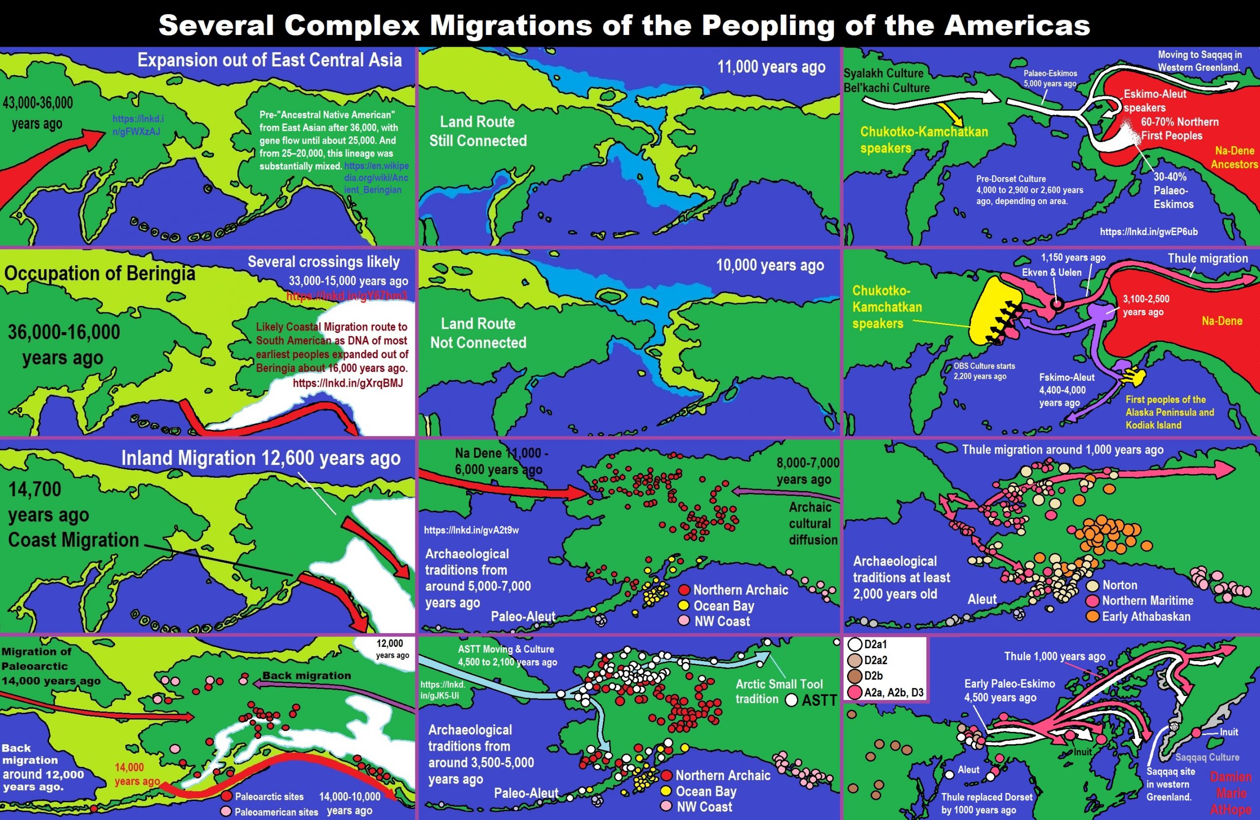
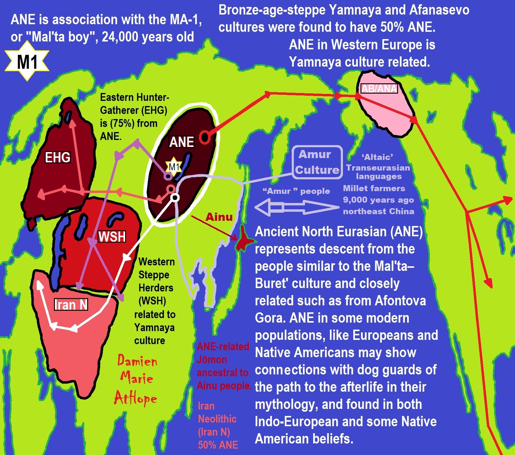
Groups partially derived from the Ancient North Eurasians
“The ANE lineage is defined by association with the MA-1, or “Mal’ta boy”, remains of 24,000 years ago in central Siberia Mal’ta-Buret’ culture 24,000-15,000 years ago. The Ancient North Eurasians (ANE) samples (Afontova Gora 3, Mal’ta 1, and Yana-RHS) show evidence for minor gene flow from an East Asian-related group (simplified by the Amis, Han, or Tianyuan) but no evidence for ANE-related geneflow into East Asians (Amis, Han, Tianyuan), except the Ainu, of North Japan.” ref
“The ANE lineage is defined by association with the MA-1, or “Mal’ta boy”, remains of 24,000 years ago in central Siberia Mal’ta-Buret’ culture 24,000-15,000 years ago “basal to modern-day Europeans”. Some Ancient North Eurasians also carried East Asian populations, such as Tianyuan Man.” ref
“Bronze-age-steppe Yamnaya and Afanasevo cultures were ANE at around 50% and Eastern Hunter-Gatherer (EHG) at around 75% ANE. Karelia culture: Y-DNA R1a-M417 8,400 years ago, Y-DNA J, 7,200 years ago, and Samara, of Y-haplogroup R1b-P297 7,600 years ago is closely related to ANE from Afontova Gora, 18,000 years ago around the time of blond hair first seen there.” ref
Ancient North Eurasian
“In archaeogenetics, the term Ancient North Eurasian (often abbreviated as ANE) is the name given to an ancestral West Eurasian component that represents descent from the people similar to the Mal’ta–Buret’ culture and populations closely related to them, such as from Afontova Gora and the Yana Rhinoceros Horn Site. Significant ANE ancestry are found in some modern populations, including Europeans and Native Americans.” ref
“The ANE lineage is defined by association with the MA-1, or “Mal’ta boy“, the remains of an individual who lived during the Last Glacial Maximum, 24,000 years ago in central Siberia, Ancient North Eurasians are described as a lineage “which is deeply related to Paleolithic/Mesolithic hunter-gatherers in Europe,” meaning that they diverged from Paleolithic Europeans a long time ago.” ref
“The ANE population has also been described as having been “basal to modern-day Europeans” but not especially related to East Asians, and is suggested to have perhaps originated in Europe or Western Asia or the Eurasian Steppe of Central Asia. However, some samples associated with Ancient North Eurasians also carried ancestry from an ancient East Asian population, such as Tianyuan Man. Sikora et al. (2019) found that the Yana RHS sample (31,600 BP) in Northern Siberia “can be modeled as early West Eurasian with an approximately 22% contribution from early East Asians.” ref
“Populations genetically similar to MA-1 were an important genetic contributor to Native Americans, Europeans, Central Asians, South Asians, and some East Asian groups, in order of significance. Lazaridis et al. (2016:10) note “a cline of ANE ancestry across the east-west extent of Eurasia.” The ancient Bronze-age-steppe Yamnaya and Afanasevo cultures were found to have a noteworthy ANE component at ~50%.” ref
“According to Moreno-Mayar et al. 2018 between 14% and 38% of Native American ancestry may originate from gene flow from the Mal’ta–Buret’ people (ANE). This difference is caused by the penetration of posterior Siberian migrations into the Americas, with the lowest percentages of ANE ancestry found in Eskimos and Alaskan Natives, as these groups are the result of migrations into the Americas roughly 5,000 years ago.” ref
“Estimates for ANE ancestry among first wave Native Americans show higher percentages, such as 42% for those belonging to the Andean region in South America. The other gene flow in Native Americans (the remainder of their ancestry) was of East Asian origin. Gene sequencing of another south-central Siberian people (Afontova Gora-2) dating to approximately 17,000 years ago, revealed similar autosomal genetic signatures to that of Mal’ta boy-1, suggesting that the region was continuously occupied by humans throughout the Last Glacial Maximum.” ref
“The earliest known individual with a genetic mutation associated with blonde hair in modern Europeans is an Ancient North Eurasian female dating to around 16000 BCE from the Afontova Gora 3 site in Siberia. It has been suggested that their mythology may have included a narrative, found in both Indo-European and some Native American fables, in which a dog guards the path to the afterlife.” ref
“Genomic studies also indicate that the ANE component was introduced to Western Europe by people related to the Yamnaya culture, long after the Paleolithic. It is reported in modern-day Europeans (7%–25%), but not of Europeans before the Bronze Age. Additional ANE ancestry is found in European populations through paleolithic interactions with Eastern Hunter-Gatherers, which resulted in populations such as Scandinavian Hunter-Gatherers.” ref
“The Ancient North Eurasians (ANE) split from the ancestors of European peoples somewhere in the Middle East or South-central Asia, and used a northern dispersal route through Central Asia into Northern Asia and Siberia. Genetic analyses show that all ANE samples (Afontova Gora 3, Mal’ta 1, and Yana-RHS) show evidence for minor gene flow from an East Asian-related group (simplified by the Amis, Han, or Tianyuan). In contrast, no evidence for ANE-related geneflow into East Asians (Amis, Han, Tianyuan), except the Ainu, was found.” ref
“Genetic data suggests that the ANE formed during the Terminal Upper-Paleolithic (36+-1,5ka) period from a deeply European-related population, which was once widespread in Northern Eurasia, and from an early East Asian-related group, which migrated northwards into Central Asia and Siberia, merging with this deeply European-related population. These population dynamics and constant northwards geneflow of East Asian-related ancestry would later gave rise to the “Ancestral Native Americans” and Paleosiberians, which replaced the ANE as dominant population of Siberia.” ref
Groups partially derived from the Ancient North Eurasians
“Eastern Hunter-Gatherer (EHG) is a lineage derived predominantly (75%) from ANE. It is represented by two individuals from Karelia, one of Y-haplogroup R1a-M417, dated c. 8.4 kya, the other of Y-haplogroup J, dated c. 7.2 kya; and one individual from Samara, of Y-haplogroup R1b-P297, dated c. 7.6 kya. This lineage is closely related to the ANE sample from Afontova Gora, dated c. 18 kya. After the end of the Last Glacial Maximum, the Western Hunter-Gatherers (WHG) and EHG lineages merged in Eastern Europe, accounting for early presence of ANE-derived ancestry in Mesolithic Europe. Evidence suggests that as Ancient North Eurasians migrated West from Eastern Siberia, they absorbed Western Hunter-Gatherers and other West Eurasian populations as well.” ref
“Caucasian Hunter-Gatherer (CHG) is represented by the Satsurblia individual dated ~13 kya (from the Satsurblia cave in Georgia), and carried 36% ANE-derived admixture. While the rest of their ancestry is derived from the Dzudzuana cave individual dated ~26 kya, which lacked ANE-admixture, Dzudzuana affinity in the Caucasus decreased with the arrival of ANE at ~13 kya Satsurblia.” ref
“Scandinavian Hunter-Gatherer (SHG) is represented by several individuals buried at Motala, Sweden ca. 6000 BC. They were descended from Western Hunter-Gatherers who initially settled Scandinavia from the south, and later populations of EHG who entered Scandinavia from the north through the coast of Norway.” ref
“Iran Neolithic (Iran_N) individuals dated ~8.5 kya carried 50% ANE-derived admixture and 50% Dzudzuana-related admixture, marking them as different from other Near-Eastern and Anatolian Neolithics who didn’t have ANE admixture. Iran Neolithics were later replaced by Iran Chalcolithics, who were a mixture of Iran Neolithic and Near Eastern Levant Neolithic.” ref
“Ancient Beringian/Ancestral Native American are specific archaeogenetic lineages, based on the genome of an infant found at the Upward Sun River site (dubbed USR1), dated to 11,500 years ago. The AB lineage diverged from the Ancestral Native American (ANA) lineage about 20,000 years ago.” ref
“West Siberian Hunter-Gatherer (WSHG) are a specific archaeogenetic lineage, first reported in a genetic study published in Science in September 2019. WSGs were found to be of about 30% EHG ancestry, 50% ANE ancestry, and 20% to 38% East Asian ancestry.” ref
“Western Steppe Herders (WSH) is the name given to a distinct ancestral component that represents descent closely related to the Yamnaya culture of the Pontic–Caspian steppe. This ancestry is often referred to as Yamnaya ancestry or Steppe ancestry.” ref
“Late Upper Paeolithic Lake Baikal – Ust’Kyakhta-3 (UKY) 14,050-13,770 BP were mixture of 30% ANE ancestry and 70% East Asian ancestry.” ref
“Lake Baikal Holocene – Baikal Eneolithic (Baikal_EN) and Baikal Early Bronze Age (Baikal_EBA) derived 6.4% to 20.1% ancestry from ANE, while rest of their ancestry was derived from East Asians. Fofonovo_EN near by Lake Baikal were mixture of 12-17% ANE ancestry and 83-87% East Asian ancestry.” ref
“Hokkaido Jōmon people specifically refers to the Jōmon period population of Hokkaido in northernmost Japan. Though the Jōmon people themselves descended mainly from East Asian lineages, one study found an affinity between Hokkaido Jōmon with the Northern Eurasian Yana sample (an ANE-related group, related to Mal’ta), and suggest as an explanation the possibility of minor Yana gene flow into the Hokkaido Jōmon population (as well as other possibilities). A more recent study by Cooke et al. 2021, confirmed ANE-related geneflow among the Jōmon people, partially ancestral to the Ainu people. ANE ancestry among Jōmon people is estimated at 21%, however, there is a North to South cline within the Japanese archipelago, with the highest amount of ANE ancestry in Hokkaido and Tohoku.” ref
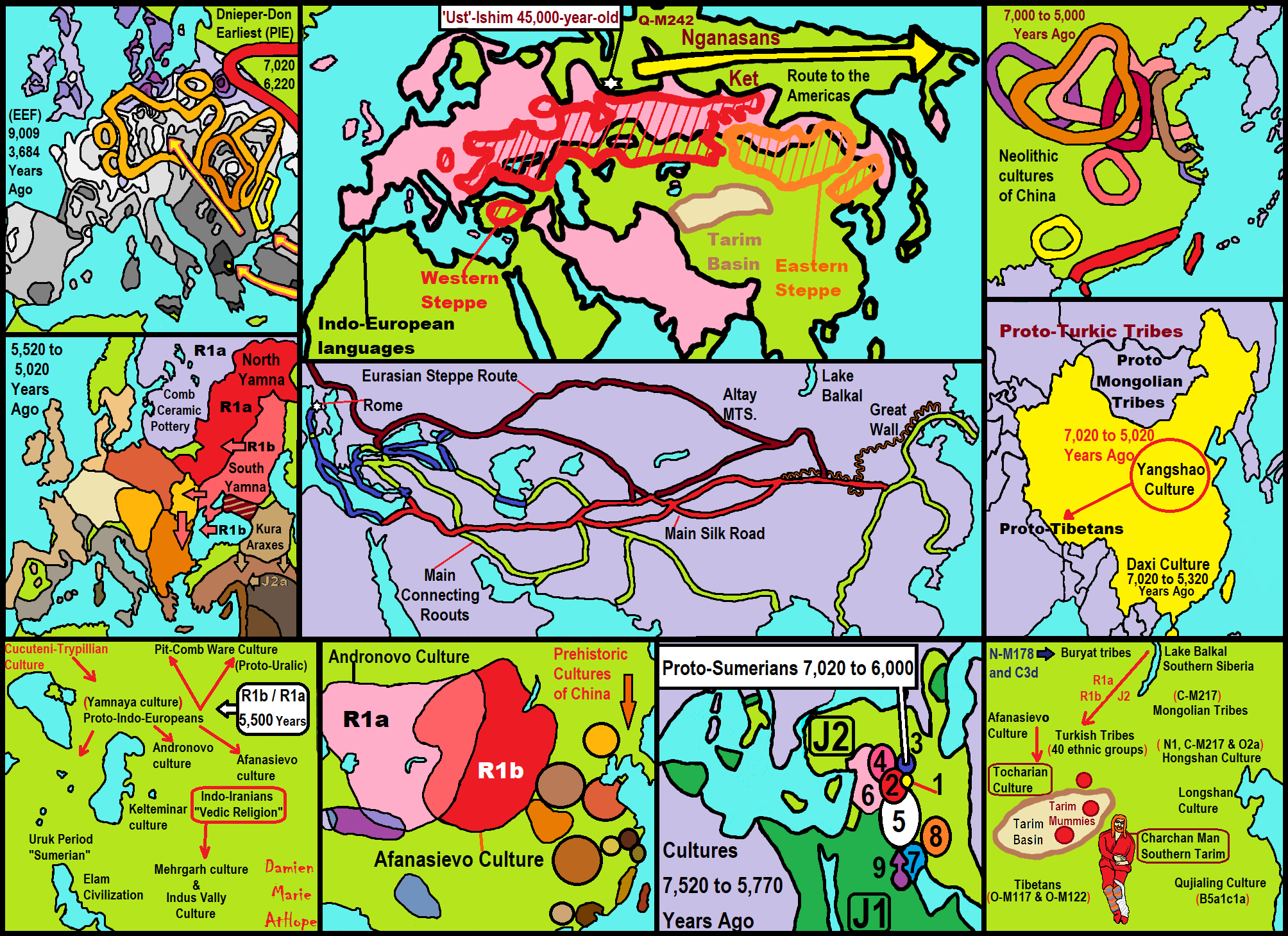
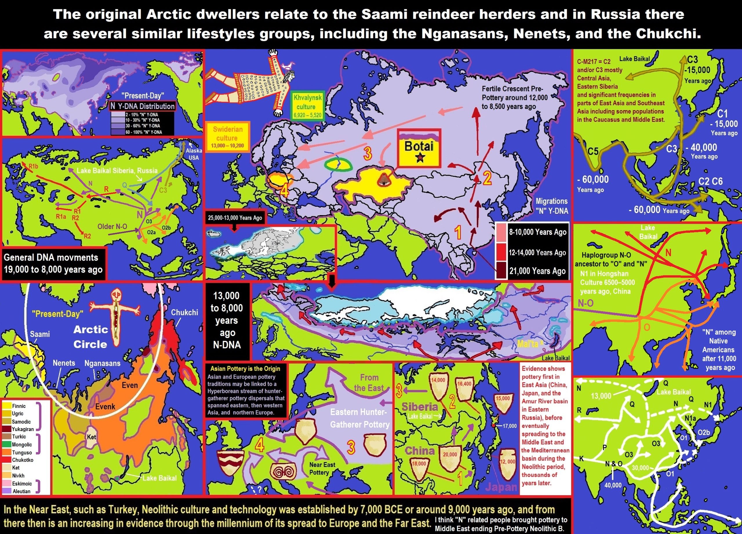
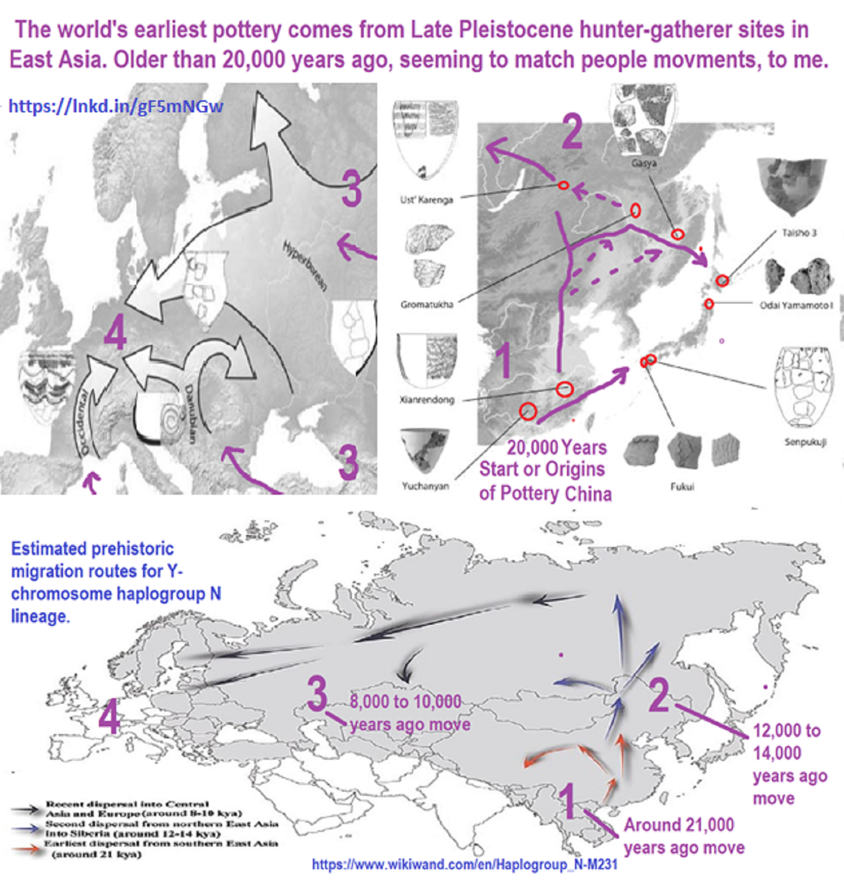
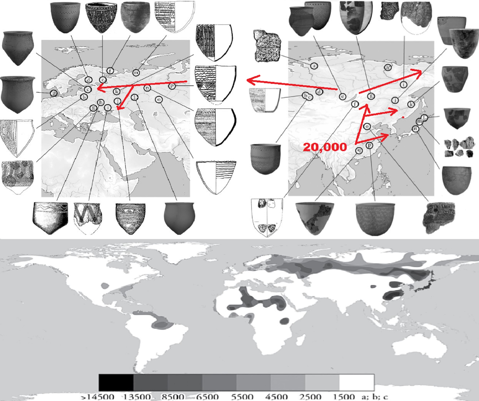
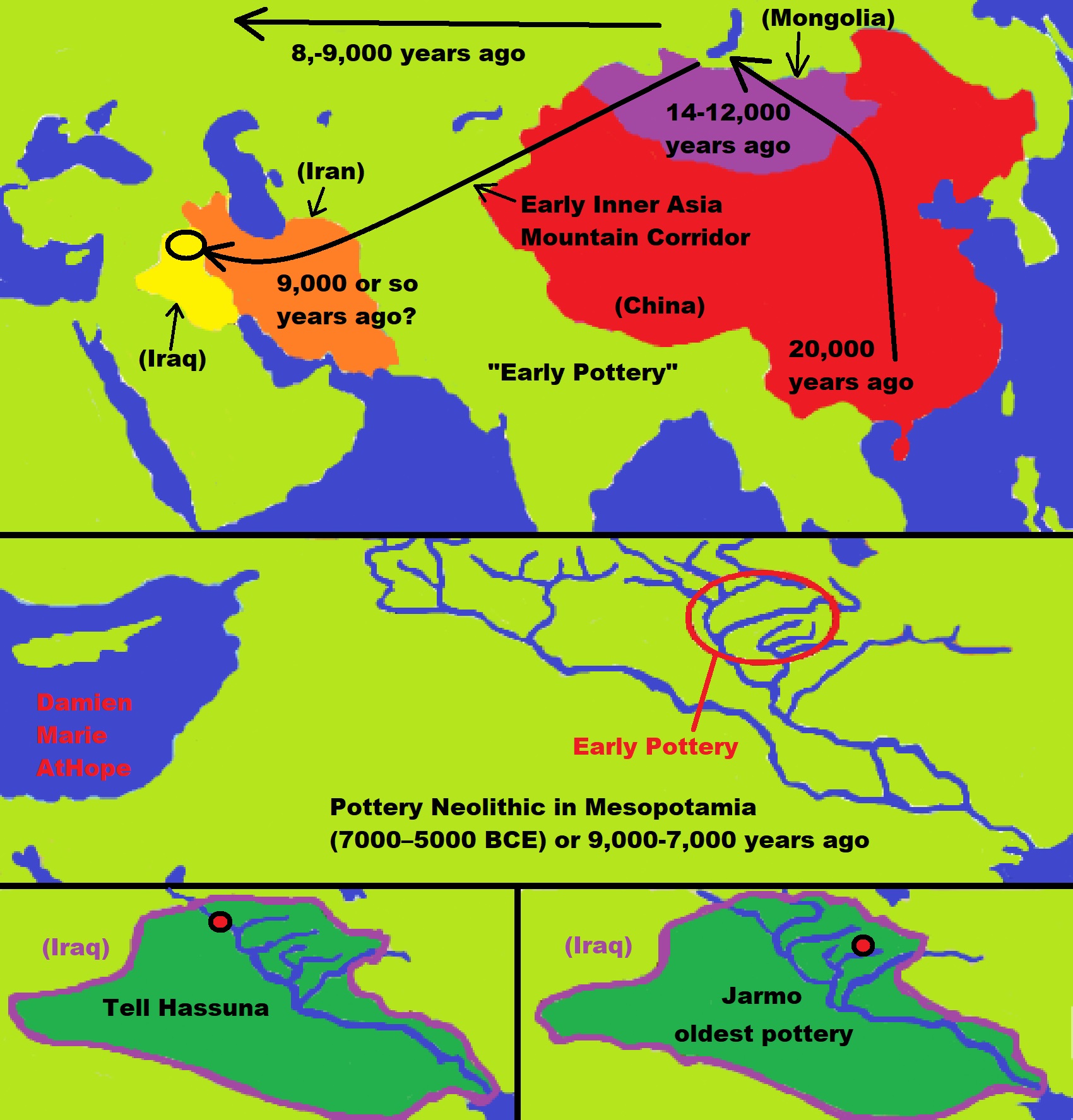
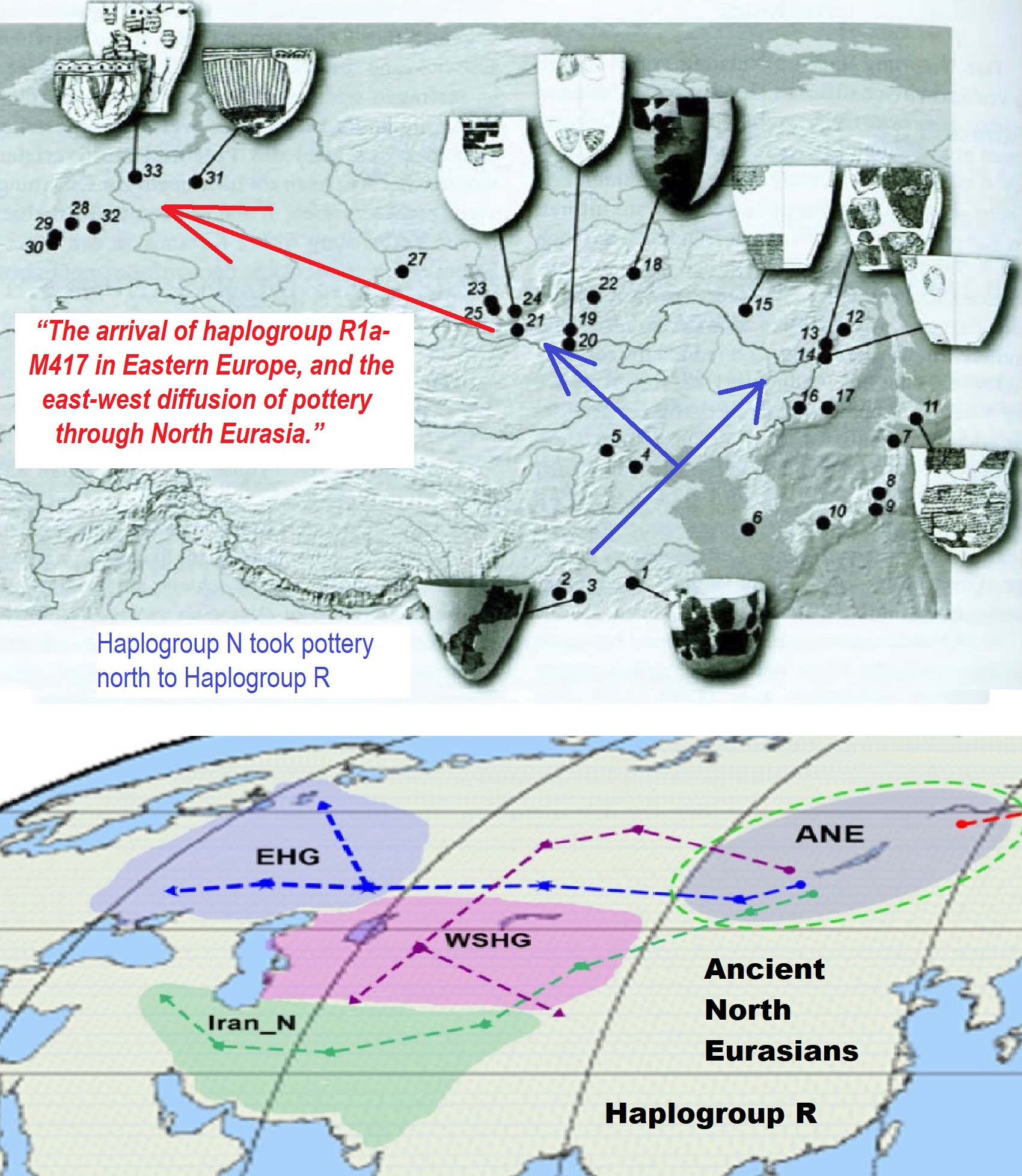
“The arrival of haplogroup R1a-M417 in Eastern Europe, and the east-west diffusion of pottery through North Eurasia.” https://indo-european.eu/2018/02/the-arrival-of-haplogroup-r1a-m417-in-eastern-europe-and-the-east-west-diffusion-of-pottery-through-north-eurasia/
Ancient North Eurasian https://en.wikipedia.org/wiki/Ancient_North_Eurasian
Ancient North Eurasian/Mal’ta–Buret’ culture haplogroup R* https://en.wikipedia.org/wiki/Mal%27ta%E2%80%93Buret%27_culture
“The arrival of haplogroup R1a-M417 in Eastern Europe, and the east-west diffusion of pottery through North Eurasia.” ref
R-M417 (R1a1a1)
“R1a1a1 (R-M417) is the most widely found subclade, in two variations which are found respectively in Europe (R1a1a1b1 (R-Z282) ([R1a1a1a*] (R-Z282) and Central and South Asia (R1a1a1b2 (R-Z93) ([R1a1a2*] (R-Z93).” ref
R-Z282 (R1a1a1b1a) (Eastern Europe)
“This large subclade appears to encompass most of the R1a1a found in Europe.
- R1a1a1b1a [R1a1a1a*] (R-Z282*) occurs in northern Ukraine, Belarus, and Russia at a frequency of c. 20%.
- R1a1a1b1a3 [R1a1a1a1] (R-Z284) occurs in Northwest Europe and peaks at c. 20% in Norway.
- R1a1a1c (M64.2, M87, M204) is apparently rare: it was found in 1 of 117 males typed in southern Iran.” ref
R1a1a1b2 (R-Z93) (Asia)
“This large subclade appears to encompass most of the R1a1a found in Asia, being related to Indo-European migrations (including Scythians, Indo-Aryan migrations, and so on).
- R-Z93* or R1a1a1b2* (R1a1a2* in Underhill (2014)) is most common (>30%) in the South Siberian Altai region of Russia, cropping up in Kyrgyzstan (6%) and in all Iranian populations (1-8%).
- R-Z2125 occurs at highest frequencies in Kyrgyzstan and in Afghan Pashtuns (>40%). At a frequency of >10%, it is also observed in other Afghan ethnic groups and in some populations in the Caucasus and Iran.
- R-M434 is a subclade of Z2125. It was detected in 14 people (out of 3667 people tested), all in a restricted geographical range from Pakistan to Oman. This likely reflects a recent mutation event in Pakistan.
- R-M560 is very rare and was only observed in four samples: two Burushaski speakers (north Pakistan), one Hazara (Afghanistan), and one Iranian Azerbaijani.
- R-M780 occurs at high frequency in South Asia: India, Pakistan, Afghanistan, and the Himalayas. The group also occurs at >3% in some Iranian populations and is present at >30% in Roma from Croatia and Hungary.” ref
R-M458 (R1a1a1b1a1)
“R-M458 is a mainly Slavic SNP, characterized by its own mutation, and was first called cluster N. Underhill et al. (2009) found it to be present in modern European populations roughly between the Rhine catchment and the Ural Mountains and traced it to “a founder effect that … falls into the early Holocene period, 7.9±2.6 KYA.” M458 was found in one skeleton from a 14th-century grave field in Usedom, Mecklenburg-Vorpommern, Germany. The paper by Underhill et al. (2009) also reports a surprisingly high frequency of M458 in some Northern Caucasian populations (for example 27.5% among Karachays and 23.5% among Balkars, 7.8% among Karanogays and 3.4% among Abazas).” ref
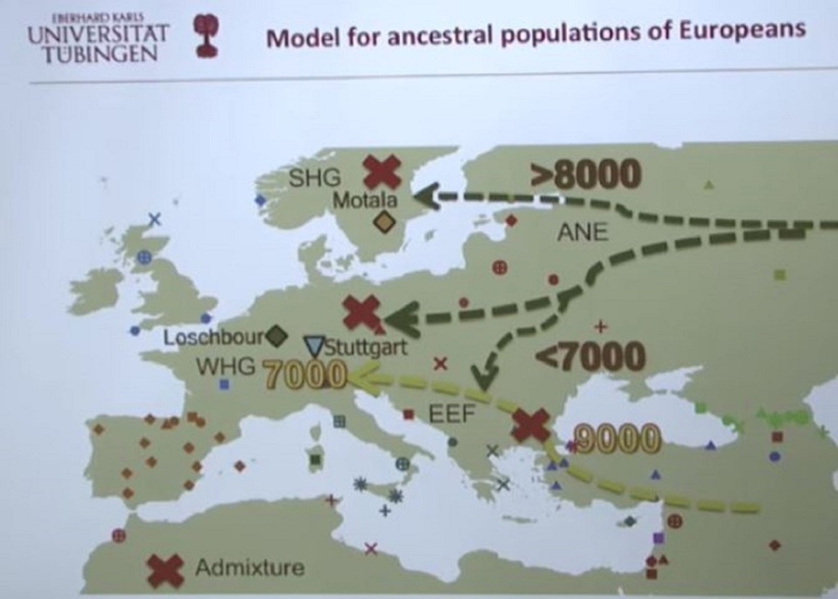
Pic ref
Ancient Human Genomes…Present-Day Europeans – Johannes Krause (Video)
Ancient North Eurasian (ANE)
Eastern Hunter-Gatherer (EHG)
Western Hunter-Gatherers (WHG)
Scandinavian Hunter-Gatherer (SHG)
Early European Farmers (EEF)
A quick look at the Genetic history of Europe
“The most significant recent dispersal of modern humans from Africa gave rise to an undifferentiated “non-African” lineage by some 70,000-50,000 years ago. By about 50–40 ka a basal West Eurasian lineage had emerged, as had a separate East Asian lineage. Both basal East and West Eurasians acquired Neanderthal admixture in Europe and Asia. European early modern humans (EEMH) lineages between 40,000-26,000 years ago (Aurignacian) were still part of a large Western Eurasian “meta-population”, related to Central and Western Asian populations. Divergence into genetically distinct sub-populations within Western Eurasia is a result of increased selection pressure and founder effects during the Last Glacial Maximum (LGM, Gravettian). By the end of the LGM, after 20,000 years ago, A Western European lineage, dubbed West European Hunter-Gatherer (WHG) emerges from the Solutrean refugium during the European Mesolithic. These Mesolithic hunter-gatherer cultures are substantially replaced in the Neolithic Revolution by the arrival of Early European Farmers (EEF) lineages derived from Mesolithic populations of West Asia (Anatolia and the Caucasus). In the European Bronze Age, there were again substantial population replacements in parts of Europe by the intrusion of Ancient North Eurasian (ANE) lineages from the Pontic–Caspian steppes. These Bronze Age population replacements are associated with the Beaker culture archaeologically and with the Indo-European expansion linguistically.” ref
“As a result of the population movements during the Mesolithic to Bronze Age, modern European populations are distinguished by differences in WHG, EEF, and ANE ancestry. Admixture rates varied geographically; in the late Neolithic, WHG ancestry in farmers in Hungary was at around 10%, in Germany around 25%, and in Iberia as high as 50%. The contribution of EEF is more significant in Mediterranean Europe, and declines towards northern and northeastern Europe, where WHG ancestry is stronger; the Sardinians are considered to be the closest European group to the population of the EEF. ANE ancestry is found throughout Europe, with a maximum of about 20% found in Baltic people and Finns. Ethnogenesis of the modern ethnic groups of Europe in the historical period is associated with numerous admixture events, primarily those associated with the Roman, Germanic, Norse, Slavic, Berber, Arab and Turkish expansions. Research into the genetic history of Europe became possible in the second half of the 20th century, but did not yield results with a high resolution before the 1990s. In the 1990s, preliminary results became possible, but they remained mostly limited to studies of mitochondrial and Y-chromosomal lineages. Autosomal DNA became more easily accessible in the 2000s, and since the mid-2010s, results of previously unattainable resolution, many of them based on full-genome analysis of ancient DNA, have been published at an accelerated pace.” ref
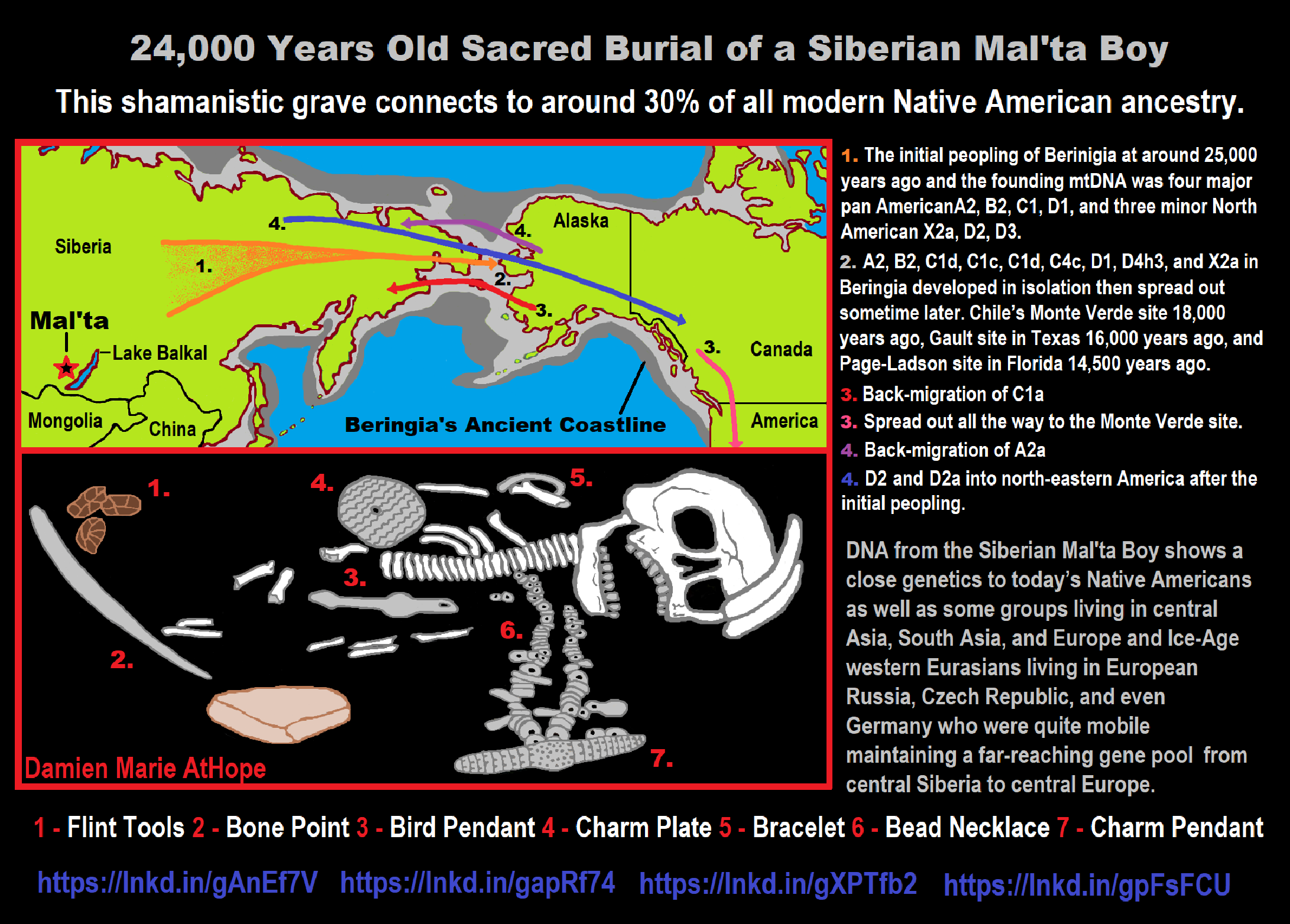
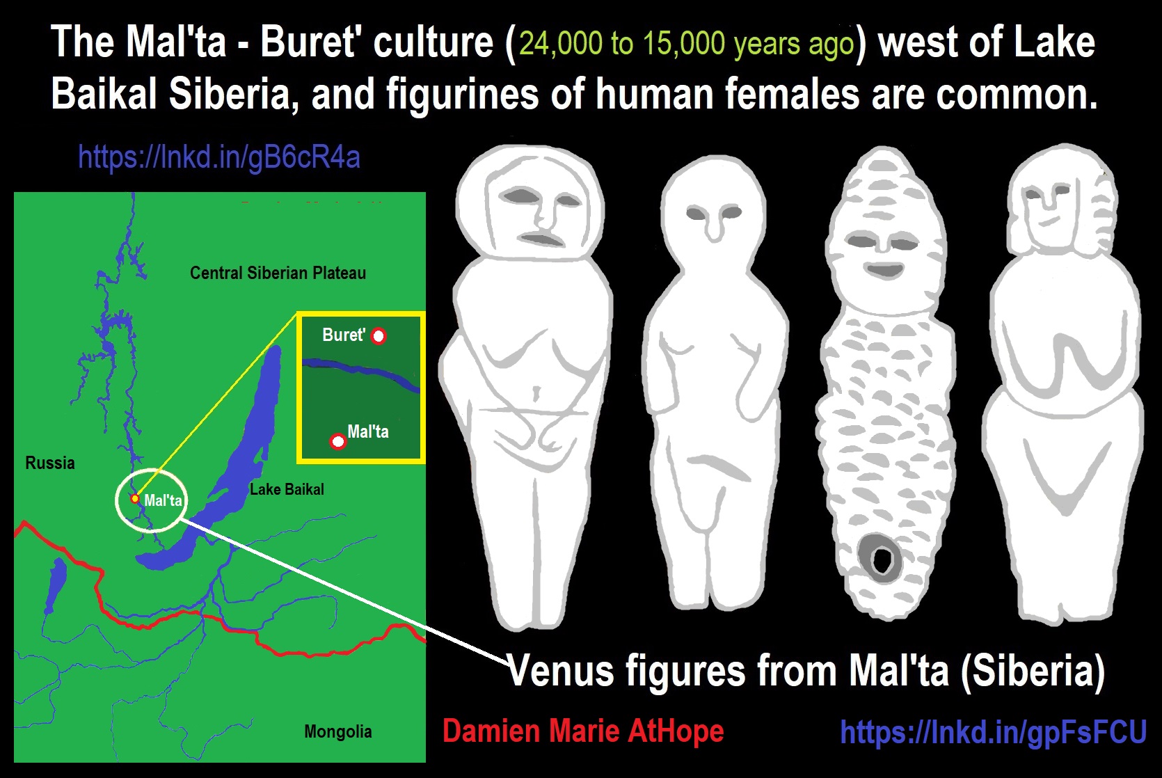
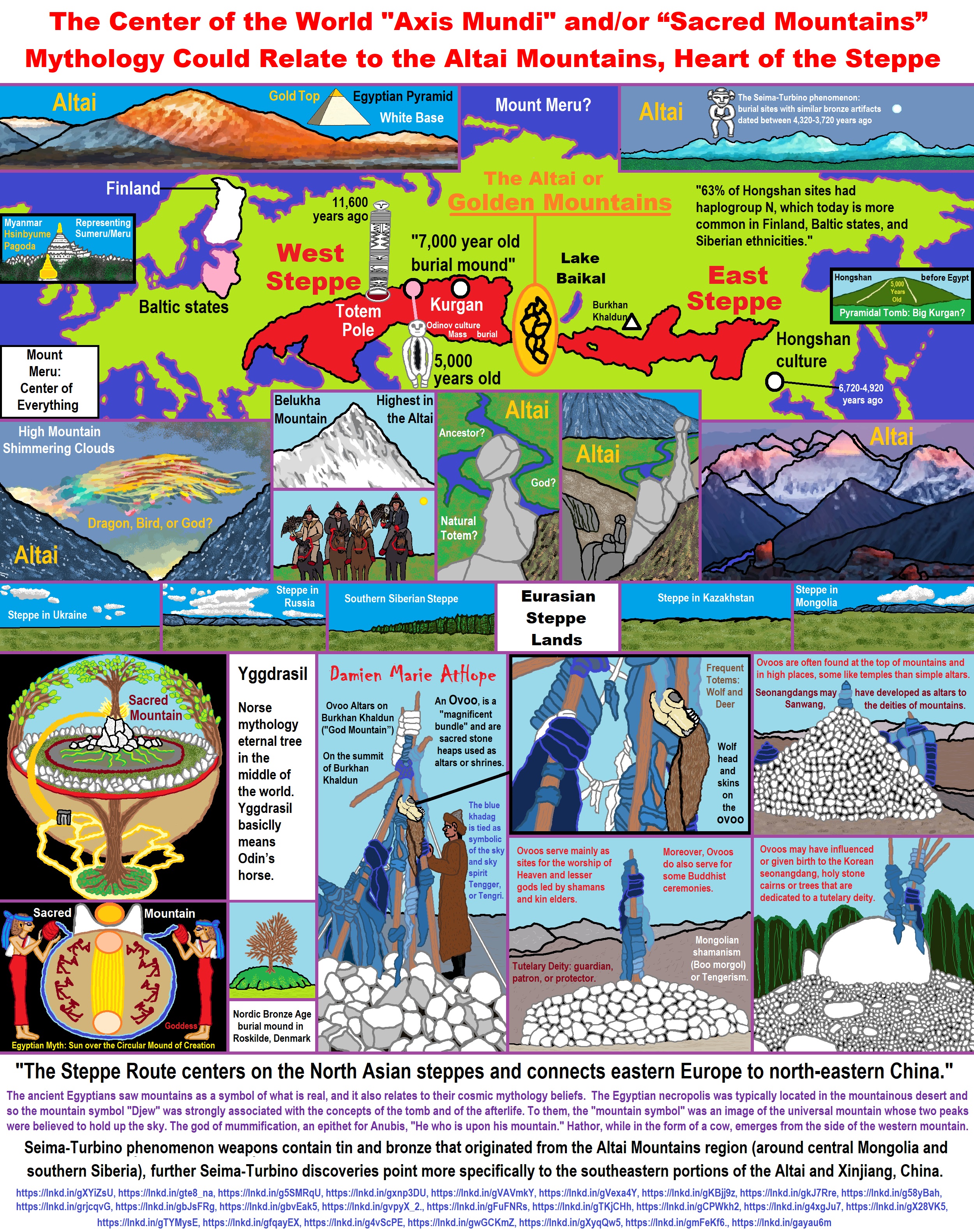
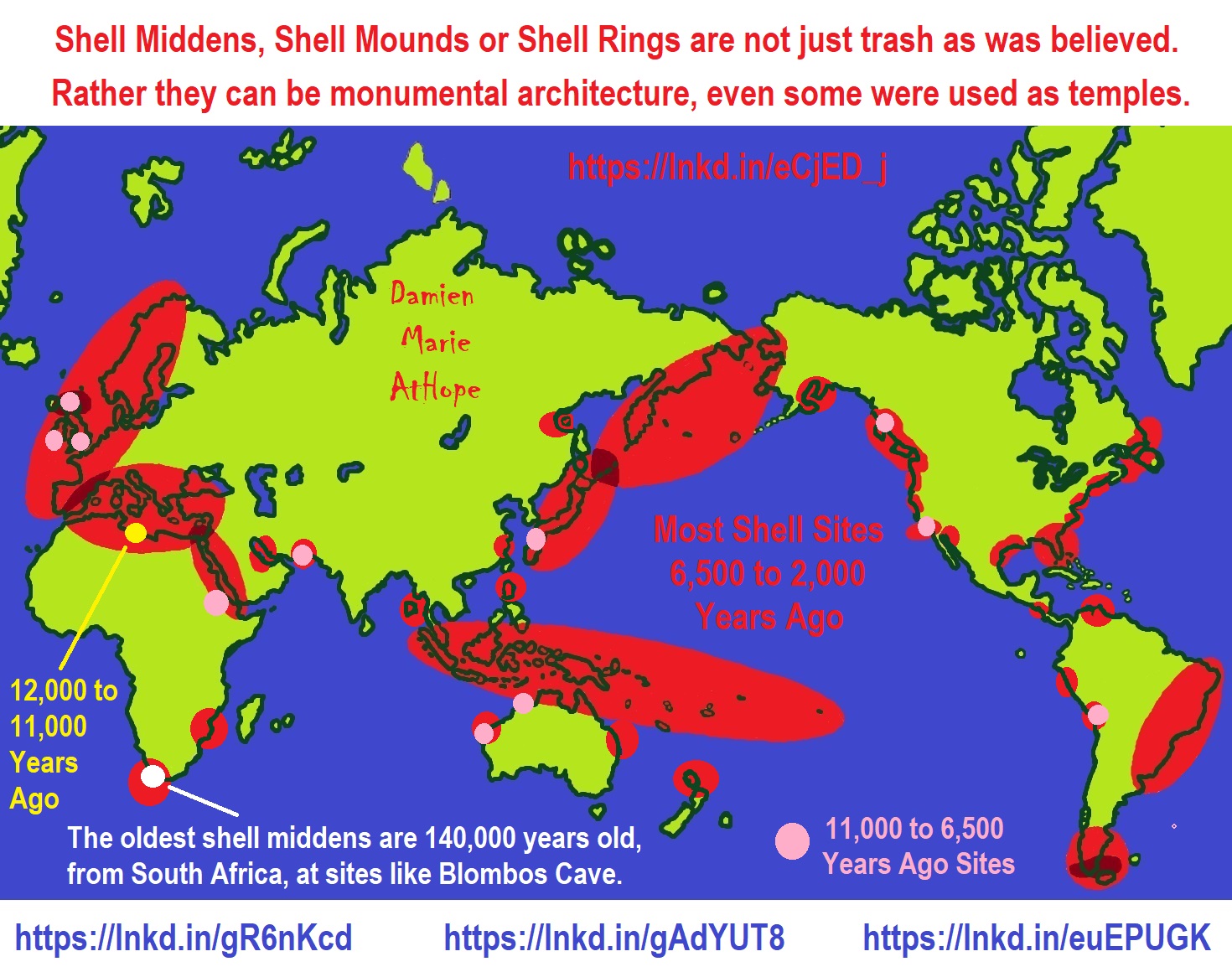
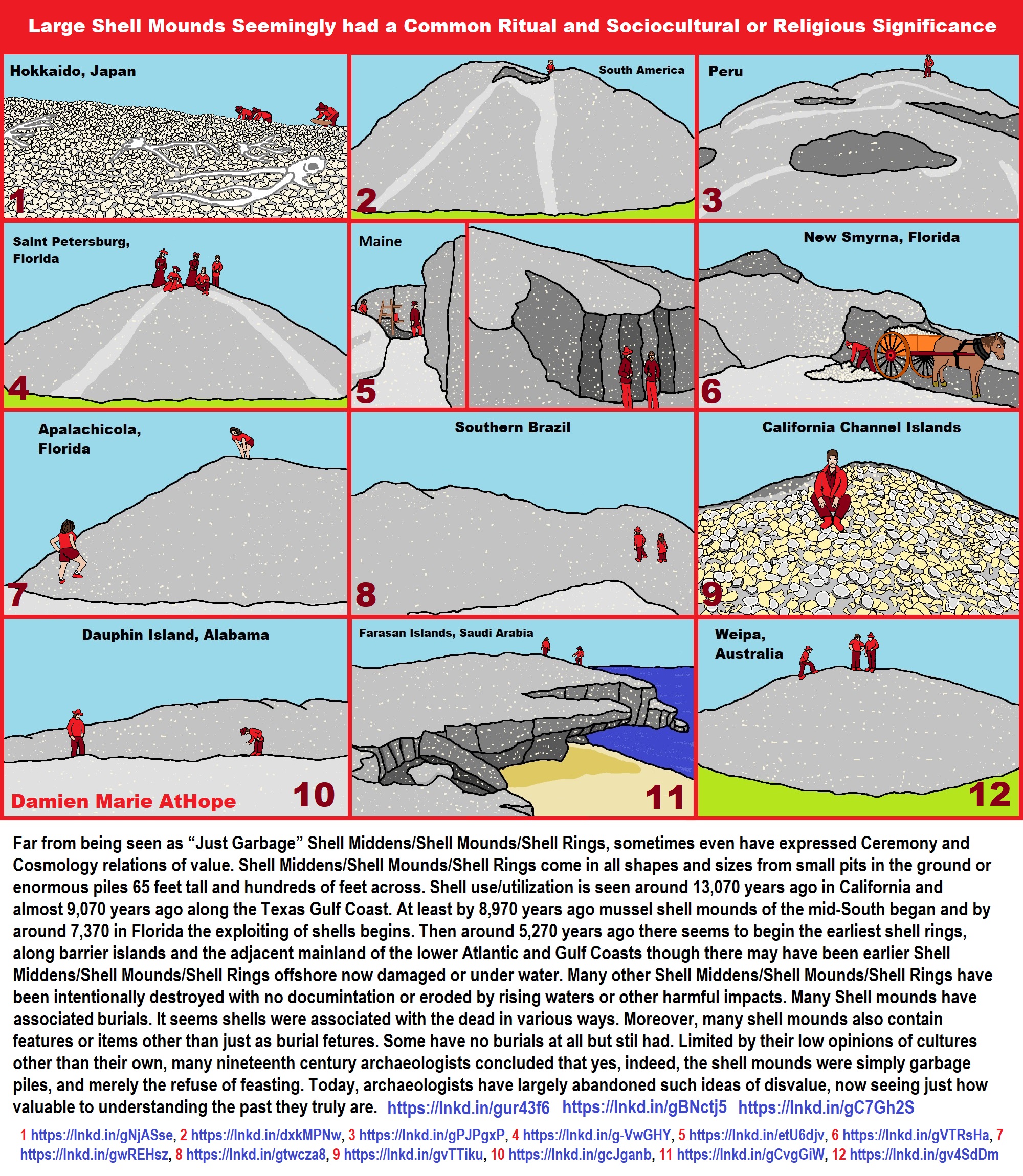
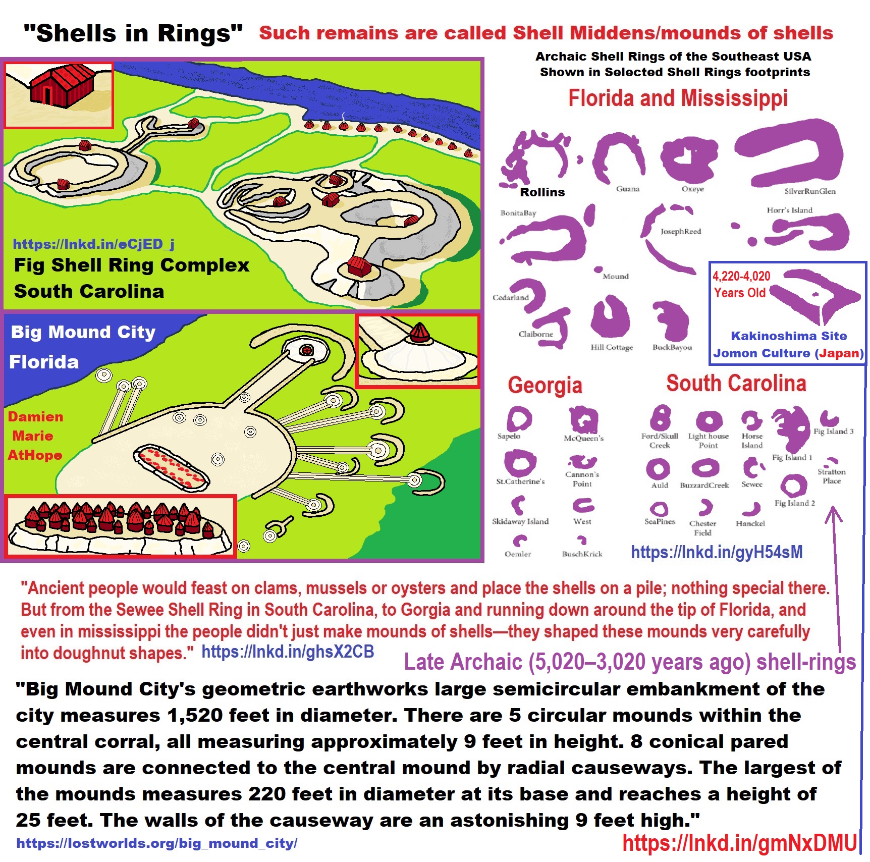
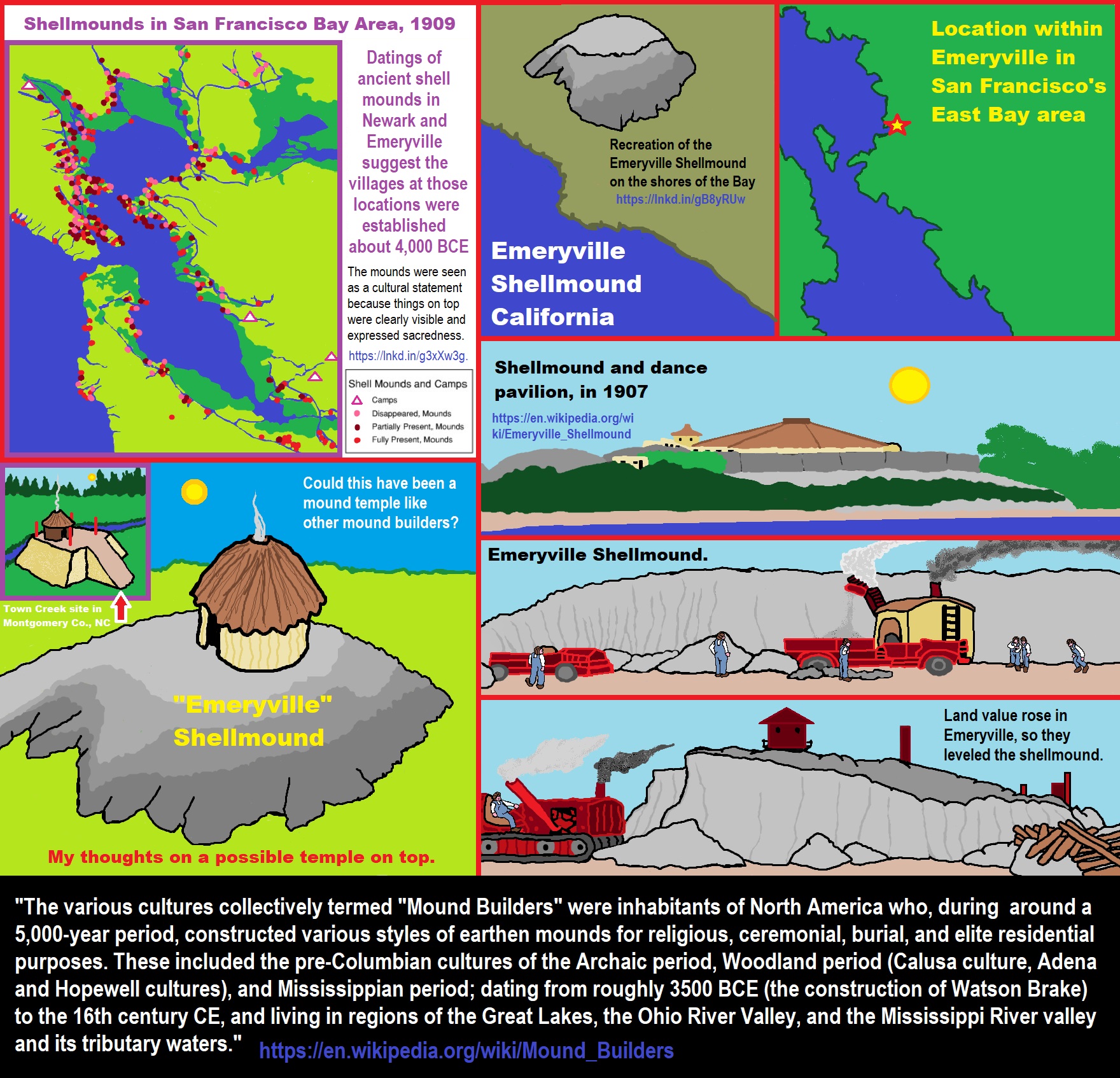
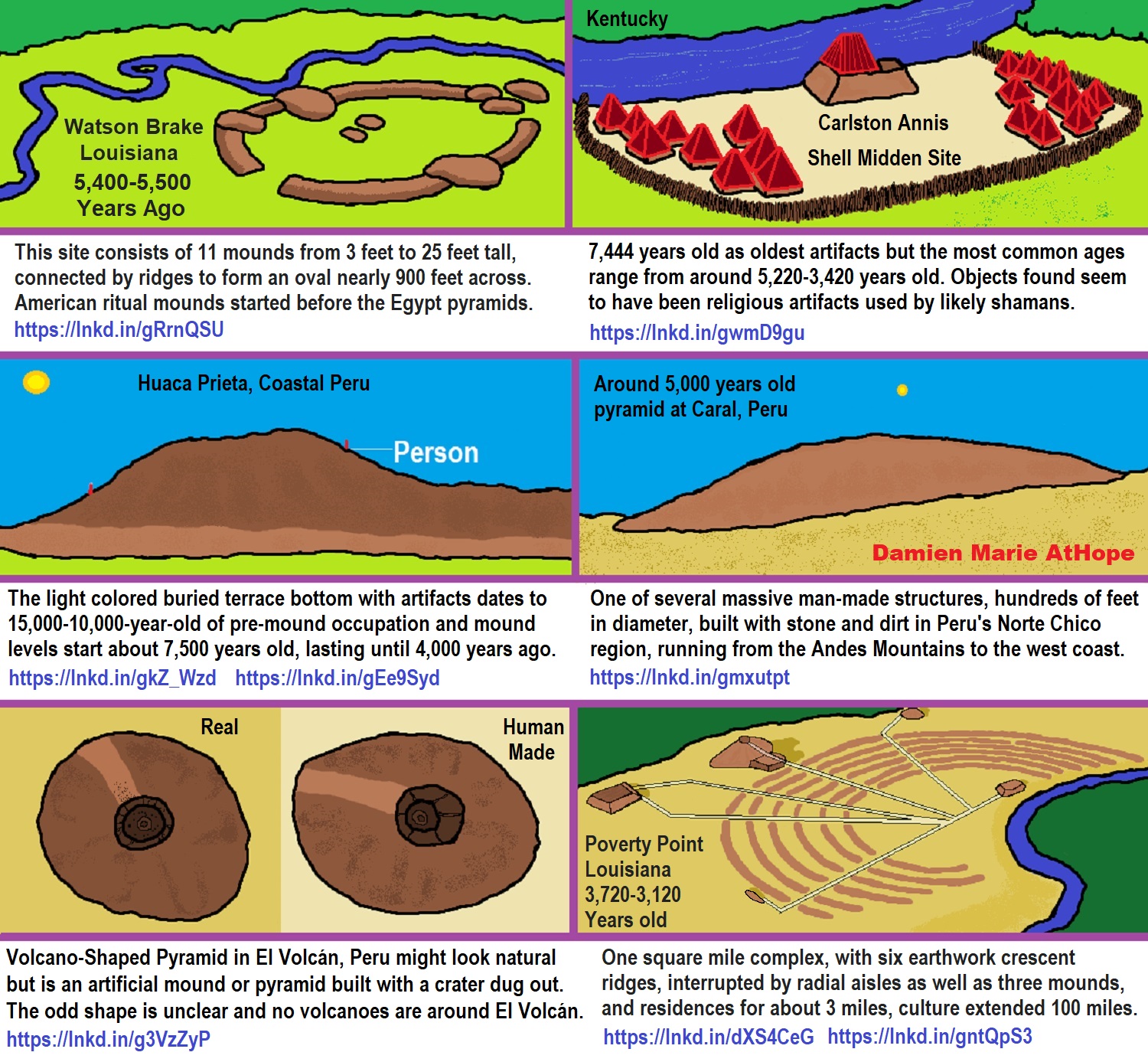
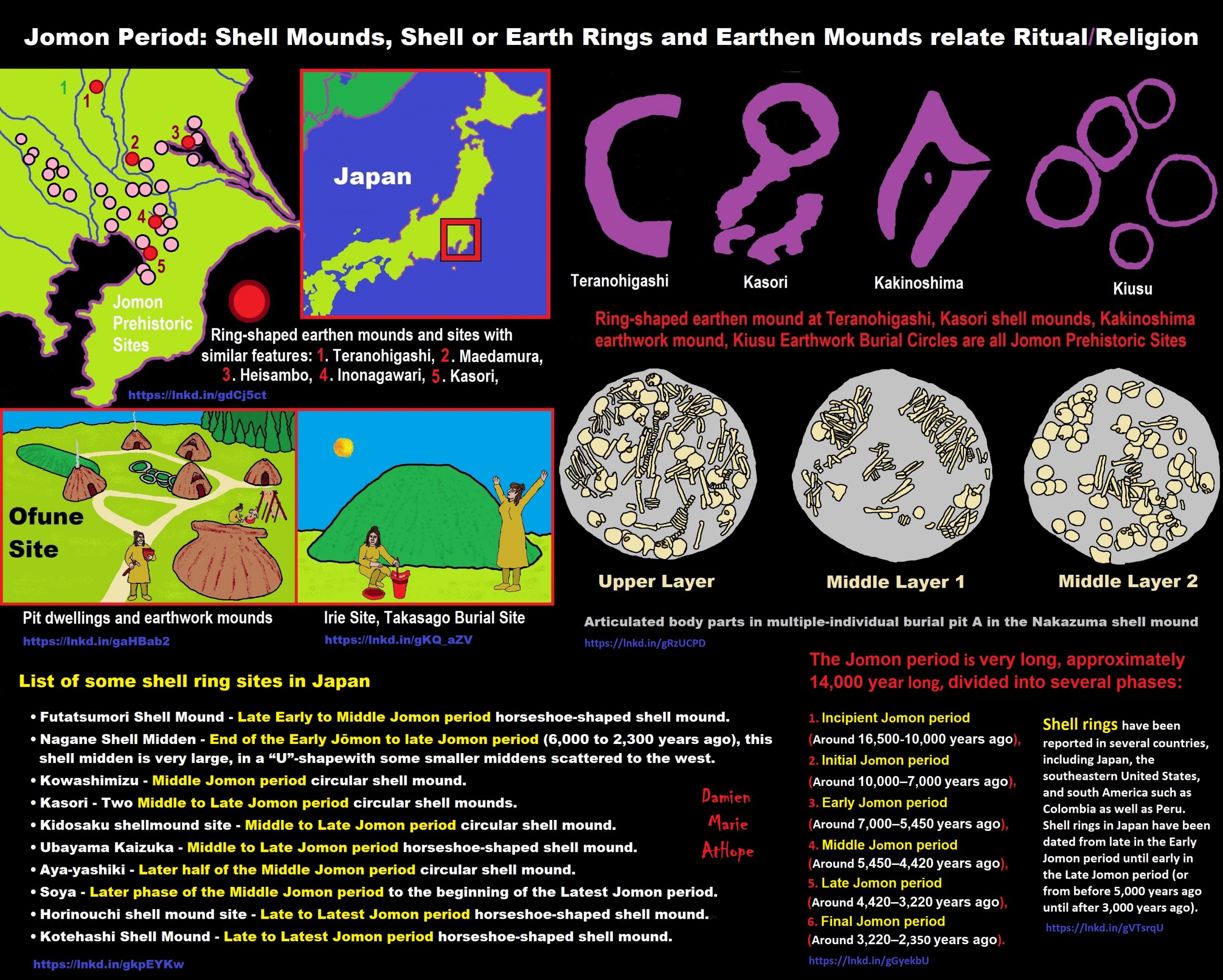
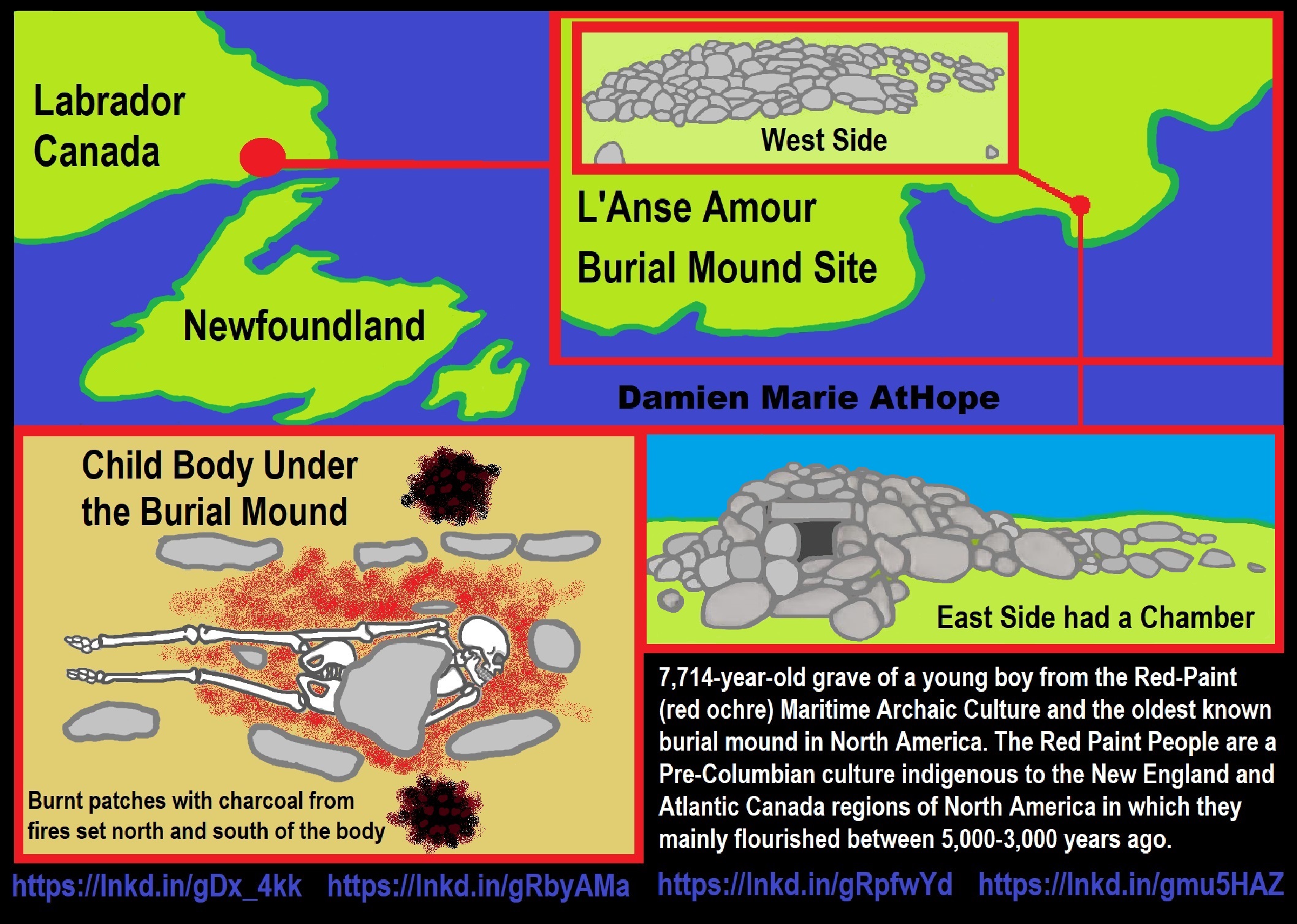
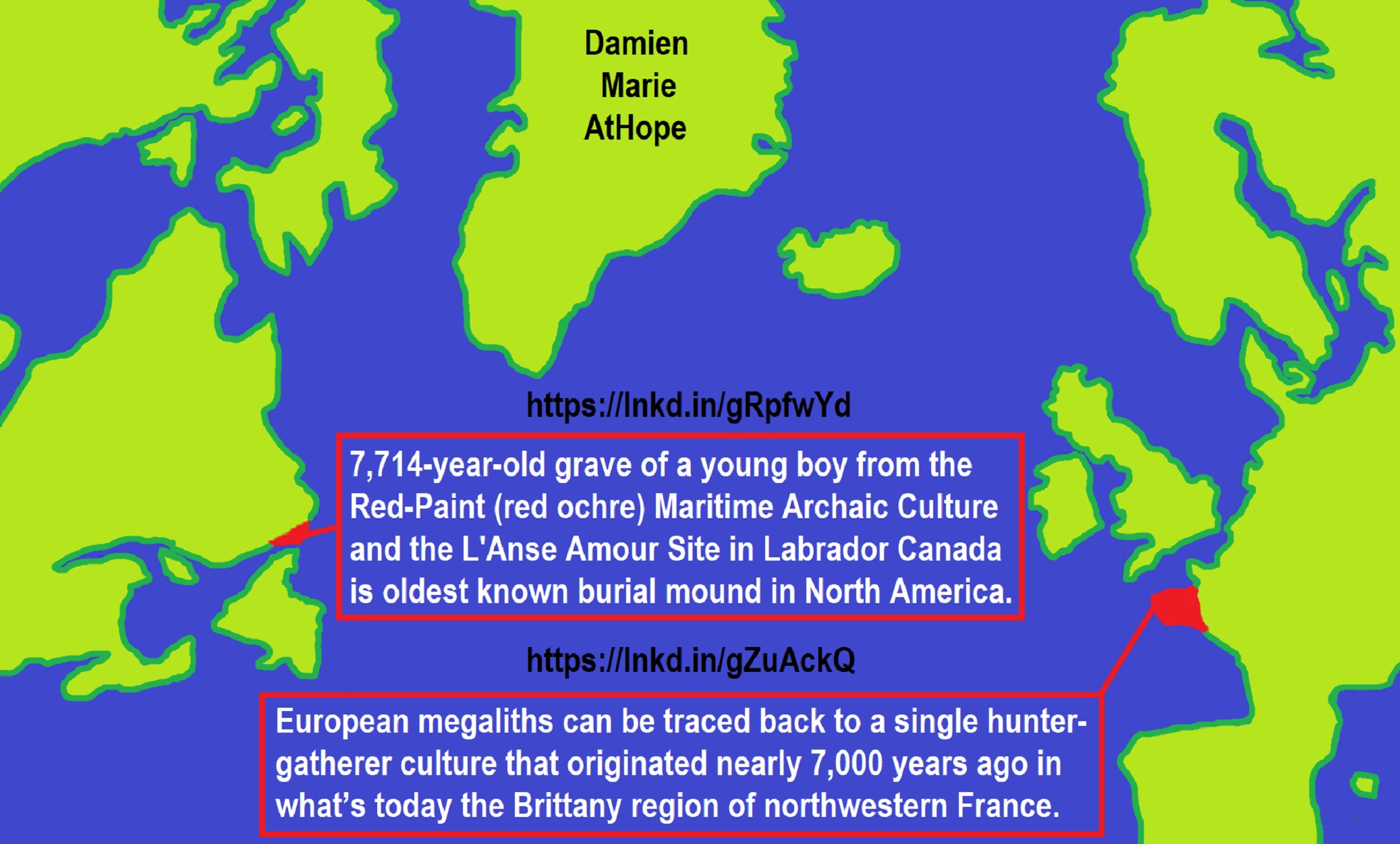
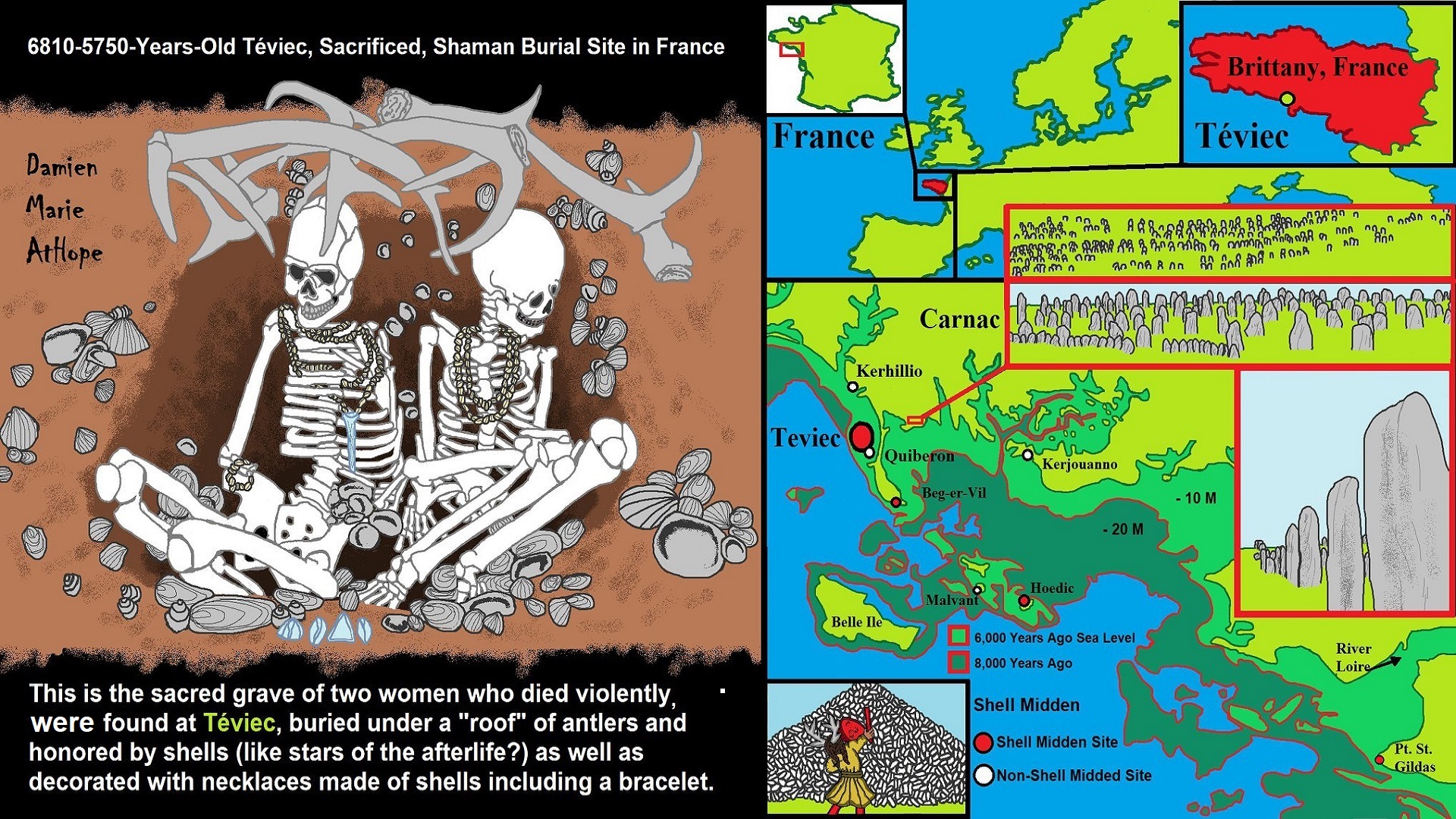
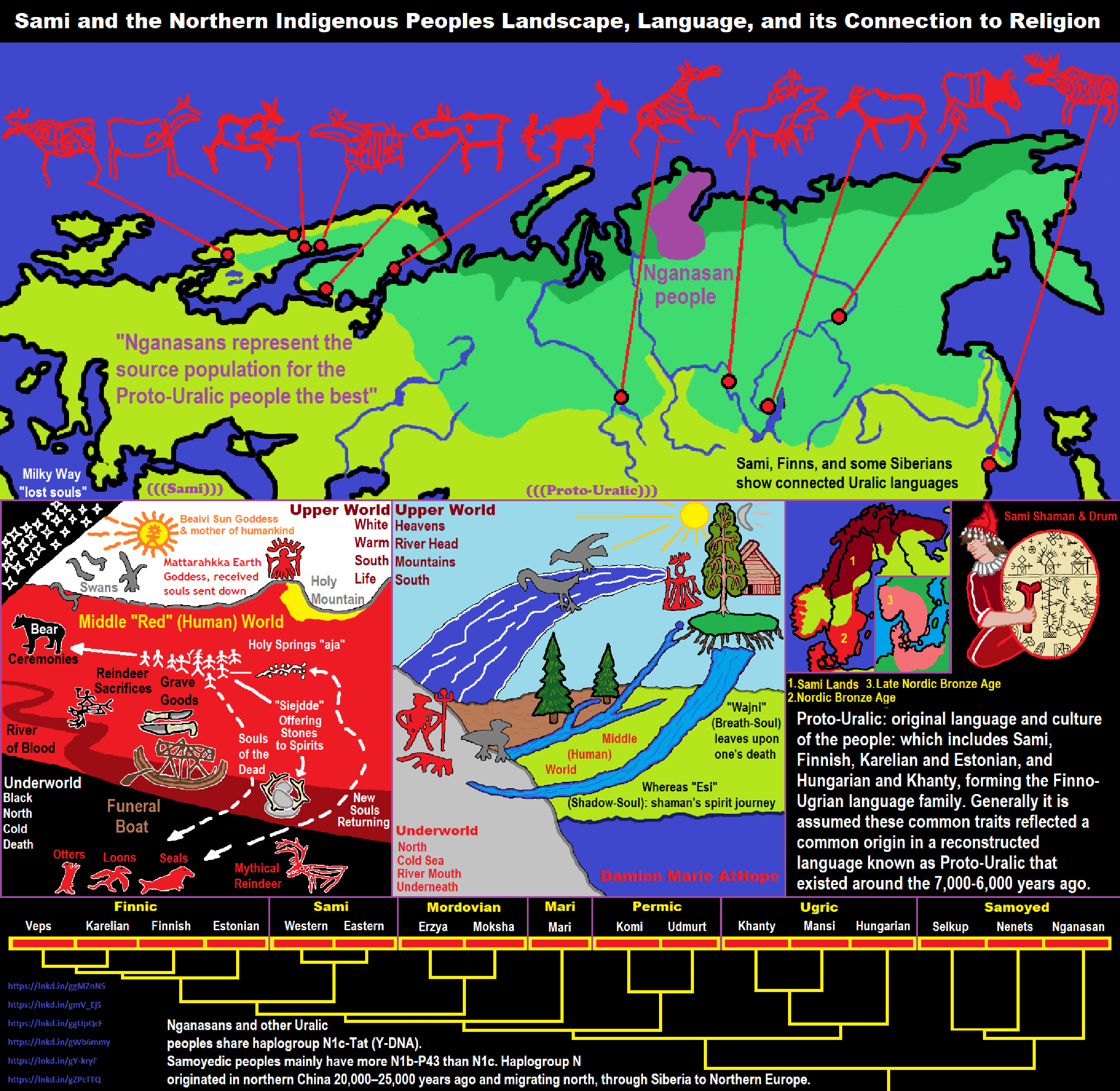
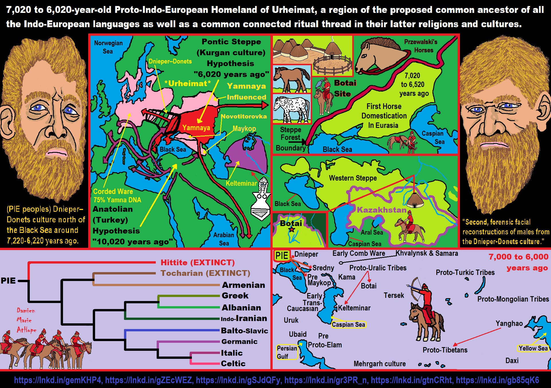
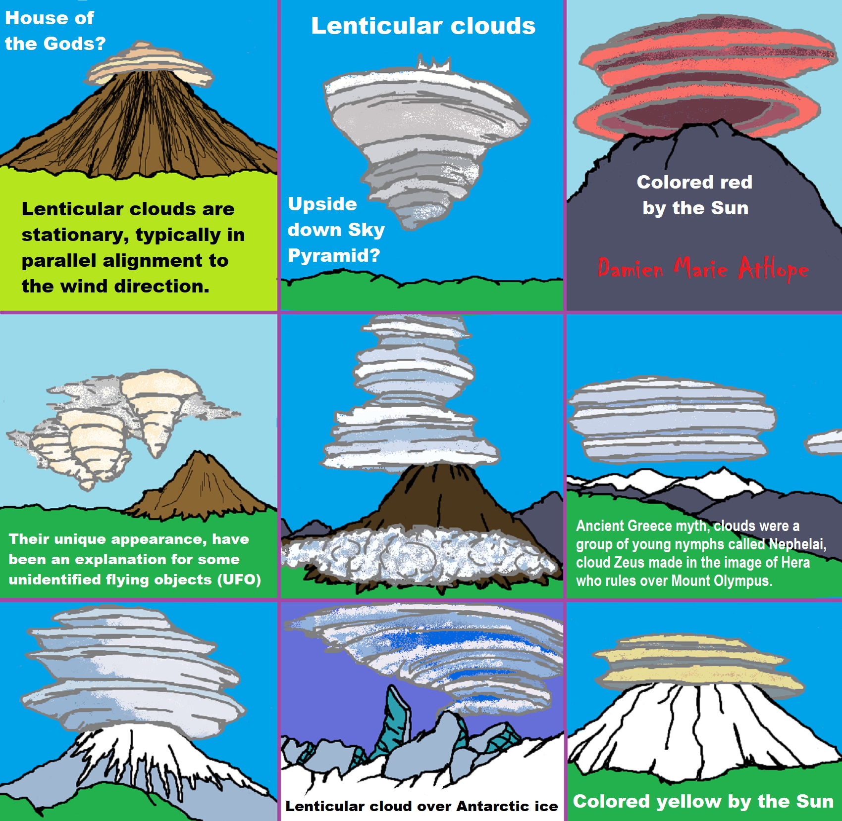
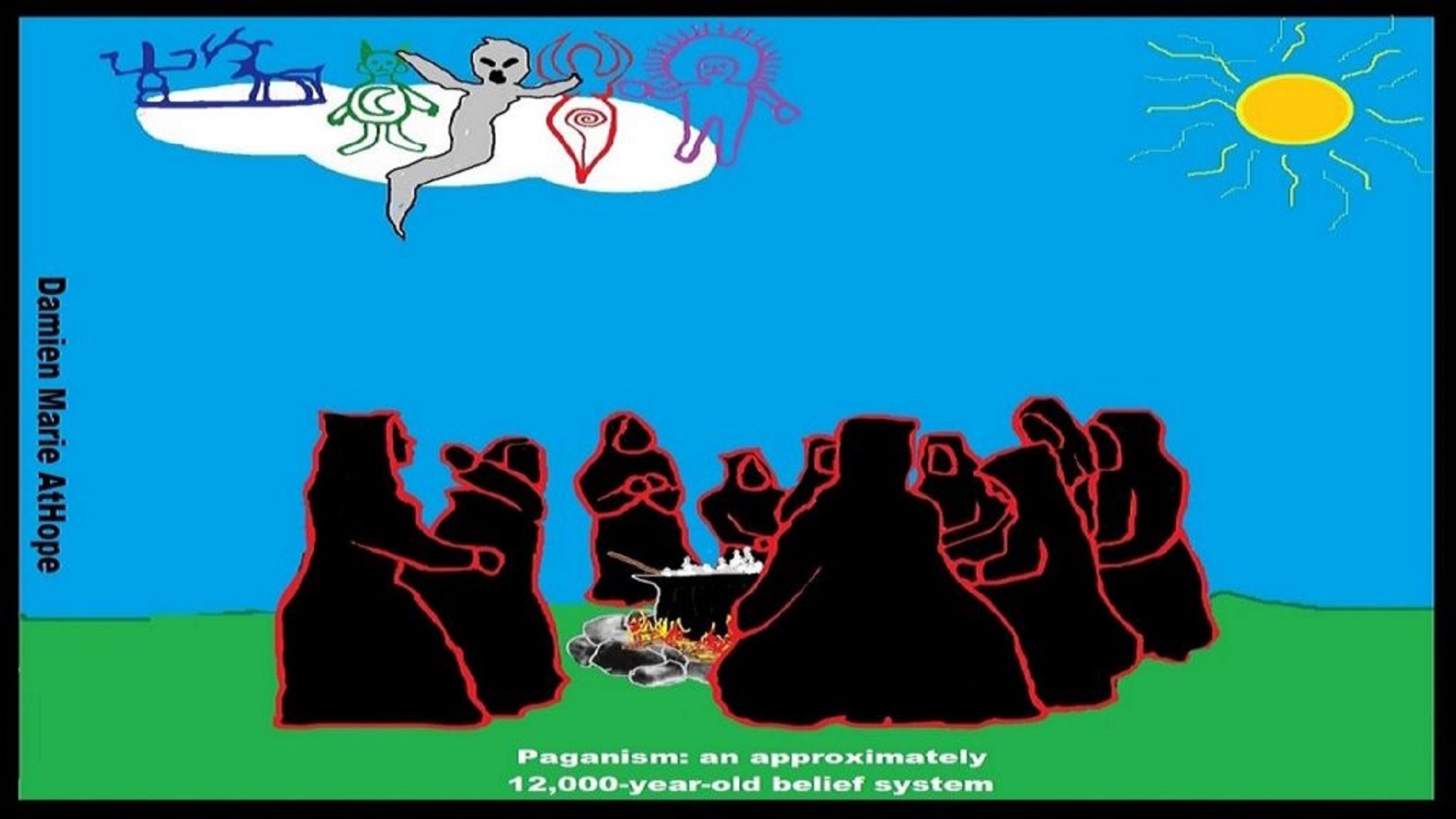
The term “paganism”, used by me and some others who are academics, roughly refers to pre-Christian, socioreligious-cultural-based traditions which were polytheistic (worshiped multiple entities), and to me, I speculate also involve elements of Animism, Totemism, and shamanism; which together with polytheism are what I call paganism.
Just think of the kind and amount of religious faith one would need to build such a site as this. Speaking of building, one of the most fascinating facts about this site is that they didn’t have the wheel nor metal tools. All they had were stone tools and little else. I see this place as having several somewhat hidden themes which include the concept of animal gods or sacred spirit animals, female gods or sacred spirit female ancestor worship, male clan leader cult, sky burials as well as skull cult. The likely hood is that the main focus of the temple varied from one theme to another over the thousands of years in which it was used.
The interconnectedness of religious thinking Animism, Totemism, Shamanism, and Paganism and Beyond……….in my speculations from the facts available.
So, to me, it all starts in a general way with Animism (theoretical belief in supernatural powers/spirits), then this is physically expressed in or with Totemism (theoretical belief in mythical relationship with powers/spirits through a totem item), which then enlists a full-time specific person to do this worship and believed interacting Shamanism (theoretical belief in access and influence with spirits through ritual), and then there is the further employment of myths and gods added to all the above giving you Paganism (often a lot more nature-based than most current top world religions, thus hinting to their close link to more ancient religious thinking it stems from). Religion started rather female-centric but generally egalitarianistic and was so at least tell like after 7,000 and definitely by 5,000 and the birth of statism women fall in status but to me, it’s 13,000 to 12,000-year-old proto-paganism goddess and animal gods that seem to come first I presume likely was driven from lesser earlier spirit beings/mythic ancestors, like a greater symbol of clan protectors in totemism which seems to go back like 50,000 to possibly 70,000 years ago which they already believed in from both proto-animism which seems to go back like 100,000 to? years ago (possibly pre-human maybe as far back as 300,000? years ago) and further developed in shanimism which seems to go back like 30,000.
* “paganist” As I conceive it in a simplified way is to believe in spirit-filled life and/or afterlife can be attached to or be expressed in things or objects and these objects can be used by special persons or in special rituals can connect to spirit-filled life and/or afterlife who are guided/supported by a goddess/god or goddesses/gods (you are a hidden paganist/Paganism: an approximately 12,000-year-old belief system) And Gobekli Tepe: “first human-made temple” as well as Catal Huyuk “first religious designed city” are both evidence of some kind of early paganism, to me.
Again just to clarify when I refer to seeming paganism thinking or behaviors (emphasize reverence for nature, polytheistic and animistic, totemistic, and shamanist religious practices). and Gobekli Tepe, by paganism I mean a grouped set of behaviors that I believe resemble the concept of paganism type beliefs. Neither am I claiming to fully know or understand all the possible mythology beliefs that may be represented in the carving at Gobekli Tepe, some seem more straightforward others beyond current understanding and possibly forever beyond full comprehension.
“Paganism was originally a pejorative and derogatory term for polytheism, implying its inferiority. Paganism (from classical Latin refers to “rural, rustic,” later “civilian”) is a term first used in the fourth century by early Christians for people who practiced polytheism.” ref
“However, Paganism as a term of meaning represents a wide variety of traditions that emphasize reverence for nature and a revival of ancient polytheistic and animistic religious practices. Paganism is not a traditional religion per se because it does not have any official doctrine, but it does have some common characteristics joining the great variety of traditions. One of the common beliefs is the divine presence in nature and the reverence of the natural order in life. Spiritual growth is related to the cycles of the Earth and great emphasis is placed on ecological concerns. Monotheism is almost universally rejected within Paganism and most Pagan traditions are particularly interested in the revival of ancient polytheist religious traditions.” ref
“Religion may be defined as “a set of beliefs concerning the cause, nature, and purpose of the universe, especially when considered as the creation of a superhuman agency or agencies, usually involving devotional and ritual observances, and often containing a moral code governing the conduct of human affairs,” whereas ritual is “an established or prescribed procedure for a religious or other rites.” ref
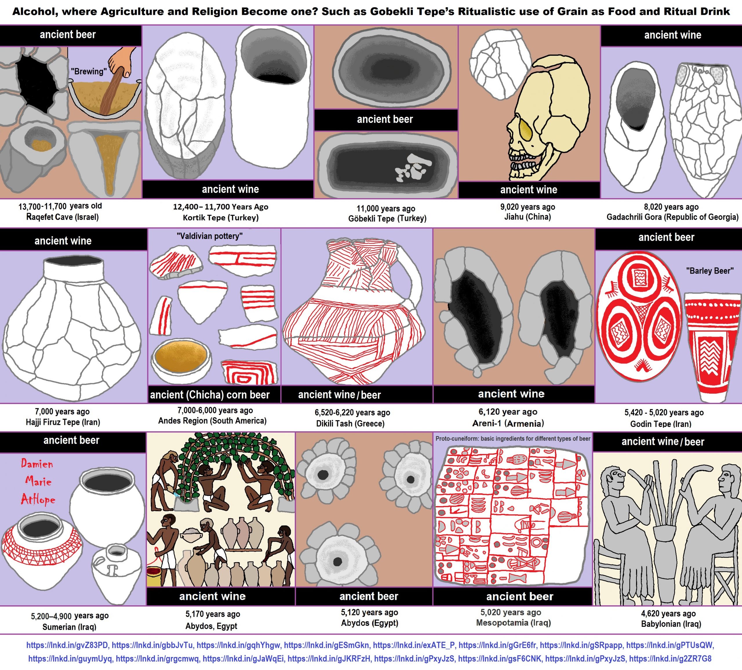
ref, ref, ref, ref, ref, ref, ref, ref, ref, ref, ref, ref, ref, ref, ref
Raqefet Cave
13,000-year-old stone mortars offers the earliest known physical evidence of an extensive ancient beer-brewing operation.
“The find comes on the heels of a July report that archaeologists working in northeastern Jordan discovered the charred remains of bread baked by Natufians some 11,600 to 14,600 years ago. According to the Stanford scientists, the ancient beer residue comes from 11,700 to 13,700 years old. Through laboratory analysis, other archaeological evidence found in the cave, and the wear of the stones, the team discovered that the ancient Natufians used species from seven plant families, “including wheat or barley, oat, legumes and bast fibers (including flax),” according to the article. “They packed plant-foods, including malted wheat/barley, in fiber-made containers and stored them in boulder mortars. They used bedrock mortars for pounding and cooking plant-foods, including brewing wheat/barley-based beer likely served in ritual feasts ca. 13,000 years ago,” the scientists write. “It has long been speculated that the thirst for beer may have been the stimulus behind cereal domestication, which led to a major social-technological change in human history; but this hypothesis has been highly controversial,” the Stanford authors say. “We report here of the earliest archaeological evidence for cereal-based beer brewing by a semi-sedentary, foraging people.” ref
“Beer making was an integral part of rituals and feasting, a social regulatory mechanism in hierarchical societies,” said Stanford’s Wang. The Raqefet Cave discovery of the first man-made alcohol production, the cave also provides one of the earliest pieces of evidence of the use of flower beds on gravesites, discovered under human skeletons. “The Natufian remains in Raqefet Cave never stop surprising us,” co-author Prof. Dani Nadel, of the University of Haifa’s Zinman Institute of Archaeology, said in a press release. “We exposed a Natufian burial area with about 30 individuals, a wealth of small finds such as flint tools, animal bones and ground stone implements, and about 100 stone mortars and cupmarks. Some of the skeletons are well-preserved and provided direct dates and even human DNA, and we have evidence for flower burials and wakes by the graves.” ref
“And now, with the production of beer, the Raqefet Cave remains provide a very vivid and colorful picture of Natufian lifeways, their technological capabilities, and inventions,” he said. Stanford’s Liu posited that the beer production was of a religious nature because its production was found near a graveyard. “This discovery indicates that making alcohol was not necessarily a result of agricultural surplus production, but it was developed for ritual purposes and spiritual needs, at least to some extent, prior to agriculture,” she said. “Alcohol making and food storage were among the major technological innovations that eventually led to the development of civilizations in the world, and archaeological science is a powerful means to help reveal their origins and decode their contents,” said Liu. “We are excited to have the opportunity to present our findings, which shed new light on a deeper history of human society.” ref
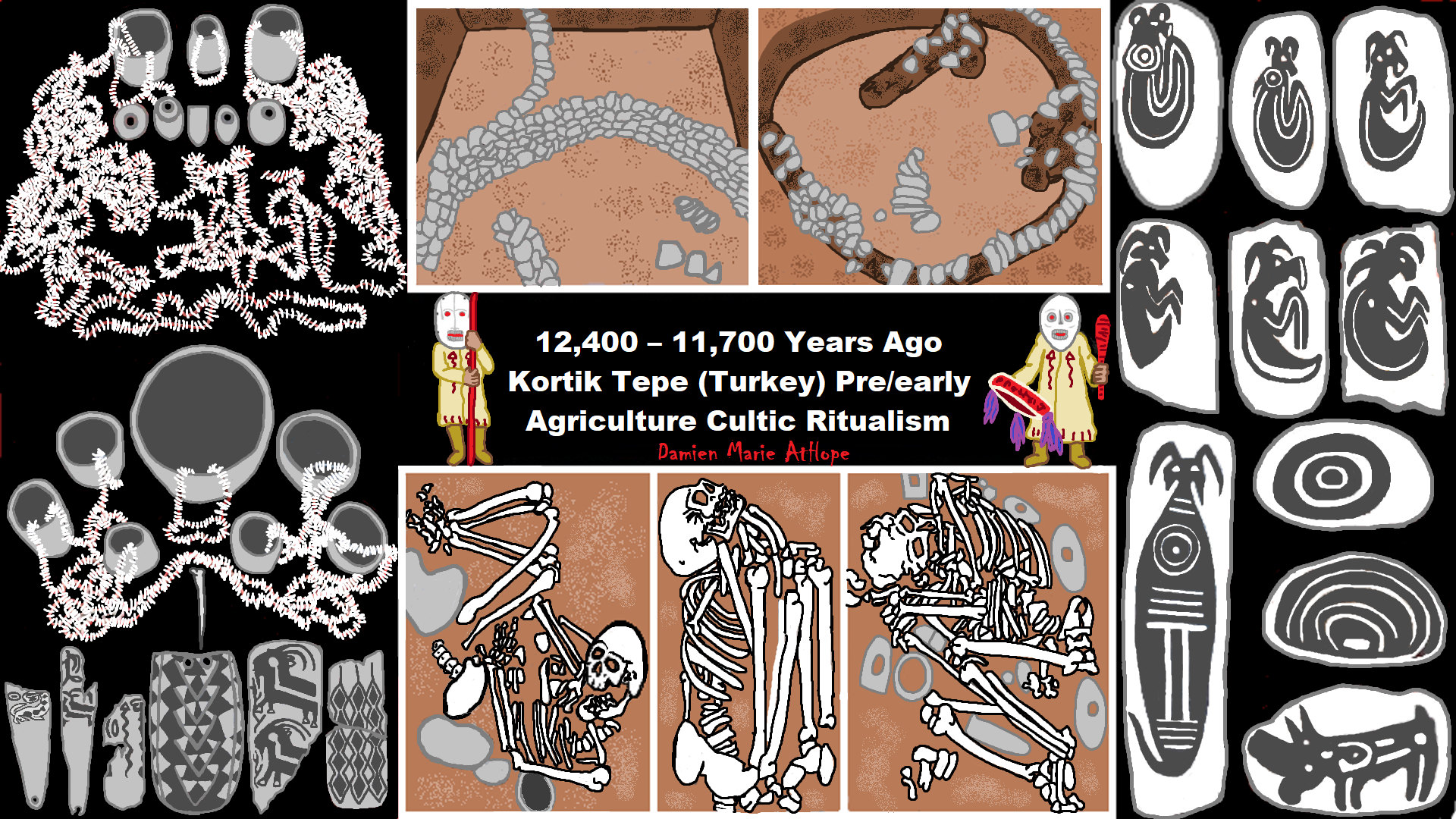
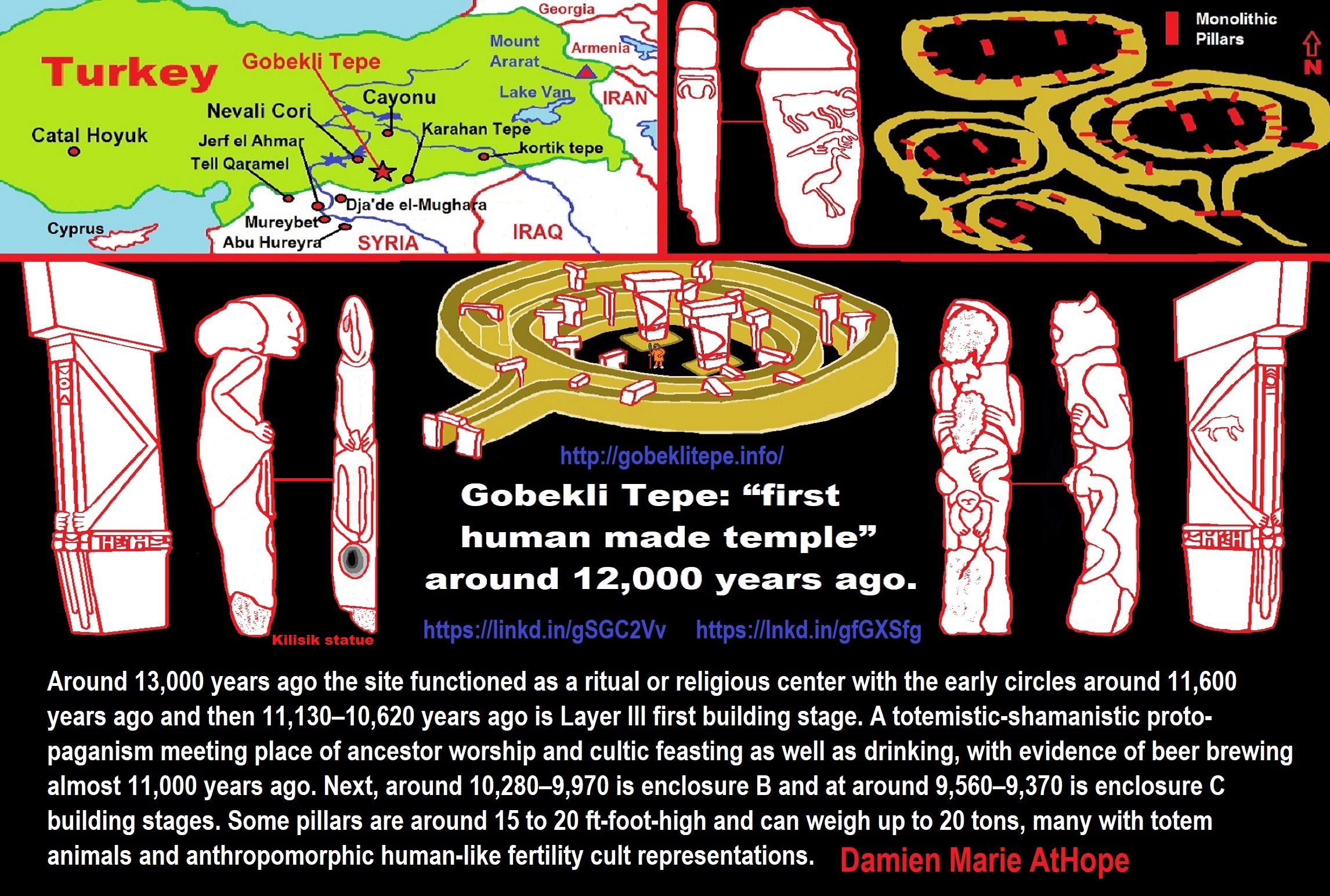
“Migration from Siberia behind the formation of Göbeklitepe: Expert states. People who migrated from Siberia formed the Göbeklitepe, and those in Göbeklitepe migrated in five other ways to spread to the world, said experts about the 12,000-year-old Neolithic archaeological site in the southwestern province of Şanlıurfa.“ The upper paleolithic migrations between Siberia and the Near East is a process that has been confirmed by material culture documents,” he said.” ref
“Semih Güneri, a retired professor from Caucasia and Central Asia Archaeology Research Center of Dokuz Eylül University, and his colleague, Professor Ekaterine Lipnina, presented the Siberia-Göbeklitepe hypothesis they have developed in recent years at the congress held in Istanbul between June 11 and 13. There was a migration that started from Siberia 30,000 years ago and spread to all of Asia and then to Eastern and Northern Europe, Güneri said at the international congress.” ref
“The relationship of Göbeklitepe high culture with the carriers of Siberian microblade stone tool technology is no longer a secret,” he said while emphasizing that the most important branch of the migrations extended to the Near East. “The results of the genetic analyzes of Iraq’s Zagros region confirm the traces of the Siberian/North Asian indigenous people, who arrived at Zagros via the Central Asian mountainous corridor and met with the Göbeklitepe culture via Northern Iraq,” he added.” ref
“Emphasizing that the stone tool technology was transported approximately 7,000 kilometers from east to west, he said, “It is not clear whether this technology is transmitted directly to long distances by people speaking the Turkish language at the earliest, or it travels this long-distance through using way stations.” According to the archaeological documents, it is known that the Siberian people had reached the Zagros region, he said. “There seems to be a relationship between Siberian hunter-gatherers and native Zagros hunter-gatherers,” Güneri said, adding that the results of genetic studies show that Siberian people reached as far as the Zagros.” ref
“There were three waves of migration of Turkish tribes from the Southern Siberia to Europe,” said Osman Karatay, a professor from Ege University. He added that most of the groups in the third wave, which took place between 2600-2400 BCE, assimilated and entered the Germanic tribes and that there was a genetic kinship between their tribes and the Turks. The professor also pointed out that there are indications that there is a technology and tool transfer from Siberia to the Göbeklitepe region and that it is not known whether people came, and if any, whether they were Turkish.” ref
“Around 12,000 years ago, there would be no ‘Turks’ as we know it today. However, there may have been tribes that we could call our ‘common ancestors,’” he added. “Talking about 30,000 years ago, it is impossible to identify and classify nations in today’s terms,” said Murat Öztürk, associate professor from İnönü University. He also said that it is not possible to determine who came to where during the migrations that were accepted to have been made thousands of years ago from Siberia. On the other hand, Mehmet Özdoğan, an academic from Istanbul University, has an idea of where “the people of Göbeklitepe migrated to.” ref
“According to Özdoğan, “the people of Göbeklitepe turned into farmers, and they could not stand the pressure of the overwhelming clergy and started to migrate to five ways.” “Migrations take place primarily in groups. One of the five routes extends to the Caucasus, another from Iran to Central Asia, the Mediterranean coast to Spain, Thrace and [the northwestern province of] Kırklareli to Europe and England, and one route is to Istanbul via [Istanbul’s neighboring province of] Sakarya and stops,” Özdoğan said. In a very short time after the migration of farmers in Göbeklitepe, 300 settlements were established only around northern Greece, Bulgaria, and Thrace. “Those who remained in Göbeklitepe pulled the trigger of Mesopotamian civilization in the following periods, and those who migrated to Mesopotamia started irrigated agriculture before the Sumerians,” he said.” ref
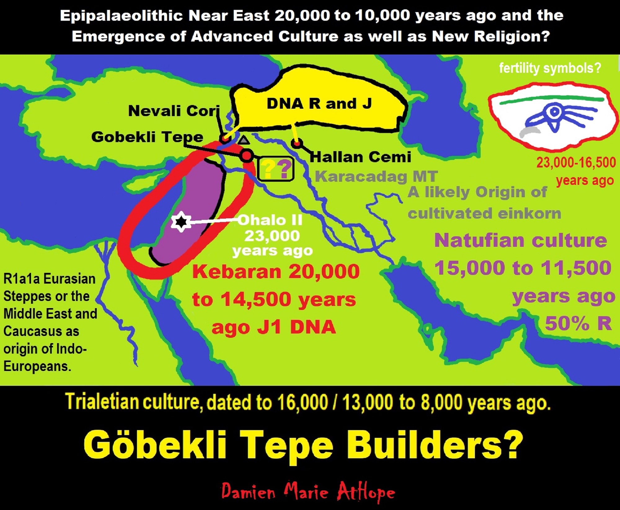
ref, ref, ref, ref, ref, ref, ref
Trialetian culture (16,000–8000 years ago) the Caucasus, Iran, and Turkey, likely involved in Göbekli Tepe. Migration 1?
Haplogroup R possible time of origin about 27,000 years in Central Asia, South Asia, or Siberia:
- Mal’ta–Buret’ culture (24,000-15,000 years ago)
- Afontova Gora culture (21,000-12,000 years ago)
- Trialetian culture (16,000–8000 years ago)
- Samara culture (7,000-6,500 years ago)
- Khvalynsk culture (7,000-6,500 years ago)
- Afanasievo culture (5,300-4,500 years ago)
- Yamna/Yamnaya Culture (5,300-4,500 years ago)
- Andronovo culture (4,000–2,900 years ago) ref
Trialetian sites
Caucasus and Transcaucasia:
- Edzani (Georgia)
- Chokh (Azerbaijan), layers E-C200
- Kotias Klde, layer B” ref
Eastern Anatolia:
- Hallan Çemi (from ca. 8.6-8.5k BC to 7.6-7.5k BCE)
- Nevali Çori shows some Trialetian admixture in a PPNB context” ref
Trialetian influences can also be found in:
- Cafer Höyük
- Boy Tepe” ref
Southeast of the Caspian Sea:
- Hotu (Iran)
- Ali Tepe (Iran) (from cal. 10,500 to 8,870 BCE)
- Belt Cave (Iran), layers 28-11 (the last remains date from ca. 6,000 BCE)
- Dam-Dam-Cheshme II (Turkmenistan), layers7,000-3,000 BCE)” ref
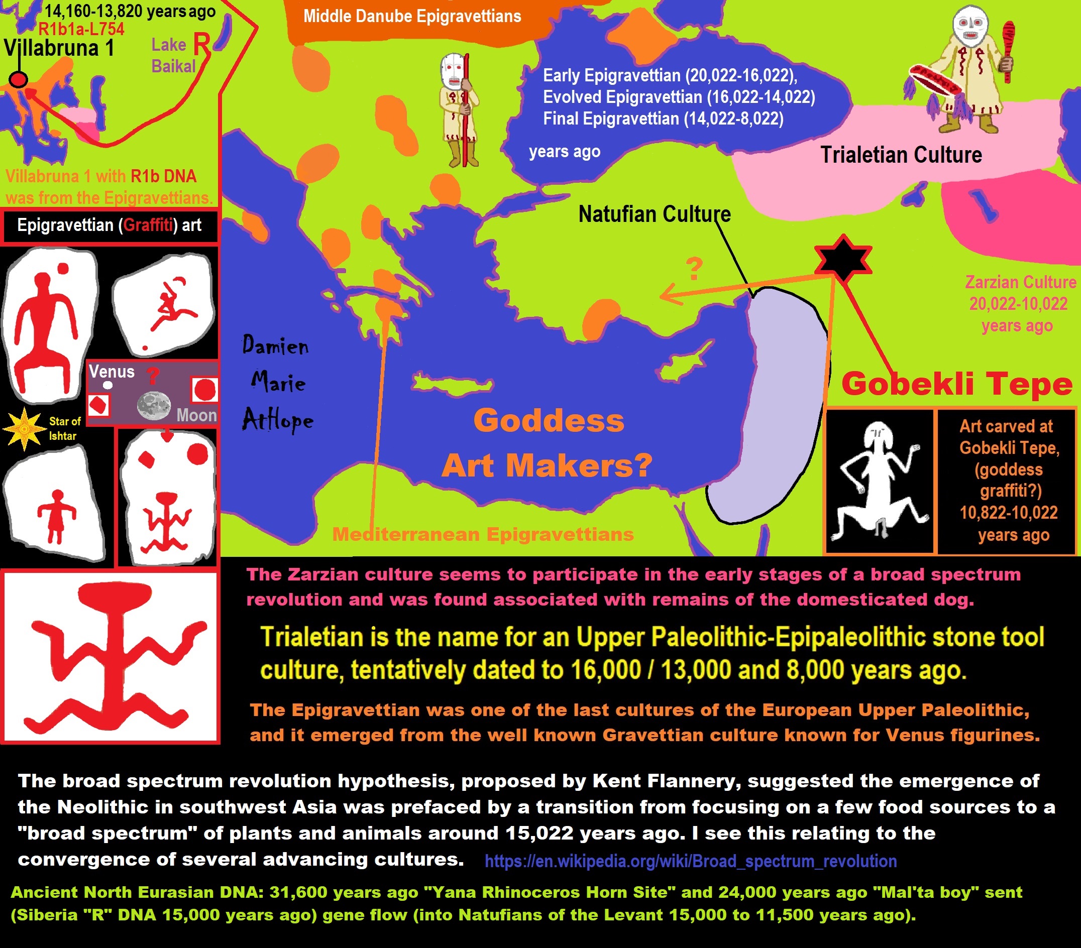
ref, ref, ref, ref, ref, ref, ref, ref, ref, ref, ref, ref, ref, ref, ref
Trialetian peoples which I think we’re more male-centric and involved in the creation of Göbekli Tepe, from its start around Pre-Pottery Neolithic A (12,000 – 10,800 years ago) began with their influence and this is seen in animal deities many clearly male and the figures also being expressively male themed as well at first, and only around Pre-Pottery Neolithic B (10,800 – 8,500 years ago) or so it seems with what I am guessing is new Epigravettian peoples with a more female-centric style (reminiscent but less than the Gravettians known for Venus figurines) influence from migration into the region, to gain new themes that add a female element both with A totem pole seeming to express birth or something similar and graffiti of a woman either ready for sex or giving birth or both. and Other bare figures seem to show a similar body position reminiscent of the graffiti of a woman.
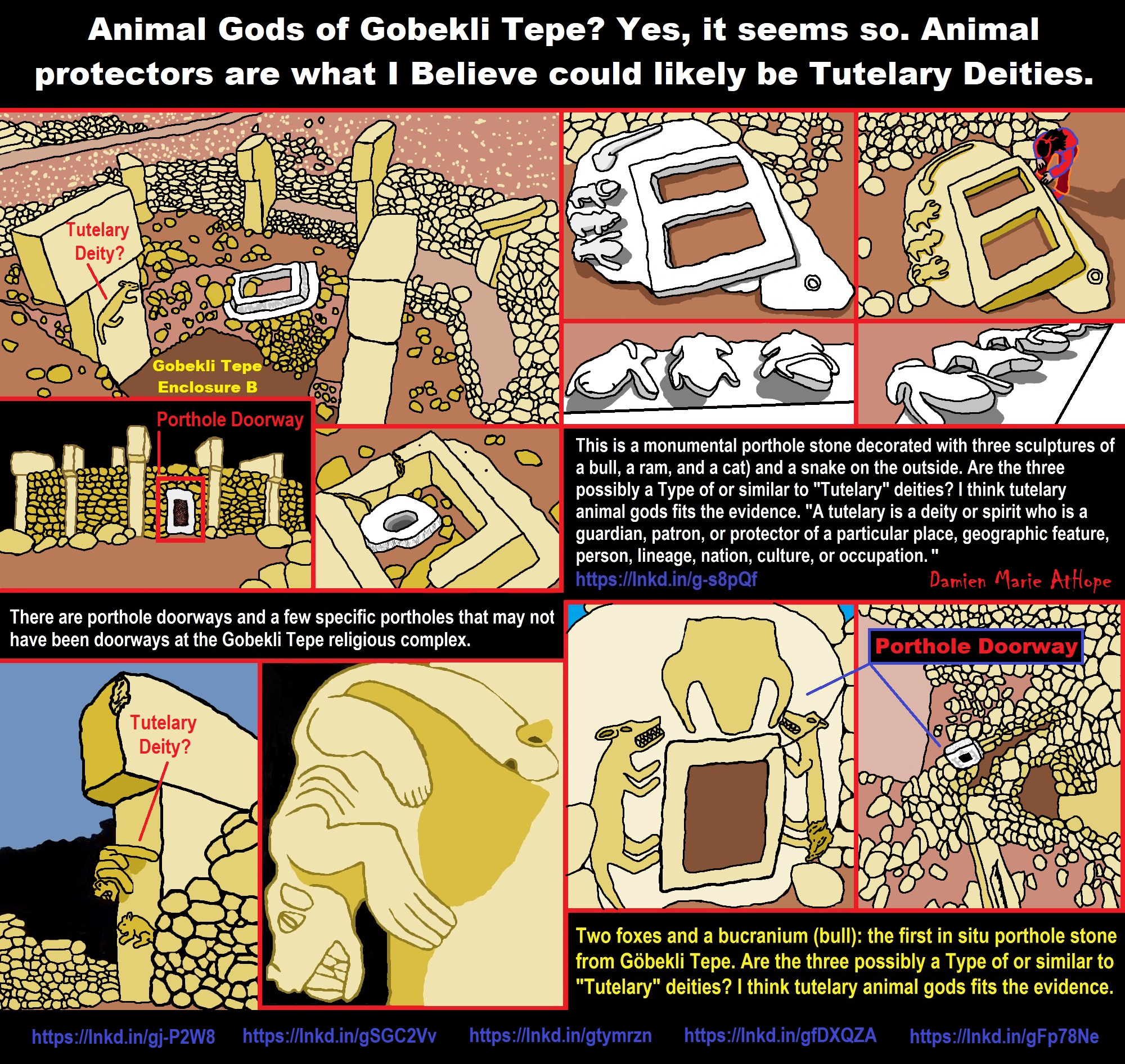
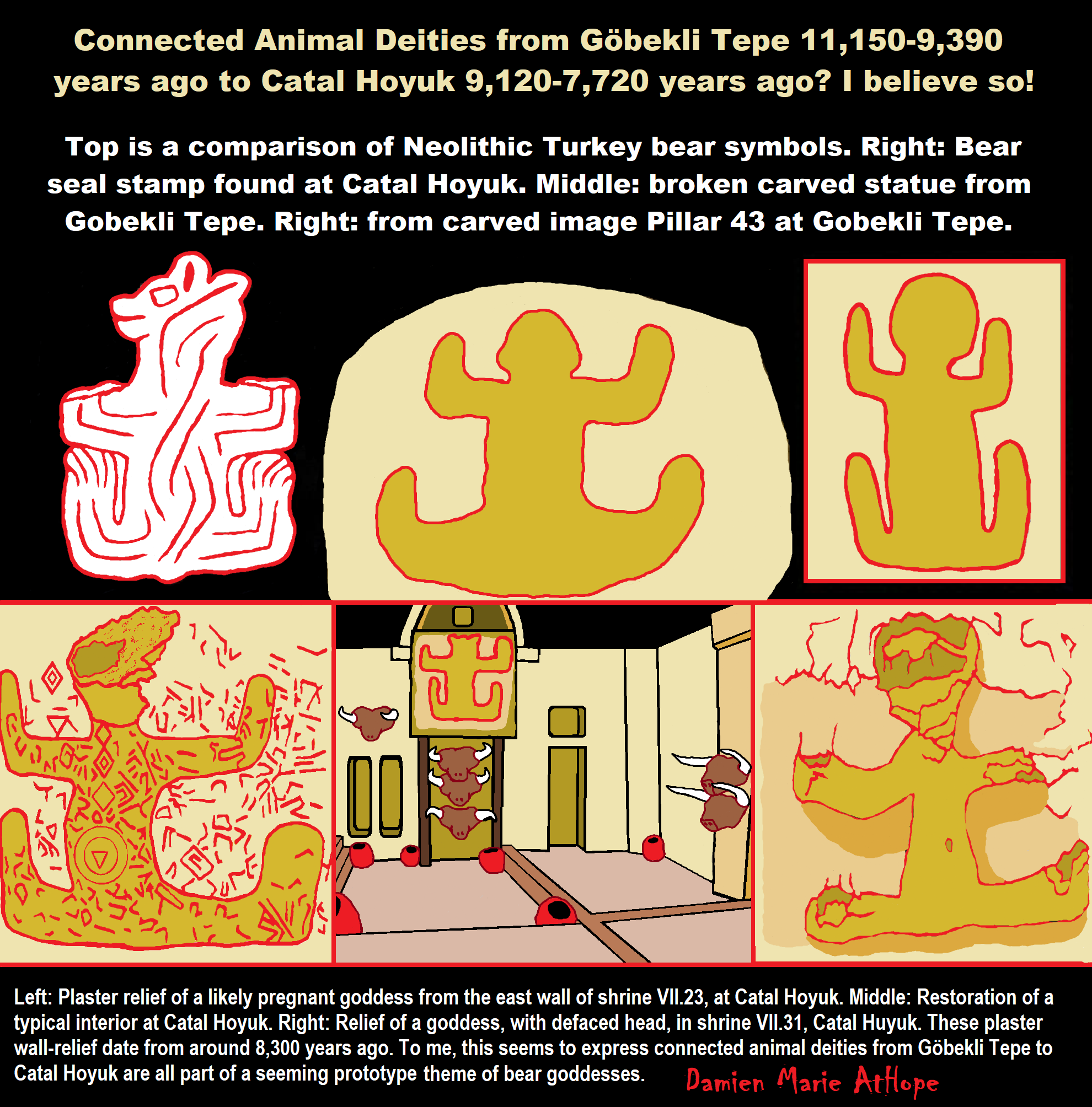
ref, ref, ref, ref, ref, ref, ref
Bear worship
“Bear worship (also known as the bear cult or arctolatry) is the religious practice of the worshipping of bears found in many North Eurasian ethnic religions such as among the Sami, Nivkh, Ainu, Basques, Germanic peoples, Slavs, and Finns. There are also a number of deities from Celtic Gaul and Britain associated with the bear, and the Dacians, Thracians, and Getians were noted to worship bears and annually celebrate the bear dance festival. The bear is featured on many totems throughout northern cultures that carve them. Bears were the most worshipped animals of Ancient Slavs. During pagan times, it was associated with the god Volos, the patron of domestic animals. Eastern Slavic folklore describes the bear as a totem personifying a male: father, husband, or a fiancé. Legends about turnskin bears appeared, it was believed that humans could be turned into bears for misbehavior.” ref
“Bears in Korean mythology, According to legend, Ungnyeo (literally “bear woman”) was a bear who turned into a woman, and gave birth to Dangun, the founder of the first Korean kingdom, Gojoseon. Bears were revered as motherly figures and as symbolic of patience. In Finnish paganism, the bear was considered a taboo animal and the word for “bear” (oksi) was a taboo word. Euphemisms such as mesikämmen “honey-hand” were used instead. Bear hunting and killing a bear was followed by a party called peijaiset with ceremony intended to show that the bear would be a “honored guest” instead of a slaughtered animal, and that its death was “accidental”, in order to not to anger the bear’s spirit. The skull of the bear was hung onto a tree, which was venerated as a totem.” ref
The bear festival is a religious festival celebrated by the indigenous Nivkh in Russia’s far east. A Nivkh shaman (ch’am) would preside over the Bear Festival, celebrated in the winter between January and February depending on the clan. Bears were captured and raised in a corral for several years by local women, treating the bear like a child. The bear is considered a sacred earthly manifestation of Nivkh ancestors and the gods in bear form. During the Festival, the bear is dressed in a specially made ceremonial costume and offered a banquet to take back to the realm of gods to show benevolence upon the clans. After the banquet, the bear is killed and eaten in an elaborate religious ceremony. The festival was arranged by relatives to honor the death of a kinsman. The bear’s spirit returns to the gods of the mountain ‘happy’ and rewards the Nivkh with bountiful forests. Generally, the Bear Festival was an inter-clan ceremony where a clan of wife-takers restored ties with a clan of wife-givers upon the broken link of the kinsman’s death. The Bear Festival was suppressed in the Soviet period; since then the festival has had a modest revival, albeit as a cultural rather than a religious ceremony.” ref
The Ainu people, who live on select islands in the Japanese archipelago, call the bear “kamuy” in their language, which translates to mean “god” similar to Kami. While many other animals are considered to be gods in the Ainu culture, the bear is the head of the gods. For the Ainu, when the gods visit the world of man, they don fur and claws and take on the physical appearance of an animal. Usually, however, when the term “kamuy” is used, it essentially means a bear. The Ainu people willingly and thankfully ate the bear as they believed that the disguise (the flesh and fur) of any god was a gift to the home that the god chose to visit. While on Earth – the world of man – the Ainu believed that the gods appeared in the form of animals. The gods had the capability of taking human form, but they only took this form in their home, the country of the gods, which is outside the world of man. To return a god back to his country, the people would sacrifice and eat the animal sending the god’s spirit away with civility. This ritual is called Omante and usually involves a deer or adult bear.” ref
“Kami (Japanese: are the deities, divinities, spirits, phenomena, or “holy powers”), that are venerated in the religion of Shinto. They can be elements of the landscape, forces of nature, or beings and the qualities that these beings express; they can also be the spirits of venerated dead people. Many kami are considered the ancient ancestors of entire clans (some ancestors became kami upon their death if they were able to embody the values and virtues of kami in life).” ref
“Omante occurred when the people sacrificed an adult bear, but when they caught a bear cub they performed a different ritual which is called Iomante, in the Ainu language, or Kumamatsuri in Japanese. Kumamatsuri translates to “bear festival” and Iomante means “sending off”. The event of Kumamatsuri began with the capture of a young bear cub. As if he was a child given by the gods, the cub was fed human food from a carved wooden platter and was treated better than Ainu children for they thought of him as a god. If the cub was too young and lacked the teeth to properly chew food, a nursing mother will let him suckle from her own breast. When the cub reaches 2–3 years of age, the cub is taken to the altar and then sacrificed. Usually, Kumamatsuri occurs in midwinter when the bear meat is the best from the added fat. The villagers will shoot it with both normal and ceremonial arrows, make offerings, dance, and pour wine on top of the cub corpse. The words of sending off for the bear god are then recited. This festival lasts for three days and three nights to properly return the bear god to his home.” ref
Bear Goddesses and Gods Across Ancient Cultures
“Gods and goddesses of the ancient world held a connection with certain animals. This is because our ancestors’ beliefs were animistic – they believed everything on earth had consciousness. Wildlife was sacred in ancient times. The bear is one of the most powerful and most feared of the animal kingdom. Dating back thousands of years, the people of Europe left their marks on cave walls—some of these drawings were of bears. Moreover, shamans have revered the bear for its power, but also for its motherhood qualities and healing abilities. Bear medicine is strong medicine. It’s no wonder ancient gods and goddesses were connected to the bear. Learn of the bear goddesses and a bear god here.” ref
The Greek Bear Goddesses
“The typical illustration of Artemis, Greek Goddess of the Hunt, depicts her with either a hunting dog or stag. However, one of Artemis’ most sacred animals was the bear. Artemis had domain over the forest and all wildlife within it. The bear was the largest and most powerful animal, and so Artemis found it to be a special animal. Any time a bear was killed by the Greeks, Artemis would lay a plague on the people as punishment. Artemis’ cult spread over Greece. In Brauron, young girls played she-bears in honor of Artemis and as a preparation for motherhood. They wore bear masks and acted wildly in worship of her. Artemis’ name is theorized to have meant bear-sanctuary. If we break it down—art is close to ark which means bear, and temis is close to temnis which means sanctuary. We will see in the next section how another Goddess’ name reflects this etymology.” ref
“Another close association between Artemis and bears is in the tale of one of Artemis’ followers named Callisto. Callisto was a nymph (demi-god nature spirit), and as followers of Artemis, women were charged to stay chaste and pure from men. Callisto was lured into having relations with Zeus, who impregnated her. When Artemis found out, she changed Callisto into a bear. Other versions say Athena was angered when Zeus impregnated the nymph and so she turned Callisto into a bear. The constellations Ursa Major and Ursa Minor (known to the Greeks as Arktos—bear) are said to be the soul remnants of Callisto and her son, and were placed in the sky by Zeus himself.” ref
Celtic Bear Goddess
“We don’t know a lot about Artio, the Bear Goddess of the ancient Celtic-Gauls, but we know she was intimately connected to bears. The few pieces of evidence we have of her cult’s existence were found in Switzerland and southern Germany. A bronze statue depicting Artio feeding a giant bear surfaced in Bern, Switzerland. Scholars say Artio feeds the bear with a bowl of fruit in her lap. But could it be the other way around? It seems to me the goddess is being confronted by the bear and she is not backing down. There was once a great tale about this encounter, I am sure; however, over time the lore of Artio has been lost. The inscription on the Bern statue translates to “for the goddess Artio”. As with Artemis’ name, there is a clear link to the bear in Artio’s name. Art translates to bear in Gaulish. Could Artio, the Bear Goddess of the Gauls, be the same goddess as the Greeks’ bear goddess Artemis?” ref
Hungarian Bear Goddess
“Much of what we know of the Hungarian Bear Goddess Ildiko has been lost in time, or perhaps is just not readily accessible by my research methods. However, according to the Encyclopedia of Spirits by Judika Iles, Ildiko was a goddess of the forest and wildlife. One of her most sacred animals was the bear. Ildiko was like Artemis – she was the goddess of the hunt but also a protector of forest animals. This is because of the need for balance—she guides the hunters but also protects animals in need of preservation or honor. Ildiko is a common name in Hungary with a Germanic origin meaning “warrior”. We can see how a warrior goddess would also be keen of bears—power, wisdom, and ferocity.” ref
Finnish Bear Goddess
“Above all, Mielikki is a healing goddess of Finland. She is associated with the woods and with wildlife, just as Artemis and Ildiko, but her main attribute is her healing abilities. She heals the animals when they are sick or wounded. This corresponds directly with the medicine of the bear. Shamans know bears to be healers, and so Mielikki is like the bear in this way. Mielikki is one of the bear goddesses who had a part in the creation of the bear. The story goes that Mielikki left earth and traveled into space, past the moon, in search of the materials with which to make the perfect animal. She returned and stitched together the materials from the heavens to make the bear. The bear is Mielikki’s favorite animal, above all. The tale of Mielikki going into space to find the materials to make the bear correlates nicely with the tales of the other Bear Goddesses Artemis, Callisto, and Zeus putting Callisto into the sky to make the Ursa Major and Minor constellations. There is an asteroid and a mountain on the planet Venus named for Mielikki.” ref
Slavs and the bear worship
“Bear was one of the most worshipped animals among the ancient Slavic tribes. It was connected to the god Volos, who was the protector of animals and wilderness. In Slavic folklore, the bear is usually depicted as a male, either as a father, husband or groom.” ref
Norse or Germanic pagans Odin: The All-Father and Bear God
“Odin is a popular god among Norse and Germanic pagans and his cult has spread to nearly every part of the modern world. He is known as the All-Father, the One-Eyed, and the terrifying one. He is a wise, yet powerful god and knows how to win a battle. Because of this, warriors and magicians of ancient times sought Odin for his knowledge and ferocity. When depicted, he is usually illustrated as an old man with white hair and beard, cloaked, and carrying a staff. One of his eyes is missing, a sacrifice Odin made to tap into the wisdom of the well of Urðr. Odin is almost always flanked by two of his totem animals—ravens and wolves. However, some claim Odin may also be guarded by two great bears. I’ve yet to find solid evidence of this claim; however, this could be in part because of Odin’s association with the berserkers (shaman warriors) who often wore the pelts of bears. Either way, a god of war, wisdom, healing, and trickery such as Odin would be well received as a friend of the bear.” ref
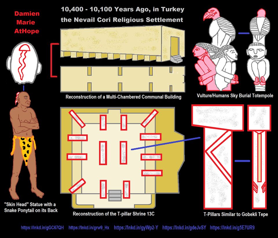
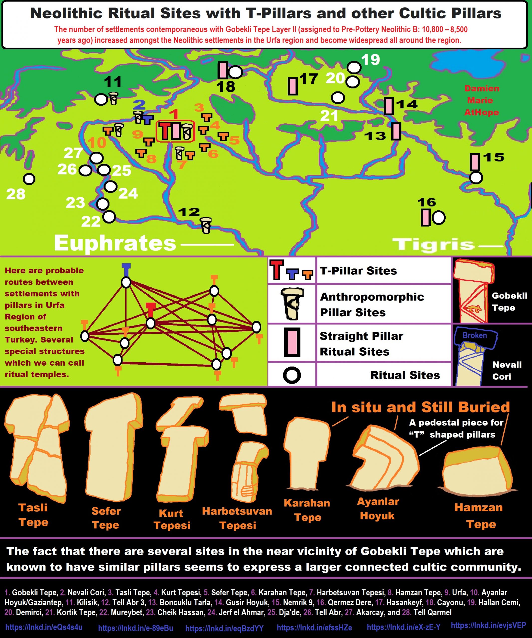
The number of settlements contemporaneous with Gobekli Tepe Layer II (assigned to Pre-Pottery Neolithic B: 10,800 – 8,500 years ago) increased amongst the Neolithic settlements in the Urfa region and become widespread all around the region.
- Gobekli Tepe, 2. Nevali Cori, 3. Tasli Tepe, 4. Kurt Tepesi, 5. Sefer Tepe, 6. Karahan Tepe, 7. Harbetsuvan Tepesi, 8. Hamzan Tepe, 9. Urfa, 10. Ayanlar Hoyuk/Gaziantep, 11. Kilisik, 12. Tell Abr 3, 13. Boncuklu Tarla, 14. Gusir Hoyuk, 15. Nemrik 9, 16. Qermez Dere, 17. Hasankeyf, 18. Cayonu, 19. Hallan Cemi, 20. Demirci, 21. Kortik Tepe, 22. Mureybet, 23. Cheik Hassan, 24. Jerf el Ahmar, 25. Dja’de, 26. Tell Abr, 27. Akarcay, and 28. Tell Qarmel
Göbekli Tepe is not alone, in fact, it is part of a religious/cultural connected ritual culture in the general region. There are several other similar sites with similar T-pillars to Göbekli Tepe or other types of stone pillar providing a seeming connected cult belief or religious culture of pillars seen in the PPNA-PPNB in the northern portion of the Near East.
“The locations of the sites that contain “T” shaped pillars are the main topic that needs more understanding to grasp the larger sociocultural-religious cultural complex in the same general region. Another matter under discussion is to comprehend the differences between the small-scale settlements that contain cult centers and “T” shaped pillars and the larger ones found at Gobekli Tepe layer III. The fact that settlements with “T” shaped pillars contain both the remains of circular domestic buildings and the pillars such as seen at Cayonu and Nevali Cori, which are also known to contain cult and domestic buildings. It is contemplated that such settlements are contemporary with Gobekli Tepe layer II and the cult building known from Nevali Cori based on the similarities and differences of the “T” shaped pillars. In the light of the finds unearthed from the settlements in Şanliurfa region that contain “T” shaped pillars, such settlements should be dated to the end of Late Pre-Pottery Neolithic A (LPPNA) and the Early Pre-Pottery Neolithic B (EPPNB).” ref
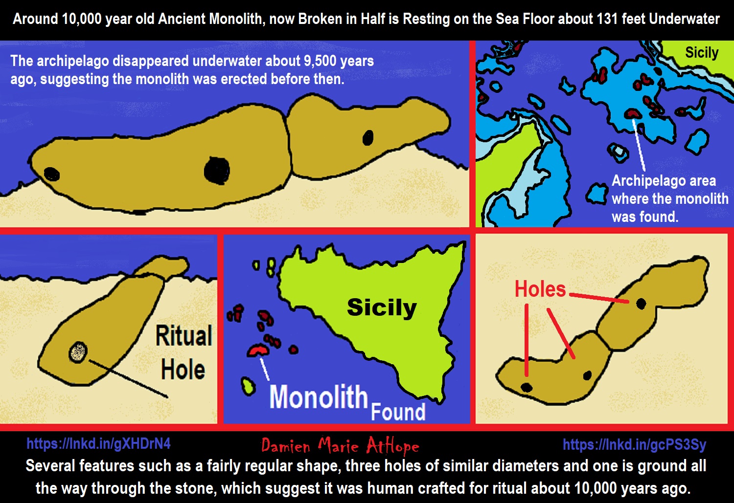
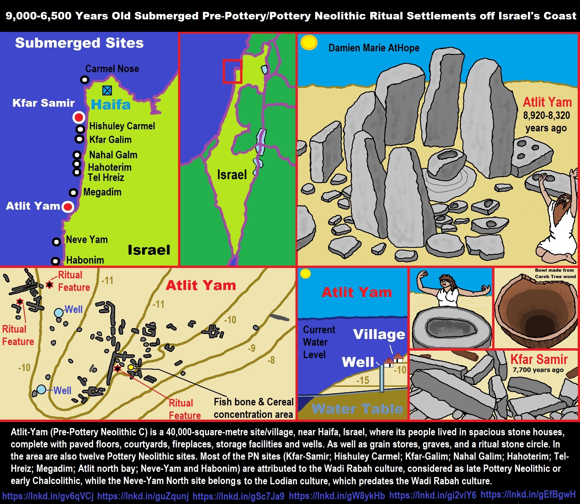
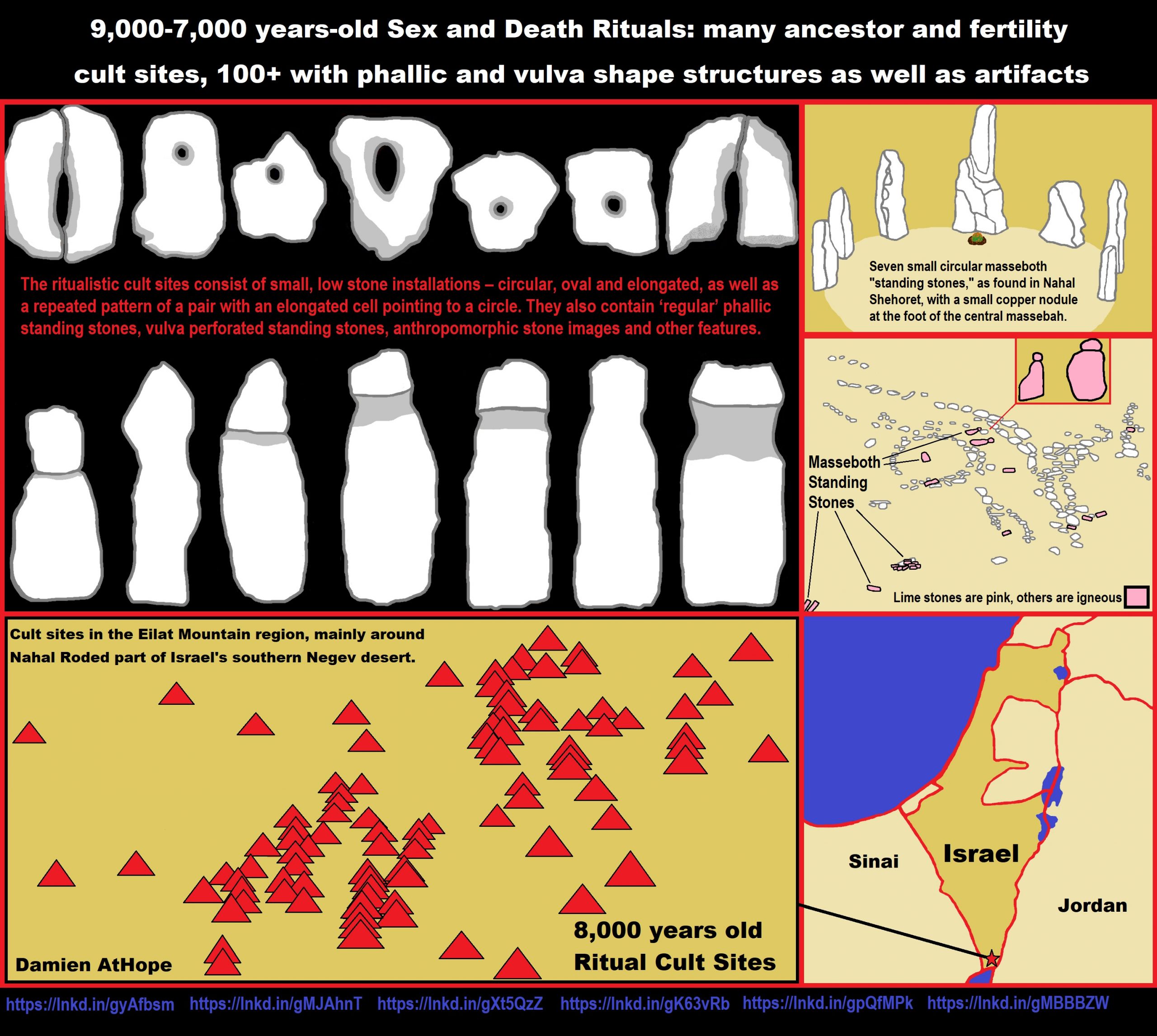
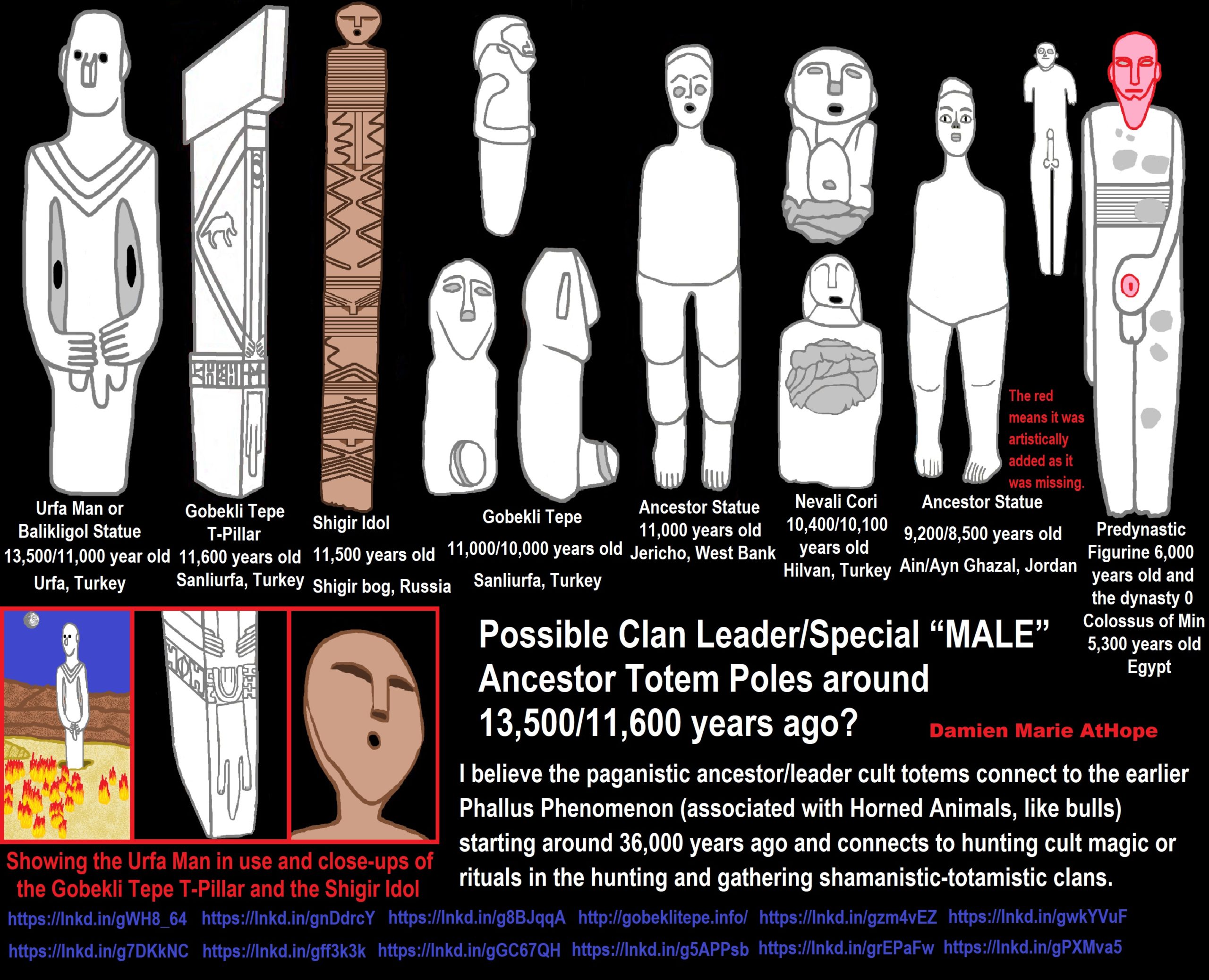
ref, ref, ref, ref, ref, ref, ref, ref, ref, ref, ref, ref, ref
I believe the paganistic ancestor/leader cult totems connect to the earlier Phallus Phenomenon (associated with Horned Animals, like bulls) starting around 36,000 years ago and connects to hunting cult magic or rituals in the hunting and gathering shamanistic-totamistic clans.
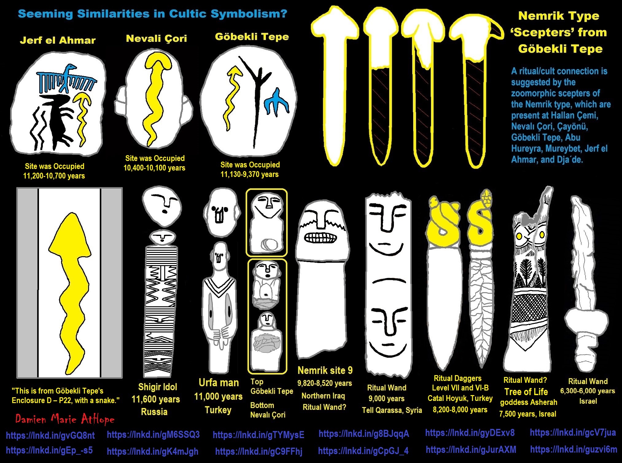
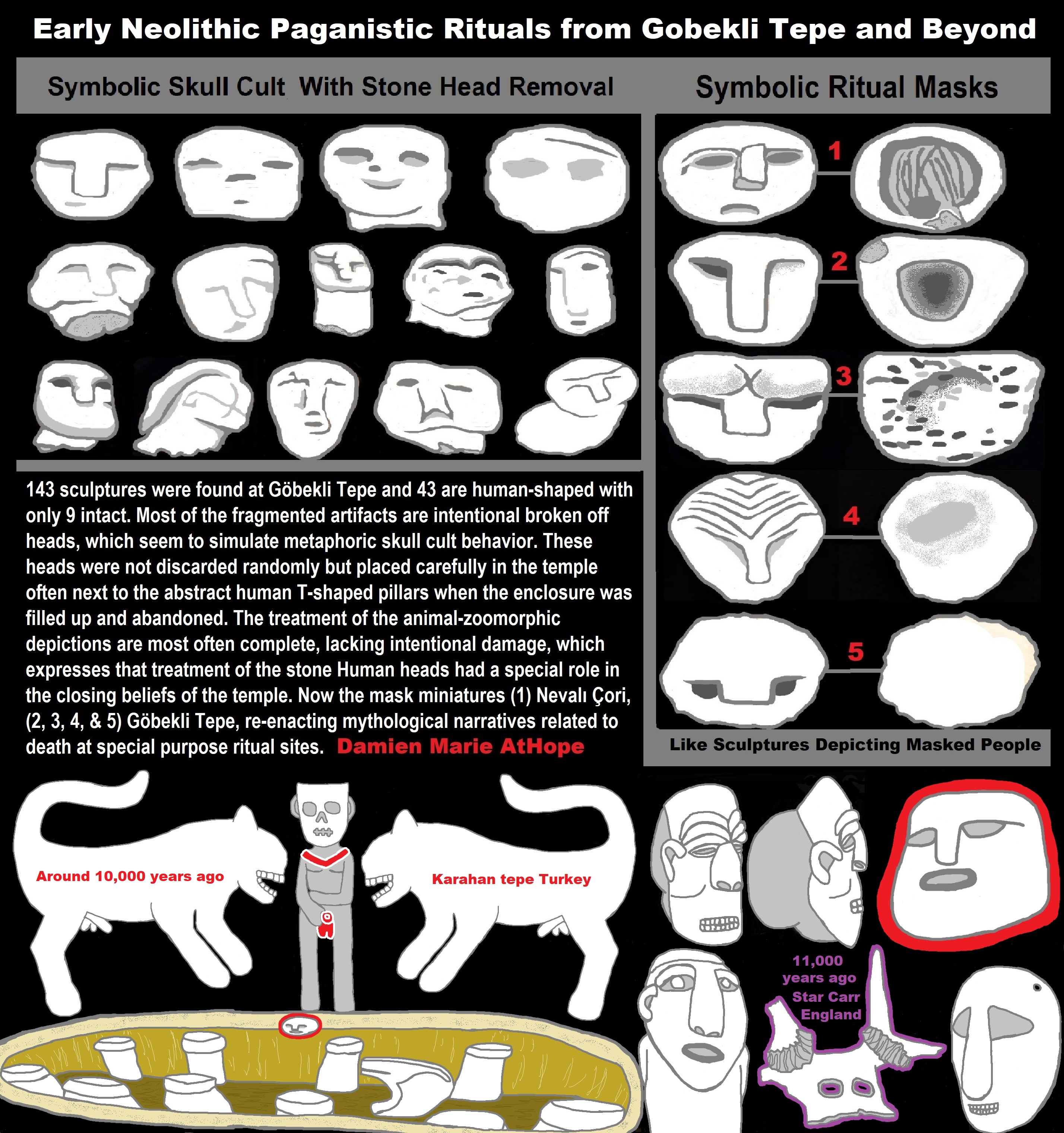
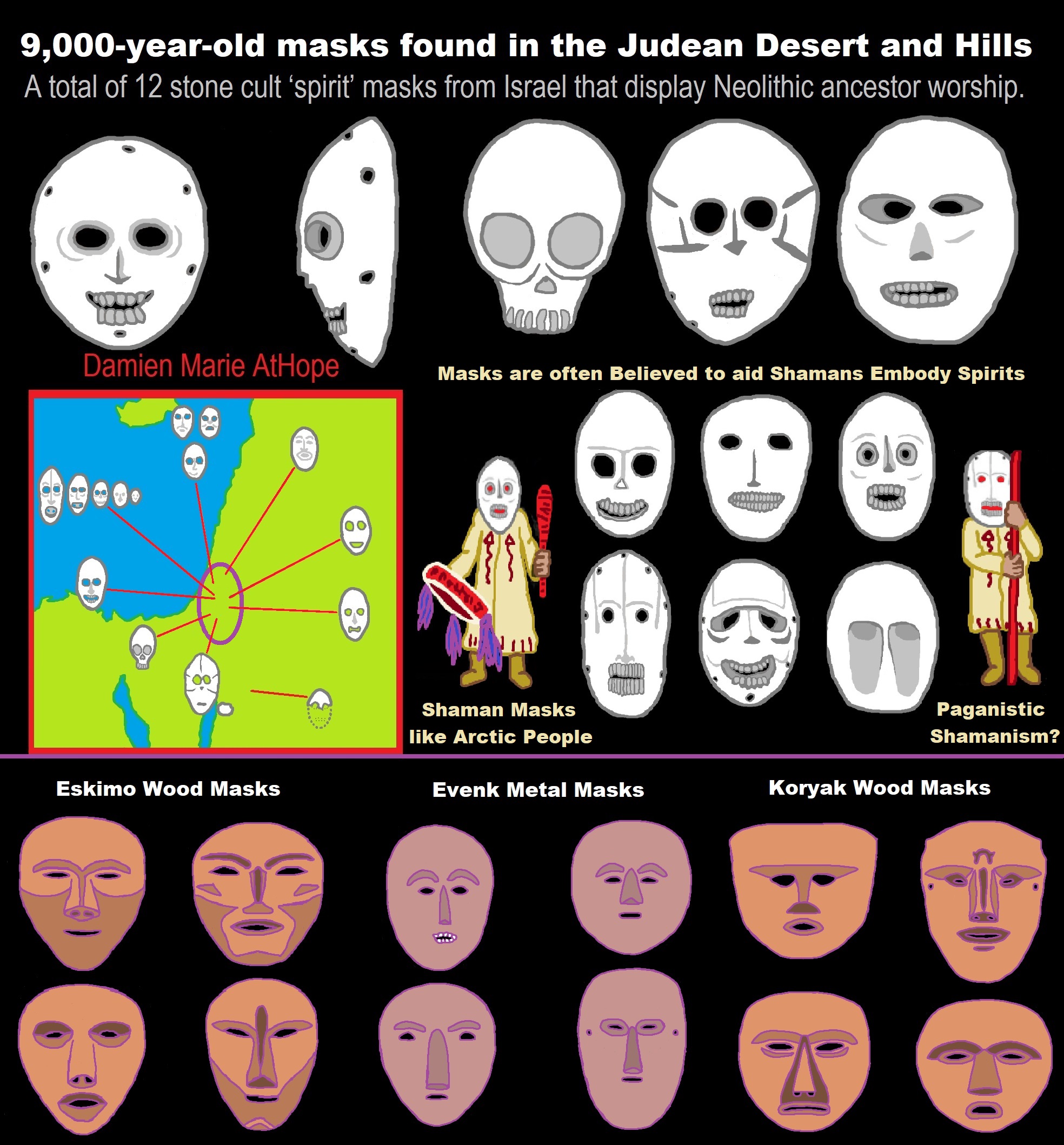
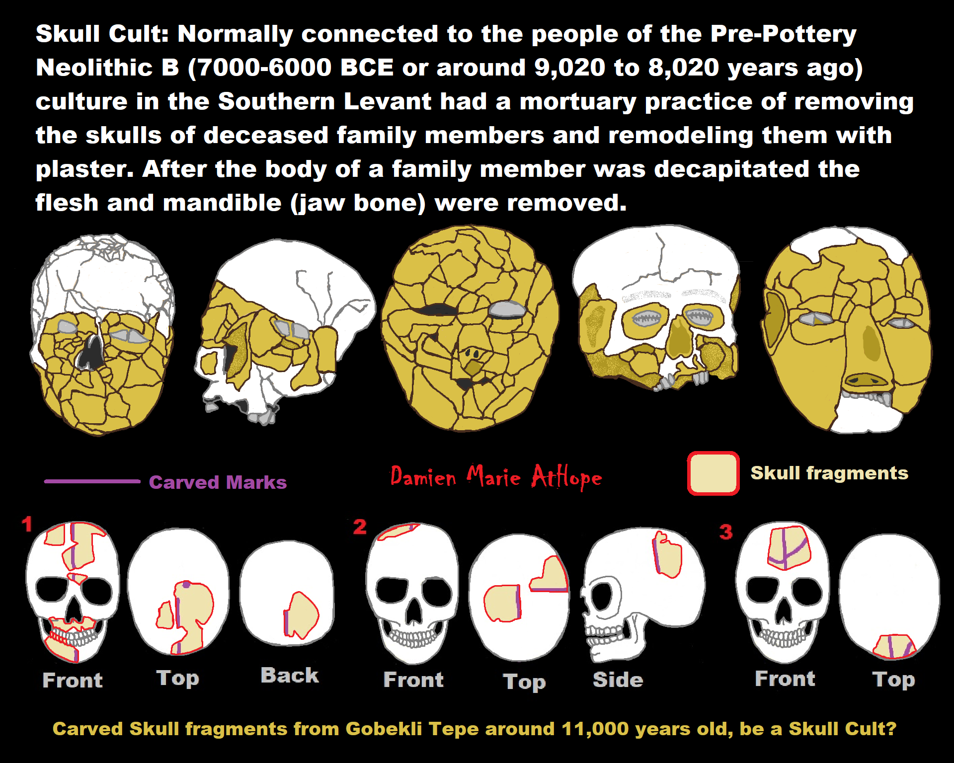

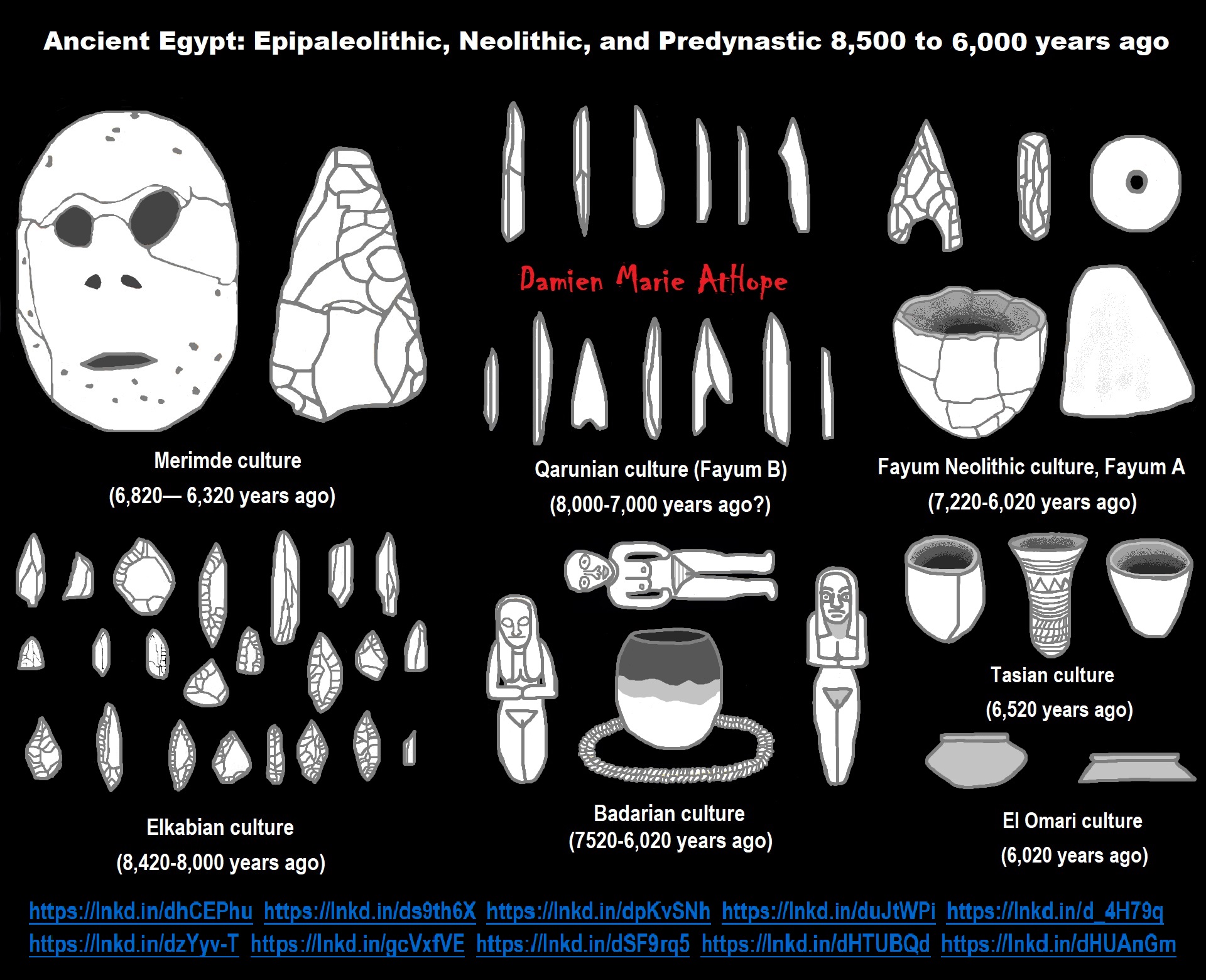
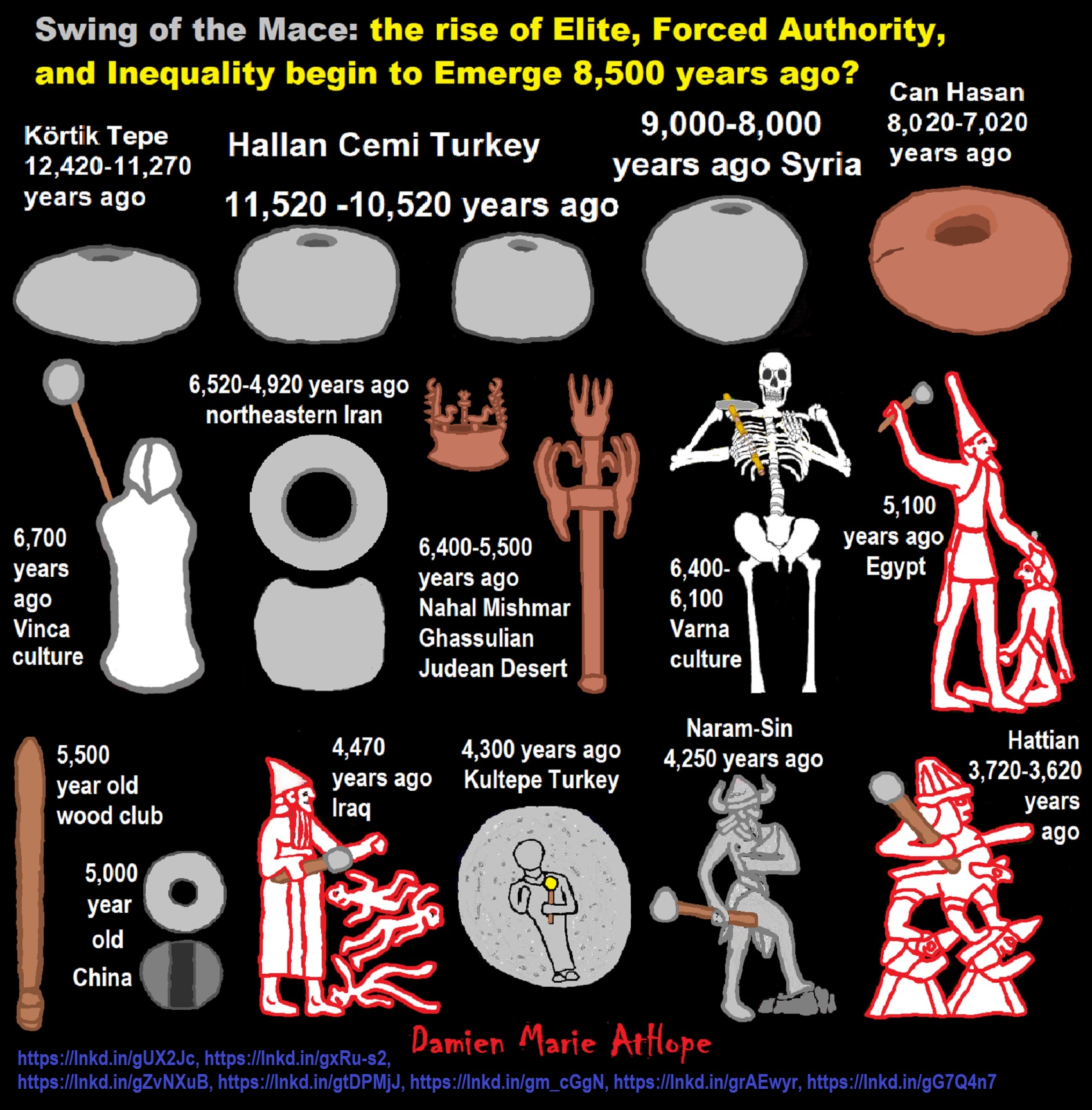
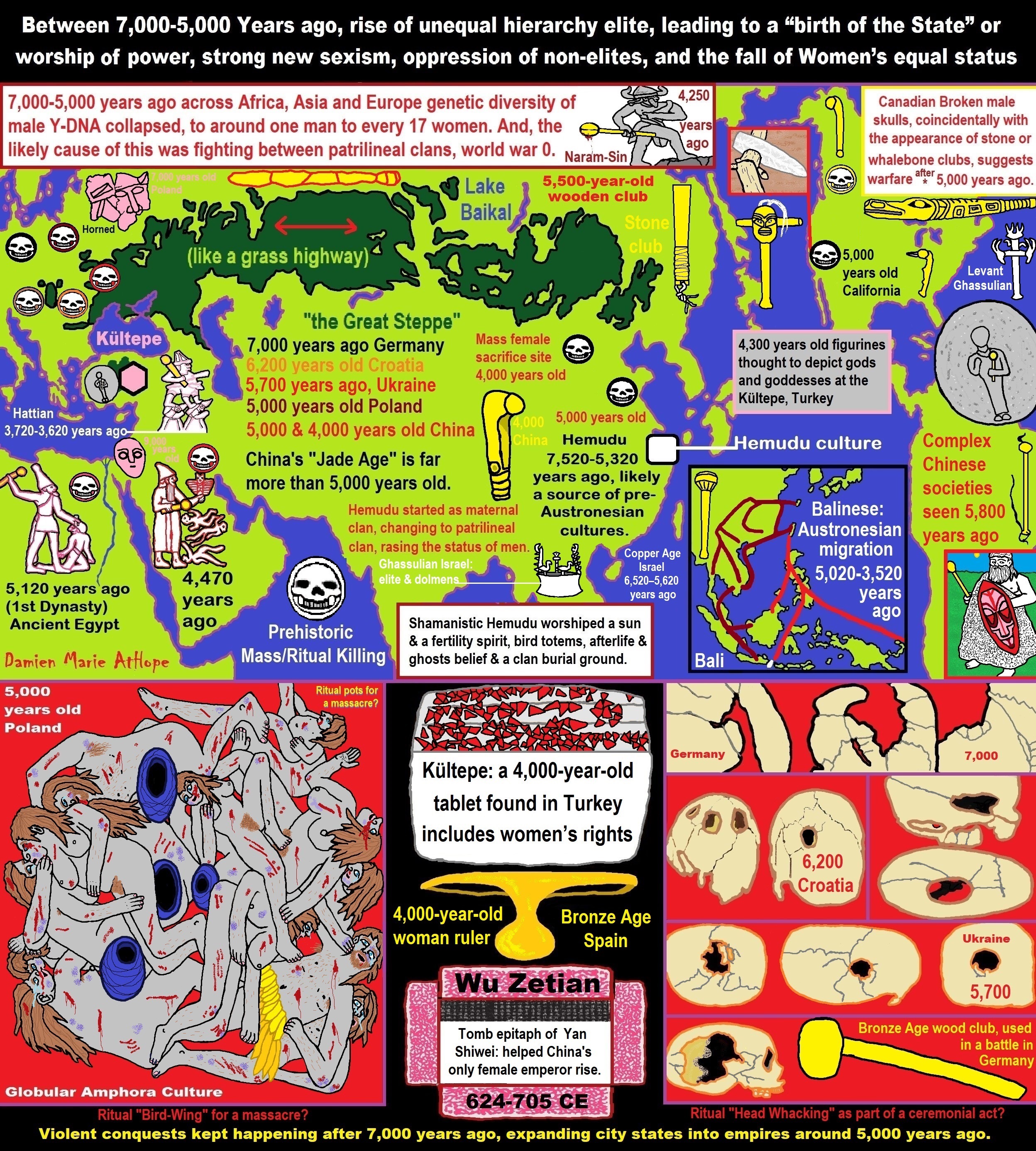
ref, ref, ref, ref, ref, ref, ref, ref, ref, ref, ref, ref, ref, ref, ref, ref, ref, ref, ref, ref, ref, ref, ref, ref, ref, ref, ref, ref, ref, ref, ref, ref, ref, ref, ref, ref, ref, ref, ref, ref, ref, ref, ref, ref, ref, ref, ref, ref, ref, ref, ref, ref, ref, ref, ref, ref, ref, ref, ref, ref, ref, ref, ref, ref, ref, ref, ref, ref, ref, ref, ref, ref, ref, ref, ref, ref, ref, ref, ref, ref, ref, ref, ref, ref, ref, ref, ref, ref, ref, ref
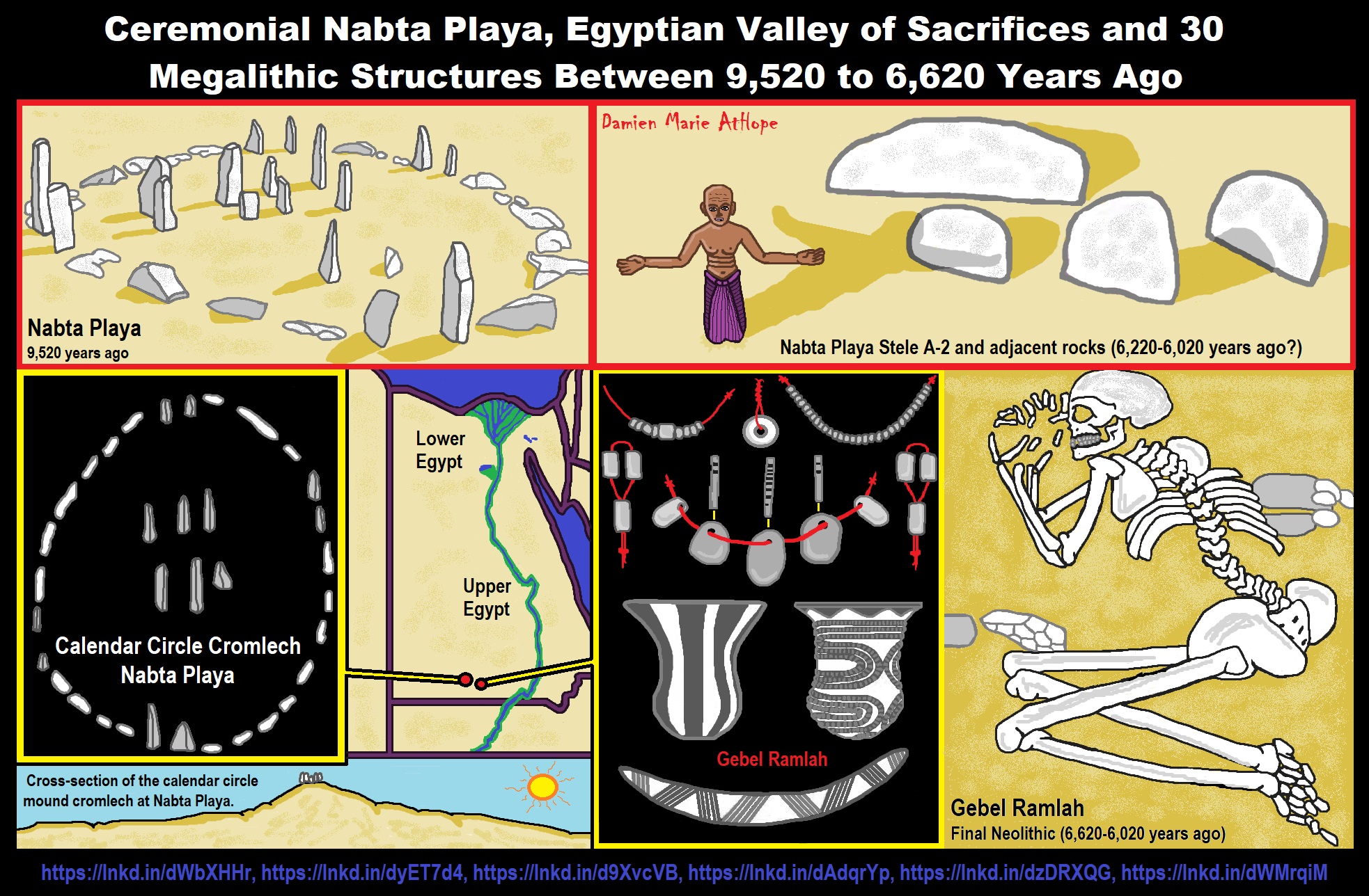

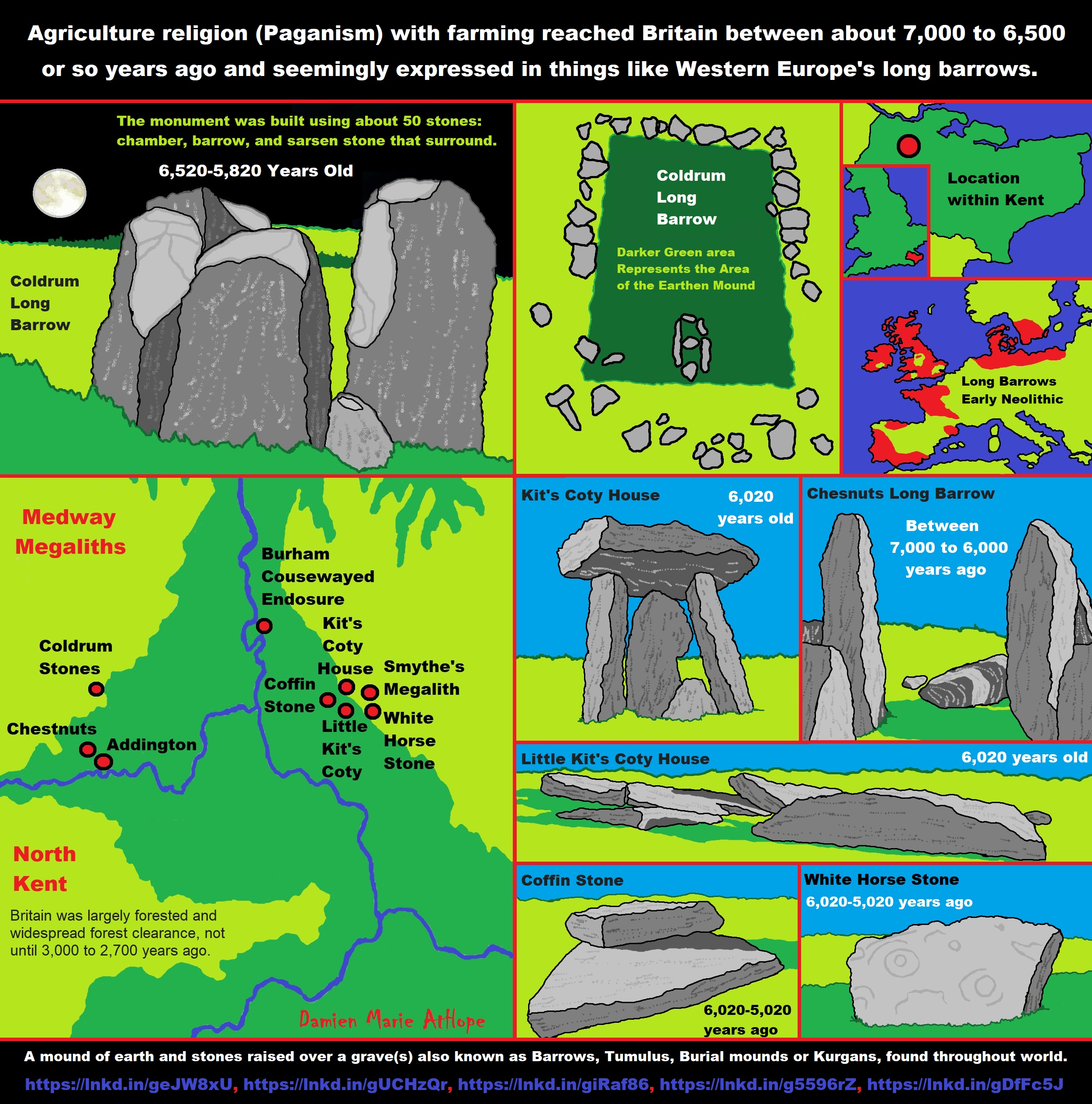
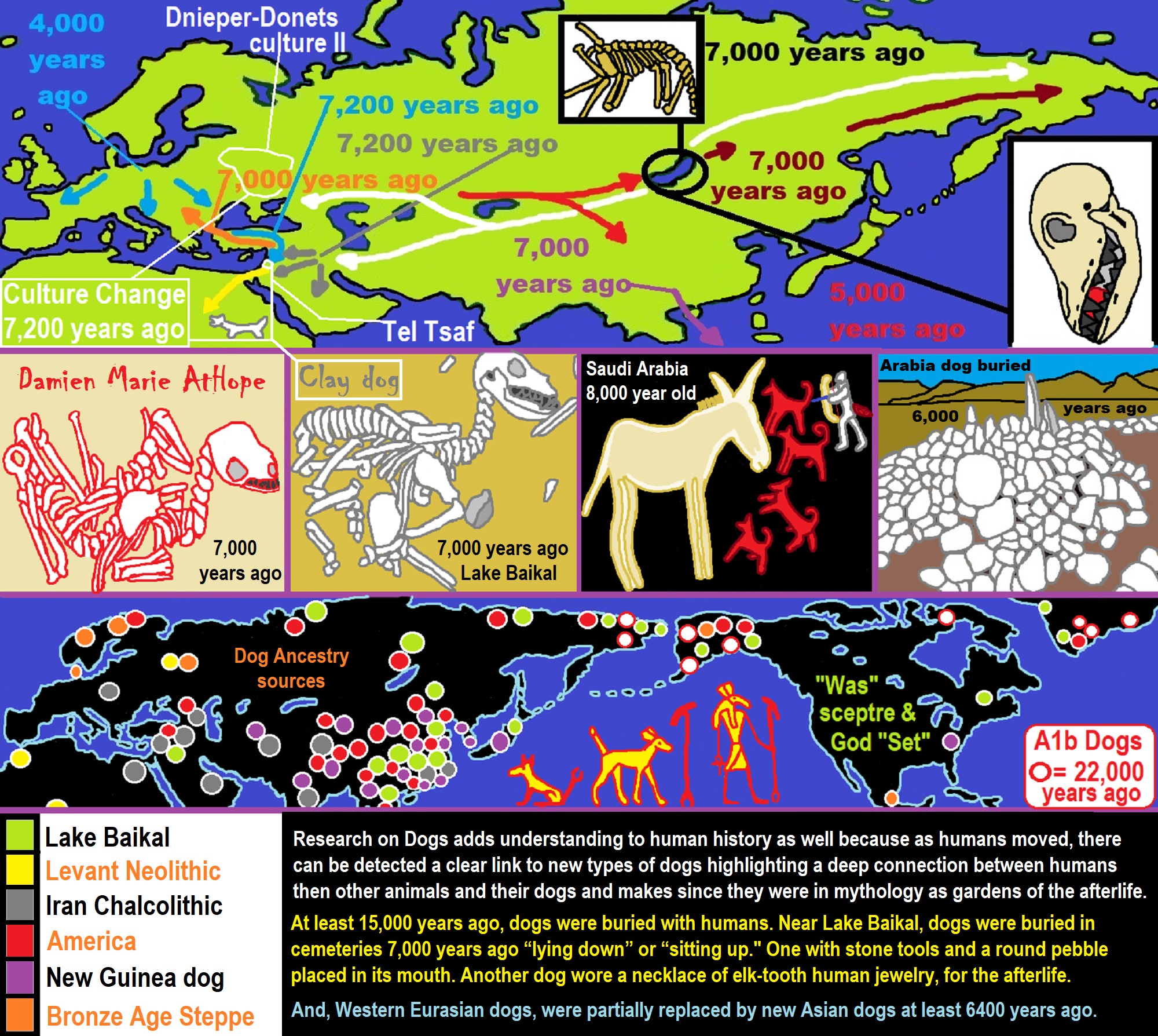
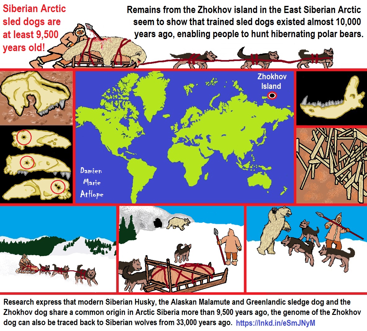
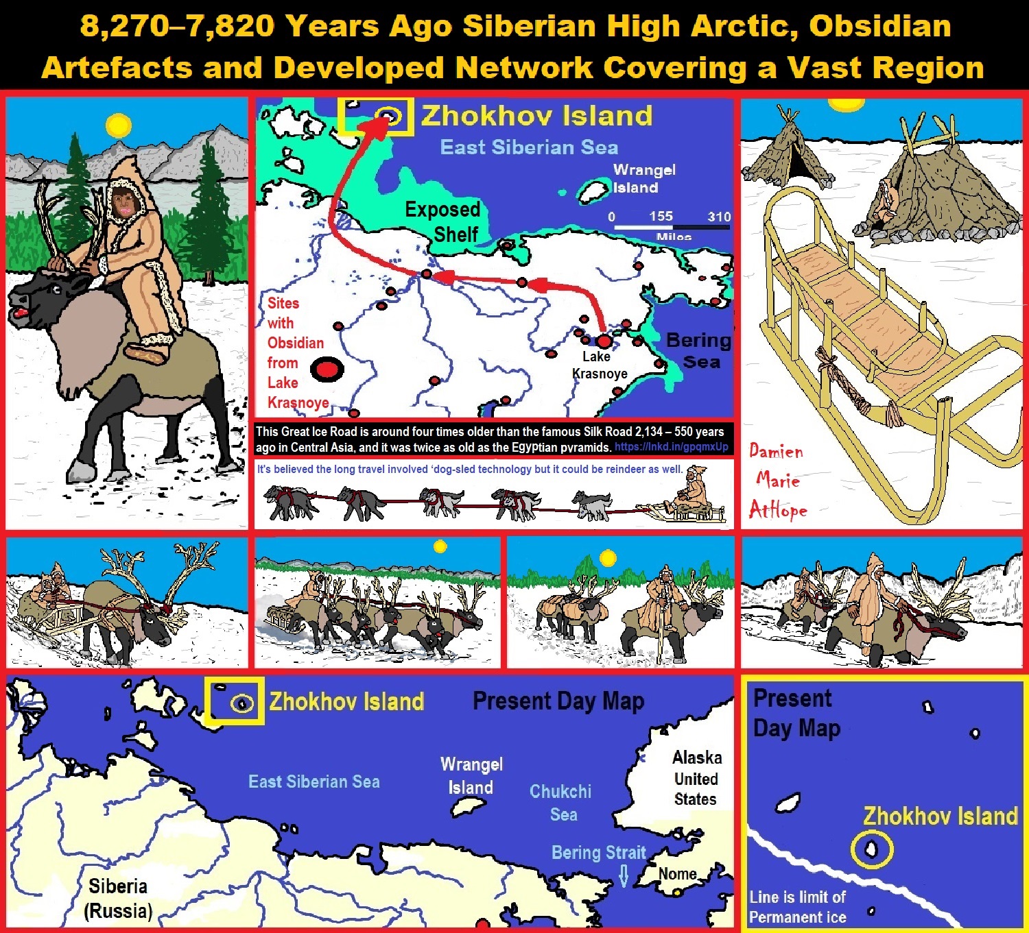
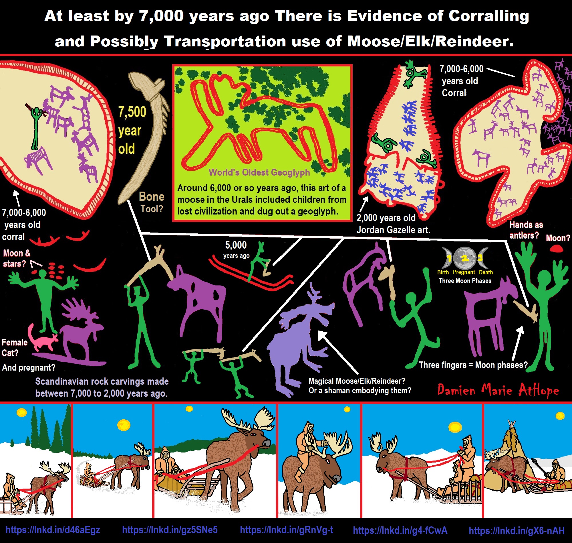
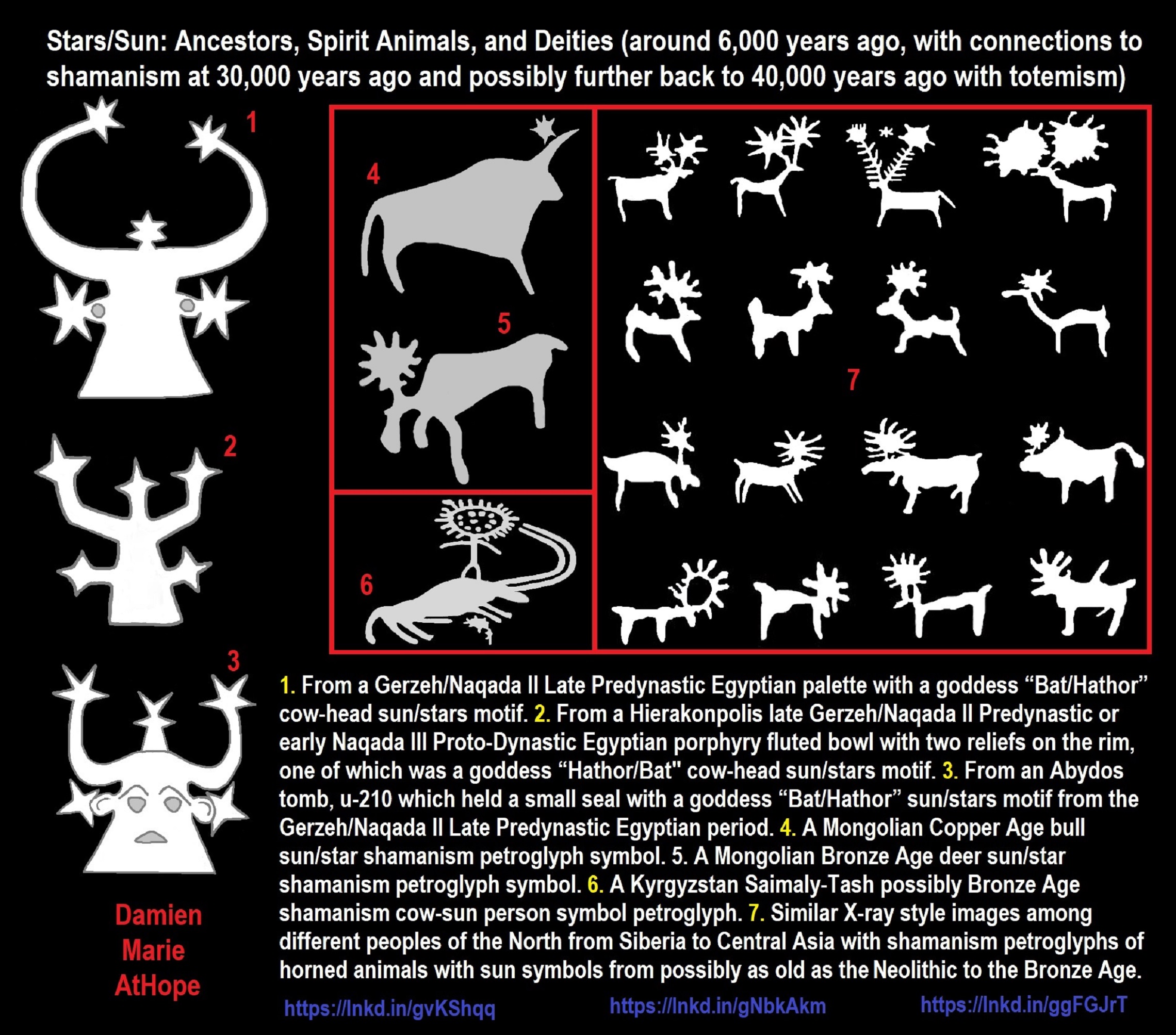
- From a Gerzeh/Naqada II Late Predynastic Egyptian palette with a goddess “Bat/Hathor” cow-head sun/stars motif.
- From a Hierakonpolis late Gerzeh/Naqada II Predynastic or early Naqada III Proto-Dynastic Egyptian porphyry fluted bowl with two reliefs on the rim, one of which was a goddess “Hathor/Bat” cow-head sun/stars motif.
- From an Abydos tomb, u-210 which held a small seal with a goddess “Bat/Hathor” sun/stars motif from the Gerzeh/Naqada II Late Predynastic Egyptian period.
- A Mongolian Copper Age bull sun/star shamanism petroglyph
- A Mongolian Bronze Age deer sun/star shamanism petroglyph symbol.
- A Kyrgyzstan Saimaly-Tash possibly Bronze Age shamanism cow-sun person symbol petroglyph.
- Similar X-ray style images among different peoples of the North from Siberia to Central Asia with shamanism petroglyphs of horned animals with sun symbols from possibly as old as the Neolithic to the Bronze Age. ref, ref, ref
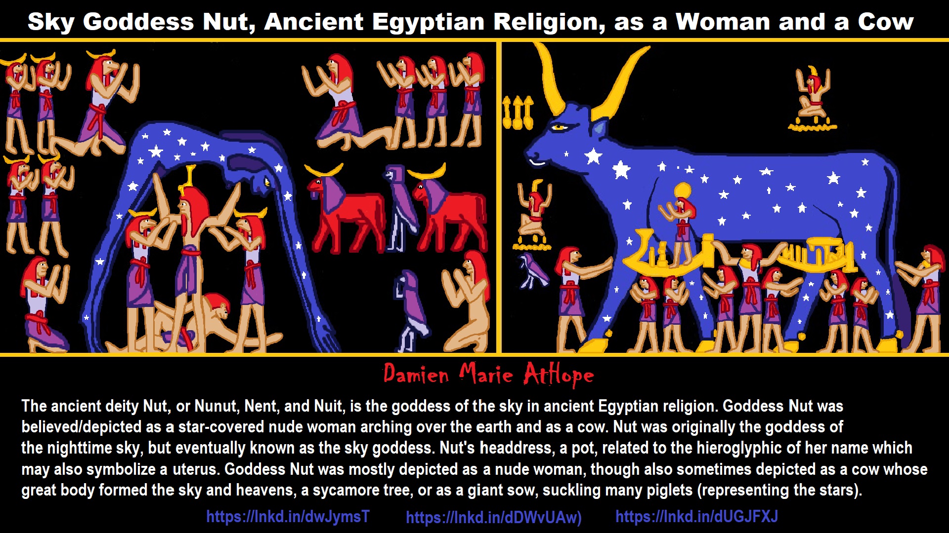


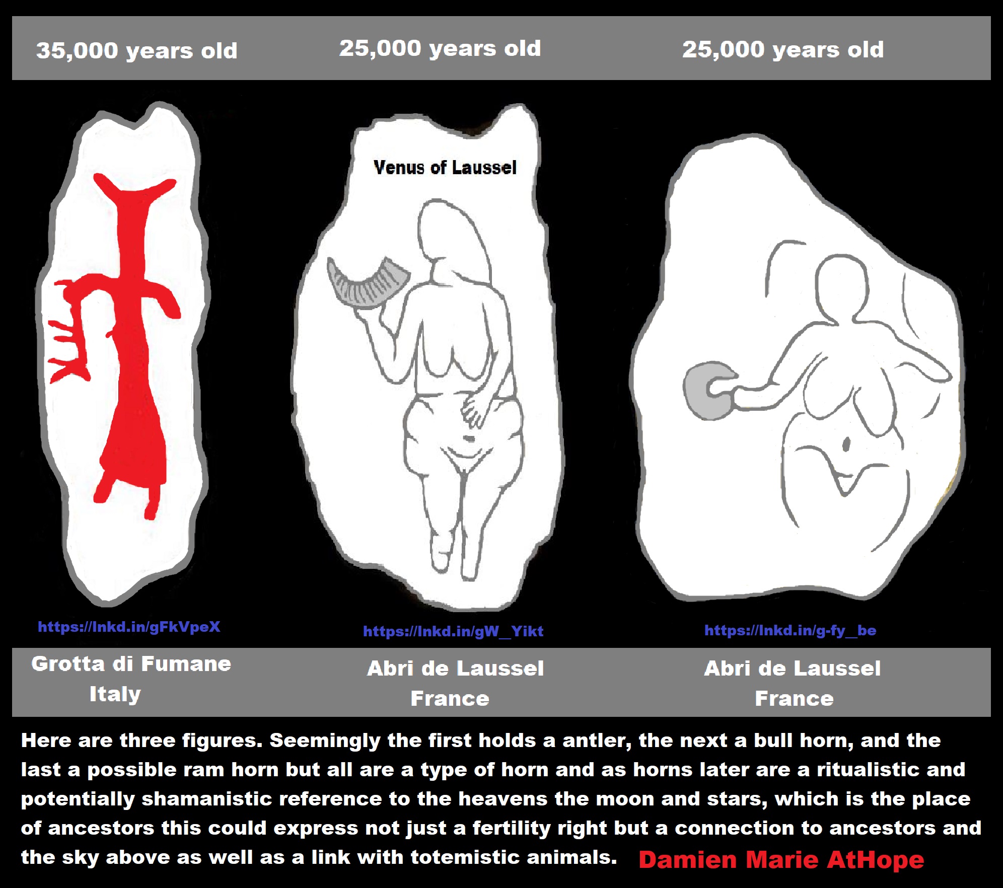
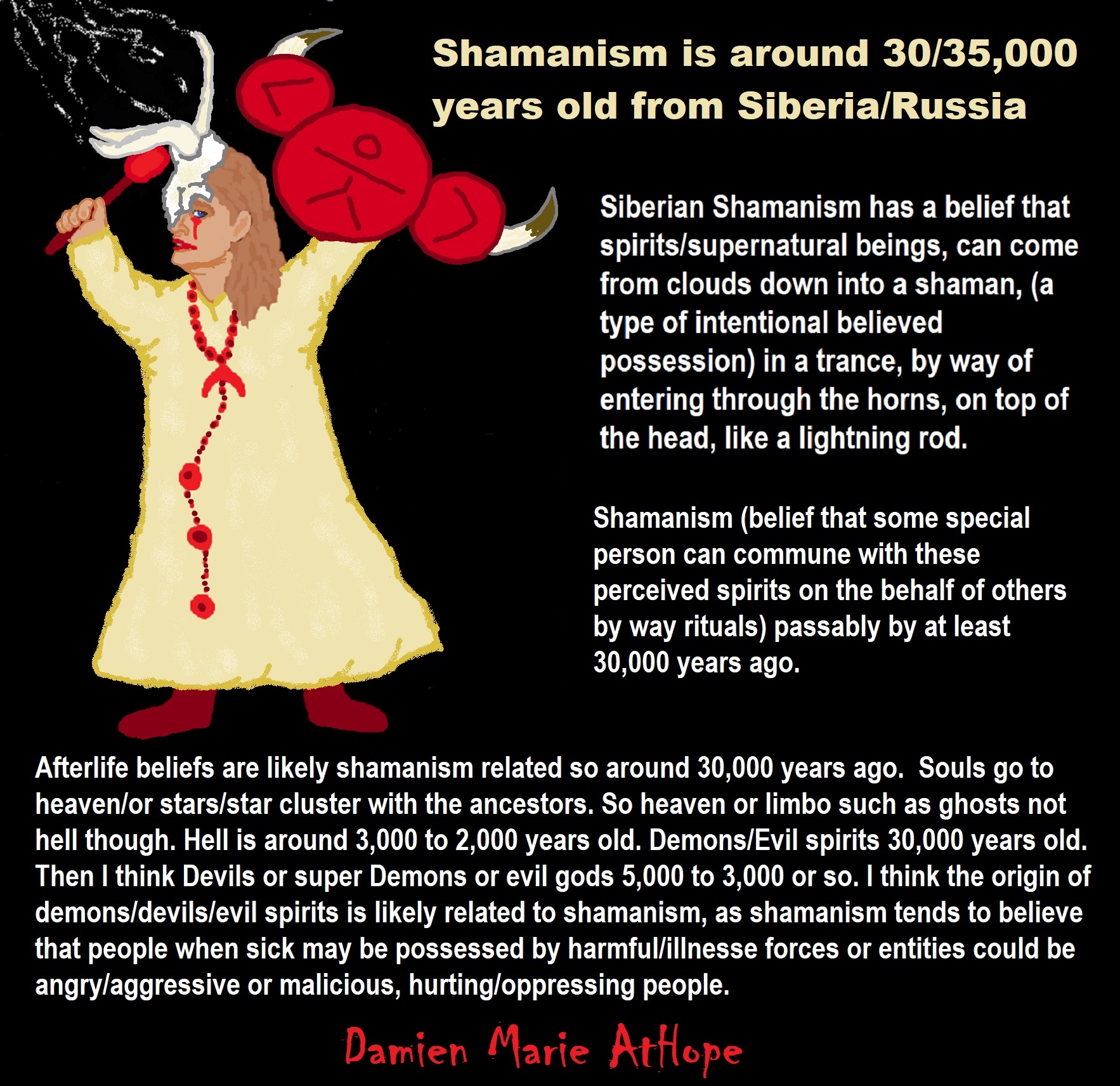
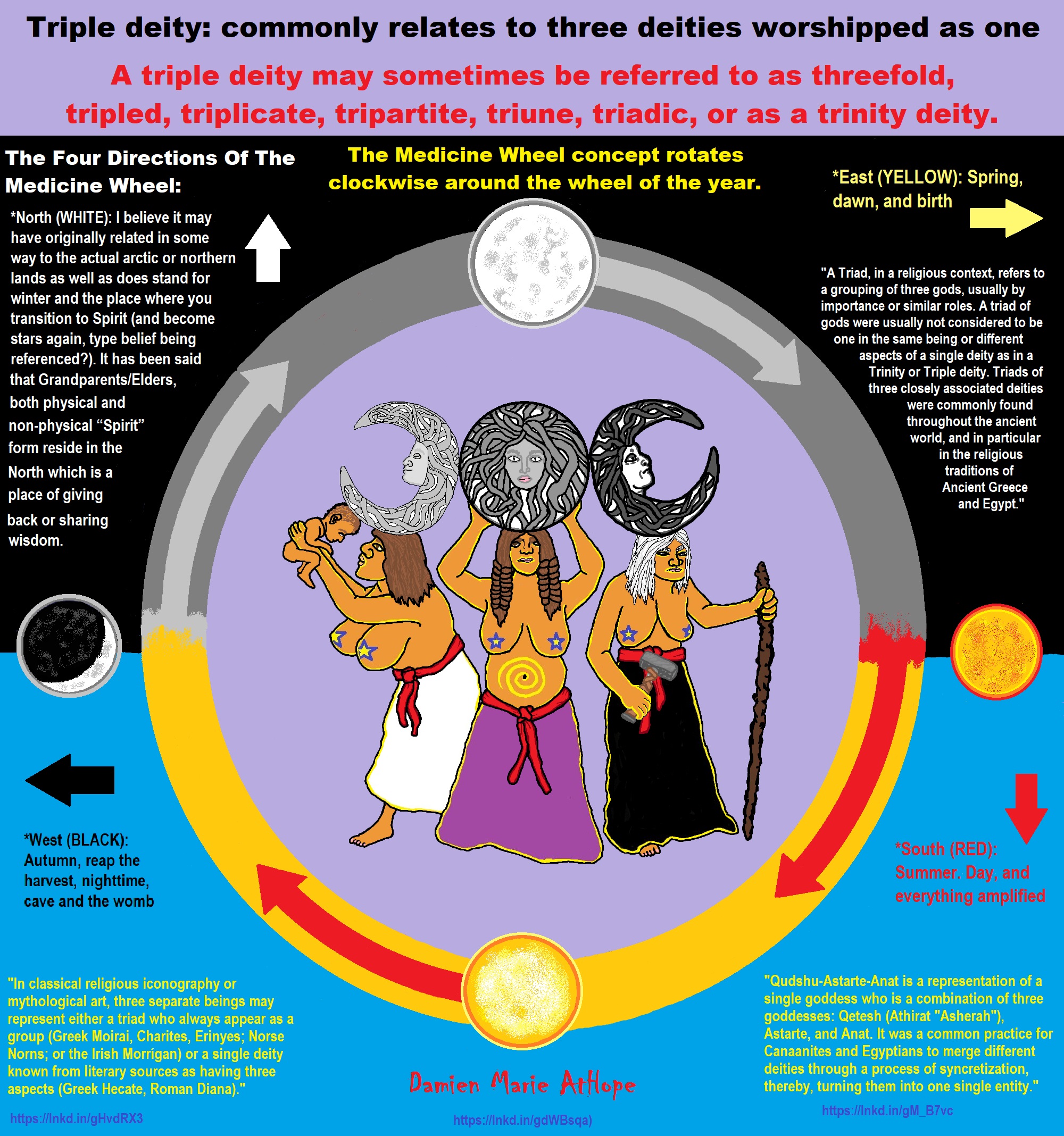
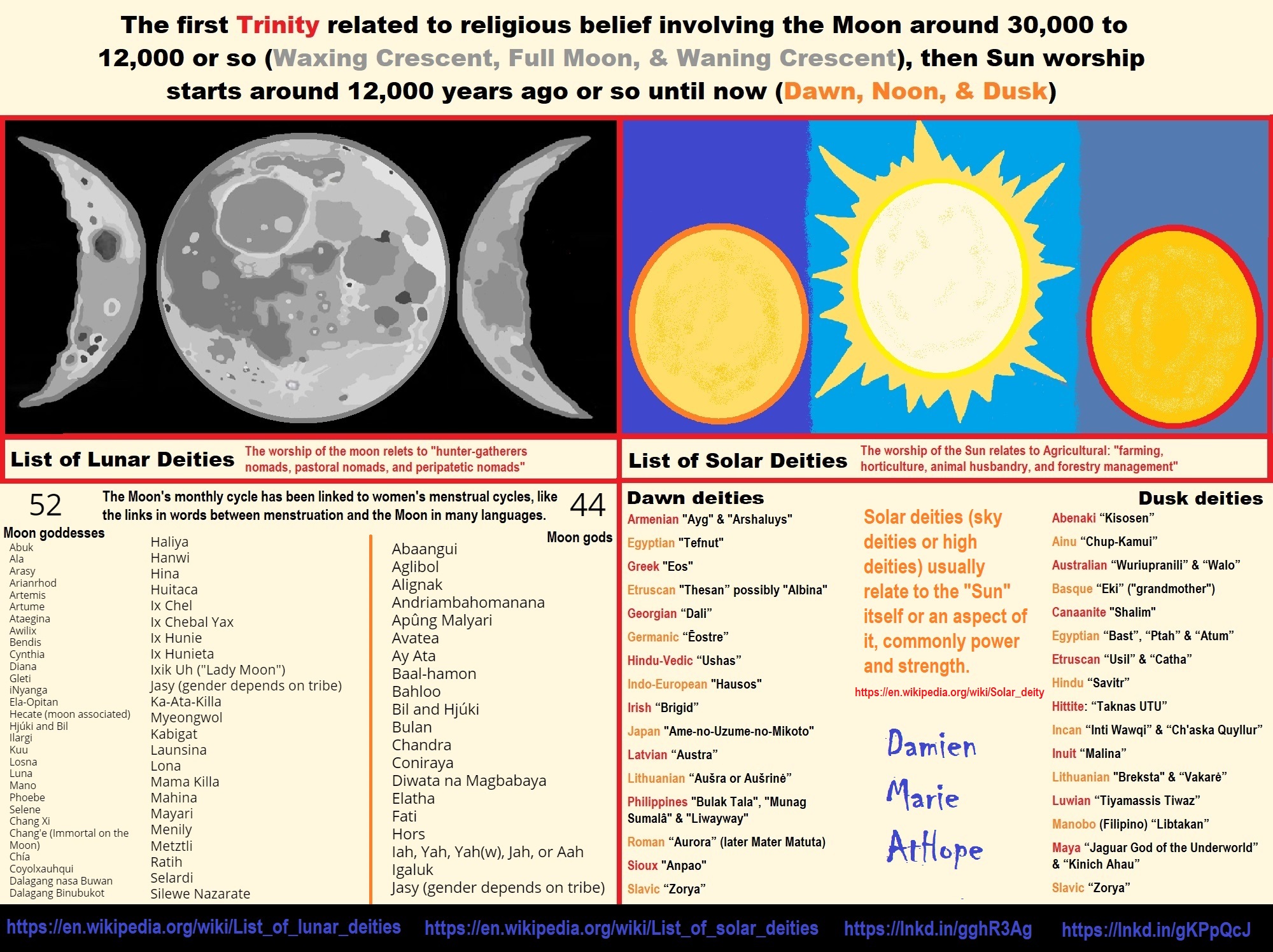
ref, ref, ref, ref, ref, ref, ref
List of Lunar Deities
“In mythology, a lunar deity is a god or goddess of the Moon, sometimes as a personification. These deities can have a variety of functions and traditions depending upon the culture, but they are often related. Some forms of moon worship can be found in most ancient religions. The Moon features prominently in art and literature, often with a purported influence in human affairs. Many cultures are oriented chronologically by the Moon, as opposed to the Sun. The Hindu calendar maintains the integrity of the lunar month and the moon god Chandra has religious significance during many Hindu festivals (e.g. Karwa Chauth, Sankashti Chaturthi, and during eclipses). The ancient Germanic tribes were also known to have a lunar calendar.” ref
“Many cultures have implicitly linked the 29.5-day lunar cycle to women’s menstrual cycles, as evident in the shared linguistic roots of “menstruation” and “moon” words in multiple language families. This identification was not universal, as demonstrated by the fact that not all moon deities are female. Still, many well-known mythologies feature moon goddesses, including the Greek goddess Selene, the Roman goddess Luna, and the Chinese goddess Chang’e. Several goddesses including Artemis, Hecate, and Isis did not originally have lunar aspects, and only acquired them late in antiquity due to syncretism with the de facto Greco-Roman lunar deity Selene/Luna. In traditions with male gods, there is little evidence of such syncretism, though the Greek Hermes has been equated with the male Egyptian lunar god Thoth.” ref
“Male lunar gods are also common, such as Sin of the Mesopotamians, Mani of the Germanic tribes, Tsukuyomi of the Japanese, Igaluk/Alignak of the Inuit, and the Hindu god Chandra. The original Proto-Indo-European lunar deity appears to have been male, with many possible derivatives including the Homeric figure of Menelaus. Cultures with male moon gods often feature sun goddesses. An exception is Hinduism, featuring both male and female aspects of the solar divine. The ancient Egyptians had several moon gods including Khonsu and Thoth, although Thoth is a considerably more complex deity. Set represented the moon in the Egyptian Calendar of Lucky and Unlucky Days.” ref
List of Solar Deities
“A solar deity is a god or goddess who represents the Sun, or an aspect of it, usually by its perceived power and strength. Solar deities and Sun worship can be found throughout most of recorded history in various forms. The following is a list of solar deities. A dawn god or goddess is a deity in a polytheistic religious tradition who is in some sense associated with the dawn. These deities show some relation with the morning, the beginning of the day, and, in some cases, become syncretized with similar solar deities.” ref, ref
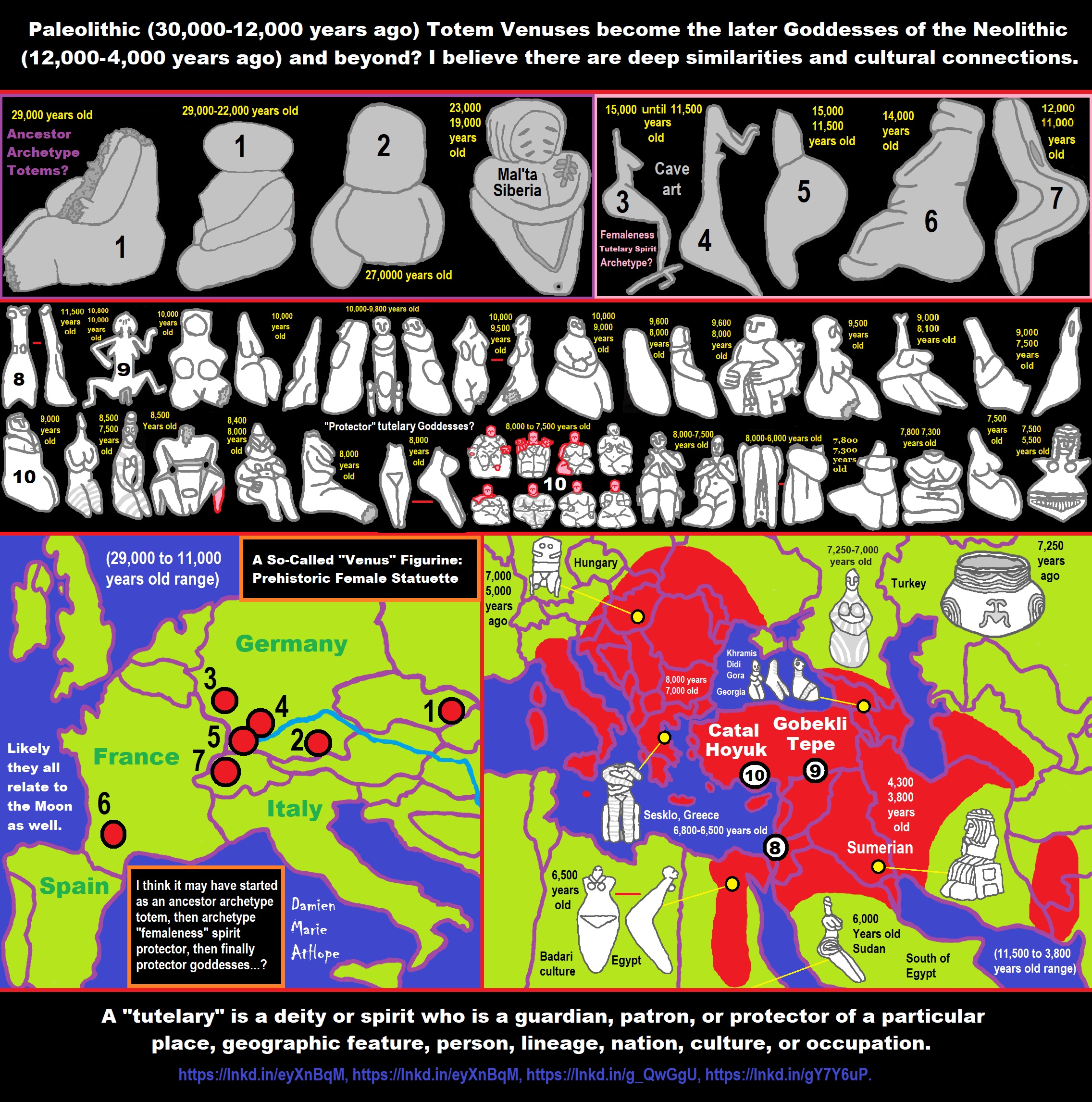
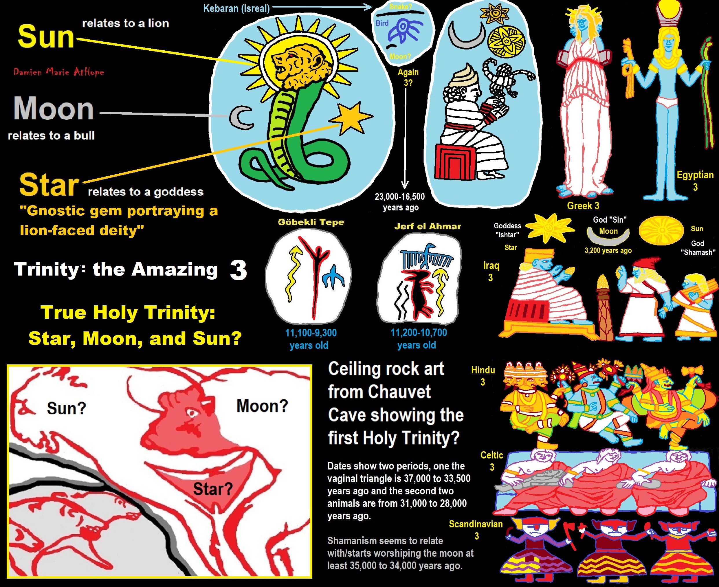
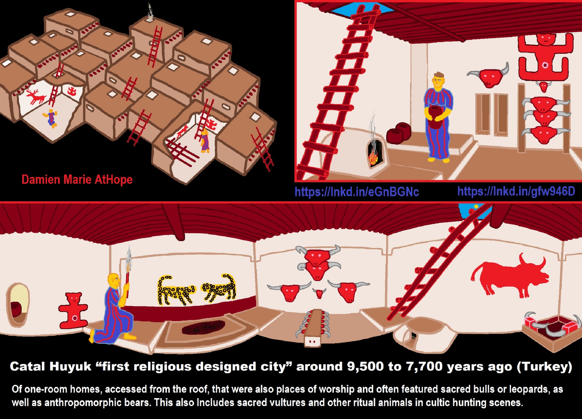
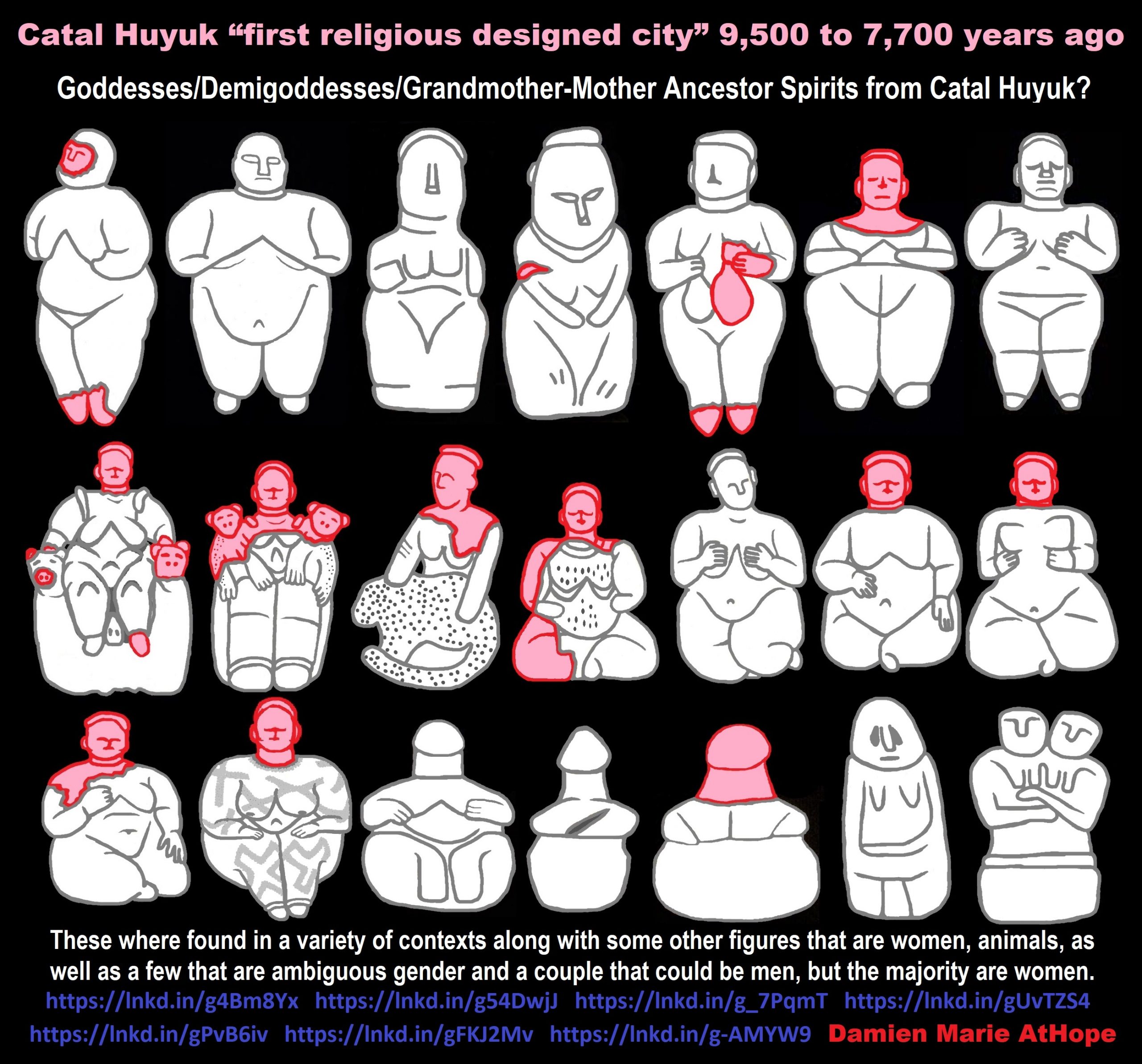
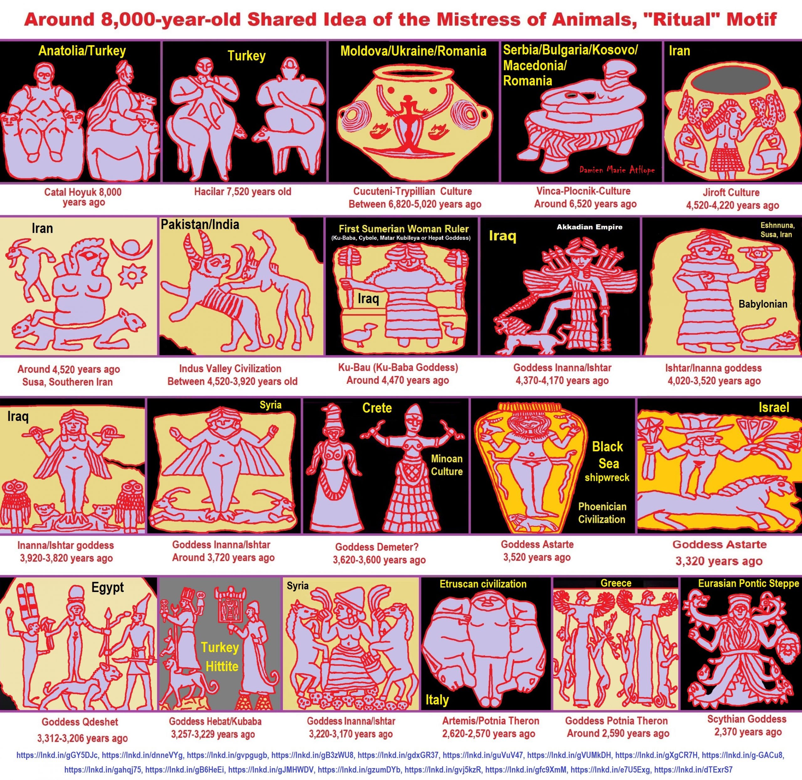
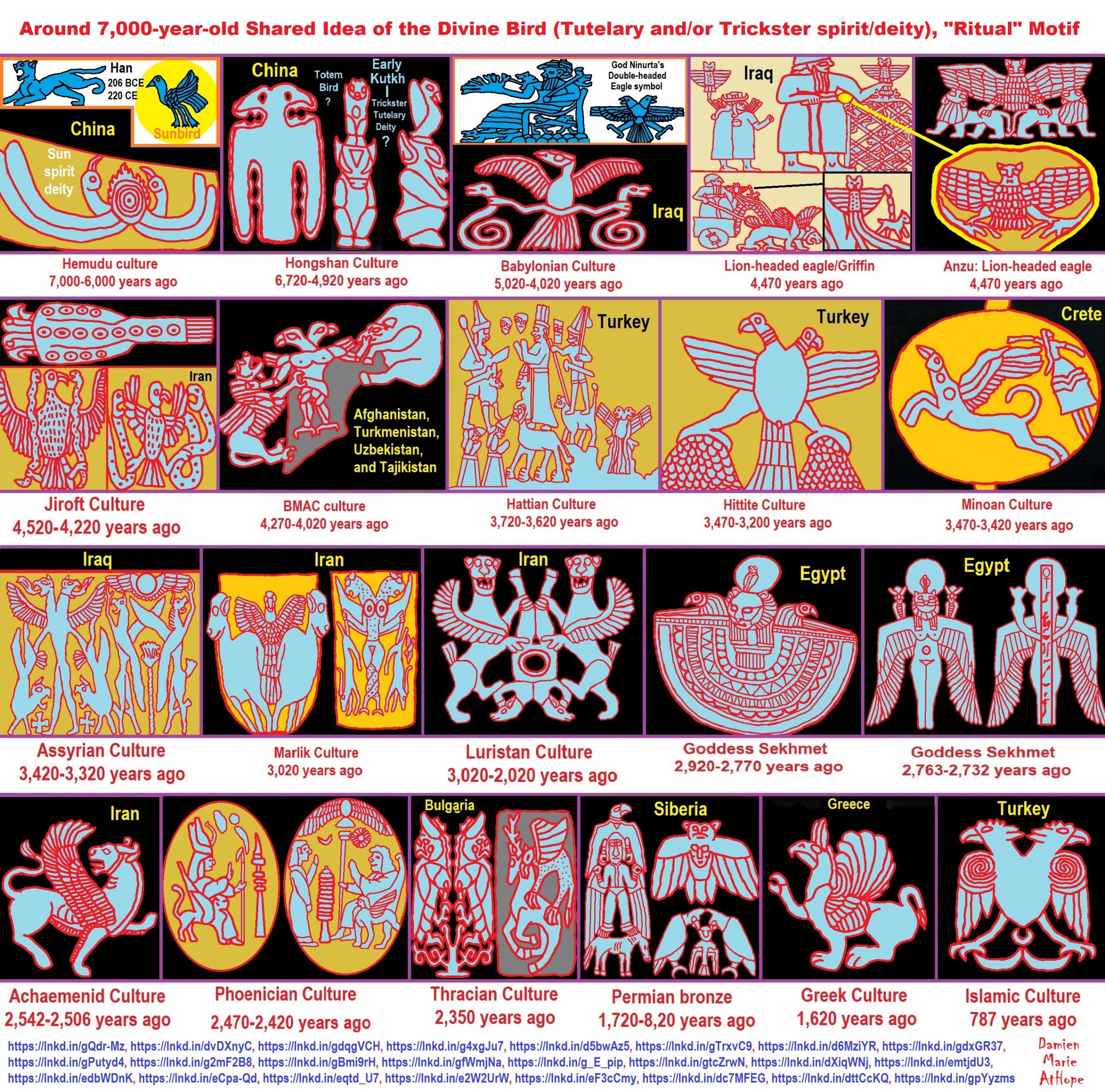
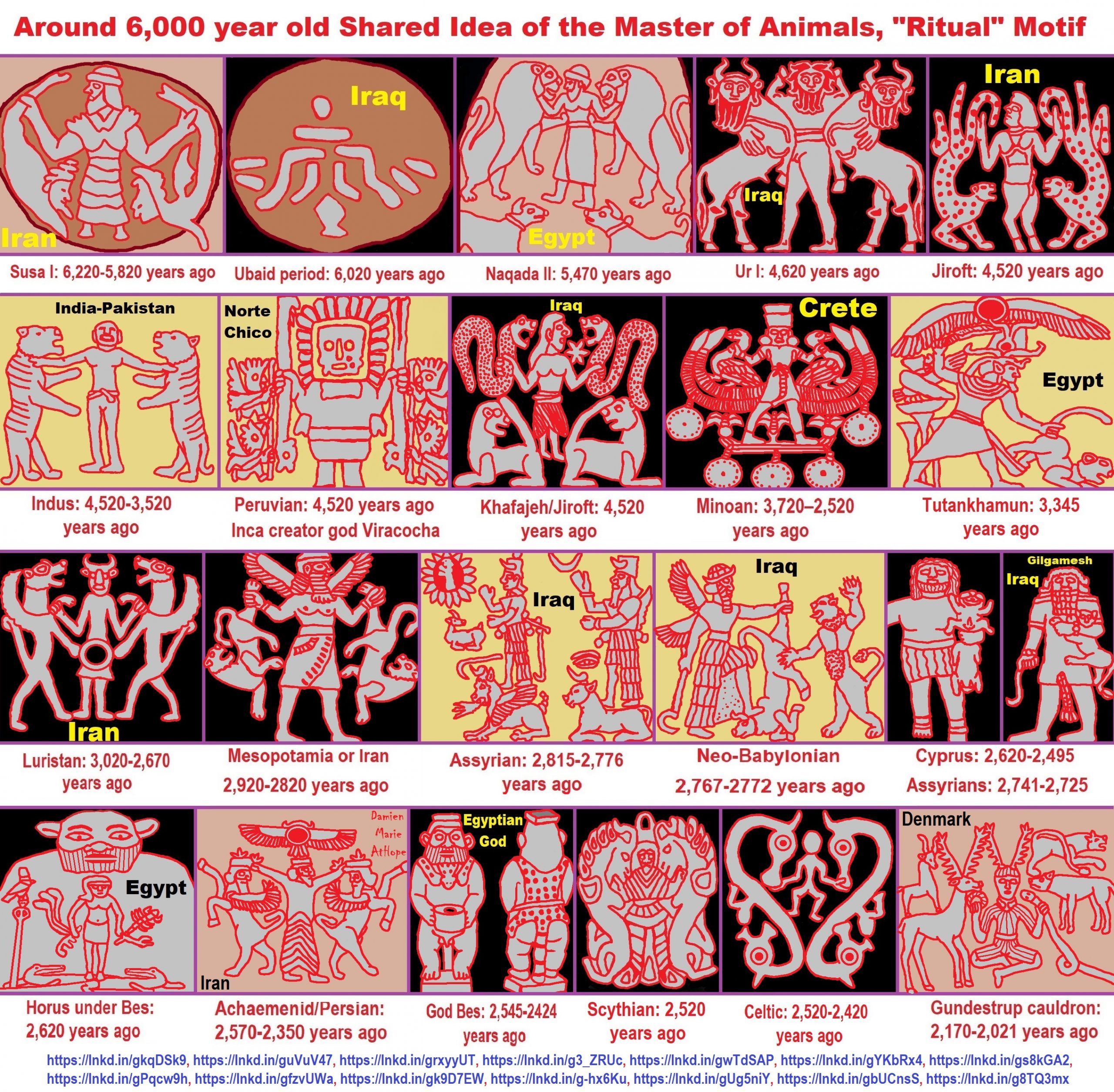
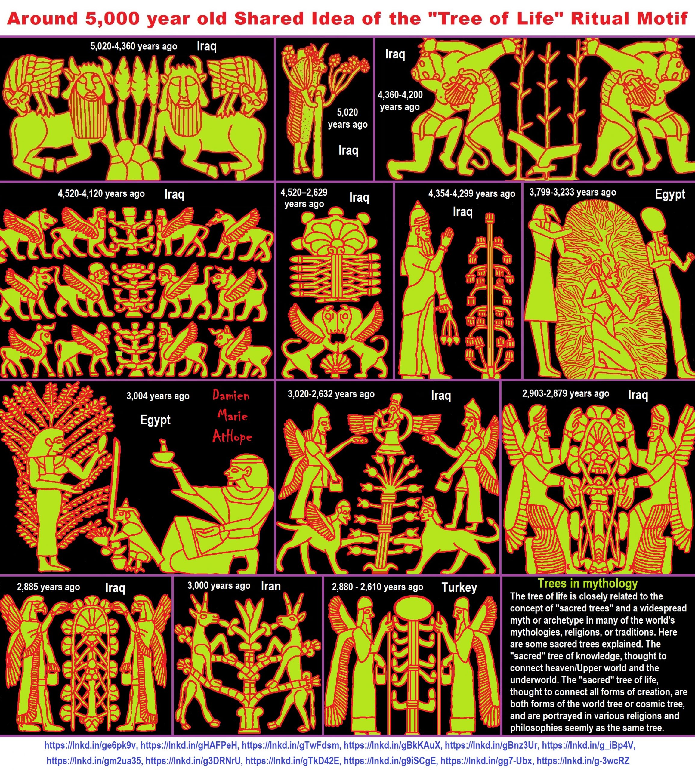
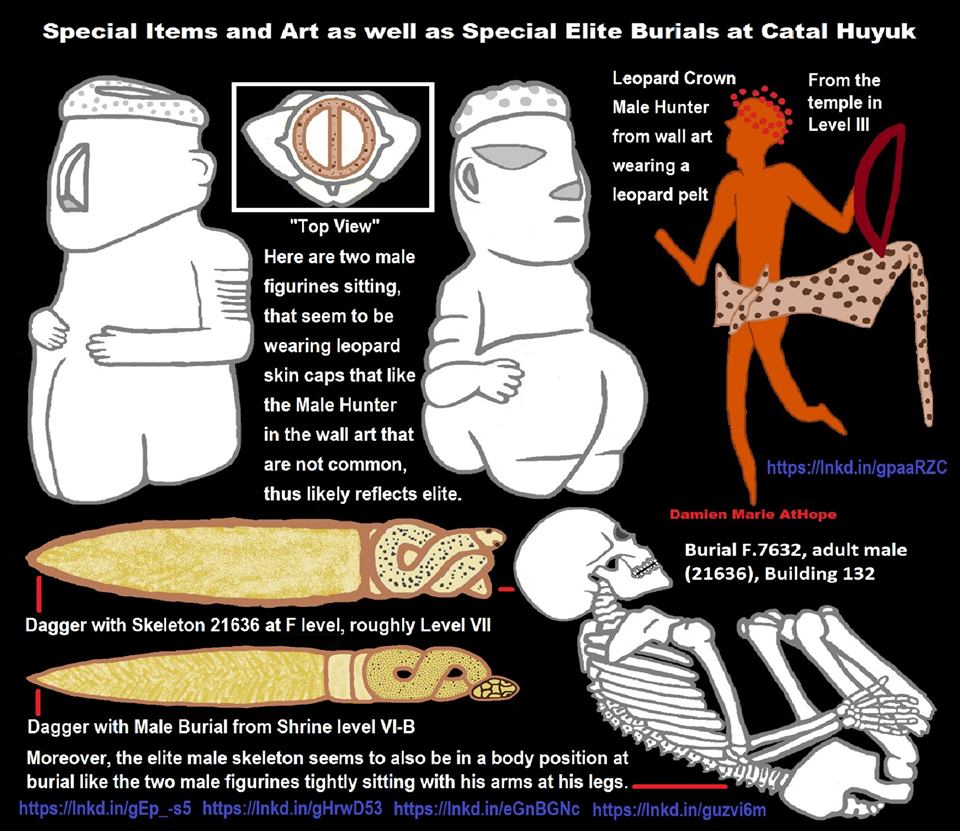
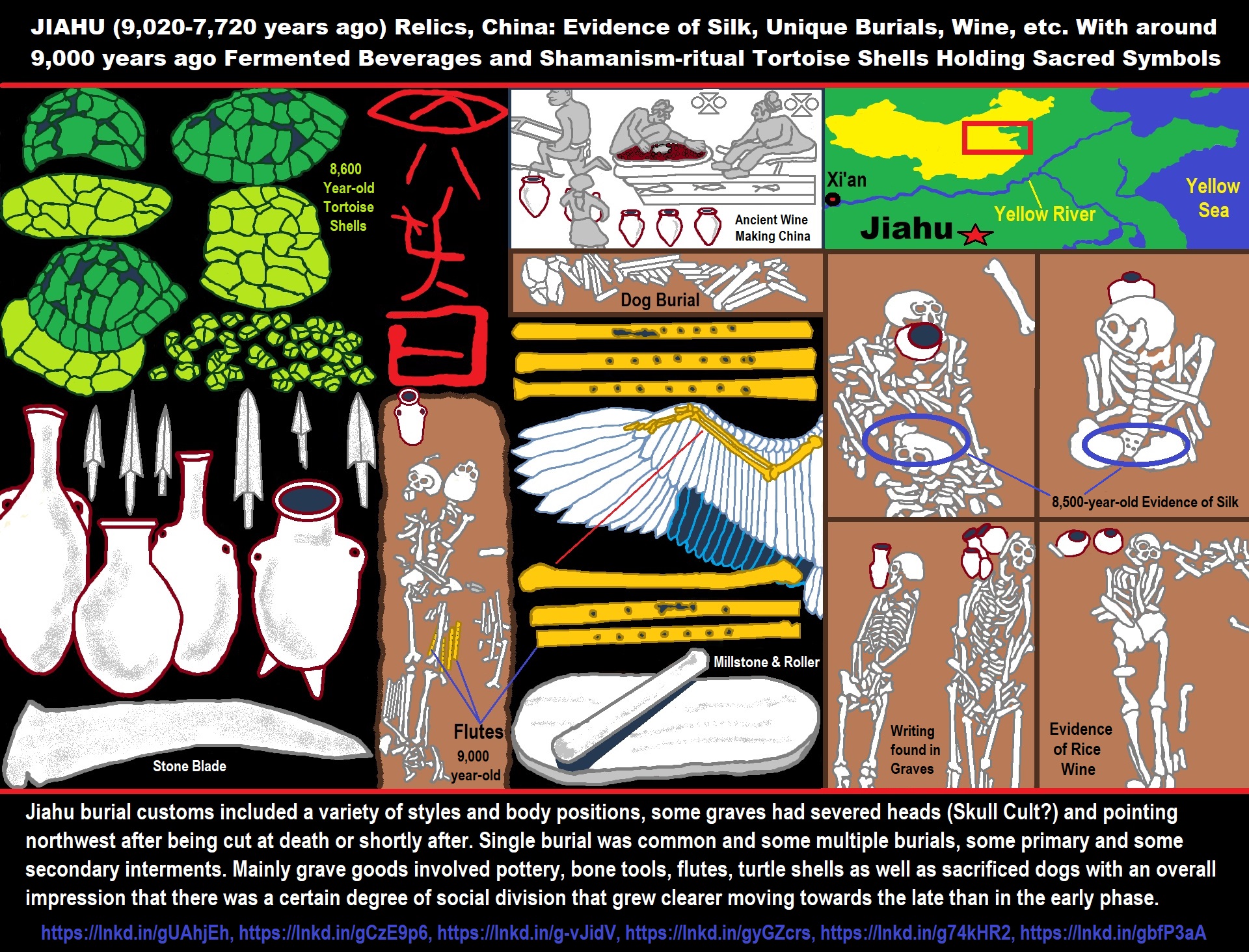
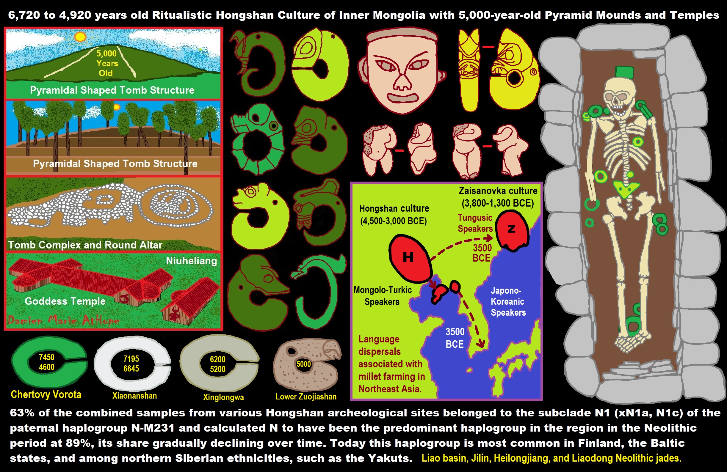
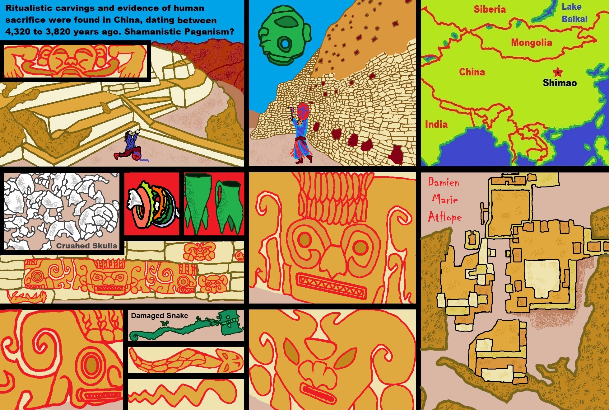
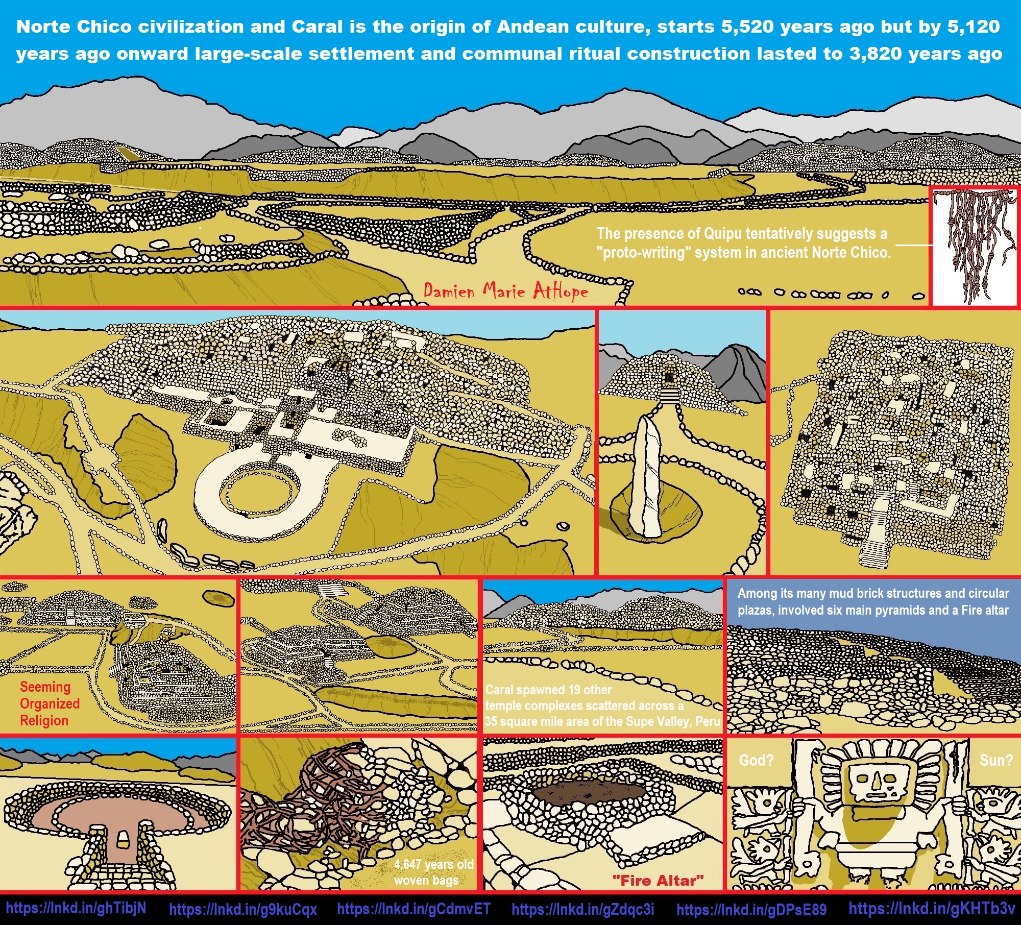
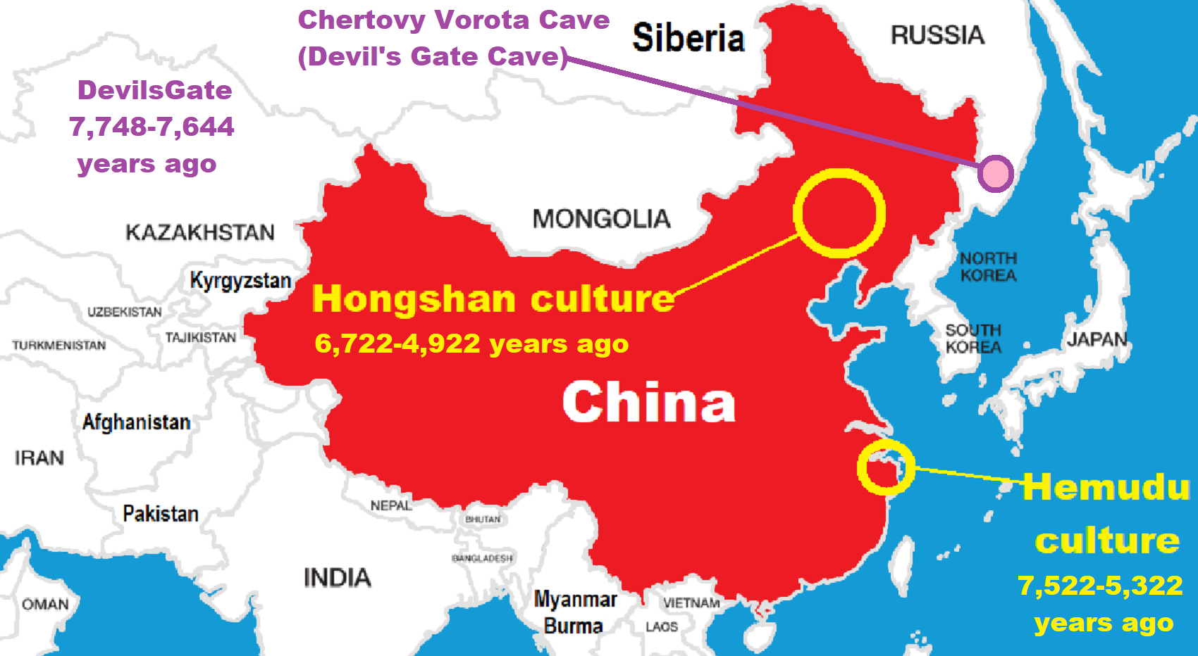
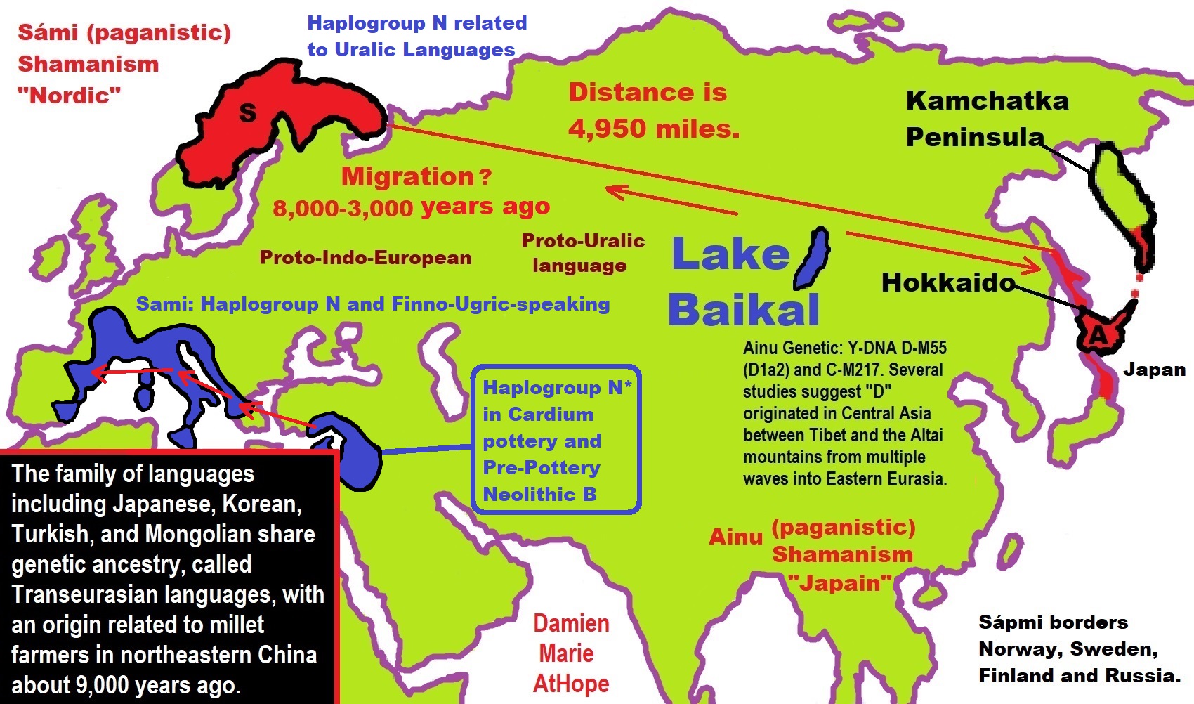
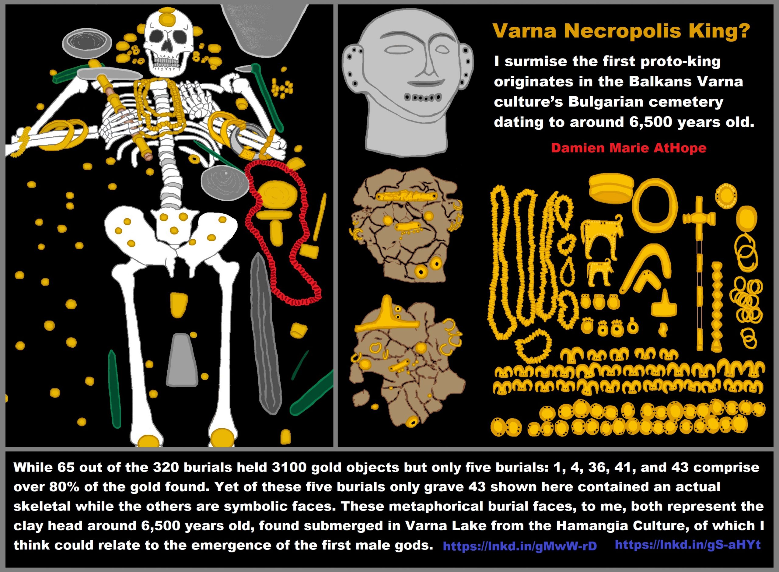
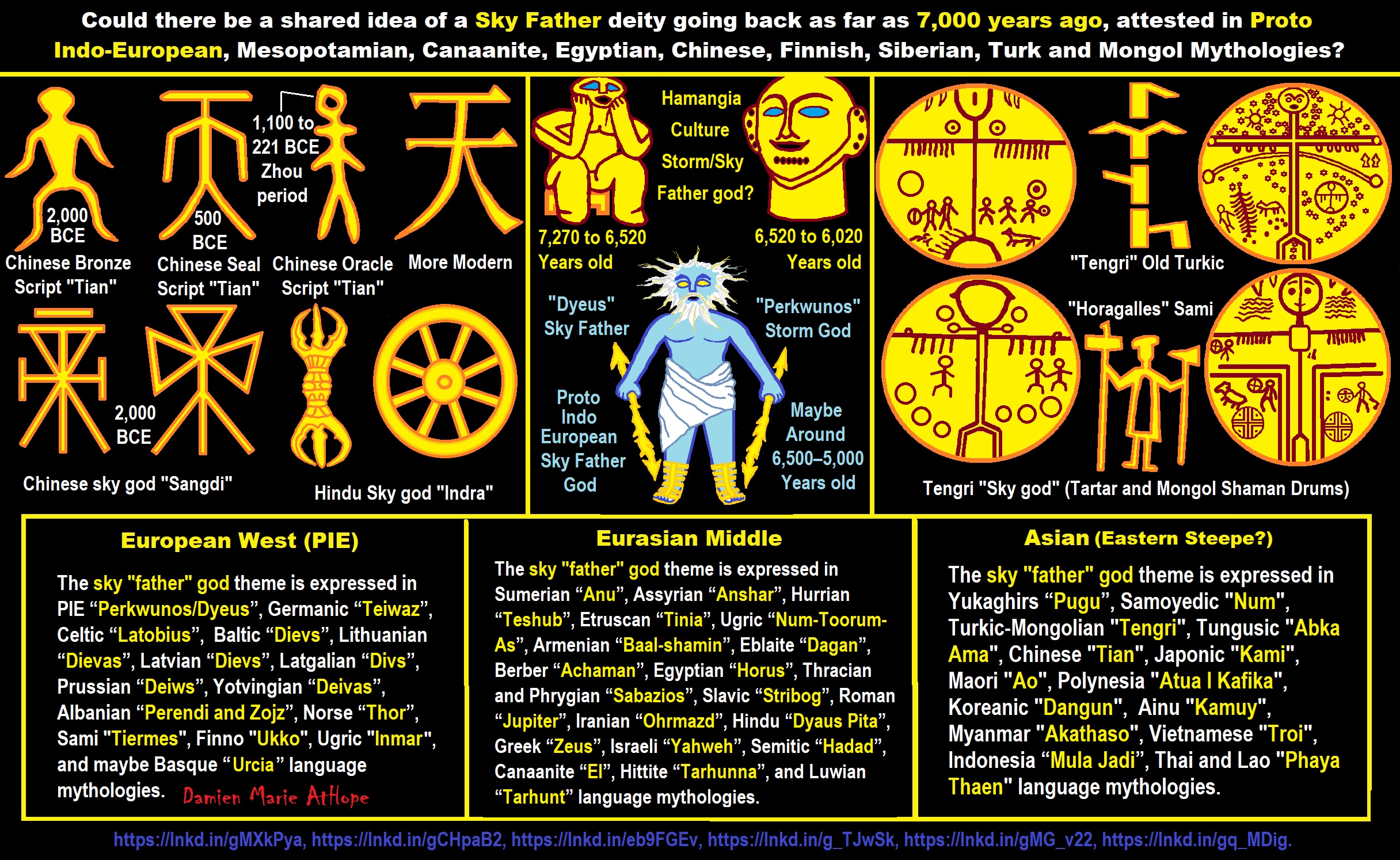
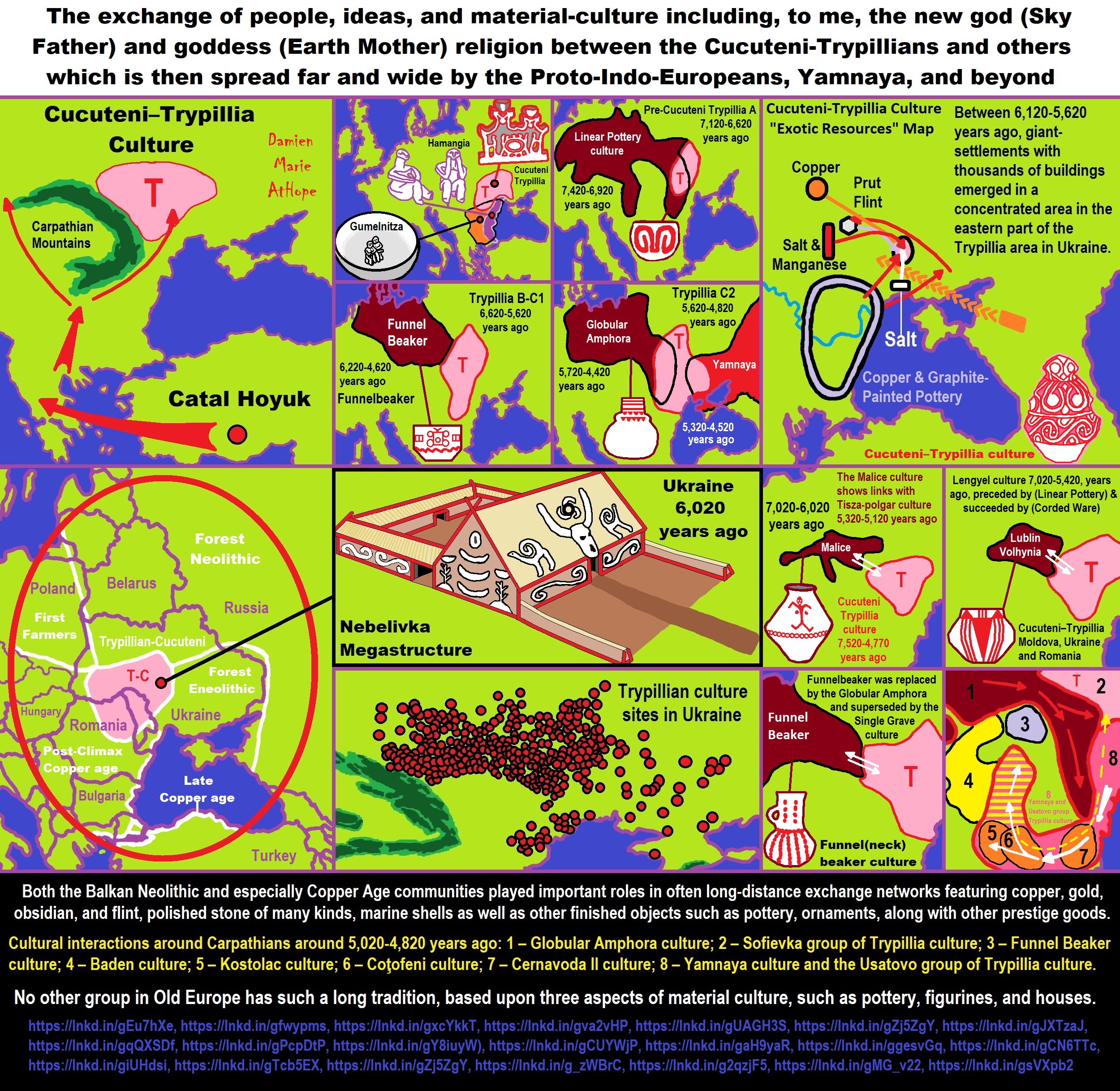
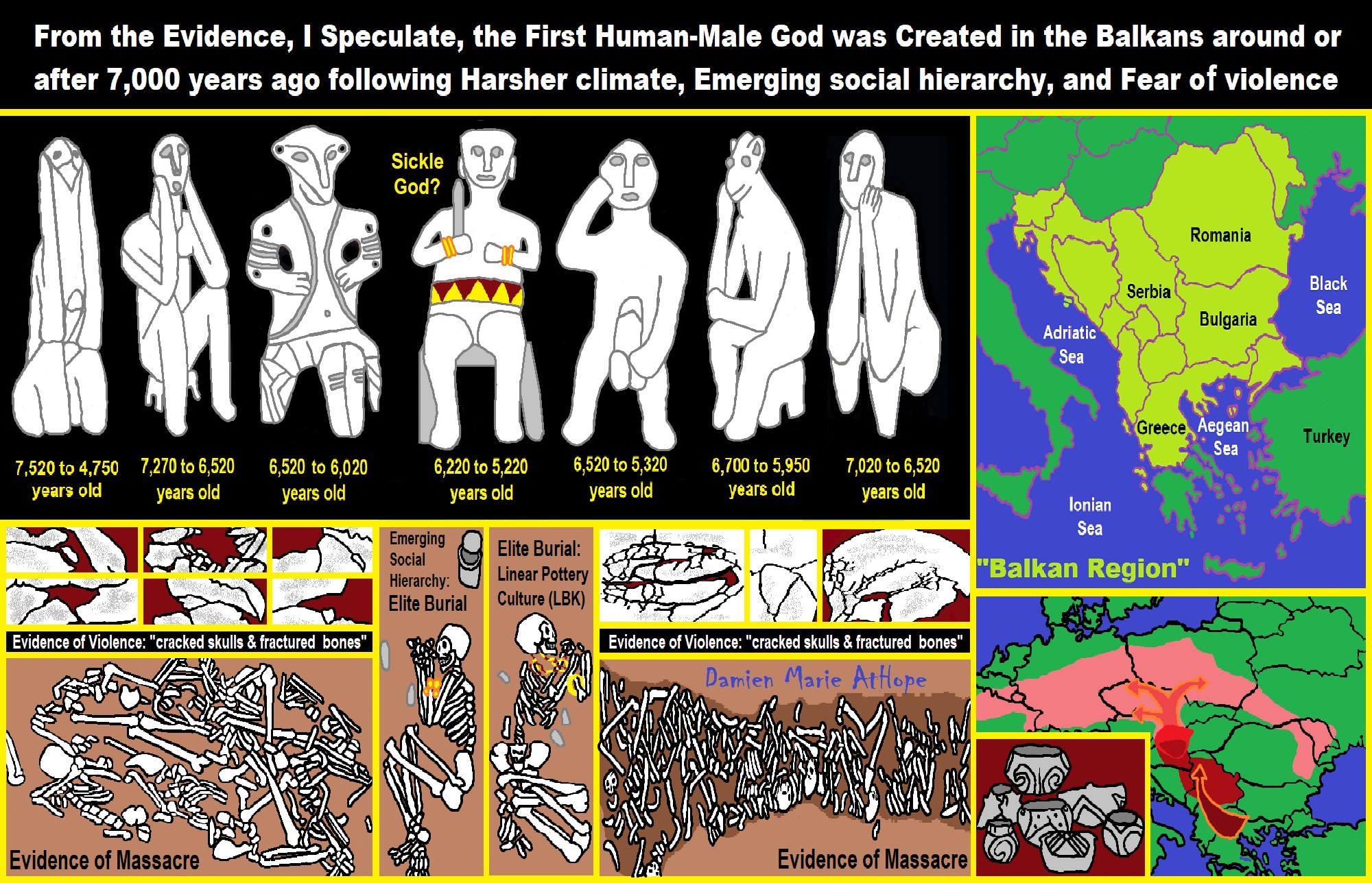
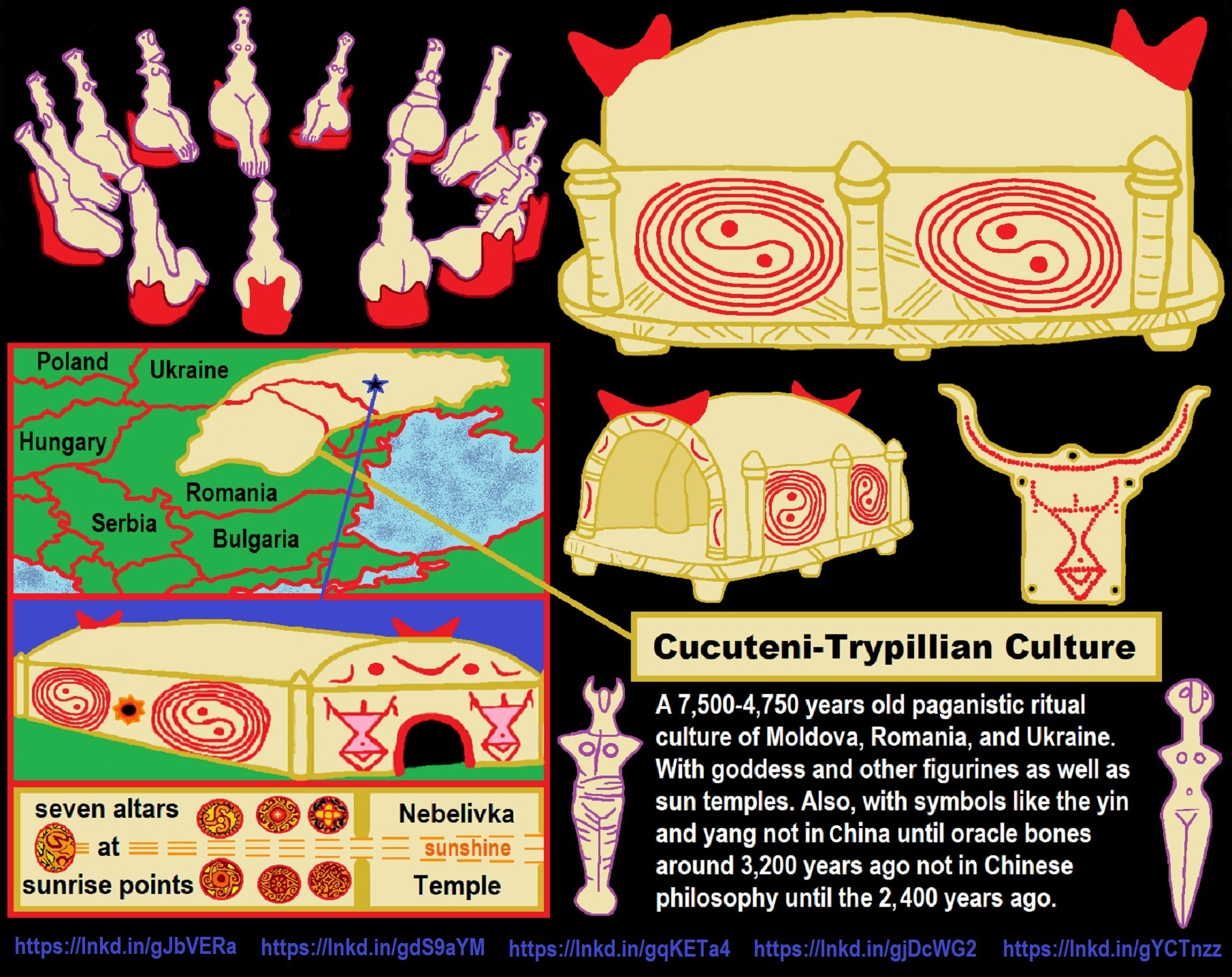
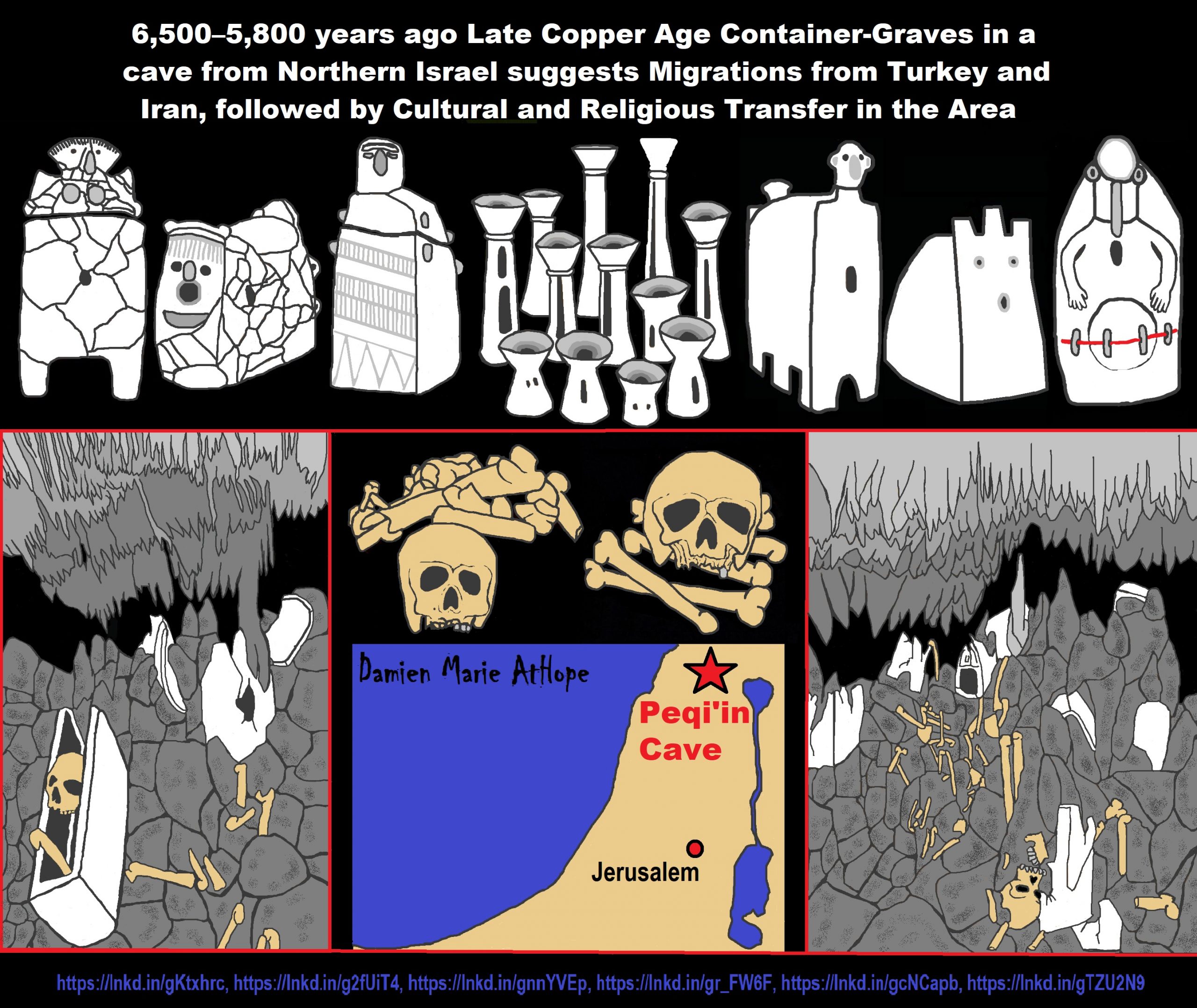
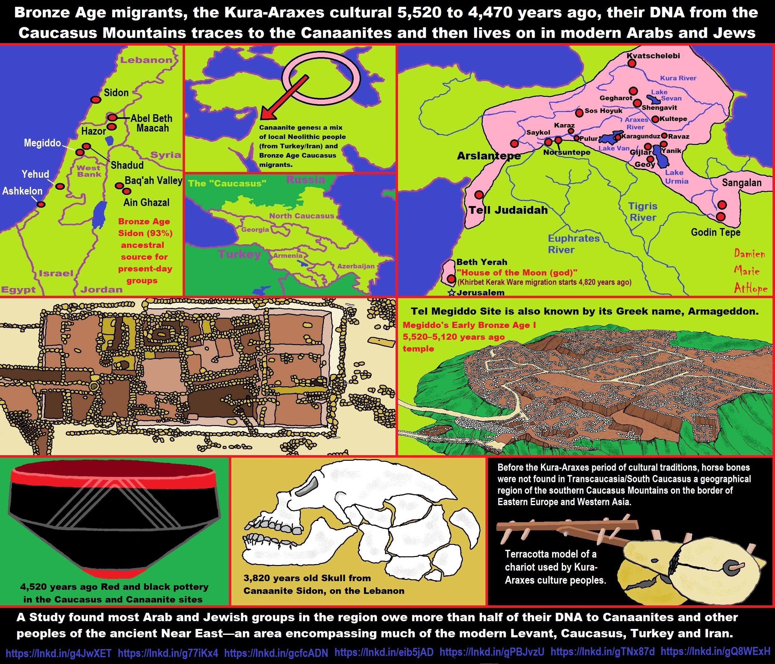
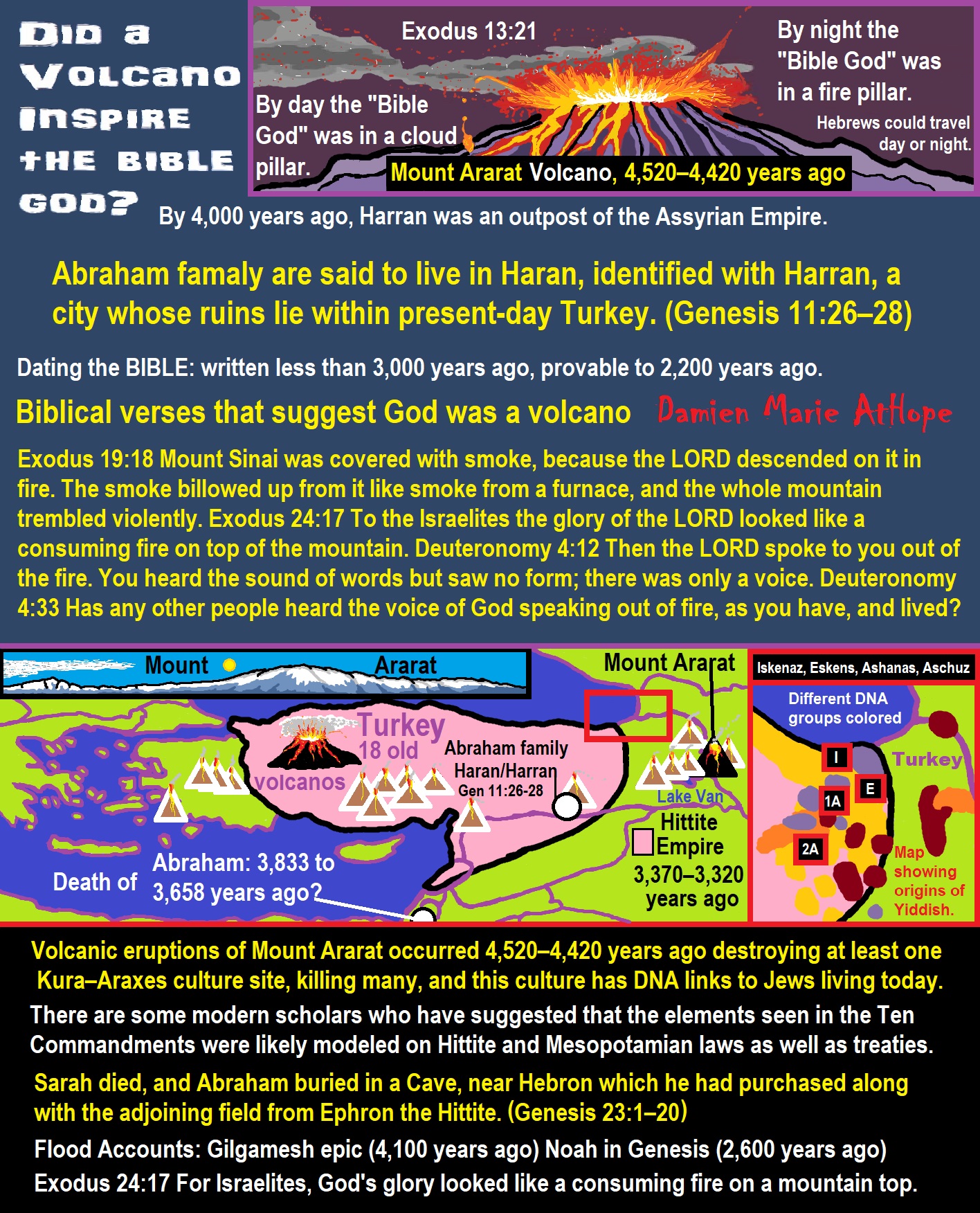
ref, ref, ref, ref, ref, ref, ref, ref, ref, ref, ref, ref, ref
By day the LORD went ahead of them in a pillar of cloud to guide them on their way and by night in a pillar of fire to give them light, so that they could travel by day or night.
- By day the “Bible God” was in a cloud pillar.
- By night the “Bible God” was in a fire pillar.
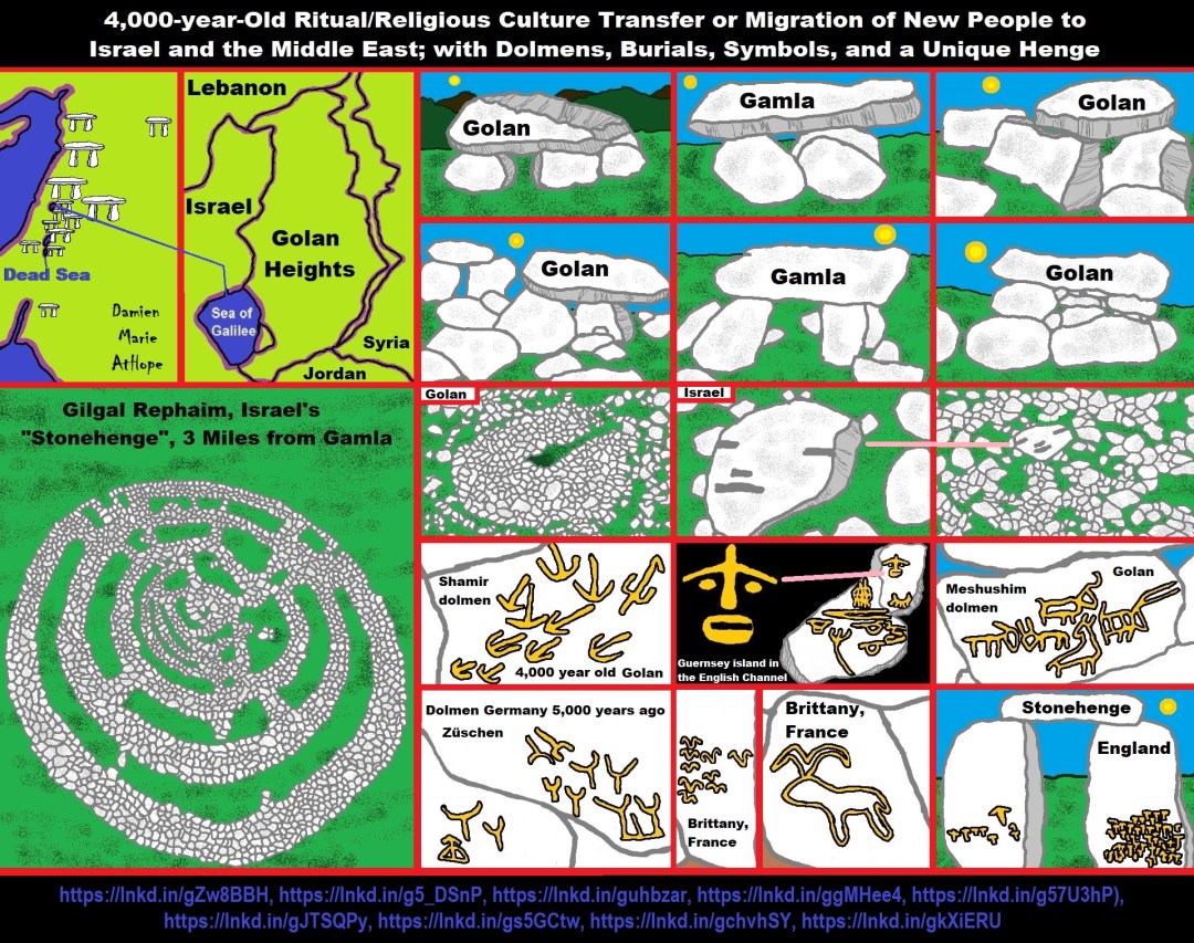

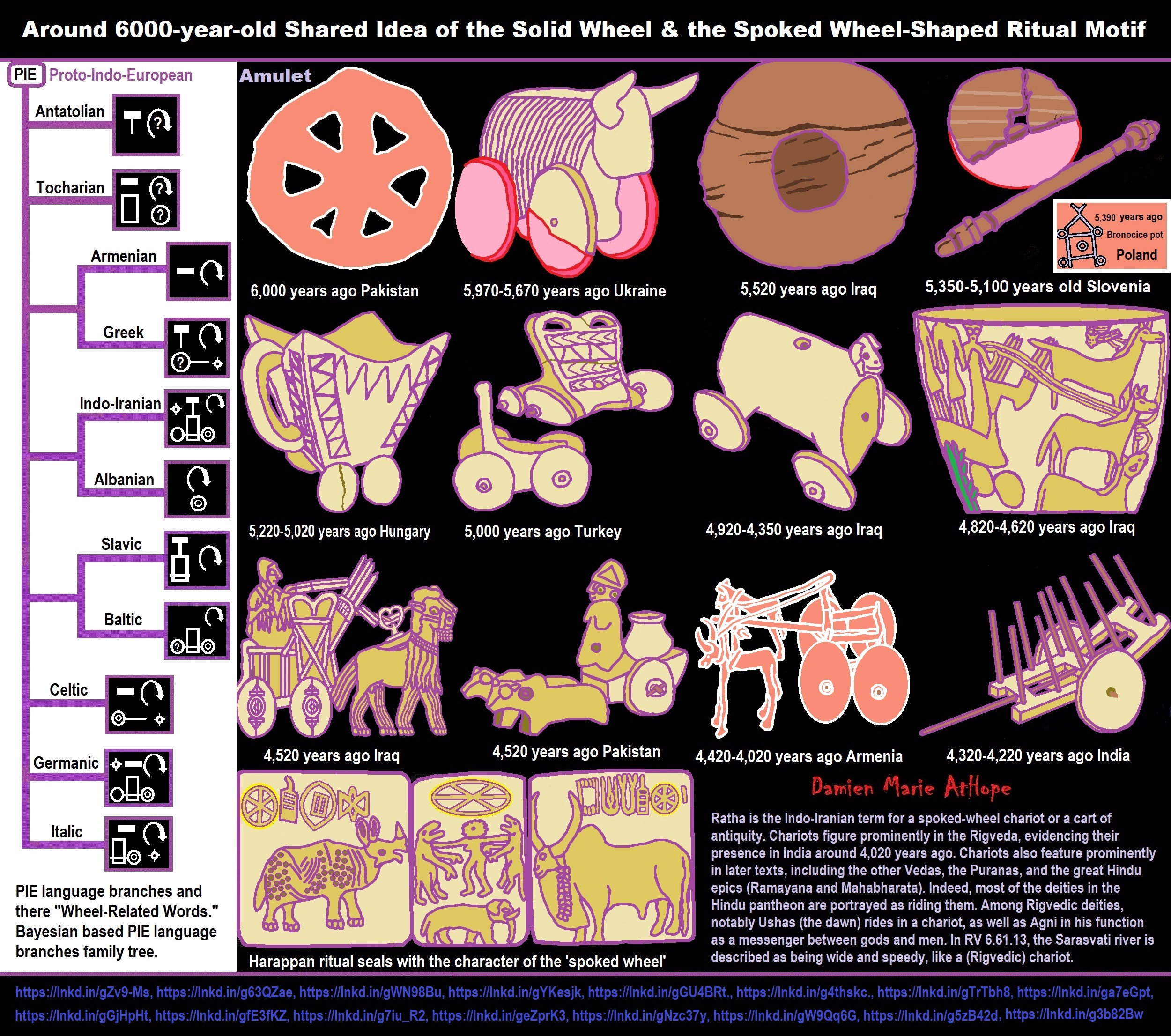
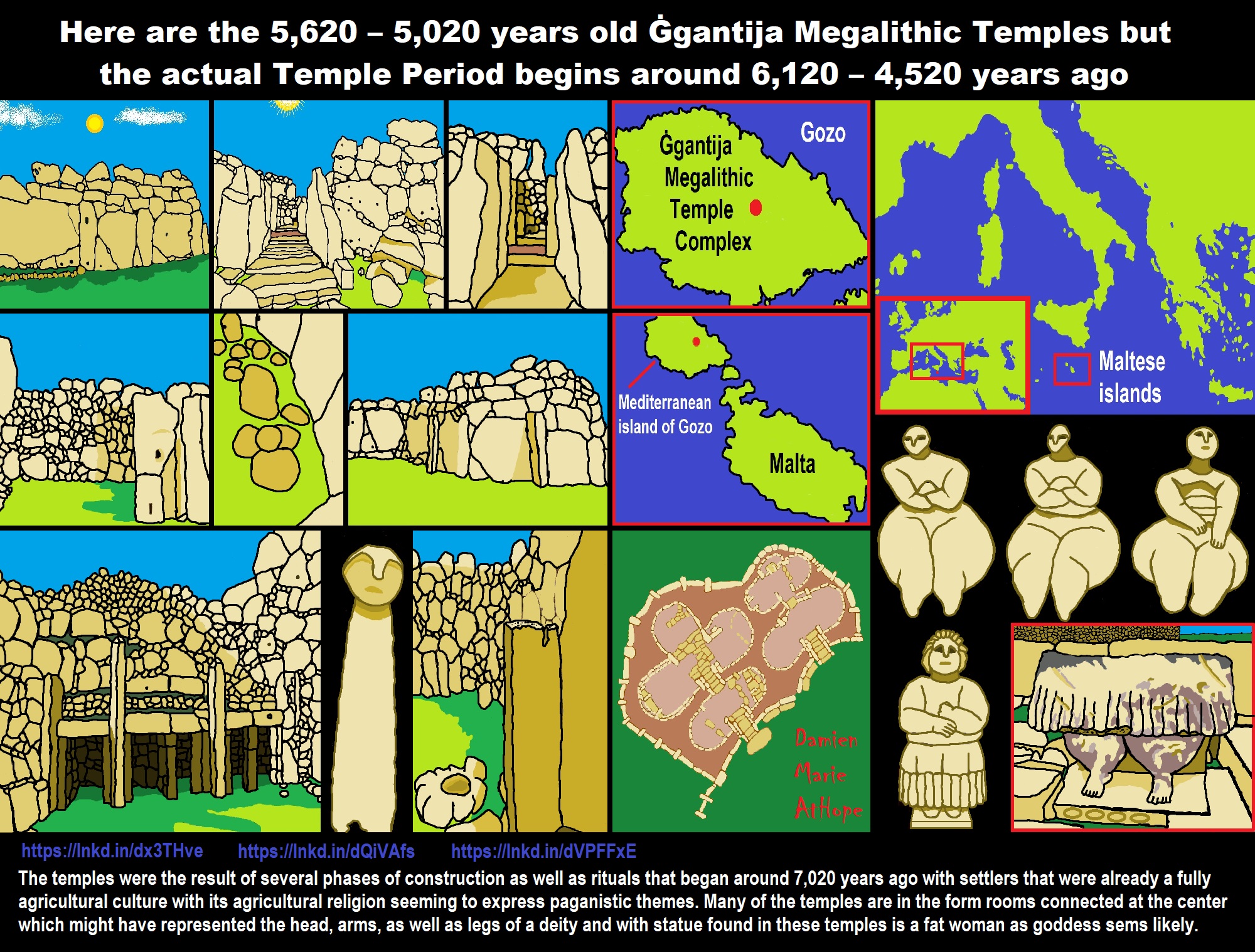
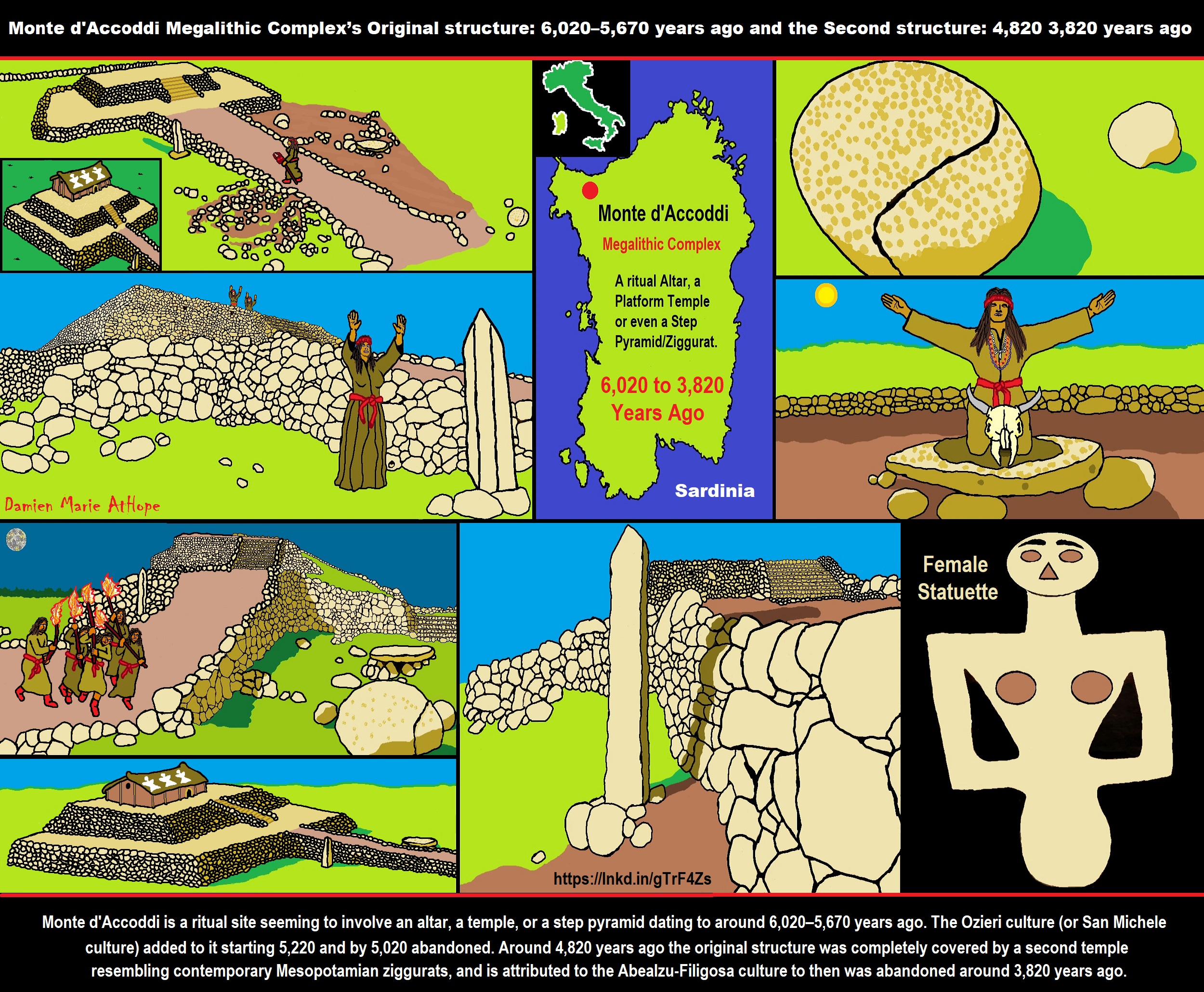
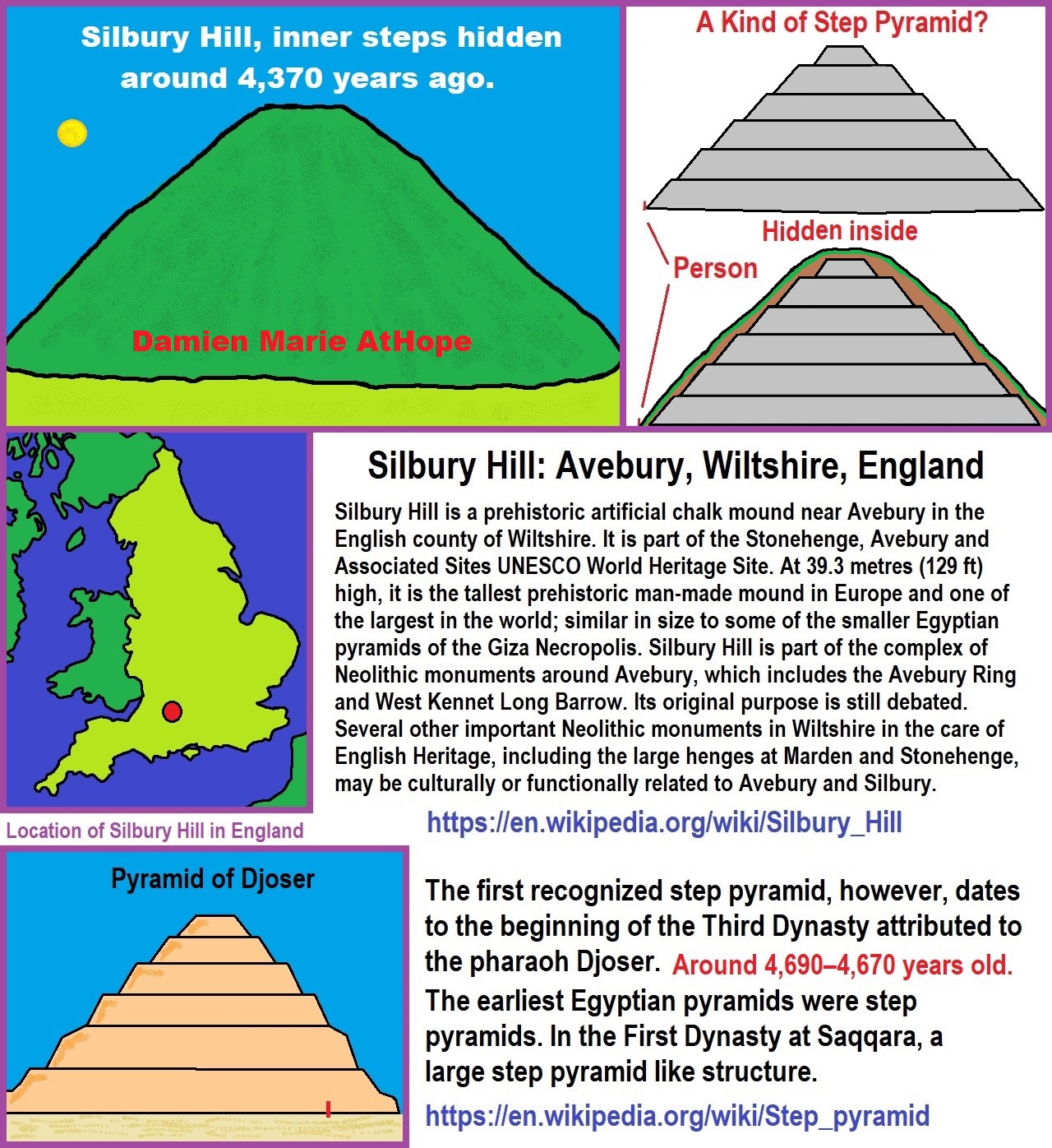

ref, ref, ref, ref, ref, ref, ref
Stonehenge: Paganistic Burial and Astrological Ritual Complex, England (5,100-3,600 years ago)
*Around 5,000 years ago Stonehenge (Britain):
Stonehenge: Paganistic Burial and Astrological Ritual Complex, England.
Stonehenge evolved in several construction phases, 1 (5,100 years ago), 2 (5,000 years ago), 3 I (4,600 years ago), 3 II (4,600-4,400 years ago), 3 III (2400-4,280 years ago), 3 IV (4,280-3,930 years ago), & 3 V (3,930-3,600 years ago). Anatolian/Turkish-farmers built Britain’s famous Stonehenge, as well as current males of Britain, 60-65% have Turkish genetics. Almost as the same as in Ireland where 85 percent of Irish men are descended from farming people that arrived 6,000 years ago. At or around Stonehenge 5,000-4,400 years ago, there were two separate burial rites, either letting the birds feed on bodies or cremation. And a 4,000-year-old burial pit for elite contains 14 females and only 9 males, as well as a chieftain’s grave, held several items including the depicted 4,000-year-old dagger. And a 4,000-year-old child’s grave held the depicted Folkton drums. As well as items from 4,600-3,600 involved gold beads, necklaces, earrings, pendants, and other jewelry show sophisticated burial culture. ref, ref, ref, ref, ref, ref, & ref
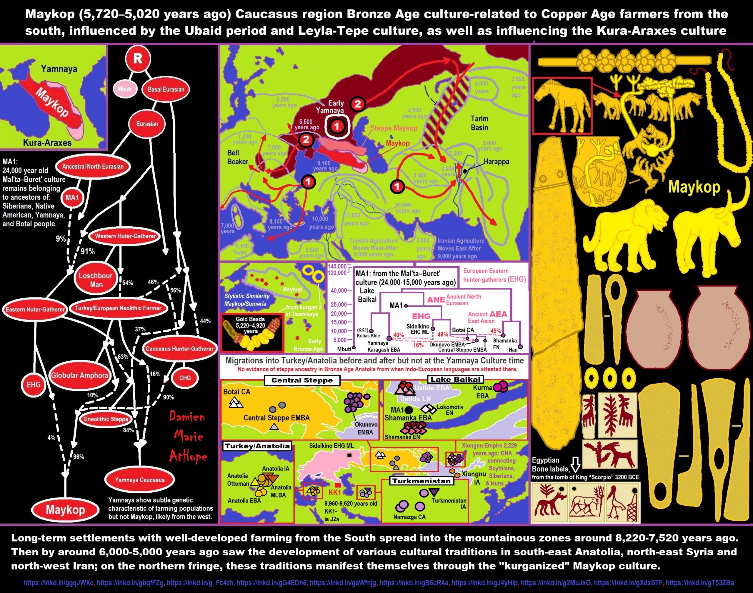
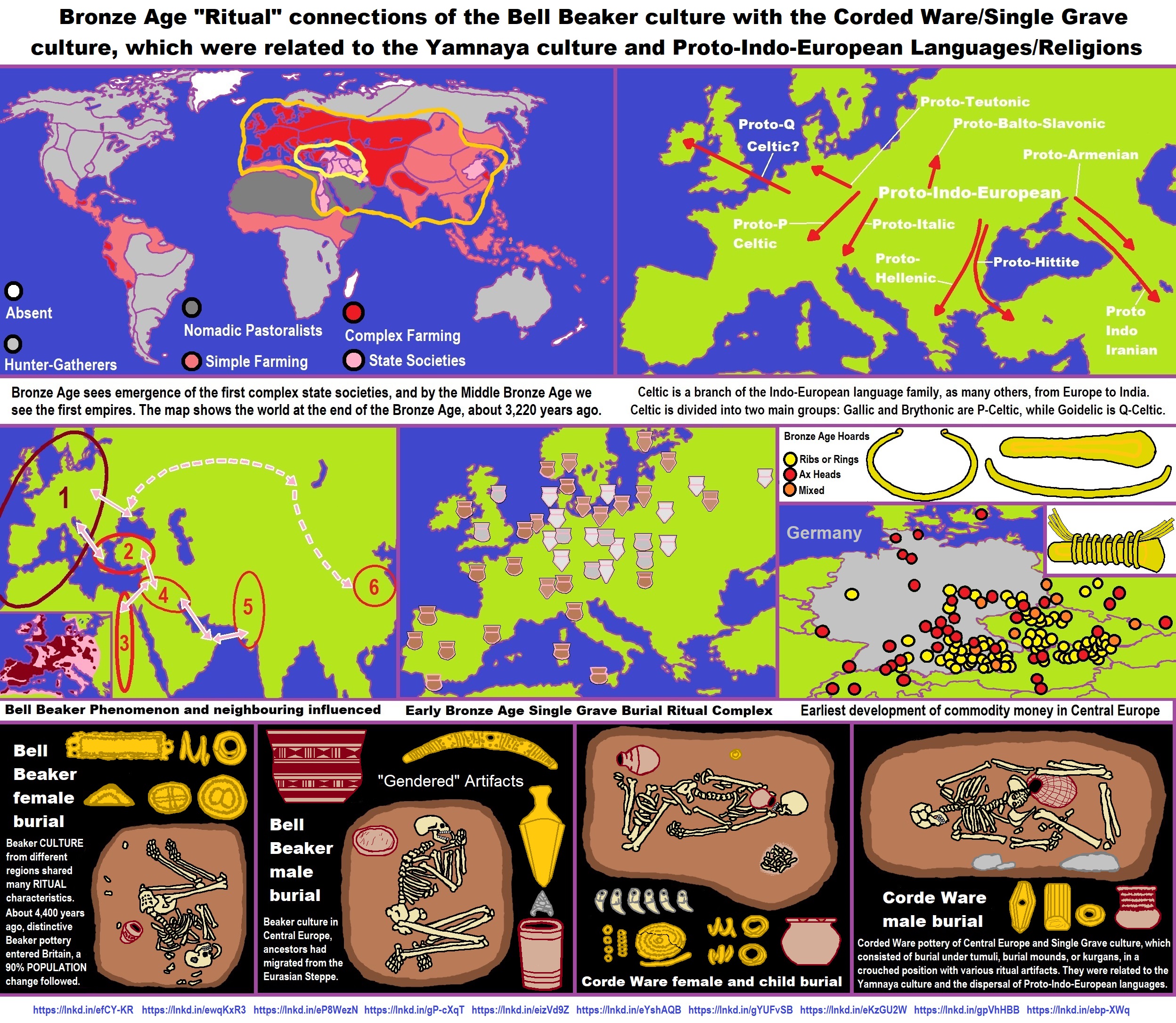
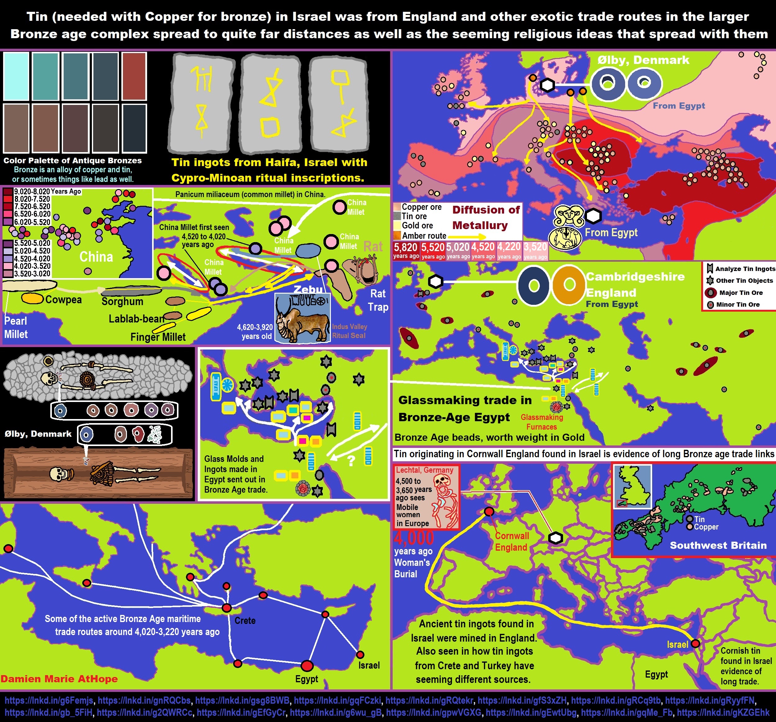
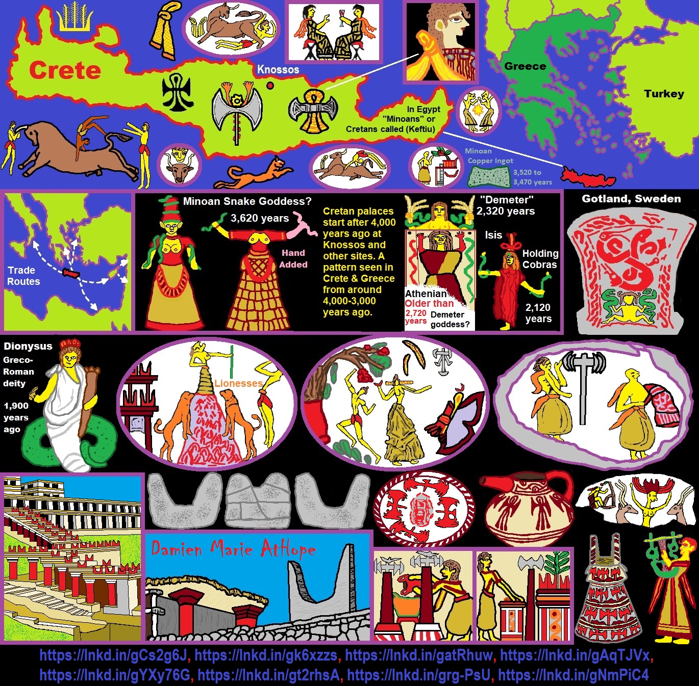
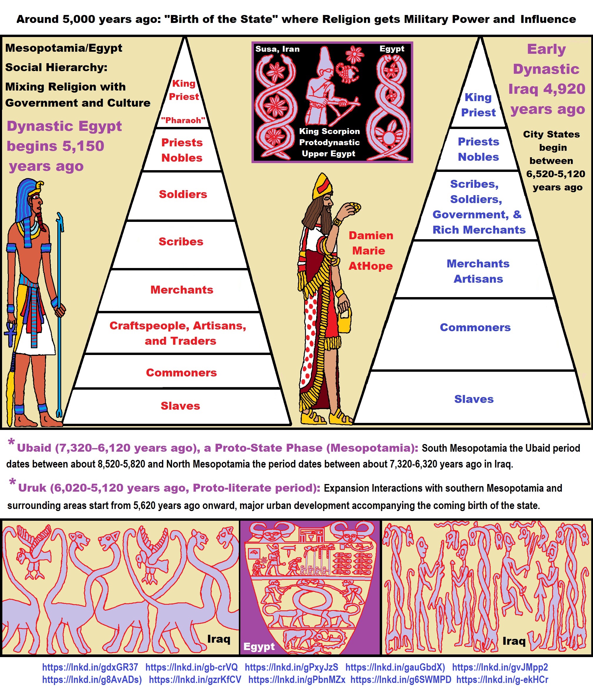
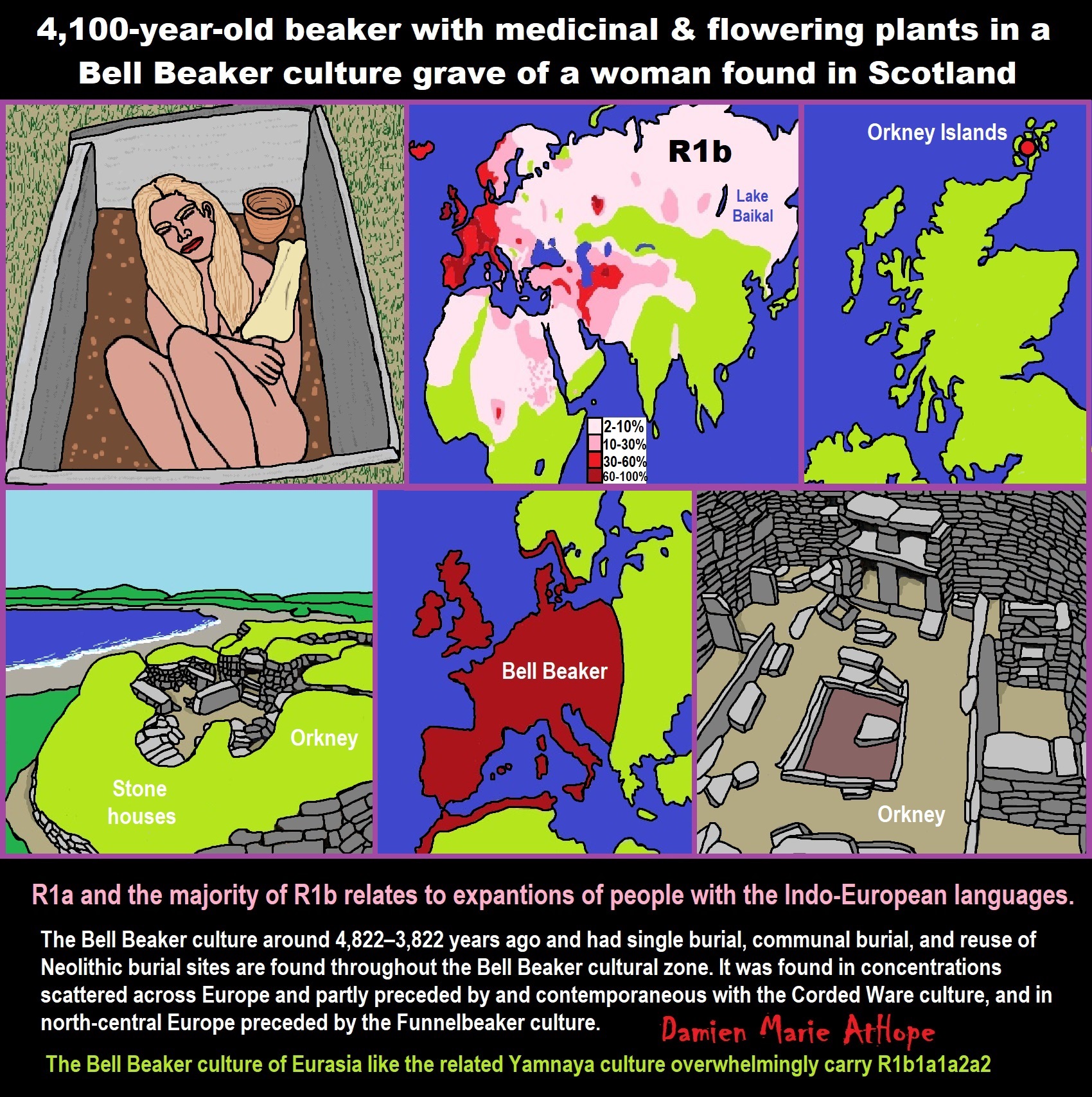


Animism: Respecting the Living World by Graham Harvey
“How have human cultures engaged with and thought about animals, plants, rocks, clouds, and other elements in their natural surroundings? Do animals and other natural objects have a spirit or soul? What is their relationship to humans? In this new study, Graham Harvey explores current and past animistic beliefs and practices of Native Americans, Maori, Aboriginal Australians, and eco-pagans. He considers the varieties of animism found in these cultures as well as their shared desire to live respectfully within larger natural communities. Drawing on his extensive casework, Harvey also considers the linguistic, performative, ecological, and activist implications of these different animisms.” ref
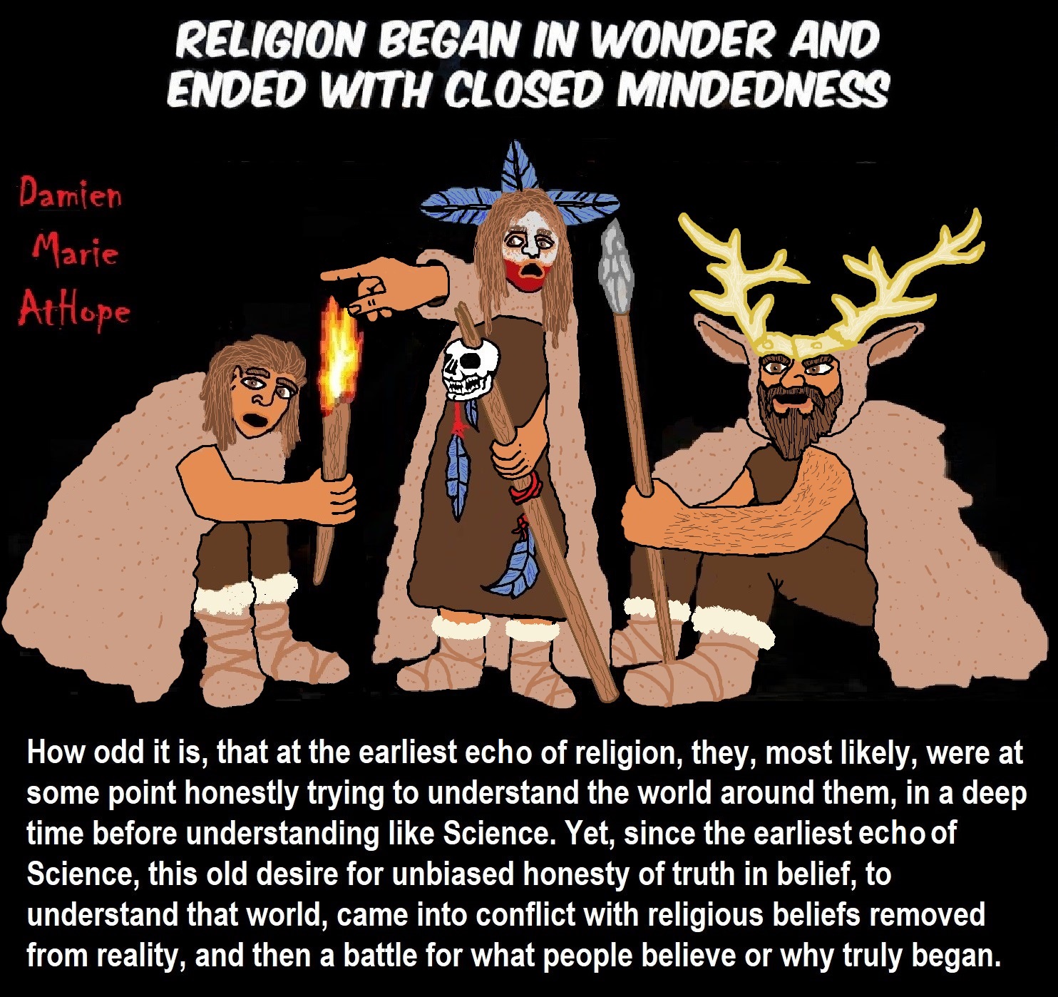
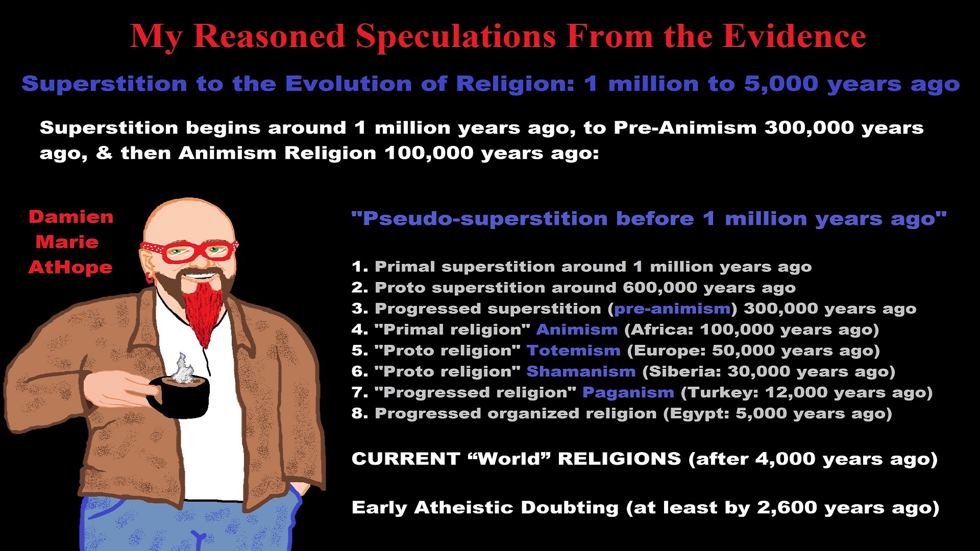
My thoughts on Religion Evolution with external links for more info:
- (Pre-Animism Africa mainly, but also Europe, and Asia at least 300,000 years ago), (Pre-Animism – Oxford Dictionaries)
- (Animism Africa around 100,000 years ago), (Animism – Britannica.com)
- (Totemism Europe around 50,000 years ago), (Totemism – Anthropology)
- (Shamanism Siberia around 30,000 years ago), (Shamanism – Britannica.com)
- (Paganism Turkey around 12,000 years ago), (Paganism – BBC Religion)
- (Progressed Organized Religion “Institutional Religion” Egypt around 5,000 years ago), (Ancient Egyptian Religion – Britannica.com)
- (CURRENT “World” RELIGIONS after 4,000 years ago) (Origin of Major Religions – Sacred Texts)
- (Early Atheistic Doubting at least by 2,600 years ago) (History of Atheism – Wikipedia)
“Religion is an Evolved Product” and Yes, Religion is Like Fear Given Wings…
Atheists talk about gods and religions for the same reason doctors talk about cancer, they are looking for a cure, or a firefighter talks about fires because they burn people and they care to stop them. We atheists too often feel a need to help the victims of mental slavery, held in the bondage that is the false beliefs of gods and the conspiracy theories of reality found in religions.
Understanding Religion Evolution:
- Pre-Animism (at least 300,000 years ago)
- Animism (Africa: 100,000 years ago)
- Totemism (Europe: 50,000 years ago)
- Shamanism (Siberia: 30,000 years ago)
- Paganism (Turkey: 12,000 years ago)
- Progressed organized religion (Egypt: 5,000 years ago), (Egypt, the First Dynasty 5,150 years ago)
- CURRENT “World” RELIGIONS (after 4,000 years ago)
- Early Atheistic Doubting (at least by 2,600 years ago)
“An Archaeological/Anthropological Understanding of Religion Evolution”
It seems ancient peoples had to survived amazing threats in a “dangerous universe (by superstition perceived as good and evil),” and human “immorality or imperfection of the soul” which was thought to affect the still living, leading to ancestor worship. This ancestor worship presumably led to the belief in supernatural beings, and then some of these were turned into the belief in gods. This feeble myth called gods were just a human conceived “made from nothing into something over and over, changing, again and again, taking on more as they evolve, all the while they are thought to be special,” but it is just supernatural animistic spirit-belief perceived as sacred.
Quick Evolution of Religion?
Pre-Animism (at least 300,000 years ago) pre-religion is a beginning that evolves into later Animism. So, Religion as we think of it, to me, all starts in a general way with Animism (Africa: 100,000 years ago) (theoretical belief in supernatural powers/spirits), then this is physically expressed in or with Totemism (Europe: 50,000 years ago) (theoretical belief in mythical relationship with powers/spirits through a totem item), which then enlists a full-time specific person to do this worship and believed interacting Shamanism (Siberia/Russia: 30,000 years ago) (theoretical belief in access and influence with spirits through ritual), and then there is the further employment of myths and gods added to all the above giving you Paganism (Turkey: 12,000 years ago) (often a lot more nature-based than most current top world religions, thus hinting to their close link to more ancient religious thinking it stems from). My hypothesis is expressed with an explanation of the building of a theatrical house (modern religions development). Progressed organized religion (Egypt: 5,000 years ago) with CURRENT “World” RELIGIONS (after 4,000 years ago).
Historically, in large city-state societies (such as Egypt or Iraq) starting around 5,000 years ago culminated to make religion something kind of new, a sociocultural-governmental-religious monarchy, where all or at least many of the people of such large city-state societies seem familiar with and committed to the existence of “religion” as the integrated life identity package of control dynamics with a fixed closed magical doctrine, but this juggernaut integrated religion identity package of Dogmatic-Propaganda certainly did not exist or if developed to an extent it was highly limited in most smaller prehistoric societies as they seem to lack most of the strong control dynamics with a fixed closed magical doctrine (magical beliefs could be at times be added or removed). Many people just want to see developed religious dynamics everywhere even if it is not. Instead, all that is found is largely fragments until the domestication of religion.
Religions, as we think of them today, are a new fad, even if they go back to around 6,000 years in the timeline of human existence, this amounts to almost nothing when seen in the long slow evolution of religion at least around 70,000 years ago with one of the oldest ritual worship. Stone Snake of South Africa: “first human worship” 70,000 years ago. This message of how religion and gods among them are clearly a man-made thing that was developed slowly as it was invented and then implemented peace by peace discrediting them all. Which seems to be a simple point some are just not grasping how devastating to any claims of truth when we can see the lie clearly in the archeological sites.
I wish people fought as hard for the actual values as they fight for the group/clan names political or otherwise they think support values. Every amount spent on war is theft to children in need of food or the homeless kept from shelter.
Here are several of my blog posts on history:
- To Find Truth You Must First Look
- (Magdalenian/Iberomaurusian) Connections to the First Paganists of the early Neolithic Near East Dating from around 17,000 to 12,000 Years Ago
- Natufians: an Ancient People at the Origins of Agriculture and Sedentary Life
- Possible Clan Leader/Special “MALE” Ancestor Totem Poles At Least 13,500 years ago?
- Jewish People with DNA at least 13,200 years old, Judaism, and the Origins of Some of its Ideas
- Baltic Reindeer Hunters: Swiderian, Lyngby, Ahrensburgian, and Krasnosillya cultures 12,020 to 11,020 years ago are evidence of powerful migratory waves during the last 13,000 years and a genetic link to Saami and the Finno-Ugric peoples.
- The Rise of Inequality: patriarchy and state hierarchy inequality
- Fertile Crescent 12,500 – 9,500 Years Ago: fertility and death cult belief system?
- 12,400 – 11,700 Years Ago – Kortik Tepe (Turkey) Pre/early-Agriculture Cultic Ritualism
- Ritualistic Bird Symbolism at Gobekli Tepe and its “Ancestor Cult”
- Male-Homosexual (female-like) / Trans-woman (female) Seated Figurine from Gobekli Tepe
- Could a 12,000-year-old Bull Geoglyph at Göbekli Tepe relate to older Bull and Female Art 25,000 years ago and Later Goddess and the Bull cults like Catal Huyuk?
- Sedentism and the Creation of goddesses around 12,000 years ago as well as male gods after 7,000 years ago.
- Alcohol, where Agriculture and Religion Become one? Such as Gobekli Tepe’s Ritualistic use of Grain as Food and Ritual Drink
- Neolithic Ritual Sites with T-Pillars and other Cultic Pillars
- Paganism: Goddesses around 12,000 years ago then Male Gods after 7,000 years ago
- First Patriarchy: Split of Women’s Status around 12,000 years ago & First Hierarchy: fall of Women’s Status around 5,000 years ago.
- Natufians: an Ancient People at the Origins of Agriculture and Sedentary Life
- J DNA and the Spread of Agricultural Religion (paganism)
- Paganism: an approximately 12,000-year-old belief system
- Paganism 12,000 years old: related to “Anarchism and Socialism” (Pre-Capitalism)
- Shaman burial in Israel 12,000 years ago and the Shamanism Phenomena
- Need to Mythicized: gods and goddesses
- 12,000 – 7,000 Years Ago – Paleo-Indian Culture (The Americas)
- 12,000 – 2,000 Years Ago – Indigenous-Scandinavians (Nordic)
- Norse did not wear helmets with horns?
- Pre-Pottery Neolithic Skull Cult around 11,500 to 8,400 Years Ago?
- 10,400 – 10,100 Years Ago, in Turkey the Nevail Cori Religious Settlement
- 9,000-6,500 Years Old Submerged Pre-Pottery/Pottery Neolithic Ritual Settlements off Israel’s Coast
- Catal Huyuk “first religious designed city” around 9,500 to 7,700 years ago (Turkey)
- Cultic Hunting at Catal Huyuk “first religious designed city”
- Special Items and Art as well as Special Elite Burials at Catal Huyuk
- New Rituals and Violence with the appearance of Pottery and People?
- Haplogroup N and its related Uralic Languages and Cultures
- Ainu people, Sámi people, Native Americans, the Ancient North Eurasians, and Paganistic-Shamanism with Totemism
- Ideas, Technology and People from Turkey, Europe, to China and Back again 9,000 to 5,000 years ago?
- First Pottery of Europe and the Related Cultures
- 9,000 years old Neolithic Artifacts Judean Desert and Hills Israel
- 9,000-7,000 years-old Sex and Death Rituals: Cult Sites in Israel, Jordan, and the Sinai
- 9,000-8500 year old Horned Female shaman Bad Dürrenberg Germany
- Neolithic Jewelry and the Spread of Farming in Europe Emerging out of West Turkey
- 8,600-year-old Tortoise Shells in Neolithic graves in central China have Early Writing and Shamanism
- Swing of the Mace: the rise of Elite, Forced Authority, and Inequality begin to Emerge 8,500 years ago?
- Migrations and Changing Europeans Beginning around 8,000 Years Ago
- My “Steppe-Anatolian-Kurgan hypothesis” 8,000/7,000 years ago
- Around 8,000-year-old Shared Idea of the Mistress of Animals, “Ritual” Motif
- Pre-Columbian Red-Paint (red ochre) Maritime Archaic Culture 8,000-3,000 years ago
- 7,522-6,522 years ago Linear Pottery culture which I think relates to Arcane Capitalism’s origins
- Arcane Capitalism: Primitive socialism, Primitive capital, Private ownership, Means of production, Market capitalism, Class discrimination, and Petite bourgeoisie (smaller capitalists)
- 7,500-4,750 years old Ritualistic Cucuteni-Trypillian culture of Moldova, Romania, and Ukraine
- Roots of a changing early society 7,200-6,700 years ago Jordan and Israel
- Agriculture religion (Paganism) with farming reached Britain between about 7,000 to 6,500 or so years ago and seemingly expressed in things like Western Europe’s Long Barrows
- My Thoughts on Possible Migrations of “R” DNA and Proto-Indo-European?
- “Millet” Spreading from China 7,022 years ago to Europe and related Language may have Spread with it leading to Proto-Indo-European
- Proto-Indo-European (PIE), ancestor of Indo-European languages: DNA, Society, Language, and Mythology
- The Dnieper–Donets culture and Asian varieties of Millet from China to the Black Sea region of Europe by 7,022 years ago
- Kurgan 6,000 years ago/dolmens 7,000 years ago: funeral, ritual, and other?
- 7,020 to 6,020-year-old Proto-Indo-European Homeland of Urheimat or proposed home of their Language and Religion
- Ancient Megaliths: Kurgan, Ziggurat, Pyramid, Menhir, Trilithon, Dolman, Kromlech, and Kromlech of Trilithons
- The Mytheme of Ancient North Eurasian Sacred-Dog belief and similar motifs are found in Indo-European, Native American, and Siberian comparative mythology
- Elite Power Accumulation: Ancient Trade, Tokens, Writing, Wealth, Merchants, and Priest-Kings
- Sacred Mounds, Mountains, Kurgans, and Pyramids may hold deep connections?
- Between 7,000-5,000 Years ago, rise of unequal hierarchy elite, leading to a “birth of the State” or worship of power, strong new sexism, oppression of non-elites, and the fall of Women’s equal status
- Paganism 7,000-5,000 years old: related to “Anarchism and Socialism” (Capitalism) (World War 0) Elite & their slaves
- Hell and Underworld mythologies starting maybe as far back as 7,000 to 5,000 years ago with the Proto-Indo-Europeans?
- The First Expression of the Male God around 7,000 years ago?
- White (light complexion skin) Bigotry and Sexism started 7,000 years ago?
- Around 7,000-year-old Shared Idea of the Divine Bird (Tutelary and/or Trickster spirit/deity), “Ritual” Motif
- Nekhbet an Ancient Egyptian Vulture Goddess and Tutelary Deity
- 6,720 to 4,920 years old Ritualistic Hongshan Culture of Inner Mongolia with 5,000-year-old Pyramid Mounds and Temples
- First proto-king in the Balkans, Varna culture around 6,500 years ago?
- 6,500–5,800 years ago in Israel Late Chalcolithic (Copper Age) Period in the Southern Levant Seems to Express Northern Levant Migrations, Cultural and Religious Transfer
- KING OF BEASTS: Master of Animals “Ritual” Motif, around 6,000 years old or older…
- Around 6000-year-old Shared Idea of the Solid Wheel & the Spoked Wheel-Shaped Ritual Motif
- “The Ghassulian Star,” a mysterious 6,000-year-old mural from Jordan; a Proto-Star of Ishtar, Star of Inanna or Star of Venus?
- Religious/Ritual Ideas, including goddesses and gods as well as ritual mounds or pyramids from Northeastern Asia at least 6,000 years old, seemingly filtering to Iran, Iraq, the Mediterranean, Europe, Egypt, and the Americas?
- Maykop (5,720–5,020 years ago) Caucasus region Bronze Age culture-related to Copper Age farmers from the south, influenced by the Ubaid period and Leyla-Tepe culture, as well as influencing the Kura-Araxes culture
- 5-600-year-old Tomb, Mummy, and First Bearded Male Figurine in a Grave
- Kura-Araxes Cultural 5,520 to 4,470 years old DNA traces to the Canaanites, Arabs, and Jews
- Minoan/Cretan (Keftiu) Civilization and Religion around 5,520 to 3,120 years ago
- Evolution Of Science at least by 5,500 years ago
- 5,500 Years old birth of the State, the rise of Hierarchy, and the fall of Women’s status
- “Jiroft culture” 5,100 – 4,200 years ago and the History of Iran
- Stonehenge: Paganistic Burial and Astrological Ritual Complex, England (5,100-3,600 years ago)
- Around 5,000-year-old Shared Idea of the “Tree of Life” Ritual Motif
- Complex rituals for elite, seen from China to Egypt, at least by 5,000 years ago
- Around 5,000 years ago: “Birth of the State” where Religion gets Military Power and Influence
- The Center of the World “Axis Mundi” and/or “Sacred Mountains” Mythology Could Relate to the Altai Mountains, Heart of the Steppe
- Progressed organized religion starts, an approximately 5,000-year-old belief system
- China’s Civilization between 5,000-3,000 years ago, was a time of war and class struggle, violent transition from free clans to a Slave or Elite society
- Origin of Logics is Naturalistic Observation at least by around 5,000 years ago.
- Paganism 5,000 years old: progressed organized religion and the state: related to “Anarchism and Socialism” (Kings and the Rise of the State)
- Ziggurats (multi-platform temples: 4,900 years old) to Pyramids (multi-platform tombs: 4,700 years old)
- Did a 4,520–4,420-year-old Volcano In Turkey Inspire the Bible God?
- Finland’s Horned Shaman and Pre-Horned-God at least 4,500 years ago?
- 4,000-year-Old Dolmens in Israel: A Connected Dolmen Religious Phenomenon?
- Creation myths: From chaos, Ex nihilo, Earth-diver, Emergence, World egg, and World parent
- Bronze Age “Ritual” connections of the Bell Beaker culture with the Corded Ware/Single Grave culture, which were related to the Yamnaya culture and Proto-Indo-European Languages/Religions
- Low Gods (Earth/ Tutelary deity), High Gods (Sky/Supreme deity), and Moralistic Gods (Deity enforcement/divine order)
- The exchange of people, ideas, and material-culture including, to me, the new god (Sky Father) and goddess (Earth Mother) religion between the Cucuteni-Trypillians and others which is then spread far and wide
- Koryaks: Indigenous People of the Russian Far East and Big Raven myths also found in Tlingit, Haida, Tsimshian, and other Indigenous People of North America
- 42 Principles Of Maat (Egyptian Goddess of the justice) around 4,400 years ago, 2000 Years Before Ten Commandments
- “Happy Easter” Well Happy Eostre/Ishter
- 4,320-3,820 years old “Shimao” (North China) site with Totemistic-Shamanistic Paganism and a Stepped Pyramid
- 4,250 to 3,400 Year old Stonehenge from Russia: Arkaim?
- 4,100-year-old beaker with medicinal & flowering plants in a grave of a woman in Scotland
- Early European Farmer ancestry, Kelif el Boroud people with the Cardial Ware culture, and the Bell Beaker culture Paganists too, spread into North Africa, then to the Canary Islands off West Africa
- Flood Accounts: Gilgamesh epic (4,100 years ago) Noah in Genesis (2,600 years ago)
- Paganism 4,000 years old: related to “Anarchism and Socialism” (First Moralistic gods, then the Origin time of Monotheism)
- When was the beginning: TIMELINE OF CURRENT RELIGIONS, which start around 4,000 years ago.
- Early Religions Thought to Express Proto-Monotheistic Systems around 4,000 years ago
- Kultepe? An archaeological site with a 4,000 years old women’s rights document.
- Single God Religions (Monotheism) = “Man-o-theism” started around 4,000 years ago with the Great Sky Spirit/God Tiān (天)?
- Confucianism’s Tiān (Shangdi god 4,000 years old): Supernaturalism, Pantheism or Theism?
- Yes, Your Male God is Ridiculous
- Mythology, a Lunar Deity is a Goddess or God of the Moon
- Sacred Land, Hills, and Mountains: Sami Mythology (Paganistic Shamanism)
- Horse Worship/Sacrifice: mythical union of Ruling Elite/Kingship and the Horse
- The Amorite/Amurru people’s God Amurru “Lord of the Steppe”, relates to the Origins of the Bible God?
- Bronze Age Exotic Trade Routes Spread Quite Far as well as Spread Religious Ideas with Them
- Sami and the Northern Indigenous Peoples Landscape, Language, and its Connection to Religion
- Prototype of Ancient Analemmatic Sundials around 3,900-3,150 years ago and a Possible Solar Connection to gods?
- Judaism is around 3,450 or 3,250 years old. (“Paleo-Hebrew” 3,000 years ago and Torah 2,500 years ago)
- The Weakening of Ancient Trade and the Strengthening of Religions around 3000 years ago?
- Are you aware that there are religions that worship women gods, explain now religion tears women down?
- Animistic, Totemistic, and Paganistic Superstition Origins of bible god and the bible’s Religion.
- Myths and Folklore: “Trickster gods and goddesses”
- Jews, Judaism, and the Origins of Some of its Ideas
- An Old Branch of Religion Still Giving Fruit: Sacred Trees
- Dating the BIBLE: naming names and telling times (written less than 3,000 years ago, provable to 2,200 years ago)
- Did a Volcano Inspire the bible god?
- The Amorite/Amurru people’s God Amurru “Lord of the Steppe”, relates to the Origins of the Bible God?
- Dené–Yeniseian language, Old Copper Complex, and Pre-Columbian Mound Builders?
- No “dinosaurs and humans didn’t exist together just because some think they are in the bible itself”
- Sacred Shit and Sacred Animals?
- Everyone Killed in the Bible Flood? “Nephilim” (giants)?
- Hey, Damien dude, I have a question for you regarding “the bible” Exodus.
- Archaeology Disproves the Bible
- Bible Battle, Just More, Bible Babble
- The Jericho Conquest lie?
- Canaanites and Israelites?
- Accurate Account on how did Christianity Began?
- Let’s talk about Christianity.
- So the 10 commandments isn’t anything to go by either right?
- Misinformed christian
- Debunking Jesus?
- Paulism vs Jesus
- Ok, you seem confused so let’s talk about Buddhism.
- Unacknowledged Buddhism: Gods, Savior, Demons, Rebirth, Heavens, Hells, and Terrorism
- His Foolishness The Dalai Lama
- Yin and Yang is sexist with an ORIGIN around 2,300 years ago?
- I Believe Archaeology, not Myths & Why Not, as the Religious Myths Already Violate Reason!
- Archaeological, Scientific, & Philosophic evidence shows the god myth is man-made nonsense.
- Aquatic Ape Theory/Hypothesis? As Always, Just Pseudoscience.
- Ancient Aliens Conspiracy Theorists are Pseudohistorians
- The Pseudohistoric and Pseudoscientific claims about “Bakoni Ruins” of South Africa
- Why do people think Religion is much more than supernaturalism and superstitionism?
- Religion is an Evolved Product
- Was the Value of Ancient Women Different?
- 1000 to 1100 CE, human sacrifice Cahokia Mounds a pre-Columbian Native American site
- Feminist atheists as far back as the 1800s?
- Promoting Religion as Real is Mentally Harmful to a Flourishing Humanity
- Screw All Religions and Their Toxic lies, they are all fraud
- Forget Religions’ Unfounded Myths, I Have Substantiated “Archaeology Facts.”
- Religion Dispersal throughout the World
- I Hate Religion Just as I Hate all Pseudoscience
- Exposing Scientology, Eckankar, Wicca and Other Nonsense?
- Main deity or religious belief systems
- Quit Trying to Invent Your God From the Scraps of Science.
- Archaeological, Scientific, & Philosophic evidence shows the god myth is man-made nonsense.
- Ancient Alien Conspiracy Theorists: Misunderstanding, Rhetoric, Misinformation, Fabrications, and Lies
- Misinformation, Distortion, and Pseudoscience in Talking with a Christian Creationist
- Judging the Lack of Goodness in Gods, Even the Norse God Odin
- Challenging the Belief in God-like Aliens and Gods in General
- A Challenge to Christian use of Torture Devices?
- Yes, Hinduism is a Religion
- Trump is One of the Most Reactionary Forces of Far-right Christian Extremism
- Was the Bull Head a Symbol of God? Yes!
- Primate Death Rituals
- Christian – “God and Christianity are objectively true”
- Australopithecus afarensis Death Ritual?
- You Claim Global Warming is a Hoax?
- Doubter of Science and Defamer of Atheists?
- I think that sounds like the Bible?
- History of the Antifa (“anti-fascist”) Movements
- Indianapolis Anti-Blasphemy Laws #Free Soheil Rally
- Damien, you repeat the golden rule in so many forms then you say religion is dogmatic?
- Science is a Trustable Methodology whereas Faith is not Trustable at all!
- Was I ever a believer, before I was an atheist?
- Atheists rise in reason
- Mistrust of science?
- Open to Talking About the Definition of ‘God’? But first, we address Faith.
- ‘United Monarchy’ full of splendor and power – Saul, David, and Solomon? Most likely not.
- Is there EXODUS ARCHAEOLOGY? The short answer is “no.”
- Lacking Proof of Bigfoots, Unicorns, and Gods is Just a Lack of Research?
- Religion and Politics: Faith Beliefs vs. Rational Thinking
- Hammer of Truth that lying pig RELIGION: challenged by an archaeologist
- “The Hammer of Truth” -ontology question- What do You Mean by That?
- Navigation of a bad argument: Ad Hominem vs. Attack
- Why is it Often Claimed that Gods have a Gender?
- Why are basically all monotheistic religions ones that have a male god?
- Shifting through the Claims in support of Faith
- Dear Mr. AtHope, The 20th Century is an Indictment of Secularism and a Failed Atheist Century
- An Understanding of the Worldwide Statistics and Dynamics of Terrorist Incidents and Suicide Attacks
- Intoxication and Evolution? Addressing and Assessing the “Stoned Ape” or “Drunken Monkey” Theories as Catalysts in Human Evolution
- Sacred Menstrual cloth? Inanna’s knot, Isis knot, and maybe Ma’at’s feather?
- Damien, why don’t the Hebrews accept the bible stories?
- Dealing with a Troll and Arguing Over Word Meaning
- Knowledge without Belief? Justified beliefs or disbeliefs worthy of Knowledge?
- Afrocentrism and African Religions
- Crecganford @crecganford offers history & stories of the people, places, gods, & culture
- Empiricism-Denier?
I am not an academic. I am a revolutionary that teaches in public, in places like social media, and in the streets. I am not a leader by some title given but from my commanding leadership style of simply to start teaching everywhere to everyone, all manner of positive education.

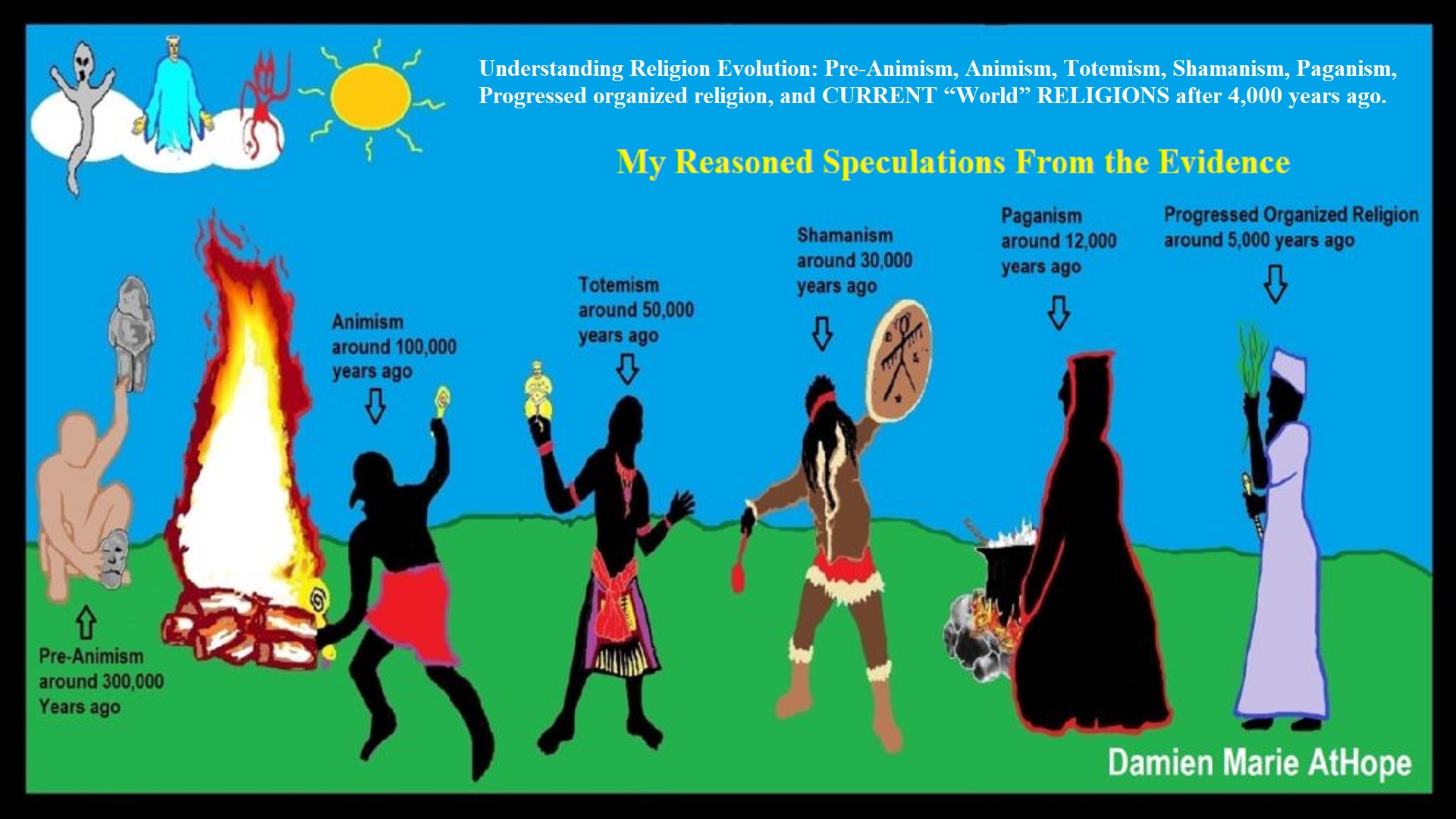
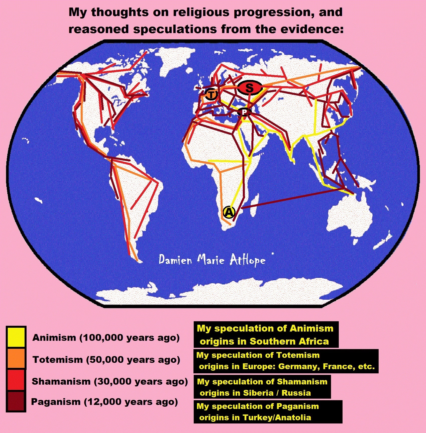


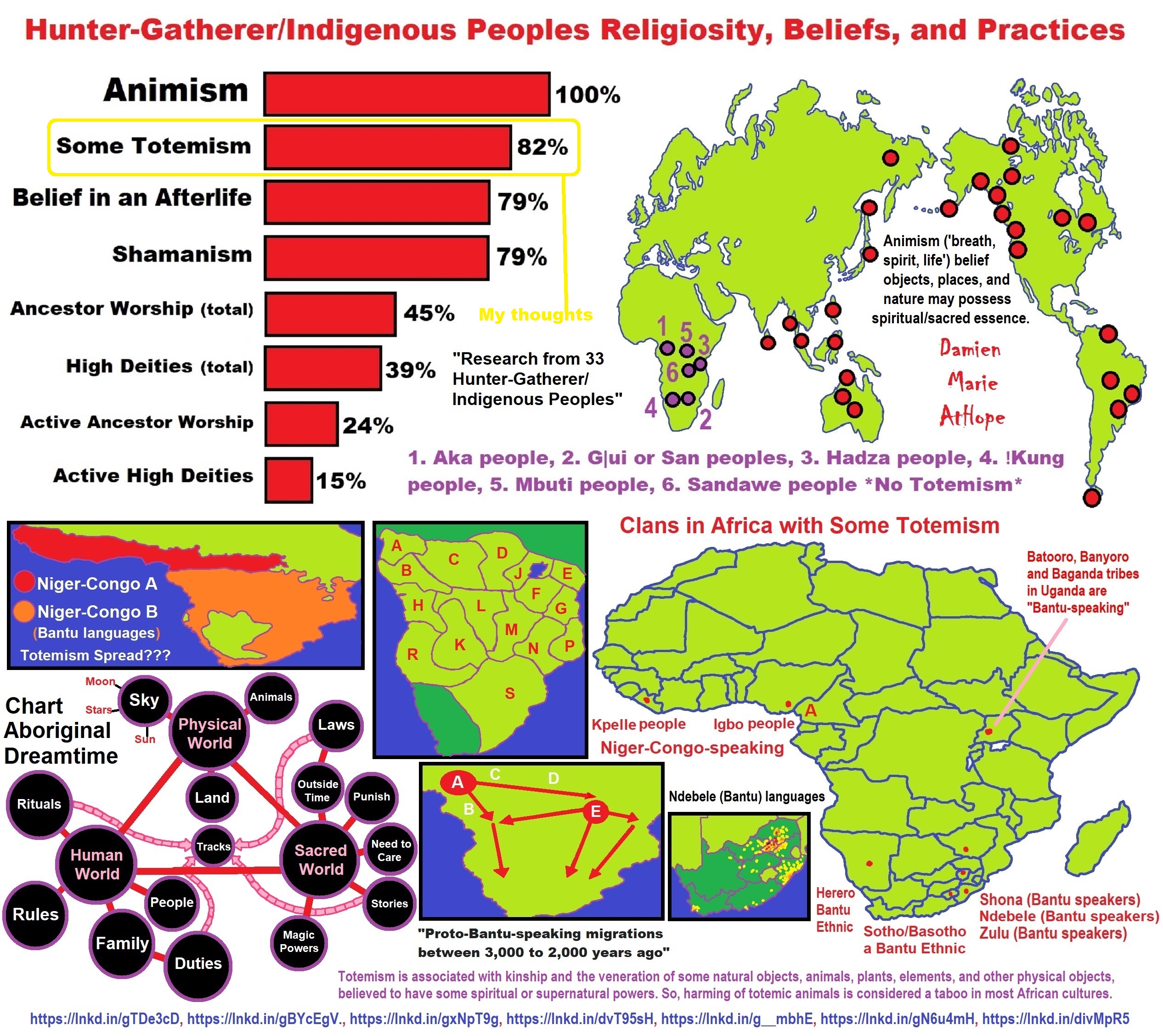
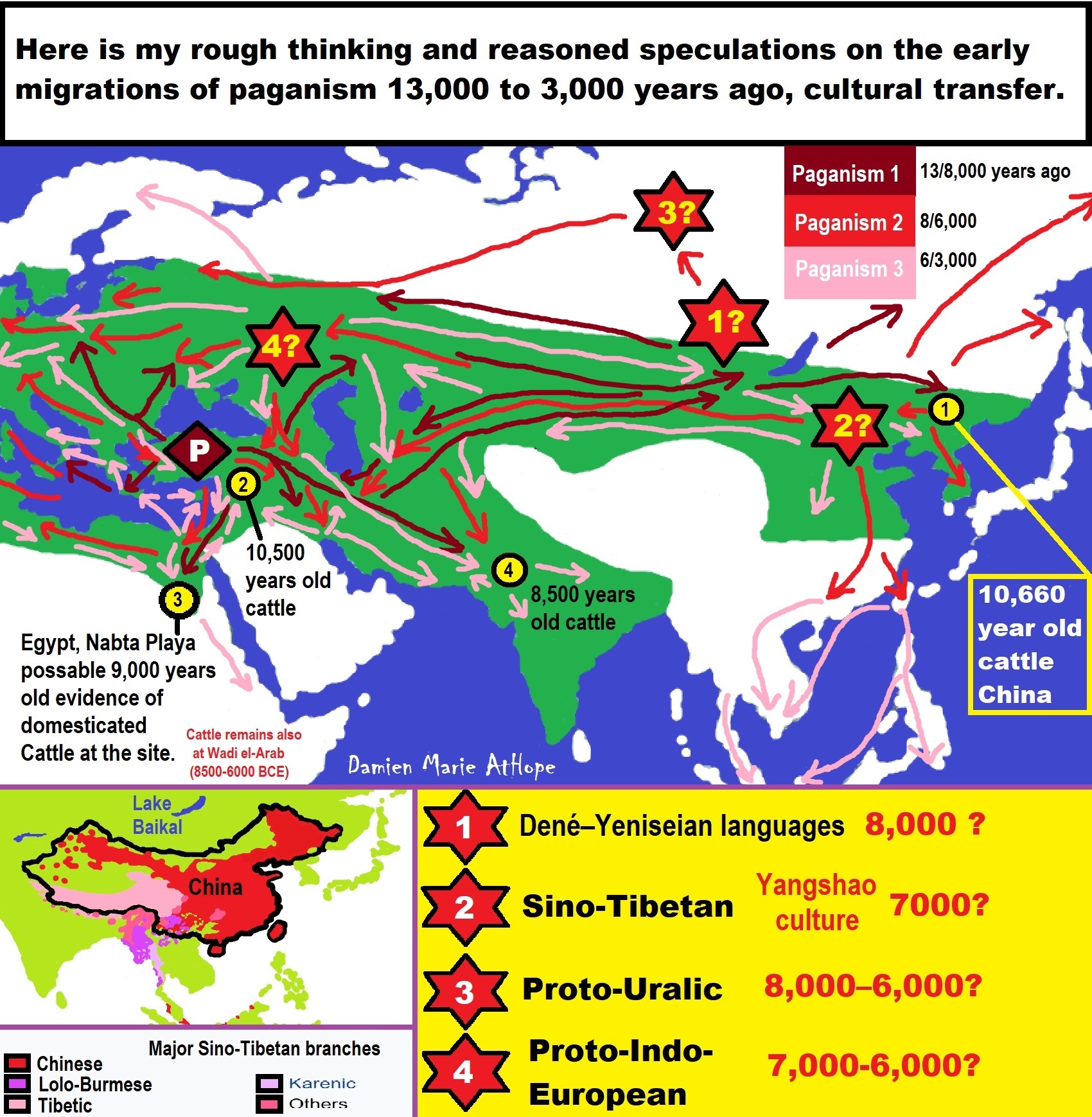
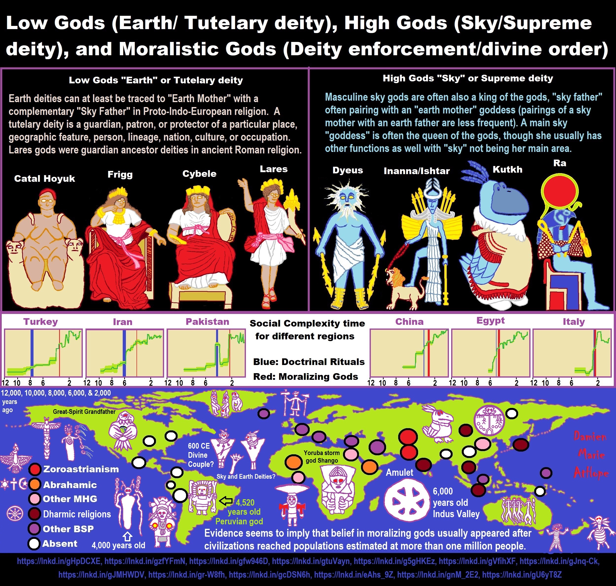
ref, ref, ref, ref, ref, ref, ref, ref, ref, ref, ref, ref, ref, ref, ref, ref, ref, ref, ref, ref, ref
Low Gods “Earth” or Tutelary deity and High Gods “Sky” or Supreme deity
“An Earth goddess is a deification of the Earth. Earth goddesses are often associated with the “chthonic” deities of the underworld. Ki and Ninhursag are Mesopotamian earth goddesses. In Greek mythology, the Earth is personified as Gaia, corresponding to Roman Terra, Indic Prithvi/Bhūmi, etc. traced to an “Earth Mother” complementary to the “Sky Father” in Proto-Indo-European religion. Egyptian mythology exceptionally has a sky goddess and an Earth god.” ref
“A mother goddess is a goddess who represents or is a personification of nature, motherhood, fertility, creation, destruction or who embodies the bounty of the Earth. When equated with the Earth or the natural world, such goddesses are sometimes referred to as Mother Earth or as the Earth Mother. In some religious traditions or movements, Heavenly Mother (also referred to as Mother in Heaven or Sky Mother) is the wife or feminine counterpart of the Sky father or God the Father.” ref
“Any masculine sky god is often also king of the gods, taking the position of patriarch within a pantheon. Such king gods are collectively categorized as “sky father” deities, with a polarity between sky and earth often being expressed by pairing a “sky father” god with an “earth mother” goddess (pairings of a sky mother with an earth father are less frequent). A main sky goddess is often the queen of the gods and may be an air/sky goddess in her own right, though she usually has other functions as well with “sky” not being her main. In antiquity, several sky goddesses in ancient Egypt, Mesopotamia, and the Near East were called Queen of Heaven. Neopagans often apply it with impunity to sky goddesses from other regions who were never associated with the term historically. The sky often has important religious significance. Many religions, both polytheistic and monotheistic, have deities associated with the sky.” ref
“In comparative mythology, sky father is a term for a recurring concept in polytheistic religions of a sky god who is addressed as a “father”, often the father of a pantheon and is often either a reigning or former King of the Gods. The concept of “sky father” may also be taken to include Sun gods with similar characteristics, such as Ra. The concept is complementary to an “earth mother“. “Sky Father” is a direct translation of the Vedic Dyaus Pita, etymologically descended from the same Proto-Indo-European deity name as the Greek Zeûs Pater and Roman Jupiter and Germanic Týr, Tir or Tiwaz, all of which are reflexes of the same Proto-Indo-European deity’s name, *Dyēus Ph₂tḗr. While there are numerous parallels adduced from outside of Indo-European mythology, there are exceptions (e.g. In Egyptian mythology, Nut is the sky mother and Geb is the earth father).” ref
Tutelary deity
“A tutelary (also tutelar) is a deity or spirit who is a guardian, patron, or protector of a particular place, geographic feature, person, lineage, nation, culture, or occupation. The etymology of “tutelary” expresses the concept of safety and thus of guardianship. In late Greek and Roman religion, one type of tutelary deity, the genius, functions as the personal deity or daimon of an individual from birth to death. Another form of personal tutelary spirit is the familiar spirit of European folklore.” ref
“A tutelary (also tutelar) in Korean shamanism, jangseung and sotdae were placed at the edge of villages to frighten off demons. They were also worshiped as deities. Seonangshin is the patron deity of the village in Korean tradition and was believed to embody the Seonangdang. In Philippine animism, Diwata or Lambana are deities or spirits that inhabit sacred places like mountains and mounds and serve as guardians. Such as: Maria Makiling is the deity who guards Mt. Makiling and Maria Cacao and Maria Sinukuan. In Shinto, the spirits, or kami, which give life to human bodies come from nature and return to it after death. Ancestors are therefore themselves tutelaries to be worshiped. And similarly, Native American beliefs such as Tonás, tutelary animal spirit among the Zapotec and Totems, familial or clan spirits among the Ojibwe, can be animals.” ref
“A tutelary (also tutelar) in Austronesian beliefs such as: Atua (gods and spirits of the Polynesian peoples such as the Māori or the Hawaiians), Hanitu (Bunun of Taiwan‘s term for spirit), Hyang (Kawi, Sundanese, Javanese, and Balinese Supreme Being, in ancient Java and Bali mythology and this spiritual entity, can be either divine or ancestral), Kaitiaki (New Zealand Māori term used for the concept of guardianship, for the sky, the sea, and the land), Kawas (mythology) (divided into 6 groups: gods, ancestors, souls of the living, spirits of living things, spirits of lifeless objects, and ghosts), Tiki (Māori mythology, Tiki is the first man created by either Tūmatauenga or Tāne and represents deified ancestors found in most Polynesian cultures). ” ref, ref, ref, ref, ref, ref, ref
Mesopotamian Tutelary Deities can be seen as ones related to City-States
“Historical city-states included Sumerian cities such as Uruk and Ur; Ancient Egyptian city-states, such as Thebes and Memphis; the Phoenician cities (such as Tyre and Sidon); the five Philistine city-states; the Berber city-states of the Garamantes; the city-states of ancient Greece (the poleis such as Athens, Sparta, Thebes, and Corinth); the Roman Republic (which grew from a city-state into a vast empire); the Italian city-states from the Middle Ages to the early modern period, such as Florence, Siena, Ferrara, Milan (which as they grew in power began to dominate neighboring cities) and Genoa and Venice, which became powerful thalassocracies; the Mayan and other cultures of pre-Columbian Mesoamerica (including cities such as Chichen Itza, Tikal, Copán and Monte Albán); the central Asian cities along the Silk Road; the city-states of the Swahili coast; Ragusa; states of the medieval Russian lands such as Novgorod and Pskov; and many others.” ref
“The Uruk period (ca. 4000 to 3100 BCE; also known as Protoliterate period) of Mesopotamia, named after the Sumerian city of Uruk, this period saw the emergence of urban life in Mesopotamia and the Sumerian civilization. City-States like Uruk and others had a patron tutelary City Deity along with a Priest-King.” ref
“Chinese folk religion, both past, and present, includes myriad tutelary deities. Exceptional individuals, highly cultivated sages, and prominent ancestors can be deified and honored after death. Lord Guan is the patron of military personnel and police, while Mazu is the patron of fishermen and sailors. Such as Tu Di Gong (Earth Deity) is the tutelary deity of a locality, and each individual locality has its own Earth Deity and Cheng Huang Gong (City God) is the guardian deity of an individual city, worshipped by local officials and locals since imperial times.” ref
“A tutelary (also tutelar) in Hinduism, personal tutelary deities are known as ishta-devata, while family tutelary deities are known as Kuladevata. Gramadevata are guardian deities of villages. Devas can also be seen as tutelary. Shiva is the patron of yogis and renunciants. City goddesses include: Mumbadevi (Mumbai), Sachchika (Osian); Kuladevis include: Ambika (Porwad), and Mahalakshmi. In NorthEast India Meitei mythology and religion (Sanamahism) of Manipur, there are various types of tutelary deities, among which Lam Lais are the most predominant ones. Tibetan Buddhism has Yidam as a tutelary deity. Dakini is the patron of those who seek knowledge.” ref
“A tutelary (also tutelar) The Greeks also thought deities guarded specific places: for instance, Athena was the patron goddess of the city of Athens. Socrates spoke of hearing the voice of his personal spirit or daimonion:
You have often heard me speak of an oracle or sign which comes to me … . This sign I have had ever since I was a child. The sign is a voice which comes to me and always forbids me to do something which I am going to do, but never commands me to do anything, and this is what stands in the way of my being a politician.” ref
“Tutelary deities who guard and preserve a place or a person are fundamental to ancient Roman religion. The tutelary deity of a man was his Genius, that of a woman her Juno. In the Imperial era, the Genius of the Emperor was a focus of Imperial cult. An emperor might also adopt a major deity as his personal patron or tutelary, as Augustus did Apollo. Precedents for claiming the personal protection of a deity were established in the Republican era, when for instance the Roman dictator Sulla advertised the goddess Victory as his tutelary by holding public games (ludi) in her honor.” ref
“Each town or city had one or more tutelary deities, whose protection was considered particularly vital in time of war and siege. Rome itself was protected by a goddess whose name was to be kept ritually secret on pain of death (for a supposed case, see Quintus Valerius Soranus). The Capitoline Triad of Juno, Jupiter, and Minerva were also tutelaries of Rome. The Italic towns had their own tutelary deities. Juno often had this function, as at the Latin town of Lanuvium and the Etruscan city of Veii, and was often housed in an especially grand temple on the arx (citadel) or other prominent or central location. The tutelary deity of Praeneste was Fortuna, whose oracle was renowned.” ref
“The Roman ritual of evocatio was premised on the belief that a town could be made vulnerable to military defeat if the power of its tutelary deity were diverted outside the city, perhaps by the offer of superior cult at Rome. The depiction of some goddesses such as the Magna Mater (Great Mother, or Cybele) as “tower-crowned” represents their capacity to preserve the city. A town in the provinces might adopt a deity from within the Roman religious sphere to serve as its guardian, or syncretize its own tutelary with such; for instance, a community within the civitas of the Remi in Gaul adopted Apollo as its tutelary, and at the capital of the Remi (present-day Rheims), the tutelary was Mars Camulus.” ref
Household deity (a kind of or related to a Tutelary deity)
“A household deity is a deity or spirit that protects the home, looking after the entire household or certain key members. It has been a common belief in paganism as well as in folklore across many parts of the world. Household deities fit into two types; firstly, a specific deity – typically a goddess – often referred to as a hearth goddess or domestic goddess who is associated with the home and hearth, such as the ancient Greek Hestia.” ref
“The second type of household deities are those that are not one singular deity, but a type, or species of animistic deity, who usually have lesser powers than major deities. This type was common in the religions of antiquity, such as the Lares of ancient Roman religion, the Gashin of Korean shamanism, and Cofgodas of Anglo-Saxon paganism. These survived Christianisation as fairy-like creatures existing in folklore, such as the Anglo-Scottish Brownie and Slavic Domovoy.” ref
“Household deities were usually worshipped not in temples but in the home, where they would be represented by small idols (such as the teraphim of the Bible, often translated as “household gods” in Genesis 31:19 for example), amulets, paintings, or reliefs. They could also be found on domestic objects, such as cosmetic articles in the case of Tawaret. The more prosperous houses might have a small shrine to the household god(s); the lararium served this purpose in the case of the Romans. The gods would be treated as members of the family and invited to join in meals, or be given offerings of food and drink.” ref
“In many religions, both ancient and modern, a god would preside over the home. Certain species, or types, of household deities, existed. An example of this was the Roman Lares. Many European cultures retained house spirits into the modern period. Some examples of these include:
- Brownie (Scotland and England) or Hob (England) / Kobold (Germany) / Goblin / Hobgoblin
- Domovoy (Slavic)
- Nisse (Norwegian or Danish) / Tomte (Swedish) / Tonttu (Finnish)
- Húsvættir (Norse)” ref
“Although the cosmic status of household deities was not as lofty as that of the Twelve Olympians or the Aesir, they were also jealous of their dignity and also had to be appeased with shrines and offerings, however humble. Because of their immediacy they had arguably more influence on the day-to-day affairs of men than the remote gods did. Vestiges of their worship persisted long after Christianity and other major religions extirpated nearly every trace of the major pagan pantheons. Elements of the practice can be seen even today, with Christian accretions, where statues to various saints (such as St. Francis) protect gardens and grottos. Even the gargoyles found on older churches, could be viewed as guardians partitioning a sacred space.” ref
“For centuries, Christianity fought a mop-up war against these lingering minor pagan deities, but they proved tenacious. For example, Martin Luther‘s Tischreden have numerous – quite serious – references to dealing with kobolds. Eventually, rationalism and the Industrial Revolution threatened to erase most of these minor deities, until the advent of romantic nationalism rehabilitated them and embellished them into objects of literary curiosity in the 19th century. Since the 20th century this literature has been mined for characters for role-playing games, video games, and other fantasy personae, not infrequently invested with invented traits and hierarchies somewhat different from their mythological and folkloric roots.” ref
“In contradistinction to both Herbert Spencer and Edward Burnett Tylor, who defended theories of animistic origins of ancestor worship, Émile Durkheim saw its origin in totemism. In reality, this distinction is somewhat academic, since totemism may be regarded as a particularized manifestation of animism, and something of a synthesis of the two positions was attempted by Sigmund Freud. In Freud’s Totem and Taboo, both totem and taboo are outward expressions or manifestations of the same psychological tendency, a concept which is complementary to, or which rather reconciles, the apparent conflict. Freud preferred to emphasize the psychoanalytic implications of the reification of metaphysical forces, but with particular emphasis on its familial nature. This emphasis underscores, rather than weakens, the ancestral component.” ref
“William Edward Hearn, a noted classicist, and jurist, traced the origin of domestic deities from the earliest stages as an expression of animism, a belief system thought to have existed also in the neolithic, and the forerunner of Indo-European religion. In his analysis of the Indo-European household, in Chapter II “The House Spirit”, Section 1, he states:
The belief which guided the conduct of our forefathers was … the spirit rule of dead ancestors.” ref
“In Section 2 he proceeds to elaborate:
It is thus certain that the worship of deceased ancestors is a vera causa, and not a mere hypothesis. …
In the other European nations, the Slavs, the Teutons, and the Kelts, the House Spirit appears with no less distinctness. … [T]he existence of that worship does not admit of doubt. … The House Spirits had a multitude of other names which it is needless here to enumerate, but all of which are more or less expressive of their friendly relations with man. … In [England] … [h]e is the Brownie. … In Scotland this same Brownie is well known. He is usually described as attached to particular families, with whom he has been known to reside for centuries, threshing the corn, cleaning the house, and performing similar household tasks. His favorite gratification was milk and honey.” ref

Hinduism around 3,700 to 3,500 years old. ref
Judaism around 3,450 or 3,250 years old. (The first writing in the bible was “Paleo-Hebrew” dated to around 3,000 years ago Khirbet Qeiyafa is the site of an ancient fortress city overlooking the Elah Valley. And many believe the religious Jewish texts were completed around 2,500) ref, ref
Judaism is around 3,450 or 3,250 years old. (“Paleo-Hebrew” 3,000 years ago and Torah 2,500 years ago)
“Judaism is an Abrahamic, its roots as an organized religion in the Middle East during the Bronze Age. Some scholars argue that modern Judaism evolved from Yahwism, the religion of ancient Israel and Judah, by the late 6th century BCE, and is thus considered to be one of the oldest monotheistic religions.” ref
“Yahwism is the name given by modern scholars to the religion of ancient Israel, essentially polytheistic, with a plethora of gods and goddesses. Heading the pantheon was Yahweh, the national god of the Israelite kingdoms of Israel and Judah, with his consort, the goddess Asherah; below them were second-tier gods and goddesses such as Baal, Shamash, Yarikh, Mot, and Astarte, all of whom had their own priests and prophets and numbered royalty among their devotees, and a third and fourth tier of minor divine beings, including the mal’ak, the messengers of the higher gods, who in later times became the angels of Judaism, Christianity and Islam. Yahweh, however, was not the ‘original’ god of Israel “Isra-El”; it is El, the head of the Canaanite pantheon, whose name forms the basis of the name “Israel”, and none of the Old Testament patriarchs, the tribes of Israel, the Judges, or the earliest monarchs, have a Yahwistic theophoric name (i.e., one incorporating the name of Yahweh).” ref
“El is a Northwest Semitic word meaning “god” or “deity“, or referring (as a proper name) to any one of multiple major ancient Near Eastern deities. A rarer form, ‘ila, represents the predicate form in Old Akkadian and in Amorite. The word is derived from the Proto-Semitic *ʔil-, meaning “god”. Specific deities known as ‘El or ‘Il include the supreme god of the ancient Canaanite religion and the supreme god of East Semitic speakers in Mesopotamia’s Early Dynastic Period. ʼĒl is listed at the head of many pantheons. In some Canaanite and Ugaritic sources, ʼĒl played a role as father of the gods, of creation, or both. For example, in the Ugaritic texts, ʾil mlk is understood to mean “ʼĒl the King” but ʾil hd as “the god Hadad“. The Semitic root ʾlh (Arabic ʾilāh, Aramaic ʾAlāh, ʾElāh, Hebrew ʾelōah) may be ʾl with a parasitic h, and ʾl may be an abbreviated form of ʾlh. In Ugaritic the plural form meaning “gods” is ʾilhm, equivalent to Hebrew ʾelōhîm “powers”. In the Hebrew texts this word is interpreted as being semantically singular for “god” by biblical commentators. However the documentary hypothesis for the Old Testament (corresponds to the Jewish Torah) developed originally in the 1870s, identifies these that different authors – the Jahwist, Elohist, Deuteronomist, and the Priestly source – were responsible for editing stories from a polytheistic religion into those of a monotheistic religion. Inconsistencies that arise between monotheism and polytheism in the texts are reflective of this hypothesis.” ref
Jainism around 2,599 – 2,527 years old. ref
Confucianism around 2,600 – 2,551 years old. ref
Buddhism around 2,563/2,480 – 2,483/2,400 years old. ref
Christianity around 2,o00 years old. ref
Shinto around 1,305 years old. ref
Islam around 1407–1385 years old. ref
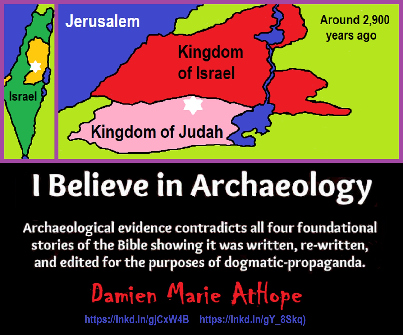
Knowledge to Ponder:
Stars/Astrology:
- Possibly, around 30,000 years ago (in simpler form) to 6,000 years ago, Stars/Astrology are connected to Ancestors, Spirit Animals, and Deities.
- The star also seems to be a possible proto-star for Star of Ishtar, Star of Inanna, or Star of Venus.
- Around 7,000 to 6,000 years ago, Star Constellations/Astrology have connections to the “Kurgan phenomenon” of below-ground “mound” stone/wood burial structures and “Dolmen phenomenon” of above-ground stone burial structures.
- Around 6,500–5,800 years ago, The Northern Levant migrations into Jordon and Israel in the Southern Levant brought new cultural and religious transfer from Turkey and Iran.
- “The Ghassulian Star,” a mysterious 6,000-year-old mural from Jordan may have connections to the European paganstic kurgan/dolmens phenomenon.
“Astrology is a range of divinatory practices, recognized as pseudoscientific since the 18th century, that claim to discern information about human affairs and terrestrial events by studying the apparent positions of celestial objects. Different cultures have employed forms of astrology since at least the 2nd millennium BCE, these practices having originated in calendrical systems used to predict seasonal shifts and to interpret celestial cycles as signs of divine communications. Most, if not all, cultures have attached importance to what they observed in the sky, and some—such as the Hindus, Chinese, and the Maya—developed elaborate systems for predicting terrestrial events from celestial observations. Western astrology, one of the oldest astrological systems still in use, can trace its roots to 19th–17th century BCE Mesopotamia, from where it spread to Ancient Greece, Rome, the Islamicate world and eventually Central and Western Europe. Contemporary Western astrology is often associated with systems of horoscopes that purport to explain aspects of a person’s personality and predict significant events in their lives based on the positions of celestial objects; the majority of professional astrologers rely on such systems.” ref
Around 5,500 years ago, Science evolves, The first evidence of science was 5,500 years ago and was demonstrated by a body of empirical, theoretical, and practical knowledge about the natural world. ref
Around 5,000 years ago, Origin of Logics is a Naturalistic Observation (principles of valid reasoning, inference, & demonstration) ref
Around 4,150 to 4,000 years ago: The earliest surviving versions of the Sumerian Epic of Gilgamesh, which was originally titled “He who Saw the Deep” (Sha naqba īmuru) or “Surpassing All Other Kings” (Shūtur eli sharrī) were written. ref
Hinduism:
- 3,700 years ago or so, the oldest of the Hindu Vedas (scriptures), the Rig Veda was composed.
- 3,500 years ago or so, the Vedic Age began in India after the collapse of the Indus Valley Civilization.
Judaism:
- around 3,000 years ago, the first writing in the bible was “Paleo-Hebrew”
- around 2,500 years ago, many believe the religious Jewish texts were completed
Myths: The bible inspired religion is not just one religion or one myth but a grouping of several religions and myths
- Around 3,450 or 3,250 years ago, according to legend, is the traditionally accepted period in which the Israelite lawgiver, Moses, provided the Ten Commandments.
- Around 2,500 to 2,400 years ago, a collection of ancient religious writings by the Israelites based primarily upon the Hebrew Bible, Tanakh, or Old Testament is the first part of Christianity’s bible.
- Around 2,400 years ago, the most accepted hypothesis is that the canon was formed in stages, first the Pentateuch (Torah).
- Around 2,140 to 2,116 years ago, the Prophets was written during the Hasmonean dynasty, and finally the remaining books.
- Christians traditionally divide the Old Testament into four sections:
- The first five books or Pentateuch (Torah).
- The proposed history books telling the history of the Israelites from their conquest of Canaan to their defeat and exile in Babylon.
- The poetic and proposed “Wisdom books” dealing, in various forms, with questions of good and evil in the world.
- The books of the biblical prophets, warning of the consequences of turning away from God:
- Henotheism:
- Exodus 20:23 “You shall not make other gods besides Me (not saying there are no other gods just not to worship them); gods of silver or gods of gold, you shall not make for yourselves.”
- Polytheism:
- Judges 10:6 “Then the sons of Israel again did evil in the sight of the LORD, served the Baals and the Ashtaroth, the gods of Aram, the gods of Sidon, the gods of Moab, the gods of the sons of Ammon, and the gods of the Philistines; thus they forsook the LORD and did not serve Him.”
- 1 Corinthians 8:5 “For even if there are so-called gods whether in heaven or on earth, as indeed there are many gods and many lords.”
- Monotheism:
- Isaiah 43:10 “You are my witnesses,” declares the LORD, “and my servant whom I have chosen, so that you may know and believe me and understand that I am he. Before me no god was formed, nor will there be one after me.
Around 2,570 to 2,270 Years Ago, there is a confirmation of atheistic doubting as well as atheistic thinking, mainly by Greek philosophers. However, doubting gods is likely as old as the invention of gods and should destroy the thinking that belief in god(s) is the “default belief”. The Greek word is apistos (a “not” and pistos “faithful,”), thus not faithful or faithless because one is unpersuaded and unconvinced by a god(s) claim. Short Definition: unbelieving, unbeliever, or unbelief.

Expressions of Atheistic Thinking:
- Around 2,600 years ago, Ajita Kesakambali, ancient Indian philosopher, who is the first known proponent of Indian materialism. ref
- Around 2,535 to 2,475 years ago, Heraclitus, Greek pre-Socratic philosopher, a native of the Greek city Ephesus, Ionia, on the coast of Anatolia, also known as Asia Minor or modern Turkey. ref
- Around 2,500 to 2,400 years ago, according to The Story of Civilization book series certain African pygmy tribes have no identifiable gods, spirits, or religious beliefs or rituals, and even what burials accrue are without ceremony. ref
- Around 2,490 to 2,430 years ago, Empedocles, Greek pre-Socratic philosopher and a citizen of Agrigentum, a Greek city in Sicily. ref
- Around 2,460 to 2,370 years ago, Democritus, Greek pre-Socratic philosopher considered to be the “father of modern science” possibly had some disbelief amounting to atheism. ref
- Around 2,399 years ago or so, Socrates, a famous Greek philosopher was tried for sinfulness by teaching doubt of state gods. ref
- Around 2,341 to 2,270 years ago, Epicurus, a Greek philosopher known for composing atheistic critics and famously stated, “Is God willing to prevent evil, but not able? Then he is not omnipotent. Is he able, but not willing? Then he is malevolent. Is he both able and willing? Then whence cometh evil? Is he neither able nor willing? Then why call him god?” ref
This last expression by Epicurus, seems to be an expression of Axiological Atheism. To understand and utilize value or actually possess “Value Conscious/Consciousness” to both give a strong moral “axiological” argument (the problem of evil) as well as use it to fortify humanism and positive ethical persuasion of human helping and care responsibilities. Because value-blindness gives rise to sociopathic/psychopathic evil.
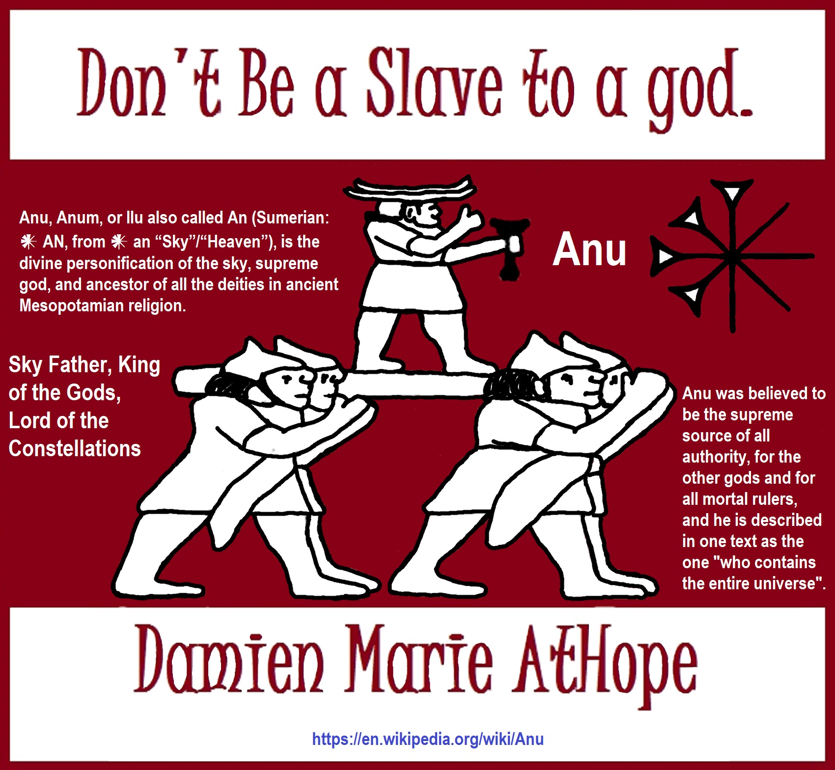


While hallucinogens are associated with shamanism, it is alcohol that is associated with paganism.
The Atheist-Humanist-Leftist Revolutionaries Shows in the prehistory series:
Show two: Pre-animism 300,000 years old and animism 100,000 years old: related to “Anarchism and Socialism”
Show tree: Totemism 50,000 years old: related to “Anarchism and Socialism”
Show four: Shamanism 30,000 years old: related to “Anarchism and Socialism”
Show five: Paganism 12,000 years old: related to “Anarchism and Socialism”
Show six: Emergence of hierarchy, sexism, slavery, and the new male god dominance: Paganism 7,000-5,000 years old: related to “Anarchism and Socialism” (Capitalism) (World War 0) Elite and their slaves!
Prehistory: related to “Anarchism and Socialism” the division of labor, power, rights, and recourses: VIDEO
Pre-animism 300,000 years old and animism 100,000 years old: related to “Anarchism and Socialism”: VIDEO
Totemism 50,000 years old: related to “Anarchism and Socialism”: VIDEO
Shamanism 30,000 years old: related to “Anarchism and Socialism”: VIDEO
Paganism 12,000 years old: related to “Anarchism and Socialism” (Pre-Capitalism): VIDEO
Paganism 7,000-5,000 years old: related to “Anarchism and Socialism” (Capitalism) (World War 0) Elite and their slaves: VIEDO
Paganism 5,000 years old: progressed organized religion and the state: related to “Anarchism and Socialism” (Kings and the Rise of the State): VIEDO
Paganism 4,000 years old: related to “Anarchism and Socialism” (First Moralistic gods, then the Origin time of Monotheism): VIEDO
I do not hate simply because I challenge and expose myths or lies any more than others being thought of as loving simply because of the protection and hiding from challenge their favored myths or lies.
The truth is best championed in the sunlight of challenge.
An archaeologist once said to me “Damien religion and culture are very different”
My response, So are you saying that was always that way, such as would you say Native Americans’ cultures are separate from their religions? And do you think it always was the way you believe?
I had said that religion was a cultural product. That is still how I see it and there are other archaeologists that think close to me as well. Gods too are the myths of cultures that did not understand science or the world around them, seeing magic/supernatural everywhere.
I personally think there is a goddess and not enough evidence to support a male god at Çatalhöyük but if there was both a male and female god and goddess then I know the kind of gods they were like Proto-Indo-European mythology.
This series idea was addressed in, Anarchist Teaching as Free Public Education or Free Education in the Public: VIDEO
Our 12 video series: Organized Oppression: Mesopotamian State Force and the Politics of power (9,000-4,000 years ago), is adapted from: The Complete and Concise History of the Sumerians and Early Bronze Age Mesopotamia (7000-2000 BC): https://www.youtube.com/watch?v=szFjxmY7jQA by “History with Cy“
Show #1: Mesopotamian State Force and the Politics of Power (Samarra, Halaf, Ubaid)
Show #2: Mesopotamian State Force and the Politics of Power
Show #3: Mesopotamian State Force and the Politics of Power (Uruk and the First Cities)
Show #4: Mesopotamian State Force and the Politics of Power (First Kings)
Show #5: Mesopotamian State Force and the Politics of Power (Early Dynastic Period)
Show #6: Mesopotamian State Force and the Politics of Power
Show #7: Mesopotamian State Force and the Politics of Power (Sargon and Akkadian Rule)
Show #9: Mesopotamian State Force and the Politics of Power (Gudea of Lagash and Utu-hegal)
Show #12: Mesopotamian State Force and the Politics of Power (Aftermath and Legacy of Sumer)

The “Atheist-Humanist-Leftist Revolutionaries”
Cory Johnston ☭ Ⓐ Atheist Leftist @Skepticallefty & I (Damien Marie AtHope) @AthopeMarie (my YouTube & related blog) are working jointly in atheist, antitheist, antireligionist, antifascist, anarchist, socialist, and humanist endeavors in our videos together, generally, every other Saturday.
Why Does Power Bring Responsibility?
Think, how often is it the powerless that start wars, oppress others, or commit genocide? So, I guess the question is to us all, to ask, how can power not carry responsibility in a humanity concept? I know I see the deep ethical responsibility that if there is power their must be a humanistic responsibility of ethical and empathic stewardship of that power. Will I be brave enough to be kind? Will I possess enough courage to be compassionate? Will my valor reach its height of empathy? I as everyone, earns our justified respect by our actions, that are good, ethical, just, protecting, and kind. Do I have enough self-respect to put my love for humanity’s flushing, over being brought down by some of its bad actors? May we all be the ones doing good actions in the world, to help human flourishing.
I create the world I want to live in, striving for flourishing. Which is not a place but a positive potential involvement and promotion; a life of humanist goal precision. To master oneself, also means mastering positive prosocial behaviors needed for human flourishing. I may have lost a god myth as an atheist, but I am happy to tell you, my friend, it is exactly because of that, leaving the mental terrorizer, god belief, that I truly regained my connected ethical as well as kind humanity.
Cory and I will talk about prehistory and theism, addressing the relevance to atheism, anarchism, and socialism.
At the same time as the rise of the male god, 7,000 years ago, there was also the very time there was the rise of violence, war, and clans to kingdoms, then empires, then states. It is all connected back to 7,000 years ago, and it moved across the world.
Cory Johnston: https://damienmarieathope.com/2021/04/cory-johnston-mind-of-a-skeptical-leftist/?v=32aec8db952d
The Mind of a Skeptical Leftist (YouTube)
Cory Johnston: Mind of a Skeptical Leftist @Skepticallefty
The Mind of a Skeptical Leftist By Cory Johnston: “Promoting critical thinking, social justice, and left-wing politics by covering current events and talking to a variety of people. Cory Johnston has been thoughtfully talking to people and attempting to promote critical thinking, social justice, and left-wing politics.” http://anchor.fm/skepticalleft
Cory needs our support. We rise by helping each other.
Cory Johnston ☭ Ⓐ @Skepticallefty Evidence-based atheist leftist (he/him) Producer, host, and co-host of 4 podcasts @skeptarchy @skpoliticspod and @AthopeMarie
Damien Marie AtHope (“At Hope”) Axiological Atheist, Anti-theist, Anti-religionist, Secular Humanist. Rationalist, Writer, Artist, Poet, Philosopher, Advocate, Activist, Psychology, and Armchair Archaeology/Anthropology/Historian.
Damien is interested in: Freedom, Liberty, Justice, Equality, Ethics, Humanism, Science, Atheism, Antiteism, Antireligionism, Ignosticism, Left-Libertarianism, Anarchism, Socialism, Mutualism, Axiology, Metaphysics, LGBTQI, Philosophy, Advocacy, Activism, Mental Health, Psychology, Archaeology, Social Work, Sexual Rights, Marriage Rights, Woman’s Rights, Gender Rights, Child Rights, Secular Rights, Race Equality, Ageism/Disability Equality, Etc. And a far-leftist, “Anarcho-Humanist.”
I am not a good fit in the atheist movement that is mostly pro-capitalist, I am anti-capitalist. Mostly pro-skeptic, I am a rationalist not valuing skepticism. Mostly pro-agnostic, I am anti-agnostic. Mostly limited to anti-Abrahamic religions, I am an anti-religionist.
To me, the “male god” seems to have either emerged or become prominent around 7,000 years ago, whereas the now favored monotheism “male god” is more like 4,000 years ago or so. To me, the “female goddess” seems to have either emerged or become prominent around 11,000-10,000 years ago or so, losing the majority of its once prominence around 2,000 years ago due largely to the now favored monotheism “male god” that grow in prominence after 4,000 years ago or so.
My Thought on the Evolution of Gods?
Animal protector deities from old totems/spirit animal beliefs come first to me, 13,000/12,000 years ago, then women as deities 11,000/10,000 years ago, then male gods around 7,000/8,000 years ago. Moralistic gods around 5,000/4,000 years ago, and monotheistic gods around 4,000/3,000 years ago.

Damien Marie AtHope (Said as “At” “Hope”)/(Autodidact Polymath but not good at math):
Axiological Atheist, Anti-theist, Anti-religionist, Secular Humanist, Rationalist, Writer, Artist, Jeweler, Poet, “autodidact” Philosopher, schooled in Psychology, and “autodidact” Armchair Archaeology/Anthropology/Pre-Historian (Knowledgeable in the range of: 1 million to 5,000/4,000 years ago). I am an anarchist socialist politically. Reasons for or Types of Atheism
My Website, My Blog, & Short-writing or Quotes, My YouTube, Twitter: @AthopeMarie, and My Email: damien.marie.athope@gmail.com

